SlideShare a Scribd company logo
1 of 14
Black Creek Parkway Proposal
A Less Intrusive Alternative to the
Often Abandoned I-170 Extension
I-170
• I-170 was never meant to end at I-64
• Cost Overruns Shelved Southward Expansion
• 2 Proposed Routes were created one following
creek, the other follow railroad right of way
• Several Attempts at Resuming Construction
met with Strong Opposition
Opposition Concerns
• Noisy
• Ugly/Blight
• Leads to Urban Sprawl
• Interferes with Walk-able Routes
• Property Loss
Extension Benefits
• Allows southern residents convenient access
to Central Corridor
• Reduce pollution caused by Stop and Go
Traffic
• Reduces Traffic from 3 Alternative Major
Streets
Original Plan
• Follow Black Creek with 6 Lane Interstate
• Consumes 152 Homes, 208 Apartments, 43
Businesses and 3 Parks
Changes Since Original Proposal
• Brentwood Promenade claimed nearly 80 of
the Affected Homes Already
• MetroLink built over railroad route, leaving
only Black Creek Alternative.
• Venture Store long shuttered (9 months after
County Councilman Kurt Odenwald used it as
an example of loss from Interstate
Proposal…Don’t Worry… He is no longer in
office… he’s a Circuit Court Judge now!).
Determining Original Route
• No County Proposal Map
Available
• Only Map comes from 1990
Newspaper Article
• Georeferenced Map,
Traced Routes, Inaccuracies
Manually corrected based
on verbal details listed in
several Newspaper Articles
Methods for Determining Interstate
Effects
• Using Traced Original Black Creek Route
• 120ft Buffer created to represent 240 average
width of 6 lane Interstate
• County Parcels Selected which overlap buffer
• Interstate would now only affect 93
properties, most would need to be completely
razed
• Property Values lost would equal $82 Million
Dollars
Methods for Determining Parkway
Effects
• Traced Original Black Creek Route
• 40ft Buffer created to represent 80ft average
width of 4 lane Parkway similar to Forest Park
Parkway
• County Parcels Selected which overlap buffer
• Interstate would now only affect 73 properties
• If all represented lost Property, Values lost would
equal $72 Million Dollars
• Most Properties would not be completely lost
Comparisons
Comparisons
Effects of Parkway Substitute
• Total Losses would include 2 Houses, 12
Vacant/Agricultural Tracts along Black Creek
Flood Plain and 1 Brentwood Park
• 7 Houses would loose some backyard property
• 2 Parks would lose approximately 1/3 total
area
• 1 Apartment Complex and 8 Industrial Parks
would lose portions of their parking lots.
Opposition Concerns Mitigated
• Eye-sore creek replaced with eye-sore Parkway
• Commuter Cars only and reduced speed limits
create less noise
• Introduction of Stead Speed Route reduces stop
and go traffic on 3 major street alternatives, thus
reducing pollution from emissions
• Elevated Parkway would actually block view of
Industrial Courts(and other blights) from many
neighborhoods
• Property Loss very minimal
Conclusion
• Parkway would provide many of the long
sought after benefits while minimizing the
effects on local residents
• Richmond Heights, Maplewood, and
Brentwood could all see increased tax revenue
as Parkway would conveniently bring
commuters straight to the heart of their retail
districts

More Related Content

Similar to Black creek parkway proposal

Site Alternative Report
Site Alternative ReportSite Alternative Report
Site Alternative Report
Taylor Wilson
 
Wpc.sw barriers
Wpc.sw barriersWpc.sw barriers
Wpc.sw barriers
WPCwalks
 
Public Presentation V: Draft Master Plan
Public Presentation V: Draft Master PlanPublic Presentation V: Draft Master Plan
Public Presentation V: Draft Master Plan
awweiss
 
Public Forum 2 - Display Boards
Public Forum 2 - Display BoardsPublic Forum 2 - Display Boards
Public Forum 2 - Display Boards
GardinerEast
 

Similar to Black creek parkway proposal (15)

Site Alternative Report
Site Alternative ReportSite Alternative Report
Site Alternative Report
 
Fulton Market Streetscape Public Meeting 12/10/2014
Fulton Market Streetscape Public Meeting 12/10/2014Fulton Market Streetscape Public Meeting 12/10/2014
Fulton Market Streetscape Public Meeting 12/10/2014
 
Wpc.sw barriers
Wpc.sw barriersWpc.sw barriers
Wpc.sw barriers
 
Bike Path Presentation
Bike Path PresentationBike Path Presentation
Bike Path Presentation
 
Public Presentation V: Draft Master Plan
Public Presentation V: Draft Master PlanPublic Presentation V: Draft Master Plan
Public Presentation V: Draft Master Plan
 
BiCounty Parkway Presentation for Congressman Wittman
BiCounty Parkway Presentation for Congressman WittmanBiCounty Parkway Presentation for Congressman Wittman
BiCounty Parkway Presentation for Congressman Wittman
 
Public Forum 2 - Display Boards
Public Forum 2 - Display BoardsPublic Forum 2 - Display Boards
Public Forum 2 - Display Boards
 
Route 28 Widening Public Information Meeting: March 12, 2019
Route 28 Widening Public Information Meeting: March 12, 2019Route 28 Widening Public Information Meeting: March 12, 2019
Route 28 Widening Public Information Meeting: March 12, 2019
 
Hunter Mill Road and Sunset Hills Road Study
Hunter Mill Road and Sunset Hills Road StudyHunter Mill Road and Sunset Hills Road Study
Hunter Mill Road and Sunset Hills Road Study
 
Hunter Mill Road and Sunset Hills Road Study-Community Meeting #4
Hunter Mill Road and Sunset Hills Road Study-Community Meeting #4Hunter Mill Road and Sunset Hills Road Study-Community Meeting #4
Hunter Mill Road and Sunset Hills Road Study-Community Meeting #4
 
Fairhill/MLK pre-construction public meeting 3-25-2015
Fairhill/MLK pre-construction public meeting 3-25-2015Fairhill/MLK pre-construction public meeting 3-25-2015
Fairhill/MLK pre-construction public meeting 3-25-2015
 
Bird Rock CA corridor with roundabouts
Bird Rock CA corridor with roundaboutsBird Rock CA corridor with roundabouts
Bird Rock CA corridor with roundabouts
 
Continuous Flow Intersection
Continuous Flow IntersectionContinuous Flow Intersection
Continuous Flow Intersection
 
Mountain View Transit Center
Mountain View Transit CenterMountain View Transit Center
Mountain View Transit Center
 
Complete Streets in Large Urban Counties
Complete Streets in Large Urban CountiesComplete Streets in Large Urban Counties
Complete Streets in Large Urban Counties
 

Black creek parkway proposal

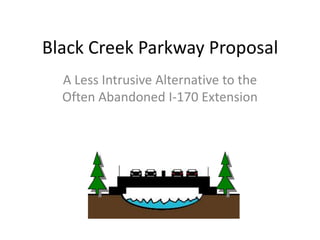
  • 1. Black Creek Parkway Proposal A Less Intrusive Alternative to the Often Abandoned I-170 Extension
  • 2. I-170 • I-170 was never meant to end at I-64 • Cost Overruns Shelved Southward Expansion • 2 Proposed Routes were created one following creek, the other follow railroad right of way • Several Attempts at Resuming Construction met with Strong Opposition
  • 3. Opposition Concerns • Noisy • Ugly/Blight • Leads to Urban Sprawl • Interferes with Walk-able Routes • Property Loss
  • 4. Extension Benefits • Allows southern residents convenient access to Central Corridor • Reduce pollution caused by Stop and Go Traffic • Reduces Traffic from 3 Alternative Major Streets
  • 5. Original Plan • Follow Black Creek with 6 Lane Interstate • Consumes 152 Homes, 208 Apartments, 43 Businesses and 3 Parks
  • 6. Changes Since Original Proposal • Brentwood Promenade claimed nearly 80 of the Affected Homes Already • MetroLink built over railroad route, leaving only Black Creek Alternative. • Venture Store long shuttered (9 months after County Councilman Kurt Odenwald used it as an example of loss from Interstate Proposal…Don’t Worry… He is no longer in office… he’s a Circuit Court Judge now!).
  • 7. Determining Original Route • No County Proposal Map Available • Only Map comes from 1990 Newspaper Article • Georeferenced Map, Traced Routes, Inaccuracies Manually corrected based on verbal details listed in several Newspaper Articles
  • 8. Methods for Determining Interstate Effects • Using Traced Original Black Creek Route • 120ft Buffer created to represent 240 average width of 6 lane Interstate • County Parcels Selected which overlap buffer • Interstate would now only affect 93 properties, most would need to be completely razed • Property Values lost would equal $82 Million Dollars
  • 9. Methods for Determining Parkway Effects • Traced Original Black Creek Route • 40ft Buffer created to represent 80ft average width of 4 lane Parkway similar to Forest Park Parkway • County Parcels Selected which overlap buffer • Interstate would now only affect 73 properties • If all represented lost Property, Values lost would equal $72 Million Dollars • Most Properties would not be completely lost
  • 12. Effects of Parkway Substitute • Total Losses would include 2 Houses, 12 Vacant/Agricultural Tracts along Black Creek Flood Plain and 1 Brentwood Park • 7 Houses would loose some backyard property • 2 Parks would lose approximately 1/3 total area • 1 Apartment Complex and 8 Industrial Parks would lose portions of their parking lots.
  • 13. Opposition Concerns Mitigated • Eye-sore creek replaced with eye-sore Parkway • Commuter Cars only and reduced speed limits create less noise • Introduction of Stead Speed Route reduces stop and go traffic on 3 major street alternatives, thus reducing pollution from emissions • Elevated Parkway would actually block view of Industrial Courts(and other blights) from many neighborhoods • Property Loss very minimal
  • 14. Conclusion • Parkway would provide many of the long sought after benefits while minimizing the effects on local residents • Richmond Heights, Maplewood, and Brentwood could all see increased tax revenue as Parkway would conveniently bring commuters straight to the heart of their retail districts