Download to read offline

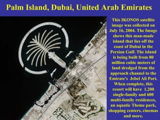
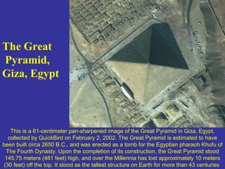
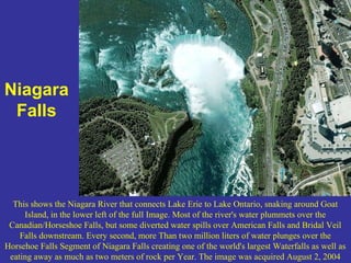
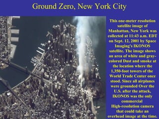
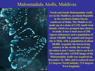
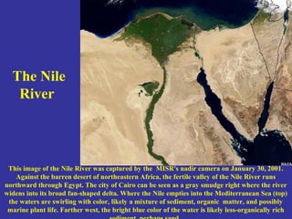
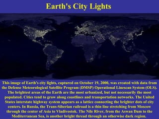


This document provides satellite images and descriptions of various locations around the world, including: - Palm Island in Dubai, showing the man-made island being built from dredged materials. - The Great Pyramid of Giza in Egypt, captured by satellite in 2002. - Niagara Falls, showing the river connecting Lake Erie to Lake Ontario and the massive waterfall. - Ground Zero in New York City, captured by satellite just days after the 9/11 attacks. - The Nile River running through northeast Africa and Egypt. - Earth's city lights at night, with the brightest areas being the most urbanized regions along coastlines and transportation networks.


