DownThemAll is a Firefox add-on that allows downloading multiple files simultaneously. To install, search for DownThemAll on the Firefox add-ons website and add it. Then configure the add-on by changing the maximum concurrent downloads setting to 2 to prevent errors when downloading more than two files at once.
This document describes a study that used remote sensing and spatial multi-criteria analysis to create a wildfire risk map of eastern Mongolia. Eleven factors related to environment, climate, fire history and socioeconomics were used as inputs and assigned weights. These included land cover, slope, temperature, rainfall, fire frequency and distance to roads. The factors were analyzed spatially to produce a map dividing the study area into five risk categories. The map was validated against historical burn areas with 62% accuracy. The final risk map is intended to help fire prevention planning and resource allocation.
GDAL (Geospatial Data Abstraction Library) is a translator library for raster and vector geospatial data formats. It supports over 140 raster and vector data formats and has tools for data translation and processing. Key GDAL utilities include gdalinfo for reporting metadata, gdal_translate for format conversion, gdalwarp for image warping and projection changes, and gdal_merge for mosaicking multiple rasters. GDAL is open source and works across many operating systems.
This document discusses using geographic information systems (GIS) and remote sensing to study and conserve two endangered ungulate species in Mongolia, the Asiatic wild ass or khulan and the goitered gazelle. GPS collars were used to track the movements of 20 khulans and 10 gazelles, finding that they range widely, including important habitat areas outside of protected areas. Ground surveys estimated populations of around 36,000 khulans and 28,000 gazelles in Southern Gobi. Spatial modeling identified surface water and human disturbance as most influencing species distributions, with around 25% of suitable habitat for each located within protected areas. GIS and remote sensing were useful conservation planning tools.
This document analyzes dust weather categorization in Mongolia using satellite data from 2000-2013. Ground-based meteorological data from 113 stations is compared to satellite-retrieved aerosol optical depth to categorize dust haze, blowing dust, and dust storms. Dust phenomenon types are categorized based on the correlation between aerosol optical depth and horizontal visibility. The study finds a good exponential relationship between aerosol optical depth and visibility in April, allowing dust weather to be categorized from satellite data with spatial frequencies consistent with ground reports.
This document outlines a study to estimate above-ground biomass and carbon stock in boreal forests in Mongolia using satellite data and machine learning. Boreal forests cover about 9.2% of Mongolia but have been declining in recent decades. The study aims to develop a suitable machine learning model to map forest biomass and carbon stock. Random forest was the best performing model with an R2 of 0.24 and RMSE of 33 Mg/ha. Important input features included shortwave infrared band 1, green leaf index, and radar polarization data. The predicted forest biomass ranged from 32.5-122.5 Mg/ha and carbon stock ranged from 16.5-62.5 Mg C/ha. Some reference
The document outlines a study that uses multispectral drones and ground sampling to collect vegetation data from pasture sites over three sampling periods in June, July, and August. Various vegetation indices will be calculated from the drone and ground spectrometer data to analyze changes in biomass, chlorophyll content, and other vegetation metrics over time. A total of 285 sample points will be collected and various biophysical parameters will be measured at each point to analyze temporal changes in pasture sites.
The Mongolian Geospatial Association has a board that executes the CEO and Secretary. It has 9 technical commissions and 3 member communities. The association has regular, student, institutional, honorary, and advisory members. It partners internationally and participates in activities in countries like the US, UAE, Taiwan, South Korea, and others. In 2021, the association held webinars, talks, workshops and participated in a United Nations workshop on GNSS applications. It celebrates GIS day and holds monthly geo-meetings and quarterly geo-forums.
The document provides an overview of CHCNAV's AlphaUni 300/900/1300 mobile mapping solutions. It describes the key features and performance specifications of the AlphaUni series, including its universal lidar platform design, accuracy levels, data storage capabilities, and compatibility with various installation methods for airborne, vehicle, boat, and backpack use cases. The document also introduces CHC's new BB4 UAV platform as a high-payload professional solution for airborne lidar applications.
Mongolia has been involved in space technology since 1965 under the INTERCOSMOS program. The first satellite data receiving station and weather satellite ground station were established in 1970. In 1981, J. Gurragchaa became the first Mongolian cosmonaut. In 2017, Mazaalai, Mongolia's first satellite, was launched into space.
The Space Technology Association of Mongolia is the main organization related to space technology. It has a board, CEO, secretary and various technical commissions. Members include students, regular members, institutions and honorary members. The association partners with space organizations in countries around the world and participates in international conferences and workshops on space technology.
Mongolia began developing space technology in 1965 under the INTERCOSMOS program. Some key early developments included establishing the first satellite data receiving station in 1970 and a meteorological satellite data station. The first Mongolian cosmonaut launched in 1981. More recently, Mongolia launched its first satellite, Mazaalai, in 2017.
The Association of Mongolian Geodesy and Cartography brings together members involved in fields like photogrammetry, GIS, and surveying. It has over 1500 members across categories like students, institutions, and honorary members. The Association partners with space technology organizations internationally and runs various events and programs.
Demonstration of super map ai gis technology GeoMedeelel
This document demonstrates SuperMap's AI GIS technology. It discusses geospatial deep learning and the AI GIS workflow, including data acquisition and preparation, model building and management, and model application. It provides examples of using deep learning models for tasks like object detection, segmentation, and classification of imagery. The workflow and tools for training models with SuperMap software and deploying trained models as web services are also described. A case study on building extraction is presented to illustrate the full AI GIS process.
Supermap gis 10i(2020) ai gis technology v1.0GeoMedeelel
This document provides information about SuperMap Software Co., Ltd. It includes:
1. Background information on SuperMap such as its founding date and headquarters location.
2. Market share data showing SuperMap has the largest share of the GIS software market in China.
3. An overview of SuperMap's products and technologies including distributed GIS, cross-platform GIS, 3D GIS, big data GIS, and AI GIS.
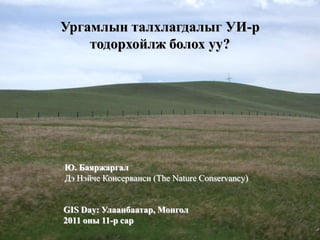
1. Ургамлын талхлагдалыг УИ-р
тодорхойлж болох уу?
Ю. Баяржаргал
Дэ Нэйче Консерванси (The Nature Conservancy)
GIS Day: Улаанбаатар, Монгол
2011 оны 11-р сар
4. NDVI-ийн зарчим
• The NDVI is based on the difference between
the maximum absorption of radiation in the
Red (due to the chlorophyll pigments) vs. the
maximum reflection of radiation in the NIR
(due to the leaf cellular structure), and the
fact that soil spectra, lacking these
mechanisms, typically do not show such a
dramatic spectral difference
24. Хамаарал (NDVI, EVI, Red and NIR)
Red NIR NDVI
NIR -0.27
NDVI 0.88 0.68
EVI 0.49 0.91 0.81
Values in Italic indicate significant level higher than 99%.
Relative sensitivity values. Sr > 1 means that index X is more sensitive, Sr =1
means the sensitivities are equal, and Sr < 1 means that index Y is more
sensitive to the independent variable. NDVI is more sensitive to the reflectance in
the red band than the EVI while EVI more sensitive than the NDVI to NIR
X=EVI
0.86| for Red
Y=NDVI
2.09| for NIR