SlideShare a Scribd company logo
1 of 12
Badland and gully erosion assessment
using remotely sensed data, non-
invasive field techniques and stochastic
modelling approaches
Michael Maerker1, Alberto Bosino1, & Ulrike Hardenbicker2
1University of Pavia, Italy; 2University of Regina, Canada
1
splash
Spatio-temporal scales of soil erosion processes
interrill
rill
gully
fluvial
after Renschler & Harbor (2002): Geomorphology 47, 189-209.
badlands
 Models often only address single processes and therefore
are scale dependent (USLE, WEPP, Erosion 2D/3D, USPED)
 Models often are focussing only on laminar soil erosion
(sheet/rill-interrill erosion)
 Integrated modelling is very complex
- Different soil erosion processes
- Parameter request
- Scale dependency (spatial/temporal)
 Spatio-temporal distribution
Research Question: How to assess and quantify different soil
erosion processes?
4
Challenges for soil erosion modeling:
Märker et al. (2011): Geomorphology, 125(4), 530-540; Zakerinejad & Märker (2015): Natural Hazards, 79 (1), 25-50
Sidorchuk et al. (2003): Catena, 50, 507-525. Märker et al. (2001): Geografia Fisica e Dinamica Quaternaria, 24, 71-83
How to get Information about processes and forms?
GSSI EMP 400 EM
Conductivity Meter
FieldspectrometerNon invasive
Field methods
Local Information about substrates and soils
Multi & Hyperspectral
Remotely Sensed Information
and Derivatives
TanDEM-X 90m, 30m, 12m
Terrain Analysis &
Topographic Indices
High resolution DEM by
Structure from Motion
Spatial continuous information about forms, features
and surface characteristics
How to get Information about processes and forms?
7
Badland & Gully Inventory
Forms & Features
Identification &
Mapping
Identification &
Mapping
8
Maerker, M., Pelacani, S. & B. Schröder (2011): A functional entity approach to
predict soil erosion processes in a small Plio-Pleistocene Mediterranean catchment in
Northern Chianti, Italy . GEOMORPHOLOGY, vol. 125 (4), pp. 530-540
Susceptibility map
MaxEnt stochastic approach to assess
the driving factors for gully formation
Variable importance
Internal validation via ROC curves
10
Initial phase
(5%)
Static phase
(95%)
Sidorchuk (1999): Catena 37, 401-414
Sidorchuk, Maerker, Moretti & Rodolfi (2003) Catena 50, 507-525
Zakerinejad & Maerker (2015) Natural Hazards 79(1), 25-50
Quantitative Assessment
Maerker, M., Pelacani, S. & B. Schröder (2011): A functional entity approach to
predict soil erosion processes in a small Plio-Pleistocene Mediterranean catchment in
Northern Chianti, Italy . GEOMORPHOLOGY, vol. 125 (4), pp. 530-540
Gully Modelling
Conclusion
• Integrated method to assess gully and badland erosion
susceptibilities over large areas using RS, fieldwork
and stochastic modelling approaches.
• Spatial resolution of environmental data (DEM; RS-
data) is increasing, however data need field validation
• Basis for process quantification and connectivity
analysis on basin scale.
11
Badland and gully erosion assessment using remotely sensed data, non-invasive field techniques and stochastic modelling approaches

More Related Content

Similar to Badland and gully erosion assessment using remotely sensed data, non-invasive field techniques and stochastic modelling approaches

Gi4DM2010 GIS and geomatics for disaster relief
Gi4DM2010 GIS and geomatics for disaster reliefGi4DM2010 GIS and geomatics for disaster relief
Gi4DM2010 GIS and geomatics for disaster reliefMassimo Lanfranco
 
Heritage hetherington lidar_pdf[1]
Heritage hetherington lidar_pdf[1]Heritage hetherington lidar_pdf[1]
Heritage hetherington lidar_pdf[1]llica
 
A Study of Disaster Management & Geotechnical Investigation of Landslides: A ...
A Study of Disaster Management & Geotechnical Investigation of Landslides: A ...A Study of Disaster Management & Geotechnical Investigation of Landslides: A ...
A Study of Disaster Management & Geotechnical Investigation of Landslides: A ...IRJET Journal
 
Geophysics for Geotechnical Engineers
Geophysics for Geotechnical EngineersGeophysics for Geotechnical Engineers
Geophysics for Geotechnical EngineersRamanuja Chari Kannan
 
Geotechnical Engineering I Co
Geotechnical Engineering I CoGeotechnical Engineering I Co
Geotechnical Engineering I Cojagadeesha M U
 
#1-2013GL-5082 (Eka Nurmuzaki's conflicted copy 2013-03-04).ppt
#1-2013GL-5082 (Eka Nurmuzaki's conflicted copy 2013-03-04).ppt#1-2013GL-5082 (Eka Nurmuzaki's conflicted copy 2013-03-04).ppt
#1-2013GL-5082 (Eka Nurmuzaki's conflicted copy 2013-03-04).pptcornelia23001
 
3 d seismic method for reservoir geothermal exploration n assessment
3 d seismic method for reservoir geothermal exploration n assessment3 d seismic method for reservoir geothermal exploration n assessment
3 d seismic method for reservoir geothermal exploration n assessmentMuhammad Khawarizmi
 
Numerical analysis of block caving induced instability in large open pit slopes
Numerical analysis of block caving induced instability in large open pit slopesNumerical analysis of block caving induced instability in large open pit slopes
Numerical analysis of block caving induced instability in large open pit slopesDr. Alex Vyazmensky
 
Services presentation, minerals
Services presentation, mineralsServices presentation, minerals
Services presentation, mineralsGeorge Barber
 
IRJET - Rock Slope Assessment using Artificial Neural Networks
IRJET -  	  Rock Slope Assessment using Artificial Neural NetworksIRJET -  	  Rock Slope Assessment using Artificial Neural Networks
IRJET - Rock Slope Assessment using Artificial Neural NetworksIRJET Journal
 
01 - Overview of Geophysical Methods.pptx
01 - Overview of Geophysical Methods.pptx01 - Overview of Geophysical Methods.pptx
01 - Overview of Geophysical Methods.pptxAgnikulakshatriyasan
 
Ecological indicators
Ecological indicatorsEcological indicators
Ecological indicatorsTaha Gorji
 
The use of geoinformatics in mineral exploration and exploitation
The use of geoinformatics in mineral exploration and exploitationThe use of geoinformatics in mineral exploration and exploitation
The use of geoinformatics in mineral exploration and exploitationMarguerite Walsh
 

Similar to Badland and gully erosion assessment using remotely sensed data, non-invasive field techniques and stochastic modelling approaches (20)

Gi4DM2010 GIS and geomatics for disaster relief
Gi4DM2010 GIS and geomatics for disaster reliefGi4DM2010 GIS and geomatics for disaster relief
Gi4DM2010 GIS and geomatics for disaster relief
 
Heritage hetherington lidar_pdf[1]
Heritage hetherington lidar_pdf[1]Heritage hetherington lidar_pdf[1]
Heritage hetherington lidar_pdf[1]
 
A Study of Disaster Management & Geotechnical Investigation of Landslides: A ...
A Study of Disaster Management & Geotechnical Investigation of Landslides: A ...A Study of Disaster Management & Geotechnical Investigation of Landslides: A ...
A Study of Disaster Management & Geotechnical Investigation of Landslides: A ...
 
Geophysics for Geotechnical Engineers
Geophysics for Geotechnical EngineersGeophysics for Geotechnical Engineers
Geophysics for Geotechnical Engineers
 
Geotechnical Engineering I Co
Geotechnical Engineering I CoGeotechnical Engineering I Co
Geotechnical Engineering I Co
 
TT_Introduction6
TT_Introduction6TT_Introduction6
TT_Introduction6
 
#1-2013GL-5082 (Eka Nurmuzaki's conflicted copy 2013-03-04).ppt
#1-2013GL-5082 (Eka Nurmuzaki's conflicted copy 2013-03-04).ppt#1-2013GL-5082 (Eka Nurmuzaki's conflicted copy 2013-03-04).ppt
#1-2013GL-5082 (Eka Nurmuzaki's conflicted copy 2013-03-04).ppt
 
20200727 IEM WEBINAR .pdf
20200727 IEM WEBINAR .pdf20200727 IEM WEBINAR .pdf
20200727 IEM WEBINAR .pdf
 
S24 naldi
S24 naldiS24 naldi
S24 naldi
 
S24 naldi
S24 naldiS24 naldi
S24 naldi
 
S24 naldi
S24 naldiS24 naldi
S24 naldi
 
GSA presentation
GSA presentationGSA presentation
GSA presentation
 
AbouShakerCV 10032015
AbouShakerCV 10032015 AbouShakerCV 10032015
AbouShakerCV 10032015
 
3 d seismic method for reservoir geothermal exploration n assessment
3 d seismic method for reservoir geothermal exploration n assessment3 d seismic method for reservoir geothermal exploration n assessment
3 d seismic method for reservoir geothermal exploration n assessment
 
Numerical analysis of block caving induced instability in large open pit slopes
Numerical analysis of block caving induced instability in large open pit slopesNumerical analysis of block caving induced instability in large open pit slopes
Numerical analysis of block caving induced instability in large open pit slopes
 
Services presentation, minerals
Services presentation, mineralsServices presentation, minerals
Services presentation, minerals
 
IRJET - Rock Slope Assessment using Artificial Neural Networks
IRJET -  	  Rock Slope Assessment using Artificial Neural NetworksIRJET -  	  Rock Slope Assessment using Artificial Neural Networks
IRJET - Rock Slope Assessment using Artificial Neural Networks
 
01 - Overview of Geophysical Methods.pptx
01 - Overview of Geophysical Methods.pptx01 - Overview of Geophysical Methods.pptx
01 - Overview of Geophysical Methods.pptx
 
Ecological indicators
Ecological indicatorsEcological indicators
Ecological indicators
 
The use of geoinformatics in mineral exploration and exploitation
The use of geoinformatics in mineral exploration and exploitationThe use of geoinformatics in mineral exploration and exploitation
The use of geoinformatics in mineral exploration and exploitation
 

More from ExternalEvents

More from ExternalEvents (20)

Mauritania
Mauritania Mauritania
Mauritania
 
Malawi - M. Munthali
Malawi - M. MunthaliMalawi - M. Munthali
Malawi - M. Munthali
 
Malawi (Mbewe)
Malawi (Mbewe)Malawi (Mbewe)
Malawi (Mbewe)
 
Malawi (Desideri)
Malawi (Desideri)Malawi (Desideri)
Malawi (Desideri)
 
Lesotho
LesothoLesotho
Lesotho
 
Kenya
KenyaKenya
Kenya
 
ICRAF: Soil-plant spectral diagnostics laboratory
ICRAF: Soil-plant spectral diagnostics laboratoryICRAF: Soil-plant spectral diagnostics laboratory
ICRAF: Soil-plant spectral diagnostics laboratory
 
Ghana
GhanaGhana
Ghana
 
Ethiopia
EthiopiaEthiopia
Ethiopia
 
Item 15
Item 15Item 15
Item 15
 
Item 14
Item 14Item 14
Item 14
 
Item 13
Item 13Item 13
Item 13
 
Item 7
Item 7Item 7
Item 7
 
Item 6
Item 6Item 6
Item 6
 
Item 3
Item 3Item 3
Item 3
 
Item 16
Item 16Item 16
Item 16
 
Item 9: Soil mapping to support sustainable agriculture
Item 9: Soil mapping to support sustainable agricultureItem 9: Soil mapping to support sustainable agriculture
Item 9: Soil mapping to support sustainable agriculture
 
Item 8: WRB, World Reference Base for Soil Resouces
Item 8: WRB, World Reference Base for Soil ResoucesItem 8: WRB, World Reference Base for Soil Resouces
Item 8: WRB, World Reference Base for Soil Resouces
 
Item 7: Progress made in Nepal
Item 7: Progress made in NepalItem 7: Progress made in Nepal
Item 7: Progress made in Nepal
 
Item 6: International Center for Biosaline Agriculture
Item 6: International Center for Biosaline AgricultureItem 6: International Center for Biosaline Agriculture
Item 6: International Center for Biosaline Agriculture
 

Recently uploaded

Holdier Curriculum Vitae (April 2024).pdf
Holdier Curriculum Vitae (April 2024).pdfHoldier Curriculum Vitae (April 2024).pdf
Holdier Curriculum Vitae (April 2024).pdfagholdier
 
Making and Justifying Mathematical Decisions.pdf
Making and Justifying Mathematical Decisions.pdfMaking and Justifying Mathematical Decisions.pdf
Making and Justifying Mathematical Decisions.pdfChris Hunter
 
Unit-IV- Pharma. Marketing Channels.pptx
Unit-IV- Pharma. Marketing Channels.pptxUnit-IV- Pharma. Marketing Channels.pptx
Unit-IV- Pharma. Marketing Channels.pptxVishalSingh1417
 
ICT role in 21st century education and it's challenges.
ICT role in 21st century education and it's challenges.ICT role in 21st century education and it's challenges.
ICT role in 21st century education and it's challenges.MaryamAhmad92
 
General Principles of Intellectual Property: Concepts of Intellectual Proper...
General Principles of Intellectual Property: Concepts of Intellectual  Proper...General Principles of Intellectual Property: Concepts of Intellectual  Proper...
General Principles of Intellectual Property: Concepts of Intellectual Proper...Poonam Aher Patil
 
Application orientated numerical on hev.ppt
Application orientated numerical on hev.pptApplication orientated numerical on hev.ppt
Application orientated numerical on hev.pptRamjanShidvankar
 
Python Notes for mca i year students osmania university.docx
Python Notes for mca i year students osmania university.docxPython Notes for mca i year students osmania university.docx
Python Notes for mca i year students osmania university.docxRamakrishna Reddy Bijjam
 
Grant Readiness 101 TechSoup and Remy Consulting
Grant Readiness 101 TechSoup and Remy ConsultingGrant Readiness 101 TechSoup and Remy Consulting
Grant Readiness 101 TechSoup and Remy ConsultingTechSoup
 
The basics of sentences session 2pptx copy.pptx
The basics of sentences session 2pptx copy.pptxThe basics of sentences session 2pptx copy.pptx
The basics of sentences session 2pptx copy.pptxheathfieldcps1
 
Mixin Classes in Odoo 17 How to Extend Models Using Mixin Classes
Mixin Classes in Odoo 17  How to Extend Models Using Mixin ClassesMixin Classes in Odoo 17  How to Extend Models Using Mixin Classes
Mixin Classes in Odoo 17 How to Extend Models Using Mixin ClassesCeline George
 
Food Chain and Food Web (Ecosystem) EVS, B. Pharmacy 1st Year, Sem-II
Food Chain and Food Web (Ecosystem) EVS, B. Pharmacy 1st Year, Sem-IIFood Chain and Food Web (Ecosystem) EVS, B. Pharmacy 1st Year, Sem-II
Food Chain and Food Web (Ecosystem) EVS, B. Pharmacy 1st Year, Sem-IIShubhangi Sonawane
 
Explore beautiful and ugly buildings. Mathematics helps us create beautiful d...
Explore beautiful and ugly buildings. Mathematics helps us create beautiful d...Explore beautiful and ugly buildings. Mathematics helps us create beautiful d...
Explore beautiful and ugly buildings. Mathematics helps us create beautiful d...christianmathematics
 
ICT Role in 21st Century Education & its Challenges.pptx
ICT Role in 21st Century Education & its Challenges.pptxICT Role in 21st Century Education & its Challenges.pptx
ICT Role in 21st Century Education & its Challenges.pptxAreebaZafar22
 
1029-Danh muc Sach Giao Khoa khoi 6.pdf
1029-Danh muc Sach Giao Khoa khoi  6.pdf1029-Danh muc Sach Giao Khoa khoi  6.pdf
1029-Danh muc Sach Giao Khoa khoi 6.pdfQucHHunhnh
 
Beyond the EU: DORA and NIS 2 Directive's Global Impact
Beyond the EU: DORA and NIS 2 Directive's Global ImpactBeyond the EU: DORA and NIS 2 Directive's Global Impact
Beyond the EU: DORA and NIS 2 Directive's Global ImpactPECB
 
PROCESS RECORDING FORMAT.docx
PROCESS      RECORDING        FORMAT.docxPROCESS      RECORDING        FORMAT.docx
PROCESS RECORDING FORMAT.docxPoojaSen20
 
1029 - Danh muc Sach Giao Khoa 10 . pdf
1029 -  Danh muc Sach Giao Khoa 10 . pdf1029 -  Danh muc Sach Giao Khoa 10 . pdf
1029 - Danh muc Sach Giao Khoa 10 . pdfQucHHunhnh
 

Recently uploaded (20)

INDIA QUIZ 2024 RLAC DELHI UNIVERSITY.pptx
INDIA QUIZ 2024 RLAC DELHI UNIVERSITY.pptxINDIA QUIZ 2024 RLAC DELHI UNIVERSITY.pptx
INDIA QUIZ 2024 RLAC DELHI UNIVERSITY.pptx
 
Holdier Curriculum Vitae (April 2024).pdf
Holdier Curriculum Vitae (April 2024).pdfHoldier Curriculum Vitae (April 2024).pdf
Holdier Curriculum Vitae (April 2024).pdf
 
Making and Justifying Mathematical Decisions.pdf
Making and Justifying Mathematical Decisions.pdfMaking and Justifying Mathematical Decisions.pdf
Making and Justifying Mathematical Decisions.pdf
 
Mehran University Newsletter Vol-X, Issue-I, 2024
Mehran University Newsletter Vol-X, Issue-I, 2024Mehran University Newsletter Vol-X, Issue-I, 2024
Mehran University Newsletter Vol-X, Issue-I, 2024
 
Unit-IV- Pharma. Marketing Channels.pptx
Unit-IV- Pharma. Marketing Channels.pptxUnit-IV- Pharma. Marketing Channels.pptx
Unit-IV- Pharma. Marketing Channels.pptx
 
ICT role in 21st century education and it's challenges.
ICT role in 21st century education and it's challenges.ICT role in 21st century education and it's challenges.
ICT role in 21st century education and it's challenges.
 
General Principles of Intellectual Property: Concepts of Intellectual Proper...
General Principles of Intellectual Property: Concepts of Intellectual  Proper...General Principles of Intellectual Property: Concepts of Intellectual  Proper...
General Principles of Intellectual Property: Concepts of Intellectual Proper...
 
Application orientated numerical on hev.ppt
Application orientated numerical on hev.pptApplication orientated numerical on hev.ppt
Application orientated numerical on hev.ppt
 
Python Notes for mca i year students osmania university.docx
Python Notes for mca i year students osmania university.docxPython Notes for mca i year students osmania university.docx
Python Notes for mca i year students osmania university.docx
 
Grant Readiness 101 TechSoup and Remy Consulting
Grant Readiness 101 TechSoup and Remy ConsultingGrant Readiness 101 TechSoup and Remy Consulting
Grant Readiness 101 TechSoup and Remy Consulting
 
The basics of sentences session 2pptx copy.pptx
The basics of sentences session 2pptx copy.pptxThe basics of sentences session 2pptx copy.pptx
The basics of sentences session 2pptx copy.pptx
 
Mixin Classes in Odoo 17 How to Extend Models Using Mixin Classes
Mixin Classes in Odoo 17  How to Extend Models Using Mixin ClassesMixin Classes in Odoo 17  How to Extend Models Using Mixin Classes
Mixin Classes in Odoo 17 How to Extend Models Using Mixin Classes
 
Food Chain and Food Web (Ecosystem) EVS, B. Pharmacy 1st Year, Sem-II
Food Chain and Food Web (Ecosystem) EVS, B. Pharmacy 1st Year, Sem-IIFood Chain and Food Web (Ecosystem) EVS, B. Pharmacy 1st Year, Sem-II
Food Chain and Food Web (Ecosystem) EVS, B. Pharmacy 1st Year, Sem-II
 
Explore beautiful and ugly buildings. Mathematics helps us create beautiful d...
Explore beautiful and ugly buildings. Mathematics helps us create beautiful d...Explore beautiful and ugly buildings. Mathematics helps us create beautiful d...
Explore beautiful and ugly buildings. Mathematics helps us create beautiful d...
 
Asian American Pacific Islander Month DDSD 2024.pptx
Asian American Pacific Islander Month DDSD 2024.pptxAsian American Pacific Islander Month DDSD 2024.pptx
Asian American Pacific Islander Month DDSD 2024.pptx
 
ICT Role in 21st Century Education & its Challenges.pptx
ICT Role in 21st Century Education & its Challenges.pptxICT Role in 21st Century Education & its Challenges.pptx
ICT Role in 21st Century Education & its Challenges.pptx
 
1029-Danh muc Sach Giao Khoa khoi 6.pdf
1029-Danh muc Sach Giao Khoa khoi  6.pdf1029-Danh muc Sach Giao Khoa khoi  6.pdf
1029-Danh muc Sach Giao Khoa khoi 6.pdf
 
Beyond the EU: DORA and NIS 2 Directive's Global Impact
Beyond the EU: DORA and NIS 2 Directive's Global ImpactBeyond the EU: DORA and NIS 2 Directive's Global Impact
Beyond the EU: DORA and NIS 2 Directive's Global Impact
 
PROCESS RECORDING FORMAT.docx
PROCESS      RECORDING        FORMAT.docxPROCESS      RECORDING        FORMAT.docx
PROCESS RECORDING FORMAT.docx
 
1029 - Danh muc Sach Giao Khoa 10 . pdf
1029 -  Danh muc Sach Giao Khoa 10 . pdf1029 -  Danh muc Sach Giao Khoa 10 . pdf
1029 - Danh muc Sach Giao Khoa 10 . pdf
 

Badland and gully erosion assessment using remotely sensed data, non-invasive field techniques and stochastic modelling approaches

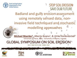
  • 1. Badland and gully erosion assessment using remotely sensed data, non- invasive field techniques and stochastic modelling approaches Michael Maerker1, Alberto Bosino1, & Ulrike Hardenbicker2 1University of Pavia, Italy; 2University of Regina, Canada 1
  • 2.
  • 3. splash Spatio-temporal scales of soil erosion processes interrill rill gully fluvial after Renschler & Harbor (2002): Geomorphology 47, 189-209. badlands
  • 4.  Models often only address single processes and therefore are scale dependent (USLE, WEPP, Erosion 2D/3D, USPED)  Models often are focussing only on laminar soil erosion (sheet/rill-interrill erosion)  Integrated modelling is very complex - Different soil erosion processes - Parameter request - Scale dependency (spatial/temporal)  Spatio-temporal distribution Research Question: How to assess and quantify different soil erosion processes? 4 Challenges for soil erosion modeling: Märker et al. (2011): Geomorphology, 125(4), 530-540; Zakerinejad & Märker (2015): Natural Hazards, 79 (1), 25-50 Sidorchuk et al. (2003): Catena, 50, 507-525. Märker et al. (2001): Geografia Fisica e Dinamica Quaternaria, 24, 71-83
  • 5. How to get Information about processes and forms? GSSI EMP 400 EM Conductivity Meter FieldspectrometerNon invasive Field methods Local Information about substrates and soils
  • 6. Multi & Hyperspectral Remotely Sensed Information and Derivatives TanDEM-X 90m, 30m, 12m Terrain Analysis & Topographic Indices High resolution DEM by Structure from Motion Spatial continuous information about forms, features and surface characteristics How to get Information about processes and forms?
  • 7. 7 Badland & Gully Inventory Forms & Features Identification & Mapping Identification & Mapping
  • 8. 8 Maerker, M., Pelacani, S. & B. Schröder (2011): A functional entity approach to predict soil erosion processes in a small Plio-Pleistocene Mediterranean catchment in Northern Chianti, Italy . GEOMORPHOLOGY, vol. 125 (4), pp. 530-540
  • 9. Susceptibility map MaxEnt stochastic approach to assess the driving factors for gully formation Variable importance Internal validation via ROC curves
  • 10. 10 Initial phase (5%) Static phase (95%) Sidorchuk (1999): Catena 37, 401-414 Sidorchuk, Maerker, Moretti & Rodolfi (2003) Catena 50, 507-525 Zakerinejad & Maerker (2015) Natural Hazards 79(1), 25-50 Quantitative Assessment Maerker, M., Pelacani, S. & B. Schröder (2011): A functional entity approach to predict soil erosion processes in a small Plio-Pleistocene Mediterranean catchment in Northern Chianti, Italy . GEOMORPHOLOGY, vol. 125 (4), pp. 530-540 Gully Modelling
  • 11. Conclusion • Integrated method to assess gully and badland erosion susceptibilities over large areas using RS, fieldwork and stochastic modelling approaches. • Spatial resolution of environmental data (DEM; RS- data) is increasing, however data need field validation • Basis for process quantification and connectivity analysis on basin scale. 11

Editor's Notes

  1. Raumzeitliche Skalen der Bodenerosion