Download to read offline
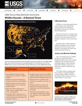

Wildfires pose significant threats to life, property, and ecosystems. The USGS conducts research on wildfire impacts, risks, and management. This includes studying historical fire patterns, monitoring fuel reduction efforts, and assessing post-fire effects like erosion. The USGS provides tools to map fuels, monitor active fires, and predict hazards. This science-based information helps land managers and emergency responders mitigate wildfire dangers and impacts.