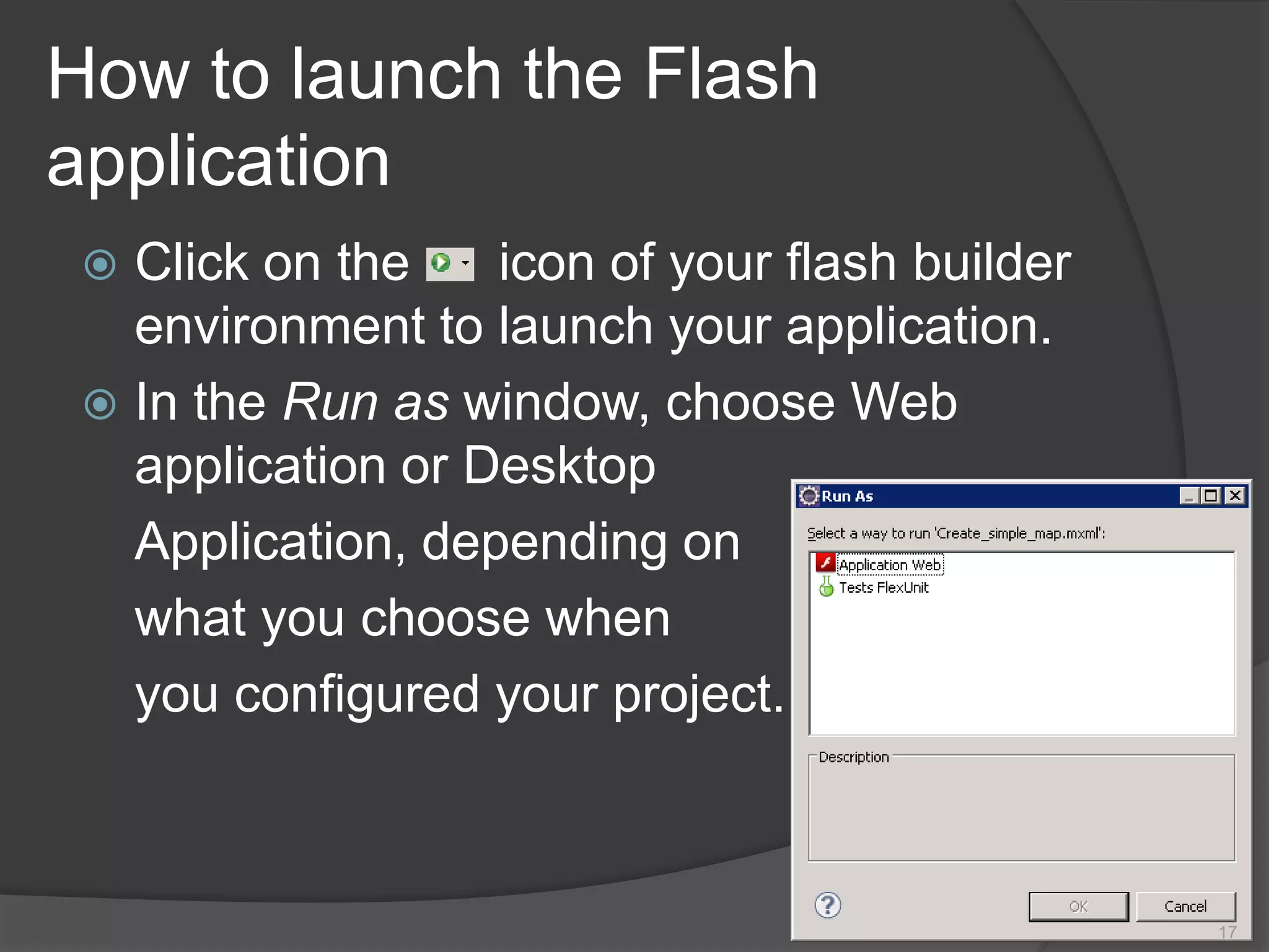
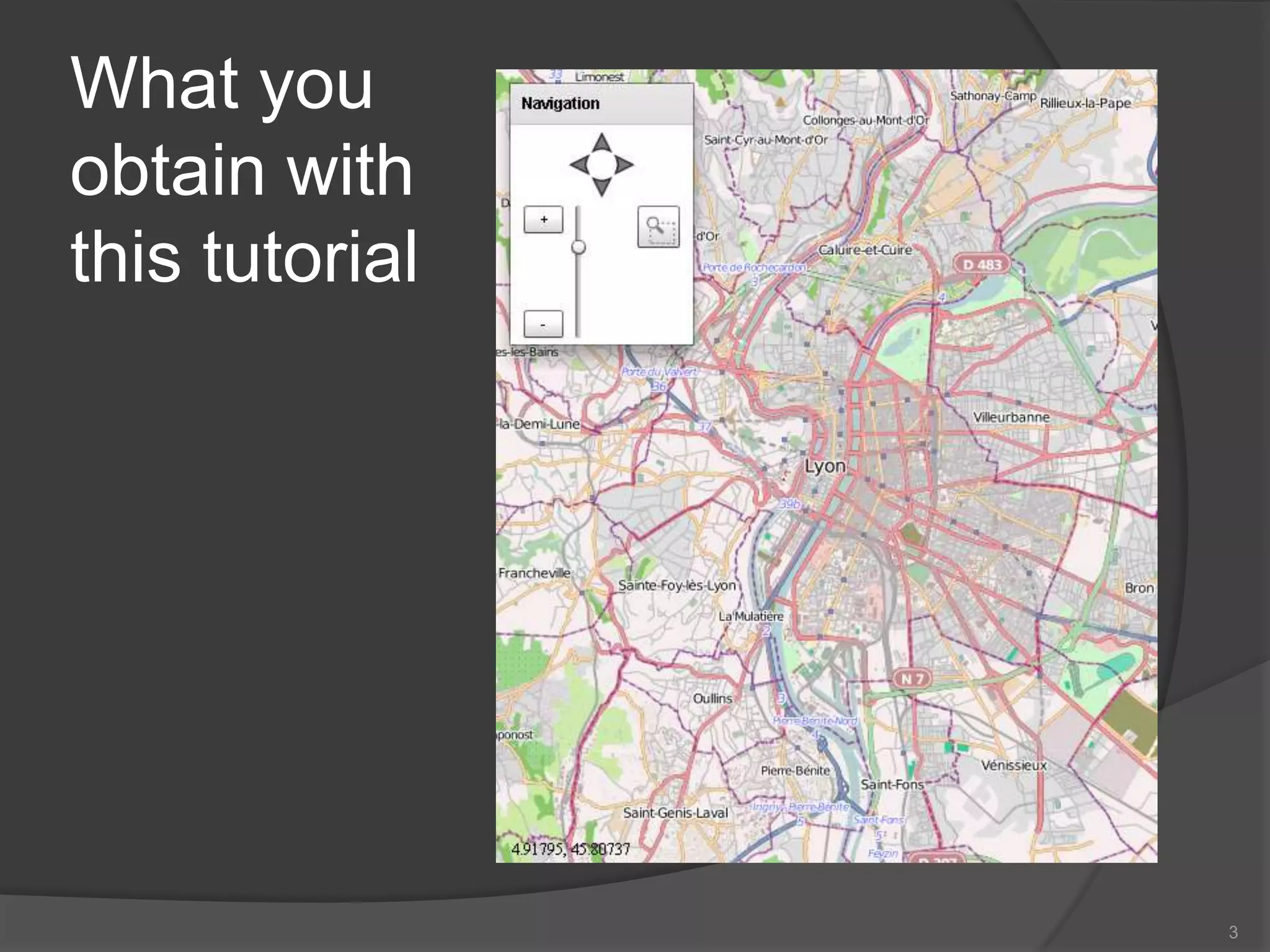
This tutorial teaches how to create a basic map application using OpenScales by:
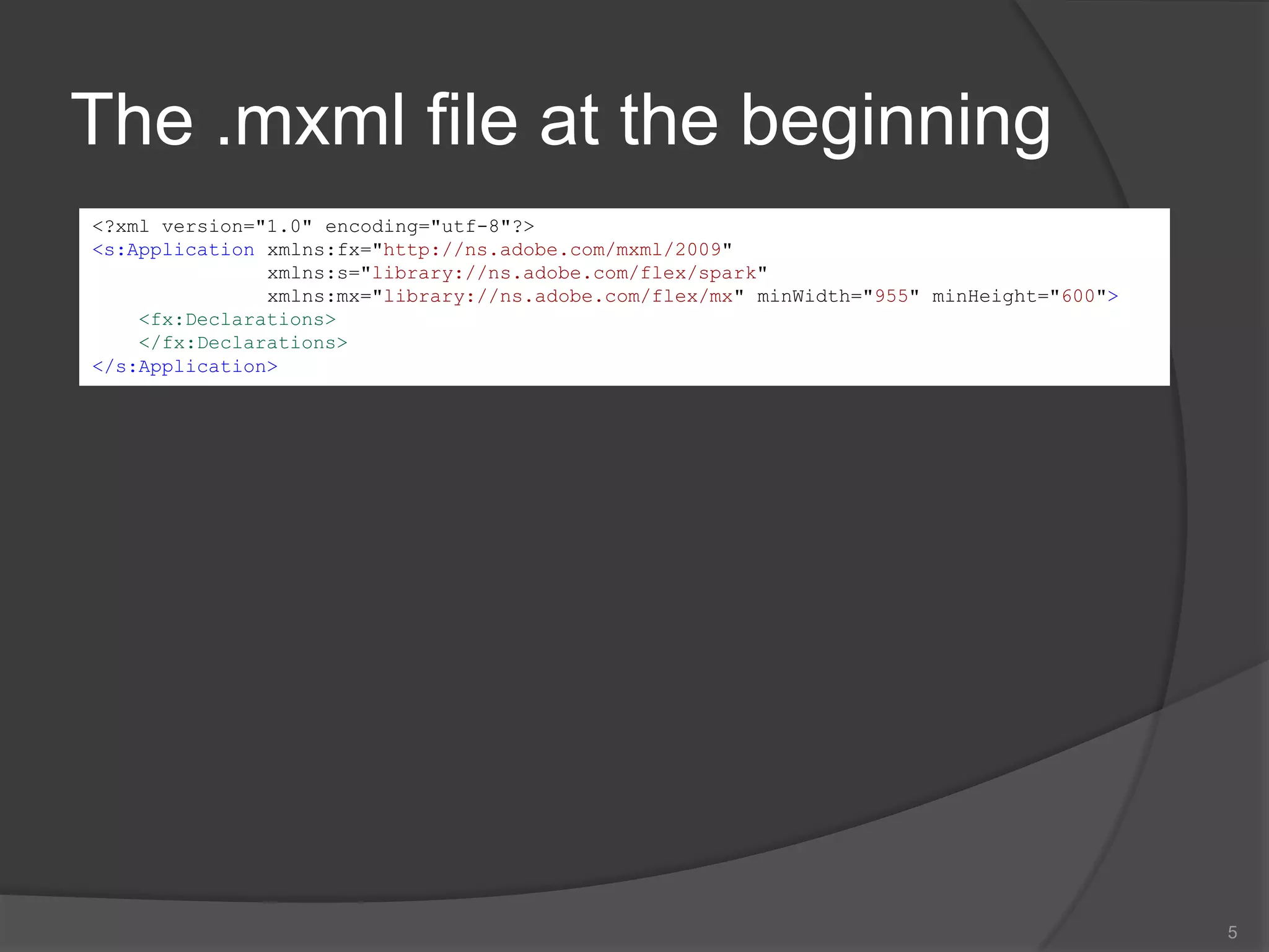
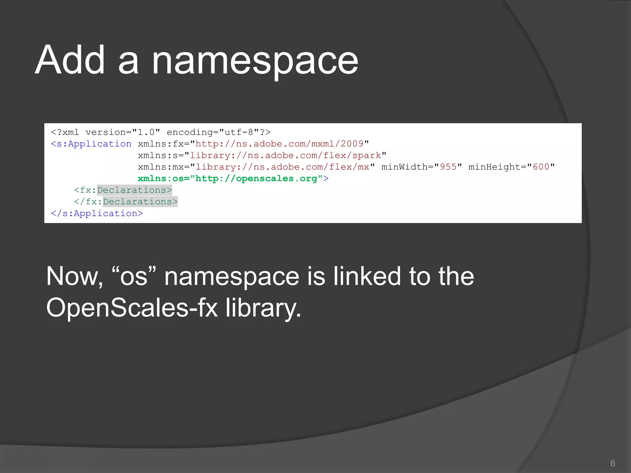
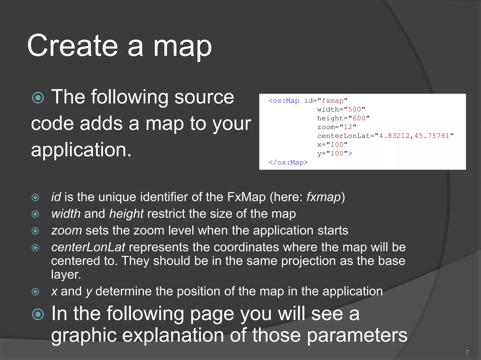
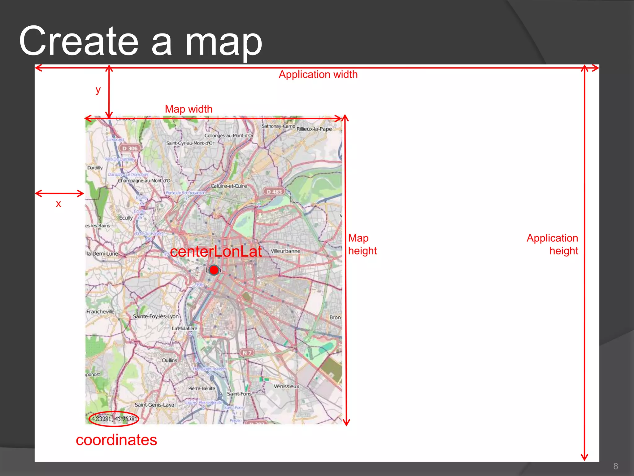
1) Adding an OpenScales namespace and creating a map component.
2) Adding base layers like OpenStreetMap or WFS layers.
3) Adding controls for mouse interactions and a control panel.
4) Integrating the map with ActionScript code to initialize controls.
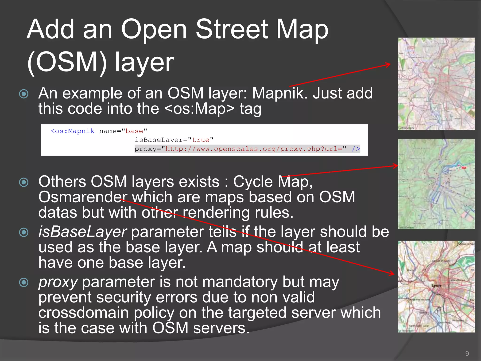
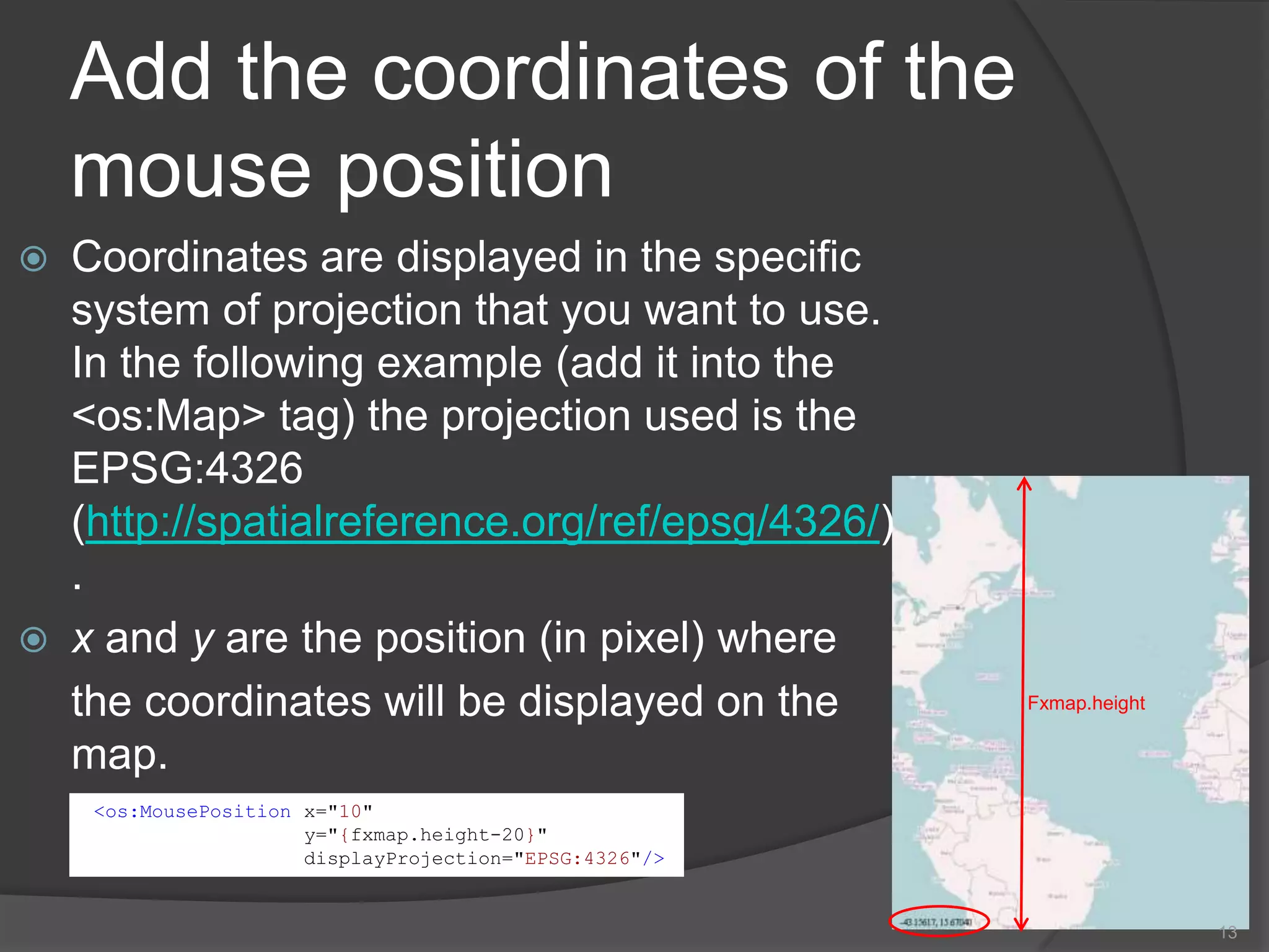
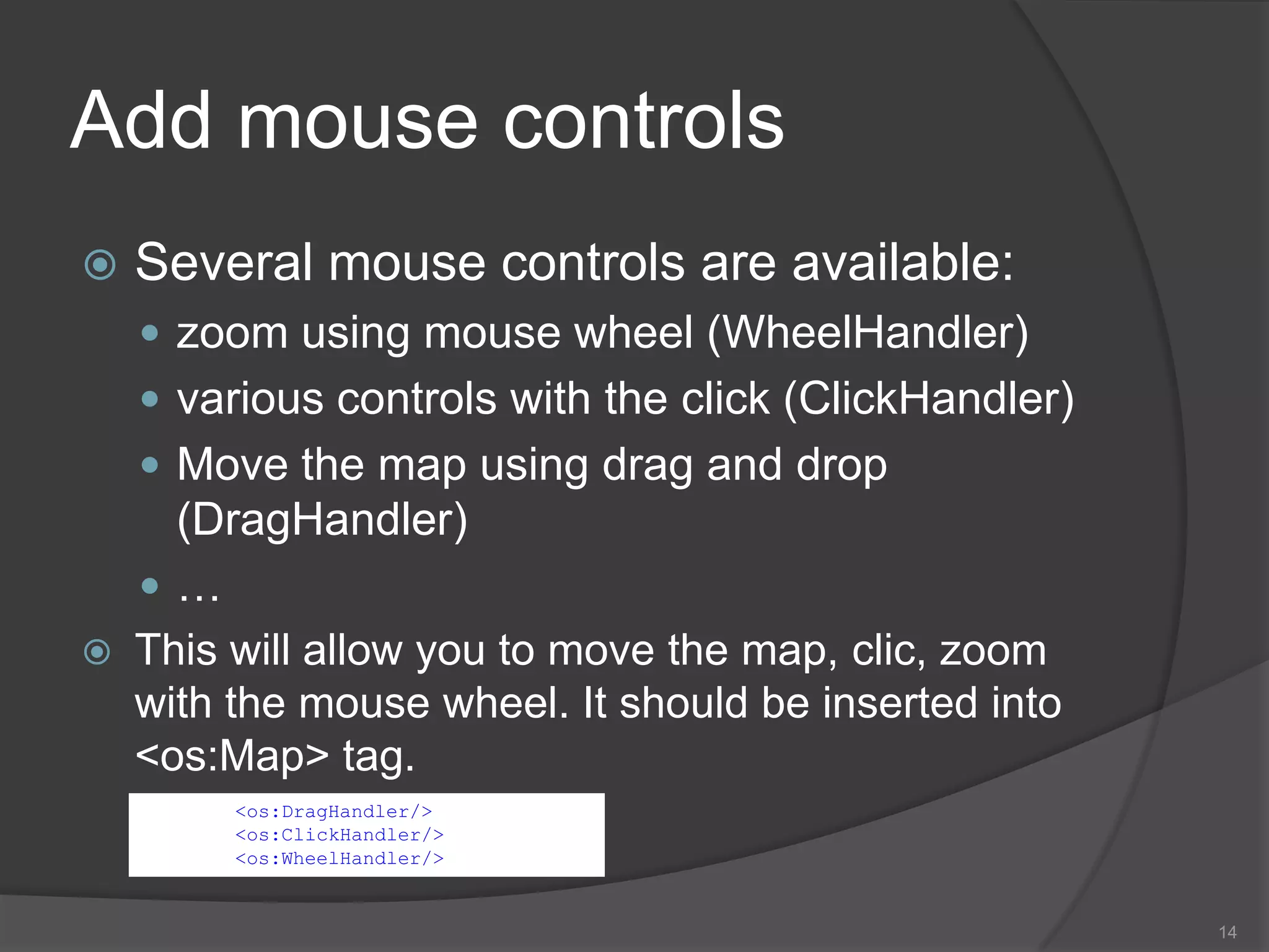
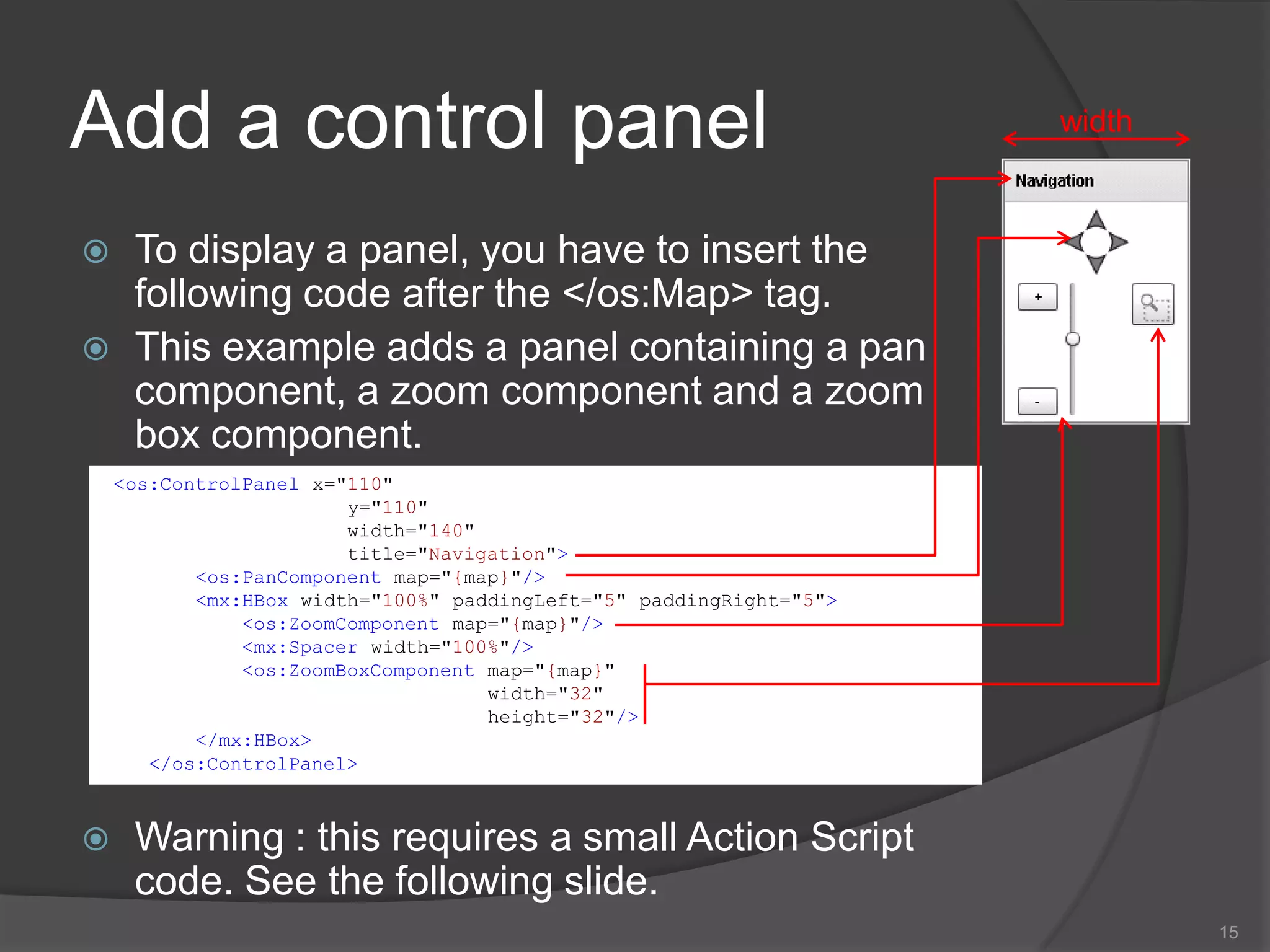
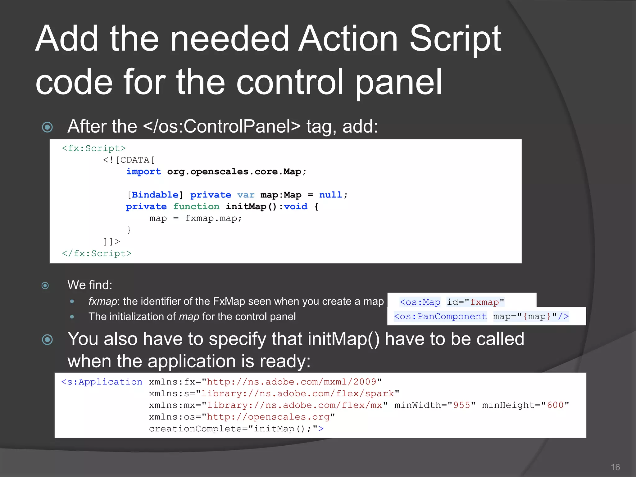
![Code to obtain the map4<?xml version="1.0" encoding="utf-8"?><s:Applicationxmlns:fx="http://ns.adobe.com/mxml/2009" xmlns:s="library://ns.adobe.com/flex/spark" xmlns:mx="library://ns.adobe.com/flex/mx" minWidth="955" minHeight="600"xmlns:os="http://openscales.org"><fx:Declarations></fx:Declarations><os:Map id="fxmap" width="500"height="600" zoom="12"centerLonLat="4.83212,45.75781" x="100" y="100"><os:Mapnik name="base"isBaseLayer="true" proxy="http://www.openscales.org/proxy.php?url=" /><os:MousePosition x="10" y="{fxmap.height-20}"displayProjection="EPSG:4326"/><os:DragHandler/><os:ClickHandler/><os:WheelHandler/></os:Map><os:ControlPanel x="110" y="110" width="140" title="Navigation"><os:PanComponent map="{map}"/><mx:HBox width="100%" paddingLeft="5" paddingRight="5"><os:ZoomComponent map="{map}"/><mx:Spacer width="100%"/><os:ZoomBoxComponent map="{map}" width="32" height="32"/></mx:HBox></os:ControlPanel><fx:Script> <![CDATA[importorg.openscales.core.Map; [Bindable] privatevar map:Map = null;privatefunctioninitMap():void { map = fxmap.map; } ]]></fx:Script></s:Application>](https://image.slidesharecdn.com/02-createfirstmap-100824060610-phpapp01/75/02-create-first-map-4-2048.jpg)