Climate change and resource development scenarios for the Nechako watershed -...
SIR2006_5207
1. U.S. Department of the Interior
U.S. Geological Survey
Scientific Investigations Report 2006-5207
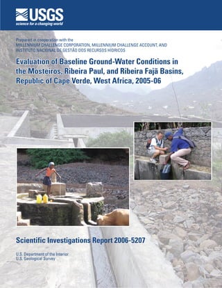
Evaluation of Baseline Ground-Water Conditions in
the Mosteiros, Ribeira Paul, and Ribeira Fajã Basins,
Republic of Cape Verde, West Africa, 2005-06
Evaluation of Baseline Ground-Water Conditions in
the Mosteiros, Ribeira Paul, and Ribeira Fajã Basins,
Republic of Cape Verde, West Africa, 2005-06
Prepared in cooperation with the
MILLENNIUM CHALLENGE CORPORATION, MILLENNIUM CHALLENGE ACCOUNT, AND
INSTITUTO NACIONAL DE GESTÃO DOS RECURSOS HÍDRICOS
2. Cover photos:
Background—Rainwater catchment structure in the Ribeira Fajã Basin, São Nicolau.
Foreground (left)—Gathering water from a well in the Mosteiros Basin, Fogo.
Foreground (right)—USGS and INGRH technicians making a discharge measurement at a
spring in Ribeira Paul Basin, Santo Antão.
(Photographs by Victor Heilweil.)
3. Evaluation of Baseline Ground-Water
Conditions in the Mosteiros, Ribeira Paul,
and Ribeira Fajã Basins, Republic of Cape
Verde, West Africa, 2005-06
By Victor M. Heilweil, John D. Earle, Jay R. Cederberg, Mickey M. Messer,
Brent E. Jorgensen, and Ingrid M. Verstraeten, U.S. Geological Survey
Miguel A. Moura, Arrigo Querido, Fernanda Spencer, and Tatiana Osório,
Instituto Nacional de Gestão dos Recursos Hídricos
U.S. Department of the Interior
U.S. Geological Survey
Prepared in cooperation with the
MILLENNIUM CHALLENGE CORPORATION, MILLENNIUM CHALLENGE ACCOUNT,
AND INSTITUTO NACIONAL DE GESTÃO DOS RECURSOS HÍDRICOS
Scientific Investigations Report 2006-5207
4. U.S. Department of the Interior
Dirk Kempthorne, Secretary
U.S. Geological Survey
P. Patrick Leahy, Acting Director
Reston, Virginia: 2006
For additional information write to:
U.S. Geological Survey
Director, USGS International Water Resources Branch
MS 420, National Center
Reston, Virginia 20192
http://international.usgs.gov/disciplines/water.htm
For more information about the USGS and its products:
Telephone: 1-888-ASK-USGS
World Wide Web: http://www.usgs.gov/
Any use of trade, firm, or product names is for descriptive purposes only and does not imply endorsement by the
U.S. Government.
Although this report is in the public domain, permission must be secured from the individual copyright owners to
reproduce any copyrighted materials contained within this report.
Scientific Investigations Report 2006-5207
5. iii
Contents
Abstract............................................................................................................................................................. 1
Introduction...................................................................................................................................................... 2
Purpose and Scope............................................................................................................................. 2
Acknowledgments............................................................................................................................... 2
General Conceptual Model of Volcanic Island Hydrogeology................................................................. 2
Methods............................................................................................................................................................ 4
Ground-Water Level Data................................................................................................................... 4
Electric-Tape Measurements...................................................................................................... 5
Pressure-Transducer Measurements........................................................................................ 5
Water-Quality Data.............................................................................................................................. 5
Field Parameters............................................................................................................................ 5
Environmental Tracer Analyses................................................................................................... 5
Spring and Stream Discharge Data.................................................................................................. 9
Hydrogeologic Setting.................................................................................................................................... 9
Mosteiros Basin, Fogo......................................................................................................................... 9
Ribeira Paul Basin, Santo Antão..................................................................................................... 12
Ribeira Fajã Basin, São Nicolau...................................................................................................... 15
Baseline Ground-Water Conditions............................................................................................................ 17
Mosteiros............................................................................................................................................. 17
Ground-Water Budget................................................................................................................. 17
Ground-Water Levels.................................................................................................................. 21
Water Quality and Environmental Tracers............................................................................... 22
Ribeira Paul......................................................................................................................................... 25
Ground-Water Discharge........................................................................................................... 25
Ground-Water Levels.................................................................................................................. 31
Water Quality and Environmental Tracers............................................................................... 32
Ribeira Fajã.......................................................................................................................................... 33
Ground-Water Discharge........................................................................................................... 33
Ground-Water Levels.................................................................................................................. 34
Water Quality and Environmental Tracers............................................................................... 35
Measured Ground-Water Discharge as a Percentage of Precipitation............................................... 37
Challenges in Evaluating Ground-Water Conditions in the Three Basins............................................ 38
Summary and Conclusions........................................................................................................................... 38
References Cited........................................................................................................................................... 40
6. iv
Figures
Figure 1. Location of the study basins within the Republic of Cape Verde, West Africa....................... 3
Figure 2. Generalized conceptual model of volcanic island hydrogeology.............................................. 4
Figure 3. Relation between land-surface altitude and water temperature for springs in
Cape Verde.......................................................................................................................................... 7
Figure 4. Estimated initial and decay-corrected tritium concentration of precipitation in Cape
Verde, 1950-2005................................................................................................................................. 9
Figure 5. Location of wells, springs, and precipitation stations in the Mosteiros Basin, Fogo,
Cape Verde........................................................................................................................................ 10
Figure 6. Geology of the Mosteiros Basin, Fogo, Cape Verde................................................................... 11
Figure 7. Location of wells, springs, and precipitation stations in the Ribeira Paul Basin,
Santo Antão, Cape Verde................................................................................................................ 13
Figure 8. Geology of the Ribeira Paul Basin, Santo Antão, Cape Verde.................................................. 14
Figure 9. Location of wells, springs, and precipitation stations in the Ribeira Fajã Basin, São
Nicolau, Cape Verde........................................................................................................................ 15
Figure 10. Geology of the Ribeira Fajã Basin, São Nicolau, Cape Verde................................................... 16
Figure 11. Historical precipitation at Posto Cachaço, Ribeira Fajã Basin, 1961-2005............................. 17
Figure 12. Total annual well withdrawal and the portion of Monte Vermelho spring discharge
used for public supply in Mosteiros Basin, 1998-2005............................................................... 17
Figure 13. Water level in well FF07, Mosteiros Basin, December 2005 through March 2006................ 21
Figure 14. Depth profile of specific-conductance values at well FF07, Mosteiros Basin,
December 2005................................................................................................................................. 22
Figure 15. Relation between δ18
O and δ2
H values in precipitation and ground water from the
Mosteiros, Ribeira Paul, and Ribeira Fajã Basins, Cape Verde................................................ 23
Figure 16. Temperature lapse band and the range of possible dissolved-gas ground-water
recharge temperatures for sites in Mosteiros, Ribeira Paul, and Ribeira Fajã Basins,
Cape Verde........................................................................................................................................ 24
Figure 17. 3
Helium:4
Helium ratios relative to the helium isotopic ratio of air and total 4
Helium
concentration in ground water from the Mosteiros, Ribeira Paul, and Ribeira Fajã
Basins, Cape Verde.......................................................................................................................... 25
Figure 18. Relation between the 3
Helium:4
Helium ratio and fraction of 4
Helium derived from
atmospheric gases in ground water from the Mosteiros, Ribeira Paul, and Ribeira
Fajã Basins, Cape Verde................................................................................................................. 30
Figure 19. Water level in well FA93, Ribeira Paul Basin, August 2005 through June 2006..................... 31
Figure 20. Galleria Fajã discharge and annual precipitation at nearby Posto Cachaço, Ribeira
Fajã Basin, 1984-2005....................................................................................................................... 34
Figure 21. Water level in well FN41, Ribeira Fajã Basin, 1980-86................................................................ 35
Figure 22. Water level in well FN21, Ribeira Fajã Basin, 1984-87................................................................ 36
Figure 23. Water level in well FN39, Ribeira Fajã Basin, December 2005 through March 2006............ 36
7. Tables
Table 1. Area, slope, and average and maximum altitude of the Mosteiros, Ribeira Paul, and
Ribeira Fajã Basins, Cape Verde.................................................................................................... 10
Table 2. Annual precipitation at selected stations in the Mosteiros, Ribeira Paul, and Ribeira
Fajã Basins, Cape Verde ............................................................................................................... 12
Table 3. Records of selected springs and streams in the Mosteiros, Ribeira Paul, and Ribeira
Fajã Basins, Cape Verde................................................................................................................. 18
Table 4. Records of selected wells in the Mosteiros, Ribeira Paul, and Ribeira Fajã Basins,
Cape Verde........................................................................................................................................ 20
Table 5. Selected field measurements, stable isotopes, dissolved-gas concentrations, and
estimated recharge temperatures of samples collected from the Mosteiros, Ribeira
Paul, and Ribeira Fajã Basins, Cape Verde.................................................................................. 26
Table 6. Tritium and helium concentration and estimated age of samples collected from the
Mosteiros, Ribeira Paul, and Ribeira Fajã Basins, Cape Verde................................................ 29
8. vi
Conversion Factors, Datums, and Abbreviated
Water-Quality Units
Multiply By To obtain
Length
millimeter (mm) 0.0394 inch (in.)
meter (m) 3.2808 foot (ft)
kilometer (km) 0.6215 mile (mi)
Area
square kilometer (km2
) 247.0966 acre
square kilometer (km2
) 0.3861 square mile (mi2
)
Volume
milliliter (ml) 0.0338 ounce, fluid (fl. oz)
liter (L) 2.1133 pint (pt)
liter (L) 1.0566 quart (qt)
liter (L) 0.2642 gallon (gal)
cubic meter (m3
) 264.201 gallon (gal)
cubic centimeter (cm3
) 0.0610 cubic inch (in3
)
cubic meter (m3
) 35.3107 cubic foot (ft3
)
cubic meter (m3
) 1.3079 cubic yard (yd3
)
Flow rate
cubic meter per day (m3
/d) 35.3107 cubic foot per day (ft3
/d)
liter per minute (L/m) 0.2642 gallon per minute (gal/min)
Density
cubic centimeter per gram (cm3
/g) 0.0160 cubic foot per pound (ft3
/lb)
Hydraulic conductivity
meter per day (m/d) 3.2808 foot per day (ft/d)
Hydraulic gradient
meter per kilometer (m/km) 5.2798 foot per mile (ft/mi)
Transmissivity1
meter squared per day (m2
/d) 10.7643 foot squared per day (ft2
/d)
1
Transmissivity: The standard unit for transmissivity is cubic foot per day per square foot times foot of aquifer thick-
ness [(ft3
/d)/ft2
]ft. In this report, the mathematically reduced form, foot squared per day (ft2
/d), is used for conve-
nience.
9. vii
Temperature in degrees Celsius (°C) may be converted to degrees Fahrenheit (°F) as follows:
°F = (1.8 × °C) + 32.
Temperature in degrees Fahrenheit (°F) may be converted to degrees Celsius (°C) as follows:
°C = (°F - 32) / 1.8.
Horizontal coordinate information is referenced to the North American Datum of 1983 (NAD 83). Vertical
coordinate information is referenced to the North American Vertical Datum of 1988 (NAVD 88). Altitude, as
used in this report, refers to distance above the vertical datum.
Specific conductance is reported in microsiemens per centimeter at 25 degrees Celsius (µS/cm at 25°C).
Concentration of chemical constituents in water is reported in milligrams per liter (mg/L). Concentration of
dissolved gases is reported in cubic centimeters at standard temperature and pressure per gram (cm3
STP/g).
Tritium concentration is reported in tritium units (TU).
11. Abstract
This report documents current (2005-06) baseline
ground-water conditions in three basins within the West
African Republic of Cape Verde (Mosteiros on Fogo, Ribeira
Paul on Santo Antão, and Ribeira Fajã on São Nicolau) based
on existing data and additional data collected during this study.
Ground-water conditions (indicators) include ground-water
levels, ground-water recharge altitude, ground-water discharge
amounts, ground-water age (residence time), and ground-water
quality. These indicators are needed to evaluate (1) long-term
changes in ground-water resources or water quality caused by
planned ground-water development associated with agricul-
tural projects in these basins, and (2) the feasibility of artifi-
cial recharge as a mitigation strategy to offset the potentially
declining water levels associated with increased ground-water
development.
Ground-water levels in all three basins vary from less
than a few meters to more than 170 meters (m) below land
surface. Continuous recorder and electric tape measurements
at three monitoring wells (one per basin) showed variations
between August 2005 and June 2006 of as much as 1.8 m. Few
historical water-level data were available for the Mosteiros or
Ribeira Paul Basins. Historical records from Ribeira Fajã indi-
cate very large ground-water declines during the 1980s and
early 1990s, associated with dewatering of the Galleria Fajã
tunnel. More-recent data indicate that ground-water levels in
Ribeira Fajã have reached a new equilibrium, remaining fairly
constant since the late 1990s.
Because of the scarcity of observation wells within each
basin, water-level data were combined with other techniques
to evaluate ground-water conditions. These techniques include
the quantification of ground-water discharge (well with-
drawals, spring discharge, seepage to springs, and gallery
drainage), field water-quality measurements, and the use of
environmental tracers to evaluate sources of aquifer recharge,
flow paths, and ground-water residence times.
In the Mosteiros Basin, measured well and spring dis-
charge is about 220,000 cubic meters per year (m3
/yr). For the
Ribeira Paul Basin, measured well discharge, spring discharge,
and ground-water seepage to springs is about 1,600,000 m3
/yr.
Ribeira Fajã Basin is the driest of the three basins with a pre-
cipitation rate of about half that of the other two basins. The
only measurable ground-water discharge from this basin is
from Galleria Fajã, estimated to be about 150,000 m3
/yr. Mea-
sured discharge for all three basins does not include submarine
outflow or agricultural/phreatophyte consumptive use (Paul
Basin, only) and is assumed to be less than total ground-water
discharge.
Ground-water ages indicate that recharge to wells and
springs occurred from more than 50 years ago at some loca-
tions to within the past decade at other sites. Ground water
in Paul is younger than that in the other two basins, indicat-
ing that recharge generally occurred within the past 50 years.
Ground water at all the dateable sites using tritium/helium in
both the Mosteiros and Ribeira Fajã Basins show that recharge
occurred more than 50 years before the sampling dates.
Ground-water tritium/helium age dating was not possible at
some sites in Mosteiros and Ribeira Fajã Basins because of the
presence of helium in the aquifer derived from the mantle or
aquifer matrix. However, this helium was useful for accurate
age dating of the unaffected ground-water sites.
Dissolved gases indicate that most ground-water recharge
occurs at mid and high altitudes within all three basins; calcu-
lated recharge altitudes ranged from 700 to more than 2,000
m. In the Mosteiros and Ribeira Fajã Basins, recharge altitudes
are much higher than the wells and springs. This suggests that
it may take many years for artificial recharge to result in a
beneficial impact on the aquifer in areas where the agricultural
projects are implemented. Recharge altitudes in Paul Basin
also were generally higher than their respective ground-water
discharge sampling sites. Generally younger ground-water
ages in Paul, however, indicate the existence of some short
flow paths where artificial recharge may possibly enhance
available water resources within a few years.
The salinity of wells and springs is generally low in the
Ribeira Paul and Ribeira Fajã Basins, but somewhat higher
in Mosteiros Basin. Specific-conductance measurements of
wells and springs in Ribeira Paul and Ribeira Fajã ranged from
about 200 to 700 microsiemens per centimeter at 25 degrees
Celsius (μS/cm). Although the Monte Vermelho spring in
Evaluation of Baseline Ground-Water Conditions in the
Mosteiros, Ribeira Paul, and Ribeira Fajã Basins, Republic
of Cape Verde, West Africa, 2005-06
By Victor M. Heilweil, John D. Earle, Jay R. Cederberg, Mickey M. Messer, Brent E. Jorgensen, and Ingrid M.
Verstraeten, U.S. Geological Survey; Miguel A. Moura, Arrigo Querido, Fernanda Spencer, and Tatiana Osório,
Instituto Nacional de Gestão dos Recursos Hídricos
12. Evaluation of Baseline Ground-Water Conditions, Republic of Cape Verde, West Africa, 2005-06
Mosteiros Basin also has very low salinity (200 μS/cm),
water from the wells along the coastal plain has specific-con-
ductance measurements of as much as 16,000 μS/cm. These
higher values indicate some brackish water intrusion. Addi-
tional ground-water development of the Mosteiros coastal
plain may exacerbate this situation.
Introduction
The Republic of Cape Verde is an island archipelago
located about 750 km off the west coast of Africa (fig. 1). Its
400,000 inhabitants live on 9 separate small islands with a
combined area of 4,000 km2
, resulting in one of the highest
population densities among the West African nations (Lang-
worthy and Finan, 1997). The majority of the population
resides in rural areas and derives its livelihood from rain-fed
agriculture. Farming is challenging in the Sahelian climate,
dominated by the cool, dry northeast trade winds. Total annual
precipitation ranges from 0 to 50 mm along the populated
coastal areas to 400-800 mm in the highlands and is extremely
variable from year to year (Haagsma, 1995). About 80 percent
of this precipitation is associated with the equatorial monsoon
(August-October; Vailleux and Bourguet, 1974) and comes
during only a few days each year. The majority of the precipi-
tation is lost to evapotranspiration and runoff to the sea. The
evaporation and runoff losses are caused by a combination
of warm climate, thin soil cover, steep topographic gradients,
and short distances to the sea. Surface-water resources on the
islands are virtually non-existent; there are no lakes and only
a few small perennial streams. Nearly all of the water for con-
sumption comes either from rainfall catchment structures or
ground water. Because of the lack of rainfall and sparse water
resources, Cape Verde currently imports about 70 percent of
its food (Instituto Nacional de Gestão dos Recursos Hídricos,
written commun., 2005).
To decrease this dependence on imported food, agricul-
tural development projects funded by the U.S. Millennium
Challenge Corporation (MCC) are currently underway in three
basins on three islands: Mosteiros on Fogo, Ribeira Paul on
Santo Antão, and Ribeira Fajã on São Nicolau. These projects
are dependent on enhanced availability of water resources
through additional rainfall catchment infrastructure and/or
ground-water development. Artificial recharge of ground
water is being planned as a mitigation strategy to offset the
potential of declining aquifer water levels and/or deteriorating
water quality associated with increased use. An important met-
ric for the success of the agricultural development projects is
the identification of current ground-water baseline conditions
in order to evaluate any long-term changes in ground-water
resources or water quality.
The U.S. Geological Survey (USGS) received support
from the MCC to provide training in ground-water data collec-
tion and to assess the current (2005-06) baseline ground-water
conditions in the three project basins. Ground-water conditions
include ground-water levels, ground-water recharge altitudes
and sources, ground-water discharge quantities, ground-water
age (residence time), and ground-water quality. These tasks
were accomplished, in coordination with the Instituto Nacional
de Gestão dos Recursos Hídricos (INGRH), during and after
two technical missions to Cape Verde.
Purpose and Scope
The purpose of this report is to summarize and interpret
the ground-water data collected during the project. In addition
to this report, ground-water monitoring equipment, training
classes and manuals, and field demonstrations were provided
in all three study basins. Because of the scarcity of observa-
tion wells within each basin and the inability to drill additional
wells within the scope of this project, sparse water-level data
were combined with other techniques to evaluate ground-water
conditions. These other methods include (1) the use of pres-
sure transducers and historical ground-water levels to evaluate
temporal changes in potentiometric surfaces in each basin, (2)
the measurement of well withdrawals, spring discharge, and
gallery drainage in order to estimate ground-water discharge
budgets for each basin, and (3) the use of environmental trac-
ers to evaluate sources of aquifer recharge, flow paths, and
ground-water residence times.
Acknowledgments
The authors thank Sra. Elsa Samoes, Millennium Chal-
lenge Account Cape Verde, for providing historical precipita-
tion data and artificial recharge development plans; Sra. Maria
Modesto, Ministereo de Infrastructuras, Transportes, e Mar,
Cape Verde, for providing GIS topographic coverages; Tony
Mulhern and Kayo Shiraishi, U.S. Peace Corps volunteers in
Santo Antão, for collecting precipitation samples and provid-
ing translating assistance during the USGS missions; D. Kip
Solomon and Alan Rigby, University of Utah Dissolved-Gas
Service Center, for their laboratory analysis and interpretive
assistance with dissolved-gas samples; Keith Halford and
Edwin Weeks, USGS, for their assistance with interpreting the
Galleria Fajã aquifer drawdown data; Patrick Tucci, Richard
Healy, and Steven Gingerich, USGS, for technical support;
and Lourdes Lima, Instituto Nacional de Gestão dos Recursos
Hídricos, Cape Verde, for overseeing in-country logistical sup-
port and technical assistance
General Conceptual Model of Volcanic
Island Hydrogeology
Cape Verde consists of a chain of volcanic islands
believed to have been formed over an oceanic hot spot (Lodge
and Helffrich, 2006). The islands are predominantly basaltic
layered lava flows interspersed with pyroclastics and breccias
13. Figure 1. Location of the study basins within the Republic of Cape Verde, West Africa.
San Tiago
Fogo
Boa Vista
Sal
Santo Antão
Maio
São Nicolau
São Vicente
Brava
Santa Luzia
Raso
Branco
Ilheus Seco
Mosteiros
Basin
Ribeira Fajã
Basin
Ribeira Paul
Basin
Mosteiros
Basin
Ribeira Fajã
Basin
Ribeira Paul
Basin
Praia
EXPLANATION
15°
16°
17°
25° 24° 23°
Study basin
0 8040 KILOMETERS
0 40 MILES20
Base from Environmental Systems Research Institute, Inc.
Digital Chart of the World, 1993, 1:1,000,000
Cabo Verde National Grid Projection
Coastal
West Africa
Mali
Mauritania
Guinea
Senegal
Liberia
Sierra Leone
Guinea-Bissau
The Gambia
Cape Verde
Islands
Dakar
Bissau
Conakry
Monrovia
Freetown
Nouakchott
Saint Louis
Coastal
West Africa
Mali
Mauritania
Guinea
Senegal
Liberia
Sierra Leone
Guinea-Bissau
The Gambia
Cape Verde
Islands
Dakar
Bissau
Conakry
Monrovia
Freetown
Nouakchott
Saint Louis
BanjulBanjul
General Conceptual Model of Volcanic Island Hydrogeology
14. Evaluation of Baseline Ground-Water Conditions, Republic of Cape Verde, West Africa, 2005-06
and intruded by near-vertical mafic dikes (Barmen and others,
1990). Volcanic islands, especially those recently formed like
Cape Verde, typically have high topographic relief, shallow
soils, and rapid runoff. Rainfall distribution and infiltration is
dependent upon basin altitude and morphology, orientation
with respect to the tropical trade winds, strength of monsoonal
patterns, and the thickness and type of soil cover. As is com-
mon on most islands with much topographic relief, the islands
of Cape Verde typically have wet and dry sides that result from
wind and precipitation patterns. In general, however, most
infiltration occurs in the higher-altitude parts of the islands,
where precipitation rates are highest. Part of this moisture is
subsequently lost as either evapotranspiration or lateral flow
to perched springs. The component of infiltration that contin-
ues downward to recharge the aquifer is herein referred to as
net infiltration. Water-table altitude and slope of this aquifer
would generally be dependent on both aquifer permeability
and net infiltration (recharge) rate. Hydraulic conductivity of
basalt is reported to range from about 0.1 to 1,000 m/d (Freeze
and Cherry, 1979). Studies from Hawaii indicate that highly
transmissive volcanic island basalts generally have hydrau-
lic-conductivity values of about 100 to 1,000 m/d (Gingerich
and Voss, 2002), whereas low-transmissivity basalts generally
have hydraulic-conductivities of about 0.1 to 10 m/d (Izuka
and Gingerich, 2003). Watersheds with high recharge rates
and/or low permeability basalt aquifers would have steeper
water-table slopes and higher-altitude water tables; water-
sheds with low net-infiltration rates and/or high permeability
basalt aquifers would have lesser slopes, with water tables
only a few meters above sea level. Relatively high horizontal
hydraulic-conductivity values (hundreds of meters per day) are
often reported for basaltic volcanic islands (Prada and others,
2005) and result in a regional (basal) water table within tens
of meters of sea level. Low-permeability intrusive mafic dikes,
where present, are thought to act as horizontal flow barriers.
Similarly, low-permeability breccias, tuffs, and pyroclastics
may act as either horizontal or vertical flow barriers. Horizon-
tal and vertical flow barriers may cause perched ground water,
high-altitude springs, and/or ground-water compartmentaliza-
tion resulting in a stepped (rather than smooth) overall water
table (fig. 2)
Measurable ground-water discharge from volcanic island
watersheds typically includes discharge to springs, well with-
drawals, seepage to streams, and evapotranspiration in areas
of shallow water table. Also, in Cape Verde and some other
volcanic islands, horizontal tunnels have often been con-
structed to drain ground water as an additional water-supply
source. Ground-water discharge, however, is often dominated
by submarine outflow, which is difficult to quantify. Subma-
rine discharge has been documented in other volcanic island
sites (Izuka and Gingerich, 2003; Prada and others, 2005) and
quantified in other settings (Bokuniewicz, 1980; Cable, 1997;
Cambareri and Eichner, 1998; Michael and others, 2003).
Small islands typically have a freshwater lens of ground
water (lower density) floating on top of higher-density brack-
ish and salt water. The fresh water/brackish water boundary
is not fixed or sharp; rather it is controlled by pressure and
density and dependent upon the balance between ground-water
recharge and ground-water discharge. Aquifer drawdown
associated with excessive pumping, therefore, may lower
water levels in the aquifer and move the fresh/brackish water
boundary inland, causing salt-water intrusion.
Methods
Ground-Water Level Data
In order to evaluate ground-water conditions and provide
a baseline for the future assessment of changes in ground-
water storage in the three study basins, ground-water levels
were measured periodically with electric tapes. In addi-
tion, pressure transducers and data loggers were installed in
selected observation wells to provide a continuous record of
water-level changes.
Figure 2. Generalized conceptual model of volcanic island hydrogeology.EXPLANATION
Fractured basalt
Unconsolidated materials
Brackish water
Brackish water
Submarine
outflow
Galleria Tunnel
WellWell
Brackish water
Brackish water
Atlantic
Ocean
Atlantic
Ocean
FreshwaterFreshwater
SaltwaterSaltwater
SaltwaterSaltwater
NOT TO SCALE Modified from Macdonald and others (1983)
Water table
Perched
water body
Dike-compartment
water table
15. Electric-Tape Measurements
Manual water-level measurements in production and
observation wells were made by the INGRH and the USGS
with calibrated electric tapes in all three project basins. The
accuracy of this method is about 0.01 m, which is of sufficient
precision to provide a baseline for monitoring both seasonal
and longer-term water-level changes. Three lengths of electric
water-level tapes (60-, 100- and 250-m) were used, depending
on the depth to water at each well. Water-level measurements
were corrected by subtracting the distance from the measur-
ing point above land surface. Land-surface altitudes were
estimated with hand-held GPS, topographic maps, or from
drillers’ logs. Although the accuracy of these altitudes is only
about plus or minus 10 m, this study was concerned with rela-
tive depth below land surface and temporal changes in ground-
water levels, rather than absolute altitude.
Pressure-Transducer Measurements
Two types of pressure transducers, vented and non-
vented, and data loggers were installed in observation wells
to continuously monitor water levels. A vented transducer
was installed in observation well FA93 in the Ribeira Paul
Basin. These transducers are vented to the atmosphere and
automatically compensate for changes in atmospheric pres-
sure. They do not require barometric pressure corrections, but
have a fixed-length cable that cannot be modified. Non-vented
transducers were installed in observation wells FF07 in the
Mosteiros Basin and FN39 in the Ribeira Fajã Basin. The non-
vented transducers require independently measured barometric
pressure data in order to correct for changes in atmospheric
pressure; thus loggers also were installed in FF07 and FN39 to
record barometric pressure. The non-vented transducers hang
on a small-diameter steel cable rather than requiring a fixed-
length cable and, therefore, are better suited for wells with
large depths to water and/or where sharp objects in the well
may damage the more-delicate vented cable. All the transduc-
ers were programmed to record water-pressure and barometric
pressure or water-level data every 6 hours, which was later
corrected for instrument drift based on independent electric-
tape water-level measurements (Freeman and others, 2004).
Because of both ocean and earth tides and the relatively
small daily absolute water-level change, tidal effects were
corrected in two of the four transducer wells. The tidal cor-
rections were done with a digital Butterworth filter program
(Umari, M.J., and Earle, J.D., U.S. Geological Survey, written
commun., 2002) using a low pass cutoff frequency of 0.8
cycles per day. This is based on frequencies of tidal harmonic
components ranging from 0.85 to 2 cycles per day (Merritt,
2004).
Water-Quality Data
Field parameters were measured and laboratory analysis
of environmental tracers was conducted on water samples
collected from springs, wells, streams, and tunnels in the three
study basins. This information is used for evaluating sources
of recharge, ground-water residence times, ground-water flow
paths, and salt-water intrusion. It will also provide a baseline
geochemical data set for potential evaluation of future changes
to the ground-water systems.
Field Parameters
Field water-quality parameters were measured at ground-
water and surface-water sites according to USGS procedures
(Wilde and Radtke, 1998). Parameters include specific con-
ductance, pH, temperature, dissolved oxygen, barometric and
total dissolved-gas pressure. These parameters were measured
with a multimeter probe, which was calibrated daily to a repre-
sentative set of standards.
Specific conductance was used as a proxy for dissolved-
solids concentration because geochemical laboratory analysis
of dissolved solids was not within the scope of this study.
Dissolved-solids concentration is generally about 55 to 75
percent of the specific-conductance value, depending on the
chemical makeup of the water (Hem, 1992). The pH of a water
sample is often indicative of the movement of ground water
through differing geologic layers, such as volcanic or allu-
vial deposits. Low pH values may indicate geothermal water
sources. Water temperature also is useful for evaluating the
influence of upwelling geothermal waters and is needed for
the dissolved-gas solubility calculations used in determining
recharge temperatures and for tritium/helium age dating. Dis-
solved oxygen is an indicator of oxidation conditions within
an aquifer, including both anaerobic and aerobic bacterial
activity associated with the decomposition of organic matter.
Barometric and total dissolved-gas pressures are used to guide
appropriate dissolved-gas sampling methods and are needed
for the determination of absolute dissolved-gas concentrations
from in-situ diffusion samplers. Total dissolved gas pressures
can also be used to evaluate hydrologic processes such as
denitrification, anaerobic decay and gas production (CH4
, H2
,
CO2
), degassing of deep geothermal fluids (CO2
production),
and air entrapment in the recharge zone.
Environmental Tracer Analyses
Ground-water samples were analyzed for the stable
(deuterium and oxygen-18) isotopes of the water molecule.
Samples for deuterium (2
H) and oxygen-18 (18
O) were col-
lected from open boreholes by using polyvinyl chloride 1,000-
ml sample bailers. Water samples from production wells were
collected by using existing submersible pumps. Water samples
from springs and tunnels were collected by gravity flow.
Stable-isotope samples were collected according to procedures
Methods
16. described by Coplen and others (1996), stored in clean poly-
ethylene bottles, and analyzed by the USGS Stable Isotope
Laboratory in Reston, Virginia. The stable isotopes (2
H, 18
O)
are used to evaluate the relative altitude of source precipitation
that recharges a ground-water system. These stable isotopes
are analyzed by measuring the ratio of the heavier, less-abun-
dant isotope to the lighter, more-abundant isotope and are
reported as differences to a known standard. The isotope ratios
are reported as delta (δ) values expressed as parts per thousand
(permil). The δ value for an isotope ratio, R, is determined by:
δR = (Rsample
/ Rstandard
–1)x1000 (1)
where:
δR is the δ value for a specific isotope in the sample
(2
H or 18
O),
Rsample
is the ratio of the rare isotope to the common iso-
tope for a specific element in the sample, and
Rstandard
is the ratio of the rare isotope to the common iso-
tope for the same element in the standard reference
material.
A positive δR value indicates that the sample is enriched in
the heavier isotope with respect to the sample. A negative
δR value indicates that the sample is depleted in the heavier
isotope with respect to the sample. In general, precipitation
falling at a higher altitude is more isotopically depleted in
2
H and 18
O than precipitation at lower altitudes. Therefore,
these stable isotopes are generally helpful for evaluating the
precipitation source areas of recharge to an aquifer (Mazor,
1991). The relation between δ2
H and δ18
O values generally
plots along a trend line known as the global meteoric water
line. This trend is described by the equation:
δ2
H = 8 (δ18
O)+ d (2)
where:
d is defined as the 2
H excess (Dansgaard, 1964). The
mean global value for d in freshwater is 10 (Craig,
1961).
Dissolved-gas samples were collected to evaluate
ground-water recharge temperature (temperature of water
entering the water table). In contrast to stable isotopes, these
tracers are useful for evaluating the altitude where recharge
actually enters the aquifer rather than the altitude where the
precipitation occurs. A large fraction of gases dissolved in
ground water originate in the atmosphere and their solubil-
ity in water is temperature-dependent (Stute and Schlosser,
2001). As recharging water enters an aquifer, these dissolved-
gas concentrations are “locked in” based on the temperature,
barometric pressure, amount of excess air, and salinity at the
water table (Aeschbach-Hertig and others, 1999; Ballentine
and Hall, 1999; Stute, 2001). Because the gases are rela-
tively inert, their concentrations generally remain unchanged
along ground-water flow paths to points of discharge (wells
and springs). Dissolved-gas concentrations in discharging
ground water, therefore, can be used to estimate ground-water
recharge temperatures. For this study, dissolved concentrations
of N2
, 40
Ar, 84
Kr, 20
Ne, and 129
Xe were used in the closed sys-
tem equilibration model (Aeschbach-Hertig and others, 2000;
Kipfer and others, 2002) to calculate estimated ground-water
recharge temperature, pressure, excess air, and a fractionation
factor (related to the partial dissolution of trapped air bubbles).
Because there are five known parameters (the individual
dissolved-gas concentrations) and four unknowns, this is an
over-determined problem that can be solved (optimized) with
a system of linear equations.
Dissolved-gas samples were collected as water samples
in copper tubes and as gas samples with in-situ diffusion sam-
plers. The copper-tube collection method for dissolved gases
is described by Stute and Schlosser (2001). The diffusion
sampler method is described by Sheldon (2002). The diffu-
sion sampler consists of a small copper chamber (about 0.82
cm3
) with gas-permeable membranes. Samplers were installed
in wells and springs and allowed to equilibrate with the water
for 24 hours. The samples were quickly removed and cold-
welded by using a pinch-off tool. Dissolved-gas concentra-
tions were analyzed by the University of Utah’s Dissolved Gas
Service Center using both quadrapole and sector-field mass
spectrometers. The mass-spectrometer analysis provides the
relative mole fractions of dissolved gases. The dissolved-gas
concentrations of the water sample are then calculated based
on Henry’s Law relations by using field measurements of total
dissolved-gas pressure and water temperature. The University
of Utah’s analytical precision generally results in a ± 0.5°C
uncertainty in dissolved-gas recharge temperatures for samples
with small amounts of excess air and known recharge altitude
(K. Solomon, University of Utah, oral commun., 2006).
Recharge altitude is an unknown parameter, a typical
situation in locations with high topographic gradient, such
as the three study basins in Cape Verde. Because recharge
temperature and recharge altitude are correlated, it is com-
mon to generate a range of estimated dissolved-gas recharge
temperatures for each ground-water sample using (1) the land-
surface altitude (the minimum altitude where recharge could
occur) at each sample site to calculate a maximum dissolved-
gas recharge temperature (Trmax
), and (2) the highest possible
water-table altitude (the maximum altitude where recharge
could occur) within the watershed to calculate a minimum
dissolved-gas recharge temperature (Trmin
). This possible range
of dissolved-gas recharge temperatures for each sample is then
compared to the atmospheric temperature lapse curve to deter-
mine the “most-probable” dissolved-gas recharge temperature
and recharge altitude.
Temperature lapse rates vary at different locations.
Factors affecting temperature lapse rates include strength of
solar radiation (season, slope, aspect), proximity to oceans,
topography (cold air drainage), and relative humidity. Air
temperature lapse rates are generally about -6°C per 1,000 m
(Rolland, 2003), but can vary from -10°C per 1,000 m (dry air
adiabatic lapse rate) to -4°C per 1,000 m (saturated adiabatic
lapse rate). Water-table temperature lapse rates are assumed
Evaluation of Baseline Ground-Water Conditions, Republic of Cape Verde, West Africa, 2005-06
17. to be similar to air temperature lapse rates in places having
shallow depth to water and can be generated from measure-
ments of spring altitude and water temperature (Manning and
Solomon, 2003). However, if there is a thick vadose zone and
large depth to water, the apparent temperature lapse rate may
be lower because of the geothermal gradient. Therefore, appar-
ent recharge altitudes derived from dissolved-gas recharge
temperatures in this study are likely a minimum and may
underestimate actual recharge altitudes towards the interior of
the islands where there is the possibility of a thick vadose zone
and deep water table.
A local temperature lapse rate for Cape Verde was con-
structed based on the relation between altitude and measured
water temperature for seven springs within the three study
basins, as well as other published data. These published data
include 10 springs in Fogo but outside the Mosteiros Basin
study area (Kallrén and Schreiber, 1988; Barmen and others,
1990) and 34 springs on the island of Santiago (Barmen and
others, 1984). In order to minimize the influence of geother-
mally affected waters, only springs with water temperatures of
26°C were used when constructing the lapse curve. Spring
altitude and water temperature are closely correlated (r2
=
0.75; fig. 3). The resulting temperature lapse rate is about
-5°C per 1,000 m. This lapse rate is within the reported range
in lapse rates (Rolland, 2003). The following relation can be
used for estimating water-table temperature lapse rate (fig. 3):
A = (24.3 – T) / 0.005 (3)
where:
A is altitude, in m, and
T is temperature, in °C.
Figure 3. Relation between land-surface altitude and water temperature for springs in Cape Verde.
0
200
400
600
800
1,000
1,200
1,400
1,600
1,800
2,000
10 12 14 16 18 20 22 24 26 28 30
WATER TEMPERATURE, IN DEGREES CELSIUS
LAND-SURFACEALTITUDE,INMETERS
Maximum
temperature
Minimum
temperature
Best fit
Methods
18. Because of uncertainty in the measured temperature lapse
curve, it is often presented as a band of altitude-dependent
temperatures. Residuals calculated by subtracting the mea-
sured temperature from the theoretical temperature for each
spring by using equation 3 result in a standard deviation of
1.6°C. A 2-sigma temperature band of 3.2°C for each altitude
was used, therefore, in order to encompass 95 percent of the
samples.
The “most probable” range of recharge temperature/alti-
tude combinations is then determined by the intersection of
the maximum range of recharge temperatures (Trmin
/Trmax
) and
the temperature lapse band. Estimated recharge altitudes have
an uncertainty that is difficult to quantify, caused primarily by
uncertainty in the temperature lapse rate.
Ground-water samples also were collected and analyzed
for the tritium (3
H) isotope in the water molecule. As with the
stable isotopes, 3
H samples were collected from open bore-
holes by using polyvinyl chloride 1,000-ml sample bailers.
Water samples from production wells were collected by using
existing submersible pumps. Water samples from springs
and tunnels were collected by gravity flow. All samples were
stored in clean polyethylene bottles. Tritium samples were
analyzed with the tritium in-growth method (Clarke and oth-
ers, 1976) at the University of Utah’s Dissolved Gas Service
Center.
Tritium is a radioactive isotope of hydrogen and decays
to tritiogenic helium (3
Hetrit
) with a half life of 12.3 years and,
therefore, can be used for evaluating the relative age of ground
water. As with the stable isotopes, tritium is analyzed by
measuring the ratio of the heavier and less-abundant isotope to
the lighter and more-abundant isotope. Tritium concentrations
are reported in tritium units, where one tritium unit represents
one molecule of 3
H1
HO in 1018
molecules of 1
H2
O (Solomon
and Cook, 2000). Tritium is naturally produced in earth’s
upper atmosphere through cosmic-ray neutron bombardment
of nitrogen. Much larger amounts were introduced into the
atmosphere during thermonuclear testing in the 1950s and
1960s. On the basis of International Atomic Energy Agency
records from network stations at similar latitudes (Barbados,
Ascension Island, St. Helena), Barmen and others (1990)
estimated that the natural background concentration of 3
H in
precipitation in Cape Verde was about 4 TU prior to 1953 and
after 1980. This conclusion is consistent with five precipita-
tion samples collected on Santiago Island during 1984 with 3
H
concentrations ranging from 2.3 ± 0.1 to 4.4 ± 0.2 TU (Akiti,
1985) and one sample collected on Fogo Island in 1987 with
a 3
H concentration of 3.0 ± 1 TU (Barmen and others, 1990).
The samples collected during the 1980s, however, may still
have contained some anthropogenic 3
H. Sampling during
2005, as part of this study, indicates a current atmospheric
concentration of 1 to 3 TU, which may be a more accurate
natural background concentration for Cape Verde. Relatively
large amounts of anthropogenic 3
H were introduced into the
atmosphere by thermonuclear testing in the 1950s and 1960s,
with estimated peak precipitation 3
H concentrations in Cape
Verde reaching about 175 TU in 1964 (Kallrén and Schreiber,
1988).
Based on its 12.3-year half life, decay-corrected 3
H con-
centrations can be calculated with:
C = Co
e-tλ
(4)
where:
C is the measured 3
H concentration in water,
Co
is the initial 3
H concentration,
t is the number of years since the precipitation
occurred, and
λ is the decay constant (0.0565/yr for 3
H).
The estimated initial and decay-corrected 3
H concentra-
tion of precipitation in Cape Verde from 1950 through 2005,
modified from Barmen and others (1990), is shown in figure
4. Assuming that precipitation recharging aquifers in Cape
Verde prior to the early 1950s had an initial 3
H concentra-
tion of 3.0 TU, these waters in 2005 would have had a 3
H
concentration of ≤0.3 TU. Recharge that occurred during
above-ground nuclear testing in the late 1950s and 1960s
(assuming initial 3
H concentrations in precipitation of 10 to
175 TU) would have current 3
H concentrations of about 1 to
17 TU. Water recharging the aquifer during the 1970s (assum-
ing initial 3
H concentrations in precipitation of 4.0 to 14 TU)
would have current 3
H concentrations between 0.6 and 2.0 TU.
Water recharging the aquifer during the 1980s (assuming an
average 3
H concentration in precipitation of 3.5 TU) would
have current 3
H concentrations between 0.9 to 1.4 TU. Water
recharging the aquifer during the 1990s to present (assuming
an average 3
H concentration in precipitation of about 2.0 to
3.0 TU) would have current 3
H concentrations between 1.4
and 3.0 TU. Ground water discharging from springs and wells
often contains a mixture of flow paths having water of various
ages. Ground water having a 3
H concentration less than 4 TU
but greater than 0.3 TU may represent a mixture of both young
and old waters rather than representing a discrete flow path
and recharge year. Except for ground-water recharge occurring
during the 1963 3
H peak, therefore, it is generally not possible
to uniquely determine modern (post-1950s) ground-water ages
from tritium alone.
Tritium/helium (3
H/ 3
Hetrit
) age dating is a technique,
however, that can be used for dating relatively young ground
water recharged within the past 50 years. 3
H in the water
molecule decays to 3
Hetrit
, a gas which is readily lost in the
atmosphere but is geochemically conservative (inert) when
dissolved in ground water. The age-dating clock begins, there-
fore, when recharge crosses the water table rather than when
it infiltrates the subsurface. The 3
H/ 3
Hetrit
ratio can be used
to determine the number of years since the water entered the
aquifer as recharge with the following equation:
t = λ-1
ln(3
Hetrit
/ 3
H +1) (5)
Evaluation of Baseline Ground-Water Conditions, Republic of Cape Verde, West Africa, 2005-06
19. Figure 4. Estimated initial and decay-corrected tritium concentration of precipitation in Cape
Verde, 1950-2005.
0
20
40
60
80
100
120
140
160
180
1950 1955 1960 1965 1970 1975 1980 1985 1990 1995 2000 2005
TRITIUMCONCENTRATION,INTRITIUMUNITS
Decay-corrected tritium
concentration in precipitation
Initial tritium concentration
in precipitation
Modified from Barmen and others (1990)
where:
t is the apparent age in years, and
λ is the 3
H decay constant of 0.0563/yr (Solomon and
Cook, 2000).
In areas with thick vadose zones and low recharge rates,
this apparent recharge age may underestimate the actual time
since the infiltration of precipitation occurred. Also, the appar-
ent age of ground water at sites with convergent flow, such
as at springs or wells with large perforated intervals, will be
a weighted average age of water traveling along various flow
paths. The 3
H/ 3
Hetrit
ratio only yields the age of the modern
component of ground water. The ratio of the reconstructed
initial 3
H concentration in the ground-water sample (sum of 3
H
plus 3
Hetrit
) divided by the expected initial 3
H concentration in
precipitation (fig. 4) yields the modern (post-1950s) fraction
of water.
Spring and Stream Discharge Data
Two methods were used to quantify ground-water
discharge to springs and streams. A bucket of known volume
(generally 10 L) and stopwatch was used for smaller discharge
measurements where the flow could be diverted into a free-
falling column. A current (pygmy) meter to measure velocity
(Buchanon and Somers, 1969) was used for higher discharge
rates (greater than 300 L/min) and where the flow could not be
diverted to a free-falling column.
Hydrogeologic Setting
Mosteiros Basin, Fogo
Mosteiros is the southernmost of the three study basins
and is located on the island of Fogo (fig. 1), which has the
only active volcano in the archipelago. The island is a rela-
tively new addition to the archipelago, having been formed
within the last 500,000 years. Its most recent eruption
occurred in 1995. The island is a spherical cone with a peak at
2,900 m, the second tallest point in the Atlantic Ocean.
Because of the island’s conical shape, the Mosteiros
Basin (fig. 5) is uniquely composed of eight smaller water-
sheds on the flank of the volcano that each drain directly
to the ocean. In contrast, the other two basins (Ribeira Paul
and Ribeira Fajã) only consist of one watershed each drain-
ing to the ocean. The Mosteiros Basin is also larger than the
other two basins, with a total area of 42 km2
(table 1). It has a
maximum altitude of 2,400 m, about 1,000 m higher than the
other basins. The average topographic slope of the basin is 27
degrees, steeper than the Ribeira Fajã Basin (23 degrees) but
not as steep as the Ribeira Paul Basin (38 degrees).
Hydrogeologic Setting
20. Figure 5. Location of wells, springs, and precipitation stations in the Mosteiros Basin, Fogo, Cape Verde.
FF29
FF07
FF06
FF21
FF22
Monte Vermelho
Mosteiros
Monte Velha Pãu Cortado
Monte Barro Fonsaco
Atalaia
Fajazinha
Mosteiros
Pai Antonio
Ribeira Ilheu
Fajazinha Airport
Cha das
Caldeiras
Mosteiros Basin
Fogo
FF29
FF07
FF06
FF21
FF22
Monte Vermelho
Mosteiros
Monte Velha Pãu Cortado
Monte Barro Fonsaco
Atalaia
Fajazinha
Mosteiros
Pai Antonio
Ribeira Ilheu
Fajazinha Airport200
400
600
800
1000
1200
1400
1600
1800
2000
2200
Cha das
Caldeiras
Mosteiros Basin
Fogo
24°24' 24°22' 24°20'
15°0'
15°2'
Base from Instituto Nacional de Gestão dos Recursos Hídricos
Digital Elevation Data, 2005, 1:2,400
Cabo Verde National Grid Projection
Spring
Precipitation station
Town
Altitude, in meters
2,400
0
Basin boundary
200-meter topographic contour
100-meter topographic contour
Road
Stream
Well
EXPLANATION
FF06
KILOMETERS0 1 2 30.5
0 1 MILE0.5
Table 1. Area, slope, and average and maximum altitude of the Mosteiros,
Ribeira Paul, and Ribeira Fajã Basins, Cape Verde
Basin
Total area
(square kilo-
meters)
Average
slope
(degrees)
Average
altitude
(meters)
Maximum
altitude
(meters)
Mosteiros 42 27 820 2,400
Ribeira Paul 15 38 620 1,500
Ribeira Fajã 16 23 480 1,300
10 Evaluation of Baseline Ground-Water Conditions, Republic of Cape Verde, West Africa, 2005-06
21. The geology of the Mosteiros Basin (fig. 6) is dominated
by basaltic lava flows with intercalated pyroclastic deposits
(Barmen and others, 1990). The basin is also dotted with
numerous cinder cones made of coarse volcanic fragments
(lapilli). The basement rocks within the basin consist of an
alkaline-carbonatite basaltic complex. Lava flows associ-
ated with the basement rocks are highly weathered to clays,
presumably acting as a low-permeability barrier. The basement
rocks are also cut by a dense network of igneous dikes and
contain granular xenoliths, further reducing their permeability.
Basaltic lava flows of the Principal Eruptive Complex
overlie these basement rocks. These basalts have prominent
columnar jointing (Barmen and others, 1990), as observed
along the sea cliffs in the northernmost part of the Mosteiros
Basin. Pillow lavas also are associated with these basalts. The
basalts are intercalated with both coarse-grained pyroclas-
tic tuffs and thin layers of clays. The lava flows form fairly
continuous steeply dipping layers (20 to more than 30 degrees)
from the island’s central caldera complex (Cha das Caldeiras)
to the sea that likely are important conduits of ground-water
flow. In addition to columnar jointing, widespread fracturing
Figure 6. Geology of the Mosteiros Basin, Fogo, Cape Verde.
Cha das
Caldeiras
Monte Vermelho
Fajazinha Airport
Monte Vermelho
Fonsaco
Atalaia
Mosteiros
Pai Antonio
Ribeira Ilheu
Fonsaco
Atalaia
Mosteiros
Pai Antonio
Ribeira Ilheu
FF21
FF22
FF21
FF22
KILOMETERS0 1 2 30.5
0 1 MILE0.5
Mosteiros Basin
Fogo
Mosteiros Basin
Fogo
24°24' 24°22' 24°20'
15°0'
15°2'
Base from Instituto Nacional de Gestão dos Recursos Hídricos
Digital Elevation Data, 2005, 1:2,400
Geologic data from Barmen and others (1990)
Cabo Verde National Grid Projection
FF07
FF06
FF29
FF07
FF06
FajazinhaFajazinha
Fajazinha Airport
FF29
Recent basaltic lava flow
Basalts with intercalated pyroclastic
deposits of the Principal Eruptive Complex
Pre-Caldera cinder cones
Pyroclastic deposits intercalated with
basalts of the Upper Principal Eruptive
Complex
Recent cinder cones
Caldera wall
EXPLANATION
Town
Basin boundary
Road
Stream
WellFF06
Approximate location
of contact
Hydrogeologic Setting 11
22. 12 Evaluation of Baseline Ground-Water Conditions, Republic of Cape Verde, West Africa, 2005-06
also increases the permeability of these basaltic lava flows. In
contrast to the basement rocks, the noticeable absence of dikes
cutting across the basalts of the Principal Eruptive Complex
reduces the likelihood of flow barriers, thus further enhancing
the probability of ground-water flow in this layer.
The southern (highest-altitude) part of the Mosteiros
Basin is composed of the Upper Principal Eruptive Complex
associated with Fogo’s upper volcanic cone. In contrast to the
prominent lava flows of the Principal Eruptive Complex, this
layer is dominated by pyroclastic tuffs, lapilli, and agglomer-
ates and is cut by a dense network of basaltic sills and dikes,
which are less transmissive for ground-water flow.
The morphology of the Mosteiros Basin is dominated
by the steep slope of the main volcanic cone and numerous
recent lava flows and cinder cones (fig. 6). Superimposed on
this slope are narrow incised gullies, indicative of the high-
energy runoff from sporadic but intense precipitation events.
Because of the recent creation of the island and the intensity of
runoff, soil layers are generally very thin or non-existent. The
exception to this is along the northeastern coast, where vol-
canic cliffs form a very steep escarpment juxtaposed against
a nearly flat coastal plain with rich volcanically derived soils.
The southern border of the Mosteiros Basin is defined by the
1,000-m near-vertical wall of the island’s 8-km-wide caldera.
This feature acts as a prominent surface-water divide. Water
falling on the north-facing slope of the caldera wall runs off
toward the coastal areas of the Mosteiros Basin; water falling
on the south-facing slope drains into the closed basin of the
caldera. Because the caldera bottom is covered by highly
permeable volcanic deposits (lapilli, scoria, and basalt flows)
and receives relatively large amounts of precipitation, this area
likely provides a substantial amount of recharge to the island’s
ground-water system.
Seven-year (1996-2002) average annual precipitation was
207 mm at the Mosteiros station (75-m altitude), 346 mm at
the Monte Barro station (348-m altitude), and 379 mm at the
Pau Cortado station (460-m altitude) (fig. 5, table 2; Instituto
Nacional de Meteorologia e Geofisica, written commun.,
2005). These data follow the expected trend of higher precipi-
tation rates at higher altitudes. Although precipitation data
for the same 7-year period are not available in the highland
areas of the basin, historical data from the Monte Velha station
(850-m altitude) and the Cha das Caldeiras station (1,650-m
altitude) indicate that annual rainfall exceeds 1,000 mm in the
upper reaches of the basin (Barmen and others, 1990). This
precipitation supplies sporadic runoff and flow to gullies, but
there are no perennial streams in the basin. The range from 72
to 453 mm/yr at Mosteiros (table 2) shows the annual variabil-
ity in precipitation within the basin.
Ribeira Paul Basin, Santo Antão
Santo Antão is the northwesternmost island of Cape
Verde and the Ribeira Paul Basin is located on its northeast-
ern coast (fig. 1). The basin area, not including the adjacent
La Cova closed basin, is 15 km2
(table 1). The basin’s verti-
cal relief of 1,500 m (fig. 7) is much less than that of the
Mosteiros Basin; however, it is a more deeply incised basin,
as indicated by its higher average topographic slope of about
38 degrees, compared to 23 and 27 degrees for the other two
study basins.
As with the Mosteiros Basin, the geology of the Ribeira
Paul Basin is dominated by volcanic rocks. In contrast to
Fogo, the island of Santo Antão is geologically much older,
Table 2. Annual precipitation at selected stations in the Mosteiros, Ribeira Paul, and Ribeira Fajã Basins, Cape Verde
[Precipitation reported in millimeters]
Station name Mosteiros
Monte
Barro
Pau
Cortado
Figeuiral
Paul
Passagem Covão Posto
Canto
Fajã
Cachaço
Altitude
(meters)
75 348 460 200 300 810 410 575 715
Basin Mosteiros Mosteiros Mosteiros Paul Paul Paul Fajã Fajã Fajã
1996 72 435 207 599 1054 773 187 251 319
1997 149 213 272 246 525 509 237 371 378
1998 158 410 366 276 384 409 230 213 296
1999 453 504 620 1,044 1,391 958 430 386 541
2000 76 117 196 695 1,172 940 366 187 344
2001 279 403 731 263 314 438 189 207 352
2002 264 339 259 443 658 636 411 501 677
7-year average 207 346 379 509 785 666 293 302 415
12 Evaluation of Baseline Ground-Water Conditions, Republic of Cape Verde, West Africa
23. thus there has been more time for erosion to create a well-
developed canyon system. The predominant exposed rocks
within the basin include basaltic lava flows and pyroclas-
tic deposits (fig. 8). Many near-vertical igneous dikes in
the basalts are exposed along the upper canyon headwalls.
Beneath these rocky headwalls, most of the sloping terrain
within the basin has only a veneer of soils. Alluvial deposits
thicker than a few meters are only present along the wash at
the lower end of Ribeira Paul.
Annual precipitation in the Ribeira Paul Basin is much
higher than the other two study basins, even though the aver-
age basin altitude (620 m) is less than the Mosteiros Basin
(820 m; table 1). This difference is caused by the orientation
and steep topographic relief of the basin and its ability to trap
the moisture of ascending air masses associated with both the
northeastern trade winds and the equatorial monsoon winds
(Haagsma, 1995). Seven-year (1996-2002) average annual
precipitation was 509 mm at the Figueiral Paul station (200-m
altitude), 785 mm at the Passagem station (300-m altitude),
and 666 mm at the Covão station (810-m altitude; fig. 7, table
2; Instituto Nacional de Meteorologia e Geofisica, written
commun., 2005). The larger amount of precipitation at Pas-
sagem, at an altitude about 500 m lower than that of Covão,
illustrates the spatially erratic nature of precipitation in the
Figure 7. Location of wells, springs, and precipitation stations in the Ribeira Paul Basin, Santo Antão, Cape Verde.
1000
800
600
200
400
600
400600
800
200
400
1400 800
1200
1000
1200
400
200
R. Joao Deaninha
R. Cringa - Cha de Padre Cima
Covão
Ladeira
Passagem
Chazinha
Paul (Vila das Pombas)
FA93
FA57
R. Cringa
R. Cabouco
R. Cabelao
R. das Morcas
R. Oio de Agua
R. Calistrinho diversion
R. Zeagrios #5
R. Zeagrios #4
R. Zeagrios #3
R. Calistrinho
R. Cha Joao Vaz
R. Covada Clara
R. Fidelo Diversion
R. Cabelao Diversion
Covão
Passagem
Figueiral Paul
NA21
Tabulera
Seladinha
Ribeirinha
Dragueiro #1
Dragueiro #2
Ribeira Paul Basin
Santo Antão
Ribeira Paul Basin
Santo Antão
Base from Instituto Nacional de Gestão dos Recursos Hídricos
Digital Elevation Data, 2005, 1:2,400
Cabo Verde National Grid Projection
25°4' 25°2'
17°6'
17°8'
La Cova
Altitude, in meters
1,500
0
Stream site
Spring
Precipitation station
Town
Basin boundary
200-meter topographic contour
100-meter topographic contour
Road
Crater wall
Stream
WellFF06
EXPLANATION
KILOMETERS0 1 2 30.5
0 1 MILE0.5
Hydrogeologic Setting 13
24. 14 Evaluation of Baseline Ground-Water Conditions, Republic of Cape Verde, West Africa, 2005-06
Figure 8. Geology of the Ribeira Paul Basin, Santo Antão, Cape Verde.
basin. These varying microclimates are likely caused by sharp
vertical temperature gradients, cloud cover, wind velocity, and
topography (Haagsma, 1995). Five-year average precipitation
(1945-46, 1948-50) at Vila das Pombas (altitude 20 m) was
320 mm/yr (Vailleux and Bourguet, 1974).
Ribeira Paul is unique among the three study basins in
its abundance of springs and spring-fed streams (about 100).
The basins on the northeastern side of Santo Antão, including
Ribeira Paul, are the only ones in all of Cape Verde containing
perennial streams. Although Ribeira Paul is perennial (except
for its lower reaches near well FA93; fig. 7), there are no
historical streamflow records. In addition to the larger amount
of annual precipitation, there are other possible contributing
factors for the abundant ground-water discharge. Its more-
incised morphology, compared to that of the other two basins,
likely causes the locally perched or regional water table to be
intersected by land surface; many of the larger springs and
streams discharge from altitudes between 600 to 900 m at the
base of the near-vertical canyon walls. Abundant low-perme-
ability mafic dikes (exposed in outcropping rock throughout
the basin), tuffs, and breccias may impede lateral flow and
also cause ground-water discharge. Also, subsurface inflow
from the adjacent La Cova volcanic caldera likely provides
additional recharge to the ground-water system of the Ribeira
Paul Basin (fig. 7). La Cova receives substantial precipitation
and is a closed basin. None of its rainfall leaves the basin as
surface water. Because of its small size and permeable soils,
however, there is no reported streamflow within the basin,
even after large precipitation events. Rainfall in La Cova is,
therefore, either lost to evapotranspiration or becomes subsur-
Ribeira Paul Basin
Santo Antão
La Cova
Covão
Ladeira
Passagem
Chazinha
Paul (Vila das Pombas)
FA93
FA57
Ribeira Paul Basin
Santo Antão
Base from Instituto Nacional de Gestão dos Recursos Hídricos
Digital Elevation Data, 2005, 1:2,400
Geologic data from Burgeap (1974)
Cabo Verde National Grid Projection
25°4' 25°2'
17°6'
17°8'
La Cova
Covão
Ladeira
Chazinha
Paul (Vila das Pombas)
FA93
FA57
KILOMETERS0 1 2 30.5
0 1 MILE0.5
Ribeira Paul Basin
Santo Antão
La Cova
Covão
Ladeira
Passagem
Chazinha
Paul (Vila das Pombas)
FA93
FA57
EXPLANATION
Basalts with intercalated
pyroclastic deposits
Marine tuffs and breccias
Older tuffs and breccias
Pyroclastic deposits
Town
Basin boundary
Road
Stream
WellFA57
14 Evaluation of Baseline Ground-Water Conditions, Republic of Cape Verde, West Africa
25. face recharge, similar to that in the Cha das Caldeiras caldera
located adjacent to the Mosteiros Basin.
Ribeira Fajã Basin, São Nicolau
São Nicolau is located near the center of the Cape Verde
island archipelago. The Ribeira Fajã Basin is a deep basin
incised in the mountains on the northwestern side of the island
(fig. 1). The basin is about the same size as the Ribeira Paul
Basin, with an area of 16 km2
. The basin’s vertical relief of
1,300 m (fig. 9) is also similar to Ribeira Paul Basin, however,
Ribeira Fajã Basin is longer than Ribeira Paul Basin, resulting
in a smaller average topographic slope of about 23 degrees
(table 1).
Like the other two study basins, the geology of the
Ribeira Fajã Basin is volcanic. The geologic map (fig. 10)
shows exposures of basalt and scoria along much of the main
reach of the Ribeira Fajã stream channel (Hidroprojecto
Engenharia Gestão, 2000). The side walls and head of the
basin have exposed basalts with intercalated pyroclastic depos-
its, crosscut by near-vertical igneous dikes. The highland area
along the southwestern margin of the basin has a thick out-
cropping layer of pyroclastic deposits, which have weathered
to clays at the surface, resulting in a fairly low-permeability
surficial soil that likely impedes infiltration of precipitation.
Annual precipitation in the Ribeira Fajã Basin is much
less than that in the other two basins. The rain generally
occurs between June and December, with the most intense
storms during August and September (Langworthy and Finan,
Figure 9. Location of wells, springs, and precipitation stations in the Ribeira Fajã Basin, São Nicolau, Cape Verde.
1000
400
600
200
400
800
400
200
1200
600
GalleriaTunnel
GalleriaTunnel
24°22' 24°20' 24°18'
16°38'
16°40'
Ribeira Fajã Basin
São Nicolau
Ribeira Fajã Basin
São Nicolau
Base from Instituto Nacional de Gestão dos Recursos Hídricos
Digital Elevation Data, 2005, 1:2,400
Cabo Verde National Grid Projection
KILOMETERS0 1 2 30.5
0 1 MILE0.5
Potential artificial
recharge
Water storage tank
Spring
Precipitation station
Town
Altitude, in meters
1,300
0
Basin boundary
200-meter topographic contour
100-meter topographic contour
Road
Stream
Well
EXPLANATION
FN41
Cha de Miguel de Jose
Cha de Monte
(dry spring)(dry spring)
FN12
Posto
Cachaco
Canto Faja
Monte Gordo
Queimada
Faja de Cima
Faja de Baixo
Cruz Roque
Monte Gordo
Lombo Pelado
FN21
FN41
FN39
Caldeirinha
Cha de Miguel de Jose
Cha de Monte
(dry spring)(dry spring)
FN12
Posto
Cachaco
Canto Faja
Monte Gordo
Queimada
Faja de Cima
Faja de Baixo
Cruz Roque
Monte Gordo
Lombo Pelado
FN21
FN41
FN39
Caldeirinha
Hydrogeologic Setting 15
26. 16 Evaluation of Baseline Ground-Water Conditions, Republic of Cape Verde, West Africa, 2005-06
Figure 10. Geology of the Ribeira Fajã Basin, São Nicolau, Cape Verde.
FN12
Queimada
Fajã de Cima
Fajã de Baixo
FN21
FN41
FN39
GalleriaTunnel
FN12
Queimada
Fajã de Cima
Fajã de Baixo
FN21
FN41
FN39
GalleriaTunnel
Ribeira Fajã Basin
São Nicolau
Ribeira Fajã Basin
São Nicolau
Base from Instituto Nacional de Gestão dos Recursos Hídricos
Digital Elevation Data, 2005, 1:2,400
Geologic data from Hídroprojecto Engenharia E Gestão (2000)
Cabo Verde National Grid Projection
24°22' 24°20'
24°18'
16°38'
16°40'
KILOMETERS0 1 2 30.5
0 1 MILE0.5
EXPLANATION
FF06
Town
Basin boundary
Road
Stream
Well
Basaltic slope deposits
Pyroclastic deposits
Phonolitic and basaltic chimney
Basalts with intercalated pyroclastic deposits
Vesicular basalt and scoria
1997). Seven-year (1996-2002) average annual precipitation
was 293 mm at the Posto Fajã station (410-m altitude), 302
mm at the Canto Fajã station (575-m altitude), and 415 mm
at the Cachaço station (715-m altitude; fig. 9, table 2; Insti-
tuto Nacional de Meteorologia e Geofisica, written commun.,
2005). In contrast to Ribeira Paul, the Ribeira Fajã Basin fol-
lows the expected trend of higher precipitation rates at higher
altitudes.
A historical chart of precipitation at the Cachaço station
(fig. 11) was constructed from data obtained from the Min-
istero de Agricultura e Ambiente (written commun., 2005),
the Instituto Nacional de Meteorologia e Geofisica (written
commun., 2005), Sabino (1986), and Olivry (1981). In order
to estimate total precipitation at Cachaço for 2004, the ratio of
the average precipitation for the Cachaço and Posto stations
for 1978-85, 1995-2002, and 2005 was multiplied by the total
2004 precipitation at Posto. No precipitation data are available
within the Ribeira Fajã Basin for 2003. The histogram indi-
cates that the most recent two decades (1984-2005) were wet-
ter than the prior two decades (1961-1983). This illustrates the
cyclical nature of precipitation in Cape Verde and is consistent
with longer historical records that show periods of several suc-
cessive extremely dry years (Haagsma, 1995; Langworthy and
Finan, 1997). The driest year on record during the past four
decades was 1972, with only 19 mm of rain; the wettest year
was 2002 with 677 mm of rain (Olivry, 1981).
16 Evaluation of Baseline Ground-Water Conditions, Republic of Cape Verde, West Africa
27. Baseline Ground-Water Conditions
Mosteiros
Ground-Water Budget
The measurable sources of ground-water discharge in the
Mosteiros Basin are from the Monte Vermelho spring (also
referred to as Fajãzinha) and from pumping wells. Submarine
discharge, particularly associated with the Monte Vermelho
spring, is also known to occur and may be the dominant form
of ground-water discharge from the basin. Discharge to the
ocean below the spring has been observed during the spring
and neap low tides (Jose Manuel Andrade Alves, Agua Brava,
oral commun., 2005), but could not be quantified during
this study. The two main sources of recharge to the basin are
infiltration of precipitation and subsurface inflow from the
adjacent Cha das Caldeiras closed basin. A previous report
estimated a minimum infiltration rate within Cha das Caldeiras
of 9,000 m3
/d (Kallrén and Schreiber, 1988). Because of the
island’s conical shape, however, it is likely that much of this
infiltration would radiate outward toward other basins besides
Mosteiros.
Monte Vermelho is the only large spring within the
Mosteiros Basin and one of three large springs on the island of
Fogo. It discharges at the base of the columnar basalts of the
Principal Eruptive Complex. The spring’s location is believed
to be controlled by the contact of the basalt with an underly-
ing low-permeability clay layer. This clay layer is thought to
dip toward the south beneath the island in a direction opposite
to the topographic slope, thus acting as a hydraulic barrier
and trapping freshwater above it. A discharge of 518 m3
/d
(190,000 m3
/yr) was measured on December 2, 2005 (table 3).
This is much higher than a previously measured discharge rate
in 1986 of 200 m3
/d (Kallrén and Schreiber, 1988) and likely
represents increased flow associated with recent spring capture
enhancements. During 2003-05, about 200 m3
/d (80,000
m3
/yr) of the spring discharge was pumped into the municipal
water system for public supply (fig. 12; Agua Brava L. da Del-
egacão dos Mosteiros, written commun., 2006). This is about
twice as much as the average reported spring use of about 100
m3
/d (40,000 m3
/yr) during 1998-2002. The rest of the water is
lost as submarine discharge below the bottom of the catchment
tank.
Figure 11. Historical precipitation at Posto Cachaço, Ribeira Fajã Basin, 1961-2005.
0
100
200
300
400
500
600
700
800
1961 1966 1971 1976 1981 1986 1991 1996 2001 2005
PRECIPITATION,INMILLIMETERS
PERYEAR
missing
estimated
Figure 12. Total annual well withdrawal and the portion of
Monte Vermelho spring discharge used for public supply in
Mosteiros Basin, 1998-2005.
0
20,000
40,000
60,000
80,000
100,000
120,000
140,000
1998
1999
2000
2001
2002
2003
2004
2005
Monte Vermelho spring, public supply
Well withdrawal
TOTALANNUALWITHDRAWAL,
INCUBICMETERS
Baseline Ground-Water Conditions 17
28. 18 Evaluation of Baseline Ground-Water Conditions, Republic of Cape Verde, West Africa, 2005-06
Table 3. Records of selected springs and streams in the Mosteiros, Ribeira Paul, and Ribeira Fajã Basins, Cape Verde
[Altitude: m, meters; Discharge: m3
/d, cubic meters per day; Specific conductance: μS/cm, microsiemens per centimeter at 25 degrees Celsius; Temperature:
°C, degrees Celsius; Measurement Agency: INGRH, Instituto Nacional de Gestão dos Recursos Hídricos; MAAP, Ministero do Ambiente, Agricultura e
Pescas; SAF, Servicio Autonimo Fajã; USGS, U.S. Geological Survey; —, no data]
Site name Basin
Latitude Longitude
(degree/minute/
second)
Altitude
(m)
Discharge
measurement
method
Date
Springs
Tabulera Paul 170654 0250328 830 Bucket stopwatch 8/4/2005
NA21 Paul 170834 0250234 440 Bucket stopwatch 8/6/2005
Dragueiro #1 Paul 170816 0250231 270 Bucket stopwatch 12/8/2005
Dragueiro #2 Paul 170823 0250231 250 Bucket stopwatch 12/7/2005
Seladinha Paul 170711 0250249 460 Bucket stopwatch 12/5/2005
Bucket stopwatch 12/8/2005
Passagem Paul 170756 0250232 300 Bucket stopwatch 8/4/2005
Monte Vermelho Mosteiros 150254 0242147 5 — 8/12/2005
Bucket stopwatch; tank level 12/2/2005
Galleria Fajã (Total) Fajã 163845 0241927 250 Tank level, in-line flow meter 8/18/2005
Tank level, in-line flow meter 12/13/2005
G. Fajã Monte Gordo Irrigation Fajã 270 In-line flow meter stopwatch 12/13/2005
G. Fajã Monte Gordo Domestic Fajã 270 In-line flow meter stopwatch 12/13/2005
G. Fajã Cruz Roque Branch Fajã 267 Bucket stopwatch 12/13/2005
G. Fajã Lombo Pelado Branch Fajã 265 Bucket stopwatch 12/13/2005
Streams
Ribeirinha Paul 170819 0250231 250 Bucket stopwatch 12/6/2005
Morcas Paul 170628 0250302 710 Bucket stopwatch 12/5/2005
Oio de Agua Paul 170624 0250320 955 Bucket stopwatch 12/5/2005
João Deaninha Paul 170648 0250227 740 Bucket stopwatch 12/5/2005
Covada Clara Paul 170646 0250239 550 Bucket stopwatch 12/5/2005
Cabouco Paul 170755 0250245 560 Bucket stopwatch 12/5/2005
Cringa stream channel Paul 170656 0250259 560 Bucket stopwatch 12/8/2005
Cringa - Cha de Padre Cima Paul 170654 0250256 480 Bucket stopwatch 12/8/2005
Zeagrios # 3 Paul 170629 0250234 680 Bucket stopwatch 12/5/2005
Zeagrios # 4 Paul 170629 0250232 700 Bucket stopwatch 12/5/2005
Bucket stopwatch 12/8/2005
Zeagrios # 5 Paul 170636 0250230 750 Bucket stopwatch 12/8/2005
Calistrinho Paul 170650 0250243 500 Estimate only 12/5/2005
Calistrinho A Paul 170659 0250242 500 Bucket stopwatch 12/8/2005
Calistrinho B Paul 170659 0250242 500 Pygmy flow meter 12/8/2005
Fidelo Diversion Paul 170715 0250258 430 Estimate only 12/5/2005
Pygmy flow meter 12/9/2005
Cabelão Diversion Paul 170714 0250256 430 Bucket stopwatch 12/9/2005
Ribeira Cabelão Paul 170702 0250258 425 Bucket stopwatch 12/5/2005
170717 0250256 420 Pygmy flow meter 12/9/2005
Cha João Vaz A Paul 170734 0250248 360 Bucket stopwatch 12/9/2005
Cha João Vaz B Paul 170734 0250248 355 Bucket stopwatch 12/9/2005
Cha João Vaz C Paul 170734 0250248 350 Pygmy flow meter 12/9/2005
Cha João Vaz D Paul 170734 0250248 355 Pygmy flow meter 12/9/2005
1
Spring and stream sites measured by the INGRH on December 5-6, 2005, do not have specific-conductance measurements because of equipment failure.
29. Table 3. Records of selected springs and streams in the Mosteiros, Ribeira Paul, and Ribeira Fajã Basins, Cape
Verde—Continued
Site name
Discharge
(m3
/d)
Specific
conductance
(μS/cm)
Temper-
ature
(°C)
Measurement
agency
Springs
Tabulera 95 220 18.9 INGRH, USGS
NA21 100 265 23.7 INGRH, USGS
Dragueiro #1 19 365 23.4 INGRH, USGS
Dragueiro #2 34 375 23.7 INGRH, USGS
Seladinha 35 1
— 24.1 INGRH
23 450 21.3 INGRH, USGS
Passagem 950 510 22.6 INGRH, USGS
Monte Vermelho — 200 — INGRH, USGS
518 215 22.2 INGRH, USGS
Galleria Fajã (Total) 430 — — SAF
430 — — SAF
G. Fajã Monte Gordo Irrigation 250 380 21.3 INGRH, MAAP, USGS
G. Fajã Monte Gordo Domestic 91 — — INGRH, MAAP, USGS
G. Fajã Cruz Roque Branch 56 440 — INGRH, MAAP, USGS
G. Fajã Lombo Pelado Branch 73 550 — INGRH, MAAP, USGS
Streams
Ribeirinha 35 1
— 25.0 INGRH
Morcas 140 1
— 18.3 INGRH
Oio de Agua 63 1
— 21.2 INGRH
João Deaninha 95 1
— 26.0 INGRH
Covada Clara 25 1
— 23.3 INGRH
Cabouco 24 1
— 24.0 INGRH
Cringa stream channel 170 440 22.4 INGRH, MAAP, USGS
Cringa - Cha de Padre Cima 230 420 20.2 INGRH, MAAP, USGS
Zeagrios # 3 86 1
— 22.0 INGRH
Zeagrios # 4 320 1
— 22.5 INGRH
270 200 19.1 INGRH, MAAP, USGS
Zeagrios # 5 260 190 19.0 INGRH, MAAP, USGS
Calistrinho 1,700 1
— 23.5 INGRH
Calistrinho A 300 370 21.0 INGRH, MAAP, USGS
Calistrinho B 950 — — INGRH, MAAP, USGS
Fidelo Diversion 1,200 1
— 23.2 INGRH
780 480 22.2 INGRH, USGS
Cabelão Diversion 42 590 22.0 MAAP, USGS
Ribeira Cabelão 19 1
— 24.2 INGRH
420 570 21.4 INGRH, USGS
Cha João Vaz A 630 410 23.2 INGRH, USGS
Cha João Vaz B 860 520 23.0 INGRH, USGS
Cha João Vaz C 240 540 22.6 INGRH, USGS
Cha João Vaz D 2,100 580 22.3 INGRH, USGS
Baseline Ground-Water Conditions 19
30. 20 Evaluation of Baseline Ground-Water Conditions, Republic of Cape Verde, West Africa, 2005-06
Table 4. Records of selected wells in the Mosteiros, Ribeira Paul, and Ribeira Fajã Basins, Cape Verde
[Altitude, Depth of well, and Water level below land surface: m, meters; Pumping rate: m3
/d, cubic meters per day; —, no data]
Well name Basin
Latitude Longitude
(degree/minute/second)
Altitude
(m)
Year
Drilled
Depth of
well (m)
Water level
below land
surface (m)
Date
Pumping
rate
(m3
/d)
FF06 Mosteiros 150133 0241908 60 70.6 63.50 12/02/05
FF07 Mosteiros 150221 0242014 20 35.8 17.61 12/02/05
17.57 12/03/05
17.73 03/31/06
FF21 Mosteiros 150246 0242104 40 54.3 — 08/11/05 180
39.46 12/03/05
FF22 Mosteiros 150246 0242104 40 53.0 39.55 03/11/98
39.55 08/11/05
39.25 12/03/05 470
FF29 Mosteiros 150229 0242043 60 2005 61.9 51.94 06/01/05
51.46 08/12/05
51.45 12/03/05
51.48 03/31/06
FA57 Paul 170820 0250140 80 1993 43.0 1.60 08/17/93
1.29 01/07/94
— 08/08/05 192
— 12/07/05
FA93 Paul 170849 0250104 20 2004 21.1 16.15 07/14/04
15.40 08/25/04
16.24 08/05/05
15.34 12/08/05
16.40 06/15/06
FN12 Fajã 163839 0241935 250 1978 146.0 111.10 10/14/78
FN21 Fajã 163813 0242014 310 1980 128.0 115.07 04/10/79
FN39 Fajã 163950 0241914 80 1980 104.3 51.54 01/10/80
52.58 10/30/82
72.43 11/02/98
72.81 02/18/02
73.12 12/13/05
73.11 03/08/06
FN41 Faja 163758 0242042 490 1980 189.2 173.40 03/10/80
163809 0242025 Dry 03/08/06
31. 17.2
17.3
17.4
17.5
17.6
17.7
17.8
17.9
DEPTHTOWATERBELOWLANDSURFACE,INMETERS
JANUARY
20062005
DECEMBER FEBRUARY MARCH
Barometer-corrected
Barometer-corrected and tide-filtered
Figure 13. Water level in well FF07, Mosteiros Basin, December 2005 through March 2006.
Currently (2006) two production wells exist in the
Mosteiros Basin: FF21 and FF22. Collectively, withdrawals
from these wells averaged about 100 m3
/d between 1998 and
2005 (Agua Brava L. da Delegacão dos Mosteiros, written
commun., 2006). Well FF21 had a measured instantaneous
pumping rate of 180 m3
/d on August 11, 2005 (table 4). Well
FF22 had a measured instantaneous pumping rate of 470 m3
/d
on December 3, 2005. Combined total annual well withdrawal
from the two wells from 1998 to 2005 has varied between
about 28,000 and 48,000 m3
(fig. 12). One new well (FF29)
was recently completed (2005) with plans to eventually install
a submersible pump.
The average annual volume of precipitation falling within
the Mosteiros Basin is estimated to be about 2.5 x 10⁷
m3
(7
x 104
m3
/d). This is based on an average basin altitude of 816
m, an interpolated annual precipitation value of 590 mm, and
a basin area of about 42 km2
. The interpolated 590 mm annual
precipitation is based on a linear interpolation of the 1996-
2002 average precipitation for the three lower-altitude pre-
cipitation stations (75 m, 348 m, and 460 m) in the Mosteiros
Basin, along with reported precipitation at Monte Velha (850
m) and Cha das Caldeiras (1,650 m). Combining the Monte
Vermelho spring discharge with withdrawals from the two
production wells, the total spring and well discharge from the
Mosteiros Basin is estimated to be about 620 m3
/d or 230,000
m3
/yr. Subsurface outflow as submarine discharge is thought
to be a large component of the ground-water budget, but could
not be quantified during this study. By using the estimated
average annual 2.5 x 10⁷
m3
volume of precipitation falling
within the basin, about 1 percent (2.3 x 10⁵
m3
divided by 2.5
x 107
m3
) of this precipitation is calculated to discharge from
the aquifer through wells and springs.
Ground-Water Levels
Ground-water levels were measured with an electric
tape at five wells in the Mosteiros Basin: FF06, FF07, FF21,
FF22, and FF29 (table 4). These wells are all located along
the coastal plain in the northeastern part of the basin (fig. 5).
There are no wells located in the highlands part of the basin to
evaluate ground-water levels or ground-water hydraulic gra-
dients. The land-surface altitude of the five wells ranged from
about 20 to 60 m and the depth to water ranged from 18 to
64 m below land surface. Wells FF06 and FF07 are currently
monitoring wells; both were drilled as production wells but
subsequently abandoned. Well FF06 had a very low yield dur-
ing well testing (Agua Brava L. da Delegacão dos Mosteiros,
written commun., 2006) and well FF07 had only a thin lens of
freshwater overlying brackish water.
A nonvented pressure transducer, barometer, and data
logger were installed in well FF07 in December 2005 to
continuously record water level and barometric pressure.
Barometrically corrected water levels, both corrected and non-
corrected for tidal fluctuations, are shown in figure 13. After
removing the tidal effects, there is a gradual decline of about
0.2 m between December 2005 and March 2006. Without
additional information, it cannot be determined if this is a
seasonal or longer-term decline. A seasonal decline in ground-
water level may be caused by either decreased infiltration of
precipitation at the end of the rainy season (August-Novem-
ber) or a delayed response to seasonal pumping. The combined
monthly pumping of wells FF21 and FF22, located 1.6 km
to the northwest, was 3,600 m3
/month during May-October,
2005, larger than the 4-year (2002-2005) average of about
3,000 m3
/month (Agua Brava L. da Delegacão dos Mosteiros,
Baseline Ground-Water Conditions 21
32. 22 Evaluation of Baseline Ground-Water Conditions, Republic of Cape Verde, West Africa, 2005-06
written commun., 2006). Because precipitation data were not
available beyond 2002, it cannot be determined if the small
water-level decline is part of a longer-term climatic trend.
Total annual pumping from wells FF21 and FF22 (fig. 12) also
does not show any trend of increased pumping as a cause for
long-term regional water-level declines.
Water Quality and Environmental Tracers
The specific-conductance value of ground water in the
Mosteiros Basin varies from about 200 to 16,000 μS/cm (table
5; fig. 14). The best-quality (lowest specific-conductance
value) water was sampled at the Monte Vermelho spring. The
poorest quality (highest specific-conductance value) water was
sampled at depth in the FF07 observation well. Because of its
proximity to the ocean, a thin lens of fresh ground water in
the Mosteiros coastal plain overlies brackish water. Discrete
depth sampling with a downhole water-quality meter at FF07
illustrates this (fig. 14). The specific-conductance value of the
shallowest 4 m of water was about 2,200 μS/cm, but gradually
increased to more than 10,000 μS/cm at a depth of 7 m below
the water table. Similarly, if either of the two production wells
in the Mosteiros Basin (FF21 and FF22) pumps more than
about 160 m3
/d, they produce brackish water. This influx of
brackish water was documented during environmental tracer
sampling at FF21 on August 11 and 12, 2005. The specific-
conductance value of the well water at the beginning of the
pumping period was 870 μS/cm and increased to about 1,500
μS/cm after a 20-hour pumping period. Therefore, only one
well is generally pumped at a time and for a maximum of
about 8 hours per day. This is similar to salt-water intrusion
problems reported by Kallrén and Schreiber (1988, fig. 4.2) at
the Praia Ladrao spring located at a similar altitude (5 m) on
the west coast of Fogo. The specific conductance of water dis-
charging from this spring increased from about 400 to 1,500
μS/cm during June 1987 and was attributed to pumping.
Ground-water pH and temperature ranges in the Moste-
iros Basin are 6.8 to 7.8 and 20.3°C to 23.0°C, respectively
(table 5). These values are similar to those of ground water
from the other two study basins and do not indicate upwelling
geothermal sources of water. The relatively high dissolved-
oxygen concentration of 5.6 to 7.6 mg/L (61 to 88 percent
saturation) indicates oxidized conditions within the aquifer
and the lack of substantial bacterial decay of organic matter.
Measured total dissolved-gas pressure values were within a
very small range (747 to 766 mm Hg) and are nearly identical
to barometric pressure values (754 to 758 mm Hg), indicat-
ing little or no excess gas in the aquifer from air entrapment,
degassing of deep geothermal fluids, or anaerobic decay and
gas production.
No source precipitation data were collected for stable-iso-
tope analysis within Mosteiros Basin for this study. Stable-
isotope samples of two agricultural products (wine and juice)
from the nearby Cha das Caldeiras were collected, but the
analyses were not successful. Stable-isotope concentrations
of Fogo precipitation were previously reported at Cha das
Caldeiras (-7.0 permil for δ18
O and -45 permil for δ2
H) and
at Achada Fora (-4.0 permil for δ18
O and -30 permil for δ2
H;
Barmen and others, 1990). Except for well FF06, the stable-
isotope ratios of ground water from the Mosteiros Basin fall
within a fairly tight cluster on the meteoric water line (fig.
15), with values ranging from -3.4 to -3.8 permil for δ18
O and
from -15 to -21 permil for δ2
H. The water sample from well
FF06 is much more depleted (δ18
O of -5.1 and δ2
H of -28),
indicating a higher-altitude precipitation source of recharge
to this well. The well is located southeast of the other wells
and Monte Vermelho spring, closer to the high-altitude Cha
das Caldeiras caldera (fig. 5). The stable-isotope concentra-
tions of the Monte Vermelho spring water do not seem to vary
substantially with time: the concentration of δ18
O and δ2
H was
-3.8 and -21 permil, respectively, on August 12, 2005, and -3.8
and -18 permil, respectively, on December 2, 2005. A previous
ground-water isotopic study by Kallrén and Schreiber (1988)
reported similar concentrations on October 10, 1987, of -3.9
and -22 permil for δ2
H and δ18
O, respectively. This indicates a
steady, uniform recharge source.
The dissolved-gas concentration of N2
, 40
Ar, 84
Kr, 20
Ne,
4
He, and 129
Xe in ground water is listed in table 5. Most of the
dissolved gases in ground-water samples from the Mosteiros
Basin are of atmospheric origin, as indicated by the close
comparison between measured and theoretical atmospheri-
cally equilibrated concentrations of the individual gases (K.
Solomon, written commun., 2006). Furthermore, the relatively
low excess-air concentrations indicate that little air entrapment
at the water table or gas generation from within or beneath
the aquifer is occurring. Little excess air generally reduces
uncertainty in the calculation of recharge temperatures based
on dissolved-gas concentrations. Estimated most-probable
recharge temperatures are 19°C for the Monte Vermelho
spring and less than 7 to 19°C for wells FF07, 21, 22, and
0
2
4
6
8
10
12
14
16
0 5,000 10,000 15,000 20,000
SPECIFIC CONDUCTANCE, IN MICROSIEMENS
PER CENTIMETER
DEPTHBELOWWATERTABLE,
INMETERS
Figure 14. Depth profile of specific-conductance values at
well FF07, Mosteiros Basin, December 2005.
33. 29. Plotting Trmin
/Trmax
ranges for each sample against the
temperature lapse curve (fig. 16) indicates a most-probable
recharge altitude of 1,000 m for the Monte Vermelho spring.
This is very similar to a previously reported estimate of 900
m based on the relation between spring altitude and δ18
O
values (Kallrén and Schreiber, 1988). Estimated dissolved-gas
recharge altitudes for wells FF07, 21, 22, and 29 range from
1,000 to more than 2,000 m (table 5). These recharge altitudes
are higher than the land-surface altitudes at all of these sites
(5 to 60 m), indicating that recharge to these wells and springs
does not occur locally, but rather higher up in the watershed.
It also indicates that the water-table altitudes in the recharge
zone of Mosteiros basin are much higher than sea level, either
because of horizontal flow barriers and compartmentalization
(fig. 2) or low permeability of the basalts.
Although no precipitation 3
H samples were collected
in Mosteiros Basin, two agricultural product samples were
analyzed from Cha das Caldeiras: wine from grapes of the
2004 growing season and juice from grapes and pomegran-
ates grown during the 2005 season. These samples had 3
H
concentrations of 3.0 and 1.0 TU, respectively (table 6).
This indicates that precipitation 3
H concentrations in Fogo
have remained fairly constant since previous sampling in the
1980s. Ground-water 3
H concentrations from samples col-
lected in Mosteiros Basin ranged from about 0.2 to 1.2 TU.
As discussed in the “Methods” section, values less than 0.3
TU indicate ground-water recharge that occurred prior to the
early 1950s. Water from wells FF06, FF21, and FF29 all had
3
H concentrations less than 0.3 TU. Water from well FF22 and
the Monte Vermelho spring had 3
H concentrations between 0.4
and 0.8 TU, likely indicating a mixture of pre- and post-1950s
recharge (a sample collected from Monte Vermelho spring on
April 28, 1980, had a reported 3
H concentration of less than
2 TU (Barmen and others, 1990), which would be equivalent
to a decay-corrected 2005 concentration of less than 0.5 TU).
Water from well FF07 had a 3
H concentration of 1.2 TU,
indicating either uniform post-1960s recharge or a mixture of
pre- and post-1950s recharge.
Elevated dissolved 4
He concentrations and 3
He:4
He ratios
were measured in water from all of the wells sampled in
Mosteiros (fig. 17, table 6). This is likely caused by the occur-
-40
-35
-30
-25
-20
-15
-10
-5
0
-6.0 -5.5 -5.0 -4.5 -4.0 -3.5 -3.0 -2.5 -2.0 -1.5 -1.0 -0.5 0.0
18
O, IN PERMIL
2
H,INPERMIL
Precipitation (this study)
Ribeira Paul wells
Mosteiros wells
Ribeira Fajã wells
Global Meteoric Water Line (Craig, 1961)
Ribeira Paul springs
Mosteiros springs
Galleria Fajã
Precipitation on São Nicolau (Barmen and others, 1990)
Figure 15. Relation between δ18
O and δ2
H values in precipitation and ground water from the Mosteiros, Ribeira Paul,
and Ribeira Fajã Basins, Cape Verde.
Baseline Ground-Water Conditions 23
34. 24 Evaluation of Baseline Ground-Water Conditions, Republic of Cape Verde, West Africa, 2005-06
0
200
400
600
800
1,000
1,200
1,400
1,600
1,800
2,000
5 7 9 11 13 15 17 19 21 23 25
TEMPERATURE, IN DEGREES CELSIUS
LAND-SURFACEALTITUDE,INMETERS
Dragueiro Spring
Galleria Passagem
Seladinha Spring
Tabulera Spring
Well FF07
Well FF21
Well FF22
Well FF29
Galleria Fajã
Average temperature lapse
Maximum temperature
Minimum temperature
Monte Vermelho Spring
Maximum
dissolved-gas
recharge
temperature
Minimum
dissolved-gas
recharge
temperature
Temperature lapse band
EXPLANATION
Well FA57
Well FA93
Well FN39
NA21 Spring
Figure 16. Temperature lapse band (from fig. 3) and the range of possible dissolved-gas ground-water recharge temperatures
for sites in Mosteiros, Ribeira Paul, and Ribeira Fajã Basins, Cape Verde.
35. Ribeira Paul Ribeira Fajã Mosteiros
0.0
1.0
2.0
3.0
4.0
5.0
6.0
7.0
8.0
9.0
10.0
0.0E+00
5.0E-08
1.0E-07
1.5E-07
2.0E-07
2.5E-07
3.0E-07
3.5E-07
4.0E-07
4.5E-07
3
He:4
He ratio
4
He concentration
RATIOOF3
HELIUMTO4
HELIUMINSAMPLEDIVIDED
BYRATIOOFATMOSPHERIC3
HELIUMTO4
HELIUMTabulera
Spring
Seladinha
SpringNA
21Spring
Galleria
PassagemW
ellFA93
Dragueiro
#1SpringW
ellFA57
W
ellFN39
Galleria
Fajã
-August
Galleria
Fajã
-Decem
ber
M
onte
Verm
elho
Spring
W
ellFF07
W
ellFF21
W
ellFF22
W
ellFF29
4
HELIUMCONCENTRATION,INCUBICCENTIMETERSPER
GRAMATSTANDARDTEMPERATUREANDPRESSURE
Figure 17. 3
Helium:4
Helium ratios relative to the helium isotopic ratio of air and total 4
Helium concentration in ground water from
the Mosteiros, Ribeira Paul, and Ribeira Fajã Basins, Cape Verde.
rence of terrigenically derived helium in the aquifer, associ-
ated with recent volcanic activity of the island (last eruption in
1995). 4
He concentrations from these wells range as much as
an order of magnitude higher than typical concentrations mea-
sured in atmospherically equilibrated ground water. Similarly,
the dissolved 3
He:4
He ratios of samples from these wells are as
much as eight times Ra
, where Ra
is the atmospheric 3
He:4
He
ratio of 1.384 x 10⁻⁶
. This is consistent with earlier studies of
mantle-derived helium (Andrews, 1985). Because of its sensi-
tivity to non-atmospheric sources of helium, 3
H/3
He age dating
of these samples was not possible.
The 3
He and 4
He concentrations of these and other ter-
rigenically influenced samples, however, are very useful for
constraining the 3
H/3
He age dating of the Monte Vermelho
spring and ground water from other basins not affected by ter-
rigenically derived helium. The relation between the 3
He:4
He
ratio and the fraction of 4
He derived from atmospheric gases
in ground-water samples from Mosteiros and the other two
basins is shown in figure 18. The samples not affected by
terrigenic helium sources are those having a fraction of 4
He
derived from the atmosphere equal to about 1.0 and 3
He:4
He
ratios of about 2 x 10⁻⁶
. The samples that are affected by ter-
rigenic helium plot along a linear trend of increasing 3
He:4
He
ratio with decreasing fraction of 4
He derived from the atmo-
sphere. The extrapolation of this straight line to a zero fraction
of atmospherically derived 4
He yields a y-intercept (3
He:4
He
ratio) of about 1.3 x 10⁻⁵
, very similar to mantle ratios
(Andrews, 1985). This ratio was used as the end-member
terrigenic helium value in the age-dating corrections for those
ground-water samples not significantly affected by terrigeni-
cally derived helium. With this ratio, the Monte Vermelho
spring sample collected on December 2, 2005, has an apparent
age of 5 to 50 years, indicating that recharge occurred after the
1950s (table 6).
Ribeira Paul
Ground-Water Discharge
The measurable sources of ground-water discharge in
the Ribeira Paul Basin are to springs, seepage to streams,
and well withdrawals. Because of the shallow water table in
the basin, ground-water discharge as evapotranspiration also
likely occurs. As in Mosteiros Basin, submarine ground-water
outflow may be the dominant form of ground-water discharge,
but this could not be quantified during this study.
About 100 springs and spring-fed streams are reported in
the Ribeira Paul Basin. Measured discharge at five sites where
springs discharge directly from the subsurface ranged from 19
to 100 m3
/d (table 3). Measured discharge at 21 stream sites
Baseline Ground-Water Conditions 25