The document provides information about the ancient city of Cahokia Mounds and the present city of Amsterdam. Some key details:
- Cahokia Mounds was a large, complex pre-Columbian Native American city located in modern-day Illinois near St. Louis, Missouri from around 600-1400 CE. It covered around 6 square miles and had around 120 earthen mounds, including Monks Mound, the largest in North America.
- Amsterdam is the capital of the Netherlands, located in the province of North Holland. It has a population of over 825,000 within city limits. The city has over 100 km of navigable canals that divide it into islands linked by over 1,
Top Rated Bangalore Call Girls Ramamurthy Nagar ⟟ 9332606886 ⟟ Call Me For G...
The future
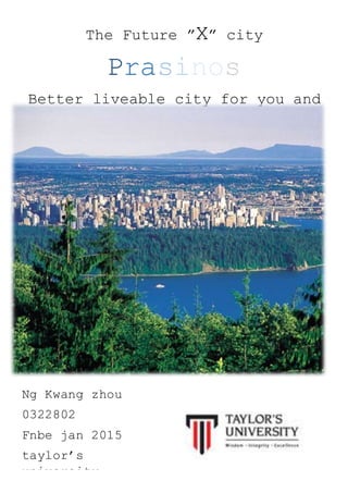
1. The Future ”X” city
Prasinos
Better liveable city for you and
me
Ng Kwang zhou
0322802
Fnbe jan 2015
taylor’s
university
2. 1)Introduction
From this project,I need to learn and investigate the ancient cities from their history.After that,I need
to study what is the basic requirement to build up the better and modern town.Next, I need to think
that what are the problems faces today and think the best solution to solve the problems of cities
nowadays.The city must be create in Malaysia and the citizens must be Malaysian and I have to
settle 100,000-250,000 of people in a limited amount of land.I have to done an A4 pamphlet and a
progress journal compilation.
Before we start to build the future “ x “ city ,we need to understand what is city and what is the clear
information of the definition of the city.
3. 2)What is city?
A city is a large and permanent human settlement. Although there is no agreement on how a city is
distinguished from a town in general English language meanings, many cities have a particular
administrative, legal, or historical status based on local law.
Cities generally have complex systems for sanitation, utilities, land usage, housing, and
transportation. The concentration of development greatly facilitates interaction between people and
businesses, benefiting both parties in the process, but it also presents challenges to managing urban
growth.A big city or metropolis usually has associated suburbs and exurbs. Such cities are usually
associated with metropolitan areas and urban areas, creating numerous business commuters
traveling to urban centers for employment. Once a city expands far enough to reach another city,
this region can be deemed a conurbation or megalopolis. In terms of population, the largest city
proper is Shanghai, while the fastest growing is Dubai.
Common issues
Every coins have two foils and every city have its issues.All of the cities are facing their issues
daily .Hence for design a better future city,we should look at the problems and solution before create
a nice future “X’ city.Here are some example I analyse out:
-Suburban development
4. -Organized crime
-Traffic and automobile issues
-Segregation
-Poor planning
-Gentrification
-Lack of space
-Lack of sales tax revenue
-Lack of water resource
-Corruption in local government
-Unbalanced pay for city employees like policemen,fire-fighters
-Decaying downtowns
-Lack of afforadable housing-Dying enclosed malls and outdoor malls
-Lack of diverse economic workforce
-Envoronmental issues
-etc…
5.
6. 3)Defination of city
Acient & old cities
Acient times
Early cities developed in a number of regions of the ancient world. Uruk is the world's first city.
After Mesopotamia, this culture arose in Syria and Anatolia, as shown by the city of Çatalhöyük
(7500–5700BC). It is the largest Neolithic site found to date. Although it has sometimes been
claimed[citation needed] that ancient Egypt lacked urbanism, several types of urban settlements
were found in ancient times.
Middle ages
While David Kessler and Peter Temin consider ancient Rome the largest city before the 19th
century, London was the first to exceed a population of 1 million. George Modelski considers
medieval Baghdad, with an estimated population of 1.2 million at its peak, the largest city before
19th century London and the first with a population of over one million.Others estimate that
Baghdad's population may have been as large as 2 million in the 9th century.
Early moden
While the city-states, or poleis, of the Mediterranean and Baltic Sea languished from the 16th
century, Europe's larger capitals benefited from the growth of commerce following the emergence
of an Atlantic trade. By the early 19th century, London had become the largest city in the world
with a population of over a million, while Paris rivaled the well-developed regionally traditional
capital cities of Baghdad, Beijing, Istanbul and Kyoto. During the Spanish colonization of the
Americas the old Roman city concept was extensively used. Cities were founded in the middle of
the newly conquered territories, and were bound to several laws about administration, finances
and urbanism.
7.
8. Industrial age
The growth of modern industry from the late 18th century onward led to massive urbanization and
the rise of new great cities, first in Europe and then in other regions, as new opportunities brought
huge numbers of migrants from rural communities into urban areas. In the United States from
1860 to 1910, the introduction of railroads reduced transportation costs, and large manufacturing
centers began to emerge, thus allowing migration from rural to city areas. Cities during this period
were deadly places to live in, due to health problems resulting from contaminated water and air,
and communicable diseases. In the Great Depression of the 1930s cities were hard hit by
unemployment, especially those with a base in heavy industry. In the U.S. urbanization rate
increased forty to eighty percent during 1900–1990. Today the world's population is slightly over
half urban,with millions still streaming annually into the growing cities of Asia, Africa and Latin
America.
Present cities
A present city, is a prominent centre of trade, banking, finance, innovation, and markets. Present
city is one of enormous power or influence. Present cities, according to Sassen, have more in
common with each other than with other cities in their host nations.
Future cities
A future city uses digital technologies to enhance performance and wellbeing, to reduce costs and
resource consumption, and to engage more effectively and actively with its citizens.A future city
should be able to respond faster to city and global challenges than one with a simple
'transactional' relationship with its citizens.
9. What makes a city?
Cities typically provide a variety of services to their inhabitants,including:
Sanitation
Roads Water Supply
Transportation Electric Supply Food Distribution
A city doesn’t produce its own material.In order to ensure the survivability of a city,it should achieve
at least the requirement mention above.A good city is a city that provide all kinds of variety and
services to the citizen to ensure their daily life is easy and they will statisfied with what the city
provided to them.
Apart from that,cities serve as a center of
communication.New technology and ideas usually
originate from these places and spread to other places in
the nation.Besides that,Malaysia is known as a multi races
country.A city also build up from different races of citizen
such as Malay,Chinese,Indian,Iban,Khadazan and
many.Hence,religious element such as cathedrals,mosque
and temples that represent the local belief systems.
Cities tend to have a denser population than the
surrounding environment.As we know that citizen always
having their daily activities in the city.As a good city,there
should be some representative tower or building to show
the unique of the city.
10. What makes a good city?
A healthy city criteria set by World health Organisation(WHO)
-clean and safe environment
-meet the basic inhabitat
-involve community in local government
-easy access to health service
A good quality of environment makes a good cities.Cities are the centre of economic
growth,technological advances,source of income of nation and good quality of production.However
if a cities are dirty,overcrowding,pollution,traffic congestion will leads the city become a bad city.
A good cities consider these vital support system:
Natural
Environment-
Provide fresh,green
and cleanair to
citizen
Residentional
Area-
Provide aliving
space for citizen
Security System-
Special unitsfor
emergencypurpose
Transportation-
Easy to allowcitizen
travel aroundthe
city
Waste
Management-
Minimize the
pollutioninthe city
Agriculture-
Highunitproduction
perunitarea to
overcome high
demand
11. Grid plan
A formation where the streets intersect each other in specific angles. Grid plans facilitate
development because developers can subdivide and auction off large parcels of land .The geometry
yields regular lots that maximize use and minimize boundary disputes.There are a few types of grid
use in planning a city:
Square/rectangular grid
Commonly used in developed countries such as the
United States.It can easy for commuters to negative
around the city.Efficient and minimize boundary disputers
between land owners but long straight roads make
vehicle move fast.
Radial grid
Used in Moscow.Extends from the city centre to the
suburbs at all angles.The center of the town becomes the
focal destination for the most of the residents . All sorts of
odd shaped property which are unsuitable for the
construction will be formed
Irregular grid
Most common in third world countries or town built on
terrain with many counters.Might be the result of lack
of planning and inefficient.
As result I choose square grid to built my city
12. Investigation and data collection
Acient / Old cities(Cahokia Mounds State)
History of Development
Cahokia Mounds State Historic Site /kəˈhoʊkiə/ (11 MS 2) is located on the site of a pre-
Columbian Native American city (c. 600–1400 CE) situated directly across the Mississippi
River from modern St. Louis, Missouri. This historic park lies in southern Illinois between East
St. Louis and Collinsville.The park covers 2,200 acres (890 ha), or about 3.5 square miles (9
km2), and contains about 80 mounds, but the ancient city was much larger. In its heyday,
Cahokia covered about 6 square miles (16 km2) and included about 120 human-made
earthen mounds in a wide range of sizes, shapes, and functions.
Although there is some evidence of Late Archaic
period (approximately 1200 BCE) occupation in and
around the site,[6] Cahokia as it is now defined was
settled around 600 CE during the Late Woodland
period. Mound building at this location began with the
Emergent Mississippian cultural period, about the 9th
century CE.[7] The inhabitants left no written records
beyond symbols on pottery, shell, copper, wood and
stone, but the elaborately planned community,
woodhenge, mounds and burials reveal a complex and
sophisticated society.The city's original name is
unknown.
Notable features
1)Monks Mound
Monks Mound is the largest structure and central focus of the city:
a massive platform mound with four terraces, 10 stories tall, and
the largest man-made earthen mound north of Mexico. Facing
south, it is 100 ft (30 m) high, 951 ft (290 m) long, 836 ft (255 m)
wide and covers 13.8 acres (5.6 ha).It also contains about 814,000
cu yd (622,000 m3) of earth.The mound was built higher and wider
over the course of several centuries through as many as ten
separate construction episodes, as the mound was built taller and
the terraces and apron were added
13. 2)Urban Landscape
The Grand Plaza is a large open plaza that spreads out to the south of Monks Mound. Researchers
originally thought the flat, open terrain in this area reflected Cahokia's location on the Mississippi's
alluvial flood plain but instead soil studies have shown that the landscape was originally undulating.
In one of the earliest large-scale construction projects, the site had been expertly and deliberately
leveled and filled by the city's inhabitants. It is part of the sophisticated engineering displayed
throughout the site. The Grand Plaza covered roughly 50 acres (20 ha) and measured over 1,600
ft (490 m) in length by over 900 ft (270 m) in width. It was used for large ceremonies and gatherings,
as well as for ritual games, such as chunkey. Along with the Grand Plaza to the south, three other
very large plazas surround Monks Mound in the cardinal directions to the east, west, and north.
3) Mound 72
During excavation of Mound 72, a ridge-top burial mound south of Monks Mound,
archaeologists found the remains of a man in his 40s who was probably an important
Cahokian ruler. The man was buried on a bed of more than 20,000 marine-shell disc beads
arranged in the shape of a falcon, with the bird's head appearing beneath and beside the
man's head, and its wings and tail beneath his arms and legs.
The falcon warrior or "birdman" is a common motif in Mississippian culture. This burial clearly
had powerful iconographic significance. In addition, a cache of sophisticated, finely worked
arrowheads in a variety of different styles and materials was found near the grave of this
important man. Separated into four types, each from a different geographical region, the
arrowheads demonstrated Cahokia's extensive trade links in North America.
14. Investigation and data collection
Present cities(Amsterdam)
Amsterdam is the capital city and most populous city of the Kingdom of the Netherlands. Its status
as the Dutch capital is mandated by the Constitution of the Netherlands though it is not the seat
of the Dutch government, which is The Hague. Amsterdam has a population of 825,080 within
the city proper, 1,317,663 in the urban area and 1,590,520 in the metropolitan area. The city
region has an approximate population of 2,431,000.The city is located in the province of North
Holland in the west of the country. It comprises much of the northern part of the Randstad, one
of the larger conurbations in Europe, with a population of approximately 7 million.
Geography
Amsterdam is home to more than one hundred
kilometers of canals. The three main canals are
Prinsengracht, Herengracht and
Keizersgracht, all 3 of which are navigable by
boat. In the Middle Ages, Amsterdam was
surrounded by a moat, called the Singel, which
now forms the innermost ring in the city, and
makes the city center a horseshoe shape. The
city is also served by a seaport. It has been
compared with Venice, due to its division into
approximately 90 islands, which are linked by
more than 1,200 bridges
15. Architectural
Amsterdam fans out south from the Amsterdam Centraal railway station. The oldest area of the
town is known as de Wallen (the quays). It lies to the east of Damrak and contains the city's
famous red light district. To the south of de Wallen is the old Jewish quarter of Waterlooplein. The
medieval and colonial age canals of Amsterdam, known as Grachten, embraces the heart of the
city where homes have interesting gables. Beyond the Grachtengordel are the former working
class areas of Jordaan and de Pijp. The Museumplein with the city's major museums, the
Vondelpark, a 19th-century park named after the Dutch writer Joost van den Vondel, and the
Plantage neighbourhood, with the zoo, are also located outside the Grachtengordel.
Amsterdam has a rich architectural history. The oldest building in Amsterdam is the Oude
Kerk (Old Church), at the heart of the Wallen, consecrated in 1306.The oldest wooden
building is het Houten Huys at the Begijnhof. It was constructed around 1425 and is one of
only two existing wooden buildings. It is also one of the few examples of Gothic architecture
in Amsterdam. In the 16th century, wooden buildings were razed and replaced with brick
ones. During this period, many buildings were constructed in the architectural style of the
Renaissance. Buildings of this period are very recognisable with their stepped gable façades,
which is the common Dutch Renaissance style. Amsterdam quickly developed its own
Renaissance architecture. These buildings were built according to the principles of the
architect Hendrick de Keyser. One of the most striking buildings designed by Hendrick de
Keyer is the Westerkerk. In the 17th century baroque architecture became very popular, as
it was elsewhere in Europe. This roughly coincided with Amsterdam’s Golden Age. The
leading architects of this style in Amsterdam were Jacob van Campen, Philips Vingboons
and Daniel Stalpaert.
16. Economy
Tourism
Amsterdam is the financial and business capital of the Netherlands.Amsterdam is currently one
of the best European cities in which to locate an international business.[by whom?] It is ranked
fifth in this category and is only surpassed by London, Paris, Frankfurt and Barcelona.Many large
corporations and banks have their headquarters in Amsterdam, including Akzo Nobel, Heineken
International, ING Group, ABN AMRO, TomTom, Delta Lloyd Group and Philips. KPMG
International's global headquarters is located in nearby Amstelveen, where many non-Dutch
companies have settled as well, because surrounding communities allow full land ownership,
contrary to Amsterdam's land-lease system.
Amsterdam is the financial and business capital of the Netherlands.Amsterdam is currently one
of the best European cities in which to locate an international business.[by whom?] It is ranked
fifth in this category and is only surpassed by London, Paris, Frankfurt and Barcelona Many
large corporations and banks have their headquarters in Amsterdam, including Akzo Nobel,
Heineken International, ING Group, ABN AMRO, TomTom, Delta Lloyd Group and Philips.
KPMG International's global headquarters is located in nearby Amstelveen, where many non-
Dutch companies have settled as well, because surrounding communities allow full land
ownership, contrary to Amsterdam's land-lease system.
Culture
During the later part of the 16th century Amsterdam's Rederijkerskamer (Chamber of Rhetoric)
organized contests between different Chambers in the reading of poetry and drama. In 1638,
Amsterdam opened its first theatre. Ballet performances were given in this theatre as early as 1642.
In the 18th century, French theatre became popular. While Amsterdam was under the influence of
German music in the 19th century there were few national opera productions; the Hollandse Opera
of Amsterdam was built in 1888 for the specific purpose of promoting Dutch opera.[104] In the 19th
century, popular culture was centred on the Nes area in Amsterdam (mainly vaudeville and music-
hall).[105] The metronome, one of the most important advances in European classical music, was
invented here in 1812 by Dietrich Nikolaus Winkel. At the end of this century, the Rijksmuseum and
Stedelijk Museum were built.[citation needed] In 1888, the Concertgebouworkest was established.
With the 20th century came cinema, radio and television.[citation needed] Though most studios are
located in Hilversum and Aalsmeer, Amsterdam's influence on programming is very strong. Many
people who work in the television industry live in Amsterdam. Also, the headquarters of the Dutch
SBS Broadcasting Group is located in Amsterdam
17. Investigation and data collection
Future cities(Masdar city)
Masdar City is an arcology project in Abu Dhabi, in the United Arab Emirates. Its core is a planned
city, which is being built by Masdar, a subsidiary of Mubadala Development Company, with the
majority of seed capital provided by the Government of Abu Dhabi. Designed by the British
architectural firm Foster and Partners, the city relies on solar energy and other renewable energy
sources.Masdar City is being constructed 17 kilometres (11 mi) east-south-east of the city of Abu
Dhabi, beside Abu Dhabi International Airport.
Masdar City will host the headquarters of the
International Renewable Energy Agency
(IRENA).The city is designed to be a hub for
cleantech companies. Its first tenant is the Masdar
Institute of Science and Technology, which has been
operating in the city since it moved into its campus in
September 2010.
Architectural
Masdar is a sustainable mixed-use development designed to be very friendly to pedestrians and
cyclists.
Masdar City has terracotta walls decorated with arabesque patterns. From a distance, the city
looks like a cube. The temperature in the streets is generally 15 to 20 °C (59 to 68 °F) cooler than
the surrounding desert. The temperature difference is due to Masdar's unique construction. A 45-
meter (148 ft) high wind tower modeled on traditional Arab designs sucks air from above and
pushes a cooling breeze through Masdar's streets. The site is raised above the surrounding land
to create a slight cooling effect. Buildings are clustered close together to create streets and
walkways shielded from the sun.
Masdar City was designed by Foster and Partners. Foster's design team started its work by
touring ancient cities such as Cairo and Muscat to see how they kept cool. Foster found that
these cities coped with hot desert temperatures through shorter, narrower streets usually no
longer than 70 meters (230 ft). The buildings at the end of these streets create just enough wind
turbulence to push air upwards, creating a flushing effect that cools the street
18. Transport System
The initial design banned automobiles, as travel will be accomplished via public mass transit and
personal rapid transit (PRT) systems, with existing road and railways connecting to other locations
outside the city. The absence of motor vehicles coupled with Masdar's perimeter wall, designed to
keep out the hot desert winds, allows for narrow and shaded streets that help funnel cooler breezes
across the city. In October 2010 it was announced the PRT would not expand beyond the pilot
scheme due to the cost of creating the undercroft to segregate the system from pedestrian
traffic.Subsequently, a test fleet of 10 Mitsubishi i-MiEV electric cars was deployed in 2011 as part
of a one-year pilot to test a point-to-point transportation solution for the city as a complement to the
PRTand the freight rapid transit (FRT), both of which consist of automated electric-powered vehicles.
Under a revised design, public transport within the city will rely on methods other than the PRTs.
Masdar will instead use a mix of electric vehicles and other clean-energy vehicles for mass transit
inside the city. The majority of private vehicles will be restricted to parking lots along the city's
perimeter. Abu Dhabi's existing light rail and metro line will connect Masdar City's centre with the
greater metropolitan area.
International Renewable Energy Agency
Masdar City will host the headquarters of the International Renewable Energy Agency, commonly
known as IRENA. As of May 2013, construction of IRENA's headquarters was underway. Masdar
was selected to host IRENA's headquarters after a high-profile campaign by the UAE. In its bid,
the UAE offered rent-free offices in Masdar City, 20 IRENA scholarships to the Masdar Institute
of Science and Technology, and up to US$350 million in loans for renewable energy projects in
developing countries.
Renewable resources
Masdar is powered by a 22-hectare (54-acre) field of 87,777 solar panels with additional
panels on roofs.
19. When I create a city there are a few things I should concern about before I create the
city:
1) shape and pattern
2) new technology
3) main focus like town hall and etc
4) zoning of the city
5) population and culture
6) transportation and networking
7) infrastructure
8) climate
9) services
10)significant figures
11)food and energy
12)name of the city
13)street of a city
14)landscape design
15)map(main street ,business)
16)public spaces
I had chose square grid pattern as design of my city and the topic given to me is forest
area so I choose Taman Negara in Malaysia as the place to built my city.
20. Name of my city-prasinos
The word “Prasinos” is from Greek which means green.This name that created is indicated that
the city will mainly focus on green and nature live style
Introduction to Prasinos
Prasinos is a city built on the east side of Malaysia which is Pahang and the city is located in the
center of Taman Negara. The city is a small size city which is 35.17km2 and the is city is very near
to the Gunung Tahan. Prasinos is a new green city and it mainly design for those citizen that love
the nature. Eco-tourism will be the theme of the city. Prasinos will have busting economic activity
and it providing its citizen and the country a certain amount of income. The aim of the city is to
function as commercial,education and tourism hub. Prasinos promises healthy sustainable living, a
new clean and green environment, efficient transport and economic growth to its citizens.
Prasinos is a city which is in square shape.As we can see that the location have high ground and
low ground the high ground is untouched zone and it will becomes a forest reserve area.The
estimated population of Prasinos is around 100,000-250,000 people.
The Prasinos will divide into two parts which is high ground and low ground.The high ground will be
untouched and it will create as forest conserve area and theme park.The lower ground will be divide
into 4 layer due to the concept of tropical rainforest in Malaysia .
21. Why I created this city in Malaysia?
Job
The population of Malaysia is booming and keep
increasing from day to day.As Malaysiais a small
country ,the is not much land available for new
development and create more living space
unless we keep on chop down our precious
rainforest. Malaysia is a beautiful country that
rich in natural resources hence we should use it
wisely by not destroyed them instead of leaving
it. As a nutshell ,the most logical solution to use
our rich natural resources is by creating a city in
the forest so that tourist and citizen can enjoy the
natural and release their pressure in the natural.
A complete city should include some job opportunities so that citizen income and the economy
system of the city will be stable .Hence here is the example of industry area I will created for the
citizen:
1) Tourism I ndust r y
2) I ndustrial I ndustry
3) Agricultural Industry
4) Education Industry
22. BUILDINGS
Buildings are the important basic to build up a city.A complete city should include different kind of
facilities so that the city can be move on smoothly.Here are the buildings that I include in my city:
1) Government buildings ,law and admistration
2) School and University
3) Solar panels ,Technology hub ,Wind harvesting
4) Agriculture ,Product processing ,Waste management ,Fertiliser production ,Biomass
production , Recycling centre, Solar panels, Wind harvesting
5) Religious centre ,Food Court, Residential Buildings, Entertainment places, Walkways
6) Green forest, Green garden, Sports & recreation, Theme park, Culture activities
23. SKY scraper
Every good city will have a significant tower which called as sky scraper. For example,
our mother country Malaysia have KLCC Twin tower which is the significant tower of
this country. So this is the design of sky scraper of my city. The design shape is looks
like a flower and this shows the nature theme of my city. This sky scraper is used as
government buildings, law and administration center. On the top of the roof had set up
solar panel to absorb the sunlight and convert it into electrical energy for the
building .This building will placed at the highest ground of the city so that it can absorb
the maximum sunlight.
24. Residential area
Every city have its own resident and every own resident have its own residential area.From the
research of modern city,most of their building are schematic and standard shape to indicate that
there are same type of building in their city.Hence,in my city I design all the trees on the top of the
tree which called it as tree house but the houses that build is in modern way so that resident can
enjoy modern lifestyle in nature.
25. Culture
Culture Activities
The culture of Malaysia draws on
the varied cultures of the different
people of Malaysia. The first
people to live in the area were
indigenous tribes that still remain;
they were followed by the Malays,
who moved there from mainland
Asia in ancient times. Chinese and
Indian cultural influences made
their mark when trade began with
those countries, and increased
with immigration to Malaysia.
Hence when we build the city we
should concern about our country
culture.
Here are the example list of cultural buildings that built
in my city:
1) Mosque
2) Chinese Temple
3) Church
4) Hindu Temple
Joget Melayu ,a Malay dance
There are some various culture activities will be held in PROSINOS:
Wayang Kulit
Lion Dance
26. Agriculture
Agriculture is the cultivation of animals, plants, fungi, and other life forms for food, fiber, biofuel,
medicinal and other products used to sustain and enhance human life.Agriculture was the key
development in the rise of sedentary human civilization, whereby farming of domesticated
species created food surpluses that nurtured the development of civilization.
The major agricultural products
can be broadly grouped into foods,
fibers, fuels, and raw materials.
Specific foods include cereals
(grains), vegetables, fruits, oils,
meats and spices. Fibers include
cotton, wool, hemp, silk and flax.
Raw materials include lumber and
bamboo. Other useful materials
are produced by plants, such as
resins, dyes, drugs, perfumes,
biofuels and ornamental products
such as cut flowers and nursery
plants.
The main agricultural productwill be plant in
PRASINOS are:
1) Sugar cane
2) Maize
3) Rice
4) Wheat
5) Potatoes
6) Sugar beet
7) Soybeans
8) Cassava
9) Tomatoes
10)Barley
27. Waste management
The increasing number of municipal solid waste management has become the biggest
environmental problem in Malaysia . Population growth has led to the increase in generation of
solid wastes in Malaysia and it has become a crucial issue to be solved. The waste generated
are from sources like domestic, industrial and commercial and it shows an increasing trends
throughout the world. Due to this reason, solid waste management plays an important role in
maintaining a sustainable environment.
In addition, construction waste is
part of the waste generated and
categorized under solid waste
constructionwaste materials can
be defined as the comprising of
unwanted materials generated
during construction.
Furthermore, pollution caused
by construction waste has
caused negative impacts
towards the environment and
leads to economic lose
From my opinion , waste product
should be generated accordingly so
that the nature can be conserved
and the pollution would not happen
in PRASINOS.
Hence,there will be a waste
management factories to clean up
the waste product in the city
28. Fertiliser production
A fertilizer is any material of natural or synthetic origin (other than liming materials) that is
applied to soils or to plant tissues (usually leaves) to supply one or more plant nutrients
essential to the growth of plants. Fertilizers enhance the growth of plants. This goal is met in
two ways, the traditional one being additives that provide nutrients. The second mode by which
some fertilizers act is to enhance the effectiveness of the soil by modifying its water retention
and aeration. Fertilizers are commonly used for growing all crops, with application rates
depending on the soil fertility, usually as measured by a soil test and according to the particular
crop. Legumes, for example, fix nitrogen from the atmosphere and generally do not require
nitrogen fertilizer.
From my opinion,use the waste
product of human,plants and animal
to produce fertilizer is a kind of good
low budget and high efficient
method in boots up PRAZINOS
economic.
29. Recycling
Recycling is a process to change waste materials into new products to prevent waste of
potentially useful materials, reduce the consumption of fresh raw materials, reduce energy
usage, reduce air pollution (from incineration) and water pollution (from landfilling) by reducing
the need for "conventional" waste disposal, and lower greenhouse gas emissions as compared
to plastic production. Recycling is a key component of modern waste reduction and is the third
component of the "Reduce, Reuse and Recycle" waste hierarchy.
Recyclable materials include many kinds of
glass, paper, metal, plastic, textiles, and
electronics. The composting or other reuse
of biodegradable waste—such as food or
garden waste—is also considered recycling.
Materials to be recycled are either brought
to a collection center or picked up from the
curbside, then sorted, cleaned, and
reprocessed into new materials bound for
manufacturing.
From my opinion , recycle
centre should be built up in
city so that the pollution rate
of the city can be
decrease .Reduce ,Reuse
and Recycle the recyclable
item should be keep practice
by citizen so that can keep
our forest city clean and
green
30. Solar panel
Solar panel refers either to a photovoltaics (PV) module, a solar hot water panel, or to a set of
solar photovoltaics modules electrically connected and mounted on a supporting structure. A
PV module is a packaged, connected assembly of solar cells. Solar panels can be used as a
component of a larger photovoltaic system to generate and supply electricity in commercial and
residential applications. Each module is rated by its DC output power under standard test
conditions, and typically ranges from 100 to 320 watts. The efficiency of a module determines
the area of a module given the same rated output – an 8% efficient 230 watt module will have
twice the area of a 16% efficient 230 watt module. There are a few solar panels available that
are exceeding 19% efficiency. A single solar module can produce only a limited amount of
power; most installations contain multiple modules. A photovoltaic system typically includes a
panel or an array of solar modules, an inverter, and sometimes a battery and/or solar tracker
and interconnection wiring.
From my opinion, PRASINOS is a good city to install and place the solar panel due to its
hot climate.PRASINOS is located at Malaysia and most of the day is sunny day so that if
build up solar panel can save up the city electric fees and is more green and more high
technology.
31. Conclusion
From this project I had learn that building a projectis not an important things and the
building a proper cities requires many kinds of manpower and thinking a layout plan
require to refer many good city layout to improve the city that you going to design
In a city all the facilities need to be well prepared and a city not just only about good
building and facilities, population of people and culture of different religion are the
important key to affect the successionof a city.
To build up a city we need to find a place and understand the topography ofa city and
the climate so that we can know the details and base on the details set up wat we
going to building the city.
A good city does not build in a day, a week or even a month .It requires many times
and effort so that it only can produce a good city.
32. Reference of links
The structure of city, Retrieved 07 May,2015
https://www.boundless.com/sociology/textbooks/boundless-sociology-
textbook/population-and-urbanization-17/urbanization-and-the-
development-of-cities-123/the-structure-of-cities-694-10482
Technology of city, Retrieved 24 January 2013
http://www.dezeen.com/2013/01/24/kenya-starts-construction-of-konza-
technology-city/
Culture Malaysia
http://www.tourism.gov.my/en/es/about-malaysia/culture-n-heritage
Services of city, Retrieved 18 Jan,2012
http://www.skylinescity.com/cities-skylines-faq
Zoning of city, Retrived 23,Feb 2011
http://www.nyc.gov/html/dcp/html/zone/zonedex.shtml
Grid of a city,Retrieved 02 Sep,2004
http://www.quora.com/Is-the-grid-system-in-city-planning-the-most-
efficient
33. Contents:
1) Introduction
2) Investigation of Town
3) Investigation and data collection:
Acients/old cities
4) Investigation and data collection:
Present cities
5) Investigation and data collection:
Future cities
6) The new “X” city-PRASINOS
7) Conclusion
8) Reference list