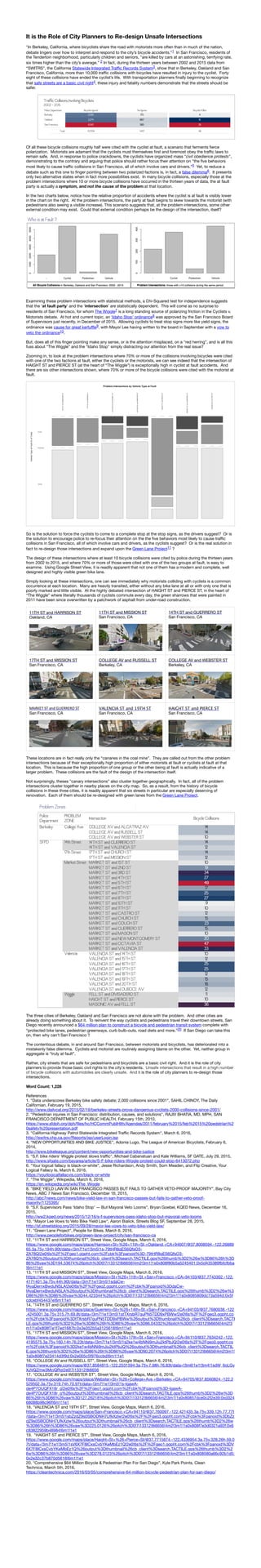
1. It is the Role of City Planners to Re-design Unsafe Intersections
"In Berkeley, California, where bicyclists share the road with motorists more often than in much of the nation,
debate lingers over how to interpret and respond to the city’s bicycle accidents.”1 In San Francisco, residents of
the Tenderloin neighborhood, particularly children and seniors, "are killed by cars at an astonishing, terrifying rate,
six times higher than the city’s average.” 2 In fact, during the thirteen years between 2002 and 2015 data from
“SWITRS”, the California Statewide Integrated Traffic Records System3, show that in Berkeley, Oakland and San
Francisco, California, more than 10,000 traffic collisions with bicycles have resulted in injury to the cyclist. Forty
eight of these collisions have ended the cyclist’s life. With transportation planners finally beginning to recognize
that safe streets are a basic civil right4, these injury and fatality numbers demonstrate that the streets should be
safer.
Of all these bicycle collisions roughly half were cited with the cyclist at fault, a scenario that ferments fierce
polarization. Motorists are adamant that the cyclists must themselves first and foremost obey the traffic laws to
remain safe. And, in response to police crackdowns, the cyclists have organized mass "civil obedience protests",
demonstrating to the contrary and arguing that police should rather focus their attention on "the five behaviors
most likely to cause traffic collisions in San Francisco, all of which involve cars and drivers.”5 Yet, to reduce a
debate such as this one to finger pointing between two polarized factions is, in fact, a false dilemma6. It presents
only two alternative states when in fact more possibilities exist. In many bicycle collisions, especially those at the
problem intersections where 10 or more bicycle collisions have occurred in the thirteen years of data, the at fault
party is actually a symptom, and not the cause of the problem at that location.
In the two charts below, notice how the relative proportion of accidents where the cyclist is at fault is visibly lower
in the chart on the right. At the problem intersections, the party at fault begins to skew towards the motorist (with
pedestrians also seeing a visible increase). This scenario suggests that, at the problem intersections, some other
external condition may exist. Could that external condition perhaps be the design of the intersection, itself?
Examining these problem intersections with statistical methods, a Chi-Squared test for independence suggests
that the ‘at fault party’ and the ‘intersection’ are statistically dependent. This will come as no surprise to
residents of San Francisco, for whom The Wiggle7 is a long standing source of polarizing friction in the Cyclists v.
Motorists debate. At hot and current topic, an ‘Idaho Stop’ ordinance8 was approved by the San Francisco Board
of Supervisors just recently, in December of 2015. Allowing cyclists to treat stop signs more like yield signs, the
ordinance was cause for great kerfuffle9, with Mayor Lee having written to the board in September with a vow to
veto the ordinance10.
But, does all of this finger pointing make any sense, or is the attention misplaced, on a “red herring”, and is all this
fuss about “The Wiggle” and the “Idaho Stop" simply distracting our attention from the real issue?
Zooming in, to look at the problem intersections where 70% or more of the collisions involving bicycles were cited
with one of the two factions at fault, either the cyclists or the motorists, we can see indeed that the intersection of
HAIGHT ST and PIERCE ST (at the heart of “The Wiggle”) is exceptionally high in cyclist at fault accidents. And
there are six other intersections shown, where 70% or more of the bicycle collisions were cited with the motorist at
fault.
So is the solution to force the cyclists to come to a complete stop at the stop signs, as the drivers suggest? Or is
the solution to encourage police to re-focus their attention on the the five behaviors most likely to cause traffic
collisions in San Francisco, all of which involve cars and drivers, as the cyclists suggest? Or is the real solution in
fact to re-design those intersections and expand upon the Green Lane Project11 ?
The design of these intersections where at least 10 bicycle collisions were cited by police during the thirteen years
from 2002 to 2015, and where 70% or more of those were cited with one of the two groups at fault, is easy to
examine. Using Google Street View, it is readily apparent that not one of them has a modern and complete, well
designed and highly visible green bike lane.
Simply looking at these intersections, one can see immediately why motorists colliding with cyclists is a common
occurrence at each location. Many are heavily transited, either without any bike lane at all or with only one that is
poorly marked and little visible. At the highly debated intersection of HAIGHT ST and PIERCE ST, in the heart of
“The Wiggle” where literally thousands of cyclists commute every day, the green sharrows that were painted in
2011 have been since overwritten by a patchwork of asphalt from under-road construction.
11TH ST and HARRISON ST
Oakland, CA
11TH ST and MISSION ST
San Francisco, CA
14TH ST and GUERRERO ST
San Francisco, CA
17TH ST and MISSION ST
San Francisco, CA
COLLEGE AV and RUSSELL ST
Berkeley, CA
COLLEGE AV and WEBSTER ST
Berkeley, CA
MARKET
ST
and
GUERRERO
ST
San Francisco, CA
VALENCIA ST and 19TH ST
San Francisco, CA
HAIGHT ST and PIERCE ST
San Francisco, CA
These locations are in fact really only the “canaries in the coal mine”. They are called out from the other problem
intersections because of their exceptionally high proportion of either motorists at fault or cyclists at fault at that
location. This is because the high proportion of one group or the other being at fault is actually indicative of a
larger problem. These collisions are the fault of the design of the intersection itself.
Not surprisingly, theses "canary intersections” also cluster together geographically. In fact, all of the problem
intersections cluster together in nearby places on the city map. So, as a result, from the history of bicycle
collisions in these three cities, it is readily apparent that six streets in particular are especially deserving of
renovation. Each of them should be re-designed with green lanes from the Green Lane Project.
The three cities of Berkeley, Oakland and San Francisco are not alone with the problem. And other cities are
already doing something about it. To reinvent the way cyclists and pedestrians travel their downtown streets, San
Diego recently announced a $64 million plan to construct a bicycle and pedestrian transit system complete with
“protected bike lanes, pedestrian greenways, curb bulb-outs, road diets and more.”20 If San Diego can take this
on, then why can’t San Francisco ?
The contentious debate, in and around San Francisco, between motorists and bicyclists, has deteriorated into a
mistakenly false dilemma. Cyclists and motorist are routinely assigning blame on the other. Yet, neither group in
aggregate is "truly at fault”.
Rather, city streets that are safe for pedestrians and bicyclists are a basic civil right. And it is the role of city
planners to provide those basic civil rights to the city's residents. Unsafe intersections that result in a high number
of bicycle collisions with automobiles are clearly unsafe. And it is the role of city planners to re-design those
intersections.
Word Count: 1,228
References
1. "Data underscores Berkeley bike safety debate; 2,000 collisions since 2001", SAHIL CHINOY, The Daily
Californian, February 19, 2015,
http://www.dailycal.org/2015/02/19/berkeley-streets-prove-dangerous-cyclists-2000-collisions-since-2001/
2. "Pedestrian injuries in San Francisco: distribution, causes, and solutions", RAJIV BHATIA, MD, MPH, SAN
FRANCISCO DEPARTMENT OF PUBLIC HEALTH, February 15th, 2010,
https://www.sfdph.org/dph/files/hc/HCCommPublHlth/Agendas/2011/february%2015/feb%2015%20pedstrian%2
0safety%20presentation.pdf
3. "California Highway Patrol Statewide Integrated Traffic Records System", March 6, 2016,
http://iswitrs.chp.ca.gov/Reports/jsp/userLogin.jsp
4. "NEW OPPORTUNITIES AND BIKE JUSTICE", Adonia Lugo, The League of American Bicyclists, February 6,
2014,
http://www.bikeleague.org/content/new-opportunities-and-bike-justice
5. "S.F. bike riders’ Wiggle protest slows traffic", Michael Cabanatuan and Kale Williams, SF GATE, July 29, 2015,
http://www.sfgate.com/bayarea/article/S-F-bike-riders-Wiggle-protest-could-stop-6413072.php
6. "Your logical fallacy is black-or-white”, Jesse Richardson, Andy Smith, Som Meaden, and Flip Creative, Your
Logical Fallacy Is, March 6, 2016,
https://yourlogicalfallacyis.com/black-or-white
7. "The Wiggle”, Wikipedia, March 6, 2016,
https://en.wikipedia.org/wiki/The_Wiggle
8. "BIKE YIELD LAW IN SAN FRANCISCO PASSES BUT FAILS TO GATHER VETO-PROOF MAJORITY”, Bay City
News, ABC 7 News San Francisco, December 16, 2015,
http://abc7news.com/news/bike-yield-law-in-san-francisco-passes-but-fails-to-gather-veto-proof-
majority/1125395/
9. "S.F. Supervisors Pass ‘Idaho Stop’ — But Mayoral Veto Looms”, Bryan Goebel, KQED News, December 16,
2015,
http://ww2.kqed.org/news/2015/12/16/s-f-supervisors-pass-idaho-stop-but-mayoral-veto-looms
10. "Mayor Lee Vows to Veto Bike Yield Law", Aaron Bialick, Streets Blog SF, September 28, 2015,
http://sf.streetsblog.org/2015/09/28/mayor-lee-vows-to-veto-bike-yield-law/
11. "Green Lane Project", People for Bikes, March 6, 2016,
http://www.peopleforbikes.org/green-lane-project/city/san-francisco-ca
12. "11TH ST and HARRISON ST”, Street View, Google Maps, March 6, 2016,
https://www.google.com/maps/place/Harrison+St+%26+11th+St,+Oakland,+CA+94607/@37.8008594,-122.26889
65,3a,75y,194h,90t/data=!3m7!1e1!3m5!1s-79tHR8qES6QfsO3-
ZA78Q!2e0!6s%2F%2Fgeo1.ggpht.com%2Fcbk%3Fpanoid%3D-79tHR8qES6QfsO3-
ZA78Q%26output%3Dthumbnail%26cb_client%3Dsearch.TACTILE.gps%26thumb%3D2%26w%3D86%26h%3D
86%26yaw%3D194.53674%26pitch%3D0!7i13312!8i6656!4m2!3m1!1s0x808f80b5a5245401:0x5d435389fbfcfbba
!6m1!1e1
13. "11TH ST and MISSION ST”, Street View, Google Maps, March 6, 2016,
https://www.google.com/maps/place/Mission+St+%26+11th+St,+San+Francisco,+CA+94103/@37.7743302,-122.
4171401,3a,75y,44h,90t/data=!3m7!1e1!3m5!1sdaCw-
fAyaDernxBwduNSLA!2e0!6s%2F%2Fgeo2.ggpht.com%2Fcbk%3Fpanoid%3DdaCw-
fAyaDernxBwduNSLA%26output%3Dthumbnail%26cb_client%3Dsearch.TACTILE.gps%26thumb%3D2%26w%3
D86%26h%3D86%26yaw%3D44.423344%26pitch%3D0!7i13312!8i6656!4m2!3m1!1s0x8085809dc73a594d:0x5f
cdcebf454437e!6m1!1e1
14. "14TH ST and GUERRERO ST”, Street View, Google Maps, March 6, 2016,
https://www.google.com/maps/place/Guerrero+St+%26+14th+St,+San+Francisco,+CA+94103/@37.7680038,-122
.4245001,3a,75y,315.7h,69.8t/data=!3m7!1e1!3m5!1stTXrsbR7guPN5TDD9xPBWw!2e0!6s%2F%2Fgeo3.ggpht.co
m%2Fcbk%3Fpanoid%3DtTXrsbR7guPN5TDD9xPBWw%26output%3Dthumbnail%26cb_client%3Dsearch.TACTI
LE.gps%26thumb%3D2%26w%3D86%26h%3D86%26yaw%3D86.04332%26pitch%3D0!7i13312!8i6656!4m2!3
m1!1s0x808f7e1f7ed1687b:0x3e352b5a3125618!6m1!1e1
15. "17TH ST and MISSION ST”, Street View, Google Maps, March 6, 2016,
https://www.google.com/maps/place/Mission+St+%26+17th+St,+San+Francisco,+CA+94110/@37.7634242,-122.
4195575,3a,75y,160.14h,76.23t/data=!3m7!1e1!3m5!1s2ke1w4bNNi9mJju2ktPbJQ!2e0!6s%2F%2Fgeo0.ggpht.co
m%2Fcbk%3Fpanoid%3D2ke1w4bNNi9mJju2ktPbJQ%26output%3Dthumbnail%26cb_client%3Dsearch.TACTIL
E.gps%26thumb%3D2%26w%3D86%26h%3D86%26yaw%3D90.2074%26pitch%3D0!7i13312!8i6656!4m2!3m1!
1s0x808f7e23414d3f9d:0x2e005c5f976ccbd!6m1!1e1
16. "COLLEGE AV and RUSSELL ST”, Street View, Google Maps, March 6, 2016,
https://www.google.com/maps/@37.8584815,-122.2531594,3a,75y,7.98h,76.83t/data=!3m6!1e1!3m4!1sdW_6oLGy
XJVQZmw3McjQRg!2e0!7i13312!8i6656
17. "COLLEGE AV and WEBSTER ST”, Street View, Google Maps, March 6, 2016,
https://www.google.com/maps/place/Webster+St+%26+College+Ave,+Berkeley,+CA+94705/@37.8560824,-122.2
529502,3a,75y,319.74h,70.97t/data=!3m7!1e1!3m5!1s-lgawA-
de4P7OUQFX18r_g!2e0!6s%2F%2Fgeo1.ggpht.com%2Fcbk%3Fpanoid%3D-lgawA-
de4P7OUQFX18r_g%26output%3Dthumbnail%26cb_client%3Dsearch.TACTILE.gps%26thumb%3D2%26w%3D
86%26h%3D86%26yaw%3D127.26218%26pitch%3D0!7i13312!8i6656!4m2!3m1!1s0x80857dce0c2f2e39:0xd324
68088b98c96f!6m1!1e1
18. "VALENCIA ST and 19TH ST”, Street View, Google Maps, March 6, 2016,
https://www.google.com/maps/place/San+Francisco,+CA+94110/@37.760097,-122.421435,3a,75y,339.12h,77.77t
/data=!3m7!1e1!3m5!1sbZzdZ9s0SBODNH7UfkXzlw!2e0!6s%2F%2Fgeo3.ggpht.com%2Fcbk%3Fpanoid%3DbZz
dZ9s0SBODNH7UfkXzlw%26output%3Dthumbnail%26cb_client%3Dsearch.TACTILE.gps%26thumb%3D2%26w
%3D86%26h%3D86%26yaw%3D225.0126%26pitch%3D0!7i13312!8i6656!4m2!3m1!1s0x808f7e3d0321a92f:0x6
c83822959b48984!6m1!1e1
19. "HAIGHT ST and PIERCE ST”, Street View, Google Maps, March 6, 2016,
https://www.google.com/maps/place/Haight+St+%26+Pierce+St/@37.7715874,-122.4336954,3a,75y,328.26h,59.0
7t/data=!3m7!1e1!3m5!1sV6X7F8ICxsCvbYKeMbEz1Q!2e0!6s%2F%2Fgeo1.ggpht.com%2Fcbk%3Fpanoid%3DV
6X7F8ICxsCvbYKeMbEz1Q%26output%3Dthumbnail%26cb_client%3Dsearch.TACTILE.gps%26thumb%3D2%2
6w%3D86%26h%3D86%26yaw%3D278.0123%26pitch%3D0!7i13312!8i6656!4m2!3m1!1s0x808580a66c92b1d5:
0x2e32c37b870d5618!6m1!1e1
20. "Comprehensive $64 Million Bicycle & Pedestrian Plan For San Diego”, Kyle Park Points, Clean
Technica, March 5th, 2016,
https://cleantechnica.com/2016/03/05/comprehensive-64-million-bicycle-pedestrian-plan-for-san-diego/