![International Journal of Trend in Scientific Research and Development @ www.ijtsrd.com eISSN: 2456-6470
@ IJTSRD | Unique Paper ID – IJTSRD50025 | Volume – 6 | Issue – 4 | May-June 2022 Page 384
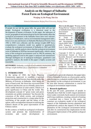
Figure 1: View of the construction process of Saihanba Forestry
3. Evaluation of the ecological impact of Saihanba
3.1. Constructing evaluation indicators
In the evaluation work, the establishment of a scientific and reasonable evaluation system is crucial to the
accuracy of the evaluation work. This paper establishes a model for assessing the degree of impact of the
Saihanba on the ecological environment based on five principles: scientific, comprehensive, concise and
universal, sustainable and dynamic[1]-[3]
.
Checking a large number of research results and literature on forestry, combined with expert opinions and
principles of evaluation system construction, 10 important indicators were selected to establish the model,
and the reasons for selection are shown in Table 1 below.
Table 1: Reasons for the selection of second-tier indicators
Targets Reason
dryness Measuring climate dryness
average temperature Average annual temperature in the forest over a period of time
precipitation
(meteorology)
Depth of precipitation that accumulates on the horizontal plane
without evaporation, infiltration and loss
frost-free period The longer the frost-free period, the longer the growing period
Area covered by forest
trees
Reflects the actual level of forest resources and forest land holdings in
a country (or region)
slope of the terrain
The greater the slope, the greater the susceptibility to erosion and the
greater the amount of power lost to machine cultivation
soil erosion rate
Simultaneous loss of water and soil due to rainwater not being able to
be dissipated on site, flowing downstream and washing away the soil
Arable land per capita
Important implications for the development of the national economy
and agricultural production
Environmental
Management Index
Indicates the Government's efforts to manage the ecological
environment of the forest
Environmental Protection
Investment Index
Reflects the level of environmental importance and environmental
management in the forestry industry
It is divided into 3 dimensions: meteorological, geographical and social, to form a system of evaluation
indicators, see Figure 2.](data:image/gif;base64,R0lGODlhAQABAIAAAAAAAP///yH5BAEAAAAALAAAAAABAAEAAAIBRAA7)
Recommended
Recommended
More Related Content
Similar to Analysis on the Impact of Saihanba Forest Farm on Ecological Environment
Similar to Analysis on the Impact of Saihanba Forest Farm on Ecological Environment (20)
More from ijtsrd
More from ijtsrd (20)
Recently uploaded
Recently uploaded (20)
Analysis on the Impact of Saihanba Forest Farm on Ecological Environment
- 1. International Journal of Trend in Scientific Research and Development (IJTSRD) Volume 6 Issue 4, May-June 2022 Available Online: www.ijtsrd.com e-ISSN: 2456 – 6470 @ IJTSRD | Unique Paper ID – IJTSRD50025 | Volume – 6 | Issue – 4 | May-June 2022 Page 383 Analysis on the Impact of Saihanba Forest Farm on Ecological Environment Wenjing Ai, Bo Wang, Xin Lin School of Information, Beijing Wuzi University, Beijing, China ABSTRACT If people do not fail the green hills, the green hills will not fail people. Ecological civilization is a historical trend in the development of human civilization. In this paper, the indicators of social, geographical and meteorological factors that mainly affect the ecological environment in the Saihanba forest farm were selected. The data of 10 indicators, such as environmental management index, forest cover area and dryness in Saihanba Mechanical Forestry from 1962 to 2020 were collected, and the entropy-weight-AHP fuzzy comprehensive evaluation model was applied to quantitatively evaluate the ecological environment of Saihanba in 1962 and 2020 respectively, and the analysis shows that the ecological environment score of Saihanba in 2020 has increased significantly, which is about twice of the ecological environment score in 1962.In summary, the modeling approach used in this paper is analyzed and summarized. Through intelligent use of analogical techniques, quantitative and qualitative analysis, the model in this paper is highly accurate and reasonable. KEYWORDS: Saihanba; ecological environment construction; AHP- entropy weight method; fuzzy comprehensive evaluation How to cite this paper: Wenjing Ai | Bo Wang | Xin Lin "Analysis on the Impact of Saihanba Forest Farm on Ecological Environment" Published in International Journal of Trend in Scientific Research and Development (ijtsrd), ISSN: 2456- 6470, Volume-6 | Issue-4, June 2022, pp.383-390, URL: www.ijtsrd.com/papers/ijtsrd50025.pdf Copyright © 2022 by author(s) and International Journal of Trend in Scientific Research and Development Journal. This is an Open Access article distributed under the terms of the Creative Commons Attribution License (CC BY 4.0) (http://creativecommons.org/licenses/by/4.0) 1. INTRODUCTION In the spring of 1962, the State Planning Commission approved: to establish a national largest mechanized forestry farm directly under the Ministry of Forestry in Saihanba. After nearly 60 years of hard work, the forest has recovered from the desert and become an eco-friendly green farm with a stable function of sand control, which is of great significance to China and the world. The development concept of "green water and green mountains are golden mountains" has become the consensus of the whole society, and ecological protection and construction is a major plan for the well-being of the people and the future of the nation, and is an important element in realizing the Chinese dream of the great rejuvenation of the Chinese nation. In this context, to build an ecological civilization system and promote the transformation of economic and social development to comprehensive green development, this paper takes China's Saihanba Forestry as a focus point, and by constructing an evaluation model of the impact of this forestry on the ecological environment, it can be seen that forestry construction is crucial for ecological environment improvement. 2. Research significance In the past 60 years, generations of people in Saihanba have built the world's largest plantation forest under extremely harsh natural environment and living conditions, creating a miracle of turning a wasteland into a forest. In this paper, we construct an evaluation model of the ecological impacts of the Sekhamba forestry plantation and quantitatively analyze the impacts of the forestry plantation on the ecological environment before and after its construction has implications for the subsequent improvement of the global ecological environment. IJTSRD50025
- 2. International Journal of Trend in Scientific Research and Development @ www.ijtsrd.com eISSN: 2456-6470 @ IJTSRD | Unique Paper ID – IJTSRD50025 | Volume – 6 | Issue – 4 | May-June 2022 Page 384 Figure 1: View of the construction process of Saihanba Forestry 3. Evaluation of the ecological impact of Saihanba 3.1. Constructing evaluation indicators In the evaluation work, the establishment of a scientific and reasonable evaluation system is crucial to the accuracy of the evaluation work. This paper establishes a model for assessing the degree of impact of the Saihanba on the ecological environment based on five principles: scientific, comprehensive, concise and universal, sustainable and dynamic[1]-[3] . Checking a large number of research results and literature on forestry, combined with expert opinions and principles of evaluation system construction, 10 important indicators were selected to establish the model, and the reasons for selection are shown in Table 1 below. Table 1: Reasons for the selection of second-tier indicators Targets Reason dryness Measuring climate dryness average temperature Average annual temperature in the forest over a period of time precipitation (meteorology) Depth of precipitation that accumulates on the horizontal plane without evaporation, infiltration and loss frost-free period The longer the frost-free period, the longer the growing period Area covered by forest trees Reflects the actual level of forest resources and forest land holdings in a country (or region) slope of the terrain The greater the slope, the greater the susceptibility to erosion and the greater the amount of power lost to machine cultivation soil erosion rate Simultaneous loss of water and soil due to rainwater not being able to be dissipated on site, flowing downstream and washing away the soil Arable land per capita Important implications for the development of the national economy and agricultural production Environmental Management Index Indicates the Government's efforts to manage the ecological environment of the forest Environmental Protection Investment Index Reflects the level of environmental importance and environmental management in the forestry industry It is divided into 3 dimensions: meteorological, geographical and social, to form a system of evaluation indicators, see Figure 2.
- 3. International Journal of Trend in Scientific Research and Development @ www.ijtsrd.com eISSN: 2456-6470 @ IJTSRD | Unique Paper ID – IJTSRD50025 | Volume – 6 | Issue – 4 | May-June 2022 Page 385 Figure 2: Hierarchical map of Saihanba's impact on the ecological environment 3.2. Model construction This paper combines the entropy and AHP methods, which can effectively draw on the experience and expertise of experts and use the objective information of the data to avoid judging too subjective or too objective.[4] . 3.2.1. Model assumptions There are many factors that affect the evaluation model and because of the large amount of data, the following assumptions were made without affecting the effectiveness of the model[5]-[7] : In the analysis of the impact of forestry on the ecological environment, in order to make the comparison of the results clear, the annual average of relevant indicators at three points in time were chosen for comparison between the non-established forestry, the forestry with additional forest ecotourism and the current[8] . The evaluation indicators selected can influence the evaluation model to a greater extent, i.e. evaluation indicators not considered are weak or no-impact indicators. Ecological changes considering only forestry relationships. The data have a degree of reasonableness and credibility. The data cleaning method used in this paper removes outliers and makes the data more reliable. 3.2.2. Hierarchical analysis: determination of weights for first-level indicators In order to score the evaluation indicators reasonably, letters were sent to 10 renowned professors from our forestry faculty to score the 3 levels using the 1-9 scale method; the results were then collected and tallied; for the disputed scores, letters were sent a second time to discuss with the experts in an anonymous form to seek their opinions, and the experts were asked to state their reasons and score again to summarize the results. The above process is repeated until the 10 experts are in agreement.[9] . Table 2: Proportional scale table Scale Connotation 1 Indicates that both factors are of equal importance 3 denotes two factors, the former being slightly more important than the latter 5 denotes two factors, the former being significantly more important than the latter 7 Indicates two factors where the former is strongly more important than the latter 9 denotes two factors, the former being more extremely important than the latter 2,4,6,8 denotes the intermediate value of adjacent judgments for the above one-factor comparison mark the ratio of the importance of the factor j to the factori is i j a After 13 rounds of anonymous deliberation, a two-by-two comparison of social, geographic and meteorological factors resulted in an importance score. A judgment matrix U was constructed. U= 1 4 1 5 3 1 4 1 5 1 3 1
- 4. International Journal of Trend in Scientific Research and Development @ www.ijtsrd.com eISSN: 2456-6470 @ IJTSRD | Unique Paper ID – IJTSRD50025 | Volume – 6 | Issue – 4 | May-June 2022 Page 386 According to the judgment matrix U of the first level indicator, combined with the weight calculation formula, the weight of the first level indicator is obtained as ( 0 .6 2 6 7 , 0 .2 7 9 7 , 0 .0 9 3 6 ) T m = . ( ) 5 , 4 , 3 , 2 , 1 5 1 = = = i a m n ij i i π ( ) 5 , 4 , 3 , 2 , 1 5 1 = = ∑ = i m m m i i i The consistency test of the judgment matrix is calculated as follows. 5 m a x 1 ( ) i i i A m n m λ = = ∑ m a x 1 n C I n λ − = − C I C R R I = where RI = 0.58, according to the above formula, we get m a x 3 .0 8 5 8 λ = , 0 .0 4 2 9 C I = , 0 .0 1 2 4 0.1 C R = < , i.e., the judgment matrix U has consistency. 3.2.3. Entropy weighting method: determination of secondary indicator weights 3.2.3.1. Data pre-processing First, the data need to be standardized to eliminate the incommensurability caused by differences in units and orders of magnitude, and the standardization of indicators used in this paper is as follows[10] : The following is the standardization method used in this paper. min max min max max min ij j ij j j j ij ij j j x x x x x x x x x x − ′ = − − ′ = − The formula i j x ′ is the standardized indicator value, where m a x j x is the maximum value of the j indicator and min j x is the minimum value of the j indicator. The first formula is chosen for the positive indicators and the second formula is used for the inverse indicators for data processing. The processed data are shown in Table 3. Table 3: Dimensionless two-level indicators 1962 2015 2020 Average temperature (°C) 0.015398844 0.031145991 0.016342756 Precipitation (mm) 1 1 1 Frost-free period (days) 0.107514451 0.118759455 0.114840989 dryness 0 0 0 Terrain slope (。 ) 1 0.337286879 0.187861272 Forest cover (%) 0 1 1 Soil erosion rate (%) 1 0 0 Arable land per capita (hm²) 0 0 0 Environmental management index (%) 1 1 1 Environmental protection investment index (‰) 0.074153696 0.052939771 0.105320126 3.2.3.2. Determination of weights for secondary indicators The entropy method can be used for comprehensive evaluation of multiple indicators, and its basic idea is mainly to use the information entropy tool to measure the weight of indicators in the evaluation through the degree of variation of the data itself, and then to objectively assign weights and comprehensive evaluation to the system[11] . In this paper, the entropy weighting method is used to determine the weights of secondary indicators with the following formula, which is calculated through python 3.8 implementation. 1 ij ij m ij i x y x = ′ = ′ ∑ ln j ij ij e k y y = − ∑
- 5. International Journal of Trend in Scientific Research and Development @ www.ijtsrd.com eISSN: 2456-6470 @ IJTSRD | Unique Paper ID – IJTSRD50025 | Volume – 6 | Issue – 4 | May-June 2022 Page 387 To estimate the weight of the indicator, the higher the value coefficient of the indicator the greater the impact on the evaluation, i.e. the more important the indicator is. After the above formula, the weights of the indicators of j are. 1 j j n j j d W d = = ∑ The weight values for the secondary indicators were calculated based on the above formula, as shown in Table 4. Table 4: Weight values of three-level indicators Secondary indicators Weight W Average temperature (°C) 0.3939 Precipitation (mm) 0.2526 Frost-free period (days) 0.1791 dryness 0.1744 Terrain slope (.) 0.2532 Forest cover (%) 0.3334 Soil erosion rate (%) 0.4134 Arable land per capita (hm²) 0.3349 Environmental management index (%) 0.3553 Environmental protection investment index (‰) 0.3098 The scores for each secondary indicator were derived according to the following formula, and the results are shown in Table 5. 1 m j j i j j C W y = = ∑ Table 5: Saihanba's ecological impact on secondary indicators score Secondary indicators 1962 2015 2020 Average temperature (°C) 0.4423 0.4530 0.4456 Precipitation (mm) 0.2836 0.2905 0.2857 Frost-free period (days) 0.2011 0.2060 0.2026 dryness 0.1958 0.2006 0.1973 Terrain slope (。 ) 0.5064 0.3386 0.3008 Forest cover (%) 0.6668 0.4459 0.3960 Soil erosion rate (%) 0.8268 0.5528 0.4911 Arable land per capita (hm²) 0.3597 0.3526 0.3702 Environmental management index (%) 0.3817 0.3741 0.3927 3.2.4. Fuzzy evaluation method In order to evaluate the impact effect of the Saihanba forestry field on the ecological environment, the fuzzy comprehensive evaluation method is used to construct the evaluation criteria system[12] . The evaluation criteria set is represented by V, and the evaluation is standardized into 4 grades: excellent, good, medium and poor. The qualitative evaluation index is scored, where excellent represents 8 points, good represents 6 points, medium represents 4 points and poor represents 2 points, as shown in Table 6. By converting the rubric into scores, a quantitative evaluation of the ecological environment before and after the restoration of Saihanba can be made. Table 6: Qualitative evaluation index score interval Evaluation level excellent virtuous in error Score range for secondary evaluation indicators 8 6 4 2 Referring to the research method of Gu Chenglin scholars, the fuzzy intervals of 10 evaluation indicators were determined by the affiliation degree and the fuzzy evaluation matrix was constructed according to the relevant guiding policies in China and the opinions of 10 experts from the College of Forestry of our university. The evaluation index taking value intervals are divided according to the rubric level, and the results are shown in Table 7, and the urban ecological environment quality level is determined by weighted average[13] .
- 6. International Journal of Trend in Scientific Research and Development @ www.ijtsrd.com eISSN: 2456-6470 @ IJTSRD | Unique Paper ID – IJTSRD50025 | Volume – 6 | Issue – 4 | May-June 2022 Page 388 Table 7: Indicator affiliation criteria score excellent virtuous in error Arable land per capita (0, 0.01) (0.01, 0.05) (0.05, 0.1) (0.1, -) Environmental Management Index (80, 100) (60, 80) (30, 60) (0, 30) Environmental Protection Investment Index (8, -) (5, 8) (3, 5) (0, 3) Forest cover (60, 100) (30, 60) (15, 30) (0, 15) slope of the terrain (0, 15) (15, 25) (25, 30) (30, -) soil erosion rate (0, 5) (5, 10) (10, 15) (15, -) dryness (0, 1) (1, 1.49) (1.5, 3.99) (4, -) precipitation (meteorology) (800, 1000) (600, 800) (400, 600) (0, 400) frost-free period (75, -) (65, 75) (55, 65) (45, 55) The weights of the primary indicators social factors, geographical factors, meteorological factors and the secondary indicators under them were calculated according to the entropy weighting method and expressed in a matrix 3 2 1 W W W 、 、 respectively. Combining with Table 8, we can obtain, 1 W = (0.3349, 0.3553, 0.3098), representing the weights of arable land area per capita, environmental management index and environmental protection investment index, respectively; 2 W = (0.3334, 0.2532, 0.4134), representing the weights of forest cover, topographic slope and soil erosion rate, respectively; 3 W = (0.1744, 0.3939 0.2526, 0.1791), representing weights for dryness, mean temperature, precipitation, and frost-free, respectively[14] . In order to analyze the ecological impact of restoration of the Saihanba forestry site, the data from 1962 and 2020 were selected for comparison in this paper, and the model comparison results are shown in Table 8. Table 8: Comparison data before and after the restoration of Saihanba Forestry 1962 2020 Q1 T (2, 4, 2) (6, 6, 6) Q2 T (4, 2, 2) (8, 6, 6) Q3 T (2, -, 4, 2) (8, -, 4, 6) W1 2.7106 6 W2 2.6668 6.668 W3 1.7174 3.4802 m (0.556, 0.333, 0.112) (0.556, 0.333, 0.112) score (of student's work) 2.5875 5.946 Based on the calculations of the above-mentioned model assessment, it can be seen that after the restoration of the Saihanba, the ecological environment score is about twice as high as the original one. During the Qing dynasty, the area was degraded to a plateau dune due to the destruction of forest vegetation. Today, it has been transformed into "a source of water, a home of clouds, a world of flowers and a sea of forests".[15] The area has been transformed into "a source of water, a home of clouds, a world of flowers and a sea of forests". Combining with the actual situation, it can be seen that the entropy-AHP fuzzy evaluation model is more accurate, and the restoration of Saihanba has improved the ecological environment significantly. 4. Summary 4.1. Model analysis The model in this paper aims to evaluate the impact of protected areas on the ecological environment. First, a system of indicators of the impact of protected areas on the ecological environment needs to be established. The impact indicators can be divided into 3 categories: social level, meteorological level, and geographical level. Multiple indicators are selected from these 3 levels and the indicator weights are derived based on objective data using the entropy weighting method. Then, the 3 impact level weights are scored by Delphi expert scoring method. Based on the hierarchical structure diagram and the weights of each indicator, using the fuzzy comprehensive evaluation method, the data of each evaluation indicator for two years before (1962) and after (2020) restoration of the Saihanba reserve were selected, brought into the model, calculated, and scores were obtained, which can complete the quantitative evaluation of the reserve on ecological environment.
- 7. International Journal of Trend in Scientific Research and Development @ www.ijtsrd.com eISSN: 2456-6470 @ IJTSRD | Unique Paper ID – IJTSRD50025 | Volume – 6 | Issue – 4 | May-June 2022 Page 389 4.2. Model Evaluation and Extension 4.2.1. Model evaluation Model Benefits: Using entropy-AHP and fuzzy evaluation method to establish an evaluation model of the relationship between indicators, the model idea is clear. This paper is relatively complete for data processing, and the collected data are pre- processed by the split-box method and random forest algorithm, which ensures the rigor of this paper and eliminates the problem of inaccurate prediction results that may be caused by improper data processing. Based on the results obtained from the model, which are consistent with the direction of relevant national policies, it can be seen that the conclusions are more convincing. Model disadvantages: There is a degree of error in the data collected due to objective reasons. Only a part of the important related factors are considered for the ecological environment, without considering their own influence on it, and there is no closed-loop feedback, which affects the accuracy of the evaluation model. The analysis of the relevant data cannot take into account both the depth and the breadth of the data set due to the influence of the computer's arithmetic power, because the relevant data collected in this question are the annual average data before, during and after the construction of the Saihanba Forest, so the breadth of the data cannot be taken into account, thus affecting the accuracy of the prediction results. 4.2.2. Model extension In the subsequent study, to ensure that both depth and breadth of data are taken into account, the first step is to improve the hardware performance, train the collected dataset several times and continuously optimize the model to improve the validity and accuracy of the results obtained by the model. The second improvement is to conduct a sub-regional study on the siting of ecological reserves and the number and size of such reserves, to improve the accuracy of the judgement on the siting and the number and size of a specific area. In this paper, we have built an evaluation model to quantitatively study the impact of the construction of Saihanba on the ecological environment of its surrounding areas. We will further construct a model to intuitively and scientifically obtain the location, number and scale of ecological reserves similar to the Saihanba model to be extended to the whole country and the Asia-Pacific region. In the context of the community of human destiny, ecological civilization is the historical trend of human civilization development, and the model algorithm will be promoted from China to the Asia-Pacific region and the world, so that the "Chinese experience" can inject positive energy into the global ecological protection. References [1] Liu J. T., Yuan H., Wu J., Yang S., Zhang X. W. Evaluation of ecological livability based on entropy-weight-AHP fuzzy evaluation method[J]. Shanxi Architecture, 2021, 47(03):1-5. [2] Chen Xingguo, Chen Mingquan, Chen Xinghong, Gao Tao, Zhou Yu, Shi Shuai, Xu Min, Guo Shiyu. Study on the near-natural forest management model of Panshiling Forestry in Zhongxiang City[J]. Green Science and Technology, 2021, 23(13):89- 91. [3] Meng Yanshan. Huangshui scale forestry construction and development ideas in Qinghai Province [J]. Qinghai Agriculture and Forestry Science and Technology, 2019(01):43-45+83. [4] Pan Pengxu. Carbon stock distribution and characteristics of tree forests in Jiangdong Forestry, Ning'an City[J]. Forestry Survey and Design, 2020, 49(04):29-32. [5] Cheng Pengen, Huang Yi. Flood risk assessment of Nanchang City based on AHP- entropy power method[J]. People's Changjiang, 2021, 52(10):18-25. [6] Ma Yan. Evaluation of ecological security of land in Wuhan based on AHP method and entropy power method[J]. Rural Economy and Technology, 2014, 25(01):5-7+96. [7] Bai Zhaoming,Liao Kefei,Ouyang Xuan,Li Jingjing,Li Aijong. Optimal scheduling algorithm for multifunctional grouping cognitive radar resources based on maximizing scheduling benefits [J]. Science, Technology and Engineering, 2020, 20(14):5709-5714. [8] Deng Huiping,Dan Li, Wang Qian, Yang Xiujing, Yang Fuqiang. Simulation of climate and vegetation cover changes on the carbon and water cycle in an alpine watershed in Southwest Asia, China[J]. Climate and Environment Research, 2020,
- 8. International Journal of Trend in Scientific Research and Development @ www.ijtsrd.com eISSN: 2456-6470 @ IJTSRD | Unique Paper ID – IJTSRD50025 | Volume – 6 | Issue – 4 | May-June 2022 Page 390 25(01):19-31. [9] Han M. Y., Ding J. W., Chen M. Q., Huo K. X. Optimization of emergency material distribution path based on hybrid genetic algorithm [J]. Science Technology and Engineering, 2021, 21(22):9432-9439. [10] Shen Songyu, Chen Weilin. Changes in vegetation cover in the source area of sandstorms--Beijing as an example[J]. China Science and Technology Information, 2015(15):34-36. [11] LIU Qinghui, GAO Ziqi, HU Huifang, CHENG Xian, ZHAO Yiheng, ZHANG Lixia, ZHOU Xiangyi, LIU Xinguang. Questionnaire survey and analysis of the effect of vegetation cover on sandstorm control--Beijing as an example[J]. Forestry Economics, 2013(09):43-46. DOI:10.13843/j.cnki.lyjj.2013.09.005. [12] Gou Qianqian, Han Zhiwen, Du Heqiang, Sun Jiahuan, Wang Guohua. A review of research on the source areas of dust storms and their management in China [J]. China Desert, 2012, 32(06):1559-1564. [13] Saihanba: Transforming the development model to create a green miracle[J]. PR World, 2018(11):74-81. [14] China Environment News. Transcript of the regular press conference of the Ministry of Ecology and Environment in October [EB/OL](2020-02-26)[2021-11-01]. https://www.cenes.com.cn/news/202102/t202 10226_970791.html?from=singlemessage&is appinstalled=0 [15] Ministry of Ecology and Environment of the People's Republic of China. Air quality forecast. Jingzhengbanfa [A/OL] (2021-08- 31) [2021-11-01]. https://www.mee.gov.cn/hjzl/dqhj/qgkqzlzk/i ndex_1.shtml