SlideShare a Scribd company logo
1 of 45
Highwayengineering
Highway development and planning
• A road is a linear way for the conveyance of traffic that mostly has an Improved
surface for use by vehicles (motorized and non-motorized) and pedestrians.
Unlike streets the main function of roads is transportation.
• There are many types of roads, including parkways, avenues, controlled-access
highways (freeways, motorways, and
expressways), tollways, interstates, highways, thoroughfares, and local roads.
• The primary features of roads Organization for Economic Co-operation and
Development include lanes, sidewalks (pavement), roadways
(carriageways), medians, shoulders, verges, bike paths (cycle paths), and shared-
use paths.
• A road is a linear way for the conveyance of traffic that mostly has
an Improved surface for use by vehicles (motorized and non-motorized) and
pedestrians. Unlike streets the main function of roads is transportation.
• There are many types of roads, including parkways, avenues, controlled-
access highways (freeways, motorways, and
expressways), tollways, interstates, highways, thoroughfares, and local roads.
• The primary features of roads Organization for Economic Co-operation and
Development include lanes, sidewalks (pavement), roadways
(carriageways), medians, shoulders, verges, bike paths (cycle paths),
and shared-use paths.
Definitions
• Historically many roads were simply recognizable routes without any formal
construction or some maintenance.[1]
• The Organization for Economic Co-operation and Development (OECD)
defines a road as "a line of communication (travelled way) using a stabilized
base other than rails or air strips open to public traffic, primarily for the use
of road motor vehicles running on their own wheels", which includes
"bridges, tunnels, supporting structures, junctions, crossings, interchanges,
and toll roads, but not cycle paths"
• The Eurostat, ITF and UNECE Glossary for Transport Statistics
Illustrated defines a road as a "Line of communication (traveled way) open to
public traffic, primarily for the use of road motor vehicles, using a stabilized
base other than rails or air strips. [...] Included are paved roads and other
roads with a stabilized base, e.g. gravel roads. Roads also cover streets,
bridges, tunnels, supporting structures, junctions, crossings and interchanges.
Toll roads are also included. Excluded are dedicated cycle lanes.
• The 1968 Vienna Convention on Road Traffic defines a road as the entire
surface of any way or street open to public traffic.
• In urban areas roads may diverge through a city or village and be named as
streets, serving a dual function as urban space easement and route. Modern
roads are normally smoothed, paved, or otherwise prepared to allow easy
travel,
Australia
• Part 2, Division 1, clauses 11-13 of the National Transport Commission
Road Transport Legislation 2006 defines a road in Australia as 'an area that is
open to or used by the public and is developed for, or has as one of its main
uses, the driving or riding of motor vehicles.
• Further, it defines a shoulder (typical an area of the road outside the edge
line, or the curb) and a road-related area which includes green areas
separating roads, areas designated for cyclists and areas generally accessible
to the public for driving, riding or parking vehicles.
New Zealand
In New Zealand, the definition of a road is broad in common law where the
statutory definition includes areas the public has access to, by right or
not, Beaches, publicly accessible car parks and yards (even if privately owned),
river beds, road shoulders (verges), wharves and bridges are included. However,
the definition of a road for insurance purposes may be restricted to reduce risk.
United Kingdom
• In the United Kingdom The Highway Code details rules for "road users", but
there is some ambiguity between the terms highway and road. For the purposes
of the English law, Highways Act 1980, which covers England and Wales but
not Scotland or Northern Ireland, road is "any length of highway or of any
other road to which the public has access, and includes bridges over which a
road passes". This includes footpaths, bridleways and cycle tracks, and also
road and driveways on private land and many car parks. Vehicle Excise Duty,
a road use tax, is payable on some vehicles used on the public road.
.
• The assertion that the first pathways were the trails made by animals has not
been universally accepted; in many cases animals do not follow constant
paths. Some believe that some roads originated from following animal
trails. The Infield Way may exemplify this type of road origination, where
human and animal both selected the same natural line. By about 10,000 BC
human travelers used rough roads/pathways.
• The world's oldest known paved road was constructed in Egypt some time
between 2600 and 2200 BC. Stone-paved streets appear in the city of Ur in
the Middle East dating back to 4000 BC.
• Corduroy roads (log roads) are found dating to 4000 BC in Glastonbury
England.
• The Sweet Track, a timber track causeway in England, is one of the oldest
engineered roads discovered and the oldest timber trackway discovered in
Northern Europe. Built in winter 3807 BC or spring 3806 BC, (tree-ring
dating – dendrochronology – enabled very precise dating). It was claimed to
be the oldest road in the world] until the 2009 discovery of a 6,000-year-old
trackway in Plummeted, London.
• Brick-paved streets appeared in India as early as 3000 BC
• 1995 BC: an early subdividing of roadways evidenced with sidewalks built in
Anatolia.
• In 500 BC, Darius I the Great started an extensive road system for
the Achaemenes Empire (Persia), including the Royal Road, which was one
of the finest highways of its time, connecting Sardis (the westernmost major
city of the empire) to Susa. The road remained in use after Roman times.
These road systems reached as far east as Bactria and India.
• In ancient times, transport by river was far easier and faster than transport by
road, especially considering the cost of road construction and the difference
in carrying capacity between carts and river barges. A hybrid of road
transport and ship transport beginning in about 1740 is the horse-drawn
boat in which the horse follows a cleared path along the river bank.
• From about 312 BC, the Roman Empire built straight] strong stone Roman
roads throughout Europe and North Africa, in support of its military
campaigns. At its peak the Roman Empire was connected by 29 major roads
moving out from Rome and covering 78,000 kilometers or 52,964 Roman
miles of paved roads.
• In the 8th century AD, many roads were built throughout the Arab Empire.
The most sophisticated roads were those in Baghdad, which were paved
with tar. Tar was derived from petroleum, accessed from oil fields in the
region, through the chemical process of destructive distillation.
Design
• Road design is part of highway engineering. Structural road design is
designing a road for the environment in order to extend its longevity and
reduce maintenance. The Shell pavement design method is used in many
countries for the design of new asphalt roadsides.
Construction
• Road construction requires the creation of an engineered continuous right-
of-way or roadbed, overcoming geographic obstacles and having grades low
enough to permit vehicle or foot travel, and may be required to meet
standards set by law or official guidelines. The process is often begun with
the removal of earth and rock by digging or blasting, construction
of embankments, bridges and tunnels, and removal of vegetation (this may
involve deforestation) and followed by the laying of pavement material. A
variety of road building equipment is employed in road building
• After design, approval, planning, legal, and environmental considerations
have been addressed alignment of the road is set out by a surveyor
The radii and gradient are designed and staked out to best suit the natural
ground levels and minimize the amount of cut and fill. Great care is taken to
preserve reference Benchmarks
Roads are designed and built for primary use by vehicular and pedestrian
traffic. Storm drainage and environmental considerations are a major
concern. Erosion and sediment controls are constructed to prevent detrimental
effects. Drainage lines are laid with sealed joints in the road easement with
runoff coefficients and characteristics adequate for the land zoning and storm
water system. Drainage systems must be capable of carrying the ultimate design
flow from the upstream catchment with approval for the outfall from the
appropriate authority to a watercourse, creek, river or the sea for drainage
discharge.
• Old road surfaces, fences, and buildings may need to be removed before
construction can begin. Trees in the road construction area may be marked
for retention. These protected trees should not have the topsoil within the
area of the tree's drip line removed and the area should be kept clear of
construction material and equipment. Compensation or replacement may be
required if a protected tree is damaged. Much of the vegetation may
be mulched and put aside for use during reinstatement. The topsoil is usually
stripped and stockpiled nearby for rehabilitation of newly constructed
embankments along the road. Stumps and roots are removed and holes filled
as required before the earthwork begins. Final rehabilitation after road
construction is completed will include seeding, planting, watering and other
activities to reinstate the area to be consistent with the untouched
surrounding areas.
• Processes during earthwork include excavation, removal of material to spoil,
filling, compacting, construction and trimming. If rock or other unsuitable
material is discovered it is removed, moisture content is managed and
replaced with standard fill compacted to meet the design requirements
(generally 90–95% relative compaction). Blasting is not frequently used to
excavate the roadbed as the intact rock structure forms an ideal road base.
When a depression must be filled to come up to the road grade the native
bed is compacted after the topsoil has been removed. The fill is made by the
"compacted layer method" where a layer of fill is spread then compacted to
specifications, under saturated conditions. The process is repeated until the
desired grade is reached. General fill material should be free of organics,
meet minimum California bearing ratio (CBR) results and have a
low plasticity index. The lower fill generally comprises sand or a sand-rich
mixture with fine gravel, which acts as an inhibitor to the growth of plants or
other vegetable matter.
• The compacted fill also serves as lower-stratum drainage. Select second fill
(sieved) should be composed of gravel, decomposed rock or broken
rock below a specified particle size and be free of large lumps of clay. San
clay fill may also be used. The roadbed must be "proof rolled" after each
layer of fill is compacted. If a roller passes over an area without creating
visible deformation or spring the section is deemed to comply. such
as geotextiles, georgics, and grovels are frequently used in the various
pavement layers to improve road quality. These materials and methods are
used in low-traffic private roadways as well as public roads and
highways. Geosynthetics perform four main functions in roads: separation,
reinforcement, filtration, and drainage; which increase the pavement
performance, reduce construction costs and decrease maintenance
• The completed roadway is finished by paving or left with a gravel or
other natural surface. The type of road surface is dependent on economic
factors and expected usage. Safety improvements such as traffic signs, crash
barriers, raised pavement markers and other forms of road surface
marking are installed. According to a May 2009 report by the American
Association of State Highway and Transportation Officials (AASHTO) and
TRIP – a national transportation research organization – driving on rough
roads costs the average American motorist approximately $400 a year in extra
vehicle operating costs. Drivers living in urban areas with populations more
than 250,000 are paying upwards of $750 more annually because of
accelerated vehicle deterioration, increased maintenance, additional fuel
consumption, and tire wear caused by poor road conditions.
• When a single carriageway road is converted into dual carriageway by
building a second separate carriageway alongside the first, it is usually
referred to as duplication, twinning or doubling. The original carriageway is
changed from two-way to become one-way, while the new carriageway is
one-way in the opposite direction. In the same way as converting railway
lines from single track to double track, the new carriageway is not always
constructed directly alongside the existing carriageway.
Reallocation
• Roads that are intended for use by a particular mode of transport can be
reallocated for another mode of transport, i.e. by using traffic signs. For
instance, in the ongoing road space reallocation effort, some roads
(particularly in city centers) which are intended for use by cars are
increasingly being repurposed for cycling and/or walking.
Maintenance
• Like all structures, roads deteriorate over time. Deterioration is primarily due to
environmental effects such as frost heaves, thermal cracking and oxidation often
contribute, however accumulated damage from vehicles also contributes. According
to a series of experiments carried out in the late 1950s, called the AASHO Road
Test, it was empirically determined that the effective damage done to the road is
roughly proportional to the Fourth power of axle weight. A typical tractor-
trailer weighing 80,000 pounds (36.287 t) with 8,000 pounds (3.629 t) on the steer
axle and 36,000pounds (16.329 t) on both of the tandem axle groups is expected to
do 7,800 times more damage than a passenger vehicle with 2,000 pounds (0.907 t)
on each axle. Potholes on roads are caused by rain damage and vehicle braking or
related construction works.
• are designed for an expected service life or design life. In some parts of the
United Kingdom the standard design life is 40 years for new bitumen and
concrete pavement. Maintenance is considered in the whole life cost of the
road with service at 10, 20 and 30 year milestone. Roads can be and are
designed for a variety of lives (8-, 15-, 30-, and 60-year designs). When
pavement lasts longer than its intended life, it may have been overbuilt, and
the original costs may have been too high. When a pavement fails before its
intended design life, the owner may have excessive repair and rehabilitation
costs. Some asphalt pavements are designed as perpetual pavements with an
expected structural life in excess of 50 years. Many asphalt pavements built
over 35 years ago, despite not being specifically designed as a perpetual
pavement, have remained in good condition long past their design life. Many
concrete pavements built since the 1950s have significantly outlived their
intended design livesSome roads like Chicago, Illinois's Wacker Drive,
• a major two-level (and at one point, three-level) roadway in the downtown area, are
being rebuilt with a designed service life of 100 years Virtually all roads require
some form of maintenance before they come to the end of their service life. Pro-
active agencies use pavement management techniques to continually monitor road
conditions and schedule preventive maintenance treatments as needed to prolong
the lifespan of their roads. Technically advanced agencies monitor the road network
surface condition with sophisticated equipment such as laser/inertial Profilometers.
These measurements include road curvature, cross
slope, asperity, roughness, rutting and texture. Software algorithms use this data to
recommend maintenance or new construction. Maintenance treatments for asphalt
concrete generally include thin asphalt overlays, crack sealing, surface rejuvenating,
fog sealing, micro milling or diamond grinding and surface treatments. Thin
surfacing preserves, protects and improves the functional condition of the road
while reducing the need for routing maintenance, leading to extended service life
without increasing structural capacity
• When a single carriageway road is converted into dual carriageway by
building a second separate carriageway alongside the first, it is usually
referred to as duplication, twinning or doubling. The original carriageway is
changed from two-way to become one-way, while the new carriageway is
one-way in the opposite direction. In the same way as converting railway
lines from single track to double track, the new carriageway is not always
constructed directly alongside the existing carriageway.
Slab stabilization
• Distress and serviceability loss on concrete roads can be caused by loss of
support due to voids beneath the concrete pavement slabs. The voids usually
occur near cracks or joints due to surface water infiltration. The most
common causes of voids are pumping, consolidation, subgrade failure and
bridge approach failure. Slab stabilization is a non-destructive method of
solving this problem and is usually employed with other Concrete Pavement
Restoration (CPR) methods including patching and diamond grinding. The
technique restores support to concrete slabs by filing small voids that
develop underneath the concrete slab at joints, cracks or the pavement edge.
• The process consists of pumping a cementitious grout or polyurethane mixture
through holes drilled through the slab. The grout can fill small voids beneath the
slab and/or sub-base. The grout also displaces free water and helps keep water from
saturating and weakening support under the joints and slab edge after stabilization is
complete. The three steps for this method after finding the voids are locating and
drilling holes, grout injection and post-testing the stabilized slabs. Slab stabilization
does not correct depressions, increase the design structural capacity, stop erosion or
eliminate faulting. It does, however, restore the slab support, therefore, decreasing
deflections under the load. Stabilization should only be performed at joints and
cracks where the loss of support exists. Visual inspection is the simplest manner to
find voids. Signs that repair is needed are transverse joint faulting, corner breaks and
shoulder drop off and lines at or near joints and cracks. Deflection testing is
another common procedure utilized to locate voids. It is recommended to do this
testing at night as during cooler temperatures, joints open, aggregate interlock
diminishes and load deflections are at their highest.
Testing
• Ground penetrating radar pulses electromagnetic waves into the pavement
and measures and graphically displays the reflected signal. This can reveal
voids and other defects. The epoxy/core test, detects voids by visual and
mechanical methods. It consists of drilling a 25 to 50 millimeter hole
through the pavement into the sub-base with a dry-bit root-hammer. Next, a
two-part epoxy is poured into the hole – dyed for visual clarity. Once the
epoxy hardens, technicians drill through the hole. If a void is present, the
epoxy will stick to the core and provide physical evidence. Common
stabilization materials include pozzolan-cement grout and polyurethane. The
requirements for slab stabilization are strength and the ability to flow into or
expand to fill small voids.
• Colloidal mixing equipment is necessary to use the pozzolan-cement grouts.
The contractor must place the grout using a positive-displacement injection
pump or a non-pulsing progressive cavity pump. A drill is also necessary but
it must produce a clean hole with no surface spalling or breakouts. The
injection devices must include a grout packer capable of sealing the hole.
The injection device must also have a return hose or a fast-control reverse
switch, in case workers detect slab movement on the uplift gauge. The uplift
beam helps to monitor the slab deflection and has to have sensitive dial
gauges.
Joint sealing
• Also called joint and crack repair, this method's purpose is to minimize infiltration
of surface water and incompressible material into the joint system. Joint sealants are
also used to reduce dowel bar corrosion in Concrete Pavement Restoration (CPR)
techniques. Successful resealing consists of old sealant removal, shaping and
cleaning the reservoir, installing the backer rod and installing the sealant. Sawing,
manual removal, plowing and cutting are methods used to remove the old sealant.
Saws are used to shape the reservoir. When cleaning the reservoir, no dust, dirt or
traces of old sealant should remain. Thus, it is recommended to water wash, sand-
blast and then air blow to remove any sand, dirt or dust. The backer rod installation
requires a double-wheeled, steel roller to insert the rod to the desired depth. After
inserting the backer rod, the sealant is placed into the joint. There are various
materials to choose for this method including hot pour bituminous liquid, silicone
and preformed compression seals
Road conditions
• Road conditions are the collection of factors describing the ease of driving on a
particular stretch of road, or on the roads of a particular locality, including the
quality of the pavement surface, potholes, road markings, and weather. It has been
reported that "[p] roblems of transportation participants and road conditions are
the main factors that lead to road traffic accidents". It has further been specifically
noted that "weather conditions and road conditions are interlinked as weather
conditions affect the road conditions". Specific aspects of road conditions can be
of particular importance for particular purposes. For example, for autonomous
vehicles such as self-driving cars significant road conditions can include "shadowing
and lighting changes, road surface texture changes, and road markings consisting of
circular reflectors, dashed lines, and solid lines
Environmental performance
• Careful design and construction of a road can reduce any negative
environmental impacts. Water management systems can be used to reduce
the effect of pollutants from roads Rainwater and snowmelt running off of
roads tends to pick up gasoline, motor oil, heavy metals, trash and other
pollutants and result in water pollution. Road runoff is a major source
of nickel, copper, zinc, cadmium, lead and polycyclic aromatic
hydrocarbons (PAHs), which are created as combustion byproducts of
gasoline and other fossil fuels De-icing chemicals and sand can run off into
roadsides, contaminate groundwater and pollute surface waters and road salts
can be toxic to sensitive plants and animals Sand applied to icy roads can be
ground up by traffic into fine particulates and contribute to air pollution.
Regulation
• Right- and left-hand traffic:- Traffic flows on the right or on the left side
of the road depending on the country. In countries where traffic flows on
the right, traffic signs are mostly on the right side of the
road, roundabouts and traffic circles go counter-clockwise/anti-clockwise,
and pedestrians crossing a two-way road should watch out for traffic from
the left first. In countries where traffic flows on the left, the reverse is true.
About 33% of the world by population drive on the left, and 67% keep right.
By road distances, about 28% drive on the left, and 72% on the right, even
though originally most traffic drove on the left worldwide
Economics
• Transport economics is used to understand both the relationship between
the transport system and the wider economy and the complex network
effects when there are multiple paths and competing modes for both
personal and freight (road/rail/air/ferry) and where Induced demand can
result in increased on decreased transport levels when road provision is
increased by building new roads or decreased (for example California State
Route 480). Roads are generally built and maintained by the public
sector using taxation although implementation may be
through private contractors).or occasionally using road tolls
Public-private partnerships are a way for communities to address the rising
cost by injecting private funds into the infrastructure. There are four main ones:
• design/build
• design/build/operate/maintain
• design/build/finance/operate
• build/own/operate
Society depends heavily on efficient roads. In the European Union
(EU) 44% of all goods are moved by trucks over roads and 85% of all people
are transported by cars, buses or coaches on roads. The term was also
commonly used to refer to roadsteads, waterways that lent themselves to use by
shipping.
Construction costs
• According to the New York State Thruway Authority,[92] some sample per-mile costs to construct
multi-lane roads in several US northeastern states were:
• Connecticut Turnpike – $3,449,000 per mile
• New Jersey Turnpike – $2,200,000 per mile
• Pennsylvania Turnpike (Delaware Extension) – $1,970,000 per mile
• Northern Indiana Toll Road – $1,790,000 per mile
• Garden State Parkway – $1,720,000 per mile
• Massachusetts Turnpike – $1,600,000 per mile
• Thruway, New York to Pennsylvania Line – $1,547,000 per mile
• Ohio Turnpike – $1,352,000 per mile
• Pennsylvania Turnpike (early construction) – $736,000 per mile
Organization
• The Indian road network is administered by various government authorities,
given India's federal form of government. The following table shows the
total length of India's road network by type of road and administering
authority as of 31 March 2020.
Category
Managing Authority Length
(km)
Length share
National
Highway Ministry of Road Transport and Highways 151,00
2.19%
State
highways
Public works department of state/union
territory
186,528 3.00%
District
Roads
Public works department of state/union
territory
632,154 10.17%
Rural roads Panchayats and PMGSY 4,535,511 72.97%
Urban roads Municipal corporations and municipalities 544,683 8.76%
Project roads Various government departments of
states/union territories,
and SAIL, NMDC and BRO
354,921 5.70%
Total Total roadways 6,215,797 100%
Growth of Road Network by Categories (km)[3]
Road
Category
1950–51 1960–61 1970–71 1980–81 1990–91 2000–01 2010–11 2015–16 2020-21
National
Highways
19,811
(4.95%)
23,798
(4.54%)
23,838
(2.61%)
31,671
(2.13%)
33,650
(1.45%)
57,737
(1.71%)
70,934
(1.52%)
101,011
(1.80%)
151,000
(2.51%)
State
highways
^ ^
56,765
(6.20%)
94,359
(6.35%)
127,311
(5.47%)
132,100
(3.92%)
163,898
(3.50%)
176,166
(3.14%)
186,528
(3.00%)
District
roads
173,723
(43.44%)
257,125
(49.02%)
276,833
(30.26%)
421,895
(28.40%)
509,435
(21.89%)
736,001
(21.82%)
998,895
(21.36%)
561,940
(10.03%)
632,154
(10.17%)
Rural
roads
206,408
(51.61%)
197,194
(37.60%)
354,530
(38.75%)
628,865
(42.34%)
1,260,430
(54.16%)
1,972,016
(58.46%)
2,749,804
(58.80%)
3,935,337
(70.23%)
4,535,511
(72.97%)
Urban
roads
0
46,361
(8.84%)
72,120
(7.88%)
123,120
(8.29%)
186,799
(8.03%)
252,001
(7.47%)
411,679
(8.80%)
509,730
(9.10%)
544,683
(8.76%)
Project
roads
0 0
130,893
(14.31%)
185,511
(12.49%)
209,737
(9.01%)
223,665
(6.63%)
281,628
(6.02%)
319,109
(5.70%)
354,921
(5.71%)
Total 399,942 524,478 914,979 1,485,421 2,327,362 3,373,520 4,676,838 5,603,293 6,215,797
Types of Roads
• Expressways:- Expressways are high-speed roads that are four- or more lanes, and
are access controlled where entrance and exit is controlled by the use of ramps that are
incorporated into the design of the expressway. Most of the existing expressways in India
are toll roads Expressways make up approximately 2,091 km (1,299 mi) of India's road
network, as of 2020.[ The government has drawn up a target to build a 18,637-kilometre
(11,580 mi) network of new expressways by 2022 National Expressways Authority of India
(NEAI) operating under the Ministry of Road Transport and Highways will be in-charge of
the construction and maintenance of expressways. The NHAI by Government of
India aims to expand the expressway network and plans to add an additional 18,637 km
(11,580 mi) of expressways by 2022 apart from existing national highways
National Highways
• National highways are highways connecting major cities throughout the country with
premium quality and are at-grade roads. National Highways are designated with NH,
followed by the highway number. Indian national highways are further classified based on
the width of the carriageway of the highway. India has around 150,000 km (93,000 mi) of
National Highways as of April 2021 and is expected to reach 200,000km By 2024 consisting
of Top Notch Highways And Expressways.[36] National Highways constituted 2.7% of
India's total road network, but carried about 40% of road traffic, as of 2013.[37] In 2016, the
government vowed to double the highway length from 96,000 to 2,00,000 km
Lanes Length (km) Length share
Single-lane/intermediate lane 29,693 20.49%
Double-lane 72,281 55.05%
Four-lane/six-lane/eight-lane 37,058 24.46%
Total 1,39,032 100%
Length
2001
Length
2011
Length
2021
Total rural roads 2.7 million 3.1 million 4.5 million
Paved unmaintained
rural roads
0.5 million
Unpaved rural roads 2.2 million 1.9 million
Paved maintained rural
roads
728,871
New rural roads 322,900 82,743 1,500,000
State highways
• State highways are highways connecting major cities throughout a state and
are also at-grade roads. They also connect with National Highways or state
highways of neighboring states. State Highways are designated with SH,
followed by the highway number and preceded by state code. As of 31
March 2020, the total length of state highways was 186,528 kilometers
(115,903 mi). As of 31 March 2020, Maharashtra has the largest share of
state highways among all states (22.14%), followed
by Karnataka (11.11%), Gujarat (9.76%), Rajasthan (8.62%) and Tamil Nadu
• Border roads:-Border Roads are the roads constructed along the northern and northeastern
borders of our country. These roads are constructed and maintained by Border Roads
Organization (BRO) which was set up in 1960 by the government of India. BRO is regarded as a
symbol of nation building, national integration and an inseparable component in maintaining the
security of the country.
• Congestion:-India's intra-city vehicle speed is among the lowest in the world. As per a study
by Ola Cabs, in 2017, the average traffic speed in Delhi was 25 km/h (16 mph). Amongst other
major cities, the average traffic speed in Chennai was 18.9 km/h (11.7 mph), in Mumbai was
20.7 km/h (12.9 mph), in Kolkata as 19.2 km/h (11.9 mph), in Hyderabad was 18.5 km/h
(11.5 mph), and in Bengaluru was 17.2 km/h (10.7 mph).
• Fatalities:-The World Health Organization's compilation of road network safety data for
major economies found India to have the highest number of road fatalities in the world,
with 299,091 deaths caused by road accidents in 2016. Also, fatalities per 100,000 population
stay among the highest, at 22.6. Of total fatalities, 40% were of riders of 2 or 3 wheelers,
18% were of drivers and passengers of 4-wheeled cars and light vehicles, 18% were of
drivers and passengers of buses and heavy trucks, 10% of pedestrians, 2% of cyclists and
13% of other
HIGHWAY.ppt
HIGHWAY.ppt

More Related Content

Similar to HIGHWAY.ppt

Road construction terms dictionary
Road construction terms dictionaryRoad construction terms dictionary
Road construction terms dictionaryHeba Mohamed
 
Transportation engineering
Transportation engineeringTransportation engineering
Transportation engineeringPralhad Kore
 
Elements of a Typical Cross-section of Road and Highway drainage
Elements of a Typical Cross-section of Road and Highway drainageElements of a Typical Cross-section of Road and Highway drainage
Elements of a Typical Cross-section of Road and Highway drainagenslinkprecinctprojec
 
Top school in noida
Top school in noidaTop school in noida
Top school in noidaEdhole.com
 
Roads & Pavements
Roads & PavementsRoads & Pavements
Roads & PavementsAaqib Iqbal
 
Introduction to transportation engineering
Introduction to transportation engineeringIntroduction to transportation engineering
Introduction to transportation engineeringCivil Zone
 
Road-Cross-Section-Elements.pdf
Road-Cross-Section-Elements.pdfRoad-Cross-Section-Elements.pdf
Road-Cross-Section-Elements.pdfSnehalChavan75
 
Complete Street Design Guideline: Chicago
Complete Street Design Guideline: ChicagoComplete Street Design Guideline: Chicago
Complete Street Design Guideline: ChicagoSJ Ohi
 
Urban Design-Literature study St. Marks Road, Bangalore
Urban Design-Literature study St. Marks Road, BangaloreUrban Design-Literature study St. Marks Road, Bangalore
Urban Design-Literature study St. Marks Road, BangaloreAnsh Agarwal
 
NSW linear reserve environmental management forum proceedings 2012
NSW linear reserve environmental management forum proceedings 2012NSW linear reserve environmental management forum proceedings 2012
NSW linear reserve environmental management forum proceedings 2012Neil Dufty
 
Development of road network
Development of road networkDevelopment of road network
Development of road networkkishan korat
 
Chapter 1 Introduction to road
Chapter 1 Introduction to roadChapter 1 Introduction to road
Chapter 1 Introduction to roadKHUSHBU SHAH
 
Academic Presentation On Road Network
Academic Presentation On Road NetworkAcademic Presentation On Road Network
Academic Presentation On Road NetworkKamal Rumah
 
Academic Presentation On Review Of Road Network
Academic Presentation On Review Of Road NetworkAcademic Presentation On Review Of Road Network
Academic Presentation On Review Of Road NetworkKamal Rumah
 

Similar to HIGHWAY.ppt (20)

Road construction terms dictionary
Road construction terms dictionaryRoad construction terms dictionary
Road construction terms dictionary
 
Transportation engineering
Transportation engineeringTransportation engineering
Transportation engineering
 
Elements of a Typical Cross-section of Road and Highway drainage
Elements of a Typical Cross-section of Road and Highway drainageElements of a Typical Cross-section of Road and Highway drainage
Elements of a Typical Cross-section of Road and Highway drainage
 
transportation
transportationtransportation
transportation
 
Highway civil
Highway civilHighway civil
Highway civil
 
Top school in noida
Top school in noidaTop school in noida
Top school in noida
 
Roads & Pavements
Roads & PavementsRoads & Pavements
Roads & Pavements
 
Highways
HighwaysHighways
Highways
 
Introduction to transportation engineering
Introduction to transportation engineeringIntroduction to transportation engineering
Introduction to transportation engineering
 
Transportation Engineering 2
Transportation Engineering 2Transportation Engineering 2
Transportation Engineering 2
 
Road-Cross-Section-Elements.pdf
Road-Cross-Section-Elements.pdfRoad-Cross-Section-Elements.pdf
Road-Cross-Section-Elements.pdf
 
Highway unit-1-hand-outs
Highway unit-1-hand-outsHighway unit-1-hand-outs
Highway unit-1-hand-outs
 
Complete Street Design Guideline: Chicago
Complete Street Design Guideline: ChicagoComplete Street Design Guideline: Chicago
Complete Street Design Guideline: Chicago
 
Urban Design-Literature study St. Marks Road, Bangalore
Urban Design-Literature study St. Marks Road, BangaloreUrban Design-Literature study St. Marks Road, Bangalore
Urban Design-Literature study St. Marks Road, Bangalore
 
NSW linear reserve environmental management forum proceedings 2012
NSW linear reserve environmental management forum proceedings 2012NSW linear reserve environmental management forum proceedings 2012
NSW linear reserve environmental management forum proceedings 2012
 
Development of road network
Development of road networkDevelopment of road network
Development of road network
 
Chapter 1 Introduction to road
Chapter 1 Introduction to roadChapter 1 Introduction to road
Chapter 1 Introduction to road
 
Academic Presentation On Road Network
Academic Presentation On Road NetworkAcademic Presentation On Road Network
Academic Presentation On Road Network
 
Academic Presentation On Review Of Road Network
Academic Presentation On Review Of Road NetworkAcademic Presentation On Review Of Road Network
Academic Presentation On Review Of Road Network
 
AN M.ENG PRESENTATION ON ROAD NETWORK
AN M.ENG PRESENTATION ON ROAD NETWORKAN M.ENG PRESENTATION ON ROAD NETWORK
AN M.ENG PRESENTATION ON ROAD NETWORK
 

Recently uploaded

Sachpazis Costas: Geotechnical Engineering: A student's Perspective Introduction
Sachpazis Costas: Geotechnical Engineering: A student's Perspective IntroductionSachpazis Costas: Geotechnical Engineering: A student's Perspective Introduction
Sachpazis Costas: Geotechnical Engineering: A student's Perspective IntroductionDr.Costas Sachpazis
 
ZXCTN 5804 / ZTE PTN / ZTE POTN / ZTE 5804 PTN / ZTE POTN 5804 ( 100/200 GE Z...
ZXCTN 5804 / ZTE PTN / ZTE POTN / ZTE 5804 PTN / ZTE POTN 5804 ( 100/200 GE Z...ZXCTN 5804 / ZTE PTN / ZTE POTN / ZTE 5804 PTN / ZTE POTN 5804 ( 100/200 GE Z...
ZXCTN 5804 / ZTE PTN / ZTE POTN / ZTE 5804 PTN / ZTE POTN 5804 ( 100/200 GE Z...ZTE
 
Call Girls Delhi {Jodhpur} 9711199012 high profile service
Call Girls Delhi {Jodhpur} 9711199012 high profile serviceCall Girls Delhi {Jodhpur} 9711199012 high profile service
Call Girls Delhi {Jodhpur} 9711199012 high profile servicerehmti665
 
Oxy acetylene welding presentation note.
Oxy acetylene welding presentation note.Oxy acetylene welding presentation note.
Oxy acetylene welding presentation note.eptoze12
 
Software and Systems Engineering Standards: Verification and Validation of Sy...
Software and Systems Engineering Standards: Verification and Validation of Sy...Software and Systems Engineering Standards: Verification and Validation of Sy...
Software and Systems Engineering Standards: Verification and Validation of Sy...VICTOR MAESTRE RAMIREZ
 
High Profile Call Girls Nagpur Isha Call 7001035870 Meet With Nagpur Escorts
High Profile Call Girls Nagpur Isha Call 7001035870 Meet With Nagpur EscortsHigh Profile Call Girls Nagpur Isha Call 7001035870 Meet With Nagpur Escorts
High Profile Call Girls Nagpur Isha Call 7001035870 Meet With Nagpur Escortsranjana rawat
 
VIP Call Girls Service Hitech City Hyderabad Call +91-8250192130
VIP Call Girls Service Hitech City Hyderabad Call +91-8250192130VIP Call Girls Service Hitech City Hyderabad Call +91-8250192130
VIP Call Girls Service Hitech City Hyderabad Call +91-8250192130Suhani Kapoor
 
main PPT.pptx of girls hostel security using rfid
main PPT.pptx of girls hostel security using rfidmain PPT.pptx of girls hostel security using rfid
main PPT.pptx of girls hostel security using rfidNikhilNagaraju
 
Heart Disease Prediction using machine learning.pptx
Heart Disease Prediction using machine learning.pptxHeart Disease Prediction using machine learning.pptx
Heart Disease Prediction using machine learning.pptxPoojaBan
 
Past, Present and Future of Generative AI
Past, Present and Future of Generative AIPast, Present and Future of Generative AI
Past, Present and Future of Generative AIabhishek36461
 
Artificial-Intelligence-in-Electronics (K).pptx
Artificial-Intelligence-in-Electronics (K).pptxArtificial-Intelligence-in-Electronics (K).pptx
Artificial-Intelligence-in-Electronics (K).pptxbritheesh05
 
Decoding Kotlin - Your guide to solving the mysterious in Kotlin.pptx
Decoding Kotlin - Your guide to solving the mysterious in Kotlin.pptxDecoding Kotlin - Your guide to solving the mysterious in Kotlin.pptx
Decoding Kotlin - Your guide to solving the mysterious in Kotlin.pptxJoão Esperancinha
 
What are the advantages and disadvantages of membrane structures.pptx
What are the advantages and disadvantages of membrane structures.pptxWhat are the advantages and disadvantages of membrane structures.pptx
What are the advantages and disadvantages of membrane structures.pptxwendy cai
 
Architect Hassan Khalil Portfolio for 2024
Architect Hassan Khalil Portfolio for 2024Architect Hassan Khalil Portfolio for 2024
Architect Hassan Khalil Portfolio for 2024hassan khalil
 
Microscopic Analysis of Ceramic Materials.pptx
Microscopic Analysis of Ceramic Materials.pptxMicroscopic Analysis of Ceramic Materials.pptx
Microscopic Analysis of Ceramic Materials.pptxpurnimasatapathy1234
 
power system scada applications and uses
power system scada applications and usespower system scada applications and uses
power system scada applications and usesDevarapalliHaritha
 
APPLICATIONS-AC/DC DRIVES-OPERATING CHARACTERISTICS
APPLICATIONS-AC/DC DRIVES-OPERATING CHARACTERISTICSAPPLICATIONS-AC/DC DRIVES-OPERATING CHARACTERISTICS
APPLICATIONS-AC/DC DRIVES-OPERATING CHARACTERISTICSKurinjimalarL3
 
College Call Girls Nashik Nehal 7001305949 Independent Escort Service Nashik
College Call Girls Nashik Nehal 7001305949 Independent Escort Service NashikCollege Call Girls Nashik Nehal 7001305949 Independent Escort Service Nashik
College Call Girls Nashik Nehal 7001305949 Independent Escort Service NashikCall Girls in Nagpur High Profile
 
Call Girls Narol 7397865700 Independent Call Girls
Call Girls Narol 7397865700 Independent Call GirlsCall Girls Narol 7397865700 Independent Call Girls
Call Girls Narol 7397865700 Independent Call Girlsssuser7cb4ff
 

Recently uploaded (20)

Sachpazis Costas: Geotechnical Engineering: A student's Perspective Introduction
Sachpazis Costas: Geotechnical Engineering: A student's Perspective IntroductionSachpazis Costas: Geotechnical Engineering: A student's Perspective Introduction
Sachpazis Costas: Geotechnical Engineering: A student's Perspective Introduction
 
ZXCTN 5804 / ZTE PTN / ZTE POTN / ZTE 5804 PTN / ZTE POTN 5804 ( 100/200 GE Z...
ZXCTN 5804 / ZTE PTN / ZTE POTN / ZTE 5804 PTN / ZTE POTN 5804 ( 100/200 GE Z...ZXCTN 5804 / ZTE PTN / ZTE POTN / ZTE 5804 PTN / ZTE POTN 5804 ( 100/200 GE Z...
ZXCTN 5804 / ZTE PTN / ZTE POTN / ZTE 5804 PTN / ZTE POTN 5804 ( 100/200 GE Z...
 
Call Girls Delhi {Jodhpur} 9711199012 high profile service
Call Girls Delhi {Jodhpur} 9711199012 high profile serviceCall Girls Delhi {Jodhpur} 9711199012 high profile service
Call Girls Delhi {Jodhpur} 9711199012 high profile service
 
Oxy acetylene welding presentation note.
Oxy acetylene welding presentation note.Oxy acetylene welding presentation note.
Oxy acetylene welding presentation note.
 
Software and Systems Engineering Standards: Verification and Validation of Sy...
Software and Systems Engineering Standards: Verification and Validation of Sy...Software and Systems Engineering Standards: Verification and Validation of Sy...
Software and Systems Engineering Standards: Verification and Validation of Sy...
 
High Profile Call Girls Nagpur Isha Call 7001035870 Meet With Nagpur Escorts
High Profile Call Girls Nagpur Isha Call 7001035870 Meet With Nagpur EscortsHigh Profile Call Girls Nagpur Isha Call 7001035870 Meet With Nagpur Escorts
High Profile Call Girls Nagpur Isha Call 7001035870 Meet With Nagpur Escorts
 
VIP Call Girls Service Hitech City Hyderabad Call +91-8250192130
VIP Call Girls Service Hitech City Hyderabad Call +91-8250192130VIP Call Girls Service Hitech City Hyderabad Call +91-8250192130
VIP Call Girls Service Hitech City Hyderabad Call +91-8250192130
 
main PPT.pptx of girls hostel security using rfid
main PPT.pptx of girls hostel security using rfidmain PPT.pptx of girls hostel security using rfid
main PPT.pptx of girls hostel security using rfid
 
Heart Disease Prediction using machine learning.pptx
Heart Disease Prediction using machine learning.pptxHeart Disease Prediction using machine learning.pptx
Heart Disease Prediction using machine learning.pptx
 
Past, Present and Future of Generative AI
Past, Present and Future of Generative AIPast, Present and Future of Generative AI
Past, Present and Future of Generative AI
 
9953056974 Call Girls In South Ex, Escorts (Delhi) NCR.pdf
9953056974 Call Girls In South Ex, Escorts (Delhi) NCR.pdf9953056974 Call Girls In South Ex, Escorts (Delhi) NCR.pdf
9953056974 Call Girls In South Ex, Escorts (Delhi) NCR.pdf
 
Artificial-Intelligence-in-Electronics (K).pptx
Artificial-Intelligence-in-Electronics (K).pptxArtificial-Intelligence-in-Electronics (K).pptx
Artificial-Intelligence-in-Electronics (K).pptx
 
Decoding Kotlin - Your guide to solving the mysterious in Kotlin.pptx
Decoding Kotlin - Your guide to solving the mysterious in Kotlin.pptxDecoding Kotlin - Your guide to solving the mysterious in Kotlin.pptx
Decoding Kotlin - Your guide to solving the mysterious in Kotlin.pptx
 
What are the advantages and disadvantages of membrane structures.pptx
What are the advantages and disadvantages of membrane structures.pptxWhat are the advantages and disadvantages of membrane structures.pptx
What are the advantages and disadvantages of membrane structures.pptx
 
Architect Hassan Khalil Portfolio for 2024
Architect Hassan Khalil Portfolio for 2024Architect Hassan Khalil Portfolio for 2024
Architect Hassan Khalil Portfolio for 2024
 
Microscopic Analysis of Ceramic Materials.pptx
Microscopic Analysis of Ceramic Materials.pptxMicroscopic Analysis of Ceramic Materials.pptx
Microscopic Analysis of Ceramic Materials.pptx
 
power system scada applications and uses
power system scada applications and usespower system scada applications and uses
power system scada applications and uses
 
APPLICATIONS-AC/DC DRIVES-OPERATING CHARACTERISTICS
APPLICATIONS-AC/DC DRIVES-OPERATING CHARACTERISTICSAPPLICATIONS-AC/DC DRIVES-OPERATING CHARACTERISTICS
APPLICATIONS-AC/DC DRIVES-OPERATING CHARACTERISTICS
 
College Call Girls Nashik Nehal 7001305949 Independent Escort Service Nashik
College Call Girls Nashik Nehal 7001305949 Independent Escort Service NashikCollege Call Girls Nashik Nehal 7001305949 Independent Escort Service Nashik
College Call Girls Nashik Nehal 7001305949 Independent Escort Service Nashik
 
Call Girls Narol 7397865700 Independent Call Girls
Call Girls Narol 7397865700 Independent Call GirlsCall Girls Narol 7397865700 Independent Call Girls
Call Girls Narol 7397865700 Independent Call Girls
 

HIGHWAY.ppt

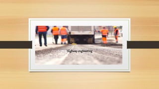
  • 2. Highway development and planning • A road is a linear way for the conveyance of traffic that mostly has an Improved surface for use by vehicles (motorized and non-motorized) and pedestrians. Unlike streets the main function of roads is transportation. • There are many types of roads, including parkways, avenues, controlled-access highways (freeways, motorways, and expressways), tollways, interstates, highways, thoroughfares, and local roads. • The primary features of roads Organization for Economic Co-operation and Development include lanes, sidewalks (pavement), roadways (carriageways), medians, shoulders, verges, bike paths (cycle paths), and shared- use paths. • A road is a linear way for the conveyance of traffic that mostly has an Improved surface for use by vehicles (motorized and non-motorized) and pedestrians. Unlike streets the main function of roads is transportation. • There are many types of roads, including parkways, avenues, controlled- access highways (freeways, motorways, and expressways), tollways, interstates, highways, thoroughfares, and local roads. • The primary features of roads Organization for Economic Co-operation and Development include lanes, sidewalks (pavement), roadways (carriageways), medians, shoulders, verges, bike paths (cycle paths), and shared-use paths.
  • 3. Definitions • Historically many roads were simply recognizable routes without any formal construction or some maintenance.[1] • The Organization for Economic Co-operation and Development (OECD) defines a road as "a line of communication (travelled way) using a stabilized base other than rails or air strips open to public traffic, primarily for the use of road motor vehicles running on their own wheels", which includes "bridges, tunnels, supporting structures, junctions, crossings, interchanges, and toll roads, but not cycle paths"
  • 4. • The Eurostat, ITF and UNECE Glossary for Transport Statistics Illustrated defines a road as a "Line of communication (traveled way) open to public traffic, primarily for the use of road motor vehicles, using a stabilized base other than rails or air strips. [...] Included are paved roads and other roads with a stabilized base, e.g. gravel roads. Roads also cover streets, bridges, tunnels, supporting structures, junctions, crossings and interchanges. Toll roads are also included. Excluded are dedicated cycle lanes. • The 1968 Vienna Convention on Road Traffic defines a road as the entire surface of any way or street open to public traffic. • In urban areas roads may diverge through a city or village and be named as streets, serving a dual function as urban space easement and route. Modern roads are normally smoothed, paved, or otherwise prepared to allow easy travel,
  • 5. Australia • Part 2, Division 1, clauses 11-13 of the National Transport Commission Road Transport Legislation 2006 defines a road in Australia as 'an area that is open to or used by the public and is developed for, or has as one of its main uses, the driving or riding of motor vehicles. • Further, it defines a shoulder (typical an area of the road outside the edge line, or the curb) and a road-related area which includes green areas separating roads, areas designated for cyclists and areas generally accessible to the public for driving, riding or parking vehicles.
  • 6. New Zealand In New Zealand, the definition of a road is broad in common law where the statutory definition includes areas the public has access to, by right or not, Beaches, publicly accessible car parks and yards (even if privately owned), river beds, road shoulders (verges), wharves and bridges are included. However, the definition of a road for insurance purposes may be restricted to reduce risk.
  • 7. United Kingdom • In the United Kingdom The Highway Code details rules for "road users", but there is some ambiguity between the terms highway and road. For the purposes of the English law, Highways Act 1980, which covers England and Wales but not Scotland or Northern Ireland, road is "any length of highway or of any other road to which the public has access, and includes bridges over which a road passes". This includes footpaths, bridleways and cycle tracks, and also road and driveways on private land and many car parks. Vehicle Excise Duty, a road use tax, is payable on some vehicles used on the public road.
  • 8. . • The assertion that the first pathways were the trails made by animals has not been universally accepted; in many cases animals do not follow constant paths. Some believe that some roads originated from following animal trails. The Infield Way may exemplify this type of road origination, where human and animal both selected the same natural line. By about 10,000 BC human travelers used rough roads/pathways.
  • 9. • The world's oldest known paved road was constructed in Egypt some time between 2600 and 2200 BC. Stone-paved streets appear in the city of Ur in the Middle East dating back to 4000 BC. • Corduroy roads (log roads) are found dating to 4000 BC in Glastonbury England. • The Sweet Track, a timber track causeway in England, is one of the oldest engineered roads discovered and the oldest timber trackway discovered in Northern Europe. Built in winter 3807 BC or spring 3806 BC, (tree-ring dating – dendrochronology – enabled very precise dating). It was claimed to be the oldest road in the world] until the 2009 discovery of a 6,000-year-old trackway in Plummeted, London. • Brick-paved streets appeared in India as early as 3000 BC
  • 10. • 1995 BC: an early subdividing of roadways evidenced with sidewalks built in Anatolia. • In 500 BC, Darius I the Great started an extensive road system for the Achaemenes Empire (Persia), including the Royal Road, which was one of the finest highways of its time, connecting Sardis (the westernmost major city of the empire) to Susa. The road remained in use after Roman times. These road systems reached as far east as Bactria and India. • In ancient times, transport by river was far easier and faster than transport by road, especially considering the cost of road construction and the difference in carrying capacity between carts and river barges. A hybrid of road transport and ship transport beginning in about 1740 is the horse-drawn boat in which the horse follows a cleared path along the river bank.
  • 11. • From about 312 BC, the Roman Empire built straight] strong stone Roman roads throughout Europe and North Africa, in support of its military campaigns. At its peak the Roman Empire was connected by 29 major roads moving out from Rome and covering 78,000 kilometers or 52,964 Roman miles of paved roads. • In the 8th century AD, many roads were built throughout the Arab Empire. The most sophisticated roads were those in Baghdad, which were paved with tar. Tar was derived from petroleum, accessed from oil fields in the region, through the chemical process of destructive distillation.
  • 12. Design • Road design is part of highway engineering. Structural road design is designing a road for the environment in order to extend its longevity and reduce maintenance. The Shell pavement design method is used in many countries for the design of new asphalt roadsides.
  • 13. Construction • Road construction requires the creation of an engineered continuous right- of-way or roadbed, overcoming geographic obstacles and having grades low enough to permit vehicle or foot travel, and may be required to meet standards set by law or official guidelines. The process is often begun with the removal of earth and rock by digging or blasting, construction of embankments, bridges and tunnels, and removal of vegetation (this may involve deforestation) and followed by the laying of pavement material. A variety of road building equipment is employed in road building
  • 14. • After design, approval, planning, legal, and environmental considerations have been addressed alignment of the road is set out by a surveyor The radii and gradient are designed and staked out to best suit the natural ground levels and minimize the amount of cut and fill. Great care is taken to preserve reference Benchmarks Roads are designed and built for primary use by vehicular and pedestrian traffic. Storm drainage and environmental considerations are a major concern. Erosion and sediment controls are constructed to prevent detrimental effects. Drainage lines are laid with sealed joints in the road easement with runoff coefficients and characteristics adequate for the land zoning and storm water system. Drainage systems must be capable of carrying the ultimate design flow from the upstream catchment with approval for the outfall from the appropriate authority to a watercourse, creek, river or the sea for drainage discharge.
  • 15. • Old road surfaces, fences, and buildings may need to be removed before construction can begin. Trees in the road construction area may be marked for retention. These protected trees should not have the topsoil within the area of the tree's drip line removed and the area should be kept clear of construction material and equipment. Compensation or replacement may be required if a protected tree is damaged. Much of the vegetation may be mulched and put aside for use during reinstatement. The topsoil is usually stripped and stockpiled nearby for rehabilitation of newly constructed embankments along the road. Stumps and roots are removed and holes filled as required before the earthwork begins. Final rehabilitation after road construction is completed will include seeding, planting, watering and other activities to reinstate the area to be consistent with the untouched surrounding areas.
  • 16. • Processes during earthwork include excavation, removal of material to spoil, filling, compacting, construction and trimming. If rock or other unsuitable material is discovered it is removed, moisture content is managed and replaced with standard fill compacted to meet the design requirements (generally 90–95% relative compaction). Blasting is not frequently used to excavate the roadbed as the intact rock structure forms an ideal road base. When a depression must be filled to come up to the road grade the native bed is compacted after the topsoil has been removed. The fill is made by the "compacted layer method" where a layer of fill is spread then compacted to specifications, under saturated conditions. The process is repeated until the desired grade is reached. General fill material should be free of organics, meet minimum California bearing ratio (CBR) results and have a low plasticity index. The lower fill generally comprises sand or a sand-rich mixture with fine gravel, which acts as an inhibitor to the growth of plants or other vegetable matter.
  • 17. • The compacted fill also serves as lower-stratum drainage. Select second fill (sieved) should be composed of gravel, decomposed rock or broken rock below a specified particle size and be free of large lumps of clay. San clay fill may also be used. The roadbed must be "proof rolled" after each layer of fill is compacted. If a roller passes over an area without creating visible deformation or spring the section is deemed to comply. such as geotextiles, georgics, and grovels are frequently used in the various pavement layers to improve road quality. These materials and methods are used in low-traffic private roadways as well as public roads and highways. Geosynthetics perform four main functions in roads: separation, reinforcement, filtration, and drainage; which increase the pavement performance, reduce construction costs and decrease maintenance
  • 18. • The completed roadway is finished by paving or left with a gravel or other natural surface. The type of road surface is dependent on economic factors and expected usage. Safety improvements such as traffic signs, crash barriers, raised pavement markers and other forms of road surface marking are installed. According to a May 2009 report by the American Association of State Highway and Transportation Officials (AASHTO) and TRIP – a national transportation research organization – driving on rough roads costs the average American motorist approximately $400 a year in extra vehicle operating costs. Drivers living in urban areas with populations more than 250,000 are paying upwards of $750 more annually because of accelerated vehicle deterioration, increased maintenance, additional fuel consumption, and tire wear caused by poor road conditions.
  • 19. • When a single carriageway road is converted into dual carriageway by building a second separate carriageway alongside the first, it is usually referred to as duplication, twinning or doubling. The original carriageway is changed from two-way to become one-way, while the new carriageway is one-way in the opposite direction. In the same way as converting railway lines from single track to double track, the new carriageway is not always constructed directly alongside the existing carriageway.
  • 20. Reallocation • Roads that are intended for use by a particular mode of transport can be reallocated for another mode of transport, i.e. by using traffic signs. For instance, in the ongoing road space reallocation effort, some roads (particularly in city centers) which are intended for use by cars are increasingly being repurposed for cycling and/or walking.
  • 21. Maintenance • Like all structures, roads deteriorate over time. Deterioration is primarily due to environmental effects such as frost heaves, thermal cracking and oxidation often contribute, however accumulated damage from vehicles also contributes. According to a series of experiments carried out in the late 1950s, called the AASHO Road Test, it was empirically determined that the effective damage done to the road is roughly proportional to the Fourth power of axle weight. A typical tractor- trailer weighing 80,000 pounds (36.287 t) with 8,000 pounds (3.629 t) on the steer axle and 36,000pounds (16.329 t) on both of the tandem axle groups is expected to do 7,800 times more damage than a passenger vehicle with 2,000 pounds (0.907 t) on each axle. Potholes on roads are caused by rain damage and vehicle braking or related construction works.
  • 22. • are designed for an expected service life or design life. In some parts of the United Kingdom the standard design life is 40 years for new bitumen and concrete pavement. Maintenance is considered in the whole life cost of the road with service at 10, 20 and 30 year milestone. Roads can be and are designed for a variety of lives (8-, 15-, 30-, and 60-year designs). When pavement lasts longer than its intended life, it may have been overbuilt, and the original costs may have been too high. When a pavement fails before its intended design life, the owner may have excessive repair and rehabilitation costs. Some asphalt pavements are designed as perpetual pavements with an expected structural life in excess of 50 years. Many asphalt pavements built over 35 years ago, despite not being specifically designed as a perpetual pavement, have remained in good condition long past their design life. Many concrete pavements built since the 1950s have significantly outlived their intended design livesSome roads like Chicago, Illinois's Wacker Drive,
  • 23. • a major two-level (and at one point, three-level) roadway in the downtown area, are being rebuilt with a designed service life of 100 years Virtually all roads require some form of maintenance before they come to the end of their service life. Pro- active agencies use pavement management techniques to continually monitor road conditions and schedule preventive maintenance treatments as needed to prolong the lifespan of their roads. Technically advanced agencies monitor the road network surface condition with sophisticated equipment such as laser/inertial Profilometers. These measurements include road curvature, cross slope, asperity, roughness, rutting and texture. Software algorithms use this data to recommend maintenance or new construction. Maintenance treatments for asphalt concrete generally include thin asphalt overlays, crack sealing, surface rejuvenating, fog sealing, micro milling or diamond grinding and surface treatments. Thin surfacing preserves, protects and improves the functional condition of the road while reducing the need for routing maintenance, leading to extended service life without increasing structural capacity
  • 24. • When a single carriageway road is converted into dual carriageway by building a second separate carriageway alongside the first, it is usually referred to as duplication, twinning or doubling. The original carriageway is changed from two-way to become one-way, while the new carriageway is one-way in the opposite direction. In the same way as converting railway lines from single track to double track, the new carriageway is not always constructed directly alongside the existing carriageway.
  • 25. Slab stabilization • Distress and serviceability loss on concrete roads can be caused by loss of support due to voids beneath the concrete pavement slabs. The voids usually occur near cracks or joints due to surface water infiltration. The most common causes of voids are pumping, consolidation, subgrade failure and bridge approach failure. Slab stabilization is a non-destructive method of solving this problem and is usually employed with other Concrete Pavement Restoration (CPR) methods including patching and diamond grinding. The technique restores support to concrete slabs by filing small voids that develop underneath the concrete slab at joints, cracks or the pavement edge.
  • 26. • The process consists of pumping a cementitious grout or polyurethane mixture through holes drilled through the slab. The grout can fill small voids beneath the slab and/or sub-base. The grout also displaces free water and helps keep water from saturating and weakening support under the joints and slab edge after stabilization is complete. The three steps for this method after finding the voids are locating and drilling holes, grout injection and post-testing the stabilized slabs. Slab stabilization does not correct depressions, increase the design structural capacity, stop erosion or eliminate faulting. It does, however, restore the slab support, therefore, decreasing deflections under the load. Stabilization should only be performed at joints and cracks where the loss of support exists. Visual inspection is the simplest manner to find voids. Signs that repair is needed are transverse joint faulting, corner breaks and shoulder drop off and lines at or near joints and cracks. Deflection testing is another common procedure utilized to locate voids. It is recommended to do this testing at night as during cooler temperatures, joints open, aggregate interlock diminishes and load deflections are at their highest.
  • 27. Testing • Ground penetrating radar pulses electromagnetic waves into the pavement and measures and graphically displays the reflected signal. This can reveal voids and other defects. The epoxy/core test, detects voids by visual and mechanical methods. It consists of drilling a 25 to 50 millimeter hole through the pavement into the sub-base with a dry-bit root-hammer. Next, a two-part epoxy is poured into the hole – dyed for visual clarity. Once the epoxy hardens, technicians drill through the hole. If a void is present, the epoxy will stick to the core and provide physical evidence. Common stabilization materials include pozzolan-cement grout and polyurethane. The requirements for slab stabilization are strength and the ability to flow into or expand to fill small voids.
  • 28. • Colloidal mixing equipment is necessary to use the pozzolan-cement grouts. The contractor must place the grout using a positive-displacement injection pump or a non-pulsing progressive cavity pump. A drill is also necessary but it must produce a clean hole with no surface spalling or breakouts. The injection devices must include a grout packer capable of sealing the hole. The injection device must also have a return hose or a fast-control reverse switch, in case workers detect slab movement on the uplift gauge. The uplift beam helps to monitor the slab deflection and has to have sensitive dial gauges.
  • 29. Joint sealing • Also called joint and crack repair, this method's purpose is to minimize infiltration of surface water and incompressible material into the joint system. Joint sealants are also used to reduce dowel bar corrosion in Concrete Pavement Restoration (CPR) techniques. Successful resealing consists of old sealant removal, shaping and cleaning the reservoir, installing the backer rod and installing the sealant. Sawing, manual removal, plowing and cutting are methods used to remove the old sealant. Saws are used to shape the reservoir. When cleaning the reservoir, no dust, dirt or traces of old sealant should remain. Thus, it is recommended to water wash, sand- blast and then air blow to remove any sand, dirt or dust. The backer rod installation requires a double-wheeled, steel roller to insert the rod to the desired depth. After inserting the backer rod, the sealant is placed into the joint. There are various materials to choose for this method including hot pour bituminous liquid, silicone and preformed compression seals
  • 30. Road conditions • Road conditions are the collection of factors describing the ease of driving on a particular stretch of road, or on the roads of a particular locality, including the quality of the pavement surface, potholes, road markings, and weather. It has been reported that "[p] roblems of transportation participants and road conditions are the main factors that lead to road traffic accidents". It has further been specifically noted that "weather conditions and road conditions are interlinked as weather conditions affect the road conditions". Specific aspects of road conditions can be of particular importance for particular purposes. For example, for autonomous vehicles such as self-driving cars significant road conditions can include "shadowing and lighting changes, road surface texture changes, and road markings consisting of circular reflectors, dashed lines, and solid lines
  • 31. Environmental performance • Careful design and construction of a road can reduce any negative environmental impacts. Water management systems can be used to reduce the effect of pollutants from roads Rainwater and snowmelt running off of roads tends to pick up gasoline, motor oil, heavy metals, trash and other pollutants and result in water pollution. Road runoff is a major source of nickel, copper, zinc, cadmium, lead and polycyclic aromatic hydrocarbons (PAHs), which are created as combustion byproducts of gasoline and other fossil fuels De-icing chemicals and sand can run off into roadsides, contaminate groundwater and pollute surface waters and road salts can be toxic to sensitive plants and animals Sand applied to icy roads can be ground up by traffic into fine particulates and contribute to air pollution.
  • 32. Regulation • Right- and left-hand traffic:- Traffic flows on the right or on the left side of the road depending on the country. In countries where traffic flows on the right, traffic signs are mostly on the right side of the road, roundabouts and traffic circles go counter-clockwise/anti-clockwise, and pedestrians crossing a two-way road should watch out for traffic from the left first. In countries where traffic flows on the left, the reverse is true. About 33% of the world by population drive on the left, and 67% keep right. By road distances, about 28% drive on the left, and 72% on the right, even though originally most traffic drove on the left worldwide
  • 33. Economics • Transport economics is used to understand both the relationship between the transport system and the wider economy and the complex network effects when there are multiple paths and competing modes for both personal and freight (road/rail/air/ferry) and where Induced demand can result in increased on decreased transport levels when road provision is increased by building new roads or decreased (for example California State Route 480). Roads are generally built and maintained by the public sector using taxation although implementation may be through private contractors).or occasionally using road tolls Public-private partnerships are a way for communities to address the rising cost by injecting private funds into the infrastructure. There are four main ones:
  • 34. • design/build • design/build/operate/maintain • design/build/finance/operate • build/own/operate Society depends heavily on efficient roads. In the European Union (EU) 44% of all goods are moved by trucks over roads and 85% of all people are transported by cars, buses or coaches on roads. The term was also commonly used to refer to roadsteads, waterways that lent themselves to use by shipping.
  • 35. Construction costs • According to the New York State Thruway Authority,[92] some sample per-mile costs to construct multi-lane roads in several US northeastern states were: • Connecticut Turnpike – $3,449,000 per mile • New Jersey Turnpike – $2,200,000 per mile • Pennsylvania Turnpike (Delaware Extension) – $1,970,000 per mile • Northern Indiana Toll Road – $1,790,000 per mile • Garden State Parkway – $1,720,000 per mile • Massachusetts Turnpike – $1,600,000 per mile • Thruway, New York to Pennsylvania Line – $1,547,000 per mile • Ohio Turnpike – $1,352,000 per mile • Pennsylvania Turnpike (early construction) – $736,000 per mile
  • 36. Organization • The Indian road network is administered by various government authorities, given India's federal form of government. The following table shows the total length of India's road network by type of road and administering authority as of 31 March 2020.
  • 37. Category Managing Authority Length (km) Length share National Highway Ministry of Road Transport and Highways 151,00 2.19% State highways Public works department of state/union territory 186,528 3.00% District Roads Public works department of state/union territory 632,154 10.17% Rural roads Panchayats and PMGSY 4,535,511 72.97% Urban roads Municipal corporations and municipalities 544,683 8.76% Project roads Various government departments of states/union territories, and SAIL, NMDC and BRO 354,921 5.70% Total Total roadways 6,215,797 100%
  • 38. Growth of Road Network by Categories (km)[3] Road Category 1950–51 1960–61 1970–71 1980–81 1990–91 2000–01 2010–11 2015–16 2020-21 National Highways 19,811 (4.95%) 23,798 (4.54%) 23,838 (2.61%) 31,671 (2.13%) 33,650 (1.45%) 57,737 (1.71%) 70,934 (1.52%) 101,011 (1.80%) 151,000 (2.51%) State highways ^ ^ 56,765 (6.20%) 94,359 (6.35%) 127,311 (5.47%) 132,100 (3.92%) 163,898 (3.50%) 176,166 (3.14%) 186,528 (3.00%) District roads 173,723 (43.44%) 257,125 (49.02%) 276,833 (30.26%) 421,895 (28.40%) 509,435 (21.89%) 736,001 (21.82%) 998,895 (21.36%) 561,940 (10.03%) 632,154 (10.17%) Rural roads 206,408 (51.61%) 197,194 (37.60%) 354,530 (38.75%) 628,865 (42.34%) 1,260,430 (54.16%) 1,972,016 (58.46%) 2,749,804 (58.80%) 3,935,337 (70.23%) 4,535,511 (72.97%) Urban roads 0 46,361 (8.84%) 72,120 (7.88%) 123,120 (8.29%) 186,799 (8.03%) 252,001 (7.47%) 411,679 (8.80%) 509,730 (9.10%) 544,683 (8.76%) Project roads 0 0 130,893 (14.31%) 185,511 (12.49%) 209,737 (9.01%) 223,665 (6.63%) 281,628 (6.02%) 319,109 (5.70%) 354,921 (5.71%) Total 399,942 524,478 914,979 1,485,421 2,327,362 3,373,520 4,676,838 5,603,293 6,215,797
  • 39. Types of Roads • Expressways:- Expressways are high-speed roads that are four- or more lanes, and are access controlled where entrance and exit is controlled by the use of ramps that are incorporated into the design of the expressway. Most of the existing expressways in India are toll roads Expressways make up approximately 2,091 km (1,299 mi) of India's road network, as of 2020.[ The government has drawn up a target to build a 18,637-kilometre (11,580 mi) network of new expressways by 2022 National Expressways Authority of India (NEAI) operating under the Ministry of Road Transport and Highways will be in-charge of the construction and maintenance of expressways. The NHAI by Government of India aims to expand the expressway network and plans to add an additional 18,637 km (11,580 mi) of expressways by 2022 apart from existing national highways
  • 40. National Highways • National highways are highways connecting major cities throughout the country with premium quality and are at-grade roads. National Highways are designated with NH, followed by the highway number. Indian national highways are further classified based on the width of the carriageway of the highway. India has around 150,000 km (93,000 mi) of National Highways as of April 2021 and is expected to reach 200,000km By 2024 consisting of Top Notch Highways And Expressways.[36] National Highways constituted 2.7% of India's total road network, but carried about 40% of road traffic, as of 2013.[37] In 2016, the government vowed to double the highway length from 96,000 to 2,00,000 km
  • 41. Lanes Length (km) Length share Single-lane/intermediate lane 29,693 20.49% Double-lane 72,281 55.05% Four-lane/six-lane/eight-lane 37,058 24.46% Total 1,39,032 100% Length 2001 Length 2011 Length 2021 Total rural roads 2.7 million 3.1 million 4.5 million Paved unmaintained rural roads 0.5 million Unpaved rural roads 2.2 million 1.9 million Paved maintained rural roads 728,871 New rural roads 322,900 82,743 1,500,000
  • 42. State highways • State highways are highways connecting major cities throughout a state and are also at-grade roads. They also connect with National Highways or state highways of neighboring states. State Highways are designated with SH, followed by the highway number and preceded by state code. As of 31 March 2020, the total length of state highways was 186,528 kilometers (115,903 mi). As of 31 March 2020, Maharashtra has the largest share of state highways among all states (22.14%), followed by Karnataka (11.11%), Gujarat (9.76%), Rajasthan (8.62%) and Tamil Nadu
  • 43. • Border roads:-Border Roads are the roads constructed along the northern and northeastern borders of our country. These roads are constructed and maintained by Border Roads Organization (BRO) which was set up in 1960 by the government of India. BRO is regarded as a symbol of nation building, national integration and an inseparable component in maintaining the security of the country. • Congestion:-India's intra-city vehicle speed is among the lowest in the world. As per a study by Ola Cabs, in 2017, the average traffic speed in Delhi was 25 km/h (16 mph). Amongst other major cities, the average traffic speed in Chennai was 18.9 km/h (11.7 mph), in Mumbai was 20.7 km/h (12.9 mph), in Kolkata as 19.2 km/h (11.9 mph), in Hyderabad was 18.5 km/h (11.5 mph), and in Bengaluru was 17.2 km/h (10.7 mph). • Fatalities:-The World Health Organization's compilation of road network safety data for major economies found India to have the highest number of road fatalities in the world, with 299,091 deaths caused by road accidents in 2016. Also, fatalities per 100,000 population stay among the highest, at 22.6. Of total fatalities, 40% were of riders of 2 or 3 wheelers, 18% were of drivers and passengers of 4-wheeled cars and light vehicles, 18% were of drivers and passengers of buses and heavy trucks, 10% of pedestrians, 2% of cyclists and 13% of other