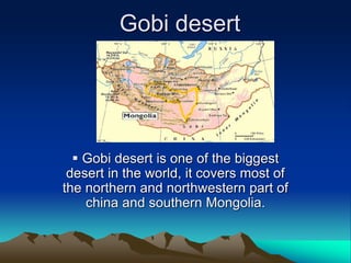
1. Gobi desert
Gobi desert is one of the biggest
desert in the world, it covers most of
the northern and northwestern part of
china and southern Mongolia.
2. Geography
• The Gobi measures over 1,610 km (1,000 mi) from southwest to northeast
and 800 km (497 mi) from north to south. The desert is widest in the west,
along the line joining the and the Lop Nor (87°-89° east). It occupies an arc
of land 1,295,000 km2 (500,002 sq mi) in area, making it fifth largest in the
world and Asia's largest. Much of the Gobi is not sandy but is covered with
bare rock.
• The Gobi has several different Chinese names, including 沙漠 (shāmò,
actually a generic term for deserts in general) and 瀚海 (hànhǎi, endless
sea).
3. Climate
• The Gobi is a cold desert, and it is not
uncommon to see frost and occasionally
snow on its dunes. Besides being quite far
north, it is also located on a plateau roughly
910–1,520 meters (3,000–5,000 ft) above
sea level, which further contributes to its low
temperatures. An average of approximately
194 millimeters (7.6 in) of rain falls per year
in the Gobi. Additional moisture reaches
parts of the Gobi in winter as snow is blown
by the wind from the Siberian Steppes.
These winds cause the Gobi to reach
extremes of temperature ranging from –
40°C (-42°F) in winter to +40°C (104°F) in
summer.
4. desertification
• Currently, the Gobi desert is expanding at an
alarming rate, in a process known as
desertification. The expansion is particularly
rapid on the southern edge into China,
which has seen 3,600 km2 (1,390 sq mi) of
grassland overtaken every year by the Gobi
Desert. Dust storms, which used to occur
regularly in China, have seen a dramatic
increase in occurrence in the past 20 years,
mainly due to desertification, and causing
further damage to China's agriculture
economy
5. Ecoregions of the Gobi desert
The Gobi, broadly defined, can be divided into five distinct dry ecoregions,
• The 'Eastern Gobi desert steppe' is the easternmost of the Gobi
ecoregions, covering an area of 281,800 km2 (108,804 sq mi). It extends
from the inner Mongolia Plateau in China northward into Mongolia. It
includes the Yins Mountains and many low-lying areas with salt pans and
small ponds. It is bounded by the Mongolian- Manchurian grassland to the
north, the Yellow River Plain to the southeast, and the Alashan Plateau
semi-desert to the southeast and east.
• The Alashan Plateau semi-desert lies west and southwest of the Eastern
Gobi desert steppe. It consists of the desert basins and low mountains lying
between the Gobi Altai range on the north, the Helan Mountains to the
southeast, and the Qilian Mountains and northeastern portion of the Tibetan
Plateau on the southwest.
• The Gobi Lakes Valley desert steppe ecoregion lies north of Alashan
Plateau semi-desert, between the Gobi Altai range to the south and the
Khangain Mountains to the north.
6. Ecoregions
• The JUnggar Bassin semi-desert includes the desert basin lying
between the Altai mountains on the north and the Tian Shan range
on the south. It includes the northern portion of China's Xinjiang
province and extends into the southeastern corner of Mongolia. The
Alashan Plateau semi-desert lies to the east, and the Emin Valley
steppe to the west, on the China-Kazakhstan border .
• The Tian shan range separates the Junggar Basin semi-desert from
the Taklamakan Desert , which is a low, sandy desert basin
surrounded by the high mountain ranges of the Tibetan Plateau to
the south and the Pamirs to the west. The Taklamakan Desert
ecoregion includes theDesert of Lop