M3M The Line Brochure - Premium Investment Opportunity for Commercial Ventures
Banff Trail Open House
1. Banff Trail Station Area Redevelopment Plan
Transit Oriented Development (TOD)
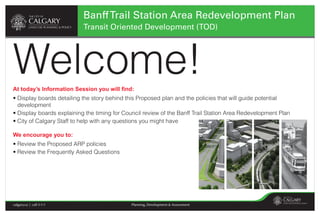
Welcome!
At today’s Information Session you will find:
• Display boards detailing the story behind this Proposed plan and the policies that will guide potential
development
• Display boards explaining the timing for Council review of the Banff Trail Station Area Redevelopment Plan
• City of Calgary Staff to help with any questions you might have
We encourage you to:
• Review the Proposed ARP policies
• Review the Frequently Asked Questions
calgary.ca | call 3-1-1 Planning, Development & Assessment
2. Banff Trail Station Area Redevelopment Plan
Transit Oriented Development (TOD)
TOD Planning Municipal Development Plan
In June 2007 Council approved a work program to develop An integrated approach to land use and mobility
Station Area Plans for 6 priority LRT stations.
On 2009 September 28, City Council approved a new
These plans were meant to address developer interest in these Municipal Development Plan (MDP) and Calgary Transportation
areas and to help facilitate the City of Calgary`s objectives of Plan (CTP). The new MDP came effective April 1, 2010.
sustainable growth. Together, these documents provide a long-term strategy for a
• Chinook (plan approved by Council June 2008) more sustainable city through the integration of land use and
• Brentwood (plan approved by Council Nov. 2009) mobility policies.
• Banff Trail (Proposed Plan Dec. 2010) The MDP proposes a more compact urban form for Calgary by
• Anderson (Draft plan 2011) locating a portion of new housing and jobs within higher
• Canyon Meadows (not proceeding) intensity, mixed-use areas that are well connected to the
• Lions Park (not proceeding) Primary Transit Network. The Banff Trail Station area is within
a Major Activity Centre and along the Primary Transit Network
(LRT).
THE CITY OF CALGARY
Municipal Development Plan Calgary Transportation Plan
Adopted by Council Adopted by Council
September 2009 September 2009
calgary.ca | call 3-1-1 calgary.ca | call 3-1-1
calgary.ca | call 3-1-1 Planning, Development & Assessment
3. Banff Trail Station Area Redevelopment Plan
Transit Oriented Development (TOD)
Banff Trail/Motel Village Banff Trail Station Area
Area Redevelopment Plan Redevelopment Plan
The community of Banff Trail currently has an Area The Proposed Banff Trail Station ARP will provide land
Redevelopment Plan (ARP), originally approved by City use and mobility direction for an area between 16 Avenue
Council in 1986, which includes both the residential N.W., north to 24 Avenue N.W. from Crowchild Trail east to
community and the Motel Village commercial area. the LRT tracks.
This ARP will continue to guide development within the
residential community.
FIGURE 5.
The proposed Banff Trail EXISTING CONDITIONS &
STATION AREA BOUNDARIES
LEGEND
Station ARP, will provide LRT station
Banff Trail Station
university of calgary
guidance to the evolution of Area Redevelopment Plan
Boundary
the Motel Village area into a northwest LRT corridor banff trail
area of change
mixed used transit oriented open space
commercial/employment/mixed use
major retail centre
foothills athletic park
community with a variety of institutional
neighbourhood/community
600m 10minute walking radius
mcmahon stadium branton junior high school
jobs and housing forms. Plan Area 200,000 sq. m (49.4 acres)
banff trail lrt station
Parcel Area 93,510 sq. m (23.1 acres)
banff trail park
motel village
st. andrews park
hounsfield heights/briar hill
This map is conceptual only.
No measurements of
distances or areas should be
taken from this map .
calgary.ca | call 3-1-1 Planning, Development & Assessment
4. Banff Trail Station Area Redevelopment Plan
Transit Oriented Development (TOD)
Banff Trail Station Area Redevelopment Plan
Community and Stakeholder Engagement Community and Stakeholder Engagement
The City of Calgary was been working the community of Information Session - Proposed
Banff Trail SARP
Dec. 8, 2010 Banff Trail Community Association
Banff Trail and Motel Village property owners since late Information Session - Draft
May 18, 2010 Banff Trail Community Association
Banff Trail SARP
2007.
Main Ideas Presentation -
June 24, 2008 Banff Trail Community Association
Banff Trail
Over the Fall and Winter of 2009/2010, Land Use Planning
Land Use Exercise April 4, 2008 SAIT - Room V202
and Policy, in partnership with several City of Calgary
Visioning Exercise March 1, 2008 Hampton Inn and Suites - Banff Trail
departments, worked with local commercial property
owners and the Banff Trail Community Association to Information Session February 9, 2008 Hampton Inn and Suites - Banff Trail
review and rework a preliminary draft plan. Based on this Information Session February 6, 2008 Hampton Inn and Suites - Banff Trail
stakeholder dialogue and feedback, a Draft document
was reviewed by the by the public, community residents
and other area stakeholders in May and June 2010.
These comments have been included into the Proposed
ARP. This Proposed ARP is the final recommended plan
by Land Use Planning and Policy and will be presented,
as displayed today, to Calgary Planning Commission and
to City Council at a Public Hearing.
Any changes to this Proposed ARP would have to made
by City Council after the Public Hearing.
calgary.ca | call 3-1-1 Planning, Development & Assessment
5. Banff Trail Station Area Redevelopment Plan
Transit Oriented Development (TOD)
Banff Trail Station Area Redevelopment Plan
Plans Concepts and Policies
In 2008, a Visioning Session and Land Use Exercise with
local residents, commercial property owners and other area
stakeholders produced a Vision and a set of Guiding Principles for
policy creation.
Vision
Banff Trail Station Area will become the heartland for the community: a
gathering place where residents and tourists can shop, dine, work, be
entertained, and meet their daily needs. It will overcome the stigma of
being an unattractive “Motel Village” and auto-dominated environment
to become a safe, mixed use, well-connected and pedestrian-friendly,
place. Existing residential community character will be preserved,
while places with an opportunity to change will enhance the area.
Guiding Principles
• Introduce an integrated street network • Establish land use precincts • Integrate with community
• Prioritize modes of transportation • Facilitate a broad mix of transit supportive uses • Ensure quality building design
• Creating vibrant pedestrian and bicycle friendly streets • Ensure appropriate ground level uses and design • Green infrastructure and green
• Creating great open spaces • Manage parking buildings
• Ensure accessibility in the public realm • Ensure transit supportive density • Create a diverse and inclusive
community
• Incorporate public art • Include a variety of building types
• Make it happen
calgary.ca | call 3-1-1 Planning, Development & Assessment
6. Banff Trail Station Area Redevelopment Plan
Transit Oriented Development (TOD)
Banff Trail Station Area Redevelopment Plan
Plans Concepts and Policies The Proposed ARP includes four primary policy sections:
p
Mobility Network
Mobility Network Public Realm
Public Realm
Land Use Density
Land Use and Density Built Form and Site Design
Built Form and Site Design
calgary.ca | call 3-1-1 Planning, Development & Assessment
7. Banff Trail Station Area Redevelopment Plan
Transit Oriented Development (TOD)
Banff Trail Station Area Redevelopment Plan 24 Ave. N.W.
FIGURE 10
Plans Concepts and Policies PEDESTRIAN NETWORK
LEGEND
existing LRT Station
future 5 car LRT Station
active pedestrian edge
mixed use edge
potential active pedestrian edge
Mobility Network potential mixed use edge
existing pedestrian connection
potential pedestrian connection
pedestrian priority area
. N.
W.
potential pedestrian priority area 23 Av
e
key pedestrian crossing
existing pedestrian overpass/underpass
Crowchild Tr. N.W.
potential pedestrian crossing 20 Ave. N.W.
FIGURE 9 24 AV NW
V 24 Ave. N.W.
AN IMPROVED STREET NETWORK
(short to medium term)
19 St. N.W.
21
ST
NW
22
22
LEGEND
ST
AS
NW
TN
W
existing LRT Station
23
23 AV NW
ST
CA
P
NW
future 5 car LRT Station
I TO
LH
IL
20 ST NW
19 ST NW
new off ramp lane
LC
RNW
closed service road AV
NW
23
public realm improvements
(new sidewalks, street trees and furniture)
signalized intersection 16 Ave. N.W.
UN
I
VE
RS
IT Y
DR
NW
22
AS
TN
23 Ave.
W
23
ST
NW
20 Ave. N.W.
20 AV NW
AV
Crowchild Tr. N.W.
CA
P
I TO
LH
IL L
CR
FIGURE 11
NW
BICYCLE NETWORK 24 Ave. N.W.
V IC
TO
R IA
19 St. N.W.
LEGEND
CR
NW
HA
Ban
existing LRT Station
L
IF A
XC
Station
future 5 car LRT Station
ff T
R
NW
existing bicycle connection
r. N
VICTORIA CR NW
key bicycle crossing
potential bicycle connection
. W.
NW
HI)
existing overpass/underpass
ST
potential dedicated bicycle space
20 ST NW
19 ST NW
E
TY
potentialbicycle crossing
key future
existing pathway connection
existing overpass/underpass
CROWCHILD T R NW
HALIFAX CR NW potential pathway connection
potential future crossing
potential bicycle lane (off street)
16 A
VN
UN
W
(T R
I
VE
A NS
CA N
RS
A DA
H I)
W.
IT Y
. N.
23 Ave
DR
16 Ave. N.W.
NW
16 AV NW (TRANS CANADA HIGHWAY)
Crowchild Tr. N.W.
20 Ave. N.W.
19 ST NW
UN
I
VE
RS
IT Y
DR
NW
W IN
D SO
RS
T NW
D T R NW
14 AV NW 14 AV NW
NW
V
4A
16 Ave. N.W.
The mobility network (infrastructure for automobiles,
pedestrians, bicycles and transit) will be improved in
the short, medium and long term.
calgary.ca | call 3-1-1 Planning, Development & Assessment
8. Banff Trail Station Area Redevelopment Plan
Transit Oriented Development (TOD)
Banff Trail Station Area Redevelopment Plan
Plans Concepts and Policies
Public Realm
private property public road right-of-way private property public road right-of-way
FIGURE 15
24 Ave. N.W.
OPEN SPACE NETWORK
LEGEND
01> Neighbourhood School Sites and Parks
02> Crowchild Trail Green
03> 23rd Avenue Linear Park 02
04> Station Square
05> Banff Trail Road Linear Green
06> 16 th Avenue Linear Green
01
property line
existing LRT Station
future 5 car LRT Station
active frontage
potential active frontage
existing pedestrian crossing
03
property line
potential pedestrian crossing 23 Ave. N.W.
primary gateway
20 Ave. N.W.
curb line
road
carriageway
Crowchild Tr. N.W.
19 St. N.W.
04
Ban
ff T
r. N
W. .
buffer road carriageway
05 set back zone
depth varies
pedestrian zone planting zone
zone set back zone
depth varies
pedestrian zone planting zone
buffer
zone
2.0 m sidewalk 2.0 m 1.0 m
2.0 m sidewalk 2.0 m 1.0 m
(mixed use) (mixed use)
06 3.0 m sidewalk
(active pedestrian)
3.0 m sidewalk
(active pedestrian)
16 Ave. N.W.
public realm varies
public realm varies
5.0 to 6.0 m
5.0 to 6.0 m
Section Plan
FUTURE PUBLIC REALM - STREET EDGE
Neighbourhood School Sites >01 Crowchild Trail Green >02 23 Avenue Linear Park >03 Station Square > 04 Banff Trail Linear Green> 05 16 Avenue Linear Green> 06
01 02 03 04 05 06
calgary.ca | call 3-1-1 Planning, Development & Assessment