SlideShare a Scribd company logo
1 of 21
Download to read offline
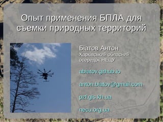
Опыт применения БПЛА дляОпыт применения БПЛА для
съемки природных территорийсъемки природных территорий
Біатов АнтонБіатов Антон
Харківський обласнийХарківський обласний
осередок НЕЦУосередок НЕЦУ
abiatov.github.ioabiatov.github.io
anton.biatov@gmail.comanton.biatov@gmail.com
pzf.gis.kh.uapzf.gis.kh.ua
necu.org.uanecu.org.ua
Национальные природные парки
НПП Слобожанский
НПП Гомольшанские леса
НПП Двуречанский
Отснятые территорииОтснятые территории
●
11 участков (4 из них 2 раза)11 участков (4 из них 2 раза)
●
Общая площадь более 1000 га.Общая площадь более 1000 га.
Слобожанский
Гомольшанские
леса Двуречанский
Съемка — 2014-2017 годСъемка — 2014-2017 год
Drone.ua
Intetics
Своими
силами
pzf.gis.kh.ua
Софт для управления БПЛАСофт для управления БПЛА
DJI GO Pix4Dcapture
Полученные данныеПолученные данные
Ортофотопланны:
- в RGB спектре
- в IRGB спектре
- ЦММ и ЦМР
- Облако точек
Хранение данные и доступ к нимХранение данные и доступ к ним
- оригинальные GeoTIFF файлы
NextGIS.com: http://conservationgisua.nextgis.com
- WMS-протокол
- Веб-карты
- подключение в мобильные ГИС
http://pzf.gis.kh.ua/services/
http://pzf.gis.kh.ua/services/#wmshttp://pzf.gis.kh.ua/services/#wms
Данные БПЛАДанные БПЛА
в НПП “Слобожанский”в НПП “Слобожанский”
http://conservationgisua.nextgis.com/resource/16/display
Данные БПЛА не в ПЗФДанные БПЛА не в ПЗФ
http://conservationgisua.nextgis.com/resource/35/display
Данные БПЛА не в ПЗФ (WMS)Данные БПЛА не в ПЗФ (WMS)
http://conservationgisua.nextgis.com/api/resource/36/wms
Данные БПЛА не в ПЗФ (WMS)Данные БПЛА не в ПЗФ (WMS)
http://conservationgisua.nextgis.com/api/resource/36/wms
Данные БПЛА не в ПЗФ (WMS)Данные БПЛА не в ПЗФ (WMS)
http://conservationgisua.nextgis.com/api/resource/36/wms
Базовые картыБазовые карты
3D-модели3D-модели
достопримечательностейдостопримечательностей
Примеры: Болото и Антарктида
Потенциал использованияПотенциал использования
Ортофотопланы:
- Визуальный анализ
- Спектральные индексы
ЦМР и ЦММ:
- Топографические индексы
- Расчет объема
- Высота лесных культур
Анализ экологических ниш
Базовые карты для веб карт и мобильных ГИС
3D-модели достопримечательностей
Визуальный осмотр местности и объектов в поле
норы, бобровые хатки, ветровалы,
каналы, растительные сообщества,
наземногнездящиеся птицы и т.д.
Вегетационная активность,
влажность листвы,
учет биомассы
Визуальный анализВизуальный анализ
ортофотоплановортофотопланов
Убежища и жизнедеятельность животных:
Растительные
сообщества
и их изменения
Локалитеты редких
видов растений:
норы, бобровые хатки,
бобровые каналы, плотины,
колонии птиц и т.д.
Топографические индексыТопографические индексы
ЦМР и производные
Анализ экологических нишАнализ экологических ниш
Визуальный осмотр местностиВизуальный осмотр местности
● Проверка труднодоступных мест / гнезд
Спасибо за внимание!Спасибо за внимание!
pzf.gis.kh.uapzf.gis.kh.ua
abiatov.github.ioabiatov.github.io
anton.biatov@gmail.comanton.biatov@gmail.com
pzf.gis.kh.ua/projects/conservation-drones/pzf.gis.kh.ua/projects/conservation-drones/

More Related Content

Viewers also liked

Mykola Kozyr Git Hub and GIS from user to developer
Mykola Kozyr   Git Hub and GIS from user to developerMykola Kozyr   Git Hub and GIS from user to developer
Mykola Kozyr Git Hub and GIS from user to developerAnton Biatov
 
Sergei Gorodilov Geocoding. What, why and how
Sergei Gorodilov   Geocoding. What, why and howSergei Gorodilov   Geocoding. What, why and how
Sergei Gorodilov Geocoding. What, why and howAnton Biatov
 
Svetlana Vinokurova Assessment of the condition of reed associations in the...
Svetlana Vinokurova   Assessment of the condition of reed associations in the...Svetlana Vinokurova   Assessment of the condition of reed associations in the...
Svetlana Vinokurova Assessment of the condition of reed associations in the...Anton Biatov
 
Ivan Oliynikov Using data of multiscale mapping to analyze the development ...
Ivan Oliynikov   Using data of multiscale mapping to analyze the development ...Ivan Oliynikov   Using data of multiscale mapping to analyze the development ...
Ivan Oliynikov Using data of multiscale mapping to analyze the development ...Anton Biatov
 
Dmitry Dyadin the experience of using mobile gis applications for urban env...
Dmitry Dyadin   the experience of using mobile gis applications for urban env...Dmitry Dyadin   the experience of using mobile gis applications for urban env...
Dmitry Dyadin the experience of using mobile gis applications for urban env...Anton Biatov
 
Yevhen Skubak Use of GIS to map northern predators of mammals into the Svya...
Yevhen Skubak   Use of GIS to map northern predators of mammals into the Svya...Yevhen Skubak   Use of GIS to map northern predators of mammals into the Svya...
Yevhen Skubak Use of GIS to map northern predators of mammals into the Svya...Anton Biatov
 
Roman Sizo Society for conservation gis - ua
Roman Sizo   Society for conservation gis - uaRoman Sizo   Society for conservation gis - ua
Roman Sizo Society for conservation gis - uaAnton Biatov
 
Volodymyr Pasternak Application of GIS-technologies for research of forest ...
Volodymyr Pasternak   Application of GIS-technologies for research of forest ...Volodymyr Pasternak   Application of GIS-technologies for research of forest ...
Volodymyr Pasternak Application of GIS-technologies for research of forest ...Anton Biatov
 
Irina Yakovleva Prospects for using modern technologies and adaptations in ...
Irina Yakovleva   Prospects for using modern technologies and adaptations in ...Irina Yakovleva   Prospects for using modern technologies and adaptations in ...
Irina Yakovleva Prospects for using modern technologies and adaptations in ...Anton Biatov
 
Alina Ovcharenko Mapping the territory of Slobozhansky national park for la...
Alina Ovcharenko   Mapping the territory of Slobozhansky national park for la...Alina Ovcharenko   Mapping the territory of Slobozhansky national park for la...
Alina Ovcharenko Mapping the territory of Slobozhansky national park for la...Anton Biatov
 
Anton Biatov Vegetation indices (general concepts)
Anton Biatov   Vegetation indices (general concepts)Anton Biatov   Vegetation indices (general concepts)
Anton Biatov Vegetation indices (general concepts)Anton Biatov
 
Dmitry Lyashenko Geoinformation environmental mapping in Ukraine
Dmitry Lyashenko   Geoinformation environmental mapping in UkraineDmitry Lyashenko   Geoinformation environmental mapping in Ukraine
Dmitry Lyashenko Geoinformation environmental mapping in UkraineAnton Biatov
 
Natalia Atamas Using a meteorological sounding balloon with a video camera ...
Natalia Atamas   Using a meteorological sounding balloon with a video camera ...Natalia Atamas   Using a meteorological sounding balloon with a video camera ...
Natalia Atamas Using a meteorological sounding balloon with a video camera ...Anton Biatov
 
Natalia Kasyanova Development of gis-project of Dvorichansky national park ...
Natalia Kasyanova   Development of gis-project of Dvorichansky national park ...Natalia Kasyanova   Development of gis-project of Dvorichansky national park ...
Natalia Kasyanova Development of gis-project of Dvorichansky national park ...Anton Biatov
 
Oleg Prilutsky Experience in organizing distributed data collection for mus...
Oleg Prilutsky   Experience in organizing distributed data collection for mus...Oleg Prilutsky   Experience in organizing distributed data collection for mus...
Oleg Prilutsky Experience in organizing distributed data collection for mus...Anton Biatov
 
Egor Yatsjuk Experience in collecting and organizing data using next gis an...
Egor Yatsjuk   Experience in collecting and organizing data using next gis an...Egor Yatsjuk   Experience in collecting and organizing data using next gis an...
Egor Yatsjuk Experience in collecting and organizing data using next gis an...Anton Biatov
 
Yuriy Strus An attempt to study the biotope distribution of black stork by ...
Yuriy Strus   An attempt to study the biotope distribution of black stork by ...Yuriy Strus   An attempt to study the biotope distribution of black stork by ...
Yuriy Strus An attempt to study the biotope distribution of black stork by ...Anton Biatov
 
Natalia Brusentsova Cerviformes seu artiodactyla monitoring organization in...
Natalia Brusentsova   Cerviformes seu artiodactyla monitoring organization in...Natalia Brusentsova   Cerviformes seu artiodactyla monitoring organization in...
Natalia Brusentsova Cerviformes seu artiodactyla monitoring organization in...Anton Biatov
 
Vasyl Korets The experience of using the geographic information system qgis...
Vasyl Korets   The experience of using the geographic information system qgis...Vasyl Korets   The experience of using the geographic information system qgis...
Vasyl Korets The experience of using the geographic information system qgis...Anton Biatov
 
Roman Sizo open software and data - history, license types, beer
Roman Sizo   open software and data - history, license types, beerRoman Sizo   open software and data - history, license types, beer
Roman Sizo open software and data - history, license types, beerAnton Biatov
 

Viewers also liked (20)

Mykola Kozyr Git Hub and GIS from user to developer
Mykola Kozyr   Git Hub and GIS from user to developerMykola Kozyr   Git Hub and GIS from user to developer
Mykola Kozyr Git Hub and GIS from user to developer
 
Sergei Gorodilov Geocoding. What, why and how
Sergei Gorodilov   Geocoding. What, why and howSergei Gorodilov   Geocoding. What, why and how
Sergei Gorodilov Geocoding. What, why and how
 
Svetlana Vinokurova Assessment of the condition of reed associations in the...
Svetlana Vinokurova   Assessment of the condition of reed associations in the...Svetlana Vinokurova   Assessment of the condition of reed associations in the...
Svetlana Vinokurova Assessment of the condition of reed associations in the...
 
Ivan Oliynikov Using data of multiscale mapping to analyze the development ...
Ivan Oliynikov   Using data of multiscale mapping to analyze the development ...Ivan Oliynikov   Using data of multiscale mapping to analyze the development ...
Ivan Oliynikov Using data of multiscale mapping to analyze the development ...
 
Dmitry Dyadin the experience of using mobile gis applications for urban env...
Dmitry Dyadin   the experience of using mobile gis applications for urban env...Dmitry Dyadin   the experience of using mobile gis applications for urban env...
Dmitry Dyadin the experience of using mobile gis applications for urban env...
 
Yevhen Skubak Use of GIS to map northern predators of mammals into the Svya...
Yevhen Skubak   Use of GIS to map northern predators of mammals into the Svya...Yevhen Skubak   Use of GIS to map northern predators of mammals into the Svya...
Yevhen Skubak Use of GIS to map northern predators of mammals into the Svya...
 
Roman Sizo Society for conservation gis - ua
Roman Sizo   Society for conservation gis - uaRoman Sizo   Society for conservation gis - ua
Roman Sizo Society for conservation gis - ua
 
Volodymyr Pasternak Application of GIS-technologies for research of forest ...
Volodymyr Pasternak   Application of GIS-technologies for research of forest ...Volodymyr Pasternak   Application of GIS-technologies for research of forest ...
Volodymyr Pasternak Application of GIS-technologies for research of forest ...
 
Irina Yakovleva Prospects for using modern technologies and adaptations in ...
Irina Yakovleva   Prospects for using modern technologies and adaptations in ...Irina Yakovleva   Prospects for using modern technologies and adaptations in ...
Irina Yakovleva Prospects for using modern technologies and adaptations in ...
 
Alina Ovcharenko Mapping the territory of Slobozhansky national park for la...
Alina Ovcharenko   Mapping the territory of Slobozhansky national park for la...Alina Ovcharenko   Mapping the territory of Slobozhansky national park for la...
Alina Ovcharenko Mapping the territory of Slobozhansky national park for la...
 
Anton Biatov Vegetation indices (general concepts)
Anton Biatov   Vegetation indices (general concepts)Anton Biatov   Vegetation indices (general concepts)
Anton Biatov Vegetation indices (general concepts)
 
Dmitry Lyashenko Geoinformation environmental mapping in Ukraine
Dmitry Lyashenko   Geoinformation environmental mapping in UkraineDmitry Lyashenko   Geoinformation environmental mapping in Ukraine
Dmitry Lyashenko Geoinformation environmental mapping in Ukraine
 
Natalia Atamas Using a meteorological sounding balloon with a video camera ...
Natalia Atamas   Using a meteorological sounding balloon with a video camera ...Natalia Atamas   Using a meteorological sounding balloon with a video camera ...
Natalia Atamas Using a meteorological sounding balloon with a video camera ...
 
Natalia Kasyanova Development of gis-project of Dvorichansky national park ...
Natalia Kasyanova   Development of gis-project of Dvorichansky national park ...Natalia Kasyanova   Development of gis-project of Dvorichansky national park ...
Natalia Kasyanova Development of gis-project of Dvorichansky national park ...
 
Oleg Prilutsky Experience in organizing distributed data collection for mus...
Oleg Prilutsky   Experience in organizing distributed data collection for mus...Oleg Prilutsky   Experience in organizing distributed data collection for mus...
Oleg Prilutsky Experience in organizing distributed data collection for mus...
 
Egor Yatsjuk Experience in collecting and organizing data using next gis an...
Egor Yatsjuk   Experience in collecting and organizing data using next gis an...Egor Yatsjuk   Experience in collecting and organizing data using next gis an...
Egor Yatsjuk Experience in collecting and organizing data using next gis an...
 
Yuriy Strus An attempt to study the biotope distribution of black stork by ...
Yuriy Strus   An attempt to study the biotope distribution of black stork by ...Yuriy Strus   An attempt to study the biotope distribution of black stork by ...
Yuriy Strus An attempt to study the biotope distribution of black stork by ...
 
Natalia Brusentsova Cerviformes seu artiodactyla monitoring organization in...
Natalia Brusentsova   Cerviformes seu artiodactyla monitoring organization in...Natalia Brusentsova   Cerviformes seu artiodactyla monitoring organization in...
Natalia Brusentsova Cerviformes seu artiodactyla monitoring organization in...
 
Vasyl Korets The experience of using the geographic information system qgis...
Vasyl Korets   The experience of using the geographic information system qgis...Vasyl Korets   The experience of using the geographic information system qgis...
Vasyl Korets The experience of using the geographic information system qgis...
 
Roman Sizo open software and data - history, license types, beer
Roman Sizo   open software and data - history, license types, beerRoman Sizo   open software and data - history, license types, beer
Roman Sizo open software and data - history, license types, beer
 

More from Anton Biatov

Anton Biatov - How to effectively collect data for biologists
Anton Biatov - How to effectively collect data for biologistsAnton Biatov - How to effectively collect data for biologists
Anton Biatov - How to effectively collect data for biologistsAnton Biatov
 
Anton Biatov - GIS for fieldworker Biologists.
Anton Biatov - GIS for fieldworker Biologists. Anton Biatov - GIS for fieldworker Biologists.
Anton Biatov - GIS for fieldworker Biologists. Anton Biatov
 
University ITMO - the first non-classical university of Russia in the field o...
University ITMO - the first non-classical university of Russia in the field o...University ITMO - the first non-classical university of Russia in the field o...
University ITMO - the first non-classical university of Russia in the field o...Anton Biatov
 
Anton Biatov - Report about ArcGIS using by ESRI conservation program in GIS...
Anton Biatov - Report about ArcGIS using  by ESRI conservation program in GIS...Anton Biatov - Report about ArcGIS using  by ESRI conservation program in GIS...
Anton Biatov - Report about ArcGIS using by ESRI conservation program in GIS...Anton Biatov
 
Anton Biatov - Geocoding museum collection as basic tool for studying animal ...
Anton Biatov - Geocoding museum collection as basic tool for studying animal ...Anton Biatov - Geocoding museum collection as basic tool for studying animal ...
Anton Biatov - Geocoding museum collection as basic tool for studying animal ...Anton Biatov
 
Sizo r. Society for conservation gis
Sizo r.   Society for conservation gisSizo r.   Society for conservation gis
Sizo r. Society for conservation gisAnton Biatov
 

More from Anton Biatov (6)

Anton Biatov - How to effectively collect data for biologists
Anton Biatov - How to effectively collect data for biologistsAnton Biatov - How to effectively collect data for biologists
Anton Biatov - How to effectively collect data for biologists
 
Anton Biatov - GIS for fieldworker Biologists.
Anton Biatov - GIS for fieldworker Biologists. Anton Biatov - GIS for fieldworker Biologists.
Anton Biatov - GIS for fieldworker Biologists.
 
University ITMO - the first non-classical university of Russia in the field o...
University ITMO - the first non-classical university of Russia in the field o...University ITMO - the first non-classical university of Russia in the field o...
University ITMO - the first non-classical university of Russia in the field o...
 
Anton Biatov - Report about ArcGIS using by ESRI conservation program in GIS...
Anton Biatov - Report about ArcGIS using  by ESRI conservation program in GIS...Anton Biatov - Report about ArcGIS using  by ESRI conservation program in GIS...
Anton Biatov - Report about ArcGIS using by ESRI conservation program in GIS...
 
Anton Biatov - Geocoding museum collection as basic tool for studying animal ...
Anton Biatov - Geocoding museum collection as basic tool for studying animal ...Anton Biatov - Geocoding museum collection as basic tool for studying animal ...
Anton Biatov - Geocoding museum collection as basic tool for studying animal ...
 
Sizo r. Society for conservation gis
Sizo r.   Society for conservation gisSizo r.   Society for conservation gis
Sizo r. Society for conservation gis
 

Anton Biatov the experience of using ua vs for surveying the natural areas of the kharkov region