SlideShare a Scribd company logo
1 of 191
WATER RESOURCES OF KARNATAKA
By
Prof. A. Balasubramanian
University of Mysore
Surface water Groundwater
Quantity Quality
Consumption Conservation
River Basin as unit District /state as a
unit
Organisation of presentation
DEPTH TO WATER
LEVEL IN INDIA
KARNATAKA STATE
KARNATAKA STATE IN INDIA
Karnataka is located in the
Precambrian and Deccan
Peninsular region of India.
It covers an area of 191,791
square km.
The water resources of Karnataka
primarily constitutes surface and
groundwater.
Rainfall is the basic source of water
in the state.
POPULATION OF KARNATAKA
 According to the 2011 Census of India, Karnataka’s
population stands at 61,130,704 (6.11 crores),
which is 5.05 percent of the total population of the
country.
 This figure comprises of 50.9 percent male
population and 49.1 percent female population.
 The state has an urban population of 23,578,175,
which accounts for 38.57 percent of its total
population.
 The rural population of Karnataka stands at
37,552,529 (37.5 million) which is 61.43 percent of
the state’s population.
Karnataka’s population stands at 61,130,704 (6.11
crores
CLIMATE:
 The climate of Karnataka State varies from very
humid rainy monsoonal climate in the West Coast,
the Ghats and Malnad areas to semiarid warm dry
climate on the east.
 There is a large variation in the rainfall with higher
amounts in the Western Ghats and reducing
towards the eastern plains.
 Along the coastal Dakshina Kannada District, the
normal rainfall is about 4000 mm and in the drought
prone districts of Bijapur, Raichur, Bellary etc., the
rainfall is of the order of 500 mm to 600 mm.
RAINFALL IN KARNATAKA
 Karnataka primarily enjoys a tropical climate that is
largely dependent on its physio-graphic and
geographic location with respect to the Arabian Sea
and the monsoons.
 The state receives the benefit of two monsoons: the
North-East monsoon and the South-West monsoon.
 Karnataka receives mean annual rainfall of around
1,355 millimeters.
 More than 73 percent of this rainfall is received due
to the South-West monsoon.
RAINFALL IN KARNATAKA
 The occurrence and distribution of rainfall in the
state is not uniform.
 The region that receives the maximum rainfall is
Coastal Karnataka.
 It gets an average annual rainfall of 3,456 mm.
 South Interior Karnataka receives only 1286 mm
average rainfall while North Interior Karnataka
receives the least rainfall with 731 mm average
figure annually.
WATER RESOURCES
KARNATAKA- THE FORTUNATE STATE
Karnataka is blessed with seven
river basins.
There are 36,753 tanks in the state
and they have a capacity of about
684518 hectares.
The rivers, along with their tributaries,
account for much of Karnataka’s
surface water resources.
SURFACE WATER IN KARNATAKA
 About 60 percent of the state’s surface water is
provided by the west flowing rivers while the east
flowing rivers account for the remaining portion.
 The annual average yield in the seven
river basins of the state is estimated to be around
3,475 TMC.
 The yield in the six basins, excluding the west
flowing rivers is estimated to be 1,440 TMC.
AVAILABILITY OF WATER RESOURCES IN
KARNATAKA
Surface water is available in Karnataka
in the form of rivers, lakes, waterfalls,
reservoirs, etc.
Being the seventh largest state in India
(area-wise), Karnataka possesses about
six percent of the country’s total surface
water resources of about 17 lakh
million cubic metres (Mcum).
CLASSIFICATION OF IRRIGATION PROJECTS
SL.No. Category Extent of CCA
1.
Major Irrigation
Projects
Those having CCA of
10,000 ha or more
2.
Medium
Irrigation
Projects
Those having CCA
between 2,000 ha to
10,000 ha
Sl. No. Scheme Details Extent of Area in Ha.
1. Major and Medium Irrigation Projects 35.00 Lakhs
MAJOR PROJECTS
 The rivers Cauvery, Hemavathy and Lakshmana
theertha are being gauged by current meter from
1916 to assess the flows at Kannambadi where the
Krishnaraja Sagara has been built up.
 The composite dam at Almatti under Upper Krishna
Project will submerge an area of 24230 Hectares
affecting 136 villages and a population of 1,80,000.
 The Baglkote Town will going to be submerged in
this Upper Krishna Project.
RIVERS IN KARNATAKA
 The rivers in Karnataka are a source of water for
drinking and household purposes.
 They are integral to agriculture, a source
of hydropower and used for transportation in certain
areas.
 In some instances, they are also vital for the
tourism industry in the state.
 Many rivers, both east-flowing and west-flowing,
are found within the boundaries of Karnataka.
 Most of the rivers originate in the
Western Ghats and runs towards the eastern side
of the state.
 These are some of the largest rivers in the state
and drain towards the Bay of Bengal.
 Therefore almost all the major east-flowing rivers
are inter-state rivers.
THE SEVEN
RIVER BASINS IN
KARNATAKA ARE:
1. Godavari
2. Krishna
3. Cauvery
4. North Pennar
5. South Pennar
6. Palar
7. West flowing rivers
Sl. No. River System Drainage Area
1000 Sq. km Percentage
1. Godavari 4.41 2.31
2. Krishna 113.29 59.48
3. Cauvery 34.27 17.99
4. North Pennar 6.94 3.64
5. South Pennar 4.37 2.29
6. Palar 2.97 1.56
7. West Flowing
Rivers
24.25 12.73
Total 190.50 100
THE KRISHNA IS SECOND LARGEST RIVER
 The Krishna is second largest river in peninsular India.
 It originates in Maharashtra and passes through
Karnataka.
 The principal tributaries of the Krishna in Karnataka are:
 The Ghataprabha
 The Malaprabha
 The Bhima
THE TUNGABHADRA
 The Tungabhadra is the chief tributary of Krishna
River.
 Tungabhadra is formed in the district of Shimoga,
by the union of the Tunga and the Bhadra rivers.
 The river Tungabhadra flows east across the
Deccan Plateau, joining the Krishna in Andhra
Pradesh state and then empties into the Bay of
Bengal.
RIVERS IN THE WESTERN GHATS
 The rivers in the Western Ghats that generally flow
westward meet the Arabian Sea after a short run
varying from 50 kilometres to 300 kilometres.
 These rivers are very steep in the upper reaches
and fairly steep in the middle reaches.
 Near the sea, they have relatively flat gradients and
a mild flood plain.
EAST-FLOWING RIVERS IN KARNATAKA
 The Kaveri (or the Cauvery) is the largest river in
the state and originates from the district of Coorg.
 It is often called the Dakshina Ganga
(the Ganges of the South) and considered one of
the sacred rivers of India.
 Talakaveri, the origin of the River Kaveri, is a
famous pilgrimage and tourist spot set amidst
Bramahagiri Hills near Madikeri in Coorg.
WEST-FLOWING RIVERS IN KARNATAKA
 The Sharavathi originates at Ambuthirtha in Thirthahalli
Taluk, flows north-west through the Western Ghats. It
forms the famous Jog Falls before joining the Arabian
Sea at Honavara.
 The Mandavi originates in the Western Ghats in
Belgaum and flows through Karnataka and Goa.
 The Kalinadi originates in Bidi village in the
Western Ghats.
 The Gangavalli starts in the Western Ghats south of
Dharwad.
 The Aghanashini begins in the Western Ghats near
Sirsi.
DAMS IN KARNATAKA
 Aheri-Jumbagi Dam, Bijpaur
 Almati Dam, Bijapur
 Amarja Dam, Gulbarga
 Arkavathy Dam, Kanakapura,
Ramanagara
 Basava Sagar Dam or Narayanpur
Dam, Yadgir, Raichur
 Bennithora Dam, Chithapur, Gulbarga
 Bhadra Dam, Chikmagalur
 Bheemasamudra Dam, Chitradurga
 Chakra Dam, Shimoga
 Chandrampalli Dam, Gulbarga
 Chiklihole Dam, Nanjarayapattana
near Madikeri
 Gajanur Dam, Shimoga
 Gandorinala Dam, Gulbarga
 Hemavathy Dam, Gorur, Hassan
 Kadavinakatta Dam, Bhatkal
 Kabini Dam, Mysore
 Kanakanala Dam, Killarhatti
 KRS Dam / Brindavan Gardens,
Mysore
 Lakhya Dam, Kudremukh
 Malaprabha Dam, Belgaum
 Maralvadi Dam, Ramanagara
 Markonahalli Dam
 Nugu Dam, Heggadadevana Kote,
Mysore
 Supa Dam, Dandeli
 Tunga Anicut Dam, Shimoga
 Tungabhadra Dam, Hospet
 Votehole Dam, Hassan
 Yagachi Dam, Belur
THE OUTPUT ANALYSIS
 The ultimate Irrigation Potential, from all sources
has been estimated as 61.00 lakh hectares, out of
which 35 Lakhs hectares is under major and
medium irrigation projects.
 Upto end of March 2009, cumulative irrigation
potential of 24.28 lakh ha has been created.
KRISHNA
BASIN
KRISHNA BASIN
KRISHNA BASIN
SURFACE WATER BODIES –KRISHNA BASIN
 Surface water bodies have traditionally played an
important role in the lives of common people in
India.
 According to the assessment, the total utilizable
Surface Water Resource in Krishna Basin is 58.0
BCM. Reported Live Storage capability of Krishna
Basin is 49.55 BCM. Maximum number of surface
water bodies in Krishna basin falls in size range 0-
25 Ha.
 There are reportedly 536 major reservoirs in the
basin.
KRISHNA BASIN
KRISHNA RIVER SYSTEM :
 The river Krishna is an Inter-State river in Southern
India.
 It is the second largest river in Peninsular India,
rises in the Western Ghats at an altitude of 1337 m.
near Mahabaleshwar in Maharashtra State.
 It flows across the whole width of the peninsula,
from west to east, for a length of about 1400 km,
through Maharashtra, Karnataka and Andhra
Pradesh.
 The entire catchment area of Krishna basin is
2,58,948 sq km. including the other basin states,
and their catchment area are indicated below.
KRISHNA RIVER SYSTEM
Sl. No.
Name of the
Basin State
Catchment area
in Sq.kms
1 Maharastra 69,425
2 Karnataka 113,271
3 Andhra pradesh 76,252
Total 2,58,948
Sl.
No.
Name of the
tributary
Catchmen
t area in
Sq.kms
Origin
, Altitude &Length
Sub-tributaries
Name of the
state
1 Ghataprabha 8829 Western ghats, 884m,
283kms
Hiranyakeshi,Mark
andeya
Maharshatra,
Karnataka
2 Malaprabha 11549 Western
Ghats, 792.48m,
306kms
Bennihalla,Hirehall
a,Tas nadi
Karnataka
3 Bhima 70,614 Western Ghats,
945m, 861kms
Combined waters
of Mula &
MuthaGhod, Nira,S
ina
Maharastra,K
arnataka
4 Tungabhadra 47,866 Western ghats at
Gangamula, 1198m,
531kms
Combined waters
ofTunga
& Bhadra,Varada,H
agari(vedavathy)
Karnataka
& AndhraPra
desh
CAUVERY RIVER SYSTEM :
 The river Cauvery is an Inter-State river in Southern
India. It is one of the major rivers of the Peninsular
flowing east and running into the Bay of Bengal.
 The Cauvery rises at Talakaveri on the Brahmagiri
Range of Hill in the Western Ghats, presently in the
Coorg district of the State of Karnataka, at an
elevation of 1.341m (4,400 ft.) above mean sea
level.
 The catchment area of entire Cauvery Basin
is 81,155 sq. km. including the other basin states
of Cauvery River System and their drainage ar
THE TRIBUTARIES OF THE CAUVERI INCLUDE: River Harangi
 River Hemavathi
 River Lakshmanatirtha
 River Kabini
 River Shimsha
 River Arkavati
 River Suvarnavathi or River Honnuhole
 The Honnuhole
 The Bhavani
 The Lokapavani
 The Noyyal
 The Amaravati
CAUVERY BASIN
CAUVERY BASIN
CAUVERY BASIN
CAUVERY BASIN
CAUVERY BASIN
CAUVERY BASIN
CAUVERY BASIN WATERSHEDS
WATER RESOURCE PROJECTS – CAUVERY
BASIN
 Water resources schemes and projects are multi-
disciplinary in nature and are implemented by several
departments and agencies of State Governments.
 Major and medium irrigation projects
 There are about 29 Major and Medium Irrigation
Projects in Karnataka and 25 Major and Medium
Irrigation Projects in Tamil Nadu. Besides the above,
there are series of 10 masonry Anicuts constructed
across the main Cauvery River and some of its
tributaries in Tamil Nadu. The areas getting benefited
from these channels in Karnataka lie mainly in Mysore,
Mandya and Hassan districts and to a small extent in
Kodagu and Bangalore districts.
CAUVERY BASIN (ALL STATES)
 Dams in Cauvery basin=100
 Major Medium Irrigation Projects in Cauvery
Basin= 57
 Barrages/Weirs in Cauvery Basin=81
 Lift Stations in Cauvery Basin=17
 Hydro Electric Projects in Cauvery Basin=14
RESERVOIRS
 Hemavathi Project: This project is located on the tributary
named Hemavathi. It is mainly an irrigation project. The gross
and dead storage of the reservoir is 1050.63 MCM and 37.63
MCM respectively. The total catchment area of the project is
2810 Sq km.
 Harangi Project: This project is located on the river Harangi
near the city of Somvarpet. It is a multipurpose project having
irrigation and power generation facilities. The total catchment
area of the reservoir is 419.58 Sq km. The gross and dead
storage of the reservoir is 240.69 MCM and 12.09 MCM
respectively.
 Krishnaraj Sagar Irrigation Project: This project is located on
the river Cauvery. The catchment area of this reservoir is 10619
sq. km. The gross and dead storage of the reservoir is 1400.31
MCM and 124.62 MCM respectively. Mandya and Mysore
districts are main beneficiary of this project.
WATER RESOURCES ASSETS
MIDDLE
REACHES -
CAUVERY
CAUVERY RIVER SYSTEM
Sl.No.
Name of the
Basin State
Catchment
area in Sq.kms
1 Karnataka 34,273
2 Kerala 2,866
3 Tamil nadu 43,868
4 Karaikkal region of
Pondicherry
148
Total 81,155
THE PRINCIPAL TRIBUTARIES OF CAUVERY IN
KARNATAKA
Sl.
No.
Name of the
tributary
Catchment
area in
Sq.kms.
Sub-tributaries Name of the state
1 Harangi 717 - Karnataka
2 Hemavathy 5,410 - Karnataka
3 Kabini 7,040 Taraka,Hebballa, Nugu,
Gundal
Karnataka, Kerala
& Tamiln Nadu
4 Suvarnavathy 1,787 - Karnataka &
Tamil Nadu
5 Lakshmanathirtha 1,690 Ramathirtha Karnataka
6 Shimsha 8,469 Veeravaishnavi, kanihalla,
chickkhole, Hebbahalla,
Mullahalla & Kanva
Karnataka
7 Arkavathy 4351 Kumaudavat-hy, Manihalla
& kuttehole, Vrishabhava-
thy
Karnataka & Tamil
Nadu
WATERSHEDS IN TWO MAJOR BASINS
GODAVARI RIVER SYSTEM :
 The river Godavari rises in the Nasik district of
Maharastra about 80km from the shore of Arabian
sea, at an elevation of 1067m, after flowing for
about 1465km in a general south-easterly direction,
through Maharastra and Andhra Pradesh, Godavari
falls into the Bay of Bengal above Rajamundry.
 The Godavari has a drainage area of about
3,12,813 sq.kms.
GODAVARI RIVER SYSTEM
Sl.
No.
Name of the Basin State
Catchment area
in Sq.kms.
1 Maharastra 1,52,199
2 Madhya pradesh 26,168
3 Chhattisagarh 39,087
4 Karnataka 4,406
5 Andhra pradesh 73,201
6 Orissa 17,752
Total 3,12,813
THE PRINCIPAL TRIBUTARY OF GODAVARI
Sl.
No.
Name of
the
tributary
Catchment area in Sq.kms.
Origin
,Altitude
Sub-
tributaries
Name of
the
state
1 Manjra 15,667 Sq.kms -
Maharastra,
4,406 Sq.kms -
Karnataka,
10,772 Sq.kms -Andhra
Pradesh
Bala ghat
range of
hills,
823m
Tirina,Kara
nja,
Haldi,Lendi
& Mannar
Maharas
tra,
Karnatak
a &
Andhra
Pradesh
WEST FLOWING RIVER SYSTEM :
 The Western Ghats provides a principal geographical barrier
in the path of the Arabian Sea branch of the Southwest
monsoon, and is principally responsible for the heavy rainfall
over the western coastal belt.
 The Southwest monsoon season (june to september) is the
principal rainy season, over 90 % of annual rainfall is realised
in this period.
 The rivers in the Western Ghats region generally originate at
an elevation ranging from 400 meters to 1,600 meters above
the mean sea level, close to the Western Ghats ridge.
 The rivers generally flow westward and meet the Arabian Sea
after a short run varying from 50 kms to 300 kms. the rivers
are very steep in the upper reaches and fairly steep in the
middle reaches.
 It is only near the sea that they have relatively flat gradients
and some sort of flood plain.
INDEPENDENT CATCHMENTS
 There are many independent catchment in the West Flowing River system, which are
indicated as below.
 a. Independent catchment between Sharavathi and Chakra river.
 There are numbers of independent streams joining the arabian seas. Kollur River,
Ghantihole, Venkatapur, Baindurhole, Shankargundi, Kumbarhole and Yedamavinahole are
the important streams in this reach.
 The entire catchment of the streams coming in this reach lies in the state of Karnataka.
 b. Independent catchment between Varahi and Netravathi river.
 The independent catchment comprises of streams namely Swarna, Seethanadhi, Mulki
river, Pavanje, Nadisalu, Gurpur,Yennehole and Madisalhole.
 The entire catchment of the streams coming in this reach lies in the state of Karnataka.
 c. Independent catchment between Netravathy and Chandragiri (Payaswani)
 The main streams draining are Chandragiri ( payaswani) and Shiriya
river. The Chandragiri rises west of Mercara in Coorg District of Karnataka State at an
elevation of about 600 Mts. Pyayaswani River originates from Patti Ghats reserve forest in
Coorg District of Karnataka at an elevation of 1350 Mts.
 The two river joins together at Machipana about 15 kms upstream of their out fall point into
Arabian sea near Kasaragud.
 It drains catchment area of 1406 Sq kms out of which 836 Sq kms lies in Karnataka state
and the balance portion in Kerala state.
THE LIST OF WEST FLOWING RIVERS, THEIR
IMPORTANT TRIBUTARIES
Sl.No. Name of the tributary
Catchment
area in
Sq.kms.
Sub-tributaries Name of the state
1 Mahadayi/ Mandavi 2,032 Maderi Karnataka,Goa
2 Kalinadi 4,188 Pandhari, Tatti-
halla and Nagi
Karnataka
3 Gangavalli(Bedthi) 3,574 - karnataka
4 Aghanashini (Tadri) 1,330 - Karnataka
5 Sharavathi 3,592 - Karnataka
6 Chakra Nadi 336 Kollur Karnataka
7 Varahi (Haladi) 759 - Karnataka
8 Netravathy 3,222 Gundiahole,
Kumaradara and
Shisiahole.
Karnataka
9 Barapole
(Valapattanam)
1,867 - Karnataka &
Kerala
‘WATER OF WEST-FLOWING RIVERS OF
KARNATAKA REMAINS UNUTILISED’
 As much as 2,000 tmcft runs off into the Arabian
Sea from Karnataka of which “50 per cent to 75 per
cent is wasted into the sea.”
 The total availability of water in Karnataka because
of its seven basins is 3,475 tmcft.
 Of that, the 13 west-flowing rivers, including Kali,
Sharavathi, Chakra, Nethravathi, Varahi, Mahadayi,
Bedthi, Aghanashini, and Barapole and the areas
lying in among these rivers contribute to total 2,000
tmcft.
 Of them, the rivers that flow close to the Cauvery
basin contribute 923 tmcft.
GROUNDWATER
GROUNDWATER IS THE MAJOR SOURCE
 Groundwater is the major source of drinking water in
Karnataka.
 Over 90 percent of the drinking water supply schemes in
the rural areas of the state are based on ground water.
 This over exploitation is causing the fast decline of
ground water resources in the state.
 The result is the scarcity of safe drinking water across
many parts of Karnataka.
 In order to cater to the water requirement of the
expanding population, the existing water resources must
be conserved and prevented from
further degradation and depletion.
 Judicious and economic use of water resources for
agricultural, industrial and domestic purposes can help
in solving the problem to a large extent.
 Karnataka state depends on groundwater for
irrigation to the extent of 51 percent.
 Thus the State depends almost equally on
groundwater and surface water for irrigation.
STRESSFUL SITUATION OF WATER RESOURCES IN
KARNATAKA
 Though Karnataka enjoys a substantial amount of
rainfall and has a significant quantity of water
resources, it is not enough to meet the ever-
increasing water requirement of the state.
 Karnataka suffers repetitive droughts.
 In spite of the availability of water from the river
systems and tanks, Karnataka faces the serious
issue of 67 percent of its land marked for irrigation
falling under dry tracts.
PRESSURE ON THE WATER RESOURCES
 With a rapidly increasing population and improved living
standards, the pressure on the water resources is
constantly on the rise.
 The per capita availability of water resources is reducing
day by day.
 The erratic behaviour of rainfall and the Inter-State River
Water disputes aggravate the problem.
 The impact of climate change on the water resources
also cannot be ignored.
 Siltation of water bodies, misuse of resources, poor
management of catchment area, all add to the stressful
water resource situation in the state.
GROUND WATER LEVELS IN
KARNATAKA(2013)
 The Obs network comprises 1385 stations-CGWB+ 382
piezometers drilled under Hydrology Project
 Depth to Water Level - May 2013-A total of 402
stations were found to be dry during the period.
 Depth to Water Level - August 2013- A total of 158
stations were found to be dry during the period.
 Depth to Water Level - November 2013- A total of 94
stations were found to be dry during the period.
 Depth to Water Level - January 2014- A total of 173
stations were found to be dry during the period.
HYDROCHEMISTRY
 The water samples from 794 shallow aquifers of NHNS from
30 districts were collected in the month of May 2012.
 Distribution of Electrical Conductivity= electrical
conductivity in the State shown wide variations (60–7320
μS/cm at 25˚ C). The maximum value for the parameter was
recorded in the sample collected from Belavanki, Gadag
district.
 Distribution of Chloride.
 The distribution of chloride followed similar trend as that of EC
and the values were in the range of 4 to 5085 mg/l, the
highest value recorded is for the sample collected from
 Bannikoppa, Koppal district which showed a value of 5085
mg/l.
DISTRIBUTION OF NITRATE
 The distribution of nitrate in the State indicated that
the values are in the range of 1 to 350 mg/l and the
highest value was recorded in the sample collected
from Hirekoppa, Gadag district.
 A significant percentage of samples collected from
Bagalkot, Bangalore, Gulbarga, Bijapur,
Chamarajanagar, Chitradurga, Davanagere,
Dharwar, Gadag, Hassan, Kolar, Mandya, Mysore
and Tumkur districts showed nitrate concentration
greater than 45 mg/l rendering them unsuitable for
drinking
DISTRIBUTION OF FLUORIDE
 The occurrence of fluoride in ground water in the
State exhibited wide variations from 0.01mg/l to 5.3
mg/l.
 The sample collected from Revanur, Gulbarga
district recorded thehighest value of 5.3 mg/l.
 In the State, 88% of the samples collected were
found to contain fluoride concentration in the
‘desirable’ limit (1.0 mg/l) for drinking followed by 95
% in the ‘permissible’ (1.5 mg/l) range.
 Thus, about 5 % of the analysed samples are in the
‘unsuitable’ range.
Classified areas in India
CLASSIFIED AREAS IN KARNATAKA
GROUNDWATER RESOURCES OF KARNATAKA
 Karnataka has groundwater resources estimated to
be around 485 TMC.
 Ground water resources have not been exploited
evenly across the state.
 In areas where adequate surface water is available,
exploitation of ground water resources is minimum.
 Exploitation of ground water in the dry taluks of
North and South interior Karnataka is higher as
compared to Coastal, Malnad and irrigation
command areas of the state.
ENERGY SUBSIDIES AND GROUND WATER
EXTRACTION
 The practice of providing power subsidies for agriculture has
played a major role in the decline of water levels in India. In
2009, of the total amount of ground water extracted, 89% was
for irrigation, and 11% was for domestic and industrial uses.
 Since power is a main component of the cost of ground water
extraction, the availability of cheap/subsidised power in many
states adds to the greater extraction of this resource.
 Moreover, electricity supply is not metered and a flat tariff is
charged depending on the horsepower of the pump.
 The Draft National Water Framework Bill, 2013
alsobbsuggested that over extraction of ground water should
be curtailed by regulating the use of electricity needed for its
extraction.
 The challenge is to find a balance between the needs of
farmers and the need to ensure sustainable use of ground
water
INADEQUATE REGULATION OF GROUND WATER LAW
 The government, from time to time has stated that ground
water needs to be managed as a community resource.
However, Section 7(g) of the Easement Act, 1882 states that
every owner of land has the right to collect and dispose within
his own limits all water under the land and on its surface
which does not pass in a defined channel.
 The legal consequence of this law is that the owner of the
land ncan dig wells in his land and extract water based on
availability and his discretion.
 Additionally, landowners are not legally liable for any damage
caused to the water resources as a result of over-extraction.
 The lack of regulation for over-extraction of this resource
further worsens the situation and has made private ownership
of ground water common in most urban and rural areas.
LOCAL MANAGEMENT OF GROUND WATER
 The phenomena of local water users successfully managing their
water resources has been observed in only a few areas. The
Planning Commission recommended that local planners take the
following steps while planning for ground water management:
 Determining the relationship between surface hydrological
units such as watershed or river basins, and hydrological units
below the ground such as aquifers,
 Identification of ground water recharge areas,
 Maintaining ground water balance at the level of the village or
the watershed, and
 Creating regulatory options at the community level such as
panchayat. Examples of activities that could be regulated at the
local level include drilling depth, distance between wells,
cropping patterns to ensure sustainability of aquifers and
participatory ground water management.
HOW MUCH WATER DOES AN URBAN CITIZEN
NEED?
 For communities with a population of between 20,000 to
100,000 — 100 to 150 litres per head per day
 For communities with a population of over 100,000 — 150 to
200 litres per head per day.
 135 litres per person per day.
 The break-up was as follows:
 Bathing: 55 litres
 Toilet flushing: 30 litres
 Washing of clothes: 20 litres
 Washing the house: 10 litres
 Washing utensils: 10 litres
 Cooking: 5 litres
 Drinking: 5 litres.
 There are 80 reservoirs in Karnataka irrigating 12,91,110
hectares.
 There are 33217 minor irrigation tanks of all dimensions
irrigating a meagre 2,34,276 hectares.
 Other sources irrigate 160162 hectares.
 The area irrigated by major irrigation forms 77 percent of
the total surface irrigated area and that by minor irrigation
(tanks of all dimensions) and other sources form the rest
(23 percent).
 However, both the major irrigation reservoirs and minor
irrigation (tanks) receive water from rainfall and hence
the variation in rainfall has the greatest impact on the
surface irrigation.
THE BASIN WISE BREAKUP OF THIS
YIELD IS GIVEN IN THE FOLLOWING
TABLE:
Sl. No. River System Estimated average yield in
m.cum TMC Percentage
1 Krishna 27,451 969.44 27.90
2 Cauvery 12,034 425.00 12.23
3 Godavari 1,415 49.97 1.44
4 West Flowing river 56,600 1998.83 57.51
5 North Pennar
South Pennar
Palar​​
906 32.00 0.92
6
7
TOTAL 98406 3475.24 100
However, the economically utilisable water potential for Irrigation is about
48,000 Mcum (1695 TMC).
TOTAL
WATER RESOURCES OF KARNATA
KA
 The average annual yield of the rivers of
the Karnataka has been roughly
estimated as 98406 m.cum.
 (3475 Tmc).
THUMB RULE
 As a thumb rule, usually 1 TMC of water can irrigate 4000
ha of semi dry crops or 1000 ha of paddy or 1600 ha of
sugarcane.
COST AND PRICING OF WATER
 Cost of surface water in Rs/cu.m reservoir &
tank)
 The crop wise cost of surface water for reservoir /
tank indicates that it ranges from Rs. 86 to Rs. 988
per ha depending upon the water use intensity of
the crop.
 For instance
 for paddy the surface water cost is Rs 247 per ha,
 for sugarcane it is Rs. 988 per ha,
 for horticulture crops it is Rs. 148 per ha and
 for semi dry crops it is Rs. 87 per ha.
COST OF GROUNDWATER
 Cost of groundwater in Rs/cu.m (open & tube wells)
including pricing of Electricity in the state
 The electricity tariff for pumping groundwater (during
2005, the latest) are as under:
 I. Till electric meters are fixed –
 For I.P. Sets Up to and inclusive of 10 HP, the farmers
are to pay Rs. 20 per HP per month and 40 paise per
unit (1 unit = 1 Kilo watt hour);
 II. where electric meters are already fixed, farmers
are to pay Rs 10 per HP per month and 40 paise per
unit;
 III. for Coconut and Areca nut plantations, Lift
Irrigation Schemes / Community Irrigation Schemes
of all capacities.
 the tariff is Rs. 20 per HP per month and one rupee
(or 100 paise) per unit;
 IV. for I.P. Sets above 10 HP, and for Private
Horticultural Nurseries and Coffee and Tea
plantations irrespective of sanctioned load.
 the tariff is Rs 30 per HP per month, and one rupee
per unit.
SEVERAL ISSUES IN WATER USE
KRISHNA WATER DISPUTES TRIBUNAL
 On the 10-4-1969, the Government of India
constituted the Krishna Water Disputes Tribunal for
adjudication the water dispute regarding the inter-
state river Krishna and the river valley thereof.
 The tribunal gave it's report on 24- 12 - 1973.
 The tribunal gave it's further reports on 27 -5- 1976.
 The water allocated to the state of Karnataka is 700
TMC.
KRISHNA RIVER WATER ACCORD
 The Bachawat commission (KWDT I) went over the
matter in detail and gave its final award in 1973.
 The award contended based on 75% dependability that
the total quantum of water available for distribution was
2060 TMC.
 This was divided between the three states in the
following manner.
 Maharashtra 560 TMC
 Karnataka 700 TMC
 Andhra Pradesh 800 TMC
THE CAUVERY WATER DISPUTE
 The Cauvery Water Dispute has given an Interim
Order directing Karnataka to release water from
it's reservoirs in Karnataka so as to ensure that
205 TMC of water is available in Tamil Nadu 's
Mettur Reservoir in a Water year.
 Karnataka shall not increase it's area under
irrigation by the waters of river Cauvery beyond
existing 11.2 Lakh Acres.
A REPORT SAYS:
 “There will be no harm to any of the basins like
Hemavathi and Lakhmana Theertha by diverting the
flows. Besides, the diversion of 300 tmcft to 400 tmcft
water would help irrigate substantial land in the basins of
the Cauvery, Hemavathi, Herangi and Krishnaraja Sagar
(estimated to be 11 lakh acres) that are crying for water.”
 Of the 48 taluks of nine districts in Karnataka, lying
wholly or partly in Cauvery basin, 28 taluks are identified
drought-prone.
GROUND WATER LEVEL HITS
ROCK BOTTOM-TUMAKURU,
MARCH 25, 2015, DHNS:
 Ground water is fast depleting the in the district.
 Efforts to get ground water by digging deep into the
ground have failed in most of the places.
 Only a few parts in Gubbi, Turuvekere, Kunigal and Tiptur in
the jurisdiction of Hemavathi canal are getting ground water at
a depth of 1200 foot.
 Still, borewells are being sunk up to 1800 foot for water in
Chelur hobli in Gubbi taluk.
 Madhugiri,Chikkanayakanahalli and Koratagere taluks were
found to be using ground water to the maximum limit in a joint
survey conducted by Central and State ground water
authorities in 2009.
 The ground water level has gone down by 650 foot in these
taluks while it is 350 in other taluks.
WILL BANGALORE HAVE TO BE EVACUATED BY 2023?
 "The Government of Karnataka will have to
evacuate half of Bangalore in the next ten years,
due to water scarcity, contamination of water and
diseases.“
 It is corroborated by the lab results at the Public
Health Institute, and the Department of Mines and
Geology of the Karnataka government.
 The results reveal that 52 per cent of the borewell
water, and 59 per cent of tap water in Bangalore, is
not potable and contain 8.4 per cent and 19 per
cent E.coli bacteria respectively.
 The reason: the groundwater in at least half of Bangalore
is contaminated with sewage water.
 In 1790, a British captain had described Bangalore as the
land of a thousand lakes.
 Today less than 200 of those 1000 lakes remain and are
no more than sewage tanks.
 The sewage water contaminates the ground water and
percolates into the borewells.
 For those wondering where the 800-odd lakes
disappeared
 The 850 km of storm water drains meant to carry surplus
water from higher elevation lakes to lower levels in a
cascading system of natural rainwater harvesting, now
instead carry the city's sewage into these existing so-
called lakes.
 A report says: Only 30 per cent of the sewage is treated
by the sewage treatment plants and the rest flows into
the existing lakes.
 An estimated 35 percent of water meant for the city is
wasted in leakages.
 This means of the 1400 million litres per day (MLD) that
Bangalore draws, nearly 500 MLD is lost as leakage, and
with 150 MLD allotted to industries, one crore
Bangaloreans will have to make do with 750 MLD
everyday in 2016.
 This will work out to 75 litres per capita per day (LPCD)
while the Government of India norm for metro cities is
150 LPCD.
 Clearly there is a huge mismatch between demand and
supply of water from the Cauvery.
 Bangalore gets an annual rainfall of 900 mm.
 But the use of over 3 lakh borewells in the city to draw
ground water amounts to almost three and a half times
water drawn than the amount received to recharge it.
 Hence, it comes as no surprise then that most borewells
have gone deeper, even up to 1000 feet and the ones
which aren't as deep have run dry.
 The greater fear is that even this polluted water may not
be available after 2018.
 And rainwater harvesting is merely symbolic in the
Garden city.
 Out of 18 lakh properties, only 44,000 houses have
rainwater harvesting structures.
 Most residential properties then rely on water supplied
through tankers, that have emerged as one of the most
powerful lobbies in Bangalore.
 It is such a booming business, that there have been
instances of the water tanker mafia using force to prevent
residential societies from digging borewells to reduce
their expenditure on water supplied by them.
 In its report in January 2010, the Agenda for Bengaluru
Infrastructure and Development (ABIDe) Task Force
suggested rejuvenating the lakes in the region, as part a
Bangalore Water 2020 blueprint.
 It also asked for focus on recycling of water, adding "a
specific target should be set for the quantity of water that
can be supplied from lakes by 2012.
 The goal for obtaining 500 MLD from the Integrated
Water Management project may be set as the initial
target."
USE OF DEMAND MANAGEMENT
 Experts have suggested the use of demand
management in agriculture to address excessive
ground water exploitation.
 This will reduce dependence of agriculture on
groundwater.
 These measures include:
 Dry-season crop planning for a specific area
depending on the aquifer type, ground water
extraction, monsoonal rainfall and the water table
level.
 This would include some degree of shift towards
higher-value and less-water consumption crops.
 Adoption of modern precision irrigation
technologies such as drip and sprinkler
systems which will help reduce evaporation
and other non-beneficial, non-recoverable
fractions of water use in agriculture.
 Restrictions to control ground water
abstraction or use through regulatory
measures.
 These may include restricting the depth of
irrigation water wells, establishing and
enforcing minimum distances between
irrigation.
STATE WATER POLICY-2002
 As per Entry 56 of the list I of the Constitution,
development and management of Water is primarily
a "State Subject", with legislation and
administration substantially framed within the
context of State boundaries.
OBJECTIVES
 4.1 Provide drinking water at the rate of 55 litres per person per day
in the rural areas, 70 litres per person per day in towns and 100 litres
per person per day in the city municipal council areas and 135 litres
per person per day in city corporation areas.
 4.2 Create an ultimate irrigation potential of 45 lakh hectares under
major, medium and minor irrigation projects.
 Facilitate creation of an additional irrigation potential of 16 lakh
hectares by individual farmers using ground water.
 4.3 Improve performance of all water resources projects.
 4.4 Improve productivity of irrigated agriculture by involving users in
irrigation management.
 4.5 Harness the hydropower potential of the State.
 4.6 Provide a legislative, administrative and infrastructural
environment, which will ensure fair, just and equitable distribution
and utilization of the water resources of the State to benefit all the
people of the State.
KEY ISSUES
 Present Institutional Arrangements
 Past Investments
 Utilization
 Tanks
 Operation & Maintenance Expenditure
 Drinking Water Demand
 Water Quality
 Irrigation Management.
IRRIGATION DEVELOPMENT IN
KARNATAKA :
 Agriculture being the main occupation of the state,
Irrigation place utmost significant part in obtaining
increased yields from the land.
 The development of Irrigation in the state was slow
and unsystematic during the pre independence era.
 However, there were some notable Irrigation works
undertaken and completed during the pre-
independence.
 There were more than 25,000 tanks scattered over
erstwhile Mysore state.
FINANCIAL AND PHYSICAL PROGR
AMME
 KARNATAKA NEERAVARI NIGAM LIMITED
 KRISHNA BHAGYA JALA NIGAM LIMITED
 ACCELERATED IRRIGATION BENEFIT
PROGRAMME (AIBP)
 NABARD ASSISTED PROJECTS
 WATER AND LAND MANAGEMENT INSTITUTE
(WALMI)
WATER RESOURCES DEPARTMENT
 The Water Resources Department is one of
the major department in the Government of
Karnataka.
 The Department harnesses Surface Water for
Irrigation and Drinking Water Purposes.
 The Irrigation projects are classified under two
categories, as indicated below depending upon
the extent of culturable command area (CCA).
ASPECTS TO BE CONSIDERED :
 Institutional Arrangement
 Allocation Priorities
 Expenditure Prioritization
 Participatory Approach to
Water Resources Management
 Improving Agricultural
Production & Farm Incomes
 Restructuring of Water
Resources Department
 Water Rights
 Governance
 Private Sector Participation
 Water Rates
 Removal & Prevention of
Encroachments
 Catchment & Command Area
Treatment
 Ground Water Recharge
 Coastal Management Plan
 Rainwater Harvesting and
Water Conservation
 Ecology
 Disaster Management
 Mini Hydel Schemes
 Monitoring
 Training
 Research
 Eco-Tourism
FORMULATE AND IMPLEMENT PROJECTS AND
SCHEMES
 Formulate and implement projects and schemes of
rainwater harvesting and recharging of underground
water sources, with community participation.
 Review existing legislative framework, draft new
legislation and propose amendments to existing
legislative framework
 Complete all on-going and committed water resource
development projects
 Undertake and complete rehabilitation and development
of all Minor Irrigation Tanks on the basis of participation
by water-users including farmer, within period of 10 years
and entrust these works and also subsequent Operation
& Maintenance with Tank Users Associations which will
themselves regulate water use, cropping pattern, levy
and collection of water-user charges.
 Establish Water Resource Data Information Center
RESTRUCTURE THE WATER RESOURCES
DEPARTMENT
 Restructure the Water Resources Department to improve planning
and management capabilities, eliminate multiplicity of functions,
increase efficiency of plan and non-plan expenditure, train and
redeploy staff based on needs, change operating rules to ensure
transparency and accountability and make the Department
responsive to user needs.
 Assess overall water resource availability, current and future
problems and conflicts and identify drought and flood risk zones in
each river basin.
 Mobilize community and stakeholder participation through Users
Organizations, empower them, provide training, technical support
and create public awareness.
 Develop integrated, conjunctive basin management plan using
participatory approach.
 Develop plans for modernization and rehabilitation
of water resources projects as well as reclamation
of water logged and salt affected lands and
implement them.
 Restructure and strengthen Training, Research and
Development Institutions in the water sector to
meet technology requirements to support basin
planning, participatory approaches and render
technical assistance to users organizations.
ACT ONLY ON PAPER
 The Government of Karnataka implemented the
Karnataka Ground Water (Development and
Maintenance Rules and Control) Act in 2011 to
prevent the overuse of ground water.
 But this Act is not being followed properly, the green
activists said.
IRRIGATION THROUGH GROUND WATER-INDIA
 The largest component of ground water use is the
water extracted for irrigation. The main means of
irrigation in the country are canals, tanks and wells,
including tube-wells. Of all these sources, ground
water constitutes the largest share. Wells, including
dug wells, shallow tube-wells and deep tube wells
provide about 61.6% of water for irrigation, followed
by canals with 24.5%.
GROUND WATER CONTAMINATION
 Ground water contamination is the presence of certain pollutants in
ground water that are in excess of the limits prescribed for drinking
water.
 The commonly observed contaminants include arsenic, fluoride,
nitrate and iron, which are geogenic in nature.
 Other contaminants include bacteria, phosphates and heavy metals
which are a result of human activities including domestic sewage,
agricultural practices and industrial effluents.
 The sources of contamination include pollution by landfills, septic
tanks, leaky underground gas tanks, and from overuse of fertilizers
and pesticides.
 It has been pointed out that nearly 60% of all districts in the country
have issues related to either availability of ground water, or quality of
ground water, or both.
NUMBER OF STATES AND DISTRICTS
AFFECTED BY GEOGENIC
CONTAMINANTS AS ON JULY 2014.
 States and districts affected by geogenic contamination in
groundwater
 Geogenic contaminants /Number of affected states/ Number
of affected districts
 Arsenic 10 68
 Fluoride 20 276
 Nitrate 21 387
 Iron 24 297
 Source: Central Ground Water Board; PRS.
 The Committee on Estimates 2014-15 that reviewed the
occurrence of high arsenic content in ground water observed that
68 districts in 10 states are affected by high arsenic
contamination in groundwater.
 These states are Haryana, Punjab, Uttar Pradesh, Bihar,
Jharkhand, Chhattisgarh, West Bengal, Assam, Manipur and
Karnataka.
LEGISLATIVE AND POLICY FRAMEWORK
 Currently, the Easement Act, 1882 provides every landowner
with the right to collect and dispose, within his own limits, all
water under the land and on the surface.
 This makes it difficult to regulate extraction of ground water as
it is owned by the person to whom the land belongs.
 This gives landowners significant power over ground water.
 Further the law excludes landless ground water users from its
purview.
 Water falls under the State List of the Constitution.
 This implies that state legislative assemblies can make laws
on the subject.
LEGISLATIVE AND POLICY FRAMEWORK
 In order to provide broad guidelines to state
governments to frame their own laws relating to
sustainable water usage, the central government has
published certain framework laws or model Bills.
 In 2011, the government published a Model Bill for
Ground Water Management based on which states
could choose to enact their laws.
 In addition, it outlined a National Water Policy in 2012
articulating key principles relating to demand
management, usage efficiencies,
 infrastructure and pricing aspects of water. As
recommended in this policy, the government published a
National Water Framework Bill in 2013.
AGRICULTURAL CROP PRICING AND WATER
INTENSIVE CROPS
 In the last four decades, roughly 84% of the total
addition to the net irrigated area has come through
ground water.
 The primary cause of over-exploitation has been
the rising demand for ground water from
agriculture.
 Further, decisions such as cropping pattern and
cropping intensity are taken independent of the
ground water availability in most areas.
ESTIMATION OF GROUND WATER RESOURCES
 The current assessment methodology uses 15,640
observation wells for over 30 million ground water
structures, which makes the available data
indicative and not representative.
 The rate of siltation in Tunga Badra Reservoir is
5.27 Hectare Meter per 100 Sq Km per year
which has reduced the capacity of Reservoir by
11 TMC from 1953 to 1985 .
THANK YOU

More Related Content

What's hot

Kaveri river -_ppt
Kaveri river -_pptKaveri river -_ppt
Kaveri river -_pptmadhan babu
 
Peninsular rivers
Peninsular riversPeninsular rivers
Peninsular riversMallika S
 
Traditional methods of water conservation in India: Part 1
Traditional methods of water conservation in India: Part 1Traditional methods of water conservation in India: Part 1
Traditional methods of water conservation in India: Part 1IEI GSC
 
PHYSICAL FEATURE"S OF INDIA
PHYSICAL FEATURE"S OF INDIAPHYSICAL FEATURE"S OF INDIA
PHYSICAL FEATURE"S OF INDIARahul Jain
 
Sst drainage by Anshuman
Sst drainage by AnshumanSst drainage by Anshuman
Sst drainage by AnshumanAnshuman Ghosh
 
Interlinking of rivers in india
Interlinking of rivers in indiaInterlinking of rivers in india
Interlinking of rivers in indiaIqura Malik
 
Traditional water harvesting methods – their role and scope in correcting ind...
Traditional water harvesting methods – their role and scope in correcting ind...Traditional water harvesting methods – their role and scope in correcting ind...
Traditional water harvesting methods – their role and scope in correcting ind...IEI GSC
 
The five biggest dams in india
The five biggest dams in indiaThe five biggest dams in india
The five biggest dams in indiaJayakrishnan kichu
 
Design mannual for small scale irrigation scheme book
Design mannual for small scale irrigation scheme bookDesign mannual for small scale irrigation scheme book
Design mannual for small scale irrigation scheme bookSurendra Maharjan
 
Irrigation System Of Pakistan
Irrigation System Of PakistanIrrigation System Of Pakistan
Irrigation System Of Pakistanwajeeh hassan
 

What's hot (20)

Kaveri river -_ppt
Kaveri river -_pptKaveri river -_ppt
Kaveri river -_ppt
 
Peninsular rivers
Peninsular riversPeninsular rivers
Peninsular rivers
 
Traditional methods of water conservation in India: Part 1
Traditional methods of water conservation in India: Part 1Traditional methods of water conservation in India: Part 1
Traditional methods of water conservation in India: Part 1
 
River systems of india
River  systems of indiaRiver  systems of india
River systems of india
 
Methods of Water harvesting
Methods of Water harvesting Methods of Water harvesting
Methods of Water harvesting
 
Mahanadi
MahanadiMahanadi
Mahanadi
 
Rivers of Bangladesh
Rivers of BangladeshRivers of Bangladesh
Rivers of Bangladesh
 
PHYSICAL FEATURE"S OF INDIA
PHYSICAL FEATURE"S OF INDIAPHYSICAL FEATURE"S OF INDIA
PHYSICAL FEATURE"S OF INDIA
 
Karnataka State
Karnataka StateKarnataka State
Karnataka State
 
Sst drainage by Anshuman
Sst drainage by AnshumanSst drainage by Anshuman
Sst drainage by Anshuman
 
Interlinking of rivers in india
Interlinking of rivers in indiaInterlinking of rivers in india
Interlinking of rivers in india
 
Traditional water harvesting methods – their role and scope in correcting ind...
Traditional water harvesting methods – their role and scope in correcting ind...Traditional water harvesting methods – their role and scope in correcting ind...
Traditional water harvesting methods – their role and scope in correcting ind...
 
Irrigation canals
Irrigation canalsIrrigation canals
Irrigation canals
 
Water conservation
Water conservationWater conservation
Water conservation
 
Multipurpose projects
Multipurpose projectsMultipurpose projects
Multipurpose projects
 
The five biggest dams in india
The five biggest dams in indiaThe five biggest dams in india
The five biggest dams in india
 
water resources in india
water resources in indiawater resources in india
water resources in india
 
Design mannual for small scale irrigation scheme book
Design mannual for small scale irrigation scheme bookDesign mannual for small scale irrigation scheme book
Design mannual for small scale irrigation scheme book
 
Irrigation System Of Pakistan
Irrigation System Of PakistanIrrigation System Of Pakistan
Irrigation System Of Pakistan
 
Flood management m4
Flood management m4Flood management m4
Flood management m4
 

Similar to Water Resources of Karnataka

Almatty Dam on River Krishna.pptx
Almatty Dam on River Krishna.pptxAlmatty Dam on River Krishna.pptx
Almatty Dam on River Krishna.pptxMaj Gen PC Sen
 
ALL YOU NEED TO KNOW ABOUT KAVERI ISSUE
ALL YOU NEED TO KNOW ABOUT KAVERI ISSUE ALL YOU NEED TO KNOW ABOUT KAVERI ISSUE
ALL YOU NEED TO KNOW ABOUT KAVERI ISSUE Nischay N Gowda
 
Prospects of river basin system of irrigation in tamilnadu main n
Prospects of river basin system of irrigation in tamilnadu main nProspects of river basin system of irrigation in tamilnadu main n
Prospects of river basin system of irrigation in tamilnadu main nVIGNESH E T
 
Indian river system and flood
Indian river system and floodIndian river system and flood
Indian river system and floodAmit Jain
 
Peninsular rivers
Peninsular riversPeninsular rivers
Peninsular riversMallika S
 
Floods and it's Management, Effects of Floods
Floods and it's Management, Effects of FloodsFloods and it's Management, Effects of Floods
Floods and it's Management, Effects of FloodsAUGUESTINAMARIAJOSEP1
 
East and west coast river system Kufos kerala ashish shau
East and west coast river system Kufos kerala ashish shauEast and west coast river system Kufos kerala ashish shau
East and west coast river system Kufos kerala ashish shauAshish sahu
 
PPT on India's Drainage System (River System)
PPT on India's Drainage System (River System) PPT on India's Drainage System (River System)
PPT on India's Drainage System (River System) Rohan Karmakar
 

Similar to Water Resources of Karnataka (20)

Almatty Dam on River Krishna.pptx
Almatty Dam on River Krishna.pptxAlmatty Dam on River Krishna.pptx
Almatty Dam on River Krishna.pptx
 
ALL YOU NEED TO KNOW ABOUT KAVERI ISSUE
ALL YOU NEED TO KNOW ABOUT KAVERI ISSUE ALL YOU NEED TO KNOW ABOUT KAVERI ISSUE
ALL YOU NEED TO KNOW ABOUT KAVERI ISSUE
 
River basins in India
River basins in IndiaRiver basins in India
River basins in India
 
Prospects of river basin system of irrigation in tamilnadu main n
Prospects of river basin system of irrigation in tamilnadu main nProspects of river basin system of irrigation in tamilnadu main n
Prospects of river basin system of irrigation in tamilnadu main n
 
River system of odisha
River system of odisha River system of odisha
River system of odisha
 
Drainage
Drainage Drainage
Drainage
 
Drainage
Drainage Drainage
Drainage
 
Indian river system and flood
Indian river system and floodIndian river system and flood
Indian river system and flood
 
Peninsular rivers
Peninsular riversPeninsular rivers
Peninsular rivers
 
Indian rivers
Indian riversIndian rivers
Indian rivers
 
Floods and it's Management, Effects of Floods
Floods and it's Management, Effects of FloodsFloods and it's Management, Effects of Floods
Floods and it's Management, Effects of Floods
 
East and west coast river system Kufos kerala ashish shau
East and west coast river system Kufos kerala ashish shauEast and west coast river system Kufos kerala ashish shau
East and west coast river system Kufos kerala ashish shau
 
Drainage geo class9
Drainage geo class9Drainage geo class9
Drainage geo class9
 
Indian rivers
Indian riversIndian rivers
Indian rivers
 
Drainage System CLASS XI PPT
Drainage System CLASS XI PPT Drainage System CLASS XI PPT
Drainage System CLASS XI PPT
 
Brahmaputra
BrahmaputraBrahmaputra
Brahmaputra
 
Rivers in India 3.pptx
Rivers in India 3.pptxRivers in India 3.pptx
Rivers in India 3.pptx
 
Ncert india rivers
Ncert india riversNcert india rivers
Ncert india rivers
 
PPT on India's Drainage System (River System)
PPT on India's Drainage System (River System) PPT on India's Drainage System (River System)
PPT on India's Drainage System (River System)
 
Nitin dhiman (1)
Nitin dhiman (1)Nitin dhiman (1)
Nitin dhiman (1)
 

More from Prof. A.Balasubramanian

Checklist for academic and administrative audit
Checklist for academic and administrative auditChecklist for academic and administrative audit
Checklist for academic and administrative auditProf. A.Balasubramanian
 
Framework for academic and administrative audit
Framework for academic and administrative auditFramework for academic and administrative audit
Framework for academic and administrative auditProf. A.Balasubramanian
 
WATCHIT (Water Chemistry Interpretation Techniques) software summary
WATCHIT (Water Chemistry Interpretation Techniques) software summaryWATCHIT (Water Chemistry Interpretation Techniques) software summary
WATCHIT (Water Chemistry Interpretation Techniques) software summaryProf. A.Balasubramanian
 
WATER RESOURCES PLANNING AND MANAGEMENT POSSIBILITIES IN CHAMARAJANAGAR TALUK...
WATER RESOURCES PLANNING AND MANAGEMENT POSSIBILITIES IN CHAMARAJANAGAR TALUK...WATER RESOURCES PLANNING AND MANAGEMENT POSSIBILITIES IN CHAMARAJANAGAR TALUK...
WATER RESOURCES PLANNING AND MANAGEMENT POSSIBILITIES IN CHAMARAJANAGAR TALUK...Prof. A.Balasubramanian
 
GIS TECHNIQUES IN WATER RESOURCES PLANNING AND MANAGEMENT IN CHAMARAJANAGAR ...
 GIS TECHNIQUES IN WATER RESOURCES PLANNING AND MANAGEMENT IN CHAMARAJANAGAR ... GIS TECHNIQUES IN WATER RESOURCES PLANNING AND MANAGEMENT IN CHAMARAJANAGAR ...
GIS TECHNIQUES IN WATER RESOURCES PLANNING AND MANAGEMENT IN CHAMARAJANAGAR ...Prof. A.Balasubramanian
 
POTENTIAL BIOMEDICAL APPLICATIONS OF METALLIC NANOBIOMATERIALS: A REVIEW
 POTENTIAL BIOMEDICAL APPLICATIONS OF METALLIC NANOBIOMATERIALS: A REVIEW POTENTIAL BIOMEDICAL APPLICATIONS OF METALLIC NANOBIOMATERIALS: A REVIEW
POTENTIAL BIOMEDICAL APPLICATIONS OF METALLIC NANOBIOMATERIALS: A REVIEWProf. A.Balasubramanian
 
BIOMEDICAL APPLICATIONS OF CERAMIC NANOMATERIALS: A REVIEW
 BIOMEDICAL APPLICATIONS OF CERAMIC NANOMATERIALS: A REVIEW BIOMEDICAL APPLICATIONS OF CERAMIC NANOMATERIALS: A REVIEW
BIOMEDICAL APPLICATIONS OF CERAMIC NANOMATERIALS: A REVIEWProf. A.Balasubramanian
 
Use of toposheets in civil engineering projects
Use of toposheets in civil engineering projectsUse of toposheets in civil engineering projects
Use of toposheets in civil engineering projectsProf. A.Balasubramanian
 

More from Prof. A.Balasubramanian (20)

E content development theory and practice
E content development theory and practiceE content development theory and practice
E content development theory and practice
 
Pedagogy for online teaching
Pedagogy for online teachingPedagogy for online teaching
Pedagogy for online teaching
 
Tools for conducting Virtual classes
Tools for conducting  Virtual classesTools for conducting  Virtual classes
Tools for conducting Virtual classes
 
Checklist for academic and administrative audit
Checklist for academic and administrative auditChecklist for academic and administrative audit
Checklist for academic and administrative audit
 
Framework for academic and administrative audit
Framework for academic and administrative auditFramework for academic and administrative audit
Framework for academic and administrative audit
 
Kannadada makkalu kavana autosaved
Kannadada makkalu kavana  autosaved Kannadada makkalu kavana  autosaved
Kannadada makkalu kavana autosaved
 
WATCHIT (Water Chemistry Interpretation Techniques) software summary
WATCHIT (Water Chemistry Interpretation Techniques) software summaryWATCHIT (Water Chemistry Interpretation Techniques) software summary
WATCHIT (Water Chemistry Interpretation Techniques) software summary
 
Methods of water conservation
Methods of water conservationMethods of water conservation
Methods of water conservation
 
Modern Trends in Hydrogeology
Modern Trends in HydrogeologyModern Trends in Hydrogeology
Modern Trends in Hydrogeology
 
Climatic extremes
Climatic extremesClimatic extremes
Climatic extremes
 
WATER RESOURCES PLANNING AND MANAGEMENT POSSIBILITIES IN CHAMARAJANAGAR TALUK...
WATER RESOURCES PLANNING AND MANAGEMENT POSSIBILITIES IN CHAMARAJANAGAR TALUK...WATER RESOURCES PLANNING AND MANAGEMENT POSSIBILITIES IN CHAMARAJANAGAR TALUK...
WATER RESOURCES PLANNING AND MANAGEMENT POSSIBILITIES IN CHAMARAJANAGAR TALUK...
 
Basics of Cultural Geography
Basics of Cultural Geography Basics of Cultural Geography
Basics of Cultural Geography
 
Ore bearing fluids
Ore bearing fluidsOre bearing fluids
Ore bearing fluids
 
Ict for teaching learning 2018
Ict for teaching learning 2018Ict for teaching learning 2018
Ict for teaching learning 2018
 
Characteristics of soils
Characteristics of soilsCharacteristics of soils
Characteristics of soils
 
GIS TECHNIQUES IN WATER RESOURCES PLANNING AND MANAGEMENT IN CHAMARAJANAGAR ...
 GIS TECHNIQUES IN WATER RESOURCES PLANNING AND MANAGEMENT IN CHAMARAJANAGAR ... GIS TECHNIQUES IN WATER RESOURCES PLANNING AND MANAGEMENT IN CHAMARAJANAGAR ...
GIS TECHNIQUES IN WATER RESOURCES PLANNING AND MANAGEMENT IN CHAMARAJANAGAR ...
 
POTENTIAL BIOMEDICAL APPLICATIONS OF METALLIC NANOBIOMATERIALS: A REVIEW
 POTENTIAL BIOMEDICAL APPLICATIONS OF METALLIC NANOBIOMATERIALS: A REVIEW POTENTIAL BIOMEDICAL APPLICATIONS OF METALLIC NANOBIOMATERIALS: A REVIEW
POTENTIAL BIOMEDICAL APPLICATIONS OF METALLIC NANOBIOMATERIALS: A REVIEW
 
BIOMEDICAL APPLICATIONS OF CERAMIC NANOMATERIALS: A REVIEW
 BIOMEDICAL APPLICATIONS OF CERAMIC NANOMATERIALS: A REVIEW BIOMEDICAL APPLICATIONS OF CERAMIC NANOMATERIALS: A REVIEW
BIOMEDICAL APPLICATIONS OF CERAMIC NANOMATERIALS: A REVIEW
 
Use of toposheets in civil engineering projects
Use of toposheets in civil engineering projectsUse of toposheets in civil engineering projects
Use of toposheets in civil engineering projects
 
India major forest types
India major forest typesIndia major forest types
India major forest types
 

Recently uploaded

Forest laws, Indian forest laws, why they are important
Forest laws, Indian forest laws, why they are importantForest laws, Indian forest laws, why they are important
Forest laws, Indian forest laws, why they are importantadityabhardwaj282
 
GenBio2 - Lesson 1 - Introduction to Genetics.pptx
GenBio2 - Lesson 1 - Introduction to Genetics.pptxGenBio2 - Lesson 1 - Introduction to Genetics.pptx
GenBio2 - Lesson 1 - Introduction to Genetics.pptxBerniceCayabyab1
 
Evidences of Evolution General Biology 2
Evidences of Evolution General Biology 2Evidences of Evolution General Biology 2
Evidences of Evolution General Biology 2John Carlo Rollon
 
Is RISC-V ready for HPC workload? Maybe?
Is RISC-V ready for HPC workload? Maybe?Is RISC-V ready for HPC workload? Maybe?
Is RISC-V ready for HPC workload? Maybe?Patrick Diehl
 
BREEDING FOR RESISTANCE TO BIOTIC STRESS.pptx
BREEDING FOR RESISTANCE TO BIOTIC STRESS.pptxBREEDING FOR RESISTANCE TO BIOTIC STRESS.pptx
BREEDING FOR RESISTANCE TO BIOTIC STRESS.pptxPABOLU TEJASREE
 
Analytical Profile of Coleus Forskohlii | Forskolin .pdf
Analytical Profile of Coleus Forskohlii | Forskolin .pdfAnalytical Profile of Coleus Forskohlii | Forskolin .pdf
Analytical Profile of Coleus Forskohlii | Forskolin .pdfSwapnil Therkar
 
Speech, hearing, noise, intelligibility.pptx
Speech, hearing, noise, intelligibility.pptxSpeech, hearing, noise, intelligibility.pptx
Speech, hearing, noise, intelligibility.pptxpriyankatabhane
 
OECD bibliometric indicators: Selected highlights, April 2024
OECD bibliometric indicators: Selected highlights, April 2024OECD bibliometric indicators: Selected highlights, April 2024
OECD bibliometric indicators: Selected highlights, April 2024innovationoecd
 
Call Us ≽ 9953322196 ≼ Call Girls In Lajpat Nagar (Delhi) |
Call Us ≽ 9953322196 ≼ Call Girls In Lajpat Nagar (Delhi) |Call Us ≽ 9953322196 ≼ Call Girls In Lajpat Nagar (Delhi) |
Call Us ≽ 9953322196 ≼ Call Girls In Lajpat Nagar (Delhi) |aasikanpl
 
LIGHT-PHENOMENA-BY-CABUALDIONALDOPANOGANCADIENTE-CONDEZA (1).pptx
LIGHT-PHENOMENA-BY-CABUALDIONALDOPANOGANCADIENTE-CONDEZA (1).pptxLIGHT-PHENOMENA-BY-CABUALDIONALDOPANOGANCADIENTE-CONDEZA (1).pptx
LIGHT-PHENOMENA-BY-CABUALDIONALDOPANOGANCADIENTE-CONDEZA (1).pptxmalonesandreagweneth
 
Bentham & Hooker's Classification. along with the merits and demerits of the ...
Bentham & Hooker's Classification. along with the merits and demerits of the ...Bentham & Hooker's Classification. along with the merits and demerits of the ...
Bentham & Hooker's Classification. along with the merits and demerits of the ...Nistarini College, Purulia (W.B) India
 
Pests of jatropha_Bionomics_identification_Dr.UPR.pdf
Pests of jatropha_Bionomics_identification_Dr.UPR.pdfPests of jatropha_Bionomics_identification_Dr.UPR.pdf
Pests of jatropha_Bionomics_identification_Dr.UPR.pdfPirithiRaju
 
Harmful and Useful Microorganisms Presentation
Harmful and Useful Microorganisms PresentationHarmful and Useful Microorganisms Presentation
Harmful and Useful Microorganisms Presentationtahreemzahra82
 
Scheme-of-Work-Science-Stage-4 cambridge science.docx
Scheme-of-Work-Science-Stage-4 cambridge science.docxScheme-of-Work-Science-Stage-4 cambridge science.docx
Scheme-of-Work-Science-Stage-4 cambridge science.docxyaramohamed343013
 
TOPIC 8 Temperature and Heat.pdf physics
TOPIC 8 Temperature and Heat.pdf physicsTOPIC 8 Temperature and Heat.pdf physics
TOPIC 8 Temperature and Heat.pdf physicsssuserddc89b
 
Call Girls in Munirka Delhi 💯Call Us 🔝9953322196🔝 💯Escort.
Call Girls in Munirka Delhi 💯Call Us 🔝9953322196🔝 💯Escort.Call Girls in Munirka Delhi 💯Call Us 🔝9953322196🔝 💯Escort.
Call Girls in Munirka Delhi 💯Call Us 🔝9953322196🔝 💯Escort.aasikanpl
 
Neurodevelopmental disorders according to the dsm 5 tr
Neurodevelopmental disorders according to the dsm 5 trNeurodevelopmental disorders according to the dsm 5 tr
Neurodevelopmental disorders according to the dsm 5 trssuser06f238
 
Twin's paradox experiment is a meassurement of the extra dimensions.pptx
Twin's paradox experiment is a meassurement of the extra dimensions.pptxTwin's paradox experiment is a meassurement of the extra dimensions.pptx
Twin's paradox experiment is a meassurement of the extra dimensions.pptxEran Akiva Sinbar
 
Environmental Biotechnology Topic:- Microbial Biosensor
Environmental Biotechnology Topic:- Microbial BiosensorEnvironmental Biotechnology Topic:- Microbial Biosensor
Environmental Biotechnology Topic:- Microbial Biosensorsonawaneprad
 

Recently uploaded (20)

Forest laws, Indian forest laws, why they are important
Forest laws, Indian forest laws, why they are importantForest laws, Indian forest laws, why they are important
Forest laws, Indian forest laws, why they are important
 
GenBio2 - Lesson 1 - Introduction to Genetics.pptx
GenBio2 - Lesson 1 - Introduction to Genetics.pptxGenBio2 - Lesson 1 - Introduction to Genetics.pptx
GenBio2 - Lesson 1 - Introduction to Genetics.pptx
 
Hot Sexy call girls in Moti Nagar,🔝 9953056974 🔝 escort Service
Hot Sexy call girls in  Moti Nagar,🔝 9953056974 🔝 escort ServiceHot Sexy call girls in  Moti Nagar,🔝 9953056974 🔝 escort Service
Hot Sexy call girls in Moti Nagar,🔝 9953056974 🔝 escort Service
 
Evidences of Evolution General Biology 2
Evidences of Evolution General Biology 2Evidences of Evolution General Biology 2
Evidences of Evolution General Biology 2
 
Is RISC-V ready for HPC workload? Maybe?
Is RISC-V ready for HPC workload? Maybe?Is RISC-V ready for HPC workload? Maybe?
Is RISC-V ready for HPC workload? Maybe?
 
BREEDING FOR RESISTANCE TO BIOTIC STRESS.pptx
BREEDING FOR RESISTANCE TO BIOTIC STRESS.pptxBREEDING FOR RESISTANCE TO BIOTIC STRESS.pptx
BREEDING FOR RESISTANCE TO BIOTIC STRESS.pptx
 
Analytical Profile of Coleus Forskohlii | Forskolin .pdf
Analytical Profile of Coleus Forskohlii | Forskolin .pdfAnalytical Profile of Coleus Forskohlii | Forskolin .pdf
Analytical Profile of Coleus Forskohlii | Forskolin .pdf
 
Speech, hearing, noise, intelligibility.pptx
Speech, hearing, noise, intelligibility.pptxSpeech, hearing, noise, intelligibility.pptx
Speech, hearing, noise, intelligibility.pptx
 
OECD bibliometric indicators: Selected highlights, April 2024
OECD bibliometric indicators: Selected highlights, April 2024OECD bibliometric indicators: Selected highlights, April 2024
OECD bibliometric indicators: Selected highlights, April 2024
 
Call Us ≽ 9953322196 ≼ Call Girls In Lajpat Nagar (Delhi) |
Call Us ≽ 9953322196 ≼ Call Girls In Lajpat Nagar (Delhi) |Call Us ≽ 9953322196 ≼ Call Girls In Lajpat Nagar (Delhi) |
Call Us ≽ 9953322196 ≼ Call Girls In Lajpat Nagar (Delhi) |
 
LIGHT-PHENOMENA-BY-CABUALDIONALDOPANOGANCADIENTE-CONDEZA (1).pptx
LIGHT-PHENOMENA-BY-CABUALDIONALDOPANOGANCADIENTE-CONDEZA (1).pptxLIGHT-PHENOMENA-BY-CABUALDIONALDOPANOGANCADIENTE-CONDEZA (1).pptx
LIGHT-PHENOMENA-BY-CABUALDIONALDOPANOGANCADIENTE-CONDEZA (1).pptx
 
Bentham & Hooker's Classification. along with the merits and demerits of the ...
Bentham & Hooker's Classification. along with the merits and demerits of the ...Bentham & Hooker's Classification. along with the merits and demerits of the ...
Bentham & Hooker's Classification. along with the merits and demerits of the ...
 
Pests of jatropha_Bionomics_identification_Dr.UPR.pdf
Pests of jatropha_Bionomics_identification_Dr.UPR.pdfPests of jatropha_Bionomics_identification_Dr.UPR.pdf
Pests of jatropha_Bionomics_identification_Dr.UPR.pdf
 
Harmful and Useful Microorganisms Presentation
Harmful and Useful Microorganisms PresentationHarmful and Useful Microorganisms Presentation
Harmful and Useful Microorganisms Presentation
 
Scheme-of-Work-Science-Stage-4 cambridge science.docx
Scheme-of-Work-Science-Stage-4 cambridge science.docxScheme-of-Work-Science-Stage-4 cambridge science.docx
Scheme-of-Work-Science-Stage-4 cambridge science.docx
 
TOPIC 8 Temperature and Heat.pdf physics
TOPIC 8 Temperature and Heat.pdf physicsTOPIC 8 Temperature and Heat.pdf physics
TOPIC 8 Temperature and Heat.pdf physics
 
Call Girls in Munirka Delhi 💯Call Us 🔝9953322196🔝 💯Escort.
Call Girls in Munirka Delhi 💯Call Us 🔝9953322196🔝 💯Escort.Call Girls in Munirka Delhi 💯Call Us 🔝9953322196🔝 💯Escort.
Call Girls in Munirka Delhi 💯Call Us 🔝9953322196🔝 💯Escort.
 
Neurodevelopmental disorders according to the dsm 5 tr
Neurodevelopmental disorders according to the dsm 5 trNeurodevelopmental disorders according to the dsm 5 tr
Neurodevelopmental disorders according to the dsm 5 tr
 
Twin's paradox experiment is a meassurement of the extra dimensions.pptx
Twin's paradox experiment is a meassurement of the extra dimensions.pptxTwin's paradox experiment is a meassurement of the extra dimensions.pptx
Twin's paradox experiment is a meassurement of the extra dimensions.pptx
 
Environmental Biotechnology Topic:- Microbial Biosensor
Environmental Biotechnology Topic:- Microbial BiosensorEnvironmental Biotechnology Topic:- Microbial Biosensor
Environmental Biotechnology Topic:- Microbial Biosensor
 

Water Resources of Karnataka

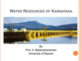
  • 1. WATER RESOURCES OF KARNATAKA By Prof. A. Balasubramanian University of Mysore
  • 2. Surface water Groundwater Quantity Quality Consumption Conservation River Basin as unit District /state as a unit Organisation of presentation
  • 3.
  • 6. KARNATAKA STATE IN INDIA Karnataka is located in the Precambrian and Deccan Peninsular region of India. It covers an area of 191,791 square km. The water resources of Karnataka primarily constitutes surface and groundwater. Rainfall is the basic source of water in the state.
  • 7. POPULATION OF KARNATAKA  According to the 2011 Census of India, Karnataka’s population stands at 61,130,704 (6.11 crores), which is 5.05 percent of the total population of the country.  This figure comprises of 50.9 percent male population and 49.1 percent female population.  The state has an urban population of 23,578,175, which accounts for 38.57 percent of its total population.  The rural population of Karnataka stands at 37,552,529 (37.5 million) which is 61.43 percent of the state’s population.
  • 8. Karnataka’s population stands at 61,130,704 (6.11 crores
  • 9. CLIMATE:  The climate of Karnataka State varies from very humid rainy monsoonal climate in the West Coast, the Ghats and Malnad areas to semiarid warm dry climate on the east.  There is a large variation in the rainfall with higher amounts in the Western Ghats and reducing towards the eastern plains.  Along the coastal Dakshina Kannada District, the normal rainfall is about 4000 mm and in the drought prone districts of Bijapur, Raichur, Bellary etc., the rainfall is of the order of 500 mm to 600 mm.
  • 10. RAINFALL IN KARNATAKA  Karnataka primarily enjoys a tropical climate that is largely dependent on its physio-graphic and geographic location with respect to the Arabian Sea and the monsoons.  The state receives the benefit of two monsoons: the North-East monsoon and the South-West monsoon.  Karnataka receives mean annual rainfall of around 1,355 millimeters.  More than 73 percent of this rainfall is received due to the South-West monsoon.
  • 11. RAINFALL IN KARNATAKA  The occurrence and distribution of rainfall in the state is not uniform.  The region that receives the maximum rainfall is Coastal Karnataka.  It gets an average annual rainfall of 3,456 mm.  South Interior Karnataka receives only 1286 mm average rainfall while North Interior Karnataka receives the least rainfall with 731 mm average figure annually.
  • 12.
  • 13.
  • 14.
  • 16. KARNATAKA- THE FORTUNATE STATE Karnataka is blessed with seven river basins. There are 36,753 tanks in the state and they have a capacity of about 684518 hectares. The rivers, along with their tributaries, account for much of Karnataka’s surface water resources.
  • 17. SURFACE WATER IN KARNATAKA  About 60 percent of the state’s surface water is provided by the west flowing rivers while the east flowing rivers account for the remaining portion.  The annual average yield in the seven river basins of the state is estimated to be around 3,475 TMC.  The yield in the six basins, excluding the west flowing rivers is estimated to be 1,440 TMC.
  • 18. AVAILABILITY OF WATER RESOURCES IN KARNATAKA Surface water is available in Karnataka in the form of rivers, lakes, waterfalls, reservoirs, etc. Being the seventh largest state in India (area-wise), Karnataka possesses about six percent of the country’s total surface water resources of about 17 lakh million cubic metres (Mcum).
  • 19. CLASSIFICATION OF IRRIGATION PROJECTS SL.No. Category Extent of CCA 1. Major Irrigation Projects Those having CCA of 10,000 ha or more 2. Medium Irrigation Projects Those having CCA between 2,000 ha to 10,000 ha Sl. No. Scheme Details Extent of Area in Ha. 1. Major and Medium Irrigation Projects 35.00 Lakhs
  • 20.
  • 21. MAJOR PROJECTS  The rivers Cauvery, Hemavathy and Lakshmana theertha are being gauged by current meter from 1916 to assess the flows at Kannambadi where the Krishnaraja Sagara has been built up.  The composite dam at Almatti under Upper Krishna Project will submerge an area of 24230 Hectares affecting 136 villages and a population of 1,80,000.  The Baglkote Town will going to be submerged in this Upper Krishna Project.
  • 22. RIVERS IN KARNATAKA  The rivers in Karnataka are a source of water for drinking and household purposes.  They are integral to agriculture, a source of hydropower and used for transportation in certain areas.  In some instances, they are also vital for the tourism industry in the state.  Many rivers, both east-flowing and west-flowing, are found within the boundaries of Karnataka.
  • 23.  Most of the rivers originate in the Western Ghats and runs towards the eastern side of the state.  These are some of the largest rivers in the state and drain towards the Bay of Bengal.  Therefore almost all the major east-flowing rivers are inter-state rivers.
  • 24. THE SEVEN RIVER BASINS IN KARNATAKA ARE: 1. Godavari 2. Krishna 3. Cauvery 4. North Pennar 5. South Pennar 6. Palar 7. West flowing rivers
  • 25. Sl. No. River System Drainage Area 1000 Sq. km Percentage 1. Godavari 4.41 2.31 2. Krishna 113.29 59.48 3. Cauvery 34.27 17.99 4. North Pennar 6.94 3.64 5. South Pennar 4.37 2.29 6. Palar 2.97 1.56 7. West Flowing Rivers 24.25 12.73 Total 190.50 100
  • 26.
  • 27.
  • 28. THE KRISHNA IS SECOND LARGEST RIVER  The Krishna is second largest river in peninsular India.  It originates in Maharashtra and passes through Karnataka.  The principal tributaries of the Krishna in Karnataka are:  The Ghataprabha  The Malaprabha  The Bhima
  • 29. THE TUNGABHADRA  The Tungabhadra is the chief tributary of Krishna River.  Tungabhadra is formed in the district of Shimoga, by the union of the Tunga and the Bhadra rivers.  The river Tungabhadra flows east across the Deccan Plateau, joining the Krishna in Andhra Pradesh state and then empties into the Bay of Bengal.
  • 30. RIVERS IN THE WESTERN GHATS  The rivers in the Western Ghats that generally flow westward meet the Arabian Sea after a short run varying from 50 kilometres to 300 kilometres.  These rivers are very steep in the upper reaches and fairly steep in the middle reaches.  Near the sea, they have relatively flat gradients and a mild flood plain.
  • 31. EAST-FLOWING RIVERS IN KARNATAKA  The Kaveri (or the Cauvery) is the largest river in the state and originates from the district of Coorg.  It is often called the Dakshina Ganga (the Ganges of the South) and considered one of the sacred rivers of India.  Talakaveri, the origin of the River Kaveri, is a famous pilgrimage and tourist spot set amidst Bramahagiri Hills near Madikeri in Coorg.
  • 32. WEST-FLOWING RIVERS IN KARNATAKA  The Sharavathi originates at Ambuthirtha in Thirthahalli Taluk, flows north-west through the Western Ghats. It forms the famous Jog Falls before joining the Arabian Sea at Honavara.  The Mandavi originates in the Western Ghats in Belgaum and flows through Karnataka and Goa.  The Kalinadi originates in Bidi village in the Western Ghats.  The Gangavalli starts in the Western Ghats south of Dharwad.  The Aghanashini begins in the Western Ghats near Sirsi.
  • 33.
  • 34.
  • 35.
  • 36. DAMS IN KARNATAKA  Aheri-Jumbagi Dam, Bijpaur  Almati Dam, Bijapur  Amarja Dam, Gulbarga  Arkavathy Dam, Kanakapura, Ramanagara  Basava Sagar Dam or Narayanpur Dam, Yadgir, Raichur  Bennithora Dam, Chithapur, Gulbarga  Bhadra Dam, Chikmagalur  Bheemasamudra Dam, Chitradurga  Chakra Dam, Shimoga  Chandrampalli Dam, Gulbarga  Chiklihole Dam, Nanjarayapattana near Madikeri  Gajanur Dam, Shimoga  Gandorinala Dam, Gulbarga  Hemavathy Dam, Gorur, Hassan  Kadavinakatta Dam, Bhatkal  Kabini Dam, Mysore  Kanakanala Dam, Killarhatti  KRS Dam / Brindavan Gardens, Mysore  Lakhya Dam, Kudremukh  Malaprabha Dam, Belgaum  Maralvadi Dam, Ramanagara  Markonahalli Dam  Nugu Dam, Heggadadevana Kote, Mysore  Supa Dam, Dandeli  Tunga Anicut Dam, Shimoga  Tungabhadra Dam, Hospet  Votehole Dam, Hassan  Yagachi Dam, Belur
  • 37. THE OUTPUT ANALYSIS  The ultimate Irrigation Potential, from all sources has been estimated as 61.00 lakh hectares, out of which 35 Lakhs hectares is under major and medium irrigation projects.  Upto end of March 2009, cumulative irrigation potential of 24.28 lakh ha has been created.
  • 38.
  • 42.
  • 43.
  • 44.
  • 45.
  • 46.
  • 47.
  • 48.
  • 49.
  • 50. SURFACE WATER BODIES –KRISHNA BASIN  Surface water bodies have traditionally played an important role in the lives of common people in India.  According to the assessment, the total utilizable Surface Water Resource in Krishna Basin is 58.0 BCM. Reported Live Storage capability of Krishna Basin is 49.55 BCM. Maximum number of surface water bodies in Krishna basin falls in size range 0- 25 Ha.  There are reportedly 536 major reservoirs in the basin.
  • 52.
  • 53.
  • 54.
  • 55.
  • 56.
  • 57.
  • 58.
  • 59.
  • 60.
  • 61.
  • 62.
  • 63.
  • 64. KRISHNA RIVER SYSTEM :  The river Krishna is an Inter-State river in Southern India.  It is the second largest river in Peninsular India, rises in the Western Ghats at an altitude of 1337 m. near Mahabaleshwar in Maharashtra State.  It flows across the whole width of the peninsula, from west to east, for a length of about 1400 km, through Maharashtra, Karnataka and Andhra Pradesh.  The entire catchment area of Krishna basin is 2,58,948 sq km. including the other basin states, and their catchment area are indicated below.
  • 65. KRISHNA RIVER SYSTEM Sl. No. Name of the Basin State Catchment area in Sq.kms 1 Maharastra 69,425 2 Karnataka 113,271 3 Andhra pradesh 76,252 Total 2,58,948
  • 66. Sl. No. Name of the tributary Catchmen t area in Sq.kms Origin , Altitude &Length Sub-tributaries Name of the state 1 Ghataprabha 8829 Western ghats, 884m, 283kms Hiranyakeshi,Mark andeya Maharshatra, Karnataka 2 Malaprabha 11549 Western Ghats, 792.48m, 306kms Bennihalla,Hirehall a,Tas nadi Karnataka 3 Bhima 70,614 Western Ghats, 945m, 861kms Combined waters of Mula & MuthaGhod, Nira,S ina Maharastra,K arnataka 4 Tungabhadra 47,866 Western ghats at Gangamula, 1198m, 531kms Combined waters ofTunga & Bhadra,Varada,H agari(vedavathy) Karnataka & AndhraPra desh
  • 67.
  • 68.
  • 69. CAUVERY RIVER SYSTEM :  The river Cauvery is an Inter-State river in Southern India. It is one of the major rivers of the Peninsular flowing east and running into the Bay of Bengal.  The Cauvery rises at Talakaveri on the Brahmagiri Range of Hill in the Western Ghats, presently in the Coorg district of the State of Karnataka, at an elevation of 1.341m (4,400 ft.) above mean sea level.  The catchment area of entire Cauvery Basin is 81,155 sq. km. including the other basin states of Cauvery River System and their drainage ar
  • 70.
  • 71.
  • 72. THE TRIBUTARIES OF THE CAUVERI INCLUDE: River Harangi  River Hemavathi  River Lakshmanatirtha  River Kabini  River Shimsha  River Arkavati  River Suvarnavathi or River Honnuhole  The Honnuhole  The Bhavani  The Lokapavani  The Noyyal  The Amaravati
  • 76.
  • 77.
  • 80.
  • 82.
  • 83.
  • 84.
  • 85.
  • 86.
  • 87.
  • 88.
  • 90. WATER RESOURCE PROJECTS – CAUVERY BASIN  Water resources schemes and projects are multi- disciplinary in nature and are implemented by several departments and agencies of State Governments.  Major and medium irrigation projects  There are about 29 Major and Medium Irrigation Projects in Karnataka and 25 Major and Medium Irrigation Projects in Tamil Nadu. Besides the above, there are series of 10 masonry Anicuts constructed across the main Cauvery River and some of its tributaries in Tamil Nadu. The areas getting benefited from these channels in Karnataka lie mainly in Mysore, Mandya and Hassan districts and to a small extent in Kodagu and Bangalore districts.
  • 91. CAUVERY BASIN (ALL STATES)  Dams in Cauvery basin=100  Major Medium Irrigation Projects in Cauvery Basin= 57  Barrages/Weirs in Cauvery Basin=81  Lift Stations in Cauvery Basin=17  Hydro Electric Projects in Cauvery Basin=14
  • 92. RESERVOIRS  Hemavathi Project: This project is located on the tributary named Hemavathi. It is mainly an irrigation project. The gross and dead storage of the reservoir is 1050.63 MCM and 37.63 MCM respectively. The total catchment area of the project is 2810 Sq km.  Harangi Project: This project is located on the river Harangi near the city of Somvarpet. It is a multipurpose project having irrigation and power generation facilities. The total catchment area of the reservoir is 419.58 Sq km. The gross and dead storage of the reservoir is 240.69 MCM and 12.09 MCM respectively.  Krishnaraj Sagar Irrigation Project: This project is located on the river Cauvery. The catchment area of this reservoir is 10619 sq. km. The gross and dead storage of the reservoir is 1400.31 MCM and 124.62 MCM respectively. Mandya and Mysore districts are main beneficiary of this project.
  • 93.
  • 96.
  • 97.
  • 98.
  • 99. CAUVERY RIVER SYSTEM Sl.No. Name of the Basin State Catchment area in Sq.kms 1 Karnataka 34,273 2 Kerala 2,866 3 Tamil nadu 43,868 4 Karaikkal region of Pondicherry 148 Total 81,155
  • 100. THE PRINCIPAL TRIBUTARIES OF CAUVERY IN KARNATAKA Sl. No. Name of the tributary Catchment area in Sq.kms. Sub-tributaries Name of the state 1 Harangi 717 - Karnataka 2 Hemavathy 5,410 - Karnataka 3 Kabini 7,040 Taraka,Hebballa, Nugu, Gundal Karnataka, Kerala & Tamiln Nadu 4 Suvarnavathy 1,787 - Karnataka & Tamil Nadu 5 Lakshmanathirtha 1,690 Ramathirtha Karnataka 6 Shimsha 8,469 Veeravaishnavi, kanihalla, chickkhole, Hebbahalla, Mullahalla & Kanva Karnataka 7 Arkavathy 4351 Kumaudavat-hy, Manihalla & kuttehole, Vrishabhava- thy Karnataka & Tamil Nadu
  • 101. WATERSHEDS IN TWO MAJOR BASINS
  • 102. GODAVARI RIVER SYSTEM :  The river Godavari rises in the Nasik district of Maharastra about 80km from the shore of Arabian sea, at an elevation of 1067m, after flowing for about 1465km in a general south-easterly direction, through Maharastra and Andhra Pradesh, Godavari falls into the Bay of Bengal above Rajamundry.  The Godavari has a drainage area of about 3,12,813 sq.kms.
  • 103. GODAVARI RIVER SYSTEM Sl. No. Name of the Basin State Catchment area in Sq.kms. 1 Maharastra 1,52,199 2 Madhya pradesh 26,168 3 Chhattisagarh 39,087 4 Karnataka 4,406 5 Andhra pradesh 73,201 6 Orissa 17,752 Total 3,12,813
  • 104. THE PRINCIPAL TRIBUTARY OF GODAVARI Sl. No. Name of the tributary Catchment area in Sq.kms. Origin ,Altitude Sub- tributaries Name of the state 1 Manjra 15,667 Sq.kms - Maharastra, 4,406 Sq.kms - Karnataka, 10,772 Sq.kms -Andhra Pradesh Bala ghat range of hills, 823m Tirina,Kara nja, Haldi,Lendi & Mannar Maharas tra, Karnatak a & Andhra Pradesh
  • 105. WEST FLOWING RIVER SYSTEM :  The Western Ghats provides a principal geographical barrier in the path of the Arabian Sea branch of the Southwest monsoon, and is principally responsible for the heavy rainfall over the western coastal belt.  The Southwest monsoon season (june to september) is the principal rainy season, over 90 % of annual rainfall is realised in this period.  The rivers in the Western Ghats region generally originate at an elevation ranging from 400 meters to 1,600 meters above the mean sea level, close to the Western Ghats ridge.  The rivers generally flow westward and meet the Arabian Sea after a short run varying from 50 kms to 300 kms. the rivers are very steep in the upper reaches and fairly steep in the middle reaches.  It is only near the sea that they have relatively flat gradients and some sort of flood plain.
  • 106. INDEPENDENT CATCHMENTS  There are many independent catchment in the West Flowing River system, which are indicated as below.  a. Independent catchment between Sharavathi and Chakra river.  There are numbers of independent streams joining the arabian seas. Kollur River, Ghantihole, Venkatapur, Baindurhole, Shankargundi, Kumbarhole and Yedamavinahole are the important streams in this reach.  The entire catchment of the streams coming in this reach lies in the state of Karnataka.  b. Independent catchment between Varahi and Netravathi river.  The independent catchment comprises of streams namely Swarna, Seethanadhi, Mulki river, Pavanje, Nadisalu, Gurpur,Yennehole and Madisalhole.  The entire catchment of the streams coming in this reach lies in the state of Karnataka.  c. Independent catchment between Netravathy and Chandragiri (Payaswani)  The main streams draining are Chandragiri ( payaswani) and Shiriya river. The Chandragiri rises west of Mercara in Coorg District of Karnataka State at an elevation of about 600 Mts. Pyayaswani River originates from Patti Ghats reserve forest in Coorg District of Karnataka at an elevation of 1350 Mts.  The two river joins together at Machipana about 15 kms upstream of their out fall point into Arabian sea near Kasaragud.  It drains catchment area of 1406 Sq kms out of which 836 Sq kms lies in Karnataka state and the balance portion in Kerala state.
  • 107. THE LIST OF WEST FLOWING RIVERS, THEIR IMPORTANT TRIBUTARIES Sl.No. Name of the tributary Catchment area in Sq.kms. Sub-tributaries Name of the state 1 Mahadayi/ Mandavi 2,032 Maderi Karnataka,Goa 2 Kalinadi 4,188 Pandhari, Tatti- halla and Nagi Karnataka 3 Gangavalli(Bedthi) 3,574 - karnataka 4 Aghanashini (Tadri) 1,330 - Karnataka 5 Sharavathi 3,592 - Karnataka 6 Chakra Nadi 336 Kollur Karnataka 7 Varahi (Haladi) 759 - Karnataka 8 Netravathy 3,222 Gundiahole, Kumaradara and Shisiahole. Karnataka 9 Barapole (Valapattanam) 1,867 - Karnataka & Kerala
  • 108. ‘WATER OF WEST-FLOWING RIVERS OF KARNATAKA REMAINS UNUTILISED’  As much as 2,000 tmcft runs off into the Arabian Sea from Karnataka of which “50 per cent to 75 per cent is wasted into the sea.”  The total availability of water in Karnataka because of its seven basins is 3,475 tmcft.  Of that, the 13 west-flowing rivers, including Kali, Sharavathi, Chakra, Nethravathi, Varahi, Mahadayi, Bedthi, Aghanashini, and Barapole and the areas lying in among these rivers contribute to total 2,000 tmcft.  Of them, the rivers that flow close to the Cauvery basin contribute 923 tmcft.
  • 110. GROUNDWATER IS THE MAJOR SOURCE  Groundwater is the major source of drinking water in Karnataka.  Over 90 percent of the drinking water supply schemes in the rural areas of the state are based on ground water.  This over exploitation is causing the fast decline of ground water resources in the state.  The result is the scarcity of safe drinking water across many parts of Karnataka.  In order to cater to the water requirement of the expanding population, the existing water resources must be conserved and prevented from further degradation and depletion.  Judicious and economic use of water resources for agricultural, industrial and domestic purposes can help in solving the problem to a large extent.
  • 111.  Karnataka state depends on groundwater for irrigation to the extent of 51 percent.  Thus the State depends almost equally on groundwater and surface water for irrigation.
  • 112. STRESSFUL SITUATION OF WATER RESOURCES IN KARNATAKA  Though Karnataka enjoys a substantial amount of rainfall and has a significant quantity of water resources, it is not enough to meet the ever- increasing water requirement of the state.  Karnataka suffers repetitive droughts.  In spite of the availability of water from the river systems and tanks, Karnataka faces the serious issue of 67 percent of its land marked for irrigation falling under dry tracts.
  • 113. PRESSURE ON THE WATER RESOURCES  With a rapidly increasing population and improved living standards, the pressure on the water resources is constantly on the rise.  The per capita availability of water resources is reducing day by day.  The erratic behaviour of rainfall and the Inter-State River Water disputes aggravate the problem.  The impact of climate change on the water resources also cannot be ignored.  Siltation of water bodies, misuse of resources, poor management of catchment area, all add to the stressful water resource situation in the state.
  • 114.
  • 115. GROUND WATER LEVELS IN KARNATAKA(2013)  The Obs network comprises 1385 stations-CGWB+ 382 piezometers drilled under Hydrology Project  Depth to Water Level - May 2013-A total of 402 stations were found to be dry during the period.  Depth to Water Level - August 2013- A total of 158 stations were found to be dry during the period.  Depth to Water Level - November 2013- A total of 94 stations were found to be dry during the period.  Depth to Water Level - January 2014- A total of 173 stations were found to be dry during the period.
  • 116.
  • 117.
  • 118.
  • 119.
  • 120.
  • 121.
  • 122.
  • 123. HYDROCHEMISTRY  The water samples from 794 shallow aquifers of NHNS from 30 districts were collected in the month of May 2012.  Distribution of Electrical Conductivity= electrical conductivity in the State shown wide variations (60–7320 μS/cm at 25˚ C). The maximum value for the parameter was recorded in the sample collected from Belavanki, Gadag district.  Distribution of Chloride.  The distribution of chloride followed similar trend as that of EC and the values were in the range of 4 to 5085 mg/l, the highest value recorded is for the sample collected from  Bannikoppa, Koppal district which showed a value of 5085 mg/l.
  • 124. DISTRIBUTION OF NITRATE  The distribution of nitrate in the State indicated that the values are in the range of 1 to 350 mg/l and the highest value was recorded in the sample collected from Hirekoppa, Gadag district.  A significant percentage of samples collected from Bagalkot, Bangalore, Gulbarga, Bijapur, Chamarajanagar, Chitradurga, Davanagere, Dharwar, Gadag, Hassan, Kolar, Mandya, Mysore and Tumkur districts showed nitrate concentration greater than 45 mg/l rendering them unsuitable for drinking
  • 125. DISTRIBUTION OF FLUORIDE  The occurrence of fluoride in ground water in the State exhibited wide variations from 0.01mg/l to 5.3 mg/l.  The sample collected from Revanur, Gulbarga district recorded thehighest value of 5.3 mg/l.  In the State, 88% of the samples collected were found to contain fluoride concentration in the ‘desirable’ limit (1.0 mg/l) for drinking followed by 95 % in the ‘permissible’ (1.5 mg/l) range.  Thus, about 5 % of the analysed samples are in the ‘unsuitable’ range.
  • 126.
  • 127.
  • 128.
  • 129.
  • 130.
  • 131.
  • 132.
  • 134.
  • 135.
  • 136. CLASSIFIED AREAS IN KARNATAKA
  • 137.
  • 138.
  • 139.
  • 140.
  • 141. GROUNDWATER RESOURCES OF KARNATAKA  Karnataka has groundwater resources estimated to be around 485 TMC.  Ground water resources have not been exploited evenly across the state.  In areas where adequate surface water is available, exploitation of ground water resources is minimum.  Exploitation of ground water in the dry taluks of North and South interior Karnataka is higher as compared to Coastal, Malnad and irrigation command areas of the state.
  • 142. ENERGY SUBSIDIES AND GROUND WATER EXTRACTION  The practice of providing power subsidies for agriculture has played a major role in the decline of water levels in India. In 2009, of the total amount of ground water extracted, 89% was for irrigation, and 11% was for domestic and industrial uses.  Since power is a main component of the cost of ground water extraction, the availability of cheap/subsidised power in many states adds to the greater extraction of this resource.  Moreover, electricity supply is not metered and a flat tariff is charged depending on the horsepower of the pump.  The Draft National Water Framework Bill, 2013 alsobbsuggested that over extraction of ground water should be curtailed by regulating the use of electricity needed for its extraction.  The challenge is to find a balance between the needs of farmers and the need to ensure sustainable use of ground water
  • 143. INADEQUATE REGULATION OF GROUND WATER LAW  The government, from time to time has stated that ground water needs to be managed as a community resource. However, Section 7(g) of the Easement Act, 1882 states that every owner of land has the right to collect and dispose within his own limits all water under the land and on its surface which does not pass in a defined channel.  The legal consequence of this law is that the owner of the land ncan dig wells in his land and extract water based on availability and his discretion.  Additionally, landowners are not legally liable for any damage caused to the water resources as a result of over-extraction.  The lack of regulation for over-extraction of this resource further worsens the situation and has made private ownership of ground water common in most urban and rural areas.
  • 144. LOCAL MANAGEMENT OF GROUND WATER  The phenomena of local water users successfully managing their water resources has been observed in only a few areas. The Planning Commission recommended that local planners take the following steps while planning for ground water management:  Determining the relationship between surface hydrological units such as watershed or river basins, and hydrological units below the ground such as aquifers,  Identification of ground water recharge areas,  Maintaining ground water balance at the level of the village or the watershed, and  Creating regulatory options at the community level such as panchayat. Examples of activities that could be regulated at the local level include drilling depth, distance between wells, cropping patterns to ensure sustainability of aquifers and participatory ground water management.
  • 145. HOW MUCH WATER DOES AN URBAN CITIZEN NEED?  For communities with a population of between 20,000 to 100,000 — 100 to 150 litres per head per day  For communities with a population of over 100,000 — 150 to 200 litres per head per day.  135 litres per person per day.  The break-up was as follows:  Bathing: 55 litres  Toilet flushing: 30 litres  Washing of clothes: 20 litres  Washing the house: 10 litres  Washing utensils: 10 litres  Cooking: 5 litres  Drinking: 5 litres.
  • 146.  There are 80 reservoirs in Karnataka irrigating 12,91,110 hectares.  There are 33217 minor irrigation tanks of all dimensions irrigating a meagre 2,34,276 hectares.  Other sources irrigate 160162 hectares.  The area irrigated by major irrigation forms 77 percent of the total surface irrigated area and that by minor irrigation (tanks of all dimensions) and other sources form the rest (23 percent).  However, both the major irrigation reservoirs and minor irrigation (tanks) receive water from rainfall and hence the variation in rainfall has the greatest impact on the surface irrigation.
  • 147.
  • 148. THE BASIN WISE BREAKUP OF THIS YIELD IS GIVEN IN THE FOLLOWING TABLE: Sl. No. River System Estimated average yield in m.cum TMC Percentage 1 Krishna 27,451 969.44 27.90 2 Cauvery 12,034 425.00 12.23 3 Godavari 1,415 49.97 1.44 4 West Flowing river 56,600 1998.83 57.51 5 North Pennar South Pennar Palar​​ 906 32.00 0.92 6 7 TOTAL 98406 3475.24 100 However, the economically utilisable water potential for Irrigation is about 48,000 Mcum (1695 TMC).
  • 149. TOTAL WATER RESOURCES OF KARNATA KA  The average annual yield of the rivers of the Karnataka has been roughly estimated as 98406 m.cum.  (3475 Tmc).
  • 150. THUMB RULE  As a thumb rule, usually 1 TMC of water can irrigate 4000 ha of semi dry crops or 1000 ha of paddy or 1600 ha of sugarcane.
  • 151. COST AND PRICING OF WATER  Cost of surface water in Rs/cu.m reservoir & tank)  The crop wise cost of surface water for reservoir / tank indicates that it ranges from Rs. 86 to Rs. 988 per ha depending upon the water use intensity of the crop.  For instance  for paddy the surface water cost is Rs 247 per ha,  for sugarcane it is Rs. 988 per ha,  for horticulture crops it is Rs. 148 per ha and  for semi dry crops it is Rs. 87 per ha.
  • 152. COST OF GROUNDWATER  Cost of groundwater in Rs/cu.m (open & tube wells) including pricing of Electricity in the state  The electricity tariff for pumping groundwater (during 2005, the latest) are as under:  I. Till electric meters are fixed –  For I.P. Sets Up to and inclusive of 10 HP, the farmers are to pay Rs. 20 per HP per month and 40 paise per unit (1 unit = 1 Kilo watt hour);
  • 153.  II. where electric meters are already fixed, farmers are to pay Rs 10 per HP per month and 40 paise per unit;  III. for Coconut and Areca nut plantations, Lift Irrigation Schemes / Community Irrigation Schemes of all capacities.  the tariff is Rs. 20 per HP per month and one rupee (or 100 paise) per unit;  IV. for I.P. Sets above 10 HP, and for Private Horticultural Nurseries and Coffee and Tea plantations irrespective of sanctioned load.  the tariff is Rs 30 per HP per month, and one rupee per unit.
  • 154.
  • 155. SEVERAL ISSUES IN WATER USE
  • 156. KRISHNA WATER DISPUTES TRIBUNAL  On the 10-4-1969, the Government of India constituted the Krishna Water Disputes Tribunal for adjudication the water dispute regarding the inter- state river Krishna and the river valley thereof.  The tribunal gave it's report on 24- 12 - 1973.  The tribunal gave it's further reports on 27 -5- 1976.  The water allocated to the state of Karnataka is 700 TMC.
  • 157. KRISHNA RIVER WATER ACCORD  The Bachawat commission (KWDT I) went over the matter in detail and gave its final award in 1973.  The award contended based on 75% dependability that the total quantum of water available for distribution was 2060 TMC.  This was divided between the three states in the following manner.  Maharashtra 560 TMC  Karnataka 700 TMC  Andhra Pradesh 800 TMC
  • 158. THE CAUVERY WATER DISPUTE  The Cauvery Water Dispute has given an Interim Order directing Karnataka to release water from it's reservoirs in Karnataka so as to ensure that 205 TMC of water is available in Tamil Nadu 's Mettur Reservoir in a Water year.  Karnataka shall not increase it's area under irrigation by the waters of river Cauvery beyond existing 11.2 Lakh Acres.
  • 159. A REPORT SAYS:  “There will be no harm to any of the basins like Hemavathi and Lakhmana Theertha by diverting the flows. Besides, the diversion of 300 tmcft to 400 tmcft water would help irrigate substantial land in the basins of the Cauvery, Hemavathi, Herangi and Krishnaraja Sagar (estimated to be 11 lakh acres) that are crying for water.”  Of the 48 taluks of nine districts in Karnataka, lying wholly or partly in Cauvery basin, 28 taluks are identified drought-prone.
  • 160. GROUND WATER LEVEL HITS ROCK BOTTOM-TUMAKURU, MARCH 25, 2015, DHNS:  Ground water is fast depleting the in the district.  Efforts to get ground water by digging deep into the ground have failed in most of the places.  Only a few parts in Gubbi, Turuvekere, Kunigal and Tiptur in the jurisdiction of Hemavathi canal are getting ground water at a depth of 1200 foot.  Still, borewells are being sunk up to 1800 foot for water in Chelur hobli in Gubbi taluk.  Madhugiri,Chikkanayakanahalli and Koratagere taluks were found to be using ground water to the maximum limit in a joint survey conducted by Central and State ground water authorities in 2009.  The ground water level has gone down by 650 foot in these taluks while it is 350 in other taluks.
  • 161. WILL BANGALORE HAVE TO BE EVACUATED BY 2023?  "The Government of Karnataka will have to evacuate half of Bangalore in the next ten years, due to water scarcity, contamination of water and diseases.“  It is corroborated by the lab results at the Public Health Institute, and the Department of Mines and Geology of the Karnataka government.  The results reveal that 52 per cent of the borewell water, and 59 per cent of tap water in Bangalore, is not potable and contain 8.4 per cent and 19 per cent E.coli bacteria respectively.
  • 162.  The reason: the groundwater in at least half of Bangalore is contaminated with sewage water.  In 1790, a British captain had described Bangalore as the land of a thousand lakes.  Today less than 200 of those 1000 lakes remain and are no more than sewage tanks.  The sewage water contaminates the ground water and percolates into the borewells.
  • 163.  For those wondering where the 800-odd lakes disappeared  The 850 km of storm water drains meant to carry surplus water from higher elevation lakes to lower levels in a cascading system of natural rainwater harvesting, now instead carry the city's sewage into these existing so- called lakes.  A report says: Only 30 per cent of the sewage is treated by the sewage treatment plants and the rest flows into the existing lakes.
  • 164.  An estimated 35 percent of water meant for the city is wasted in leakages.  This means of the 1400 million litres per day (MLD) that Bangalore draws, nearly 500 MLD is lost as leakage, and with 150 MLD allotted to industries, one crore Bangaloreans will have to make do with 750 MLD everyday in 2016.  This will work out to 75 litres per capita per day (LPCD) while the Government of India norm for metro cities is 150 LPCD.  Clearly there is a huge mismatch between demand and supply of water from the Cauvery.
  • 165.  Bangalore gets an annual rainfall of 900 mm.  But the use of over 3 lakh borewells in the city to draw ground water amounts to almost three and a half times water drawn than the amount received to recharge it.  Hence, it comes as no surprise then that most borewells have gone deeper, even up to 1000 feet and the ones which aren't as deep have run dry.  The greater fear is that even this polluted water may not be available after 2018.
  • 166.  And rainwater harvesting is merely symbolic in the Garden city.  Out of 18 lakh properties, only 44,000 houses have rainwater harvesting structures.  Most residential properties then rely on water supplied through tankers, that have emerged as one of the most powerful lobbies in Bangalore.  It is such a booming business, that there have been instances of the water tanker mafia using force to prevent residential societies from digging borewells to reduce their expenditure on water supplied by them.
  • 167.  In its report in January 2010, the Agenda for Bengaluru Infrastructure and Development (ABIDe) Task Force suggested rejuvenating the lakes in the region, as part a Bangalore Water 2020 blueprint.  It also asked for focus on recycling of water, adding "a specific target should be set for the quantity of water that can be supplied from lakes by 2012.  The goal for obtaining 500 MLD from the Integrated Water Management project may be set as the initial target."
  • 168. USE OF DEMAND MANAGEMENT  Experts have suggested the use of demand management in agriculture to address excessive ground water exploitation.  This will reduce dependence of agriculture on groundwater.  These measures include:  Dry-season crop planning for a specific area depending on the aquifer type, ground water extraction, monsoonal rainfall and the water table level.  This would include some degree of shift towards higher-value and less-water consumption crops.
  • 169.  Adoption of modern precision irrigation technologies such as drip and sprinkler systems which will help reduce evaporation and other non-beneficial, non-recoverable fractions of water use in agriculture.  Restrictions to control ground water abstraction or use through regulatory measures.  These may include restricting the depth of irrigation water wells, establishing and enforcing minimum distances between irrigation.
  • 170. STATE WATER POLICY-2002  As per Entry 56 of the list I of the Constitution, development and management of Water is primarily a "State Subject", with legislation and administration substantially framed within the context of State boundaries.
  • 171. OBJECTIVES  4.1 Provide drinking water at the rate of 55 litres per person per day in the rural areas, 70 litres per person per day in towns and 100 litres per person per day in the city municipal council areas and 135 litres per person per day in city corporation areas.  4.2 Create an ultimate irrigation potential of 45 lakh hectares under major, medium and minor irrigation projects.  Facilitate creation of an additional irrigation potential of 16 lakh hectares by individual farmers using ground water.  4.3 Improve performance of all water resources projects.  4.4 Improve productivity of irrigated agriculture by involving users in irrigation management.  4.5 Harness the hydropower potential of the State.  4.6 Provide a legislative, administrative and infrastructural environment, which will ensure fair, just and equitable distribution and utilization of the water resources of the State to benefit all the people of the State.
  • 172. KEY ISSUES  Present Institutional Arrangements  Past Investments  Utilization  Tanks  Operation & Maintenance Expenditure  Drinking Water Demand  Water Quality  Irrigation Management.
  • 173. IRRIGATION DEVELOPMENT IN KARNATAKA :  Agriculture being the main occupation of the state, Irrigation place utmost significant part in obtaining increased yields from the land.  The development of Irrigation in the state was slow and unsystematic during the pre independence era.  However, there were some notable Irrigation works undertaken and completed during the pre- independence.  There were more than 25,000 tanks scattered over erstwhile Mysore state.
  • 174. FINANCIAL AND PHYSICAL PROGR AMME  KARNATAKA NEERAVARI NIGAM LIMITED  KRISHNA BHAGYA JALA NIGAM LIMITED  ACCELERATED IRRIGATION BENEFIT PROGRAMME (AIBP)  NABARD ASSISTED PROJECTS  WATER AND LAND MANAGEMENT INSTITUTE (WALMI)
  • 175. WATER RESOURCES DEPARTMENT  The Water Resources Department is one of the major department in the Government of Karnataka.  The Department harnesses Surface Water for Irrigation and Drinking Water Purposes.  The Irrigation projects are classified under two categories, as indicated below depending upon the extent of culturable command area (CCA).
  • 176. ASPECTS TO BE CONSIDERED :  Institutional Arrangement  Allocation Priorities  Expenditure Prioritization  Participatory Approach to Water Resources Management  Improving Agricultural Production & Farm Incomes  Restructuring of Water Resources Department  Water Rights  Governance  Private Sector Participation  Water Rates  Removal & Prevention of Encroachments  Catchment & Command Area Treatment  Ground Water Recharge  Coastal Management Plan  Rainwater Harvesting and Water Conservation  Ecology  Disaster Management  Mini Hydel Schemes  Monitoring  Training  Research  Eco-Tourism
  • 177. FORMULATE AND IMPLEMENT PROJECTS AND SCHEMES  Formulate and implement projects and schemes of rainwater harvesting and recharging of underground water sources, with community participation.  Review existing legislative framework, draft new legislation and propose amendments to existing legislative framework  Complete all on-going and committed water resource development projects
  • 178.  Undertake and complete rehabilitation and development of all Minor Irrigation Tanks on the basis of participation by water-users including farmer, within period of 10 years and entrust these works and also subsequent Operation & Maintenance with Tank Users Associations which will themselves regulate water use, cropping pattern, levy and collection of water-user charges.  Establish Water Resource Data Information Center
  • 179. RESTRUCTURE THE WATER RESOURCES DEPARTMENT  Restructure the Water Resources Department to improve planning and management capabilities, eliminate multiplicity of functions, increase efficiency of plan and non-plan expenditure, train and redeploy staff based on needs, change operating rules to ensure transparency and accountability and make the Department responsive to user needs.  Assess overall water resource availability, current and future problems and conflicts and identify drought and flood risk zones in each river basin.  Mobilize community and stakeholder participation through Users Organizations, empower them, provide training, technical support and create public awareness.  Develop integrated, conjunctive basin management plan using participatory approach.
  • 180.  Develop plans for modernization and rehabilitation of water resources projects as well as reclamation of water logged and salt affected lands and implement them.  Restructure and strengthen Training, Research and Development Institutions in the water sector to meet technology requirements to support basin planning, participatory approaches and render technical assistance to users organizations.
  • 181. ACT ONLY ON PAPER  The Government of Karnataka implemented the Karnataka Ground Water (Development and Maintenance Rules and Control) Act in 2011 to prevent the overuse of ground water.  But this Act is not being followed properly, the green activists said.
  • 182. IRRIGATION THROUGH GROUND WATER-INDIA  The largest component of ground water use is the water extracted for irrigation. The main means of irrigation in the country are canals, tanks and wells, including tube-wells. Of all these sources, ground water constitutes the largest share. Wells, including dug wells, shallow tube-wells and deep tube wells provide about 61.6% of water for irrigation, followed by canals with 24.5%.
  • 183. GROUND WATER CONTAMINATION  Ground water contamination is the presence of certain pollutants in ground water that are in excess of the limits prescribed for drinking water.  The commonly observed contaminants include arsenic, fluoride, nitrate and iron, which are geogenic in nature.  Other contaminants include bacteria, phosphates and heavy metals which are a result of human activities including domestic sewage, agricultural practices and industrial effluents.  The sources of contamination include pollution by landfills, septic tanks, leaky underground gas tanks, and from overuse of fertilizers and pesticides.  It has been pointed out that nearly 60% of all districts in the country have issues related to either availability of ground water, or quality of ground water, or both.
  • 184. NUMBER OF STATES AND DISTRICTS AFFECTED BY GEOGENIC CONTAMINANTS AS ON JULY 2014.  States and districts affected by geogenic contamination in groundwater  Geogenic contaminants /Number of affected states/ Number of affected districts  Arsenic 10 68  Fluoride 20 276  Nitrate 21 387  Iron 24 297  Source: Central Ground Water Board; PRS.  The Committee on Estimates 2014-15 that reviewed the occurrence of high arsenic content in ground water observed that 68 districts in 10 states are affected by high arsenic contamination in groundwater.  These states are Haryana, Punjab, Uttar Pradesh, Bihar, Jharkhand, Chhattisgarh, West Bengal, Assam, Manipur and Karnataka.
  • 185. LEGISLATIVE AND POLICY FRAMEWORK  Currently, the Easement Act, 1882 provides every landowner with the right to collect and dispose, within his own limits, all water under the land and on the surface.  This makes it difficult to regulate extraction of ground water as it is owned by the person to whom the land belongs.  This gives landowners significant power over ground water.  Further the law excludes landless ground water users from its purview.  Water falls under the State List of the Constitution.  This implies that state legislative assemblies can make laws on the subject.
  • 186. LEGISLATIVE AND POLICY FRAMEWORK  In order to provide broad guidelines to state governments to frame their own laws relating to sustainable water usage, the central government has published certain framework laws or model Bills.  In 2011, the government published a Model Bill for Ground Water Management based on which states could choose to enact their laws.  In addition, it outlined a National Water Policy in 2012 articulating key principles relating to demand management, usage efficiencies,  infrastructure and pricing aspects of water. As recommended in this policy, the government published a National Water Framework Bill in 2013.
  • 187. AGRICULTURAL CROP PRICING AND WATER INTENSIVE CROPS  In the last four decades, roughly 84% of the total addition to the net irrigated area has come through ground water.  The primary cause of over-exploitation has been the rising demand for ground water from agriculture.  Further, decisions such as cropping pattern and cropping intensity are taken independent of the ground water availability in most areas.
  • 188.
  • 189. ESTIMATION OF GROUND WATER RESOURCES  The current assessment methodology uses 15,640 observation wells for over 30 million ground water structures, which makes the available data indicative and not representative.
  • 190.  The rate of siltation in Tunga Badra Reservoir is 5.27 Hectare Meter per 100 Sq Km per year which has reduced the capacity of Reservoir by 11 TMC from 1953 to 1985 .