2. This course supported by the LSU Coastal
Sustainability Studio.
Thank you to the directors of Water Like Stone,
Michael Pasquier, Associate Professor of
Religious Studies and Zack Godshall, Assistant
Professor of English, for sharing their knowledge
of Leeville.
Thank you Janet Rhodus of Launch Leeville for
organizing a boat tour of Leeville and introducing
the students to the joys of fishing.
Instructor, Shelby Elizabeth Doyle
Visiting Assistant Professor of Architecture
Complied by Kelli Cunningham
Graduate Student
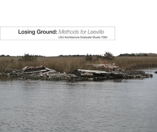
3. Introduction
Leeville, Louisiana
Symbiotic Defense
Landon Pugh
Protection
Katherine Bartkowiak
Realism
Kevin Miller
Adaptation
James Canales
Radical Survivalism
Karl Schmidt
Collective Resilience
JaLeesa Sims-Smith
Re-stitching
Josh Smith
Resistance
Kelli Cunningham
The Not Yet
Mapping exercise
Things Come Apart
Detail study
Studio Resources
methodsforleeville.wordpress.com
4. This studio examined the small coastal town
of Leeville, Louisiana as a surrogate for towns
throughout the Gulf South. The town is not
protected by the levee system and is exposed
to the impacts of a changing climate, coastal
land loss, and increasingly violent storm events.
Rather than advocating for a traditional notion
of ‘saving,’ the studio explored the concept of
absence and questioned architecture’s methods
for simultaneously preserving, un-building, and
designing possible futures for Leeville. Students
visited and documented Leeville. Through this
work they produced their position on ‘saving’
using drawing, photography, video, writing,
and modeling. This process culminated in
an architecture that reconsiders the tectonic
occupation of the delta.
Located outside the levees along Bayou
LaFourche, Leeville serves as a connection point
between Port Fourchon, the largest oil port in
the United States, and Golden Meadow, the first
town within the levee system. It is home to only
30 residents and has been recently bypassed by
the construction of the Elevated Highway leading
to Port Fourchon. Generations of citizens from
Leeville have continuously moved away, The
last children have left the town knowing the
population is going to die off outside the levee.
The major industries within this area of the
marsh are commercial and include fishing and
oil and gas extraction. One of Leeville’s thriving
businesses is Griffin’s icehouse. This is one of
last stops on the way to the Gulf of Mexico for
commercial fisherman to fill their hulls with ice
to preserve their catch. Griffin’s also serves as
a social gathering spot within Leeville, having a
restaurant and a store. Ice has literally become
the lifeline for Leeville. The culture of fishing still
maintains a social aspect within the community
as many residents return to fish, while moving
their assets within the levee.
Subsidence is an issue facing many coastal cities
around the world and Leeville is no exception.
Coastal Louisiana suffers 90 percent of the
total coastal wetland loss in the continental
United States, losing 16 square miles of land a
year. This amounts to 70% of wetlands lost in
the years since 1932. Evidence of land loss is
prevalent within Leeville as the old highway sinks
into the marsh, and cemeteries fill with water.
Every storm surge brings Leeville closer to the
edge of the Gulf of Mexico. In 1893 a hurricane
destroyed Cheniere Caminada, a former coastal
town, forcing residents to move north to Orange
City, later renamed Leeville. The fate of this
sinking city falls into a long history of loss and
migration within the coastal region.
Leeville’s land loss has been accelerated by many
factors within the lower Mississippi River deltaic
system. Bayou LaFourche was once connected
to the Mississippi River and could have become
the main channel if not for human intervention to
protect major shipping lanes through the ports of
Baton Rouge and New Orleans.
At Donaldsonville, Louisiana the bayou was
dammed in 1903, this stopped the flow of
water and sediment down the bayou and to the
Leeville, Louisiana Introduction
5. as well as for fishing access, allow for sediment
to be removed faster from the depths of the land.
This creates more edge area for the interaction
between land and water. This line has become
blurrier as land turns to marsh and marsh turns
to water. Within Leeville land is less solid earth
and more saturated mud. Exploring methods of
occupation within Leeville could provide a case
study for other similar coastal cities.
Since the construction of the Elevated Highway
in 2009, Leeville has been economically
bypassed by the oil industry while having still
been impacted by the industries canal presence.
Many residents have continued to move away
from the area, as there is no school, post office
or political boundary still associated with this
land outside the levee.
According to the 2012 Louisiana Coastal Master
Plan Leeville is slated to become salt marsh
and to be gifted to the encroaching sea. These
marsh restoration projects work to protect the
area as a whole.
marshes around Leeville. This lack of sediment
replenishment is allowing erosion to continue
unhindered.
In 1930, oil was found in Leeville, which led to a
large boom and increased industry in the town
once focused on orange groves. The opening
of Port Fourchon in 1960, now the largest oil
port in the United States, followed this increase
in oil industry in southern Louisiana. Access to
Port Fourchon is now protected by the Elevated
Highway. In 2008, during Hurricane Ike, water
washed out LA-1, cutting off access through
Leeville. In 2009, construction on the elevated
portion of the highway began. The highway
currently cuts off Leeville from any potential
through traffic. The expansion plan for the
elevated highway is planned to run past the
levee system completely cutting off Leeville from
dry land. An industry that once brought fortune
to Leeville now aids in its downfall.
Canalization is speeding up the process of
subsidence outside of the Golden Meadow levee
system. These canals cut by the early oil industry,
Leeville, Louisiana
USGS Plate 1935
Leeville 1:24000 scale
USGS Plate 1994
Leeville 1:24000 scale
6. NEW ORLEANS
LEEVILLE
PORT FOURCHON
GRAND ISLE
GOLDEN MEADOW
GALLIANO
CUT OFF
LAROSE
CAERNARVON
DIVERSION
BARATARIA BAY
LA-61
LA-1
LEVEES
NAVIGABLE WATER WAYS
EVACUATION ROUTES
AIRPORTS
RIVER CONTROL INFRASTRUCTURE
CELL TOWERS
TELECOMMUNICATION INFRASTRUCTURE
OIL INDUSTRY INFRASTRUCTURE
POLITICAL BOUNDARIES
TRANSPORTATION INFRASTRUCTURE
HELIPORTS
OIL AND GAS WELLS
OIL AND GAS PIPELINES
MILITARY BASES
`USACE PORTS
OIL AND GAS PLATFORMS
Place or area with clustered or scattered
buildings and a permanent human
population (city, settlement, town, village).
A populated place is usually not
incorporated and by definition has no legal
boundaries. However, a populated place
may have a corresponding "civil" record,
the legal boundaries of which may or may
not coincide with the perceived populated
place. Distinct from Census and Civil
classes.
US BOARD OF GGEOGRAPHIC NAMES
“POPULATED PLACES”
This studio focused on ways of negotiating a
landscape in flux. Leeville’s foundation is shifting
from terrain to water while maintaining industries
that rely on edge conditions to survive. Students
were required to maintain a position on Leeville
through the lens of “preserving”. Should the
objective be to maintain as is, adapt, move on,
or allow to die? Each Student took a varying
perspective and were asked to create a future
for Leeville. These ideas were explored at the
deltaic, city, building, and architectural detail
scale. The negotiation between land and water
was approached differently through this studio
with no preference toward any one method.
The project also calls for a negotiation of several
industries currently located within Leeville. The
production and distribution of ice, connection to
the commercial fishing through a marina, and the
idea of electricity. Leeville currently gets electricity
from behind the levee, Some projects propose
supporting Port Fourchon and protecting the
supply of electricity while others propose a future
without electricity or connection inside the levee.
Each project’s connection to the water is
important for its potential future of Leeville.
Some choose to avoid the connection to water
to protect against storm surge, while others
immerse themselves into this changing aquatic
landscape. This projects aims to serve as a
prototype for other coastal areas facing similar
issues. The way in which each project values the
landscape within the industrial arrangement is
key to the notion of saving.
7.
8. Climatic Resilience Landon Pugh
Method for Leeville: Symbiotic Survivalism
The LA-1 elevated expressway is the life line
between Port Fourchon and the rest of the United
States. This length of highway is the primary
means of transportation for the extraction and
distribution of the Louisiana coast’s abundant
resources. The centralized location of Leeville
within this stretch of highway will allow the support
of both LA-1 and Port Fourchon. With the threat
of unknown future climatic events, the country
will need to protect both Highway 1 and Leeville
in order to maintain this vital connection to Port
Fourchon. The elevation of the highway already
avoids the rising water, leaving the protection
from inclement weather to be determined.
Leeville will remain outside the levee, to ensure
the survival of Leeville and effectively maintain
the resource connection, the town must align
itself with the current infrastructure and provide
the necessary enclosure needed to withstand
most natural elements.
10. Study model of architectures interaction with
existing infrastructure
11. Ice Distribution
High Water Line
Storage
Ice Manufacturing
Seafood Conveyance
Ship Hoist
Crew Cafeteria
Crew Quarters
Crew Misc. Space
Bridge Hoist
Protective vertebrae interacting with physical
scaled bridge model
12.
13. In order to sustain Leeville’s contribution to the
fishing industry and to maintain the importance
of fishing to the economy and community of
Leeville, there needs to be an architectural
intervention that allows for easy access to sea
waters without the danger of certain weather
conditions. My proposal is a man-made platform
stationed off the coast of current Leeville, that is
spatially and programmatically designed to best
suit the fishing lifestyle, both commercial and
recreational, and yet has the ability to protect
against harsh weather. It mechanically rises as
sea level rises over time, rises in the short term
during storm surge, and folds up to protect
against hurricane winds and rain. This design
allow for the platform to best preform as a
fishing hub, but there remains the threat of severe
weather. The intervention is rooted in place with
piles, but has the ability to mechanically be raised
over time with sea level. In times of harsh storms
and hurricanes, the structure can be significantly
raised to avoid high levels of storm surge. In
these cases, the intervention closes in on itself,
creating a sealed envelope, providing protection
to person and industry from wind and water. The
ferries and floating receiving dock have the ability
to go onshore, taking with them any fishing
visitors. The residents who wish to stay behind
can dry dock their boats inside the structure and
wait out the storm. The intervention closes up by
unfolding the docks and rotating them upward
to create walls. In the dry dock areas, the dock
folds out to create a floor, with panels rotating
down from the roof as walls to close in the area.
This idea for a self protecting structure can be
used as an example for many different coastal
towns that are in danger of losing land. This
architecture allows for people to inhabit the
water, to live in areas that would previously be
at risk.
Offsite Leeville Katherine Bartkowiak
Method for Leeville: Protection
14. 1935 Land Map
Leeville
Port Fourchon
1945 Land Map
Leeville
Port Fourchon
2030 Land Map
Port Fourchon
Leeville
Old LA 1
New LA 1 Bridge
Intervention
1994 Land Map
Port Fourchon
Leeville
2012 Land Map
Leeville
Port Fourchon
Old LA 1
New LA 1 Bridge
2100 Land Map Intervention
Old LA 1
New LA 1 Bridge
Port Fourchon
Leeville
The circulation analysis of Leeville and its
surrounding area led to the placement of the
intervention off the south tip of current Leeville,
the intersection of several waterways, making
for a productive launch site for day fishermen,
and stopping site for incoming fishermen looking
to get ice or drop off fish. Because the platform
requires necessary goods for production and
provides significant amounts of sea food to the
mainland, it needs to maintain connection to the
shore. Two ferries, one for people and one
for fish, travel back and forth to a floating structure
that stays tied to the coast line as it recedes over
time. This structure has cleaning equipment and
a cold storage center as a temporary landing
place before the fish are sent out to distributors.
Eventually the piles holding the intervention will be
too short to allow for continued rise. To combat
these inevitable changes, the intervention has
the potential to become a floating structure , as
seen in the site model, that can travel back and
forth from the coast line to ships and oil platforms
providing ice, oil, and goods.
15. The model demonstrates the movements of
the intervention, the docks folding out and up,
the panels from the roof folding down, and the
raise and fall of the overall structure. The piles
are driven down into the seabed about 40’ deep.
The intervention sits on the water surface, with
about 10’ of water below it. The structure has a
35’ clearance between platform floor and ceiling.
In position one, the intervention is at its resting
state, how it is used on a day to day basis. Boats
come and go with recreational and commercial
fishermen. People relaxing can go up on top of
the structure, covered with a removable tensile
structure. When in need of supplies, the grocery
store and bait shop are conveniently located
near the housing with their own boat slips.
Position two shows the beginning stages of
closing the structure as a storm approaches. The
ferries, floating dock and tourists leave and seek
shelter behind the levee. Those wishing to stay
put their boats into boat lifts above the boat slips
around the grocery store. Those boat slips then
close up around the boats, protecting them for
future use. Other existing docks fold out and up
to create walls. Dockless areas have panels fold
down from the roof to fully enclose the structure.
Position three is the fully enclosed structure,
closed down for a storm. In preparation, the
tensile structure is removed, and residents
stock up on goods. They are able to continue
living within the structure, without the everyday
activities of fishing and distributing ice. The
joints within the moving pieces that enclose the
structure are designed to be water tight, allowing
for dry interior spaces. As storm surge rises, the
structure rises to maintain above the water line.
Leeville Electricity Switching Station
Section
Plan
Scale: 1/8” = 1’0”
50’
30’
30’
12’
12’
80’
25’ 20’
Lightning Arresters
Oil Circuit Breaker Step- Down
Transformer
Voltage
Regulators
Switchgear
Incoming Lines
Outgoing Lines
Oil Circuit Breaker
Step-Down
Transformer
Voltage Regulators Switchgear
need
height
Exposed to
elements
use of structure
needs protection
needs ground space
Easy Access to Water
Docks between slips for circulation
Large dock for
circulation,
storage and
workspace
Length for mid sized to small boats
Scale: 1/8” = 1’0”
Leeville Boat Dock
Section
Plan
15’ 25’
25’
10’
15’
78’
16.
17. Sacrificial Preservation Kevin Miller
Method for Leeville: Realism
Water Like Stone, depicts Leeville as a tightly knit
community bound by a very unique connection
to a rapidly changing environment. This
environment is the marshland of the Louisiana
coast that was once home to a fishing industry
unlike any other in the United States. After
years of hurricanes and a recent oil spill, the
land supporting the people of Leeville is being
destroyed and washed away everyday and little
is being done to change this. Michael Pasquier
identifies that one of the problems preventing
change is the inability of the community to
address the situation. He says that the general
belief of the community is that the problems of
today can be fixed tomorrow. The unfortunate
downside is the fact that whenever “tomorrow”
comes it might be too late. Is it possible that
the people of Leeville are already living within
an apocalyptic society? McCarthy might agree
comparing the way the people of Leeville think to
the nomads that travel a post-nuclear landscape
in his book The Road, “People were always
getting ready for tomorrow. I didn’t believe in
that. Tomorrow wasn’t getting ready for them.
It didn’t even know they were.” In order for any
positive change to happen residents need to
lose this way of thinking because, according to
Pasquier, residents of southern Louisiana have
held this same belief forever. Observations on
the Concepts of Place in Post-Risk Societies
would identify this as a state of pragmatic
acceptance. Characterized by a reluctant
acceptance of the present state with the
intention of only surviving tomorrow, pragmatic
acceptance fails to address the current needs
of a society. It does however point to another
state that could potentially be the key to their
survival and achieved through design. Through
radical enlightenment one identifies the potential
risks as reality and takes action to mitigate them.
However is it too late? There could be proof in
the introduction of the bridge that serves as a
new hurricane evacuation route along the coast.
Referencing the aforementioned state of radical
enlightenment this presents an opportunity
to identify the need for change in Leeville and
address the risks that require this change. Like
Design for the Apocalypse states this change
needs to be marketed not as the “end of” a
way of life but as an opportunity for Leeville to
“re-start and re-think” their current situation.
In this case we would be addressing present
needs of a community threatened by erosion. As
residents of Leeville have come to terms with the
reality that they will be forced to retreat to the
protection of the levees efforts must be focused
on preserving their culture through the protection
and development of the fishing industry, both
recreational and industrial. By sacrificing existing
parts of the site that are already threatened by
water inundation and protecting others through
new hybrid strategies encroaching water will be
able to flow freely through the site allowing the
fishing industry to continue to operate without
threat of future sea level rise and potential storm
surge.
18. In an effort to preserve existing wetlands it was
important to limit any new construction to the
existing hardscape of Leeville taking advantage
of more suitable foundation soil.
A series of spillways help to control water
inundation allowing it to pass freely through the
site. The spillway is a layered to collect sediment
as water passes through during low tide.
These diagrams illustrate the layering of
program within the context of flood protec-
tion infrastructure.
19. The operable sea wall closes when a storm
is approaching protecting the infrastructure
that is essential to the fishing industry
but remains open in normal moderate
conditions to allow access to the water.
To understand how the sea wall might be able to
move up and down I took apart the an umbrella
and put it back together that uses the same
idea of an extension arm that opens and closes
to provide protection. These ideas were then
applied to the sea wall.
Coastal development requires management
of land edge conditions using retaining
walls and sea walls. Combining the most
successful technique of rip rap and the
typical retaining wall erosion can be
prevented from this coastal edge.
Using a simple pulley system lifts help to
protect the boats from damaging waves
and additional maintenance coasts by lifting
them out of the water. Similar technology
are applied to the operable sea wall to raise
and lower it during storms.
20.
21. Systematic Curation James Canales
Method for Leeville: Adaptation
“There are old boat men, there are bold boat
men, but there are very few old bold boat
men.” This quote from the documentary Water
like Stone perfectly describes the way I would
envision the emotional attitude of the local
residents in Leeville, LA. Being from a place
so perfect but yet so challenging definitely
defines a person and a community. Although
it may appear differently, Leeville, Louisiana is
a very wealthy place. Wealthy with everything
except currency. While watching “Water like
Stone” and being informally introduced to local
residents of this small fishing town, I began
to see an emotional trend. Regardless of the
professions, current financial positions in life,
or all around well-being, the residents gave off
this glowing aura of satisfaction. Everyone from
Leeville was proud to be from Leeville. I believe
this strains from the deep rooted family heritage
that still exists in Leeville. It seems very typical
for multiple generations to live and grown in this
small community. In most cases not only live,
but work and play as well. The preservation
of Leeville is particularly important because
of this unique lifestyle that flourishes from its
soil. The question at hand is how can Leeville
adapt in order to save what is left? Typically
when something is wrong with the geographical
location in which you live, the solution is simple,
move. However I believe this case is very
different. Leeville is a small community. A small
community of fisherman and towns people.
In order for a fishing community like Leeville to
prosper they need access to one thing, water.
This necessity also happens to be the one thing
that is ruining Leeville as a whole. Hurricanes hit
the coast of Louisiana more than any other place
in the United States, second only to Key West,
Florida. The lower coast of Louisiana is depleting
at such an aggressive rate that small coastal
towns like Leeville are looking for ways to stay
afloat. In a sense that is exactly what this town
needs, a way to float. The solution must stem
way beyond better infrastructure and improved
hurricane survival tactics. These methods prove
to be effective throughout the globe, however
they will not be enough to preserve everything
that Leeville is. More than trailers, boats, and bait
shops, Leeville is a way of life. Looking toward
the future, there are ways in which Leeville can
be preserved. The memories of what Leeville is
today, and was in the past, can be recorded.
However one day the world may change and the
lifestyle existing in Leeville may be lost forever.
The article by John McMorrough, Design for the
Apocalypse, brings up many interesting points
about a changing world. Some ideas include
reasons why transformation, of a people, or a
place, may be the only possibility for existence.
John McMorrough states, “…it is scarcity,
of food, water, safety, resources, amenity or
potential, that is the engine of transformation
and change.” In the case of Leeville, many of
these commodities are becoming threatened by
natural disasters.
22. On a planet where such disasters cannot be
predicted, it is only a matter of time before the
world as we know it changes before our eyes.
This phenomenon, or Apocalypse as described
in the article, will force humans to rethink
society and the way in which we live. The article
discusses the “end” as only the moment before
the “beginning”. The glooming Apocalypse gives
us as humans the chance to “restart and rethink”
the world around us. The article also raises
interesting points related to the architecture of
the “beginning”. John McMorrough states, “How
would architecture act in a post-apocalyptic
mode? And what is the relation of architecture to
Leeville, LA: Circa 2005
Old Highway LA-1 is currently the only
transportation route between Golden Meadow
and Grand Isle, including Port Fourchon. The
local economy of the small town benefits from
the high number of commuters passing by on
their way to Port Fourchon or Grand Isle.
capital when there is no capital”. This provoking
concept that architecture would eventually stem
back to its primal purposes of mere shelter,
and move away from the prized artwork is has
led itself to become today, offers interesting
opportunities. The idea that architecture may
become a condition. The idea that being an
architect is something we all must understand
as people for survival. These ideas make us
reconsider the true value of architecture and
design. In the case that the world does not
“end”, and the apocalypse does not unfold
before our eyes, we must continue to plan ahead
and progress.
Recent advances in technology have allowed
us to predict the path and strength of distant
hurricanes and tropical storms, giving
communities the time needed to prepare, or
in some cases, evacuate when necessary.
Unfortunately this was not the case in the late
nineteenth century when Cheniere Caminada
killed hundreds of Leeville residents. The
legacy of those lost is something the people of
Leeville are desperate to preserve and protect.
Hurricanes almost tend to define Leeville. The
community has endured so much struggle that
they all seem to lean on each other for support.
Leeville represents a lifestyle much different from
Leeville, LA: Circa 2006
The year following Hurricane Katrina, phase one
of the new elevated LA-1 project begins. The
elevated highway now forces all vehicular traffic
around Leeville, creating a dead-end condition.
Tourism and the economy begins to suffer.
Leeville, LA: July 2009
Phase one of the elevated highway is completed.
The newly created LA-1 currently connects
everything south of Leeville, including Grand
Island and Port Fourchon, to old LA-1 just north
of Leeville. Phase two plans on extending the
bridge further north to eventually end in Golden
Meadow, where traffic would be protected by
the levee system.
the rest of the United States. A way of life that has
continued from generation to generation. The
people of Leeville are optimistic and continually
believe in tomorrow, because tomorrow holds
hope. Hope that one day the small community
that raised them will live long and prosper to
watch thousands more children grow. Hope
that Mother Nature will eventually stop taking
away the soil beneath their feet. Hope that a
long family legacy will forever live in the history
books. Leeville is full of hope. To lose a place like
Leeville means to lose tradition. It means to lose
a distinct culture. To lose Leeville means to lose
a way of life.
However Leeville is not alone. With the inevitable
forthcoming of rising water conditions in
Leeville, the Louisiana coast, and hundreds of
other places around the world, the aqua battle
continues. Louisiana competes with rising water
by simply building levees. The obvious solution
to any flood problem is to fortify the “edge”. But
what if a different approach was taken. What if
towns like Leeville learned to live with the water?
There are many ways in which a built community
and water can blend contiguously. One way
would be to design essentially waterproof
structures that would be able to withstand storm
conditions as well as provide an airtight seal for
damage protection. Structures such as these
would require reinforced foundations for stability
and would allow us to move away from the
stilt based housing model typical in this region.
Unfortunately the major downfall to a waterproof
structure that is securely fixed to the Earth comes
once the flood hits and we find people trapped
in their homes. Transportation is vital. The United
States is essentially founded on the concept of
separation. Once the roads are flooded and cars
are no longer a useful amenity, how will people
get from point A to point B. In a fishing town the
answer seems obvious.
Leeville, LA: Circa 2030
Sea level has risen upwards of 18+ inches. Many
areas of marsh are flooded and get washed away.
At this point my design intervention has begun to
build first the elevated housing units. Any new
residents of Leeville are required to follow the
new building regulations that ensure protection
from hurricanes through the year 2100.
Leeville, LA: Circa 2060
Sea Level has risen upwards of 32+ inches from
its level during 2014. Much of Leeville becomes
flooded and lost. Another area of elevated
structures begins to develope just south of the
first area. The elevated structures, when desired,
could be connected with a pedestrian bridge.
A parking area is constructed to maintain the
vehicular connect to Leeville.
Leeville, LA: Circa 2100
Sea Level has reached upwards of 6-7 feet
above sea levee from 2014. Leeville is entirely
underwater, with some places submerged as
much as 4 feet. At this point the intervention
begins to preserve Leeville’s existence on the
water. Floating marinas are introduced along
Bayou LaFourche which allows the seafood
economy to continue to prosper.
23. Leeville exists today in a beaten and battered
state. However multiple systems allow the town
to exist and prosper. My site analysis consisted
of identifying such “productive systems” and
implementing their attributes into the future
proposal. The systems identified as the lifeline
for Leeville are the Economic System, including
the commercial seafood economy and tourism,
Transportation System, including multiple
boat docks both public and private as well
as the connection to the newly oriented and
government protected elevated highway, Utility
System, including all necessary services for
survival such as electric and water, and lastly the
environmental condition in which Leeville exists,
the Marsh Ecosystem.
Leeville becomes a town oriented to boat traffic,
survived by elevated homes and an artificial
ground floating above the water level. The site
plan illustrates how all the commercial fishing
has been pushed along Bayou LaFourche and
the elevated structures are on the opposite side
of the main pedestrian bridge. The pedestrian
bridge serves as a spine connecting a network
of program.
2030
2060
2100
24.
25. Above show 3 prototypes in the test model.
Each prototype was documented for 20 minutes
and the results were analyzed. In every case, I
identified strong cases of scour occurring on the
front facing edges. This scour pushed the water
around the outside, whipping the sediment
around the back where it began to collect in the
calm areas.
An important aspect of the housing units are
the way the structural elements meet the water
and earth below. This model shows how the
architecture becomes productive and works
to control sediment deposition and eventually
create a new marsh below. Over time the home
owner takes ownership over the new marsh and
introduces vegetation to stabilize the soils.
Using a sediment flow model, I built and tested
multiple design options for the structural spread
footings utilized below the elevated structures.
26.
27. Peripatetic Urbanism Karl Lane Schmidt
Method for Leeville: radical survivalism
The project is an extreme form of a future wherein
humans must occupy space in a means that is
attuned to natural functions and processes of
that place, exploring the outcome of this reality
and a human propensity toward complex,
large scale infrastructural solutions in a deltaic
condition. The intervention responds to changing
conditions, keeping the built environment
aligned to the saturation threshold [ land /
water interface ], by becoming a mechanism for
strategic sediment deposition organized around
a mobile, reconfigurable infrastructure allowing
the geographic repositioning of the urban zone.
Architectures of individual programs or functions
exist within this fluctuating matrix, the relationship
of architecture to infrastructure remaining
relatively stable [ though constantly changing ]
as the urban zone adapts to the shifting context.
This provides internal stability for Leeville, whilst
providing protection for occupants and keeping
the urban condition and human occupation
adjacent to the dynamic bayou edge.
Leeville has embedded in it an essential
relationship to water: transportation, economy,
sustenance,andrecreationrelyontheconnection
a coastal town has with the adjacent water.
Yet Leeville is a place tied to the land: floating
structure has little no permanent occupation and
residences are situated on “ground”. Additionally,
circulation and interaction occur largely on land,
or proximate to land; identity is derived from
the meeting of land and water. Leeville persists
[ economically ] largely due to the existence of
an ample supply of ice and recreational tourism.
To the extent that essential character of Leeville
survives it will be place derived from the meeting
of land and water. Leeville is less “ground”
than the zone of highest relative saturation of
sediment in a water-sediment gradient with
zones of relative density. In addition, the change
in salinity that coincide with the disturbance
of the water-sediment balance will alter the
proportion of oyster shell and plant materials
relative to existing communities, further altering
the characteristics of the occupied “ground”.
Leeville exists at what is now the end of bayou
LaFourche, the bayou itself formerly the lower
fork of the Mississippi river, and the potential for
the loss of communities on the main channel,
including New Orleans, is not inconsequential.
The current fear for the potential of the
Atchafalaya river to “capture” the Mississippi
[ and therefore become the Mississippi ] is
interesting for the fact that, had the LaFourche
vein not been severed, there was the possibility [
if only slight ] that LaFourche could have become
the main artery as the river chose the path of
least resistance to the coast [ as it had in the
past ].
28.
29. Site Plan
The intervention is comprised of Nodes,
Platforms, and individual programmed spaces
and structures.
Site Section / Elevation
The proposal makes use of the stability found
in the pilings and poles in the urban condition,
the strong vertical elements standing in contrast
with the horizontal land - water mix and holding
strong via interaction with layers of slower
moving sediment found below the water level.
30.
31.
32.
33. Adaptive Culture JaLeesa Sims-Smith
Method for Leeville: Collective Adaptation
“The people of Leeville have a resilient culture
that manifests as social interaction, the fishing
industry, and a flexibility to survive despite the
fluctuating water levels and precarious weather.
Historically, this resiliency has allowed the people
of Leeville to adapt over time- from rebuilding
after hurricanes, to adjusting planted crops, to
erecting makeshift structures- while attempting
to address the city’s wavering environmental
conditions. Their ability to adjust to the ever
changing climate proves that humans can
adapt to uncertain environments and by doing
so can create a better world than what is
currently present. This adaptive culture must
be preserved. Architecture is one medium by
which this is achievable. In the New Leeville,
redeveloped pause points- physical locations
of social interaction- constant access to the
water, and adjustable modular pieces will allow
the people to adapt and actively recreate a their
community based on varying climatic conditions.
Leeville’s water level is constantly fluctuating,
so adaptive measures must be implemented
. By using adjustable elements, the people
of the New Leeville are able to transform their
environment for cultural reasons – gatherings,
festivals, and the like– as well as climactic
reasons – hurricanes, tornadoes, etc.
The current Leeville is a close knit town. Because
they spend a lot of time with one another, each
adjustable wall must have at least 2 people to
assemble it. This builds camaraderie within
the community, and it solidifies the recycled
culture of the New Leeville – a culture of
collective interaction Unfortunately, because
of Leeville’s location along the coast, it is
oftentimes susceptible to hurricanes. The design
of the multi-family residences addresses these
damaging storms. During nice, sunny weather
or rain and thunderstorms, the new complex
remains in its multi-story condition. However, if
threatening weather is approaching, the walls
of the entire complex are able to retract into
the main wall, creating a single story complex.
The programmatic design of the first floor –
having a communal kitchen, a bathroom, and
a potential sleeping space in the living room
– allows residents to live on the first floor as
long as needed should the upper walls need to
retract in an emergency situation. This allows for
increased protection when enduring a hurricane
or other threatening storms. Also, the roof acts
as a drainage system, so when there is a surplus
of rain, the new community will still be able to
function without being concerned with flooding.
Interlocking spaces – extrusions and recessions
– within the floor plan of the residences are
reminiscent of the interactive, social spaces
found in the current Leeville. Throughout the
residence, there are multiple pause points – such
as the pause points found in the current city –
that provide opportunity for verbal interaction as
well as non-verbal interaction. The non-verbal
spaces are equally as important as the spaces
with traditional, verbal forms of communication
because they house the silent extrusions and
recessions that remind each resident that
Leeville was and will continue to be a community
connected where one is never alone.”
34. In the multifamily residential complex of the future
Leeville, there are several spaces that encourage
social interaction, both verbal and nonverbal.
These spaces re-envision the characteristics
of the pause points currently seen throughout
the town. The interlocking spaces, garden,
communal kitchen, and adjustable walls
encourage verbal or nonverbal interaction and
cultural significance based on their placement,
adjacency to adjoining spaces, and design.
Pause Points
Interlocking Spaces found in Apartment 2
Interlocking Spaces found in Apartment 1
Interlocking Spaces and Pause Points
35. These diagrams address responsive systems to
the weather conditions. If it is sunny or raining
slightly, the residential complex remains two
stories. However, if a storm is approaching, the
residents are able to collapse the housing units
to one story. Because of the double wall system
found in the complex, the architecture is able to
protect the residents with walls that are twice as
strong as a regular wall. Also, in the case of a
severe rain storm, the roof of the complex acts
as a drainage system where it allows the water
to easily flow downwards. This excess water is
collected in tanks and used to water the herbal
gardens throughout the residential units.
Interlocking spaces within the floor plan are
reminiscent of the interactive social spaces
found within the old Leeville. Throughout the
residence, there are multiple pause points that
provide opportunity for verbal interaction as
well as non verbal interaction. The non verbal
spaces are equally as important as the verbal
ones because they are the silent extrusions
and recessions that remind each resident that
Leeville is a community connected and one is
never alone.
36.
37. Leeville’s is in constant flux, deteriorating land,
tropical storms, water level rise, and through it
all people continue to because of their strong
nomadic tendencies. In 2100, Leeville will
sustain seasonal recreational fishing camps.
Each spring large crowds of fisherman return
to the remaining remnants of storm damaged
deteriorating architecture in Leeville. Each year
localized marine industrial fabrics are used to
patch and reprogram these spaces to provide
temporary shelter each fisherman. Each patch
has a personal story to tell, and accommodates
the level of living that fisherman can design for
himself. Each fishing camp is then activated
for the entire season until the winter when the
town is abandoned and undressed until next
season. This cycle is presents an ever changing
adaptation and reprogramming of architecture in
Leeville every year. This intervention prompts the
interaction of fabrics and architecture or simply
“fabric architecture.” Standing at any point in this
small town it is evident that the primarily source
of traffic happens on the water. At the center of
it all the fisherman.
Seasonal Fishing Camp Joshua Smith
Method for Leeville: Adaptation
42. Leeville Realigned Kelli Cunningham
Method for Leeville: Resistance
Louisiana’s oil industry’s has destroyed access to
other resources within the lower deltaic region..
Big oil, canalization, and the elevated highway
have deformed the landscape of Leeville, starving
it of resources, impeding its ability to survive.
The architectural intervention within Leeville will
realign to provide equal access to the resources
found within this industrial landscape. This
realignment will visualize the inequality within the
infrastructural landscape that has destroyed the
economic welfare of Leeville. The urban design
of this project deploys the historic precedent of
the arpent system which spatialized resource
as a method for land division and use. This new
arpent is a three dimensional architecturalization
of resource access in the current deltaic
landscape.
The elevated highway has cut Leeville off from
the economic pipeline of lower Louisiana. The
lower Mississippi river corridor has become the
sacrifice zone for the oil industry. Traditionally a
sacrifice zone refers to the agricultural practice
of deliberately degrading one area of land to
increase productivity in another, but scholars
have begun using the term in explicitly accusatory
ways to refer to areas degraded by modern
industrial societies in pursuit of economic gain.
Transportation and resources has shaped french
land development in this area of Louisiana. The
arpent system equalized access to all resources
found within the landscape. I am proposing
that we reorient the public land survey system
Leeville currently falls into, and realign allowing
equal access to, the stability of the bridge, the
marsh for fishing habitats, ice industry of Leeville,
the old road bed of LA-1, the navigable water
channels, current oil wells and the current oyster
communities. Leeville has a history of reorienting
to resources, from orange farming, to fishing
allowing this urban scale move to fall into the
long history of place.
The people of Leeville are dissatisfied with the
impending future dystopia will resist the current
path of landscape destruction and will begin to
hoard what resources they can get a hold of
before the effects of the oil industry completely
devastate the region. People begin by fortifying
resources and claiming volumetric space then
inhabit these 3 dimensional property lines. These
property lines snake around one another some
taking stability from others structure.
This reaction of realignment is within the tools
of building within the deltaic region of Louisiana,
the extent at which people will begin to claim
resources stems from a reaction to the elevated
highway. This visualization of resources within
the Leeville is warning of a future in which people
are forced to fend of themselves producing an
ad hoc architecture that responds only to the
individuals need for resources. This future could
be applied to many coastal places.
43. The lower Mississippi River corridor has become
the sacrifice zone for the oil industry. Traditionally
a sacrifice zone refers to the agricultural practice
of deliberately degrading one area of land to
increase productivity in another, But scholars
have begun using the term in explicitly accusatory
ways to refer to areas degraded by modern
industrial societies in pursuit of economic gain.
Transportation and resources has shaped french
land development in this area of Louisiana.
Starting along the bayou with the arpent
LAKE PONTCHATRAIN
NEW ORLEANS
BONNIE CARRIE
SPILLWAYMISSISSIPPI
RIVER
LEEVILLE
PORT FOURCHON
GRAND ISLE
GOLDEN MEADOW
GALLIANO
CUT OFF
LAROSE
CAERNARVON
DIVERSION
BARATARIA BAY
I-10
LA-61
LA-1
LEEVILLE SACRIFICE ZONE
LEVEES
NAVIGABLE WATER WAYS
EVACUATION ROUTES
AIRPORTS
RIVER CONTROL INFRASTRUCTURE
CELL TOWERS
TELECOMMUNICATION INFRASTRUCTURE
OIL INDUSTRY INFRASTRUCTURE
POLITICAL BOUNDARIES
TRANSPORTATION INFRASTRUCTURE
HELIPORTS
OIL AND GAS WELLS
OIL AND GAS PIPELINES
MILITARY BASES
`USACE PORTS
OIL AND GAS PLATFORMS
Place or area with clustered or scattered
buildings and a permanent human
population (city, settlement, town, village).
A populated place is usually not
incorporated and by definition has no legal
boundaries. However, a populated place
may have a corresponding "civil" record,
the legal boundaries of which may or may
not coincide with the perceived populated
place. Distinct from Census and Civil
classes.
US BOARD OF GGEOGRAPHIC NAMES
“POPULATED PLACES”
system land was divided perpendicular to the
bayou stretching out to grasp the breadth of
the landscape to maintain equal access to all
resources embedded within the ground section.
Moving from transportation on the bayou, the
high ground allowed for housing structures to
be elevated from flood waters, then a flexible
slope allowing for farming in drier seasons and
trapping in wetter one.
PUBLIC LAND SURVEY SYSTEM
BAYOU
20 ARPENT
40 ARPENT
BACKSWAMP
LA-1
HWY 3235
LEVEE
SALTWATER
MARSH
ARPENTS REALIGNED
LEEVILLE
PORT FOURCHON
GOLDEN MEADOW
44.
45. The people of Leeville dissatisfied with the
impending future dystopia will resist the current
path of landscape destruction and will begin to
hoard what resources they can get a hold of
before the effects of the oil industry completely
devastate the region. People begin by fortifying
resources and claiming volumetric space with
flimsy blowout structures.
They then begin to inhabit these 3 dimensional
property lines with more hurricane resistant
structures. These property lines snake
around one another some taking stability from
others structure. The realigned arpents are
3 dimensional property lines but the actual
structures are placed within these arpents based
on need to access resources. This bottom up
approach to architecture allows for the residents
of leeville to take back control.
LIVING INDOOR
ELECTRICITY
ICE
OYSTER
BOAT CHANELS
COMMUNITY SPACE
NAVIGABLE WATER ACCESS
RESIDENTIAL
PEDESTRIAN PATHS
ROAD BED FOUNDATIONS
OIL WELLS
ELEVATED HIGHWAY
ARPENT RESOURCE ACCESS
ARPENT CIRCULATION
LEEVILLE REALIGNED
ELEVATED HIGHWAY SITE KEY [2014]
North
46. The world building of The Not Yet, by Moira
Crone, was a strategy used by the studio to
imagine a future for Leeville in which to site a
project.
The Not Yet
47. Things Come Apart, a book and project by Todd
McLellan inspired the following exercises which
examined dynamic objects as precedents for
architectural details.
Clock DisassemblyThings Come Apart
48. Organizations
LA 1 Coalition
www.la1coalition.org/
The LA 1 Coalition coordinates the dissemination
of public information about the highway system
between Grand Isle and U.S. Highway 90, once
passing through Leeville.
Launch Leeville
www.facebook.com/launch.leeville
Launch Leeville is a non-profit which is dedicated
to the preservation of Leeville.
Louisiana’s 2012 Coastal Master Plan
www.coastalmasterplan.louisiana.gov/
The 2012 Coastal Master Plan provides the
information Louisiana’s coastal citizens need as
they seek to take care of their families, manage
businesses, and plan for the future. The projects
in the plan strike a balance between providing im-
mediate relief to hard hit areas and laying ground-
work for the large scale efforts that are essential
if we are to protect communities and sustain our
landscape.
LSU Coastal Sustainability Studio
www.css.lsu.edu/
The LSU Coastal Sustainability Studio (CSS) is
a trans-disciplinary program of the College of Art
+ Design, College of Engineering, and School of
the Coast & Environment.
Port Fourchon
www.portfourchon.com/
Louisiana’s southern most port which brings in
over 18 percent of America’s total supply of crude
oil and natural gas located 13 miles from Leeville.
The Greater Lafourche Port Commission, a politi-
cal subdivision of the state of Louisiana, facilitates
the economic growth of the communities in which
it operates by maximizing the flow of trade and
commerce.
Videos
Paradise Faded
www.amazon.com/Paradise-Faded-The-Fight-
Louisiana
Paradise Faded: The Fight for Louisiana is a com-
pelling look at the causes, effects and solutions
to the largest environmental disaster in American
history: the loss of Louisiana’s coastal wetlands
and the impact of Hurricanes Katrina and Rita in
2005
Veins in the Gulf
www.veinsinthegulf.com/
Veins in the Gulf is a documentary that traces
the history of rapidly disappearing bayous, the
environmental crisis of southern Louisiana, and
the international impact of Cajun culture, which is
quickly losing ground.
Water Like Stone
www.waterlikestonefilm.com/
A Film, about Leeville’s Current Situation by Zack
Godshall & Michael Pasquier.
Studio Reference Texts
At bottom of Louisiana, one store keeps town
alive John Harper
Design for the Apocalypse : John McMorrough
Observations on the Concepts of Place in Post-
Risk Societies Kiel Moe
Things Come Apart Todd McLellan
The Control of Nature John Mcphee
The Flood Next Time Justin Gills
The Not Yet Moira Crone
Studio Resources