1. 1.Fig_01
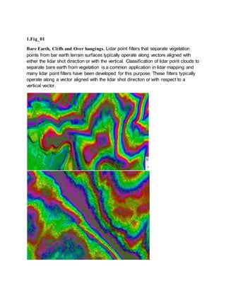
Bare Earth, Cliffs and Over hangings. Lidar point filters that separate vegetation
points from bar earth terrain surfaces typically operate along vectors aligned with
either the lidar shot direction or with the vertical. Classification of lidar point clouds to
separate bare earth from vegetation is a common application in lidar mapping and
many lidar point filters have been developed for this purpose. These filters typically
operate along a vector aligned with the lidar shot direction or with respect to a
vertical vector.
2. 2. Fig_02
Buildings, Medium Vegetation, Higher Vegetation respective parameters In recent
years it has been suggestedthat integrationof vegetationwithin the building envelope is a
sustainable design strategyfor the built environment. One of the expectedcontributions of
vegetation in terms of sustainabilityis the improved thermal behavior of buildings when
coveredwith vegetationlayers. While greenroof implementationis becomingmore
prevalent, and the researchfor greenroofs’energyefficiencyaccumulates into asignificant
body of knowledge, the implementationand researchof vertical vegetationtechnologies is
still sparse. In addition, vertical vegetation systems are typicallyvery expensive (e.g. living
wall panel systems) or very slowto mature (e.g. climbingvines on trellises) or both.
Therefore, when vertical vegetation project is considered, it is beneficial to be able to make
informative design decisions at an earlystage.
3. 3.Fig_03
Digitizationof Power Lines Features & Classification(Towers, Crossing Cables,
Tower Cross, Isolated antenna, Cable and Tower Lift).
After the data conversion ,the converted data is be checked for compliance
of specification, completeness of conversion and accuracy of converted
data. This check is carried outwith a check list and any discrepancies if
found is marked and corrected. After that an independent quality check is
carried outto eliminate chances of human error and to ensure that quality
of the data conversion is as per specifation.
4.Fig_04
4. Digitizationof Hydro Features & Classification(Ponds, Rivers, Lakes, Coast), The
48 contiguous contain at least 2.6 x 10⁶small water bodies (>600-900 m2),
and possibly as many as 9 x 10⁶(>25 m2) (Smith et al. 2002). These water
bodies are termed ‘small’ not only because of their size distributions, but also
to emphasize the distinction between the water bodies discussed here and the
much smaller number (a few percent of the total at most) of relatively well-
documented lakes,reservoirs,and large impoundments found in the available
USdatabases of water bodies.
5.Fig_05
Contours The contour can be open or closed. Closed contours correspond to
region boundaries, and the pixels in the region may be found by a filling
algorithm. An open contour may be part of a region boundary. Gaps can occur
in a region boundary because the contrast between regions may not be enough
to allow the edges along the boundary to be found by an edge detector. The edge
detection threshold may have been set too high, or the contrast along some
portion of the boundary may be so weak relative to other areasof the image that
no single threshold works everywhere in the image. Open contours also occur
when line fragments are linked together-for example, when line fragments are
5. linked along a stroke in a drawing or sample of handwriting. A contour may be
represented as an ordered list of edges or by a curve. A curve is a mathematical
model for a contour. Examples of curves include line segments and cubic
splines.
6.Fig_06
Roads ( Paint Lines, Curb, Gutter, Man Holes, Basin) POLICY.
Road and bridge construction shall be performed according to the
standards set forth in this policy.
2. PURPOSE.
The purpose of this policy is to
provide for the publication of a book
prescribing the Standard Specifications
for Road and Bridge Construction
.3. GUIDELINES FOR IMPLEMENTATION.
The book outlines the general
requirements and covenants applicable to all highway construction
improvements as well as provisions relating to materials, equipment, and
construction requirements for individual it
ems of work (as defined in the book) on
road and bridge construction projects awarded by the department.
The book provides detailed requirements on such subjects as:
a. General Requirements and Covenants
b. Earthwork, Landscaping, Erosion Control
c. Subgrades, Subbases, and Base Courses
d. Surface Courses, Pavement
6. s, Rehabilitation, and Shoulders
e. Structures
f. Incidental Construction
g. Work Zone Traffic Control and Prot
ection, Signing, and Pavement Marking
h. Electrical Requirements
i. Materials
j. Equipment
4. RESPONSIBILITIES.
The Division of Highways and its Regional Offices shall
implement the standards published in t
he book accompanying this policy.
5. ACCESSIBILITY.
Electronic versions of this
policy and the specifications book
are located at the Policy & Resear
ch Center site on InsideIDOT, the
department’s internal website. Printed
copies of this policy may be obtained by
contacting the Bureau of Design and En
vironment. Printed versions of the
specifications book may be
obtained from the Bureau of Business Services’
Policy Distribution Office.
7. 7.Fig_07
Sign boards, Fences, Railgarding
Sign/Signboard Any letter, word, numerical, pictorial presentation, illustration,
declaration, emblem, logo, device, symbol or trademark, banner or pennant,
whether illuminated or not, electronic, static or dynamic, or any figure or similar
character that is attached to,painted on, or in a manner represented on a building or
structure used to announce, direct attention toor advertise and visible to the public.
A fence is a structure that encloses an area, typically outdoors, and is usually
constructed from posts that are connected by boards, wire, rails or netting. A fence
differs from a wall in not having a solid foundation along its whole
length.[Alternatives to fencing include a ditch (sometimes filled with water,
forming a moat). A device attached to the front of a locomotiveon each side for
clearing the rail of obstructions a guard rail.
8. 8.Fig_08
Bridges, Sign boards “Bridges, Sign board” means any object, device, line or
mark on the road whose object is to convey to road users, or any specified
class of road user, restrictions, prohibitions, warnings or information, of any
description. The term Traffic Sign therefore includes not only signs on posts,
but also road markings, delineators, road studs, traffic light signals and other
traffic control devices.
9.Fig_09- Mobile Road Lidar Mapping :
Bridges, Sign boards, Railgarding “Bridges, Sign board” means any object,
device, line or mark on the road whose object is to convey to road users, or
any specified class of road user, restrictions, prohibitions, warnings or
information, of any description. The term Traffic Sign therefore includes not
only signs on posts, but also road markings, delineators, road studs, traffic
light signals and other traffic control devices. Terrestriallaserscanning
(TLS) is frequently used to provide high quality 3D models of cultural
heritage sites and historicalbuildings. Basedon the run-time of reflectedlight
pulses, these sensorsystems allow for the fast,reliable and area covering
9. measurement of millions of 3D points. However, data collectionfrom multiple
viewpoints, which is usually required for the complete coverageofspatially
complex urban environments, canresult in a considerable effort. Thus, 3D
data capturing by so-calledstatic TLS is usually restrictedto smallerareas,
which can be coveredby a limited number of viewpoints. However, cultural
heritage applications, which are aiming at architecturaldocumentation can
require data collectionfor complete places or historic parts of a town. In such
scenarios,dynamic TLS from a moving platform is advantageous.
10. 10.Fig_10- Mobile Rail Lidar Mapping
Rail roads, Rail top and bottom slopes Rail terminology is a form of technical
terminology. The difference between the American term railroad and
the international term railway (used by the International Union of
Railways and English-speaking countries outside the US) is the most
significant difference in rail terminology. There are also others, due to
the parallel development of rail transport systems in different parts of the
world.Various terms are presented here; where a term has multiple
names, this is indicated. The abbreviation "UIC" refers to standard terms
adopted by the International Union of Railways in its official
publications and thesaurus.