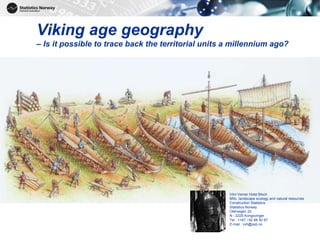
Viking age geography – Is it possible to trace back the territorial units a millennium ago?
•Download as PPTX, PDF•
1 like•214 views

Viking age geography can be traced using place names and historical sources. Oral histories from the 9th century describe early kingdoms in Norway. Viking sagas from the 1200s provide details on places, landscapes, and administrative divisions. Maps from the 16th century onward show the stability of main farm names. Combining place name registers with cadastral maps and watershed areas allows tracing of territorial units from the Viking age. Complete historical archives are needed, as pages are missing from some important protocols.

Recommended
Recommended
More Related Content
Recently uploaded
Recently uploaded (20)
Featured
Featured (20)
Viking age geography – Is it possible to trace back the territorial units a millennium ago?
- 1. 1 Viking age geography – Is it possible to trace back the territorial units a millennium ago? Vilni Verner Holst Bloch MSc. landscape ecology and natural resources Construction Statistics Statistics Norway Otervegen 23 N - 2225 Kongsvinger Tel : ++47 / 62 88 50 97 E-mail : vvh@ssb.no
- 2. Time periods and historical keys for data 2 Period 1. Division 2. Division From To Iron age Early iron age Pre Roman -500 0 Roman 0 400 Migration 400 550 Late iron age Merovinger 550 793 Viking age 793 1 066 Place names/oral tradit. Middle age Early middle age 1 066 1 130 1 130 1 240 (Civil war age) High middle age 1 240 1 400 Viking sagas The black death Late middle age Union 1 400 1 537 Reformat. Reformation Union 1 537 1 660 Matricula – Taxes ….. Absolute monarchy Union 1 660 1 814 Historical maps State of civil service Union 1 814 1 884 Cencuses Farm register National romantics Union 1 884 1 905 National atlas Independency 1905 2015 Act of place names Digital maps
- 3. Place names and oral history telling ca 870 AD - It all starts with a good story 3 - I will not marry him, unless he unites Norway to one kingdom [Gyða Eiríksdóttir] - I will not cut my hair before I have united Norway to one kingdom [Haraldr hárfagri]
- 4. 4 Place names and oral history telling - navigating without maps
- 5. 5 Gaard [Farm] oldn. garðr eng. yard got. gards oldslavisk gradu (ie. Belgrad, Petrograd), rus. gorod (ie.. Novgorod) Place names and oral history telling - a linguistic example
- 6. 6 Viking sagas ca 1200 AD – first written sources Describes persons, places, landscapes, rivers, mountains, kingdoms, parliaments, trade routes, administrative and military subdivisions etc. Ting [Law making assemblies] Fylki [Military admin. entities] Skipreide [Military «tax» area]
- 7. 7 Level Civil Church Military Juridical NUTS 2 Hovedlen / Stiftamt / Landsdel Stift / bispedømme Forsvarskommando (landsdelskommandoer) Lagdømme NUTS 3 Fylke / Len / Amt Distriktskommando Divisjonsdistrikt Lagsogn LAU 1 Grevskap / Baroni Prosti Regimentsdistrikt (1628) Krigskommissariat Birker Fogderi / futedømmer Prestegjeld Bataljonsdistrikt (ca 1770) Kompanidistrikt (1628~1770) Sorenskriveri Sysler / Skipreider... Tinglag LAU 2 Herred [old. nor. Herað] / kommune Kirkesogn… Parish Roder Legder (- 1628 - ) Skipreide «Ship area» ca 900~1850 Bydel [Basic statist. unit] Gårder [Farms] [Farms] [Farms] [Farms] NUTS - Nomenclature of territorial units for statistics LAU - Local Administrative Units Viking sagas ca 1200 AD – first written sources
- 8. The Black Death - little change in main farm name system About half of the farms abandoned Most splits of main farms before 1350
- 9. 9 1539 Carta Marina 1595 NN 1539 and 1595 maps over Scandinavia
- 10. 10 1595 Mercator 1595 Ortelius 1595 maps over Scandinavia
- 11. 1660 – Matricula [register for taxes] 11 A gold mine of NUTS, LAU and other territorial units, place names and more
- 12. 12 1730 Homann
- 13. 1757 topographic map 13 1757 Hafnie
- 14. 1826 administrative map 14 1826 Carpelan
- 15. 2015 NUTS, LAU 2 and basic stat. units 15 2015 Norway Digital
- 16. Data structure - tabular part - From farm level • UID: fixed unique identification of the sub farm – Database internal – Todays municipality/farm/sub farm number • 99.9% ready for 1886-2015 • Work with 1820-1886 remain • Search fields: DATE and HISTID UID FROMDATE TODATE HISTID 023400720001 18860101 19290511 0238/74/3 023400720001 19290511 99990101 0234/72/1 042502150001 18860101 19220701 0425/28/1 042502150001 19220701 19630101 0428/78/1 042502150001 19630101 99990101 0425/215/1 Ref.: Kåre Bævre, National Health Institute Norway
- 17. 2015 LAU2 and watershed areas 17
- 18. 2015 LAU 2 with viking place names 18
- 19. Findings from viking age - together with landscape, land cover and rivers 19 «Up the river as far as the salmon goes»
- 20. Summary • Possible to trace territorial units a millenium ago for a great part of the country • Need to combine place name registers with cadastres and watershed areas • Need knowledge of functions/definitions of historical territorial units • Crucial to have complete archives for administrative protocols (pages missing in the 1274 AD protocol) 20 THANK YOU
Editor's Notes
- Is it possible to trace back territorial units a millenium ago? And what does ship building have to do with this? Previous work at National Archives, Institute for Public Health and Statistics Norway, show that it is possible to trace changes at farm level back to about 1660.
- Viking age a period in Nordic history writings. The last part of the European Iron Age. Key factors to find and trace territorial units through history.
- Facts and fictions. What is original stories and what are lent from older stories.
- Importancy of place names and landscape desriptions. Crucial for sailing and travelling. Wrong navigation might be costly and dangerous.
- Place names often lasts through centuries. Viking settlers adopts to local language and habits, but place names remains.
- Lots of other geographic divisions Almost always a sum of parishes Parishes almost always a sum of main farms Ref.: Kåre Bævre, National Health Institute Norway
- No names in local languages. The farher North the less reliable maps. Latinification of places and names. Lots of artifacts.
- First written recordings of farms and people for tax purposes.
- Quite correct geography of Denmark, Sweden, Finland and the Baltic States. In comparison the iutline of Norway is rather crude.
- Few place names in inner part of the Country. Correct names and order along the coast. Place names in Norwegian/Danish.
- More place names. Also administrative borders and capital cities and functions.
- Full coverage and high accuracy of digital maps and registers.
- Watersheds outline natural borders for management. Ocean and sea are ores for transport, not hinders in viking age.
- Place names manually matched with transactions og land at municipality level and lower. Not possible to match automatically due to different ways of writing and duplicats of place names.