1. Inaccessible Sustainability- Analyzing Access for Organic and Local Produce
in the St. Louis Metropolitan Area
Thomas Derkos- Saint Louis University
Advisor- John Woolschlager
Fall 2015
2. Inaccessible Sustainability 1
Table of Contents
I. Executive Summary...............................................................................................2
II. Background...........................................................................................................3
The Impact of Agriculture.............................................................................3
Food Access and Income..............................................................................7
III. Study Area.............................................................................................................10
IV. Data and Methodology..........................................................................................10
Level of Study............................................................................................10
Census Tract Criteria..................................................................................11
Access Point Selection................................................................................14
Census Tract/Access Point Analysis...........................................................18
V. Data Analysis.........................................................................................................19
VI. Findings and Trends..............................................................................................22
Income and Access.......................................................................................22
Access and Market Type..............................................................................30
Income and Market Type..............................................................................32
Social Traits and Access...............................................................................37
VII. Recommendations …............................................................................................40
Food Industry Recommendations.................................................................. 40
Academic Recommendations.........................................................................50
VIII. Conclusion..............................................................................................................57
IX. Sources.....................................................................................................................61
X. Appendix..................................................................................................................64
3. Inaccessible Sustainability 2
I. Executive Summary
The purpose of this project was to assess and analyze access to organic and local
produce and the impact income and market type have on that access. Current agricultural
techniques and food inaccessibility are two large problems with the current food system.
Studies have shown that conventional large scale agriculture has negative environmental,
social, and economic impacts and access to healthy foods tends to decline as income declines.
These two problems could be linked and to find a solution to one might to involve the other.
Is there a disparity in the amount of access to organic and local produce at different income
levels and different market types? This is the question that serves as the foundation of this
project and is what this projects aims to answer.
To answer this 33 access points in 11 census tracts of differing income levels were
analyzed. The amount of organic and local produce at each of the 33 access points were
inventoried and then combined with social and economic data of the 11 census tracts. The
combined data was then analyzed and compared to find any trends or relationships that exist
between the independent variable, access to organic and local produce, and my dependent
variables, income and market type.
The results show that there does seem to be a disparity in access to organic and local
produce and both income and market types. The amount of organic and local produce at the
access points tended to decrease as income of the census tract decreased. The results also
shows the amount of organic and local produce varies greatly among market types and also
that quality of access of different market types increases with income. The findings reveal
that higher income areas tend to have more access points and higher amounts of organic and
local produce at available access points.
Using these findings recommendations for both the food industry and academia have
been crafted to help increase access to organic and local produce. The goal of sustainability
is to meet the demands of the current generations while allowing future generations to meet
their demands. It is clear that the current food system fails to do both. The environmental,
social, and economic impacts of conventional agriculture can not be maintained by future
generations and a majority of the current generation do not have access to produce, such as
organic or local, that could reduce these impacts to more manageable levels. The goal of this
4. Inaccessible Sustainability 3
project is that hopefully the findings and recommendations presented will help lead to a
solution to both of these problems.
II. Background
There has been extensive research done on both food systems and food access that has
resulted in a wealth of data and findings. The studies and findings of the literature reveal two
major problems that I believe are interconnected. The first problem is the unsustainable
nature of conventional large scale agriculture, particularly its impact on the environment and
health. The second problem the literature seems to reveal is the severe lack of food access,
particularly in low income areas, and the negative social and health impacts this lack of
access can cause. There is a possibility, which will be expand upon later in this section, that
these two separate problems are inherently linked and that in order to fix one the other must
be addressed.
The Impact of Agriculture
Agriculture has had an impact on the world since man planted the first seed. Due to
the steadily increasing population of the United States, currently 320 million and projected to
be over 400 million by 2050,
agriculture has had to find ways
to feed an ever-growing
population with a finite amount
of land and resources (Colby
2015). The issue being that the
agriculture industry, while trying
to meet rising demand, has
actually become unsustainable
and has doomed itself to failure
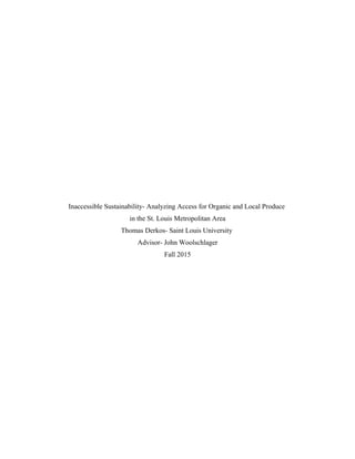
if the current course is
maintained. Current commercial
Figure 1:Land Use in United States
5. Inaccessible Sustainability 4
farming has had a variety of negative impacts on the environment in addition to creating
social and economic issues that affect millions of people. Agriculture's most obvious and
well documented impact is on the environment. Over 50% of land in the Continental United
States is used for agriculture (Nickerson 2011, see Figure 1). This leads to agriculture being
a large emitter of greenhouse gases and having a large interaction with the environment
through water use and certain farming techniques such as fertilizer and pesticide use.
Many current farming techniques can be linked to environmental damage and loss of
biodiversity. The use of chemical and artificial fertilizers and pesticides are some of the more
widely covered techniques. The potential impact of these fertilizers and pesticides include
biodiversity loss (Hole 2005), impacts on biological systems (both human and non-human
organisms) (Colborn 1993), and impacts on soil health (Horrigan 2002). Runoff of these
same fertilizers and pesticides into nearby waterways and aquifers can lead to impacts on
local ecosystems, human health, and potentially lead to large scale environmental problems
(algal blooms) (Horrigan 2002, Hallegraeff 1993).
Water use is another area where agriculture has a significant impact on the
environment. Agriculture uses a large amount of water for irrigation and to grow the large
amount of crops needed to meet demands. Agriculture uses roughly 115,000 million gallons
a day which accounted for 38% of freshwater withdrawals in 2010 (Maupin 2014, see Figure
2). This makes agriculture the 2nd
largest user of water behind
thermoelectric power. This leads to
two problems. First, agriculture
uses a large portion of a finite
resource for which there is a large
demand. This usage can lead to
conflicts over water in areas that
have limited water supplies and can
destroy nearby aquatic ecosystems. The other problem that the large dependence on water
leads to is making agriculture and the food industry extremely vulnerable to disruptions in the
water supply, such as droughts or shortages. This reliance has made agriculture a vulnerable
Figure 2: Water Use Source: United States Geological Survey
6. Inaccessible Sustainability 5
system that can be disrupted by the slightest alterations: the impact of the current drought in
the western United States is a good example.
Reliance on imported foods and the distance food travels from farm to plate is another
large environmental impact of agriculture. A large majority of the food people eat is
imported, either from different states or other countries, and travels thousands of miles to get
from farm to plate ( Hendrickson 1996, Weber 2008). The long distances food travels has led
the food industry and agriculture to being a large greenhouse gas emitter and user of fossil
fuels, accounting for 14% of all the
United States' greenhouse gas
emissions (Marshall 2013, see
Figure 3). Similar to the reliance
on water, the reliance on imported
foods can lead to a vulnerable
system. Events, such as civil
unrest, fuel shortages or sever
weather can easily disrupt the food
supply chain and lead to food
shortages (FAO 2014). Any
sustainable food or food system
would need to work on minimizing
the impact on the environment, for example biodiversity loss and soil run-off, while limiting
natural resource use, such as water and fossil fuels.
The social impacts of the current food system are not as readily apparent or covered in
as much depth as the environmental impacts, but are just as important. The major social
issue in the agriculture industry is the treatment of workers, particularly those in developing
nations. The agriculture industry has a history of treating its employees poorly and unfairly.
Poor working conditions, unfair wages, and abuse can be common in the agricultural industry
(Planas 2013). Many imported fruits and vegetables come from developing nations that
allow abuse or mistreatment of workers. Any sustainable food system would need to address
these issues and help insure workers had safe working conditions and fair wages.
Figure 3: Greenhouse Gas Emissions by Sector
7. Inaccessible Sustainability 6
Another issue that has both social and economic impact is how little of the money
paid for food goes to farmers or workers. A large portion of each dollar spent goes to the
processing of food and food service, not to farmers. On average only 11.6 cents of every
dollar spent on food goes to the farms (Canning 2011, see Figure 4). A majority of the
money goes to large food corporations and processors, not to the farmers that grow the food.
A related issue is the consolidation and centralization of the food industry. The food
industry is largely controlled by a small
handful of companies that generate
annual revenues in the billions. So
while a small portion of the actual food
dollars spent is returning to the farmers,
a larger portion is remaining with giant
corporations with poor environmental
records and unfair treatment of workers
(Hoffman 2013).
The fact that a large percentage
of money spent on food returns to huge
corporations, when combined with the
reliance on imported foods, shows a
large amount of money is leaving the
region, in this case the St. Louis region.
The St. Louis region has the ability to meet its own food demands (Vatterott 2014). The best
way to grow local economies and improve the region is to keep the money spent on goods
within the region. Money spent on goods produced in a region not only keeps the dollars in
the region, but help support local agriculture and food system employees, such as farmers or
food processors by removing “middlemen”, or large corporations (Starr 2003). By spending
money on locally produced foods as opposed to large corporations, consumers are boosting
the local economy by keeping money in their region and supporting local employees who in
turn will contribute to the local economy (Swenson 2008, Darby 2008).
A sustainable food system needs to make sure the producers and processors of the
system are treated fairly and equally. This means that workers are provided good working
Figure 4: Food Dollars Breakdown Source: USDA Economic
Research Service
8. Inaccessible Sustainability 7
conditions, given a fair wage, and are not subject to abuse. Also, a sustainable food system
needs to support local agriculture as much as feasibly possible. This helps improve the local
economy and supports fellow community members by keeping the money within the region
and not going to large corporations or non-local farmers. In addition, consumers need to be
aware of the actions and activities of the companies that they are giving their food dollars to
and actively oppose any unfair or unethical practices.
Another aspect that needs to be addressed is the affordability of sustainable produce
vs. traditional produce. In order to be truly sustainable there needs to be demand and people
willing to buy those sustainable products. Individuals are often willing to pay premiums for
more sustainable produce; organic, local and fair trade, but there are limits to the amount they
are willing to pay over the traditional counterpart (Krystallis 2005, De Pelsmecker 2005). A
product can be produced in the most sustainable way possible, but if consumers are not
willing to pay for that product it will mean nothing. If consumers are not willing to pay the
higher premiums of sustainable products then they will continue to purchase the traditional
products and support the status quo of an unsustainable food system. In order for sustainable
products to be truly sustainable they need to have competitive prices. While the price does
not necessarily have to be lower than the traditional alternative it can not be substantially
higher or consumers will not purchase the sustainable product.
Food Access and Income
The second part of this project seeks to look at food access and its relationship with
income. Studies have shown that as income decreases the quality and quantity of food access
tends to decreases as well (Alwitt & Donley 1997, Lewis 2005). The aim of this project is to
look at access to organic and local produce throughout the income spectrum while observing
whether access is low even at middle or higher incomes or if income plays a role at all. Most
studies on food access and income tend to compare low and high income and do not place
much focus on the middle income ranges. The middle income areas should receive just as
much focus, if not more, due to the large amount of individuals living in these brackets and
not the extremes. Many areas are lacking in food access, areas now called food deserts.
Areas that are considered food deserts are low income (poverty rate of 20% or higher) and
9. Inaccessible Sustainability 8
have low access to a supermarket or healthy foods (33% of population must live a mile or
more from a supermarket or grocery store) (Food Deserts 2013). When an area is a food
desert individuals in that area tend to have limited or no access to affordable healthy foods.
The access that individuals do have to foods tend to be low quality, such as fast food
restaurants or convenience stores. This lack of access can lead individuals to purchase
cheaper, processed foods which could lead to a variety of problems for individuals in the food
deserts and could represent a significant barrier to a sustainable food system.
When an individual's diet consists mainly of cheap processed foods it can lead to
health problems such as obesity, diabetes, heart disease, and other diet related illnesses
(Global Strategy 2004). Processed foods are high in sugars, fats, and carbohydrates and tend
to make up the bulk of the diet of individuals in food deserts and are one of the main causes
of diet related illnesses that are prevalent in low income areas (Arrighi 2012). Another issue
with processed foods is that they can contain artificial colors, flavors, or preservatives which
have the potential to cause serious health problems. While the effects of artificial
preservatives and colors on human health are widely debated, some have the potential or have
been found to cause diseases. Cancer (nitrates, benzoates, Red #2), allergy problems
(sorbates, sulphites) and hyperactivity (Yellow #5, Red #40) are just some of the known
health conditions that theses additives have the potential to cause (Blumethal 2009, Color
Additives 2009). The potential dangers these additives present have led some to be banned
and a large majority to be regulated (Food Additives 2014). When food access is low and a
diet consists mainly of processed foods, these artificial additives can be ingested in large
quantities and can increase the potential of health problems.
Furthermore, processed foods tend to be made by large food companies (Hoffman
2013). This means that low access to, in this case, sustainable food leads individuals to
purchase foods that tend to be unhealthy for them while maintaining the current unsustainable
conditions of the large food corporations. As mentioned before the food industry is a very
centralized industry and a large amount of processed foods are made by a handful of
companies that tend to have poor sustainability records. When individuals in food deserts
only have access to processed foods they have little option but to support these large food
companies by buying their products and maintaining the status quo of an unsustainable food
system. Not necessarily because these individuals want to, but they have no other choice.
10. Inaccessible Sustainability 9
St. Louis follows the trends associated with poor food access and food deserts. As
incomes decrease both quantity and quality of food access decrease as well (McMullin 2014,
Ver Ploeg 2015. see Figure 5, see Figure 6). As income of a census tract decreased the food
access decreased in two ways; the number of access points and the quality and variety of
access points.. In low income tracts a large majority of food access points are of poorer
quality (convenience stores, gas station) as opposed to higher quality points (supermarkets,
grocery stores) which leads to poor access to healthy foods. St. Louis also follows the trend
of poor access leading to poor health, the areas that had low access and low income tended to
have increased cases of diet related illnesses and deaths (Arrighi 2012).
It is clear from the literature that current agricultural methods are not sustainable and
that there is a lack of access to food, particularly in low income areas. Are these two
problems were inherently linked? Will changing current agricultural methods to more
sustainable practices, such as local or organic, make an impact if only high income areas have
access? Does lack of access result in less demand for sustainable produce? Does this lack of
demand lead farmers to maintain the status quo? Will improving access increase demand for
sustainable produce even in low income areas? If people do not have access to organic and
local produce there will be little demand for those products. With little demand, local
farmers will not see the need to “fix what isn’t broken” and continue to grow commodity
crops and export them out of the region.
While this study will not be the smoking gun that definitively answers these questions
or solves both problems, it could be a start in the right direction and could be easily
expanded upon. This study was influenced by many of the studies mentioned above and were
the basis for the development of my methodology. The hope was to not copy these studies
but to expand and build on them. Instead of focusing on healthy foods in food access areas,
the criteria will focus on the environmental impacts in addition to economic and social factors
of produce. Additionally, as opposed to many of the studies on food access, this study will
not be focusing solely on low incomes, but will encompass a wide range of income areas.
The hope is that this study can contribute ideas to various industry leaders on how to increase
demand and access to sustainable goods while creating incentives for farmers to adopt more
sustainable practices or keep locally grown produce in the region.
11. Inaccessible Sustainability 10
III. Study Area
This study focused mainly on census tracts in St. Louis City and St. Louis County.
The areas selected represent a good variety in both geographic and social characteristics.
Areas selected include populations of varying income, race, age, and social status. Attention
was paid to make sure that no areas selected were identical and that there was a good variety.
Portions of the St. Louis metropolitan area that could have been included but were
excluded were the Illinois counties of Monroe and St. Clair and the Missouri counties of
Jefferson and St. Charles. The Illinois counties were excluded due to Illinois having different
average household sizes and median household incomes, which were being used to establish
the ranges in this study. Two different ranges would complicate the study, so Illinois areas
were excluded. The Missouri counties of Jefferson and St. Charles are commonly included in
studies of the St. Louis region due to their close proximity. The issue with these two counties
was that they are much more rural as opposed to the more urban St. Louis City and County.
While the difference between urban and rural areas would be an interesting study, it was not
the focus of this study. The United States Department of Agriculture uses different
parameters to define food deserts for urban and rural areas which would mean potential areas
in Jefferson or St. Charles County would have different definitions for poor access than St.
Louis City or County. For cohesiveness and uniformity, the counties of Jefferson and St
Charles were excluded for this study and only census tracts of St. Louis City and County
were included.
IV. Data and Methodology
Level of Study
The first step in developing what this study would actually entail, involved deciding at
what level to study food access and income. It was decided that using census tracts, over
other options such as ZIP code or neighborhood/municipality, would be the best way to study
the relationship between food access and income largely due to availability and accessibility.
The data that was needed, such as median household income and population, was best
12. Inaccessible Sustainability 11
available at the census tract level. There was little data readily available at the
neighborhood/municipality level and the data at the ZIP code level was not as robust as the
census tract level. Another reason census tracts were chosen over ZIP codes or
neighborhood/municipalities was accessibility. Census tracts are designed to have a good
sample size while not being large geographically, which was important due to time and
resource constraints. ZIP code tracts are much larger than census tracts and in order to get
the variety of incomes desired and being able to visit every access point would have taken far
more time and resources than using census tracts. Neighborhood boundaries tend to be
unofficial and it would have been difficult to define the boundaries for certain neighborhoods,
as opposed to census tracts which have official boundaries. Since census tracts have official
boundaries, a robust and large collection of data, and could be accessed and analyzed much
quicker, while not sacrificing the aim and goals of the study, they were chosen as the best
level of study.
Census Tract Criteria
After choosing to use census tracts a way to select which census tracts best fit the
study was needed. Census tracts were chosen based on two criteria, the main one being
median household income and the second being population. Income was chosen because it is
the independent variable and is essential to the study. Population was chosen due to census
tracts having a large range when it comes to population. Census tracts can have populations
as low as 1,200 and as high as 8,000 (Geographic 2012). Low population tracts tend to be
low density areas such as rural or industrial areas and high population tracts tend to be high
density residential, both of which would lack value to study as they would have little in the
way of commercial areas with available access points. For this study income was the
priority, but each tract selected had a to have population of around 4,000, the optimal number
recommended by the United States Census Bureau. This would provide a balanced
population with a nearby commercial sector.
To find tracts a combination of U.S. Census Data and Geographic Information
Science (GIS) software was used. To create the range of incomes four factors were used; the
average household sizes of St. Louis City and County, the federal poverty level, the median
13. Inaccessible Sustainability 12
household income of St. Louis City and County, and the highest income census tract in
Missouri. The minimum value was based off the federal poverty level, which is based on
household size. The average household size of St. Louis City and County is 2.31, which was
rounded down to 2. The federal poverty level for a 2 person household is $15,930 which was
used as the minimum income value. For the median value the average median household
income of St. Louis City and County was used, which was $46,746. The highest median
household in Missouri, which is located in St. Louis County, was used as the maximum
value. Using these values four ranges were created to represent low income, lower middle
income, upper middle income and upper income levels. For lower income tracts the median
household income needed to be within within $5,000 of my minimum value of $15,930. For
streamlining purposes all tracts with a median household incomes under $20,000 were
included. For the lower middle income tracts, tracts between $20,000 and $50,000 were
selected, giving priority to tracts that were close to the median value of $46,746. For upper
middle income, tracts with median household incomes between $50,000 and $100,000 were
included. Upper income tracts were any tracts that had median household incomes above
$100,000. The original goal was to choose eight tracts, but 11 tracts ended up being selected
to create more balance and to get a better variety of areas.
11 tracts were chosen that represented a vast array of income levels and were
geographically diverse (see Figure 6). There were three lower income tracts which included
the areas of Desoto Park ($11,533, 3,329), Midtown ($15,222, 5,454) and Tower Grove
South ($18,094, 3,007). Three tracts were selected for the lower middle income range which
included the areas of Southtown ($32,467, 4,281), Carondelet ($44,837, 4,336) and Mehlville
($45,486, 5,365). The three tracts selected to represent upper middle income were the areas
of Brentwood ($74,398, 2,972), Fenton ($91,154, 4,035) and Glendale ($99,543, 5,935).
Two tracts were selected for the upper income range representing the areas of Town and
Country ($164,205, 4,808) and Chesterfield ($211,944, 6,513).
While not used in the selection of the census tracts, additional economic and social
statistics for the selected tracts were recorded. These statistics were used to get a more in-
depth description of the tracts. The statistics were not used in the analysis of the tracts, but
were used to expand my understanding of the census tracts.
14. Inaccessible Sustainability 13
The first additional statistic that was recorded was the percentage of the tract’s
population that had a bachelor’s degree or higher. It is a common assumption, that has been
been backed up by science, that people with higher education levels tend to have higher
levels of awareness, in this case environmental awareness or knowledge of food systems.
The second additional statistic used was the average median household income of the
adjacent census tracts. This was done by calculating all the incomes and dividing the sum by
the total number of tracts. The goal was to to see whether the tract was representative of the
area the tract was in or was it an isolated pocket of either high or low income that did not
match the surrounding area. The final additional statistic recorded was the tract’s Tapestry
Segmentation. Tapestry Segmentation is a social and economic analysis done by the
company ESRI of census tract based on a variety of demographics; such as age, sex,
educational attainment, housing data, income data and employment data(see Figure 7). These
were recorded to give a face to the tract and an idea as to who lives and shops in these tracts.
The Tapestry Segmentation was chosen over doing surveys, due to time and logistical
constraints and the lack of importance it had on the study as a whole.
15. Inaccessible Sustainability 14
Access Point Selection
The next step was to select the criteria the access points needed to meet and determine
which access points near the tracts met the selected criteria. The criteria used were mainly
the same criteria the USDA use when defining food deserts with some minor alterations. The
first criteria was that the access point needed to be a supermarket or large grocery store with a
dedicated produce section. The access point needed to have a reasonably sized produce
section and would be somewhere one would buy a majority of their produce, simply selling
Figure 7: Selected Census Tracts(outlined in yellow) Data Source: United States Census Bureau
16. Inaccessible Sustainability 15
produce did not automatically mean the access point qualified. Access points such as gas
stations, quick stops, convenience stores, and other similar market types were excluded from
the study due to lack of a substantial produce section. Farmer’s markets were also excluded
due to their seasonality and difficulty in accessing due to time constraints and the author’s
occupation.
The second criteria that the access point needed to meet was its proximity to the
census tract. The USDA states that an access point needs to be within a mile to be considered
accessible. The range was expanded to a mile and half and and exclusions were given to
points outside the range if the access point would logically be used by a good portion of the
tracts residents. A combination of GIS software, ArcMap and Google Maps was used to
measure the distances to verify they fell within the acceptable range. ArcMap was used to
reference the official census tracts boundaries, this is much better for finding access points
and measuring distances, since they can not be viewed on Google Maps. In ArcMap a
basemap of streets was combined with census tracts boundaries which allowed me to create a
rough outline of the tracts boundaries based on street names. The census tract outlines were=
bases on street names to give a rough idea of how the census tract boundaries would look in
Google Maps and would allow for the use of Google Maps to find access points and traveling
distances. Google maps was then used to search for grocery stores by both having Google
Maps look for them via the search option and by manually searching for any potential sites.
Some issues arose when using solely the search function, Google Maps had certain locations
labeled as grocery stores which were clearly not, wholesalers or supplement stores were
common examples. Also, it produced points that no longer existed. The search function was
used largely to cast out out a large net and then each point was manually evaluated as to
whether or not it was a viable food access point or not.
Once a point was deemed a viable food access point, the point was evaluated to find if
it met the two established criteria. First, the presence of a dedicated produce section at the
point was verified. This was done by using a combination of the store’s website, if available,
images of the store from Google Street View, and common assumptions, such as quick stops
or convenience stores not having a produce department. Any points that were difficult to
determine, but fell within the acceptable distance were physically checked during the access
point analysis and deemed acceptable or not by visual confirmation.
17. Inaccessible Sustainability 16
Points that were deemed to meet the produce department requirement were then
measured to see if they met the distance requirement. Physically measuring the distance
would obviously give the most accurate results, but due to time and resources constraints,
physical measuring was not considered a viable option. While not as accurate as physical
measurements, using the directions function of Google Maps served as a viable alternative to
physically measuring while still providing enough information and data to achieve my goal
with a good degree of accuracy.
Using the same starting point, the rough geographic center of the tract, directions
from the starting point to the desired access point were calculated. The directions would
provide the distance in miles it would take to reach the access point from the starting
position. As mentioned above a mile was the acceptable range for the USDA, but when
performing these measurements it became apparent that range would need to be expanded.
There were points that fell outside the mile range from the center but were within a mile of
other parts of the tract and it could easily be assumed that large portions of the tract used
these access points. So the range was expanded to a mile and a half to include those points
that fell out of the original range of a mile. A few exceptions were made for a small number
of points that fell outside of the mile and a half range, if to could be safely assumed they
would be accessed by a significant portion of the census tract.
The analysis resulted in 33 access points meeting the two criteria points(see Figure 8).
The 33 access points were then classified into four categories based on the size of the store,
the type of store, targeted clientele or consumer (examples include organic shoppers, local
produce consumers, or consumers who purchase particular produce), and the number of
stores and states the parent company operated in. The four categories that were chosen were
local specialty store, local chain store, national specialty store and national chain store. An
access point was deemed a local specialty store if it had a small commercial presence; low
number of stores, targeted a particular clientele and operated only in the St. Louis metro area.
An access point was deemed a local chain store if it had a fairly large local commercial
presence: many area stores, no targeted clientele and served the entire St. Louis region.
National specialty stores included access points that had a large national commercial
presence, they were focused more on particular consumers, and operated in multiple areas
outside of the St. Louis area. National chain stores included access points that had a large
18. Inaccessible Sustainability 17
national commercial presence, having a broad consumer base with no specific niche, and
operated in areas outside of the St. Louis area. The stores were classified solely for
organization and data analysis purposes and there was no difference in the physical
observation and analysis of the access points based on market type.
Figure 8: Selected Access Points Data Source: United States Census Bureau
19. Inaccessible Sustainability 18
Census Tract/Access Point Analysis
Once the acceptable access points were found a physical field study of each access
point was performed. At each access point an inventory of all fresh organic and local
produce was taken. Originally, at the beginning of the study, the criteria for produce to be
sustainable was that it needed to be local (within 150 miles), organic, fair trade, and natural.
AS these access points were being analyzed it became apparent that there were no produce
that met all the requirements. It was decided to narrow the criteria to local and organic since
they were the most prevalent and easiest to confirm. Only table crops were included in this
study, processed organic or local produce, such as salad mixes, were not included because it
was felt they fell into a different category of produce. For each access point the number of
local and organic produce was cataloged. The catalog included the type of produce, if there
were local or organic options, the conventional price, the organic price and the local price.
The price differential between the organic and conventional prices and the price differential
between the local and conventional prices were also included. Only information that was
readily available to consumers was included and no details from any of the stores analyzed
that were not publicly available was used in any part of this project.
In addition to collecting data to be analyzed, notes were taken on observations of the
access points and any differences that may have appeared between either different income
levels or different market types. Some of the items that were included in my observations
were the ease of finding the sustainable produce, how it was organized, how much
information was available to view, how well the produce was labeled and priced and how
much advertising or awareness was given to local and organic produce. Also, a few informal,
casual interviews with some employees on their particular access point’s produce, such as
how inventory is selected, where the produce comes from, and internal certification programs
were conducted.
To expand on the accessibility of the access points, general driving and walking
distances were measured for each access point. Similar to determining the distance of access
points to deem if the point would be analyzed or not, physical field measurements would
have been preferable, but again due to time and resource constraints this was not seen as a
viable option. A similar method to the one used to select access points was used to measure
20. Inaccessible Sustainability 19
the traveling distances to access points. A single starting point close to the geographic center
of the census tract was used for each measurement, then each access point was searched using
the direction tool to determine both the driving and walking distance, in miles, it took to
travel from the starting point to the selected access point. While not as detailed as physical
measurements would have been, this method provided data and the desired information
quickly and easily. Also, the data collected was not critical to the overall study and was used
mainly to broaden the analysis and recommendations. In addition to using the directions tool
on Google Maps, observations from performing the access points analysis were noted.
Observations included the amount of time it took to travel between points, ease of getting
from access point to access point, proximity access points had to one another and the location
of each point in relation to the surrounding area (a more commercial area or residential area).
These observations were to enhance the Google Map data by giving more specific examples
and to cover some of the shortcomings of not physically measuring the distances by
providing more description of the tracts.
V. Data Analysis
The data was aggregated into three spreadsheets to allow for quicker and easier data
access. The first spreadsheet contained all the data collected on the census tracts(see Table
1). The goal of this spreadsheet was to look for any relationships or trends between the
income of the census tracts and access to organic and local produce. The data included:
median household income, population, percentage of population with a bachelor’s degree or
higher, average median household income of all adjacent tracts, number and type of access
points, total number of organic produce items, total number of local produce items, average
conventional-organic price differential, average conventional-local price differential, average
walking and driving distances and the ESRI segmentations present in each tract. The second
table contained the market type data and breakdown. The goal of this spreadsheet was to
observe any trends or relationships between market types and access to organic and local
produce(see Table 2). In this table the the data was broken down by the four market types to
give an idea on how access varied between the market types. The data included: number of
stores for each type, how many tracts contained the store types, total and average number of
21. Inaccessible Sustainability 20
organic items in each market type, total and average number of local items by market type,
average conventional-organic price differential by market type, average conventional-local
price differential by market type and average household median income of the tracts that
contained at least one access point of that market type. The third spreadsheet was a
combination of the second and third spreadsheet and sought to observe the potential
relationships between income and market type, the main goal was to observe any trends or
relationships between income and market types as well as any differences in the same market
type(see Table 3). The data was broken down into four ranges created by using the median
household income of the eleven tracts. The ranges were household median income that was
less the $25,000, $26,000-$50,000, $51,000-$100,000 and $101,000 or above. Data for each
range included: number of tracts in each range, number and types of access points, average
and total number of organic produce items, total and average number of local produce items,
average driving and walking distances to access points and average percentage of population
with a bachelor’s degree or higher for each range.
23. Inaccessible Sustainability 22
VI. Findings and Trends
Income and Access
At first glance the numbers supported the hypothesis, that as income increased access
to organic and local produce increased as well. As income increased so did the number of
access points and the availability of organic and local produce. Both the total number of
organic and local produce and the average number of organic and local produce increased as
Table 2: Market Type Data and Analysis
Table 3: Market Type and Income Analysis
24. Inaccessible Sustainability 23
income increased. The lower income tracts, which consisted of the Tower Grove, Desoto
Park and Midtown tracts, had a total of six access points, two local specialty stores, three
local chain stores and one national chain store. The six access points had a total of 119
organic produce products and 45 local produce products. The lower middle income tracts,
which contained the Southtown, Carondelet and Mehlville tracts contained a total of nine
access points, seven local chain stores and two national chain stores. The nine access points
carried 164 organic produce items and 18 local produce items. The upper middle income
tracts, Brentwood, Fenton and Glendale, had 13 total access points, seven local chain stores,
three national specialty stores, and three national chain stores. These 13 access points
contained 382 organic produce items and 50 local produce items. The upper income tracts,
Country Life Acres and Chesterfield, contained four access points. The four access points
contained 148 total organic items and 26 local items, it is important to note that these
numbers are solely from the Glendale tract as the Chesterfield tract did not have any access
points within the selected range. While the numbers seem to reveal that the relationship
between income and access for sustainable produce seemed strong, when a linear regression
was ran for both the total organic produce-income and total local produce-income datasets the
results were contrary to the initial hypothesis. The linear regression resulted in weak
correlations between both income and total number or organic and local produce. The
correlation coefficient for the income and organic produce regression was 0.19 and 0.10 for
income and local produce(Figure 9, Figure 10).
Figure 10 Income and Total Number of Local ProduceFigure 9: Income and Total Number of Organic
Produce
25. Inaccessible Sustainability 24
In statistics, correlations are measured on 0-1 scale, the closer to 1 the stronger the
relationship. This means that the relationship between income of each tract and the total
number of organic and local produce is very weak. The regression results did not seem to
match up with what the collected data seemed to be showing so the data was looked at deeper
and reason seemed to appear.
After a deeper analysis of the data it became clear that my data contained two outliers
in the dataset that were severely skewing the data. The Tower Grove South census tract was
one of the outliers. Tower Grove South was a low income tract, $18,094, that had very good
access to both organic and local produce. Tower Grove’s access points contained a total of
77 organic produce items, which represented the fourth highest total out of all tracts, and 44
local produce items, which represented the highest total of all studied census tracts. The
second outlier was the stark opposite of the Tower Grove tract. The Chesterfield census tract
had the highest income out of all studied census tracts, $211,944 but had the lowest number
of access points with zero. The Chesterfield tract had zero access points that were within the
1 and half mile range used, which resulted in it having 0 organic produce and 0 local produce
items due to the nearby access points not being deemed accessible. The average distance to
the nearest access point, which will be discussed in-depth in a later section, was 5.95 miles
with the closest access point being 4.2 miles away which fell well outside the selected range.
These two tracts represented outliers on both ends of the scatter-plot and while they were still
important, this will be discussed further in a later section, they were vastly skewing the
regression results. It was curious as to what the regression results would be with the outlying
data sets removed.
The exact same linear regression was ran on the income and total organic produce
items dataset and the income and total local produce items dataset as before but this time
without the Tower Grove and Chesterfield data. The results were staggeringly different. The
regression coefficient for the income and total organic produce items dataset without Tower
Grove and Chesterfield was 0.84 and the regression coefficient for the income and total local
produce items dataset was 0.80(see Figure 11, see Figure 12). Both of these scores represent
strong positive relationships between income and the total number of both organic and local
produce items which means as income increases the number of organic and local produce
items tended to increase as well.
26. Inaccessible Sustainability 25
While both of these strong correlations do not necessarily prove that all high income
areas have higher numbers of organic or local produce, it does give strong evidence. It is
clear that the data and strong correlation between income and access to organic and local
produce coincides and supports prior studies on income and food access. Much like previous
studies, the findings show there is an obvious disparity between the quantity and quality of
access for organic and local produce and the income of an area. While the overall trend, and
the data, support this hypothesis, the two outliers, the Tower Grove tract and Chesterfield
tract, seem to show that there are exceptions to the rule and that what may be true for the
majority may not be true for all.
In addition to analyzing the relationship between median household income and
access to organic and local produce, the relationship between median household income and
the average price differential for both organic and local produce was analyzed. The price
difference of either organic or local produce was compared to their conventional alternative
and averaged for each census tract. The Chesterfield tract was excluded from each of the
regression due no price differential being available for either local or organic and the Desoto
Park tract was excluded from the local regression due to no local differential being available
due to no local . As with the income and access analysis a linear regression was ran on the
Figure 11: Income and Total Number of
Organic Produce(w/o Chesterfield and
Tower Grove South Tracts)
Figure 12:Income and Total Number of Local
Produce(w/o Chesterfield and Tower Grove South
Tracts)
27. Inaccessible Sustainability 26
the tract’s median household income and the average price differential between the
conventional produce and the organic and local produce alternative. The goal was to see how
much more organic and local produce cost than their conventional alternatives and if there
was any difference between income levels. The results reveal that income has a slight, if any,
impact on the average organic price differential and little to no impact on the average local
price differential.
The regression revealed there was a correlation of 0.02, a very weak positive
relationship between income and the average organic price differential and a correlation of
0.22, a weak positive relationship between income and average local price differential(see
Figure 13, see Figure 14). In addition to the correlation scores a simple visible analysis of the
data seemed to support the claim that income had little impact on either the average organic
price differential or the average local price differential. The scatter-plot was very flat and
consolidated showing a slight positive trend but showing very little difference. The average
organic differential for each tract differed slightly among all the tracts, the difference between
the largest differential of $1.06 (Brentwood) and the lowest differential $0.74 (Tower Grove
South) was only $0.30. This vast difference was rare as only two tracts had differentials
over $1.00 (Brentwood and Desoto Park) and the average differentials between the tracts with
differentials below $1.00 was only $0.03. The little difference between the tracts combined
with only a moderate relationship shows that income tends to not have a huge impact on
organic-conventional price differential.
Figure 13: Income and Average Organic-
Conventional Price Differential
Figure 14:Income and Average Local-Conventional
Price Differential
28. Inaccessible Sustainability 27
The same can be said of the relationship between income and the local-conventional
price differential. Oddly enough there was only one tract that contained local produce items
that had a positive price differential, Country Life Acres had a differential of $0.37. This
means that out of the ten tracts, Chesterfield was not included, that had local produce items
only one had local produce items that cost more than their conventional alternatives. Unlike
organic produce the differentials varied greatly among tracts, with the highest being $0.37
(Country Life Acres) and the lowest being $-1.38 (Brentwood). The fact that both the tracts
with the highest and lowest differentials were both in a high income area only strengthens the
fact on how much variation exist between income levels. The average difference between
tracts was 0.36 which was much larger than the organic differential, but the values were also
much more spread out and sporadic with no visible trend in the scatterplot. In addition to not
seeing a visible trend in the scatterplot the correlation score from the regression was 0.22
which denotes a very weak relationship. The regression results combined with the numbers
show that there was little impact between income and both the organic-conventional price
differential and the local-price differential.
As mentioned earlier, in the Chesterfield tract the relationship between income and
the distance to access points resulted in an interesting trend. The data revealed that high
income areas tended to have larger numbers of high quality access points but they were more
inaccessible. The driving and walking distance for each tract’s access points were measured
and then divided by the total number of access points to get an average driving and walking
distance for each tract. The tract’s average walking and driving distances were then paired
with each tract’s income into datasets. A linear regression was then ran on each dataset to get
the relationship between income and the average walking and driving distance for each tract.
The results show a stark contrast in both walking and driving distances between the different
income areas. The regression correlation between the tract’s income and average walking
distance was 0.87 and the regression correlation for the tract’s income and the average
driving distance was 0.90(see Figure 15, see Figure 16).
29. Inaccessible Sustainability 28
These two regression correlations represent very strong positive relationships between
income and average walking and driving distances. This means as a tract’s income increases
the average driving and walking distance will likely increase as well. The lower income
tracts of Tower Grove, Desoto Park and Midtown had an 0.75 miles average for both
walking and driving distances. The lower middle income tracts of Southtown, Mehlville and
Carondelet had an average walking distance of 1.16 miles and an average driving distance of
1.41 miles. The upper middle income tracts of Brentwood, Fenton and Glendale had an
average walking distance of 1.32 miles and 1.52 miles for driving distance. The upper
income tracts of Country Life Acres and Chesterfield had average walking distance of 3.93
miles and an average driving distance of 4.33 miles.
The first key point of this data is that while higher income tracts have a higher number
of access points and larger amounts of organic and local produce items, they are traveling
substantially further. While most higher income individuals, unlike some lower income
individuals, tend to have access to a vehicle, it would seem that the distance to the access
point would be irrelevant. If an individual is driving six or seven miles to get their produce is
that truly considered accessible and sustainable? Are the benefits of organic or local produce
access negated when individuals are traveling large distances, using fossil fuels and emitting
Figure 15: Income and Average Walking
Distance(in miles)
Figure 16: Income and Average Driving
Distance(in miles)
30. Inaccessible Sustainability 29
CO2 in the process? Is a food system sustainable if people rely on vehicles to reach distant
access points or is it only adding to the fragility of food systems? During the access point
analysis it became apparent how far these access points were from each other and the only
option was to drive. Also, the points seemed much more spread out, there were times when
driving through the entire tract to get from one point to another point was the only choice.
Most of the time the access points in high income areas were divided by large residential
areas, which differed from low income tracts which seemed to have the access points in a
centralized area with the residential areas surrounding them.
The second point is that while low income individuals can have issues getting to
access points (lack of vehicle, elderly) it seems that low income tracts are much more
accessible and adaptable than higher income tracts. Lower income tracts had access points
that were much more centralized than the higher income tracts which tended to be much more
spread out. The centralization in the lower income tracts means that regardless of where a
person lives in the tract the access points were within walking distance. The furthest travel
distance in the low income tracts was 1.7 miles, in the Tower Grove tract. The Tower Grove
South access point was the only travel distance over 1 mile in all of the low income tracts.
The lowest travel distance in the upper middle and high income tracts was 0.8 miles, in the
Brentwood tract, which in contrast was the only distance in the upper middle and high
income tracts below 1 mile. These lower travel distances mean that walking is a viable
option for the lower income tracts and a less likely option in high income tracts, due to both
the length of the distances and the inaccessibility of some high income areas infrastructure
(no sidewalks, hills, windy roads). The option to walk allows low income individuals the
flexibility of being able to choose how to reach access points and provides more sustainable
transportation alternatives such as walking, biking, or mass transit. Most of the points in
lower income areas were accessible with a combination of mass transit, walking or biking,
options not overly available in the high income tracts. Another difference experienced was
how consolidated access points seemed to be in lower income tracts, it seemed that access
points were in close proximity to each other and could easily be accessed at any point of the
tract.
31. Inaccessible Sustainability 30
Access and Market Type
When analyzing the relationship between market type and access two things were
looked at, the quantity and the quality of the access points of each market type. The quantity
of access points was measured by simply counting the number of access points for each
market type and the number of tracts that contained at least one access point of that market
type. By a large margin, the market type that represented the majority of access points was
the local chain stores. There was at least one local chain store in 9 of the 11 census tracts
analyzed and of those nine tracts seven had multiple local chain stores. There were 20 total
local chain stores analyzed, which represents 60% of the access points analyzed. National
chain stores represented the next largest market type with seven access points in six tracts,
21% of the total access points. Next were national specialty stores which had four stores in
three tracts and consisted of 12% of the access points. Finally, with the lowest number of
access points were local specialties stores which had two access points in two tracts, only
accounting for 6% of the total access points.
In addition, the total and average number of organic and local produce items, the
average organic-conventional and the local-conventional price differentials were calculated
for each market type to better understand the quality of each. The market type with the
highest average of organic items was the national specialty stores by a large margin.
National specialty stores had 168 total organic produce items and averaged 42 organic
produce items between four stores. Next, were the local chain stores which had the largest
total number of organic produce items with 561, but only averaged 28 organic produce items
per access point. Close behind the local chain stores were the local specialty stores with 51
total organic items averaging 25.5 per access point. National chains had a total of 34 organic
produce items at seven access points with an average of four organic produce items per
access point. National chains, while representing 21% of the total access points, only had
0.04% of the total number of organic items.
Local produce items were limited regardless of market type and only one market type
had a reasonable stock of local produce. The market type with the most local produce items
were the local specialty stores having a total of 31 local produce items between two tracts
which averaged 17 local produce items per access point. It should be noted that the 31 local
32. Inaccessible Sustainability 31
produce items were all at one access point. This means that this one access point, in Tower
Grove South, contained 22% of the total number of local items. Local chain stores similarly
to organic produce items had the largest total number of local produce items with 91, but only
averaged 4.4 local produce items per store. National specialty stores, many of whom market
themselves as environmentally friendly and conscience, carried a surprisingly low number of
local produce items. National specialty stores only had 13 local produce items, with an
average of three local items per access point. It is important to note that much like local
specialty stores, one access point, in Glendale, had a majority of the local items with eight.
National specialty stores not only had the least amount of local items, they actually had none.
Out of the seven national chain stores visited there were no local produce items at any of
them.
Other than local specialty stores there were, similarly to income, very little difference
between market type and the organic-conventional price. Local specialty stores had the
lowest differential with organic produce items costing $0.52 more than their conventional
counterparts. Local specialty stores were the lone outlier, as the three other market types had
fairly concentrated organic-conventional differentials. National specialty stores had an
average differential of $0.70, national chain stores had an average differential of $0.80, and
local chain stores had the largest organic-convention average differential at $0.87, meaning
that local chains stores usually charge the most for organic produce items over their
conventional alternatives.
The average local-conventional price differential could only be calculated for two of
the market types, local chain stores and national specialty stores. The local-conventional
price differential for national chain stores could not be calculated due to there being no local
produce items at any national chain store. Local specialty stores differential could not be
calculated due to one access point having no local produce and the other having only local
produce items and not offering any conventional alternatives, so there was no conventional
prices to compare. As with income, the average local-conventional price differentials for
both local chain stores and national specialty stores were both negative and were close
values. The average local-conventional price differential for local chain stores was - $0.20
and for national specialty chains the differential was $-0.16. It is interesting to note that for
33. Inaccessible Sustainability 32
both the income-access analysis and market type analysis, the price of local produce tended
to be cheaper than their conventional counterparts.
Income and Market Type
After analyzing the relationship between income and access for sustainable produce
and the relationship between market type and access for sustainable produce, the two analysis
were combined to see the relationship between income and market type looking for any
differences. There were two main relationships that were observed and how income
impacted them. The first was to see the relationship between income of the census tract and
market type and to if the number and type of market types differed among different income
levels. The second was to see the differences among the same market types and income and
if the amount of organic and local produce items differed among the same market types.
To analyze the relationship between income and market type access, the 11 tracts
were grouped into the same four ranges used previously when selecting the census tracts.
The ranges were less that $25,000, $26,000-$50,000, $51,000-$100,000 and $101,000 and
more. The ranges resulted in the tracts being fairly equally distributed between the four
ranges. Three tracts (Desoto Park, Midtown and Tower Grove South) fell into the first range,
three tracts (Southtown, Carondelet and Mehlville) fell into the second range, three tracts
(Brentwood, Glendale and Fenton) fell into the third range, and two tracts (Country Life
Acres and Chesterfield) fell into the last range. For each range, the total number and types of
access points, the total and average number of organic and local produce items, the average
conventional-organic and conventional-local price differential, the average driving and
walking distance and the average percentage of population with a bachelor’s degree or higher
were calculated. In addition, the average median household income of any tract that
contained at least one of the market types was calculated and included.
This analysis coincided with the findings of the earlier analysis on the impact of
median household income on access to organic and local produce that as income increases
access to organic and local produce increases as well. The highest income range only had
four total access points, it is important to note those four access points were all in one tract
34. Inaccessible Sustainability 33
(Glendale), the third range had the highest total number of access points with 13, followed by
the second range with nine access points, and the lowest range with six access points.
The market types varied on concentration. Some market types were widely
represented, while others were more consolidated into certain income ranges. The best
represented market type was the local chain stores who had a total of 20 stores and had
multiple access points in each range. The lowest range had three local chain stores, the
second range had seven local chain stores, the third range had seven local chain stores and the
highest range had three local chain stores. The average income of tracts with at least one
local chain store supports this, as the average $65,045 was very close to the overall average
of all 11 tracts, $73,534.
Also, the national chain stores were well dispersed and had access points in a variety
of income levels. Three of the four ranges had at least one national chain store with two of
the ranges having multiple national chain stores. The lowest range had one national chain
store, the second range had three national chain stores, the third range also had three national
chain stores and the highest range had no national chain stores. Similar, to the local chain
stores all income levels were fairly well represented as the average income of tracts
containing national chain stores was $76,816 almost identical to the overall average of
$73,534.
The other two market types, local specialty stores and national specialty stores were
far less diverse and usually concentrated in one certain income area. Oddly enough the two
market types were represented in totally opposite income areas. Local specialty stores only
appeared in the lowest range and national specialty stores only appeared in the two highest
ranges. The two local specialty store access points only appeared in two tracts in the lowest
range (Desoto Park and Tower Grove South) and the two tracts had an average median
income of $14,813. In contrast, the national specialty store had four access points in three
tracts (Brentwood, Glendale and Country Life Acres) and all three tracts were either in the
third range (Brentwood and Glendale) or the highest range (Country Life Acres). The
average of income of the tracts containing national specialty stores is $112,715.
The other relationship that was analyzed was if the amount of organic and local
produce items and the number of access points changed within the same market types as
income increased. The only market type that allowed for this relationship to be observed was
35. Inaccessible Sustainability 34
the local chain stores. Local specialty and national specialty stores were primarily
concentrated in one specific income area so it was not possible to track changes across all
incomes, as the incomes were too similar. While the national chain stores represented a
variety of income levels there was so little difference in the amount of local and organic
produce items across all income levels that there would be no change as income increased.
The local chain stores were the perfect fit, for they covered a wide range of incomes and had
a good variety of the number of organic and local produce items at each access point.
First, how the number of organic and local produce items changed in one particular
store as the income increased was studied. The company that was chosen, which for this
study will remain anonymous and be labeled company A, was well represented across all
income levels and had a large variety of sustainable produce items. Company A had a total
of seven access points, the most of any single company, with at least one access point in each
of the ranges, the only company studied to do so. A combination of visual data analysis and a
simple linear regression showed there was disparity among income levels within the same
company.
Company A had seven total access points, two of which were in low income tracts
which were the Tower Grove and Midtown tracts. These two tracts had the lowest number of
all the companies studied access points with Midtown having 10 total local and organic
produce items, and Tower Grove having a total of 29 total organic and local items. Also, the
company had two access points in the lower middle income areas in Carondelet and
Southtown. These two access points saw a slight increase in the total number of organic and
local items with Southtown having 35 total organic and local items and Carondelet having 40
total local and organic items. The upper middle income tracts had two of the companies
access points with one continuing the trend and one that went against the trend. The
Brentwood access point had a total of 44 total organic and local items while the Glendale
access point regressed the trend with 32 total local or organic items. The upper income tract
contained a total of 49 organic and local items, the highest total for all local chain stores, in
one access point, Country Life Acres.
Also, the linear regression added evidence to support the claim that there is a large
disparity in the number of organic and local produce items. The correlation coefficient was
0.68 which represents a moderate to slightly strong positive relationship(see Figure 17). In
36. Inaccessible Sustainability 35
addition to the correlation coefficient, the scatterplot and linear regression showed a clear
positive relationship between income and the number of organic and local items available at
this particular company.
The combination of the data and linear regression analysis showed that there was
strong evidence to support the claim that even at the individual company level, as income
increased the amount of organic and local produce increased as well, creating a disparity in
the amount of access between income levels. Another aspect that was interesting was how
certain market types or companies tended to only operate in certain areas, even among the
same market types. As discussed earlier it is clear that certain market types only operated in
certain income areas, but what about stores within the same market type. Is there a disparity
in the access to particular stores based on income? While the data does not give an exact
answer, as this was not the focus of the study, it does give evidence that it is possible and
likely that certain stores only operate in certain areas. Once again the company names will
remain anonymous for confidentiality purposes and out of respect to the companies.
Company A, the same used in the primary analysis, and company B will be the two
companies that will be compared. To provide context and clarity these two companies were
chosen because they have similar sizes, corporate structures, and economic strength. Also,
these two companies are the two largest local chains and are each others key competitor.
As mentioned earlier, Company A has the largest number of access points among all
the individual companies studied with seven and has access points in all of the established
income ranges. The average income of the tracts that contain at least one of the company’s
access points is $64,109. Company B has a total of five access points that fell within three of
the established ranges(see Figure 18). The average income of the tracts containing at least
one of Company B’s access points was $94,957.
In addition to the stark contrast in the income of the areas that company A and
company B operate in, the amount of organic and local produce items available also differed
greatly. Company A had a total of 239 organic and local produce items among its seven
stores while company B had a total of 252 organic and local produce items at only five access
points. On average company B tended to have more organic and local items available at their
stores with an average of 40 organic or local items compared to company A’s 34.
37. Inaccessible Sustainability 36
The point of this section is not to say that company B is better than company A or that
company B only caters to high income individuals, but to show that the disparity of access
along income lines exists even at smaller scales. At first glance it would seem that local
chain stores provide an even distribution of access, but it is clear that certain local chain
stores tend to only operate in certain income areas and that the overall trend of income and
access to organic and local produce is also evident at the local chain level. The data shows
that while company B offered some of the best access and highest numbers of organic and
local produce, these were only accessible in high income areas that would be difficult for low
income and many middle income individuals to access. Also it is clear, mainly among
company A, but company B to an extent, that there is a large disparity between the amount of
organic and local produce available and the income of the area the store operates in.
Social Traits and Access
The final aspect that was observed was what the general social makeup of the tracts
were, along with the amount of organic and local produce items available to those tracts, to
see if there were any trends outside of income. The tracts were divided based on the
Figure 17: Company A Figure 18: Company B
38. Inaccessible Sustainability 37
differences between the tracts total number of organic and local produce and the overall
average number of organic and local produce of the ten tracts containing organic or local
produce (Chesterfield was excluded). The average number of organic items for all tracts was
77 and the average number of local produce was 13.9 items which was rounded up to 14
which gave us a combined average of 91. The tracts were then separated into three groups
based on their combined total of organic and local produce. The four groups were the low
access group, which were tracts that contained between 10 ( the minimum value) and 50 total
organic and local items, the middle access group would be any tracts that contained 51-100
organic or local items, and the high access group would include any tracts that contained 101
or more organic or local items. The low access group included three tracts (Desoto Park,
Midtown and Carondolet), the middle access group contained three tracts as well (Southtown,
Mehlville and Fenton) and the high access group contained four tracts ( Tower Grove South,
Glendale, Country Life Acres and Brentwood).
After each tract was placed in its group, the tract’s ESRI tapestry segmentation
summary was analyzed to get an idea overall composite of the individuals in that tract and
what kind of area that tract represented. Any similarities and trends between tracts in the
same group were noted and a brief summary of each group was made.
The results from the analysis revealed that the census tracts were very diverse with no
two tracts sharing the exact same segmentation type. While no overall trend between the
groups were found, there were some traits that tracts within the same group shared. The low
access group had tracts that tended to be low income, contained very young and/or very old
individuals, individuals with tight or fixed incomes, and tended to have very diverse
populations with large numbers of minorities, mostly working service or healthcare sector
jobs, and all three tracts were in urban areas. The Desoto Park tract, the lowest income tract,
contained two segmentations, city strivers and city commons. The population in these areas
was very diverse and young with many different ethnicities represented. These areas were
very low income with mostly part time workers with little education and high levels of
government assistance. The Midtown tract had two very contrasting segmentations, dorms to
diplomas and the social security set. These areas tend to contain college students, which
would make sense due to the tract’s close proximity to Saint Louis University, and retirees.
While differing greatly in age these two groups do share common similarities as they both
39. Inaccessible Sustainability 38
tend to have either no jobs or work part time and both tend to either have fixed or very low
incomes. The Carondelet tract was similar to the Midtown and Desoto Park tracts, in that its
segmentation represented a lower income area where the individuals tend to be careful with
how they spend their money. Unlike the other two tracts, this segmentation is much less
diverse and with the name of midlife junction, this would suggest more middle-aged
individuals and represents many in transition to retirement. The middle access tracts had
very little in common and were complete opposites of each other. The Mehlville tract
contained three segmentations, rustbelt retirees, retirement communities, and midlife
junction. The population in these segmentations tend to be older with little diversity, mainly
white. Spending in these areas tends to be calculated and careful since many people have
social security or fixed incomes and there is only a small amount of expendable income. The
Southtown tract contained two segmentations, young and restless and old and newcomers.
These segmentations have a combination of young and old individuals with some diversity,
but is mostly white. The income level of these segmentations tends to be moderate with
some expendable income, but individuals in these areas tend to spend less on groceries and
are careful spenders. The last tract in the moderate access area is the Fenton tract which is
the only non-urban/metro tract in the group. Also, it is a vastly wealthier area, making it the
odd tract in the group. The two segmentations Fenton contains are exurbanites and in style,
both are similar and tend to be areas on the urban fringe that are middle aged and have a
combination of professional couples and families. These areas tend to be prosperous and
affluent, yet not extraordinarily wealthy; with well educated individuals in professional and
management positions. The ethnicity of these areas is heavily homogenous. containing
mostly white individuals.
The tracts in the high access group have similar social characteristics except, much
like the Fenton tract in the middle access group, there is one tract that does not quite match
the others. The high access tracts tend to be fairly affluent, educated areas with little
diversity. The Glendale tract contained four segmentations, suburban splendor, seaboard
suburbs, sophisticated squires, and exurbanites. There are very little differences between
these segmentations as all represent areas that tend to be middle-aged married couples or
families that have expendable income and like to shop, particularly for upscale items. The
individuals in these areas tend to have professional and management jobs and have high
40. Inaccessible Sustainability 39
incomes. These segmentations represent areas with low diversity and are primarily white.
The Country Life Acres tract contains the high society segmentation which is similar to the
segmentation of the Glendale tract. High society tracts tend to be very wealthy, highly
educated areas with low diversity and mainly white and middle-aged individuals who only
want the best of the best. The individuals in this segmentation tend to have professional and
management positions. The Brentwood tract contained the metropolitan segmentation and
was similar to the Glendale and Country Life Acres segmentations as it tends to be an
affluent, though not as wealthy, educated area with a middle-aged, white population in
professional and management positions. The biggest difference between the Brentwood
segmentation and the Glendale and Country Life Acres segmentation are that they tend to be
less wealthy, but still have high income, and are more urban areas as opposed to very wealthy
suburban areas. The contradiction of the high access group is the Tower Grove South tract.
The Tower Grove Tract contained the inner city tenants and city dimensions segmentations.
These segmentations tend to represent young, highly diverse urban areas that contain
individuals working part time jobs in the food or service sector. Which is a stark contrast
from tracts with similar access, which tend to be high income, low diversity segmentations.
While the segmentation analysis does not reveal or prove any trends it does raise a
few questions. Are there any certain social or economic characteristics that could explain
why certain tracts have different access? This analysis seems to point to no, there seems to
be no real trend as the social makeup of each tract varies with no group having exactly
identical tracts. While some tracts shared some characteristics in race, age, income, and
spending habits, they did not fit into a specific pattern overall. Why is there such a difference
between the tracts? Why is the affluent Fenton tract in the middle access group when it
shares so many characteristics with most of the high access tracts? Why does there seem to
be little difference in access in regards to age, younger individuals do not seem to have any
more or less access than older individuals? The biggest question is obviously why does the
Tower Grove tract have such high access but shares none of the traits of the other higher
access tracts? Why is access so high in an area that should not have high access to
sustainable produce? These questions were not the focus of this study and the data can not
definitively answer any of them with the broad and fairly simplistic analysis done here.
While this particular project does not answer these questions, finding the answer to these
41. Inaccessible Sustainability 40
questions is vital to increasing the access to sustainable produce and these are questions
worth asking.
VII. Recommendations
Food Industry Recommendations
Local Chains are the Key
It is obvious from the data and analysis that the local chains stores are the key to
improving food access in the St. Louis region. Local chain stores had the most access points
and were present at every income level. While other market types play a role in increasing
food access in the St. Louis region, local chain stores represent the best starting point. Local
specialty stores offer some of the best access, but are sparsely available and operate on a
much smaller scale. These these stores offer a good variety of organic produce and provide
some of the best access for local produce. Is it feasible for these stores, with smaller stores
and less logistical strength, to operate on the larger scale required to meet the produce needs
of the St. Louis region? The national chain stores while representing a range of incomes
would be a less viable option as they have little ties to the local community and are focused
more on macro level distributions instead of micro level distribution. This would make it
difficult for these large companies to work with local farmers and distributors since they
would most likely need to create new relationships with them. Also, the national chains
operate in many more areas than the local chain and it would take a lot of manpower and
resources to establish both an efficient supply chain and storage for every region they operate
in, which for some of these chains is many areas. While the national specialty stores offered
some of the best access to organic produce, they were severely lacking on local produce
which could be tied into the same problems national chains would have with logistics and
supply chain management. In an informal discussion with a produce manager at a national
specialty store it was found that all of their produce comes from a warehouse in Chicago.
This means that the produce is first shipped from the farms to their warehouse in Chicago and
then transported to St. Louis. That does not seem very sustainable, both due to the large
42. Inaccessible Sustainability 41
amount of emissions plus the ease of which that chain could be disrupted. Many variables,
such as gas shortages, bad weather, natural disasters or other events could cause the supply
chain to be halted or delayed. It is clear from the data that national specialty stores tend to
only operate in high income areas, focusing on these would not help to increase the overall
access to organic or local produce and would most likely only be increasing access to those
who already have it instead those who do not.
Local chain stores already have an established local supply chain as well as working
relationships with local farmers which would make expanding access to local and organic
produce easier and quicker. After an interview with a produce executive of one of the local
chains it was clear that integrating more organic and local produce into the stores was one of
main goals of the company. Based on access point observations other local chains also seem
to be increasing the promotion of organic and local produce by offering more items or more
advertising and promotion. This means that the local chain stores already have an established
local supply chain and are shifting their focus on increasing their local and organic selections.
While the local chains are beginning to integrate more local and organic produce in their
stores it is clear from the data that they are still severely lacking in both the amount of local
produce available as well as making those items accessible in all areas, not just high income
areas. No market types should be ignored, they all play an important role in both food
systems and food access, but local chain stores are the key and represent the best option. It is
clear that any company or group wanting to either increase food access or just have a major
impact should start with local chain stores and then work with the other market types.
Local Produce is Lacking
While organic produce tended to be widely available, even in lower income areas,
local produce was much more limited. Overall, the access points only offered a total of 136
total local items and averaged four local items per access point. The numbers are made even
worse when one access point is removed. The local specialty store in Tower Grove contained
35 of the 136 local items, 25% of the total number of local produce items. This means a
quarter of all the local produce items were at one access point. The 32 remaining access
43. Inaccessible Sustainability 42
points combined contained 101 local produce items, this is a clear sign that the availability of
local produce is severely lacking.
The low number of local produce was even worse at low income levels. Higher
income tracts had far more local produce items available to them than lower income levels.
The higher income tracts (Glendale, Country Life Acres, Brentwood and Fenton) had a total
of 72 local produce items and averaged 4.4 local items per access point. The lower income
tracts (Tower Grove South, Southtown, Carondelet, Mehlville, Desoto Park and Midtown)
had a total of 63 total local items, with an average of 4.2 local produce items per access point.
Once again the Tower Grove access point skews the data and makes the differences seem less
than they actually were. With the Tower Grove Tract removed, the total local produce items
becomes 28, with an average of two local items per access point which represents a drastic
difference than the high income tracts.
Another observation that appeared both in the analysis and collection of the data was
the little variety in local produce that was available. Most of the access points that had local
produce items had the same items regardless of market type or income level. Most people
would assume that the variety of local produce was limited because of the St. Louis region's
climate and what can and cannot be grown in the region. But once again the Tower Grove
South access point proved contrary. At this particular access point, which specialized in
locally grown produce, there was a wide variety of produce available that were all locally
grown. The St. Louis Foodshed study showed that a wide variety of produce could be
grown, but for the most part was not, a point which will be expanded upon in the following
section. This means that the St. Louis region has the ability to supply a wide variety of crops
that it currently does not, which is why we need to create the demand.
Have the Ability to Supply, Need to Create the Demand.
The St. Louis Foodshed study shows that the St. Louis region has the farmland and
farms needed to meet the food demands of the St. Louis region(Vatterott 2014). It is clear by
the lack of local produce that the demands for the region’s produce are coming from sources
outside the region leading to much of the local produce being exported. The cause of this is
two separate, but linked problems and and it might be possible to fix both at the same time.
44. Inaccessible Sustainability 43
The first problem being that farms in the St. Louis region are not growing table crops.
Largely due to government subsidies and demand for commodity crops, local farms are
producing commodity crops such as grains, corn, and soybeans as opposed to table crops
such as fruits and vegetables. Farm subsidies currently tend to emphasize and favor
commodity crops over table crops, which has led farmers to switch to commodity crops to
receive these subsidies. While interest groups and politicians are trying to reform the
subsidies, little progress has been made and farmers continue to focus on commodity crops.
Another concern is that there is a larger demand for commodity crops from various industries
than demand from consumers for table crops. Farmers are going to continue growing
commodity crops as long as the demand remains and they are much more viable and
profitable options (Vatterott 2012).
The second problem is that much of the produce created by farms in the St. Louis
region is being exported to either other parts of the country or to other countries, such as
China and India. The cause of this problem is that there is a much larger demand for these
products in other regions leading to high prices, meaning local farmers can make more
money shipping their crops elsewhere. Until there is a demand in the St. Louis region for
more locally grown produce, local farmers will continue to export their crops. This
exportation has both local crops and money leaving the region.
Demand is the key to both problems. It is clear from the data and the observations
that there is clearly a lack of demand being created for local produce partially due to local
crops not being available and poor promotion. To get local farmers to produce more table
crops and to keep local produce and money in the region it is obvious that more demand
needs to be generated for these crops. Grocery stores, particularly the local chains, and
organizations can and should play a crucial role in creating that demand.
Local grocery stores have already began to incorporate more local produce into their
stores, but as mentioned before it is clearly lacking and could be vastly improved. Local
chains have both the infrastructure, number of stores, and the capital to greatly increase the
demand for organic and local produce. Local grocery stores, as well as the other market
types, have the ability to promote organic and local produce and increase demand for these
products. While analyzing the access points there were some good examples of how stores
were promoting organic and local produce, although it was limited mainly to local chain
45. Inaccessible Sustainability 44
stores in higher income areas. These examples could be expanded or utilized in other areas,
particularly the lower income areas. The most obvious thing that can be done is to simply
carry more organic and local produce, whether by increasing the organic and local options in
higher access tracts or to begin to offer organic or local produce options in lower income
tracts. Just having a few organic or local options would allow people the choice to purchase
the produce and could lead to more demand for local produce.
Another idea is to promote the actual potential benefits of buying organic and local
produce. A good example was when certain stores provided a face to the produce by not only
giving information on where the produce came from, but provided a photo and background
on the farmers that grew it. This allows people to see where the produce came from and who
they are helping support when they buy the produce. The problem is these examples were
rare, only one or two produce items were spotlighted, and were only prevalent in higher
income areas. But these are the type of ways that stores can promote organic and local
produce and increase demand, by highlighting why buying organic or local benefits the
consumers and the surrounding community. Supporting local farmers, lower prices, less
environmental impact (travel distance and fuel used), benefits to the local economy, better
freshness and more stability are just a few points that could be highlighted to drive demand
for organic and local produce.
Using something similar to the tapestry segmentations used in this project, local
grocery stores or organizations could tailor the promotion of the benefits of organic and local
produce to fit specific areas. In areas with low or fixed income, like many of the low access
tracts, the fact that local produce tends to be cheaper than conventional produce could be
emphasized. Areas that are politically active or heavily involved in the community, the
benefits to both local farmers and the local economy could be emphasized. If an area has a
high level of environmental activism the environmental benefits, such as less artificial
fertilizer or fuel use due to shorter travel distances, could be emphasized. The fact that
organic and local produce tends to be fresher and better tasting could be utilized in high
income areas where individuals tend to want the best tasting and freshest produce which can
be compromised if the produce travels long distances. The goal is not to say that only certain
benefits should be highlighted in certain areas, but when promoting organic and local produce
it would be better to know which consumers are shopping at certain stores and to create
46. Inaccessible Sustainability 45
specific promotions for those specific stores. A blanket promotion strategy would most likely
create some demand, but I think a targeted store or area specific approach would be much
more effective.
Increasing Transparency and Traceability
While less apparent in the data and analysis and more obvious during data collection
there is a lack of transparency and traceability in regards to local and organic produce. While
collecting data it became apparent that much more could be done, at all income levels and
market types, to provide more information to consumers. All the market types, for the most
part, did a poor job in making information on where the produce came from, who grew it and
the benefits of local or organic produce available to consumers.
One issue that seemed prevalent in a lot of access points was the disorganization and
confusion of both placement of organic and local produce and poor labeling and signage.
Multiple times while analyzing an access point it was difficult to find or determine which
produce was organic or local and which produce was not. There were times when a sign
would designate a section as organic, but not all of the produce in that section was organic.
The opposite problem of organic produce being placed in areas not designated as organic
occurred multiple times as well. Organic or local produce would be spread out throughout
the entire department instead of in one convenient section. Also, there were times it was
difficult to find organic or local produce due to poor or no designation that the items were
organic or local. Some locations would have no labeling or signage at all and organic and
local produce would have to be searched for, something many on-the-go consumers would
not have time to do. Different signage types being used for different products and signs
containing incorrect or confusing information was another concern A problem that happened
multiple times was when a variety of organic items would be in a section and there would
only be one price tag for the entire section. It was obvious that the price listed was not the
price for all the items, based on my observed item prices from similar access points, and it
was difficult to associate which price belonged with each item. Other times there were no
tags at all to designate either the product as organic or local or the price of the product. There
were instance where prices from other access points of the same store were needed to find
47. Inaccessible Sustainability 46
items because of either missing tags or poor signage. This could potentially frustrate or
confuse consumers. This lack of detail could cause them to buy the conventional alternative
or turn them away from organic or local produce. Having consumers get frustrated over
something as trivial as poor organization or poor signage is easy to fix and it could help
generate more organic or local sales and drive up demand.
Another issue that was experienced at various access points was very poor consumer
information on what was considered organic or local produce and information on the origin
of the produce. While some access points had signage and labels for organic and local
produce, very few had any information on what organic produce entailed or what that specific
store considered local. Of the access points that did provide information it was very basic
information. The access points for the most part did not mention many of the benefits of
buying either organic or local produce. If benefits were mentioned they were not overly
highlighted or promoted. While analyzing the access points it became apparent that the lack
of information was worse as income decreased. The lower income tracts tended to provide
the least amount of information and promotion of either local or organic produce. This by no
means suggest that the high income tracts did a great job of relaying information, they just
did a better job.
Getting information on where the produce came from and who grew it was a problem
encountered at most access points. There were some access points that did provide some
limited information on where the produce originated, such as the name and/or location of the
farm or as mentioned before by featuring the farmer who grew a certain crop. The problem
was that these examples were rare and definitely the exception to the rule. Most of the time it
was difficult to pinpoint where the produce came from or how far it had traveled. For local
produce the name and location of the farm was generally given, but for conventional and
organic items it was rare. The information that was usually provided was essentially the
nation of origin and if it was organic or not. It would be informative to know where the
produce came from inside the USA, it would make a consumer more comfortable to have
more information on where the product came from. An in-depth description of where it is
from or who grew the crop is not necessary, but consumers might like to know the state or
area of the country it came from or the name of the farm.