Using Google Earth to Create Place-based Learning Experiences Online and in Class
•Download as PPTX, PDF•
1 like•650 views

Presentation given by Ed Sharron, science communications specialist, Inventory and Monitoring, NE Temperate Network, NPS, during 2011 THV summer institute, Place & the Digital Native: Using Technology and Social Media to Teach the Hudson Valley

Recommended
More Related Content
More from Teaching the Hudson Valley
More from Teaching the Hudson Valley (20)
Recently uploaded
Recently uploaded (20)
Using Google Earth to Create Place-based Learning Experiences Online and in Class
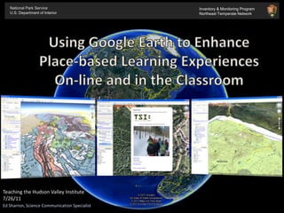
- 1. National Park Service U.S. Department of Interior Inventory & Monitoring Program Northeast Temperate Network Using Google Earth to Enhance Place-based Learning Experiences On-line and in the Classroom Teaching the Hudson Valley Institute 7/26/11 Ed Sharron, Science Communication Specialist
- 2. National Park Service U.S. Department of Interior Inventory & Monitoring Program Northeast Temperate Network What is Inventory & Monitoring? "...to promote and regulate the use of the...national parks...which purpose is to conserve the scenery and the natural and historic objects and the wild life therein and to provide for the enjoyment of the same in such manner and by such means as will leave them unimpaired for the enjoyment of future generations."
- 3. National Park Service U.S. Department of Interior Inventory & Monitoring Program Northeast Temperate Network The Northeast Temperate Network (NETN) was established by the National Park Service to monitor ecological conditions in 13 units of the NPS in seven northeastern states. What is Inventory & Monitoring? - More than 270 parks - Organized into a system of 32 ecoregionalnetworks
- 4. I. Overview Wanted:A method to easily* distribute and display science projects to National Parks and the public. *Easy to build, easy to use, easy to maintain.
- 6. Easy to Use:Flexible, intuitive interface for developer and user.
- 8. III. Two Paths to go down Google Earth ArcGIS Software Base Files Handheld GPS or “Best Guess” method Google Earth Boundaries Boundary.KML Park/School Module.KMZ KML Tool (ex. Xtools; Export to KML 2.5.4) Landmarks Landmarks.KML Share! (web, classroom, etc.) Hand type into GE program Vegetation Vegetation.KML Locations (Lat/Long) Geology Geology.KML Share! (web, classroom, etc.) Other Data Monitoring.KML Paths & Trails
- 9. Let’s Go! IV. Demonstration Google Earth Overview Opening/modifying a KML Using custom icons Saving/organizing your work as a KMZ file ArcMap Shapefile to KML using Export to KML (v. 2.5.5) http://resources.arcgis.com Resources Finding GIS / KML info on the web GE library
- 10. National Park Service Inventory & Monitoring THV Edition
- 11. National Park Service U.S. Department of Interior Inventory & Monitoring Program Northeast Temperate Network Ed Sharron – Science Communication Specialist Watching the Weather A Primer on Climate Change and NETN Monitoring Initiatives
Editor's Notes
- National Park managers across the country are confronted with increasingly complex and challenging issues that require a broad-based understanding of the status and trends of each park's natural resources as a basis for making decisions. They also need to work with other agencies, and communicate with the public to protect park natural systems and native species. A key component of the National Park Service’s mission is to manage park resources “unimpaired for the enjoyment of future generations.” But before you can do that, you need to know just exactly what you have and what condition it is in. So, much like the way that park curatorial staff helps park management understand what kinds of historic and cultural objects they have and the condition that they are in, I&M does the same, except with [click] natural resources rather than cultural. Though these can be one and the same.
- Over 390 NPs, and more than 270 of them contain significant natural resources. [click]These have been divided into a system of 32 eco-regional networks linked by similar geographic and natural resource characteristics. [click] Located in the northeastern corner of the U.S. in the temperate forest biome, the Northeast Temperate Network (NETN) is one of these networks.
- Welcome to I&M and NETN’s mammal tracking program. Today – we all get to be mystery solvers, because that’s what a Tracker is. Every track and trail in the snow is story waiting for us to read it. It reminds me a lot of what those detectives do on all those police TV shows. They use all sorts of fancy equipment to read clues left behind and piece together what happened. There is one TV show in particular that does this. Everyone heard of CSI? Well, I call this TSI…Except we won’t need any fancy equipment, just our senses…