Accurate Surface and Image Data Delivery by Australian LiDAR Experts
1. Atlass-Aerometrex Pty Ltd
4/99 Burnett Street, Buderim, Queensland 4556, Australia | PO Box 1089, Buderim, Queensland 4556, Australia
Contact: Ralph Lante (General Manager) | Mobile: 0484 599340 | Email: survey@atlass.com.au
Tel: 1300 ATLASS | URL: www.atlass.com.au
Our primary focus: Quick delivery of accurate surface and image data to clients
Atlass-Aerometrex is an innovative, Australian owned company delivering high definition surface data, stockpile volume
calculations and aerial imagery. Since 2007 we have successfully serviced a wide range of clients throughout Australia from
sectors including mining, oil and gas, forestry, water, government, natural resource management and land development.
Why use Atlass-Aerometrex?
Customer Service: Most of our work is repeat business from clients who appreciate our quality deliverables, high level of
customer service and fast turn-around. For most surveys, clients receive their data within three working days of capture.
Innovation: Atlass-Aerometrex produces world class products and continues to innovate. We have invested resources
developing software for the production of LiDAR products. LiDAR is a relatively new technology and where we discovered
weaknesses in existing commercial software, we financed the development of our own processing and data management
systems to work in conjunction with established software
Equipment: Atlass-Aerometrex owns and
operates two VULCANAIR P68C aircraft and a
Harrier H68i LiDAR Unit with 80 megapixel
camera.
We also have a backup H56 sensor and access to
hire equipment and aircraft.
Location: We are based on the Queensland
Sunshine Coast and our aircraft operate
throughout Eastern & Central Australia, with
regular surveys conducted in the Hunter Valley,
NSW and the Bowen Basin, QLD.
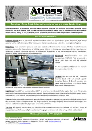
Vulcan Air P68C Aircraft and H68i LiDAR unit owned and operated by Atlass-Aerometrex
Experience: Since 2007 we have carried out 1000’s of aerial surveys and established a regular client base. This provides
opportunities to group client surveys by location to enable shared mobilisation costs. Using aircraft and LiDAR to acquire surface
and image data is cost effective and removes risks associated with ground surveys in hazardous areas.
Capacity: Our in-house expertise combined with the products and services available from the parent company, Aerometrex Pty
Ltd, means we have a full range of spatial and image capabilities, including cutting edge 3D visualisation technologies, with
access to additional aircraft and multiple digital aerial camera platforms.
Accuracy: We regularly deliver surface data with 10cm vertical and horizontal accuracy. Our H68i unit includes a built in 80
megapixel camera which captures high resolution ‘as is’ imagery in conjunction with LiDAR surveys at little additional cost.
Atlass-Aerometrex is ISO 9001 Compliant
2. Atlass-Aerometrex Pty Ltd
4/99 Burnett Street, Buderim, Queensland 4556, Australia | PO Box 1089, Buderim, Queensland 4556, Australia
Contact: Ralph Lante (General Manager) | Mobile: 0484 599340 | Email: survey@atlass.com.au
Tel: 1300 ATLASS | URL: www.atlass.com.au
Our Primary Product Range
Vegetation/Bare Earth comparison Embossed Image Ortho-rectified Image
3D surface model 3D surface model with ortho overlay Surface contours
Standard Products: Our deliverables are driven by client requirements. We build relationships and take time to understand
issues faced by clients to ensure outputs are designed to address those needs.
Quick Delivery: We have built our business by providing a three day turn-around for mine site surveys. This is ideal for clients
mandated to deliver stockpile volume calculations for end of month reporting.
Costs: With our extensive LiDAR survey experience, Atlass-Aerometrex offers a highly competitive fixed price cost model which
offers significant savings to clients while keeping our business sustainable. We never sacrifice quality for cost.
Reputation: Our reputation is our most important asset and we strive to maintain strong relationships. Customers quickly
realise Atlass-Aerometrex is a company that cares about its clients.
Let Atlass-Aerometrex provide a free quote for your next aerial survey
Risk Management: Atlass-Aerometrex utilises Risk Management Systems to control acquisition and processing operations. We
use a variety of internal and external consulting and auditing services to assess our systems and continually improve our
processes and standards. This ensures the highest level of compliance and best practice for safety and quality outcomes.
Peace of Mind: Atlass-Aerometrex is fully covered by Public Liability and Professional Indemnity Insurance. Its aircraft are
maintained to CASA standards and our pilots have extensive LiDAR and aerial photography experience. Data backup and archive
systems prevent loss during data transfer and processing and provide long term storage for client data.
We offer consistent, reliable and accurate products and services to meet client data and image requirements