

Recommended
More Related Content
What's hot
What's hot (7)
Similar to Offshore Eastern Canada brochure
Similar to Offshore Eastern Canada brochure (20)
More from TGS
More from TGS (20)
Recently uploaded
Recently uploaded (20)
Offshore Eastern Canada brochure
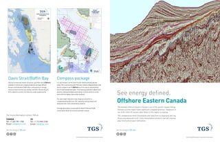
- 1. See the energy at TGS.com © 2015 TGS-NOPEC Geophysical Company ASA. All rights reserved. See energy defined. Offshore Eastern Canada 20 km TGS believes offshore Eastern Canada is one of the world’s newest energy frontiers and the region holds significant untapped potential. Expansion of our multi-client 2D seismic data library in this region is ongoing. TGS complements these investments with data from its expansive well log library and advanced multi-client interpretation products that will improve play, trend and prospect delineation.
- 2. See the energy at TGS.com Labrador Sea - Geochemical Sampling 2014 The Labrador Sea Sampling 2014 in partnership with VBPR and PGS is in the province of Newfoundland and Labrador. This study covers an area of 1,200 km’s along the coast. Data acquisition commenced during Q3 2014, with initial data available to clients Q2 2015. Deliverables include project overview, offshore operations, analytical results, and conclusions. Digital data will be provided, including navigation data, raw analytical results and original lab reports. A modern regional broadband 2D & 3D seismic database In partnership with PGS’ Geostreamer technology and complimentary TGS hi-fidelity imaging, our data is available as both near-year Fast Track, final PSTM and associated AVO angle sub-volumes with gravity data also available. We currently have two new multi-client 3D surveys in Flemish Pass Basin and NE Newfoundland as well as over 171,000 km’s of 2D data, with an additional 30,000 km’s acquired in the 2015 season from offshore Canada. The 2D’s are from Baffin Bay to Nova Scotia of which 110,000 km’s from Newfoundland and Labrador, where we are uniquely positioned to help de-risk your participation in the Nomination/Release of new sectors and parcels from the new C-NLOPB new land tenure system. Advanced multi-client interpretation products TGS has generated an interpretation project, including sequence stratigraphic and play fairway analysis, utilizing the new TGS Labrador Sea seismic survey data and available well data. This project is complete and ready for license. Work has also begun on a similar project to the south, covering NE Newfoundland and Flemish Pass, to be completed by the end of March 2015. Well data TGS offers the industry’s largest digital well log library, including the only comprehensive advanced well log package for offshore Eastern Canada wells. Well logs (LAS+), Directional Surveys (DS+), Check-Shot Surveys (CS+), MUDLAS/MUDLITH, Reports and Deepwater Borehole Data, for over 500 offshore wells, are all available for immediate delivery. Data is available for individual wells of interest, as a complete package, or bundled with your TGS seismic and interpretation data. 2013 Labrador South 2013 Eastern Newfoundland 2014 Eastern Newfoundland 2015 Labrador South 2015 South Eastern Newfoundland NL13-01LS 4 year NL14-01EN 2 year NL14-02EN 2 year NL15-01LS 4 year NL15-01SEN 4 year Call for nominations (Areas of Interest) 1 Dec. 2013 1 Dec. 2013 1 Sept. 2014 1 Feb. 2015 1 Feb. 2015 Call for nominations (AOI) closes 15 Mar. 2014 15 Mar. 2014 28 Nov. 2014 30 Apr. 2015 30 Apr. 2015 Sector identification 15 Apr. 2014 15 Apr. 2014 17 Feb. 2015 1 Jul. 2015 1 Jul. 2015 Call for nominations (Parcels) 15 Sept. 2016 15 Sept. 2014 15 Sept. 2015 1 Feb. 2018 1 Feb. 2018 Call for nominations (Parcels) closes 31 Oct. 2016 31 Oct. 2014 31 Oct. 2015 15 Mar. 2018 15 Mar. 2018 Call for bids 1 Mar. 2017 1 Mar. 2015 Feb./Mar. 2016 1 Aug. 2018 1 Aug. 2018 Call for bids closes 15 Nov. 2017 15 Nov. 2015 1 Nov. 2016 15 Nov. 2019 15 Nov. 2019 Issuance of licenses 15 Jan. 2018 15 Jan. 2016 15 Jan. 2017 15 Jan. 2020 15 Jan. 2020
- 3. See the energy at TGS.com [p [p[p [p[p[p[p[p[p[p[p[p [p [p[p [p[p[p [p [p[p [p[p[p[p [p [p [p [p[p [p[p[p[p[p[p[p[p[p [p [p [p[p[p[p[p [p[p[p[p [p [p[p [p[p[p [p[p[p[p[p [p [p[p[p[p[p[p [p[p [p[p [p[p[p[p[p[p[p[p[p[p[p [p[p[p[p[p[p[p[p[p[p [p[p[p [p[p[p [p[p[p[p[p [p [p[p [p [p [p [p[p [p[p [p [p[p[p[p[p [p [p[p [p [p[p [p [p [p [p [p [p[p[p [p[p[p[p[p[p[p[p[p[p[p [p [p[p [p[p[p[p[p[p[p[p [p[p [p[p[p [p[p [p[p [p[p [p[p[p [p[p[p[p [p[p [p[p[p [p[p [p[p [p [p[p [p[p [p[p [p[p [p[p [p[p[p[p[p [p[p [p[p [p[p [p [p[p [p[p [p[p [p[p [p[p[p[p [p[p [p[p [p[p [p[p [p[p[p[p[p[p[p[p[p[p[p[p [p[p[p [p[p[p[p[p[p [p [p [p [p [p [p [p[p [p[p [p[p [p[p [p[p !P !P !P!P!P!P !P!P!P!P !P !P !P !P !P !P !P !P !P !P!P !P !P !P !P !P !P !P!P!P !P !P !P!P!P!P!P!P!P!P!P !P!P!P!P!P !P !P!P !P!P !P!P!P !P!P!P !P!P!P !P!P!P !P!P !P !P!P !P !P!P!P!P!P!P!P!P!P!P!P!P!P!P!P!P!P!P!P!P!P!P !P !P!P!P !P!P!P!P!P!P!P!P!P!P!P!P!P!P!P!P!P!P!P!P!P!P !P!P !P !P!P!P!P!P!P!P!P !P!P !P!P !P !P!P!P!P !P!P!P!P!P!P!P !P !P!P!P!P!P !P!P!P!P!P!P !P!P!P!P!P!P!P!P !P !P!P!P!P!P!P!P!P!P!P !P!P !P!P!P !P!P !P!P!P !P!P!P !P!P !P !P !P !P!P !P !P !P !P!P !P!P !P!P !P!P !P !P !P !P !P !P!P !P !P !P!P !P!P!P!P !P!P !P!P!P !P !P !P !P!P !P !P!P!P!P !P !P !P!P!P!P !P !P!P !P !P!P !P !P!P !P !P !P !P!P !P !P !P !P !P !P !P!P !P !P!P !P!P !P!P!P!P !P!P !P!P!P!P!P !P!P!P!P!P!P!P!P!P!P!P!P!P !P!P!P!P!P!P!P !P!P!P!P!P!P!P!P!P!P!P!P!P!P!P !P!P !P!P!P!P!P!P!P!P !P !P!P !P !P!P !P !P!P !P !P !P!P !P!P !P!P !P !P!P !P!P!P!P!P !P!P!P !P!P !P!P !P !P!P!P!P!P!P!P !P!P!P!P!P!P!P!P!P!P!P!P!P!P!P!P!P!P!P!P!P!P!P!P!P!P!P!P!P!P!P!P!P!P!P!P!P!P!P!P!P!P!P!P!P!P!P!P!P!P!P!P!P!P!P!P!P!P!P!P!P!P!P!P!P!P!P!P!P!P!P!P!P!P!P!P !P!P !P !P !P!P!P !P!P !P !P!P!P!P!P!P!P !P!P!P!P !P!P!P !P !P!P !P!P!P !P !P!P !P !P!P !P!P!P !P!P !P !P!P!P !P!P !P !P !P !P!P !P !P !P !P !P!P!P!P !P !P !P !P !P !P !P !P !P !P!P !P!P !P !P!P!P !P !P!P!P !P !P !P !P !P !P !P !P !P!P !P!P!P !P!P!P NL02-LS NL01-SEN 02 08 01 05 04 06 07 03 11 10 09 NL02-EN EL2433 EL2434 EL2423 EL2424 EL2425 EL2426 EL2429 EL2430 EL1133 EL1131 EL1136 EL1118 EL1132 EL2431 EL1130 EL2432 EL1135 EL1125 EL1108 EL1106 EL1107 EL1127 EL1116 EL1134 EL1123 EL1126 EL1129 EL1121 EL1110 EL1120EL1128 EL1114 EL1119 NL01-LS Q u e b e c N e w f o u n d l a n d a n d L a b r a d o r N o v a S c o t i a N e w B r u n s w i c k S a i n t - P i e r r e e t M i q u e l o n P r i n c e E d w a r d I s l a n d G r e e n l a n d N u n a v u t Sources: Esri, GEBCO, NOAA, National Geographic, DeLorme, HERE, Geonames.org, and other contributors 30°0'0"W35°0'0"W40°0'0"W 45°0'0"W 45°0'0"W 50°0'0"W 50°0'0"W 55°0'0"W 55°0'0"W 60°0'0"W 60°0'0"W 65°0'0"W 65°0'0"W70°0'0"W 62°30'0"N60°0'0"N 60°0'0"N 57°30'0"N 57°30'0"N 55°0'0"N 55°0'0"N 52°30'0"N 52°30'0"N 50°0'0"N 50°0'0"N 47°30'0"N 47°30'0"N 45°0'0"N 45°0'0"N 42°30'0"N 42°30'0"N 40°0'0"N 40°0'0"N EAST COAST CANADA OFFSHORE 2D 0 40 80 120 160 20020 Kilometers µ0 20 40 60 80 100 Miles 1:3,750,000Scale: Projection: WGS 1984 UTM Zone 21N DISCLAIMER: This map is intended for representational purposes only. TGS is not responsible for any errors or omissions which may be presented on this map Nova Scotia NS109Nova Scotia NS109 Laurentian ChannelLaurentian Channel LC100LC100 Nova Scotia NS100Nova Scotia NS100 Nova Scotia InfillNova Scotia Infill Extension NS103Extension NS103 Laurentian ChannelLaurentian Channel Infill LC105Infill LC105 Orphan BasinOrphan Basin OB107OB107 Orphan BasinOrphan Basin Infill OB102Infill OB102 NE Newfoundland Slope 2012-2015NE Newfoundland Slope 2012-2015 Labrador Sea 2011-2012Labrador Sea 2011-2012 Labrador Shelf LS108Labrador Shelf LS108 Labrador Sea Deep Basin 2013Labrador Sea Deep Basin 2013 Nova Scotia DatasetsNova Scotia Datasets Post Stack Time MigrationPost Stack Time Migration Post Stack Depth MigrationPost Stack Depth Migration Renaissance Depth MigrationRenaissance Depth Migration Labrador Sea 2014Labrador Sea 2014 Seafloor and Seep SamplingSeafloor and Seep Sampling Southeast Grand Banks 2015Southeast Grand Banks 2015 Southeast Grand Banks 2014Southeast Grand Banks 2014 Tail of the Bank NF101Tail of the Bank NF101 South LabradorSouth Labrador Sea 2014-2015Sea 2014-2015 Some Surveys In Cooperation With: Last Update: July 16, 2015 Exploration Licenses Production Licenses Significant Discovery Licenses Call for Bids (NL15-01EN) NL Sectors World Exclusive Economic Zone (EEZ) !P TGS/PGS Proposed 2D 2015 TGS/PGS Proposed 3D 2015 TGS/PGS Owned 2D Data TGS Owned 2D Data TGS Managed 2D Data TGS/PGS/VBPR Seafloor & Seep Sampling TGS Well Data [p NE Newfoundland 3D 2015NE Newfoundland 3D 2015 South FlemishSouth Flemish Pass 3DPass 3D South LabradorSouth Labrador Sea 3D 2015Sea 3D 2015
- 4. See the energy at TGS.com © 2015 TGS-NOPEC Geophysical Company ASA. All rights reserved. CANADA Tel: +1 403 781 1700 Email: info@arcis.com US Tel: +1 713 860 2100 Email: info@tgs.com Compass package For new entrants into the more Frontier Newfoundland/Labrador areas, TGS in partnership with PGS have created a Regional Basin wide seismic subset of over 11,000 km’s as a first step to understanding this virtually unexplored region. Thus reducing evaluation legwork and decision-making timetables and helping to unlock and focus on the areas with the highest hydrocarbon potential. Pre-stack depth migrations help imaging clarity which is complemented by data from TGS’ expansive well log library, and advanced multi-client interpretation products. Package deliverables include both Kirchhoff PSTM and PSDM, interpretation (faults & horizons) and basin outlines. Davis Strait/Baffin Bay TGS has an extensive modern 2D seismic grid. More than 2,700 km’s in Canadian waters available to license over a highly prospective acreage offshore Nunavut and Greenland. Baffin Bay’s undiscovered oil and gas resources have a world class ranking, and TGS’s 2D grid can give Arctic explorers a prime, first look at an under-explored area. Nunavut Québec Nova Scotia Newfoundland and Labrador Prince Edward Island Kommuneqarfik Sermersooq Kommune Kujalleq 3180 -EC L 5170 -NFP 3105 -ECL 2176 -EC L 5350 -NFP 3011 -ECL 5230 A-N FP 4333 -NFP 4231 -NFP 4775 -NFP 2170 -EC L 502 4-NF P 5470 A-N FP 2162 -EC L 4001 -NFP 531 8-N FP 2066 -EC L 516 2-NF P 4461 -NFP 4451 -NFP 4441 -NFP 4421 -NFP 4431 -NFP 4391 -NFP 4401 -NFP 4201 -NFP 4381 -NFP 4345 -NFP 4315 -NFP 4287 -NFP 4371 -NFP 4281 -NFP 4347 -NFP 4261 -NFP 4283 -NFP 4323 -NFP 4339 -NFP 4271 -NFP 4221 -NFP 5112 -NF P 4351 -NFP 4735 -NFP 3121 A-EC L 508 0-N FP 2156 -EC L 2076 -EC L 3055 -ECL 500 0-NF P 5470B-NFP 3021 -ECL 2146 -EC L 4241 -NFP 3029 -ECL 547 0-NF P 523 0-NF P 2140 -EC L 2134 -DLS 5300 -NFP 5340 -NFP 5270 -NFP 5320 -NFP 5360 -NFP 5380 -NFP 5400 -NFP 531 0-NF P 5330 -NFP 2130 -EC L 568 0-N FP 562 0-N FP 5280 -NFP 3041 -ECL 2073 -EC L 2062 -EC L 2120 -EC L 5260 -NFP 2034 -EC L 5250 -NFP 5240 -NFP 2070 -EC L 207 8-DL S 2110 -EC L 3121 -ECL 2092 -EC L 3001 -ECL 2056 -EC L 3051 -ECL 5050 -NFP 4631 -NFP 2080 -EC L 2098 -DLS 3055 A-EC L 4211 -NFP 3067 -ECL 3073 -ECL 2052 -DLS 3113 -DLS 2100 -EC L 4575 -NFP 4157 -NFP 4361 -NFP 5710 -NFP 5290 -NFP 2050 -EC L 2040 -EC L 414 1-N FP 5650 -NFP 4191 -NFP 5530 -NFP 5590 -NFP 4247 -NFP 4521 -NFP 4305 -NFP 4471 -NFP 2030 -EC L 2020 -EC L 2000 -EC L 2008 -EC L 4411 -NFP 3061 -ECL 3065 -ECL 3071 -ECL 3077 -ECL 3085 -DLS 3083 -ECL 3111 -ECL 3091 -ECL 3097 -ECL 3101 -ECL 3180 -EC L 5170 -NFP 3105 -ECL 2176 -EC L 5350 -NFP 3011 -ECL 5230 A-N FP 4333 -NFP 4231 -NFP 4775 -NFP 2170 -EC L 502 4-NF P 5470 A-N FP 2162 -EC L 4001 -NFP 531 8-N FP 2066 -EC L 516 2-NF P 4461 -NFP 4451 -NFP 4441 -NFP 4421 -NFP 4431 -NFP 4391 -NFP 4401 -NFP 4201 -NFP 4381 -NFP 4345 -NFP 4315 -NFP 4287 -NFP 4371 -NFP 4281 -NFP 4347 -NFP 4261 -NFP 4283 -NFP 4323 -NFP 4339 -NFP 4271 -NFP 4221 -NFP 5112 -NF P 4351 -NFP 4735 -NFP 3121 A-EC L 508 0-N FP 2156 -EC L 2076 -EC L 3055 -ECL 500 0-NF P 547 0B- NFP 3021 -ECL 214 6-EC L 4241 -NFP 3029 -ECL 547 0-NF P 523 0-NF P 214 0-EC L 2134 -DLS 5300 -NFP 5340 -NFP 5270 -NFP 5320 -NFP 5360 -NFP 5380 -NFP 5400 -NFP 531 0-NF P 5330 -NFP 2130 -EC L 568 0-N FP 562 0-N FP 5280 -NFP 3041 -ECL 2073 -EC L 2062 -EC L 2120 -EC L 5260 -NFP 2034 -EC L 525 0-NF P524 0-NF P 2070 -EC L 207 8-DL S 2110 -EC L 3121 -ECL 2092 -EC L 3001 -ECL 2056 -EC L 3051 -ECL 505 0-NF P 4631 -NFP 2080 -EC L 2098 -DLS 3055 A-EC L 4211 -NFP 3067 -ECL 3073 -ECL 2052 -DLS 3113 -DLS 2100 -EC L 4575 -NFP 4157 -NFP 4361 -NFP 5710 -NFP 529 0-NF P 2050 -EC L 2040 -EC L 4141 -NFP 5650 -NFP 4191 -NFP 5530 -NFP 5590 -NFP 4247 -NFP 4521 -NFP 4305 -NFP 4471 -NFP 2030 -EC L 202 0-EC L 2000 -EC L 200 8-EC L 4411 -NFP 3061 -ECL 3065 -ECL 3071 -ECL 3077 -ECL 3085 -DLS 3083 -ECL 3111 -ECL 3091 -ECL 3097 -ECL 3101 -ECL Greenland St . Pierre & Miquelon Canada KINGITTOQ CAIRN ENERGY PLC SALLIIT CAIRN ENERGY PLC SAQQAMIUT CAIRN ENERGY PLC UUMMANARSUAQ CAIRN ENERGY PLC EL1115 HUSKY ENERGY INC EL1130 ROYAL DUTCH SHELL EL1133 ROYAL DUTCH SHELL EL2432 BP PLC EL2431 BP PLC EL2433 BP PLC EL1106 HUSKY ENERGY INC EL1107 IEC EL1108 HUSKY ENERGY INC EL1118 CONOCOPHILLIPS EL1125 STATOIL ASA EL1132 ROYAL DUTCH SHELL EL1131 ROYAL DUTCH SHELL EL2434 BP PLC EL1109 CHEVRON CORPORATION PL2901 EN CANA CORPORATION EL1105 CORRI DOR RESOURCES EL1097R SHOAL P OINT EN ERGY L EL1129 ROYAL DUTC H SHELL SDL1028 HUSK Y EN ERGY IN C SDL1025 HUSK Y EN ERGY IN C SDL2120C ROYAL DUTCH SHELL PL2903 EX XON MOBIL CORP SDL2276A ROYAL DUTC H SHELL PL2902 EN CANA CORPORATION SDL2255Q EX XON MOBIL CORP SDL2121 ROYAL DUTCH SHELL SDL2255E EX XON MOBIL CORP PL1005 EX XON MOBIL CORP EL1100 STATOIL ASA SDL1046 HUSK Y EN ERGY IN C SDL1031 HUSK Y EN ERGY IN C SDL1049 STATOIL AS A EL1117 HUSK Y EN ERGY IN C SDL1001 EX XON MOBIL CORP EL1122 STATOIL ASA EL1101 STATOIL AS A EL1093 EX XON MOBIL CORP EL1090R HUSK Y EN ERGY IN C EL1110 HUSK Y EN ERGY IN C EL1099 HUSK Y EN ERGY IN C SDL0197 EX XON MOBIL CORP SDL1009 SUNCOR EN ERGY IN C SDL1036 SUNCOR EN ERGY IN C PL1007 HUSK Y EN ERGY IN C SDL1029 HUSK Y EN ERGY IN C SDL1048 STATOIL ASA SDL0185B SUNCOR EN ERGY IN C SDL0187 SUNCOR EN ERGY IN C EL1123 STATOIL AS A EL1120 PTARM IGAN RESOURCES EL1126 STATOIL AS A EL1128 PTARM IGAN RESOURCES EL1116 EN EGI INC. SDL005 HUSK Y EN ERGY IN C PL2910 EN CANA CORPORATION EL1134 HUSK Y EN ERGY IN C EL2427 ROYAL DUTC H SHELL SDL2255A2 EX XON MOBIL CORP PL2906 EX XON MOBIL CORP SDL2298 ROYAL DUTCH SHELL SDL2255P EX XON MOBIL CORP SDL2286 EX XON MOBIL CORP SDL2299A EX XON MOBIL CORP SDL0082 BP P LC SDL2283B EX XON MOBIL CORP SDL2255D EX XON MOBIL CORP SDL2255G1 EX XON MOBIL CORP EL2428 ROYAL DUTC H SHELL SDL2277B EX XON MOBIL CORP SDL2259 EX XON MOBIL CORP SDL1008 HUSK Y EN ERGY IN C SDL1002 EX XON MOBIL CORP SDL1013 IMP ER IAL OIL RES LTD PL1001 EX XON MOBIL CORP PL1002 SUNCOR EN ERGY IN C EL1111 HUSK Y EN ERGY IN C EL1114 HUSK Y EN ERGY IN C SDL1003 EX XON MOBIL CORP SDL1037 SUNCOR EN ERGY IN C SDL1011 HUSK Y EN ERGY IN C SDL1010 SUNCOR EN ERGY IN C SDL1030 HUSK Y EN ERGY IN C EL1124 STATOIL AS A EL1112 STATOIL AS A SDL0185A SUNCOR EN ERGY IN C SDL0203 HUSK Y EN ERGY IN C SDL1047 STATOIL AS A EL1121 HUSK Y EN ERGY IN C EL1119 CONOCOPHILLIP S EL1127 PTARM IGAN RESOURCES EL1070 SHOAL P OINT EN ERGY L NL 13-03-01 NL 13-03-02 NL 13-03-03 NL 13-03-04 NL 13-02-01 NL 13-02-02 NL 13-02-03 NL 13-02-04 NL 13-01-01 NL01-EN NL01-LS NL14-01-01 Jeanne d’Arc Eastern Newfoundland South Eastern Newfoundland North Eastern Newfoundland Labrador South Labrador North Southern Newfoundland 1 2 3 4 35°W36°W37°W38°W39°W40°W41°W42°W 43°W 43°W 44°W 44°W 45°W 45°W 46°W 46°W 47°W 47°W 48°W 48°W 49°W 49°W 50°W 50°W 51°W 51°W 52°W 52°W 53°W 53°W 54°W 54°W 55°W 55°W 56°W 56°W 57°W 57°W 58°W 58°W 59°W 59°W 60°W 60°W 61°W 61°W62°W63°W64°W 62°N61°N 61°N 60°N 60°N 59°N 59°N 58°N 58°N 57°N 57°N 56°N 56°N 55°N 55°N 54°N 54°N 53°N 53°N 52°N 52°N 51°N 51°N 50°N 50°N 49°N 49°N 48°N 48°N 47°N 47°N 46°N 46°N 45°N 45°N 44°N 44°N 43°N 43°N 42°N 42°N 41°N 41°N40°N Compass Package: 11,060 km 2014 Planned 2D Seismic: 31,200 km Labrador Sea: 22,167 km NE Newfoundland Flemish Pass: 22,489 km Vintage TGS 2D Seismic World Maritime Boundaries Newfoundland/Labrador Land Tenure Regions Sector NL01-LS Sector NL01-EN Call for Bids Held Block 2015 Bid Year Forecast 2016 Bid Year Forecast TGS-NOPEC has used its best efforts to produce this map free of errors, utilization of same shall be at the sole risk of the user. TGS-NOPEC assumes no liability or responsibility for reliance placed thereon. OFFSHORE CANADA COMPASS PACKAGE N:PublicGISArc Map DocumentsCanadaCompassPackageCanada_Offshore_CompassPackage_Alt1.mxd July 24, 2014 Projection: WGS 1984 UTM Zone 21N 0 75 150 225 30037.5 Kilometers TGS believes offshore Eastern Canada is one of the world’s newest energy frontiers and the region holds significa untapped potential. Expansion of our multi-client 2D seismic data library in this region is ongoing. Our Compass package combines extensive, quality 2D seismic data coverage with robust interpretation tools to he unlock area hydrocarbon potential in this area. Seismic data is complemented by data from TGS’ expansive well log library, and advanced multi-client interpretation products that will improve play, trend, and prospect delineation. Package deliverables include both Kirchhoff PSTM and PSDM, interpretation (faults & horizons) and basin outlines The Compass package is in partnership with PGS. Compass package See the energy at TGS.com © 2014 TGS-NOPEC GEOPHYSICAL COMPANY ASA. ALL RIGHTS RESERVED. For more information contact TGS at: