Beginners Guide to TikTok for Search - Rachel Pearson - We are Tilt __ Bright...
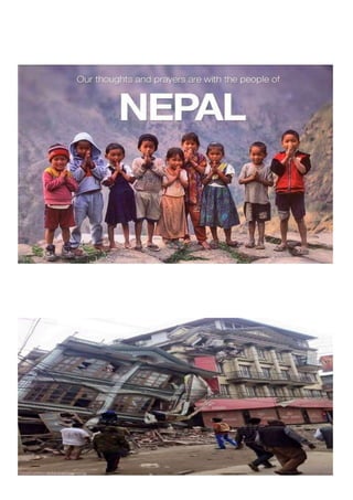
2015 nepal earthquake
1.
2. 2015 Nepal earthquake
Kathmandu
Date 25 April 2015
Origintime 11:56:26NST
Magnitude 7.8Mw
[1]
or8.1Ms
Depth 8.2km(5.1mi)
Epicenter 28.147°N84.708°ECoordinates: 28.147°N84.708°E
Type Thrust
Areasaffected Nepal
India
China
Bangladesh
Totaldamage ≈$5 billion(about25%ofGDP)
Max.intensity IX (Violent)[1]
3. Aftershocks 7.3Mw on12Mayat12:50
6.7Mw on26April at 12:54
417aftershocksof4Mw andaboveasof25Nov2015
Casualties 8,857deadinNepal (officially) and8,964intotal 21,952injured(officially)
Nepal earthquake...
The April 2015Nepalearthquake(alsoknownastheGorkhaearthquake)killedover
8,000peopleandinjuredmorethan21,000.Itoccurredat11:56Nepal StandardTimeon
25 April,withamagnitudeof 7.8 or8.1MsandamaximumMercalliIntensityofIX
(Violent).Itsepicenterwaseastof thedistrict ofLamjung,anditshypocenterwasat a
depthofapproximately8.2 km(5.1mi).Itwastheworstnaturaldisasterto
strikeNepal sincethe1934Nepal–Biharearthquake.
The earthquaketriggeredanavalancheonMount Everest,killingatleast 19, makingApril
25,2015thedeadliestdayonthemountaininhistory. Theearthquaketriggeredanother
hugeavalancheintheLangtangvalley,where250peoplewere reportedmissing.
Hundredsofthousandsofpeopleweremadehomelesswithentirevillagesflattened, across
manydistrictsofthecountry.Centuries-oldbuildingsweredestroyedatUNESCOWorld
Heritagesites intheKathmanduValley,includingsomeattheKathmanduDurbarSquare,
the PatanDurbarSquare,theBhaktapurDurbarSquare,theChanguNarayanTempleand
4. the SwayambhunathStupa.Geophysicistsandotherexpertshadwarnedfordecadesthat
Nepalwasvulnerabletoadeadlyearthquake,particularlybecauseof itsgeology,
urbanization,andarchitecture.
Continued aftershocksoccurredthroughout Nepal attheintervalsof15–20minutes,with
oneshockreachingamagnitudeof 6.7on26Aprilat 12:54:08NST.Thecountryalsohada
continuedriskoflandslides.
A majoraftershock occurredon12May2015at12:50NSTwithamomentmagnitude(Mw)
of 7.3.TheepicenterwasneartheChineseborderbetweenthecapitalof Kathmanduand
Mt.Everest.Morethan200peoplewerekilledandmorethan2,500wereinjuredbythis
aftershock.
Nepal’sEverestsinking7.9EarthquakeofApril25-
2015:Himalayanwarning
The massiveNepal earthquakeof7.9intensity(Richterscale)onApril 25,2015withepicenter77kmnorth-
westofKathmanduinNepalis amajornoteworthyeventinthe Himalayaswhich also has warnings for
whatisinstoreforfuture.Theearthquakeleft amajortrailofdestruction affecting over 20 districts of
Nepal,ofwhich8millionlivein11severelyaffecteddistricts.Besides,itaffectedareasofIndia (Bihar, UP,
W Bengal,Sikkim,Assam),Bangladesh,Tibet.Theearthquakehas now been given the official name of
Gorkha Earthquake.
The intensityofthisearthquake isgenerallycomparablewiththe2005earthquakeinKashmirwhichkilled
over86,000inPakistanandIndia.ThisisthelargestearthquakeinNepalsincetheBihar-Nepalearthquake
of 1934.The1934earthquakewas8.3magnitudeandcenterednear Mount Everest, more than 10,000
people were killed.
5. IndiaMeteorologyDepartment[1],providesa listof85aftershockstillMay4,2015aftertheearthquake of
April 25, 2015. The list is given in Annexure 1.
Arniko Highway landslide Photo from E Kantipur
Impacts in Nepal
AccordingtoNepal Government,7557 people havedied,14536areinjured,10718government buildings
are totallydestroyedand14741governmentbuildingsarepartiallyaffected.191058private buildings are
destroyedand175162aredamaged.Totalaffectedpopulationis2 6494504.Thefigures continue to rise.
Kathmanduvalleya meterupatthe costofMountEverest!Accordingto scientists from the European
SpaceAgency,postearthquake,theKathmanduValleyareaofabout120kmby50kmhasrisen by up to a
meter.A24hourGPSsurveyconfirmedthatindeedthevalleyaltitudeisup80cmfrom1338mto1338.8 m
aftertheearthquake(Kathmanduisnow80cmtallerTheTimesofIndia,May7,2015).The Mount Everest
has sunkbyoneinchandareasnorthhavesettledbelowtheiroriginal heightprobably because the land
belowloosenedup,asbuiltupstrainwasreleased.Thatpossiblytriggeredthebase camp avalanche that
killed 22 people.
The Hindureportedthatthe Kathmanduvalleyismorevulnerabletodamage asunderneaththevalley is a
300 mdeeplayerofblackclay,theremnantsofaprehistoriclake,whichamplifies the damage caused by
severe earthquakes.
The damage wasworseinthe regionintheregionsofthequake,intheGorkha-Lamjungregion, the Burhi
GandakivalleyandGaneshHimal. Kathmanduwasbadlyhitbecauseitisbuiltonoldlakesediments that
are highlysusceptibletoshaking.AstheHimalayasrise,theriverswill cutbackbyheadwallerosion. Some
largeriverslikeArun(atributaryofKosi)have cuta longwaynorthbeyondthemainHimalayan axis. But
courseofthe riverstakelongertochangeandisnotimmediatelyvisible.Theactivethrustfaultdips about
5-10degreestothenorthoftheHimalayanfront.Theearthquakedepth,about15km below the Gorkha
regionwasonthis rupture.Themaximumamountofslipalongthefaultthatrupturedmayhave been 4-5
m but the fault did not break to the surface.
A peculiarityofthisNepalEarthquakeis thatalmostallthe aftershocksandmostofthe damage has been
causedinareastotheEASTofthe epicenter of the earthquake, very little to the west. I have been
wonderinghowcanthisbeexplainedandaskinga numberofpersons,buthaveyetto find a satisfactory
reply.AsnotedbyDavidPetleyinhisblog onApril 26,2015, “In the case of the Nepal Earthquake the
6. ruptureappearstohave propagatedmostlytowardstheeastof the epicentre, not to the west. So the
epicentreitselfisatthewestendoftheearthquakeaffectedzone. ThisisclearfromtheUSGS shakemap.”
NoteworthypositivesTheearthquakeresponsehasthrown up some positives too. The effort of the
commonpeopleintheimmediateimpactzone has been praiseworthy at many places. The prompt
responseofIndiangovernment,includingair-force,NDRFandothershasbeenacknowledgedbytheNepal
government.Indianstategovernmentshave alsobeenprovidingusefulhelp to the affected people and
others.Indianandinternational mediahavebeentryingtheirbesttogivea true picture of the situation.
THE QUAKEEXPOSEDMANYFAILURES Inthe aftermathoftheearthquake, a number of failures of
India’s response system were exposed.
DysfunctionalNDMATheNationalDisasterManagementAuthorityhasbeen dysfunctional for many
months,sinceallthemembers(exceptone)ofthe NDMAresignedin June2014 after Modi government
tookover.ItwasonlyinJanuary2015that three of the eight new members were appointed. In the
meantime,the annualdrillofthedisastermanagementthisyearwascancelled.Thisdoesnot sound great
for India’spremierdisastermanagementinstitute.AformermemberoftheNDMAand senior official of
NDRF confirmed this situation to this author.
QuakeMonitoringNetworkinComa:TheHindustanTimesreported,“Thecountry’snetworkof“ground-
motion”detectors,thebackboneofquakemonitoring,hasnotbeenworkingfornearlyeightmonths now
duetoa bureaucraticbottleneck,puttingmillionsoflivesatrisk.”Groundorstrong-motion detectors —
alsocalledaccelerographs— arecriticalastheyserveasthebasisfor India’s earthquake early-warning
system,buttheywerefoundtobelyingidleinthe aftermathoftheNepalIndia’snetwork of 300 strong -
motionsensors,installedatcriticalpointsacross14states,coverhigh-riskseismiczonesVandIVaswellas
someheavilypopulatedcitiesinzone III.These importeddevices,whichmeasure movement generated
duringa quakeandalsohelpidentifyareasthatcouldbevulnerable,costRs10crore toinstallandabout Rs
1 crorea yeartomaintain.InSept2014,thegovernmentmovedthe project out of IIT-Roorkee after it
decidedtocarveoutaseparateseismologicalorganisationfromtheIndia meteorological department.
FundingwascutoffinSeptember2014,withoutanalternativearrangementinplace. When this author
askedveryseniorofficialofgovernmentofIndiaaboutthis,heconfirmedthatyes,therehasbeenproblem
in transitiontoGeological SocietyofIndia,buthopedthattheinstrumentswererecording the readings
and that the readings in any case will be useful at a latter date.
IndiahasfewerGPSstationsthanNepal The IndianExpressreportedthatNepalhasanetworkof 300-400
GPSinstrumentsspreadovertheentirefaultline,whileIndia does not have more than 25-30 that are
permanentlydeployed.Theseinstrumentshelpmonitorthetectonicmovements.Atopearthquakeexpert,
RogerBilhamofColoradoUniversity (US)saidthatNepalinfactisbetterpreparedthanIndiatowithstand
strong earthquakes since it has started taking remedial measures several years back.
Lackofactionablelandslidemapsduringdisaster Whileourgovernmentandvariousagencies talk about
thisprowessofRemoteSensingimagesprovidinginformation, what was required in the immediate
aftermathoftheearthquakewasquickinformation from this source about the possible sites where
7. earthquakehadledtolandslidessothatrescueandreliefactioncan be taken up. This was particularly
importantwhencommunicationandtransportwascompletelydisruptedintheremoteareas. However,
we didnotseeanyusefulactionable inputsinthisregard from India’s (or for that matter from other
countries) remote sensing agencies.
No PostDisasterreportingOneofthe key way to learn lessons for future from disasters is to have
comprehensivereportingaboutwhathappenedatthedisasterandwhoplayedwhatrole.Unfortunately
we havenosuchcomprehensivereportabouteventheUttarakhand disaster of June 2013 that killed
between6500and30000peopleasperdifferentestimates.NDRFdirectorGeneralandaformermemberof
NDMAwhowere withme ataLokSabhaTVdiscussionaftertheApril25earthquakeagreedweneedsuch
reports
It isgoodtoseethat UnionMinistryofEarthScienceshavedecidedtoputinplacea topological modelfor
Indiatounderstandearthquakesbetter.The governmentisalsogoingtosetup10seismicstationseachin
NepalandMyanmar.DrShaileshNayak,Secretary,UnionMinistryofEarthScienceshopesthatthiswill
helpunderstandphysicsofearthquake,firststepinmovetowardspredictingearthquakes.Thereareover
66 activefaultsinIndia,theHimalayanbeltisdissectedby15majoractivefaults.Indiacurrentlyhas84
seismicstations,andhasplacedorderstoincreasethisnumberto130.
DAMAGEDHYDROPOWERPROJECTSExperts havebeenwarningaboutthedanger of building large
damsintheseismicallyunstableHimalayas, where the collapse of large infrastructure can magnify
devastationin mountains. Such role of the projects in Uttarakhand flood disaster in June 2013
was confirmedbytheExpertBody(chairedbyDr Ravi Chopra) appointed by the Union Ministry of
EnvironmentandForests(MoEF)followingthe SupremeCourt order of Aug 2013 and also as per the
affidavit of the MoEF in the Supreme Court in December 2014.
Deaths,damagesatRasuwagadi HEP The huge earthquake caused serious damage to the 111 MW
RasuwagadhiHydropowerstation,whicha Chinesecompany startedtobuildtwoyearsago,67kilometers
westofthequake’sepicenterinRasuwadistrictofCentralDevelopmentRegion.TheChinaThree Gorges
Company&media reportedthattwoChinese&fourNepaleseworkerswerekilledinthequake andseveral
wereseriouslyinjured.OnApril28,achildand24otherpeoplewereairliftedbyhelicoptertonearbyJilung
CountyinChina’sTibetAutonomousRegion,accordingtothequake reliefheadquarters in Jilung. The
dam itselfhassufferedseriousdamages. TheRasuwagadhi Damwasbeingbuiltonthe upperTrishuliRiver
in a veryremotecornerofNepalneartheTibetanborder.Thedam’sreservoir is to stretch back 25 km,
holdingback1500millioncubicmetresofwater(these figuresareTheEcologistarticle byMichaelBuckley,
if anyonehascontraryfigures,pl letusknowwithreference).WriterMichael Buckley asks in his article
in TheEcologist:“Rasuwagadhi Damwasdescribedasseverelydamagedbythequake.Andthatbringsup a
nightmarescenario.Whatifthatdamwereupandrunning,withahugereservoir sitting behind it? … It
would be a Fukushima moment – earthquake followed by tsunami.”
8. WorkersstuckatUpperTamakoshiHEPIna newsreportthatappearedeightdaysafter the earthquake,
GaneshNeupane,chiefoftheenvironmentdivisionofthe Upper Tamakoshi Hydropower Company
Limited[13],saidsome200Chinesetechniciansandengineersaswell as70Nepaleseworkersare stranded
in thepowerhouse stationat the hydropower project site after a massive landslide caused by the
earthquakeblockedthe 11-kilometer-longLamabagar-Gongarstretchoftheroadconnectingthe region.
The 456MWProjectofNepalElectricityAuthority is located at Lamabagar VDC, Dolakha District,
JanakpurZone,CentralDevelopmentRegion.Theworkersarestuck but safe at the Upper Tamakoshi
hydropowerprojectinLamabagarAreainDolakhadistrict,wherereportssuggestthat more than 90 per
centofhousesinruralareashavebeendestroyed.The stranded workers are from China’s Sinohydro
CorporationLimited,thecontractorofcivilconstructionworkfortheUpper Tamakoshi Hydropower
Company Limited in charge of the project.
Upper Tamakoshi HEP under construction, it was damaged in the earthqu ake
Economic loss...
RoaddamageinNepal
Nepal,witha totalGrossDomesticProductofUSD$19.921billion
(accordingtoa2012estimate), isoneofAsia'spoorestcountries,and
has littleabilitytofundamajorreconstructioneffortonitsown. Even
beforethequake,theAsianDevelopmentBankestimatedthatitwould
10. Minorities/Racial element...
Single women face daunting challenges in obtaining resources after the quake.
Singlewomenhavehadverylittleaccesstorelief,accordingtoareport
by theInter-partyWomen’sAlliance(IPWA).Thereportalsofound
thatviolenceandrapesagainstwomenandminorshas increasedafter
theearthquake. Additionally,theearthquakehassignificantlyaffected
certainminorities.Tibeto-Burman(Oriental)raceswerehardesthitas
theytendtoinhabitthehigherslopesofmountainsasopposedtothe
centralvalleys,arelesseducatedandconnected,andareconsidered
lowercastewithinNepalisociety.Allofthesefactorsmakethem
hardertoaccess.Accordingtoa governmentsurvey,malnutritionin
childrenhasworsenedconsiderablysome3monthsafter thequake,
withthemostundernourishedbeingTamangandChepangpeoples.
Beforethequake,41percentofchildrenunderfivewerestunted,29
percentwereunderweight and11percentwereemaciated,according
to theWorldFoodProgramme.
As of1Mayinternationalaidagencieslike MédecinsSansFrontières
(DoctorsWithoutBorders)andtheRedCrosswereableto start
medicallyevacuatingthecriticallywoundedbyhelicopterfrom
outlyingareas,initiallycut-offfromthecapitalcity,Kathmandu,and
![2015 Nepal earthquake
Kathmandu
Date 25 April 2015
Origintime 11:56:26NST
Magnitude 7.8Mw
[1]
or8.1Ms
Depth 8.2km(5.1mi)
Epicenter 28.147°N84.708°ECoordinates: 28.147°N84.708°E
Type Thrust
Areasaffected Nepal
India
China
Bangladesh
Totaldamage ≈$5 billion(about25%ofGDP)
Max.intensity IX (Violent)[1]](data:image/gif;base64,R0lGODlhAQABAIAAAAAAAP///yH5BAEAAAAALAAAAAABAAEAAAIBRAA7)