SlideShare a Scribd company logo
1 of 25
Download to read offline
Optimization of Land use along the
proposed Metro corridor in Zone- „N‟ of
the Delhi
A paradigm shift in Urban Planning...
Sahil Singh kapoor
M.Tech, major Project Part 1
TERI University, New Delhi
Final Presentation
27th November 2015
Contents
1
• INTRODUCTION: Brief on the NDMC, Department of Internship and Challenges
• BACKGROUND : Need for the Study and Literature review
• OBJECTIVES , RESEARCH QUESTIONS and METHODOLOGY
• SUSTAINABLE vs. UNSUSTAINABLE DEVELOPMENT
• MODELLING : LTSAP Approach
• DYNAMIC MODEL
• PROPOSED SCENARIO
• APPLICATIONS OF METRO INFLUENCE ZONE
• SMART CITY
• INDICATORS
• LEARNING OUTCOMES
INTRODUCTION : NORTH DELHI MUNICIPAL CORPROATION
2
• Department : TOWN PLANNNING, NDMC
• CHALLENGES IDENTIFIED –
• LAP approach is Bottom to Top approach with Public Participation as an
essential element.
Implementation of the 74th
Amendment
GNCTD has not been able to implement the 74th
Amendment. Vital decisions particularly in the
preparation and implementation of Master Plans and
related are taken by central agency, DDA
Local Area Plans (LAP) MCD has been a new system, LAP. But, LAP violates
the „Delhi Development Act, 1957‟ and amendments
required to existing Unified Building Byelaws of
Delhi.
BACKGROUND : NEED FOR THE STUDY
3
• Interaction with DDA officials reflected LACK OF CORDINATION among DDA
(Delhi Development Authority) and DMRC (Delhi Metro Rail Corporation)
particularly in the preparation of the Zonal Development Plans (ZDP) for the
URBAN EXTENSION AREAS, mostly unencumbered in nature and suitable for
Urban Development.
• CHAPTER 19 : TOD, MPD 2021- 19.4 : states the delineation and preparation
of Metro Influence Zones map from the centre of metro station. Further,
demarcation of TOD influence zone along the Metro corridor identified in the ZDP.
Figure – Location if Urban Extension areas in
Delhi, Source - http://image.slidesharecdn.com/
Figure – Urban Extension areas in Delhi,
Source – MPD 2021.
LITERATURE REVIEW
4
REPORTS : To develop study analysis framework
CASE STUDIES :
• Prioritizing land-use surrounding metro
system for optimization
• Land use modeling around Metro station.
BACKGROUND OF PROJECT
5
OBJECTIVES
The study has following objectives –
•To examine the impact of the proposed Metro corridor in Phase – 4& 5of MRTS on
the Zonal Development Plan of Zone - ‘N’.
•Prioritization of Detail Land uses in the delineated Influence zones falling within
Metro station influence (Maximum 500m on both sides) to encourage Transit Oriented
Development (TOD).
•To understand whether aspired Land uses and establishments envisaged around
the metro station can be reached by higher FAR guidelines of DDA which is an urban
development agency of Delhi.
RESEARCH QUESTION
•How a well envisaged compact planning with multiple land use within the
influence of metro corridor will control urban growth in urban extension areas of
Delhi?
METHODOLOGY
6
Population & Employment
Literature Review
ZDP of Zone- „N‟
Land use distribution
Internal /External Linkages
Proposed Facility/Utilities
Case Studies
Literature Review
DYNAMIC MODEL (EXCEL
SHEET)
Comments and
suggestions from
identified stakeholders
namely NMDC, DDA and
DMRC
REVIEW PROCESS
Reports & Guidelines
ANALYSIS OF
SECONDARY DATABASE
1
2
3
4
5
Conceptual 3D model
of Land use around
Metro station
3D MODELLING6
ANALYSIS
7
JUXTAPOSE : ZONE M & N
SOURCE: ZDP,, DDA
Zone - M
Zone - N
Rithala Metro
station
Zone - L
8
Zone
– „M‟
Zone
– „L‟
Zone –
„K I‟
GROUND TRUTH VERIFICATION
SOURCE: Google maps
9
UNSUSTAINABLE DEVELOPMENT: METRO STATION
Source - http://tcpomud.gov.in/Divisions/MUTP/Visual_Study.pdf
Figure – Near Anand Vihar metro station, Unorganized parking
Figure – Near Laxmi Nagar Metro station,
Unorganized residential development
Figure – Near Laxmi Nagar Metro station,
Unorganized residential development
10Source - http://tcpomud.gov.in/Divisions/MUTP/Visual_Study.pdf
SUSTAINABLE DEVELOPMENT: METRO STATION
Figure - Stretch near HUDA city centre metro station
11
SUSTAINABLE DEVELOPMENT: METRO STATION
Figure - Stretch near IP metro station, Effective pedestrian movement
Source - http://tcpomud.gov.in/Divisions/MUTP/Visual_Study.pdf
MODELLING : LAND USE TRANSPORTATION STATION AREA PLAN
(LTSAP) , Chapter - 5
12
• Station area = 35m x 136m, delineating area of 500m around
the station is, 1035m x 1136m = 1.2 million square meters
(approx.) built up area.
• Nearly, 20-25% of the max. development potential area is
lost to road network. Remaining is 900,000 square meters
• If FAR of 400 is attained with 150m (335m x 436m), nearly
5,88,000 square meters of total Floor space area can be
reached. Further large plot size (Embarq, 2011) required to
achieve high FAR.
• Outside 150m, FAR range between 150 to 200
Zone 1 : Intense
Metro influence
Zone
Zone 2 : Standard
Metro influence
Zone
Zone 3 : Standard
Metro influence
Zone
Zone 4 :
Transition zone
Up to 150 meters
of Metro station
150 - 250 meters
of Metro station
250 - 500 meters
of Metro station
>500 meters of
Metro station
Zone 1 : Intense
Metro influence
Zone (<150m)
Zone 2 : Standard
Metro influence Zone
(150 - 250m)
Zone 3 : Standard Metro
influence Zone (250 -
500m)
13
Criteria for locating Metro
stations –
• Junction of Metro lines
• High Densities
Commercial areas
• Intense mixed use
development areas
.
Zone – „M‟
Zone – „L‟
Zone – „N‟
Figure –
Interchange
junctions of Metro
lines, Source-
DMRC
14
DYNAMIC LAND USE MODEL: EXCEL SHEET
OBJECTIVE : Land use as a function of DISTANCE from Metro station
LAND
USE
Zone 1 (<150m):
Intense zone
Zone 2 (150 - 250m) :
Standard zone
Zone 3 (250 - 500m) :
Standard zone
Zone 4 (>500m) :
Transition zone
Land use
distribution
(%),
Detail within
Land use
Land use
distribution
(%),
Detail within Land
use
Land use
distribution
(%),
Detail within Land
use
Land use
distribution
(%),
Detail within Land
use
Residential 5 – 10
(A), (B),
(D)
Res. With
Mixed land
use
15 – 20
(A), (D) Apartments, Group
Hosing
25 – 30
(D)
Societies, Group
Hosing
45 – 55 Plots
Commercial 25 - 30
(A),(B),
(D)
Retail Shops
15 – 20
(A), (D) City Center, CBD
10 – 15
(D)
Hotels, CC 4- 5 Informal Bazar ,
Banquets
Industrial 0 (A),(D) 0 (A), (D) 5 – 10
(D)
Small scale 4 – 5
Green areas 10 – 15
(A), (B),
(D)
Parks
15 – 20
(D)
District Park
15 – 20
(D)
District Park 15 – 20 City Parks
P & SP. 20-25
(A),(B)
Institutional,
Offices
15 – 20
(A), (D)
Hospital, College,
Offices
15 – 20
(A), (D)
Hospital,
Colleges
8 - 10 Hospital
Circulation 20- 25
(A), (B),
(D)
No parking
allowed
15 – 20
(A), (D)
Parking spaces,
Bus Stops
15 – 20
(A), (D)
Taxi Drop off 10 – 12 Car parking
facility
(A)- Transit Oriented Recommendations Report 2013, Bangalore
(B) - MRTS impacts on Land-use in Bangalore ( urbanmobilityindia.in)
(C) - Pan Hai Xi Ao, Shanghai city
(D) - L. Yang 2014
15
COMMERCIAL •PUBLIC & SEMI PUBLIC,
RECREATIONAL
•RESIDENTIAL
•Private
Development
•Sports / Leisure •Plotted Development
•Community support facilities •High value Residential
•Small retail •School •Group Housing (3- 7)
•Small industries •Healthcare •Community centers
•Entrepreneurs •Sports facilities
•Mixed use •Affordable Housing
•SME‟s •Urban Park
•Retail Shops •Apartments (8-15 storey's)
•Shopping market •Entertainment/ Leisure
•Piazza
0-150m
150-250m
250-500m
500-1000m
ANALYSIS DYNAMIC LAND USE MODEL
16
CASE STUDY of BANGALORE CITY: OPTIMIZATION OF LAND USE
AROUND METRO STATION USING LTSAP APPROACH
SOURCE: TORR, 2013
Figure 1 & 2 – Land use within catchment of Metro station
17
PROPOSED SCENARIO
Within 500m of the Metro Station
MIXED USE BUILDINGS
AFFORDABLE/HOUSING
OFFICES,
INSTITUTIONAL BLDGS
CBDs
APPLICATION OF METRO INFLUENCE ZONES : METRO STATION
18
A comprehensive Influence Zonal plan (document) will provide a
framework for envisaged TOD development comprising following
components:
A. Urban Design framework – Recreational and Open Public
spaces, Internal street network, Net FAR with residential
densities(@ 250 pph), Vertical mix uses and parking spaces.
B. Transport Impact Assessment framework - Priority for
NMT/Public transport, Parking management strategy as per
demand, mitigation of traffic noise.
C. Decentralized Infrastructure – Rain water harvesting in Open
Public spaces and green areas, ISWM (Compost plant, Plastic to
fuel, Pellet making), Roof top Solar Potential (meeting 10%
energy requirement).
D. Economic viability and social cohesion – Land value capture,
FAR benefits, provision of affordable housing, revenue collection
SMART CITY : OPTIMIZE LAND USE
19
•Optimization of Land uses can Redefine Sustainability and Liveability.
•Short on Land : Optimize Land use can SAVE the valuable space lost to private
vehicles since Metro systems occupy comparatively LESS LAND.
• Tackle urban sprawl : In a Mixed Land use urban areas, people prefer Pedestrian
movements and public transit against private vehicles.
•Integration : Integrate different Motorized and Non Motorized Transport into
convenient, efficient, affordable, safe and green system.
CONCEPTUAL TYPICAL DEVELOPMENT AREA
20
INDICATORS
21SOURCE: niti.gov.in
Questions Indicators Formula / Input
Does Metro alignment with
the Land use plan for the
urban area?
Intensity of development
FAR along metro corridor
Average FAR along Metro
corridor / Average FAR in the
ZDP = 3 – 4/1.5 - 2
What is avg. distance
travelled for work?
Average commuting
distance to work?
Avg. distance from residential
areas to work : nearly 500m
(7min. Walk)
Efficiency in transport
operations
% of population with
commute time <25 min.
Population with commute
time<25 min / Total population
Mixed Land-use % of area under mixed
Land use
Total area under mixed-land
use/ Total area of municipality x
100
City’s Carbon footprint Per capita land devoted
to transport faculties
Total area devoted to transport
facilities / Total population
LEARNING OUTCOMES
22
•Optimization can be achieved by maximizing FAR, Compactness and Mixed use.
•Mandatory provision of 15% of the total FAR for EWS housing
•FAR bonus for market developments near Low income housing
•Government built Low income housing within 800m from Metro corridor.
•Features of TOD – Compact, Mixed land use development
Safety
Affordability
Equity
Transparency
Democracy
Employment
Attraction
Land value
increment
Entrepreneur
Air, Water
Quality
Climate
comfort
Cleanliness
SOCIAL
ENVIRONMENTAL
ECONOMIC
SUSTAINABLE
METRO SYSTEM ENVIRONMENTAL BENEFITS IN DELHI
23
The Delhi metro rail system came with the following environmental benefits at certain
identified places in Delhi –
•35% reduction in CO levels for the area around ITO which is a dominant traffic
intersection area in central Delhi (Study by CDE, April 2013)
•3 to 47% reduction in NO2 concentration (Study by CDE, April 2013)
•About 20- 25 percent of trips are shifting from private vehicles to Metro as an
effective public transport. (Central Road Research Institute (CRRI) assessment)
•After completion up to Phase 3, nearly 3, 90,970 vehicles in the year 2014 went off
the roads. (Central Road Research Institute (CRRI) assessment)
Further, introduction of metro system in the outward URBAN EXTENSION areas
of Delhi can reduce about 4 lakh vehicles on the roads, curtail annual fuel
consumption of about 2.76 lakh tonne and minimize pollutants by about 5.8 lakh
tonne a year (Indian express, April 9, 2015).
DMRC certified by UN as First metro rail in world to get “Carbon credits for
reducing GHG emissions” (HINDU, September 26, 2011)
24
A city that outdistances man’s walking powers is a trap for man.
(Arnold J. Toynbee)
THANK YOU

More Related Content

What's hot

Seoul public transportation
Seoul public transportation Seoul public transportation
Seoul public transportation simrc
 
TOD - Transit Oriented Development
TOD - Transit Oriented DevelopmentTOD - Transit Oriented Development
TOD - Transit Oriented DevelopmentShruthi Kshirasagar
 
Alternatives to traffic congestion in Vadodara
Alternatives to traffic congestion in VadodaraAlternatives to traffic congestion in Vadodara
Alternatives to traffic congestion in VadodaraMIRAL SONI
 
TOD Karo - Challenges and Opportunities in Implementing TOD Principles in India
TOD Karo - Challenges and Opportunities in Implementing TOD Principles in IndiaTOD Karo - Challenges and Opportunities in Implementing TOD Principles in India
TOD Karo - Challenges and Opportunities in Implementing TOD Principles in IndiaWRI Ross Center for Sustainable Cities
 
Changing of land use in wall city
Changing of land use in wall cityChanging of land use in wall city
Changing of land use in wall cityMIRAL SONI
 
[Seoul cartoon] policy sharing makes cities around the world happier
[Seoul cartoon] policy sharing makes cities around the world happier[Seoul cartoon] policy sharing makes cities around the world happier
[Seoul cartoon] policy sharing makes cities around the world happiersimrc
 
Town planning presentation
Town planning presentationTown planning presentation
Town planning presentationVishvendu pandey
 
Principles and Practices of Tod
Principles and Practices  of Tod Principles and Practices  of Tod
Principles and Practices of Tod deespacio
 
Transit oriented development
Transit oriented developmentTransit oriented development
Transit oriented developmentPooja Jariwala
 
Financing Transit-Oriented Development with Land Values - Hiroaki Suzuki - Le...
Financing Transit-Oriented Development with Land Values - Hiroaki Suzuki - Le...Financing Transit-Oriented Development with Land Values - Hiroaki Suzuki - Le...
Financing Transit-Oriented Development with Land Values - Hiroaki Suzuki - Le...WRI Ross Center for Sustainable Cities
 
UNLOCKING POTENTIAL OF URBAN LAND SPACE: BUILDING OVER RIGHT OF WAYS
UNLOCKING POTENTIAL OF URBAN LAND SPACE: BUILDING OVER RIGHT OF WAYSUNLOCKING POTENTIAL OF URBAN LAND SPACE: BUILDING OVER RIGHT OF WAYS
UNLOCKING POTENTIAL OF URBAN LAND SPACE: BUILDING OVER RIGHT OF WAYSanuarhab
 
Architecture and Town Planning _Unit 6_SPPU_Spacial Township, SEZ, CRZ, Smart...
Architecture and Town Planning _Unit 6_SPPU_Spacial Township, SEZ, CRZ, Smart...Architecture and Town Planning _Unit 6_SPPU_Spacial Township, SEZ, CRZ, Smart...
Architecture and Town Planning _Unit 6_SPPU_Spacial Township, SEZ, CRZ, Smart...Shrikant Kate
 
Policy-sharing with Cities around the World
Policy-sharing with Cities around the World Policy-sharing with Cities around the World
Policy-sharing with Cities around the World simrc
 
Sustainable Transport Trends & Opportunities for Indian Cities - Planning for...
Sustainable Transport Trends & Opportunities for Indian Cities - Planning for...Sustainable Transport Trends & Opportunities for Indian Cities - Planning for...
Sustainable Transport Trends & Opportunities for Indian Cities - Planning for...WRI Ross Center for Sustainable Cities
 
Urban Sprawl and its Impact on Urban Environment
Urban Sprawl and its Impact on Urban EnvironmentUrban Sprawl and its Impact on Urban Environment
Urban Sprawl and its Impact on Urban EnvironmentIOSR Journals
 
Hot Topics: Transit Oriented Development
Hot Topics: Transit Oriented DevelopmentHot Topics: Transit Oriented Development
Hot Topics: Transit Oriented DevelopmentJesse Souki
 
Self Sustainable Integrated Township : A resource-base planning to improve th...
Self Sustainable Integrated Township : A resource-base planning to improve th...Self Sustainable Integrated Township : A resource-base planning to improve th...
Self Sustainable Integrated Township : A resource-base planning to improve th...Sahil Singh Kapoor
 

What's hot (19)

Seoul public transportation
Seoul public transportation Seoul public transportation
Seoul public transportation
 
TOD - Transit Oriented Development
TOD - Transit Oriented DevelopmentTOD - Transit Oriented Development
TOD - Transit Oriented Development
 
Alternatives to traffic congestion in Vadodara
Alternatives to traffic congestion in VadodaraAlternatives to traffic congestion in Vadodara
Alternatives to traffic congestion in Vadodara
 
TOD Karo - Challenges and Opportunities in Implementing TOD Principles in India
TOD Karo - Challenges and Opportunities in Implementing TOD Principles in IndiaTOD Karo - Challenges and Opportunities in Implementing TOD Principles in India
TOD Karo - Challenges and Opportunities in Implementing TOD Principles in India
 
EMBARQ
EMBARQEMBARQ
EMBARQ
 
Changing of land use in wall city
Changing of land use in wall cityChanging of land use in wall city
Changing of land use in wall city
 
[Seoul cartoon] policy sharing makes cities around the world happier
[Seoul cartoon] policy sharing makes cities around the world happier[Seoul cartoon] policy sharing makes cities around the world happier
[Seoul cartoon] policy sharing makes cities around the world happier
 
Town planning presentation
Town planning presentationTown planning presentation
Town planning presentation
 
Principles and Practices of Tod
Principles and Practices  of Tod Principles and Practices  of Tod
Principles and Practices of Tod
 
Transit oriented development
Transit oriented developmentTransit oriented development
Transit oriented development
 
Managing Urban Sprawl - Strategies of Transit-Oriented Development
Managing Urban Sprawl - Strategies of Transit-Oriented DevelopmentManaging Urban Sprawl - Strategies of Transit-Oriented Development
Managing Urban Sprawl - Strategies of Transit-Oriented Development
 
Financing Transit-Oriented Development with Land Values - Hiroaki Suzuki - Le...
Financing Transit-Oriented Development with Land Values - Hiroaki Suzuki - Le...Financing Transit-Oriented Development with Land Values - Hiroaki Suzuki - Le...
Financing Transit-Oriented Development with Land Values - Hiroaki Suzuki - Le...
 
UNLOCKING POTENTIAL OF URBAN LAND SPACE: BUILDING OVER RIGHT OF WAYS
UNLOCKING POTENTIAL OF URBAN LAND SPACE: BUILDING OVER RIGHT OF WAYSUNLOCKING POTENTIAL OF URBAN LAND SPACE: BUILDING OVER RIGHT OF WAYS
UNLOCKING POTENTIAL OF URBAN LAND SPACE: BUILDING OVER RIGHT OF WAYS
 
Architecture and Town Planning _Unit 6_SPPU_Spacial Township, SEZ, CRZ, Smart...
Architecture and Town Planning _Unit 6_SPPU_Spacial Township, SEZ, CRZ, Smart...Architecture and Town Planning _Unit 6_SPPU_Spacial Township, SEZ, CRZ, Smart...
Architecture and Town Planning _Unit 6_SPPU_Spacial Township, SEZ, CRZ, Smart...
 
Policy-sharing with Cities around the World
Policy-sharing with Cities around the World Policy-sharing with Cities around the World
Policy-sharing with Cities around the World
 
Sustainable Transport Trends & Opportunities for Indian Cities - Planning for...
Sustainable Transport Trends & Opportunities for Indian Cities - Planning for...Sustainable Transport Trends & Opportunities for Indian Cities - Planning for...
Sustainable Transport Trends & Opportunities for Indian Cities - Planning for...
 
Urban Sprawl and its Impact on Urban Environment
Urban Sprawl and its Impact on Urban EnvironmentUrban Sprawl and its Impact on Urban Environment
Urban Sprawl and its Impact on Urban Environment
 
Hot Topics: Transit Oriented Development
Hot Topics: Transit Oriented DevelopmentHot Topics: Transit Oriented Development
Hot Topics: Transit Oriented Development
 
Self Sustainable Integrated Township : A resource-base planning to improve th...
Self Sustainable Integrated Township : A resource-base planning to improve th...Self Sustainable Integrated Township : A resource-base planning to improve th...
Self Sustainable Integrated Township : A resource-base planning to improve th...
 

Viewers also liked

"Rail + Property" Joint Developing in China: The Shenzen Case Study - Lulu Xu...
"Rail + Property" Joint Developing in China: The Shenzen Case Study - Lulu Xu..."Rail + Property" Joint Developing in China: The Shenzen Case Study - Lulu Xu...
"Rail + Property" Joint Developing in China: The Shenzen Case Study - Lulu Xu...WRI Ross Center for Sustainable Cities
 
HS2.6 Interchange Stations Exec Report
HS2.6 Interchange Stations Exec ReportHS2.6 Interchange Stations Exec Report
HS2.6 Interchange Stations Exec ReportRobert Keenan AIA, OAA
 
Planning for a Multimodal Transport Interchnage
Planning for a Multimodal Transport InterchnagePlanning for a Multimodal Transport Interchnage
Planning for a Multimodal Transport InterchnageGargee Ghosh
 
Planning for a multimodal transport interchange data collection
Planning for a multimodal transport interchange   data collectionPlanning for a multimodal transport interchange   data collection
Planning for a multimodal transport interchange data collectionGargee Ghosh
 
Multi-modal transportation, dissertation brief
Multi-modal transportation, dissertation brief Multi-modal transportation, dissertation brief
Multi-modal transportation, dissertation brief Piyush KumAr
 
case study of netaji metro station
case study of netaji metro station case study of netaji metro station
case study of netaji metro station Kishmish Sethi
 
Planning for a Multimodal Transport Hub: Case Study - Sealdah Interchange, Ko...
Planning for a Multimodal Transport Hub: Case Study - Sealdah Interchange, Ko...Planning for a Multimodal Transport Hub: Case Study - Sealdah Interchange, Ko...
Planning for a Multimodal Transport Hub: Case Study - Sealdah Interchange, Ko...Gargee Ghosh
 
Delhi metro presentation(SCHOOL/COLLEGE)
Delhi metro presentation(SCHOOL/COLLEGE)Delhi metro presentation(SCHOOL/COLLEGE)
Delhi metro presentation(SCHOOL/COLLEGE)Aashna Sharma
 

Viewers also liked (9)

"Rail + Property" Joint Developing in China: The Shenzen Case Study - Lulu Xu...
"Rail + Property" Joint Developing in China: The Shenzen Case Study - Lulu Xu..."Rail + Property" Joint Developing in China: The Shenzen Case Study - Lulu Xu...
"Rail + Property" Joint Developing in China: The Shenzen Case Study - Lulu Xu...
 
HS2.6 Interchange Stations Exec Report
HS2.6 Interchange Stations Exec ReportHS2.6 Interchange Stations Exec Report
HS2.6 Interchange Stations Exec Report
 
Planning for a Multimodal Transport Interchnage
Planning for a Multimodal Transport InterchnagePlanning for a Multimodal Transport Interchnage
Planning for a Multimodal Transport Interchnage
 
Planning for a multimodal transport interchange data collection
Planning for a multimodal transport interchange   data collectionPlanning for a multimodal transport interchange   data collection
Planning for a multimodal transport interchange data collection
 
Multi-modal transportation, dissertation brief
Multi-modal transportation, dissertation brief Multi-modal transportation, dissertation brief
Multi-modal transportation, dissertation brief
 
case study of netaji metro station
case study of netaji metro station case study of netaji metro station
case study of netaji metro station
 
Planning for a Multimodal Transport Hub: Case Study - Sealdah Interchange, Ko...
Planning for a Multimodal Transport Hub: Case Study - Sealdah Interchange, Ko...Planning for a Multimodal Transport Hub: Case Study - Sealdah Interchange, Ko...
Planning for a Multimodal Transport Hub: Case Study - Sealdah Interchange, Ko...
 
Delhi metro presentation(SCHOOL/COLLEGE)
Delhi metro presentation(SCHOOL/COLLEGE)Delhi metro presentation(SCHOOL/COLLEGE)
Delhi metro presentation(SCHOOL/COLLEGE)
 
metro station planning ar.ravi sankar alumni(auce architecture)
metro station planning ar.ravi sankar alumni(auce architecture)metro station planning ar.ravi sankar alumni(auce architecture)
metro station planning ar.ravi sankar alumni(auce architecture)
 

Similar to Presentation_Sahil Singh_26.11.15

impact of MRTS on Landuse in Patna
impact of MRTS on Landuse in Patnaimpact of MRTS on Landuse in Patna
impact of MRTS on Landuse in PatnaArchit Nishant
 
Tod training session adb bangalore
Tod training session adb bangaloreTod training session adb bangalore
Tod training session adb bangaloreTOD India
 
Moud tod policy 29_sept 2013_secy_ud
Moud tod policy 29_sept 2013_secy_udMoud tod policy 29_sept 2013_secy_ud
Moud tod policy 29_sept 2013_secy_udUttipec Dda
 
IRJET- Approach for a Transit Oriented Development in Chhattisgarh
IRJET- Approach for a Transit Oriented Development in ChhattisgarhIRJET- Approach for a Transit Oriented Development in Chhattisgarh
IRJET- Approach for a Transit Oriented Development in ChhattisgarhIRJET Journal
 
IRJET- Study on Transit Oriented Development
IRJET- Study on Transit Oriented DevelopmentIRJET- Study on Transit Oriented Development
IRJET- Study on Transit Oriented DevelopmentIRJET Journal
 
Transit Oriented Development and Land Value Capture: A Concept Note
Transit Oriented Development and Land Value Capture: A Concept NoteTransit Oriented Development and Land Value Capture: A Concept Note
Transit Oriented Development and Land Value Capture: A Concept NoteHarshada Chavan
 
Tod mpd-road map-08nov09
Tod mpd-road map-08nov09Tod mpd-road map-08nov09
Tod mpd-road map-08nov09Paromita Roy
 
Feasibility Study of Mass Transport in Nasik City
Feasibility Study of Mass Transport in Nasik CityFeasibility Study of Mass Transport in Nasik City
Feasibility Study of Mass Transport in Nasik CityIRJET Journal
 
IRJET- Design of Parking Area and Traffic Signal for Moodbidri Town based...
IRJET-  	  Design of Parking Area and Traffic Signal for Moodbidri Town based...IRJET-  	  Design of Parking Area and Traffic Signal for Moodbidri Town based...
IRJET- Design of Parking Area and Traffic Signal for Moodbidri Town based...IRJET Journal
 
IRJET - Land-Use Planning Proposal along a Stretch of BRT Corridor in Context...
IRJET - Land-Use Planning Proposal along a Stretch of BRT Corridor in Context...IRJET - Land-Use Planning Proposal along a Stretch of BRT Corridor in Context...
IRJET - Land-Use Planning Proposal along a Stretch of BRT Corridor in Context...IRJET Journal
 
Studying parking policies and proposing solutions for illegally parked vehicl...
Studying parking policies and proposing solutions for illegally parked vehicl...Studying parking policies and proposing solutions for illegally parked vehicl...
Studying parking policies and proposing solutions for illegally parked vehicl...IRJET Journal
 
Tod standard 1.0
Tod standard 1.0Tod standard 1.0
Tod standard 1.0ReaVaya_KM
 
Multimodal in rail development: popularity and reaping benefits
Multimodal in rail development: popularity and reaping benefitsMultimodal in rail development: popularity and reaping benefits
Multimodal in rail development: popularity and reaping benefitsAtkins
 
Case Study of Tolled Road Project
Case Study of Tolled Road ProjectCase Study of Tolled Road Project
Case Study of Tolled Road ProjectIOSR Journals
 
Proposed cable car project, Uttarakhnad, India.
Proposed cable car project, Uttarakhnad, India.Proposed cable car project, Uttarakhnad, India.
Proposed cable car project, Uttarakhnad, India.Sameer Mohan
 
Construction Projects Feasibility studies
Construction Projects Feasibility studiesConstruction Projects Feasibility studies
Construction Projects Feasibility studiesSubhendu Datta
 
Transit Oriented Development - TOD - Human Settlement Planning - Architecture
Transit Oriented Development - TOD - Human Settlement Planning - Architecture Transit Oriented Development - TOD - Human Settlement Planning - Architecture
Transit Oriented Development - TOD - Human Settlement Planning - Architecture YuktaYogeesh1
 
Agent Based Pedestrian Modeling for Evaluation MRT Jakarta Underground Statio...
Agent Based Pedestrian Modeling for Evaluation MRT Jakarta Underground Statio...Agent Based Pedestrian Modeling for Evaluation MRT Jakarta Underground Statio...
Agent Based Pedestrian Modeling for Evaluation MRT Jakarta Underground Statio...Akhmad Hidayatno
 

Similar to Presentation_Sahil Singh_26.11.15 (20)

impact of MRTS on Landuse in Patna
impact of MRTS on Landuse in Patnaimpact of MRTS on Landuse in Patna
impact of MRTS on Landuse in Patna
 
Tod training session adb bangalore
Tod training session adb bangaloreTod training session adb bangalore
Tod training session adb bangalore
 
Moud tod policy 29_sept 2013_secy_ud
Moud tod policy 29_sept 2013_secy_udMoud tod policy 29_sept 2013_secy_ud
Moud tod policy 29_sept 2013_secy_ud
 
IRJET- Approach for a Transit Oriented Development in Chhattisgarh
IRJET- Approach for a Transit Oriented Development in ChhattisgarhIRJET- Approach for a Transit Oriented Development in Chhattisgarh
IRJET- Approach for a Transit Oriented Development in Chhattisgarh
 
IRJET- Study on Transit Oriented Development
IRJET- Study on Transit Oriented DevelopmentIRJET- Study on Transit Oriented Development
IRJET- Study on Transit Oriented Development
 
TOD and its Inclusion in the Master Plan - Mringanka Saxena, UTTIPEC
TOD and its Inclusion in the Master Plan  - Mringanka Saxena, UTTIPECTOD and its Inclusion in the Master Plan  - Mringanka Saxena, UTTIPEC
TOD and its Inclusion in the Master Plan - Mringanka Saxena, UTTIPEC
 
Transit Oriented Development and Land Value Capture: A Concept Note
Transit Oriented Development and Land Value Capture: A Concept NoteTransit Oriented Development and Land Value Capture: A Concept Note
Transit Oriented Development and Land Value Capture: A Concept Note
 
Tod mpd-road map-08nov09
Tod mpd-road map-08nov09Tod mpd-road map-08nov09
Tod mpd-road map-08nov09
 
Feasibility Study of Mass Transport in Nasik City
Feasibility Study of Mass Transport in Nasik CityFeasibility Study of Mass Transport in Nasik City
Feasibility Study of Mass Transport in Nasik City
 
IRJET- Design of Parking Area and Traffic Signal for Moodbidri Town based...
IRJET-  	  Design of Parking Area and Traffic Signal for Moodbidri Town based...IRJET-  	  Design of Parking Area and Traffic Signal for Moodbidri Town based...
IRJET- Design of Parking Area and Traffic Signal for Moodbidri Town based...
 
IRJET - Land-Use Planning Proposal along a Stretch of BRT Corridor in Context...
IRJET - Land-Use Planning Proposal along a Stretch of BRT Corridor in Context...IRJET - Land-Use Planning Proposal along a Stretch of BRT Corridor in Context...
IRJET - Land-Use Planning Proposal along a Stretch of BRT Corridor in Context...
 
Studying parking policies and proposing solutions for illegally parked vehicl...
Studying parking policies and proposing solutions for illegally parked vehicl...Studying parking policies and proposing solutions for illegally parked vehicl...
Studying parking policies and proposing solutions for illegally parked vehicl...
 
Tod standard 1.0
Tod standard 1.0Tod standard 1.0
Tod standard 1.0
 
Multimodal in rail development: popularity and reaping benefits
Multimodal in rail development: popularity and reaping benefitsMultimodal in rail development: popularity and reaping benefits
Multimodal in rail development: popularity and reaping benefits
 
Case Study of Tolled Road Project
Case Study of Tolled Road ProjectCase Study of Tolled Road Project
Case Study of Tolled Road Project
 
Proposed cable car project, Uttarakhnad, India.
Proposed cable car project, Uttarakhnad, India.Proposed cable car project, Uttarakhnad, India.
Proposed cable car project, Uttarakhnad, India.
 
Construction Projects Feasibility studies
Construction Projects Feasibility studiesConstruction Projects Feasibility studies
Construction Projects Feasibility studies
 
Transit Oriented Development - TOD - Human Settlement Planning - Architecture
Transit Oriented Development - TOD - Human Settlement Planning - Architecture Transit Oriented Development - TOD - Human Settlement Planning - Architecture
Transit Oriented Development - TOD - Human Settlement Planning - Architecture
 
Agent Based Pedestrian Modeling for Evaluation MRT Jakarta Underground Statio...
Agent Based Pedestrian Modeling for Evaluation MRT Jakarta Underground Statio...Agent Based Pedestrian Modeling for Evaluation MRT Jakarta Underground Statio...
Agent Based Pedestrian Modeling for Evaluation MRT Jakarta Underground Statio...
 
Transforming the Urban Space through TOD: The 3V Approach
Transforming the Urban Space through TOD: The 3V ApproachTransforming the Urban Space through TOD: The 3V Approach
Transforming the Urban Space through TOD: The 3V Approach
 

Presentation_Sahil Singh_26.11.15

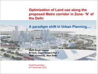
  • 1. Optimization of Land use along the proposed Metro corridor in Zone- „N‟ of the Delhi A paradigm shift in Urban Planning... Sahil Singh kapoor M.Tech, major Project Part 1 TERI University, New Delhi Final Presentation 27th November 2015
  • 2. Contents 1 • INTRODUCTION: Brief on the NDMC, Department of Internship and Challenges • BACKGROUND : Need for the Study and Literature review • OBJECTIVES , RESEARCH QUESTIONS and METHODOLOGY • SUSTAINABLE vs. UNSUSTAINABLE DEVELOPMENT • MODELLING : LTSAP Approach • DYNAMIC MODEL • PROPOSED SCENARIO • APPLICATIONS OF METRO INFLUENCE ZONE • SMART CITY • INDICATORS • LEARNING OUTCOMES
  • 3. INTRODUCTION : NORTH DELHI MUNICIPAL CORPROATION 2 • Department : TOWN PLANNNING, NDMC • CHALLENGES IDENTIFIED – • LAP approach is Bottom to Top approach with Public Participation as an essential element. Implementation of the 74th Amendment GNCTD has not been able to implement the 74th Amendment. Vital decisions particularly in the preparation and implementation of Master Plans and related are taken by central agency, DDA Local Area Plans (LAP) MCD has been a new system, LAP. But, LAP violates the „Delhi Development Act, 1957‟ and amendments required to existing Unified Building Byelaws of Delhi.
  • 4. BACKGROUND : NEED FOR THE STUDY 3 • Interaction with DDA officials reflected LACK OF CORDINATION among DDA (Delhi Development Authority) and DMRC (Delhi Metro Rail Corporation) particularly in the preparation of the Zonal Development Plans (ZDP) for the URBAN EXTENSION AREAS, mostly unencumbered in nature and suitable for Urban Development. • CHAPTER 19 : TOD, MPD 2021- 19.4 : states the delineation and preparation of Metro Influence Zones map from the centre of metro station. Further, demarcation of TOD influence zone along the Metro corridor identified in the ZDP. Figure – Location if Urban Extension areas in Delhi, Source - http://image.slidesharecdn.com/ Figure – Urban Extension areas in Delhi, Source – MPD 2021.
  • 5. LITERATURE REVIEW 4 REPORTS : To develop study analysis framework CASE STUDIES : • Prioritizing land-use surrounding metro system for optimization • Land use modeling around Metro station.
  • 6. BACKGROUND OF PROJECT 5 OBJECTIVES The study has following objectives – •To examine the impact of the proposed Metro corridor in Phase – 4& 5of MRTS on the Zonal Development Plan of Zone - ‘N’. •Prioritization of Detail Land uses in the delineated Influence zones falling within Metro station influence (Maximum 500m on both sides) to encourage Transit Oriented Development (TOD). •To understand whether aspired Land uses and establishments envisaged around the metro station can be reached by higher FAR guidelines of DDA which is an urban development agency of Delhi. RESEARCH QUESTION •How a well envisaged compact planning with multiple land use within the influence of metro corridor will control urban growth in urban extension areas of Delhi?
  • 7. METHODOLOGY 6 Population & Employment Literature Review ZDP of Zone- „N‟ Land use distribution Internal /External Linkages Proposed Facility/Utilities Case Studies Literature Review DYNAMIC MODEL (EXCEL SHEET) Comments and suggestions from identified stakeholders namely NMDC, DDA and DMRC REVIEW PROCESS Reports & Guidelines ANALYSIS OF SECONDARY DATABASE 1 2 3 4 5 Conceptual 3D model of Land use around Metro station 3D MODELLING6 ANALYSIS
  • 8. 7 JUXTAPOSE : ZONE M & N SOURCE: ZDP,, DDA Zone - M Zone - N Rithala Metro station Zone - L
  • 9. 8 Zone – „M‟ Zone – „L‟ Zone – „K I‟ GROUND TRUTH VERIFICATION SOURCE: Google maps
  • 10. 9 UNSUSTAINABLE DEVELOPMENT: METRO STATION Source - http://tcpomud.gov.in/Divisions/MUTP/Visual_Study.pdf Figure – Near Anand Vihar metro station, Unorganized parking Figure – Near Laxmi Nagar Metro station, Unorganized residential development Figure – Near Laxmi Nagar Metro station, Unorganized residential development
  • 11. 10Source - http://tcpomud.gov.in/Divisions/MUTP/Visual_Study.pdf SUSTAINABLE DEVELOPMENT: METRO STATION Figure - Stretch near HUDA city centre metro station
  • 12. 11 SUSTAINABLE DEVELOPMENT: METRO STATION Figure - Stretch near IP metro station, Effective pedestrian movement Source - http://tcpomud.gov.in/Divisions/MUTP/Visual_Study.pdf
  • 13. MODELLING : LAND USE TRANSPORTATION STATION AREA PLAN (LTSAP) , Chapter - 5 12 • Station area = 35m x 136m, delineating area of 500m around the station is, 1035m x 1136m = 1.2 million square meters (approx.) built up area. • Nearly, 20-25% of the max. development potential area is lost to road network. Remaining is 900,000 square meters • If FAR of 400 is attained with 150m (335m x 436m), nearly 5,88,000 square meters of total Floor space area can be reached. Further large plot size (Embarq, 2011) required to achieve high FAR. • Outside 150m, FAR range between 150 to 200 Zone 1 : Intense Metro influence Zone Zone 2 : Standard Metro influence Zone Zone 3 : Standard Metro influence Zone Zone 4 : Transition zone Up to 150 meters of Metro station 150 - 250 meters of Metro station 250 - 500 meters of Metro station >500 meters of Metro station Zone 1 : Intense Metro influence Zone (<150m) Zone 2 : Standard Metro influence Zone (150 - 250m) Zone 3 : Standard Metro influence Zone (250 - 500m)
  • 14. 13 Criteria for locating Metro stations – • Junction of Metro lines • High Densities Commercial areas • Intense mixed use development areas . Zone – „M‟ Zone – „L‟ Zone – „N‟ Figure – Interchange junctions of Metro lines, Source- DMRC
  • 15. 14 DYNAMIC LAND USE MODEL: EXCEL SHEET OBJECTIVE : Land use as a function of DISTANCE from Metro station LAND USE Zone 1 (<150m): Intense zone Zone 2 (150 - 250m) : Standard zone Zone 3 (250 - 500m) : Standard zone Zone 4 (>500m) : Transition zone Land use distribution (%), Detail within Land use Land use distribution (%), Detail within Land use Land use distribution (%), Detail within Land use Land use distribution (%), Detail within Land use Residential 5 – 10 (A), (B), (D) Res. With Mixed land use 15 – 20 (A), (D) Apartments, Group Hosing 25 – 30 (D) Societies, Group Hosing 45 – 55 Plots Commercial 25 - 30 (A),(B), (D) Retail Shops 15 – 20 (A), (D) City Center, CBD 10 – 15 (D) Hotels, CC 4- 5 Informal Bazar , Banquets Industrial 0 (A),(D) 0 (A), (D) 5 – 10 (D) Small scale 4 – 5 Green areas 10 – 15 (A), (B), (D) Parks 15 – 20 (D) District Park 15 – 20 (D) District Park 15 – 20 City Parks P & SP. 20-25 (A),(B) Institutional, Offices 15 – 20 (A), (D) Hospital, College, Offices 15 – 20 (A), (D) Hospital, Colleges 8 - 10 Hospital Circulation 20- 25 (A), (B), (D) No parking allowed 15 – 20 (A), (D) Parking spaces, Bus Stops 15 – 20 (A), (D) Taxi Drop off 10 – 12 Car parking facility (A)- Transit Oriented Recommendations Report 2013, Bangalore (B) - MRTS impacts on Land-use in Bangalore ( urbanmobilityindia.in) (C) - Pan Hai Xi Ao, Shanghai city (D) - L. Yang 2014
  • 16. 15 COMMERCIAL •PUBLIC & SEMI PUBLIC, RECREATIONAL •RESIDENTIAL •Private Development •Sports / Leisure •Plotted Development •Community support facilities •High value Residential •Small retail •School •Group Housing (3- 7) •Small industries •Healthcare •Community centers •Entrepreneurs •Sports facilities •Mixed use •Affordable Housing •SME‟s •Urban Park •Retail Shops •Apartments (8-15 storey's) •Shopping market •Entertainment/ Leisure •Piazza 0-150m 150-250m 250-500m 500-1000m ANALYSIS DYNAMIC LAND USE MODEL
  • 17. 16 CASE STUDY of BANGALORE CITY: OPTIMIZATION OF LAND USE AROUND METRO STATION USING LTSAP APPROACH SOURCE: TORR, 2013 Figure 1 & 2 – Land use within catchment of Metro station
  • 18. 17 PROPOSED SCENARIO Within 500m of the Metro Station MIXED USE BUILDINGS AFFORDABLE/HOUSING OFFICES, INSTITUTIONAL BLDGS CBDs
  • 19. APPLICATION OF METRO INFLUENCE ZONES : METRO STATION 18 A comprehensive Influence Zonal plan (document) will provide a framework for envisaged TOD development comprising following components: A. Urban Design framework – Recreational and Open Public spaces, Internal street network, Net FAR with residential densities(@ 250 pph), Vertical mix uses and parking spaces. B. Transport Impact Assessment framework - Priority for NMT/Public transport, Parking management strategy as per demand, mitigation of traffic noise. C. Decentralized Infrastructure – Rain water harvesting in Open Public spaces and green areas, ISWM (Compost plant, Plastic to fuel, Pellet making), Roof top Solar Potential (meeting 10% energy requirement). D. Economic viability and social cohesion – Land value capture, FAR benefits, provision of affordable housing, revenue collection
  • 20. SMART CITY : OPTIMIZE LAND USE 19 •Optimization of Land uses can Redefine Sustainability and Liveability. •Short on Land : Optimize Land use can SAVE the valuable space lost to private vehicles since Metro systems occupy comparatively LESS LAND. • Tackle urban sprawl : In a Mixed Land use urban areas, people prefer Pedestrian movements and public transit against private vehicles. •Integration : Integrate different Motorized and Non Motorized Transport into convenient, efficient, affordable, safe and green system.
  • 22. INDICATORS 21SOURCE: niti.gov.in Questions Indicators Formula / Input Does Metro alignment with the Land use plan for the urban area? Intensity of development FAR along metro corridor Average FAR along Metro corridor / Average FAR in the ZDP = 3 – 4/1.5 - 2 What is avg. distance travelled for work? Average commuting distance to work? Avg. distance from residential areas to work : nearly 500m (7min. Walk) Efficiency in transport operations % of population with commute time <25 min. Population with commute time<25 min / Total population Mixed Land-use % of area under mixed Land use Total area under mixed-land use/ Total area of municipality x 100 City’s Carbon footprint Per capita land devoted to transport faculties Total area devoted to transport facilities / Total population
  • 23. LEARNING OUTCOMES 22 •Optimization can be achieved by maximizing FAR, Compactness and Mixed use. •Mandatory provision of 15% of the total FAR for EWS housing •FAR bonus for market developments near Low income housing •Government built Low income housing within 800m from Metro corridor. •Features of TOD – Compact, Mixed land use development Safety Affordability Equity Transparency Democracy Employment Attraction Land value increment Entrepreneur Air, Water Quality Climate comfort Cleanliness SOCIAL ENVIRONMENTAL ECONOMIC SUSTAINABLE
  • 24. METRO SYSTEM ENVIRONMENTAL BENEFITS IN DELHI 23 The Delhi metro rail system came with the following environmental benefits at certain identified places in Delhi – •35% reduction in CO levels for the area around ITO which is a dominant traffic intersection area in central Delhi (Study by CDE, April 2013) •3 to 47% reduction in NO2 concentration (Study by CDE, April 2013) •About 20- 25 percent of trips are shifting from private vehicles to Metro as an effective public transport. (Central Road Research Institute (CRRI) assessment) •After completion up to Phase 3, nearly 3, 90,970 vehicles in the year 2014 went off the roads. (Central Road Research Institute (CRRI) assessment) Further, introduction of metro system in the outward URBAN EXTENSION areas of Delhi can reduce about 4 lakh vehicles on the roads, curtail annual fuel consumption of about 2.76 lakh tonne and minimize pollutants by about 5.8 lakh tonne a year (Indian express, April 9, 2015). DMRC certified by UN as First metro rail in world to get “Carbon credits for reducing GHG emissions” (HINDU, September 26, 2011)
  • 25. 24 A city that outdistances man’s walking powers is a trap for man. (Arnold J. Toynbee) THANK YOU