
Recommended
More Related Content
Similar to Structural Geology for Civil Engineering
Similar to Structural Geology for Civil Engineering (20)
More from RajkumarGhosh14
More from RajkumarGhosh14 (11)
Recently uploaded
Recently uploaded (20)
Structural Geology for Civil Engineering
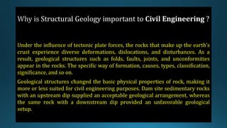
- 1. Structural Geology Under the influence of tectonic plate forces, the rocks that make up the earth's crust experience diverse deformations, dislocations, and disturbances. As a result, geological structures such as folds, faults, joints, and unconformities appear in the rocks. The specific way of formation, causes, types, classification, significance, and so on. Geological structures changed the basic physical properties of rock, making it more or less suited for civil engineering purposes. Dam site sedimentary rocks with an upstream dip supplied an acceptable geological arrangement, whereas the same rock with a downstream dip provided an unfavorable geological setup.
- 5. Inclined Bed. Steeply dipping (70 degree). Easterly dipping. W
- 6. Representing a Basin in Various ways: Schematic Diagram Representation of a basin in various ways. Schematic diagrams. (A) Three-dimensional view. Height horizons are marked. (B) Note how the height contours look similar to those in map view. The height increases as one moves away from the center (as indicated by the arrow “i”).
- 7. Representation of a basin in various ways. Schematic diagrams. (B) Note how the height contours look similar to those in map view. The height increases as one moves away from the center (as indicated by the arrow “i”). (C) Vertical section along MN marked in (A).
- 8. A solid line on the map represents a plane and the plane is: horizontal—if the line is parallel to the height contours (i.e., the broken lines);
- 9. A solid line on the map represents a plane and the plane is: inclined—if the solid line is curved and cuts the height contours; On the map, the curvature of the solid line decreases as the bed steepens. On the map, the curvature of the solid line increases as the bed gently dipping.
- 10. What is Dip ? Bedding and other geological layers and planes that are not horizontal are said to dip. The dip is the slope of a geological surface. There are two aspects to the dip of a plane: (a)the direction of dip towards which the plane slopes; and (b) Angle of dip is that plane makes with a horizontal plane. The direction of dip can be visualized as the direction in which water would flow if poured onto the plane. The angle of dip is an angle between 0° (for horizontal planes) and 90° (for vertical planes).
- 11. What is Dip ? Bedding and other geological layers and planes that are not horizontal are said to dipping. Dip is the slope of a geological surface.
- 13. A solid line on the map represents a plane and the plane is: vertical—A straight solid line cuts across height contours that indicates a vertical plane for an undulating topography. However, in a planar topography, both inclined and vertical planes appear as straight lines.
- 14. What is a strike line ? Strike lines of a single plane are mutually parallel. Successive strike lines of equal interval (500 m, 400 m, 300 m, etc.) are equidistant from each other. Steeper planes produce more close-spaced strike lines. What is Stratum Contour? stratum contours are the orthographic/map projection of strike lines on a horizontal surface.
- 22. Folds • Folds are the most common geological structures found in rocks. When a set of horizontal layers are subjected to compressive forces, they bend either upward or downward. The bend noticed in rocks are called folds. • In terms of their nature too, folds may occur as single local bends or may occur repeatedly and intricately folded to the tectonic history of the region.
- 23. Folds
- 34. Fold: Symmetric repetition of beds
- 35. Causes and Effects of Folding • Most of the important folds, as already pointed out, are due to tectonic causes. But a few folds of a minor type are due to non-tectonic causes, • Mainly, the compressive and shear type of tectonic forces are responsible for the folding phenomenon. Igneous intrusion of viscous magmas such as laccoliths and lopoliths also contribute to folding. • Non-tectonic causes like landslides, creeping, differential compaction, isostatic setting and glaciations too are responsible for some folds. These are minor in terms of frequency of occurrence and magnitude.
- 36. On the map, a fold is generally recognized by symmetrical repetition of beds (Billings, 1954; Ghosh, 1993; Fossen, 2016)
- 38. General way to distinguish the folded and unfolded litho-contacts on the map. A. Litho-contacts separating the litho units P, Q, R crop out in a way that a dark blue line joining the hinges of the contour Vs and outcrop Vs (almost) coincides. This indicates the unfolded nature of the litho-contacts.
- 39. B. Here a line joining the hinges of the contour Vs (red broken line) and that of the outcrop Vs (green broken line) are away from each other. This indicates that the litho-contacts are folded. A’. Strike lines drawn for case A.
- 45. Faults • From the Civil engineering point of view, faults are the most unfavorable and undesirable geological structures at the site for any given purpose, i.e. for location of reservoir; as foundations site for construction of dams, importance bridges or huge buildings, for tunneling; for laying roads, railways tracks, etc. • This is because faults considerably weaken the rocks and render the sites in which they occur as unfavorable places for all constructional purposes. • Further, as long as the faults are active, the site is unstable and susceptible to upward, downward or sideward movement along the fault plane, thereby making the places highly hazardous for foundation purposes. Thus, by virtue of the harm they are capable of causing, faults are necessarily investigated with special care in dealing with any major construction.
- 46. Classification and Types of Faults
- 47. Classification and Types of Faults
- 48. Classification and Types of Faults (Strike slip fault)
- 49. Heave = Horizontal component of displacement Throw = Vertical component of displacement
- 60. Unconformities Unconformity is one of the common geological structure found in rocks. It is somewhat different from other structures like folds, faults and joints in which the rock are distorted, deformed or dislocated at a particular place. Still, unconformity is a product of diastrophism and involve tectonic activity in the form of upliftment and subsidence of land mass.
- 62. Formation of unconformity involves: Unconformities are resulted due to tectonic activity in form of uplift or subsidence of land. It is referred to a period of non-deposition. Break in sedimentation or deposition. Next phase of Deposition or sedimentation cycle, where new sedimentation produce another set of conformable beds. Any deposition when takes place, that is totally in horizontal fashion. Later due to tectonic movement the layers or beds are tilted (except in case of cross-bedding- which are formed under fluvial (riverine) or Aeolian (wind) environment.
- 63. Angular unconformity When older (underlying) rocks and younger (overlying) rock strata show some angle with one another.
- 64. Disconformity When underlying (older) rock and overlying (younger) sedimentary rock strata are parallel and contact plane is an erosional surface.
- 66. Disconformity Underlying (older) rock and overlying (younger) sedimentary rock strata are parallel and contact plane is an erosional surface (look for weathering surface, boulders/pebbles of older rock in younger). But gap in geological record.
- 67. Paraconformity A gap in geological system, but no evidence of erosion, no evidence of gap in time, Plane above and below are parallel. Short period of non depositional, mostly local extension (local unconformity).
- 68. Non-conformity: When underlying rocks are Igneous or Metamorphic (i.e. unstratified) and the overlying younger rocks are sedimentary (stratified).
- 69. References Billings, M.P., 2013. Structural Geology, PHI learning private limited, Delhi. Pp 408-419 Bose N., Mukherjee, S., Map interpretation for structural Geologists. Davis, G.H., Reynolds, S.J. 1996. Structural geology of rocks and regions. John Wiley & Sons, Inc. New York, 776 p. Hobbs, B. E., Means, W. D., Williams, Paul F., 1976. An Outline of Structural Geology, John Wiley and Sons, INC. U.S.A. Pp 213-288, 571 p. Ramsey, J.G., 1967. Folding and fracturing of rocks. McGraw-Hill Book Co., New York, 560 p. Ramsey, J.G., and M.I. Huber. 1987. The techniques of modern structural geology, v.2. Folds and fractures. Academic Press, London, 381 p.