SlideShare a Scribd company logo
1 of 12
Download to read offline
BUILDING AN INFORMATION FRAMEWORK FOR
WATER SUPPLY PLANNING AND ECONOMIC DEVELOPMENT:
3-D GEOLOGIC MAPPING IN NORTHEASTERN ILLINOIS
Much of our drinking water, a significant amount of material for road building, and most natural lakes in
Illinois have one thing in common: they are a legacy of the Ice Age—glaciers created the geologic materi-
als that contain groundwater, are used in concrete, and form the containers that enclose lakes. Knowing
the distribution and characteristics of these materials is essential for water supply planning, economic
development, and sustainability of our recreational resources. A geologic map achieves that goal, and
three-dimensional (3-D) geologic maps can depict these materials several hundred feet under the ground.
Geologic maps provide a context for every decision that relies on information about the earth under our
homes, roads, and cities. These maps help us understand the availability of groundwater resources; help
avoid building in areas that are susceptible to natural hazards, such as landslides; and help those entrusted
with protecting our health and safety to make decisions. A Geologic Mapping Advisory Committee,
composed of experts from private industry; academia; and local, state, and federal governments, provides
advice on immediate and long-term societal trends that guide geologic mapping priorities.
For more information, visit: www.isgs.illinois.edu
Create geologic maps for high-priority areas that provide a context for decision making
related to the use of earth resources, identification of natural hazards, and creation of
economic development opportunities.
Objective
BUILDING AN INFORMATION FRAMEWORK FOR WATER
SUPPLY PLANNING AND ECONOMIC DEVELOPMENT:
3-D GEOLOGIC MAPPING IN NORTHEASTERN ILLINOIS
Approach
Significant Results and
Potential Outcomes
Investigators
Sponsors
Publications
STATEMAP and Great Lakes Geologic Mapping Coalition components of the National
Cooperative Geologic Mapping Program, administered by the U.S. Geological Survey;
county governments.
Brown, S. E. 2013. Three-dimensional geologic mapping of Lake County, Illinois: No small
task. In Three-Dimensional Geological Mapping Workshop extended abstracts, edited by H.
Thorleifson, R. C. Berg, and H. Russell, 23–28. Open-File Report OFR-13-2. St. Paul: Minnesota
Geological Survey.
Caron, O. 2015. 3-D geologic mapping of Will County, Illinois. Geological Society of America
Abstracts with Programs 47 (5): 18.
Curry, B. B., and J. F. Thomason. 2012. Surficial geology of the Huntley Quadrangle, Kane and
McHenry Counties, Illinois. STATEMAP Huntley-SG 2012, 1:24,000. Champaign: Illinois State
Geological Survey.
Olivier J. Caron, Steven E. Brown, Richard C. Berg, Brandon B. Curry, Jason F. Thomason,
and Andrew J. Stumpf
3-D geologic maps provide critical information for informed decision making related to all
of our natural resource needs and for protecting our health and safety from natural and
man-made hazards. Digital 3-D geologic map layers can be deployed in a county GIS for
effective use with other digital information, such as land parcel, land-use zoning, and park
and natural area boundary maps. This information has supported a number of water-sup-
ply decisions in Lake County, including planning for additional water withdrawal from Lake
Michigan. For planning purposes, dramatic changes in geology over short distances has weak-
ened confidence in long-term reliance on groundwater for western Lake County communities.
Information gleaned from 3-D geologic mapping explains why some communities have been
unable to find suitable aquifer material in areas near existing groundwater production wells.
Because each additional allocation of Lake Michigan for some Illinois communities affects the
potential future use of that resource for other communities, geologic maps that show aquifers
are essential to the long-term sustainability of both our groundwater and surface water.
Geologic mapping requires examination and geologic interpretation of historical records and
maps containing facts and observations about surface and subsurface geology. Additional
information is acquired through a number of exploration methods, including drilling. These
data are combined in a geographic information system (GIS) to form a robust 3-D database.
State-of-the-art software applications and advanced database management techniques enable
3-D representation and visualization of subsurface information. 3-D visualization provides the
capability to create enhanced 3-D geologic map products. Interaction with users of geologic
information provides opportunities to customize map products for application-specific needs.
08.15
For more information, visit: www.isgs.illinois.edu
HYDROLOGICAL FUNCTIONING AND HISTORY
OF NELSON LAKE: PROTECTING THE “JEWEL OF
KANE COUNTY” FROM URBAN ENCROACHMENT
Nelson Lake, a shallow, spring-fed lake with a wide buffering fen, is home to a nesting group of white peli-
cans, as well as rare calciphyllic orchids and other flora. Urban development and its potential impacts on
Nelson Lake were investigated through study of the hydrological functioning of the lake: its water residence
time, water chemistry, and the long-view history of lake water quality and the surrounding vegetation. Digital
modeling of the geological data acquired for the study showed a large teardrop-shaped capture zone, which
was immediately purchased or rezoned by the county. The short residence time of Nelson Lake water (less
than 3 months) and surrounding geology and topography means that it is constantly being recharged by shal-
low groundwater. Today, the capture zone of this shallow aquifer is largely overlain by soccer fields and not
strip malls and subdivisions, thereby protecting the unique and fragile aquatic and wetland ecosystems.
The long view of the functioning of Nelson Lake warns us that drought leads to landscape instability, the
erosion of the surrounding morainal landscape, and rapid infilling of what is already a shallow lake.
For more information, visit: www.isgs.illinois.edu
690
730 720 710
700
Figure 17. Ten-year capture zones for Nelson Lake and its fringing marsh (teal). For case 3, the flow
lines and contours of the potentiometric surface of the Kaneville aquifer are shown.
Case 1
Case 2
Case 3
Case 4
Case 5, low k
Case 5, high k
Percent
0
1
2
3
4
5
6
7
8
9
10
11
12
13
14
15
16
17
18
Age(calyrBP×1000)
20 40 20 40 60
spruce
20 20 20 20 40 20 40 20
sedge
black
birch
oak
hickory
grass
ragweed
elm
ash
Pollen, relative abundance
Analyst: Eric Grimm
credit: Kenneth Cole Schneider
credit: Bob Andrini
To protect the water quality and hydrologic functioning of spring-fed Nelson Lake, an Illinois
Natural Area and County Forest Preserve, home to rare and endangered animals and calciphyl-
lic plants, and to determine changes in its past moisture balance and watershed vegetation.
Objective
HYDROLOGICAL FUNCTIONING AND HISTORY
OF NELSON LAKE, KANE COUNTY
Approach
Significant Results and
Potential Outcomes
Investigators
Sponsors
Publications
Kane County Forest Preserves, Kane County Planning Department
Curry, B. B. 2003. Linking ostracodes to climate and landscape. In Bridging the gap: Trends
in the ostracode biological and geological sciences, edited by L. E. Park and A. J. Smith,
223–246. The Paleontological Society Papers, vol. 9. Boulder, CO: The Paleontological Society.
Curry, B. B., W. S. Dey, E. C. Grimm, S. L. Sargent, and S. A. Kuzin. 2004. Investigation of the
geology, hydrology, water balance, paleovegetation, and paleohydrology of Nelson Lake
Marsh. Contract Report to the Forest Preserve District of Kane County. Champaign: Illinois
State Geological Survey.
Dey, W. S., A. M. Davis, B. B. Curry, D. A. Keefer, and C. C. Abert. 2007. Kane County water
resources investigations: Final report on geologic investigations. Open File Series 2007-7.
Champaign: Illinois State Geological Survey.
Nelson, D. M., F. S. Hu, E. C. Grimm, B. B. Curry, and J. E. Slate. 2006. The influence of aridity and
fire on Holocene prairie communities in the eastern Prairie Peninsula. Ecology 87: 2523–2536.
Brandon Curry, Eric Grimm (Illinois State Museum), William Dey (retired), Steve Sargent, and
Edward Mehnert
The most profound result of the study was its immediate use by the County Forest Preserves
to purchase and rezone property determined to lie within the capture zone delimited by our
study. The properties, which were slated for residential and small business use, are now a
large sports park maintained by the county. The results of the borings, geophysical logs,
electric earth resistivity surveys, and other analyses were used to help construct a three-
dimensional model of the glacial sediment used to model groundwater flow in the drift (Dey
et al. 2007). The paleoecological studies of the lake sediment core revealed that droughty
periods led to rapid infilling of the lake from about 8,200 to 6,700 years ago (Nelson et al.
2003). Instead of being hydrologically open, Nelson Lake during that time was internally
drained, and its microflora were sensitive to inputs of limiting nutrients.
A holistic investigation of the subsurface geology revealed that Nelson Lake, a glacial kettle,
is nestled in thick deposits of sand and gravel that rapidly thin away from the lake. The
research included sampling eight sediment cores to bedrock and a continuous sounding
of the electrical properties of the sediment immediately surrounding the lake. By mapping
the thickness and extent of the sand and gravel, measuring water levels in the sand and
gravel aquifer from an array of monitoring wells, and conducting sensitivity analyses of the
hydrological and geographical variables in the analysis, we mapped the capture zone of the
shallow aquifer. The fossil record of pollen, charcoal, plant macrofossils, and ostracodes
(archived in a 50-foot-long sediment core from the center of Nelson Lake) revealed a rich
history of biotic response to climate change, including late Pleistocene deglaciation, and
climatic conditions over the past 10,000 years, including periods of severe drought.
08.15
For more information, visit: www.isgs.illinois.edu
WETLANDS PROGRAM
Wetlands provide us with a wide variety of benefits, including wildlife habitat, outdoor recreation,
groundwater recharge, floodwater storage, and water-quality improvement. The loss of 90% of Illinois
presettlement wetlands with attendant losses of these benefits prompted federal, state, and local laws
to protect wetlands and the services they provide. As a result, activities that affect many (but not all)
wetlands are subject to regulation, and governmental agencies, industry, and NGOs are routinely faced
with wetland-related decisions to meet resource conservation policies, regulatory requirements, or both.
These decisions involve issues including protection of sensitive, high-quality wetland habitats, wetland
restoration or creation, and construction of artificial wetlands to treat runoff. These groups depend on
information based on impartial collection and unbiased interpretation of data that accurately describe the
physical, hydrological, and biological characteristics of wetlands.
For more information, visit: www.isgs.illinois.edu
Collect and interpret hydrogeological, geochemical, and ecological data critical for decision
making regarding wetland management. Develop and maintain trust among stakeholders.
Objective
WETLANDS PROGRAM
Approach
Significant Results and
Potential Outcomes
Investigators
Sponsors
Publications
Illinois Department of Transportation, Illinois Tollway, Illinois Nature Preserves Commission/
Department of Natural Resources
Miner, J. J., K. W. Carr, and K. E. Bryant. 2014. Performance of bioswales used for improve-
ment of roadway runoff from a major interstate in Illinois. Paper presented at that Joint
Aquatic Sciences Meeting, Portland, Oregon, May 18–23.
Miner, J. J., and M. C. Higley. 2013. Hydrogeologic monitoring in the Illinois-Wisconsin Lake
Plain, northern Lake County, Illinois. Champaign: Illinois State Geological Survey, Open-File
Series 2013-1, 72 pp.
Miner, J. J., and M. V. Miller. 2011. Wetlands geology. In Geology of Illinois, edited by D. R.
Kolata and C. K. Nimz, pp. 361–369. Champaign: Illinois State Geological Survey.
Plankell, E. T., and J. J. Miner. 2014. Impacts to a forested fen as a result of roadway deicing activi-
ties. Paper presented at the Joint Aquatic Sciences Meeting, Portland, Oregon, May 18–23.
Pociask, G. E., and J. W. Matthews. 2013. Restoration progress and flood disturbance at IDOT
wetland mitigation sites. Rantoul: Illinois Center for Transportation, Research Report FHWA-
ICT-13-016, 31 pp.
James Miner, Steven Benton, Keith Carr, Geoffrey Pociask, Eric Plankell, Kathleen Bryant,
Jessie Ackerman, Jessica Monson, Colleen Long, Katharine Schleich, and Matthew Even
In a large, recent project providing assistance to the Illinois Tollway Authority, monitor-
ing and analysis of flow volume, water chemistry, and sediment in treatment wetlands
(bioswales) constructed to improve the quality of roadway runoff showed that most of
the bioswale sites are equally as or more effective than other best management practices,
depending on the design parameters and other site characteristics. This information will be
used to guide the design and implementation of bioswales in future road construction proj-
ects. Other notable results include identification of the geochemical conditions that sustain
populations of the federally endangered dragonflies, recommendations for restoration of the
large and unique ecosystem at Illinois Beach State Park, assistance to the Illinois Department
of Transportation (IDOT) with wetland restoration and creation for its wetland mitigation
program, evaluation of the influence of floods on the quality of plant communities at IDOT
wetland restoration sites, and delineation of groundwater protection areas for high-quality
habitats at Illinois Nature Preserves.
Data-driven assessment and characterization of wetland area, quality, and function using
traditional hydrogeological and geochemical methods and geographic information systems
(GIS); analysis and recommendations to guide the protection, restoration, or creation of natu-
ral or artificial wetlands; baseline and postconstruction monitoring of water quality, levels,
and flow to provide the basis for wetland management strategies.
08.15
For more information, visit: www.isgs.illinois.edu
A NONCONVENTIONAL CO2
-ENHANCED OIL RECOVERY
TARGET IN THE ILLINOIS BASIN: OIL RESERVOIRS OF
THE THICK CYPRESS SANDSTONE
Illinois contains economically significant energy resources in the form of natural gas, oil, and coal.
However, extraction of oil from some reservoirs (typically several thousand feet deep) through typical
recovery methods is hampered by the geologic complexities of the oil-bearing reservoir and adjacent
rocks. The oil in the reservoir rock is often accompanied by the occurrence of extremely salty water (brine).
During oil production, brine can enter the well instead of oil. Typically, these nonconventional oil-rich
zones are bypassed because of the expense of producing the oil resource and removing the brine, which
is an unwanted by-product that creates additional cost. However, innovative oil extraction methods and
technologies show great potential for recovering bypassed oil from nonconventional oil rereservoirs and
mitigating the impact of human-induced climate change. With the current impetus to reduce greenhouse
gas emissions, the carbon dioxide (CO2
) from anthropogenic or natural sources can be used to enhance oil
recovery in these nonconventional reservoirs while storing or sequestering it deep in the ground.
This study focuses on developing methods to increase CO2
enhanced oil recovery (EOR) in nonconven-
tional oil reservoirs and demonstrating economic incentives for CO2
storage and CO2
use to facilitate oil
production in the Cypress Sandstone of Illinois. The findings will be extrapolated to a regional resource
assessment and could potentially be used to aid in the development of oil resources that actually result
in removing more carbon from the atmospheric part of the carbon cycle than is created by the burning of
carbon removed from the ground.
For more information, visit: www.isgs.illinois.edu
Geocellular porosity model. Roughly 0.5 x 0.5 mi.
50x vertical exaggeration.Graphical log resulting
from a detailed core
description of the C.T.
Montgomery B-34 well
(121592606400, Sec 4,
T3N, R9E) in Noble Field,
Richland County.
Locations of logs used in the petrophysical analyses
throughout the thick Cypress Sandstone fairway.
Identify and quantify the nonconventional carbon dioxide (CO2
) enhanced oil recovery (EOR)
and storage target opportunities within the thick Cypress Sandstone in the Illinois Basin.
Objective
A NONCONVENTIONAL CO2
-ENHANCED OIL RECOVERY
TARGET IN THE ILLINOIS BASIN: OIL RESERVOIRS OF
THE THICK CYPRESS SANDSTONE
Approach
Significant Results and
Potential Outcomes
Investigators
Sponsors U.S. Department of Energy/National Energy Technology Laboratory
Nathan Webb, Scott Frailey, Hannes Leetaru, Nathan Grigsby, Peter Berger, Roland Okwen,
John Grube, Beverly Seyler, Christopher Korose, and Charles Monson
Application of these techniques will provide data that can be used to create guidelines and
recommendations for CO2
-EOR development strategies (e.g., well patterns, spacing, and
orientations as well as CO2
injection profiles) of the thick Cypress Sandstone (and similar
formations) that provide operators an economic incentive to store CO2
. Lessons learned from
this research may be extrapolated to other known and as yet undiscovered nonconventional
oil reservoirs in similar geologic formations, both within Illinois and at other locations in
the United States. Most important, the research could demonstrate that the use of CO2
to
enhance oil recovery also could potentially be used to store carbon otherwise released to the
atmosphere, thereby creating net carbon-negative oil projects.
Reservoir characterization, geologic mapping, three-dimensional modeling, and simula-
tion of oil and brine flow in the thick Cypress Sandstone and adjacent rocks will be used to
develop methods for improved oil recovery and storage efficiency through CO2
injection.
Results from a detailed oil field study will be scaled up and coupled with regional geologic
mapping to estimate the size of the potential nonconventional CO2
-EOR and storage resource
in the Illinois Basin. Economic evaluations will be completed so that the relatively high
storage component anticipated from these formations can be understood in terms of the
magnitude of the CO2
-EOR and storage.
08.15
For more information, visit: www.isgs.illinois.edu
Publications Webb, N. D., and N. P. Grigsby. 2015 (accepted). Geological characterization and modeling of
the Cypress Sandstone at Noble Field, southeastern Illinois. Paper presented at the Eastern
Section American Association of Petroleum Geologists Meeting, Indianapolis, Indiana,
September 21–22.
ILLINOIS BASIN – DECATUR PROJECT
Carbon capture and storage (CCS) from ethanol production represents a significant opportunity to miti-
gate climate change because of the low cost of capture and purity of the carbon dioxide (CO2
) produced.
The Illinois Basin – Decatur Project (IBDP) is an integrated CCS project being carried out in Decatur, Illinois,
by the Illinois State Geological Survey. The IBDP is a full-cycle CCS project—from site characterization to
closure—with the goal of injecting one million tonnes of anthropogenic CO2
captured from biofuel produc-
tion into a deep saline rock formation, the Mt. Simon Sandstone. The IBDP has successfully completed
three years of CO2
injection, with cumulative injection of one million tonnes as of November 2014. The IBDP
now moves into a three-year post-injection monitoring period.
For more information, visit: www.isgs.illinois.edu
The 1-million-tonne Illinois Basin – Decatur Project (IBDP) is verifying the storage capacity,
injectivity, and containment of the Mount Simon Sandstone, the largest regional saline reser-
voir storage resource in the Illinois Basin region.
Objective
ILLINOIS BASIN – DECATUR PROJECT
Approach
Significant Results and
Potential Outcomes
Investigators
Sponsors
Publications
U.S. Department of Energy/National Energy Technology Laboratory, Illinois Department of
Commerce and Economic Opportunity
Greenberg, S., ed. 2014. Illinois Basin – Decatur Project. Special Issue, Greenhouse Gases
Science and Technology 4 (5): 569–684.
Sallie Greenberg (PI), Kathleen Atchley, Robert Bauer, Peter Berger, Richard Berg, Alice
Bernard, Curt Blakley, Daniel Byers, Carl Carman, Johnathan Cox, James Damico, Robert
Finley, Scott Frailey, Jared Freiburg, Damon Garner, Abbas Iranmanesh, Daniel Klen,
Christopher Korose, Ivan Krapac, Timothy Larson, Hannes Leetaru, Randy Locke, Edward
Mehnert, Charles Monson, Roland Okwen, Christopher Patterson, LaDonna Pearl, Hongbo
Shao, Derek Sompong, Nathan Webb, and Bracken Wimmer
•	 In total, 999,215 tonnes have been stored over three years.
•	 Three years of pre-injection and three years of injection monitoring have been undertaken.
•	 All parameters show full containment of CO2 in the deep subsurface.
At the end of the project, we will understand:
•	 carbon storage infrastructure development and implementation.
•	 thresholds for geophysical (3-D vertical seismic profile and 2-D line) plume detection
based on rock type, depth, perforated interval, and reservoir properties.
•	 the pressure front distribution and timing of CO2 movement.
•	 the distribution of microseismic events in 3-D space around the injection well and how
clusters of events develop.
The information gained from this project is being used around the world to mitigate the
impact of greenhouse gas emissions on climate change.
The IBDP, led by the Illinois State Geological Survey in partnership with Archer Daniels Midland
Company (ADM) and Schlumberger Carbon Services, is demonstrating the geological stor-
age of 1 million tonnes of CO2
more than 7,000 feet beneath the surface. The project began
in 2008 and has created the entire infrastructure needed for carbon storage, including deep
injection and monitoring wells, a compression/dehydration facility, a pipeline, and intensive
shallow and deep monitoring systems. The IBDP captured CO2
from ethanol production
at ADM for a period of three years. A three-year period of post-injection monitoring and
research is underway to understand the reservoir response to the cessation of CO2
injection.
08.15
For more information, visit: www.isgs.illinois.edu
KARST INVESTIGATIONS IN NORTHWESTERN
AND SOUTHWESTERN ILLINOIS
About 10 percent of Illinois contains karst terrain. Karst is simply defined as an area underlain by fractured
bedrock whose fractures are enlarged by dissolution of the rock. Limestone and dolomite are susceptible
to dissolution by rainwater and soil water. The larger the fracture apertures, the more likely that sediment
will fall into the fractures or crevices and create sinkholes. The fractures and crevices also provide porosity
and permeability of the bedrock. Under certain hydrologic conditions, the fractures and crevices may be
filled with water. Provided the water quality is suitable for drinking, the fractured rock becomes an aquifer.
However, because the crevices are so large (sometimes cave size), recharge and groundwater movement
are rapid and highly susceptible to surface-borne contamination. Consequently, karst terrain is a unique
environment that requires special care when building structures and infrastructure so as not to compro-
mise the water resources of the karst aquifer. Karst terrain is also susceptible to collapse, creating a safety
hazard. In addition, the caves in these areas provide a unique environment that records climate change,
changes in land use, and earthquakes. The work we are doing in the karst areas of Illinois focuses on
protection of water resources and on taking advantage of the natural records housed within its caves.
For more information, visit: www.isgs.illinois.edu
Characterize the degree and extent of karst terrain on local and state levels to determine the
susceptibility of associated karst aquifers to surface-borne contaminants in northwestern and
southwestern Illinois, and identify seismic history associated with the New Madrid and Wabash
Valley Seismic Zones in Illinois and adjacent states through the use of speleothems in caves.
Objective
KARST INVESTIGATIONS IN NORTHWESTERN
AND SOUTHWESTERN ILLINOIS
Approach
Significant Results and
Potential Outcomes
Investigators
Sponsors
Publications
Illinois State Geological Survey, Jo Daviess County League of Women Voters, U.S. Geological
Survey, Prairie Research Institute
Panno, S. V., D. E. Luman, and D. R. Kolata. 2015. Characterization of karst terrain using
remotely sensed data in Jo Daviess County, Illinois. Circular 587, 29 pp., 1 map, 1:62,500,
http://isgs.illinois.edu/publications/58/appendix [digital appendix]. Champaign: Illinois State
Geological Survey.
Panno, S. V., P. G. Millhouse, R. W. Nyboer, D. Watson, W. R. Kelly, L. Anderson, C. C. Abert,
and D. E. Luman. 2014. Guide to the geology, hydrogeology, botany, history, and archaeology
of the Driftless Area of northwestern Illinois, Jo Daviess County. Field Trip Guidebook 2014A.
Champaign: Illinois State Geological Survey.
Tinsley, J. C., J. B. Paces, and S. V. Panno. 2015. Exploring paleoseismic signals from caves in
the central and eastern USA. Seismological Research Letters 86 (2B): 597.
Samuel Panno, Walton Kelly, Donald Luman, Dennis Kolata, Ya Zhang, Wen-Tso Liu, John
Tinsley, Robert Bauer, and Craig Lundstrom
A field trip through Jo Daviess County in northwestern Illinois was attended by more than 150
citizens and demonstrated community interest in understanding the ramifications of living
in karst terrain. Each was provided a field trip guidebook that included a detailed description
of the history, archaeology, biology, geology, and hydrology of the county. The guidebook
is now being used throughout the county as a primer on the natural history of northwestern
Illinois and the value of citizen participation in implementing groundwater protection strate-
gies. In southwestern Illinois, the techniques we developed for identifying seismic events by
using speleothems in caves are being applied to fill in gaps in the seismic history of the New
Madrid Seismic Zone and the Wabash Valley Seismic Zone. These records demonstrate that
ground-shaking (earthquake) activity has recurred during the last 200,000 to 300,000 years.
Water quality investigations in karst regions of the state are conducted through mapping
of karst features (e.g., sinkholes, large springs, crevices) by using aerial photography,
enhanced-resolution digital elevation data, and results of water chemistry. Groundwater
samples are obtained from private wells and springs and analyzed for chemical composition,
tritium, bacteria, pharmaceuticals, and personal care products to determine baseline condi-
tions. Review of land use can lead to likely sources of existing contamination. In addition, the
region’s seismic history, or record of ground shaking, has been discovered through examina-
tion of stalagmites from caves in southern Illinois and adjacent states. Our close relationship
with community leaders helps us identify local and regional issues. Citizen involvement and
community-supported outreach create an information network and ready assistance for the
protection of local resources.
08.15
For more information, visit: www.isgs.illinois.edu

More Related Content

What's hot

Saby et al., 2016
Saby et al., 2016Saby et al., 2016
Saby et al., 2016Marion Saby
 
Impact of Agricultural Stream Restoration on Riparian Hydrology and Biogeoche...
Impact of Agricultural Stream Restoration on Riparian Hydrology and Biogeoche...Impact of Agricultural Stream Restoration on Riparian Hydrology and Biogeoche...
Impact of Agricultural Stream Restoration on Riparian Hydrology and Biogeoche...National Institute of Food and Agriculture
 
Diana Allen, SFU - Water Science Research: Challenges and Success Stories in ...
Diana Allen, SFU - Water Science Research: Challenges and Success Stories in ...Diana Allen, SFU - Water Science Research: Challenges and Success Stories in ...
Diana Allen, SFU - Water Science Research: Challenges and Success Stories in ...BC Water Science Symposium
 
Implementation of In-Stream, Streambank and Riparian Practices in Conjunction...
Implementation of In-Stream, Streambank and Riparian Practices in Conjunction...Implementation of In-Stream, Streambank and Riparian Practices in Conjunction...
Implementation of In-Stream, Streambank and Riparian Practices in Conjunction...National Institute of Food and Agriculture
 
Wi Lake Level Proposal Clmn
Wi Lake Level Proposal   ClmnWi Lake Level Proposal   Clmn
Wi Lake Level Proposal ClmnUWEX Lakes
 
Ebong groundwater assessment aws
Ebong groundwater assessment awsEbong groundwater assessment aws
Ebong groundwater assessment awsEbong Dickson
 
Channel and Floodplain Alterations for River Restoration by Melinda Daniels, ...
Channel and Floodplain Alterations for River Restoration by Melinda Daniels, ...Channel and Floodplain Alterations for River Restoration by Melinda Daniels, ...
Channel and Floodplain Alterations for River Restoration by Melinda Daniels, ...Kim Beidler
 
Duke Study: Methane contamination of drinking water accompanying gas-well dri...
Duke Study: Methane contamination of drinking water accompanying gas-well dri...Duke Study: Methane contamination of drinking water accompanying gas-well dri...
Duke Study: Methane contamination of drinking water accompanying gas-well dri...Marcellus Drilling News
 
fitz poster stream symposium 2011
fitz poster stream symposium 2011fitz poster stream symposium 2011
fitz poster stream symposium 2011John Fitz
 
dam_project.pptx
dam_project.pptxdam_project.pptx
dam_project.pptxEvan Norman
 
2016_amalone_resume
2016_amalone_resume2016_amalone_resume
2016_amalone_resumeAndy Malone
 
Senior Project Paper (1)
Senior Project Paper (1)Senior Project Paper (1)
Senior Project Paper (1)Kelsey Slayton
 
Duke University Study on Potential for Fracking Fluid to Migrate into Groundw...
Duke University Study on Potential for Fracking Fluid to Migrate into Groundw...Duke University Study on Potential for Fracking Fluid to Migrate into Groundw...
Duke University Study on Potential for Fracking Fluid to Migrate into Groundw...Marcellus Drilling News
 
Rc101 Day 1 Jennings 10
Rc101 Day 1 Jennings 10Rc101 Day 1 Jennings 10
Rc101 Day 1 Jennings 10Greg Jennings
 
TUREK SALT MARSH RESTORATION FINAL 12 09 14
TUREK SALT MARSH RESTORATION FINAL 12 09 14TUREK SALT MARSH RESTORATION FINAL 12 09 14
TUREK SALT MARSH RESTORATION FINAL 12 09 14Turek James ("Jim")
 
Discharge–calcium concentration relationships in streams
Discharge–calcium concentration relationships in streamsDischarge–calcium concentration relationships in streams
Discharge–calcium concentration relationships in streamstamielkhan
 
Wetland Delineation of Neslon Reservoir
Wetland Delineation of Neslon Reservoir Wetland Delineation of Neslon Reservoir
Wetland Delineation of Neslon Reservoir Mackenzie Taggart
 

What's hot (20)

Saby et al., 2016
Saby et al., 2016Saby et al., 2016
Saby et al., 2016
 
Impact of Agricultural Stream Restoration on Riparian Hydrology and Biogeoche...
Impact of Agricultural Stream Restoration on Riparian Hydrology and Biogeoche...Impact of Agricultural Stream Restoration on Riparian Hydrology and Biogeoche...
Impact of Agricultural Stream Restoration on Riparian Hydrology and Biogeoche...
 
Diana Allen, SFU - Water Science Research: Challenges and Success Stories in ...
Diana Allen, SFU - Water Science Research: Challenges and Success Stories in ...Diana Allen, SFU - Water Science Research: Challenges and Success Stories in ...
Diana Allen, SFU - Water Science Research: Challenges and Success Stories in ...
 
Implementation of In-Stream, Streambank and Riparian Practices in Conjunction...
Implementation of In-Stream, Streambank and Riparian Practices in Conjunction...Implementation of In-Stream, Streambank and Riparian Practices in Conjunction...
Implementation of In-Stream, Streambank and Riparian Practices in Conjunction...
 
Wi Lake Level Proposal Clmn
Wi Lake Level Proposal   ClmnWi Lake Level Proposal   Clmn
Wi Lake Level Proposal Clmn
 
Ebong groundwater assessment aws
Ebong groundwater assessment awsEbong groundwater assessment aws
Ebong groundwater assessment aws
 
Channel and Floodplain Alterations for River Restoration by Melinda Daniels, ...
Channel and Floodplain Alterations for River Restoration by Melinda Daniels, ...Channel and Floodplain Alterations for River Restoration by Melinda Daniels, ...
Channel and Floodplain Alterations for River Restoration by Melinda Daniels, ...
 
Poster Presentations
Poster PresentationsPoster Presentations
Poster Presentations
 
Duke Study: Methane contamination of drinking water accompanying gas-well dri...
Duke Study: Methane contamination of drinking water accompanying gas-well dri...Duke Study: Methane contamination of drinking water accompanying gas-well dri...
Duke Study: Methane contamination of drinking water accompanying gas-well dri...
 
fitz poster stream symposium 2011
fitz poster stream symposium 2011fitz poster stream symposium 2011
fitz poster stream symposium 2011
 
dam_project.pptx
dam_project.pptxdam_project.pptx
dam_project.pptx
 
2016_amalone_resume
2016_amalone_resume2016_amalone_resume
2016_amalone_resume
 
Senior Project Paper (1)
Senior Project Paper (1)Senior Project Paper (1)
Senior Project Paper (1)
 
Duke University Study on Potential for Fracking Fluid to Migrate into Groundw...
Duke University Study on Potential for Fracking Fluid to Migrate into Groundw...Duke University Study on Potential for Fracking Fluid to Migrate into Groundw...
Duke University Study on Potential for Fracking Fluid to Migrate into Groundw...
 
Rc101 Day 1 Jennings 10
Rc101 Day 1 Jennings 10Rc101 Day 1 Jennings 10
Rc101 Day 1 Jennings 10
 
Amadi jebba
Amadi jebbaAmadi jebba
Amadi jebba
 
TUREK SALT MARSH RESTORATION FINAL 12 09 14
TUREK SALT MARSH RESTORATION FINAL 12 09 14TUREK SALT MARSH RESTORATION FINAL 12 09 14
TUREK SALT MARSH RESTORATION FINAL 12 09 14
 
Krider - Prioritizing Watersheds for PMP Placement
Krider - Prioritizing Watersheds for PMP PlacementKrider - Prioritizing Watersheds for PMP Placement
Krider - Prioritizing Watersheds for PMP Placement
 
Discharge–calcium concentration relationships in streams
Discharge–calcium concentration relationships in streamsDischarge–calcium concentration relationships in streams
Discharge–calcium concentration relationships in streams
 
Wetland Delineation of Neslon Reservoir
Wetland Delineation of Neslon Reservoir Wetland Delineation of Neslon Reservoir
Wetland Delineation of Neslon Reservoir
 

Viewers also liked

Cbc 2014 conference helenmackinnon
Cbc 2014 conference helenmackinnon Cbc 2014 conference helenmackinnon
Cbc 2014 conference helenmackinnon Joan Conlan
 
Elvira Marc animal
Elvira Marc animalElvira Marc animal
Elvira Marc animal403Marc
 
15 permainan-simulasi-demokrasi
15 permainan-simulasi-demokrasi15 permainan-simulasi-demokrasi
15 permainan-simulasi-demokrasiDimas Arianto
 
Artistic Youth vs. Teacher Stress
Artistic Youth vs. Teacher StressArtistic Youth vs. Teacher Stress
Artistic Youth vs. Teacher StressMarius Visser
 
Accounting in the Ancient World by Sable Weisman
Accounting in the Ancient World by Sable WeismanAccounting in the Ancient World by Sable Weisman
Accounting in the Ancient World by Sable WeismanSable Weisman
 
Content marketing and soc med pres_sept-2014
Content marketing and soc med pres_sept-2014Content marketing and soc med pres_sept-2014
Content marketing and soc med pres_sept-2014TomLeeDesigns
 
History and Role of the Securities and Exchange Commission
History and Role of the Securities and Exchange CommissionHistory and Role of the Securities and Exchange Commission
History and Role of the Securities and Exchange CommissionSable Weisman
 
Us health care system
Us health care systemUs health care system
Us health care systemmarylee6657
 
おうちハックではじめるIoT
おうちハックではじめるIoTおうちハックではじめるIoT
おうちハックではじめるIoTKosuga Masakatsu
 
おうちハックのすゝめ
おうちハックのすゝめおうちハックのすゝめ
おうちハックのすゝめKosuga Masakatsu
 
Wiki page-presentation- group j
Wiki page-presentation- group jWiki page-presentation- group j
Wiki page-presentation- group jLorraine Aquilina
 

Viewers also liked (15)

Why you should bake
Why you should bakeWhy you should bake
Why you should bake
 
A05 060-
A05 060-A05 060-
A05 060-
 
Why You Should Bake
Why You Should BakeWhy You Should Bake
Why You Should Bake
 
Cbc 2014 conference helenmackinnon
Cbc 2014 conference helenmackinnon Cbc 2014 conference helenmackinnon
Cbc 2014 conference helenmackinnon
 
Elvira Marc animal
Elvira Marc animalElvira Marc animal
Elvira Marc animal
 
15 permainan-simulasi-demokrasi
15 permainan-simulasi-demokrasi15 permainan-simulasi-demokrasi
15 permainan-simulasi-demokrasi
 
Artistic Youth vs. Teacher Stress
Artistic Youth vs. Teacher StressArtistic Youth vs. Teacher Stress
Artistic Youth vs. Teacher Stress
 
Accounting in the Ancient World by Sable Weisman
Accounting in the Ancient World by Sable WeismanAccounting in the Ancient World by Sable Weisman
Accounting in the Ancient World by Sable Weisman
 
Content marketing and soc med pres_sept-2014
Content marketing and soc med pres_sept-2014Content marketing and soc med pres_sept-2014
Content marketing and soc med pres_sept-2014
 
History and Role of the Securities and Exchange Commission
History and Role of the Securities and Exchange CommissionHistory and Role of the Securities and Exchange Commission
History and Role of the Securities and Exchange Commission
 
Us health care system
Us health care systemUs health care system
Us health care system
 
おうちハックではじめるIoT
おうちハックではじめるIoTおうちハックではじめるIoT
おうちハックではじめるIoT
 
おうちハックのすゝめ
おうちハックのすゝめおうちハックのすゝめ
おうちハックのすゝめ
 
Wiki page-presentation- group j
Wiki page-presentation- group jWiki page-presentation- group j
Wiki page-presentation- group j
 
11 mollusca
11 mollusca11 mollusca
11 mollusca
 

Similar to ISGS_projectdescriptions

Diehl_Research_poster(2) (1)
Diehl_Research_poster(2) (1)Diehl_Research_poster(2) (1)
Diehl_Research_poster(2) (1)Brett Diehl
 
GEOG 246 Final paper Campbell & Hargrave
GEOG 246 Final paper Campbell & HargraveGEOG 246 Final paper Campbell & Hargrave
GEOG 246 Final paper Campbell & HargraveBenjamin Campbell
 
A GIS-Based Framework to Identify Opportunities to Use Surface Water to Offse...
A GIS-Based Framework to Identify Opportunities to Use Surface Water to Offse...A GIS-Based Framework to Identify Opportunities to Use Surface Water to Offse...
A GIS-Based Framework to Identify Opportunities to Use Surface Water to Offse...ASADULISLAMSORIF
 
Assesment_of_Mancher_Lake.ppt
Assesment_of_Mancher_Lake.pptAssesment_of_Mancher_Lake.ppt
Assesment_of_Mancher_Lake.pptabebebitew
 
Aquifer Mapping, Moni-ppt.pptx
Aquifer Mapping, Moni-ppt.pptxAquifer Mapping, Moni-ppt.pptx
Aquifer Mapping, Moni-ppt.pptxTejasKadam44
 
ProjetoUrucuia_W2_TroyGilmore_english
ProjetoUrucuia_W2_TroyGilmore_englishProjetoUrucuia_W2_TroyGilmore_english
ProjetoUrucuia_W2_TroyGilmore_englishequipeagroplus
 
SPRINGER IWRM Published
SPRINGER IWRM PublishedSPRINGER IWRM Published
SPRINGER IWRM PublishedRotem Sade
 
Anderson et al. SEAC 2014 "Linking Archaeological Data At A Large Scale"
Anderson et al. SEAC 2014 "Linking Archaeological Data At A Large Scale"Anderson et al. SEAC 2014 "Linking Archaeological Data At A Large Scale"
Anderson et al. SEAC 2014 "Linking Archaeological Data At A Large Scale"dinaa_proj
 
Assessment of seasonal variations in surface water quality of Laguna Lake Sta...
Assessment of seasonal variations in surface water quality of Laguna Lake Sta...Assessment of seasonal variations in surface water quality of Laguna Lake Sta...
Assessment of seasonal variations in surface water quality of Laguna Lake Sta...Open Access Research Paper
 
Greening of the Arctic: Climate change and circumpolar Arctic vegetation
Greening of the Arctic: Climate change and circumpolar Arctic vegetation Greening of the Arctic: Climate change and circumpolar Arctic vegetation
Greening of the Arctic: Climate change and circumpolar Arctic vegetation Edie Barbour
 
DUGG 2012 Bing Final low res
DUGG 2012 Bing Final low resDUGG 2012 Bing Final low res
DUGG 2012 Bing Final low resChristiane Alepuz
 
Tropical Mountain Mires and New Geographies of Water in the Santa River Water...
Tropical Mountain Mires and New Geographies of Water in the Santa River Water...Tropical Mountain Mires and New Geographies of Water in the Santa River Water...
Tropical Mountain Mires and New Geographies of Water in the Santa River Water...InfoAndina CONDESAN
 

Similar to ISGS_projectdescriptions (20)

NGRREC
NGRRECNGRREC
NGRREC
 
Diehl_Research_poster(2) (1)
Diehl_Research_poster(2) (1)Diehl_Research_poster(2) (1)
Diehl_Research_poster(2) (1)
 
NGRREC_Paper
NGRREC_PaperNGRREC_Paper
NGRREC_Paper
 
GEOG 246 Final paper Campbell & Hargrave
GEOG 246 Final paper Campbell & HargraveGEOG 246 Final paper Campbell & Hargrave
GEOG 246 Final paper Campbell & Hargrave
 
Hedrick_Poster
Hedrick_PosterHedrick_Poster
Hedrick_Poster
 
Rude_Undergraduate_Thesis
Rude_Undergraduate_ThesisRude_Undergraduate_Thesis
Rude_Undergraduate_Thesis
 
A GIS-Based Framework to Identify Opportunities to Use Surface Water to Offse...
A GIS-Based Framework to Identify Opportunities to Use Surface Water to Offse...A GIS-Based Framework to Identify Opportunities to Use Surface Water to Offse...
A GIS-Based Framework to Identify Opportunities to Use Surface Water to Offse...
 
Assesment_of_Mancher_Lake.ppt
Assesment_of_Mancher_Lake.pptAssesment_of_Mancher_Lake.ppt
Assesment_of_Mancher_Lake.ppt
 
Poster
PosterPoster
Poster
 
fs20163037
fs20163037fs20163037
fs20163037
 
Aquifer Mapping, Moni-ppt.pptx
Aquifer Mapping, Moni-ppt.pptxAquifer Mapping, Moni-ppt.pptx
Aquifer Mapping, Moni-ppt.pptx
 
Thesis_Final
Thesis_FinalThesis_Final
Thesis_Final
 
ProjetoUrucuia_W2_TroyGilmore_english
ProjetoUrucuia_W2_TroyGilmore_englishProjetoUrucuia_W2_TroyGilmore_english
ProjetoUrucuia_W2_TroyGilmore_english
 
SPRINGER IWRM Published
SPRINGER IWRM PublishedSPRINGER IWRM Published
SPRINGER IWRM Published
 
Interpolation
InterpolationInterpolation
Interpolation
 
Anderson et al. SEAC 2014 "Linking Archaeological Data At A Large Scale"
Anderson et al. SEAC 2014 "Linking Archaeological Data At A Large Scale"Anderson et al. SEAC 2014 "Linking Archaeological Data At A Large Scale"
Anderson et al. SEAC 2014 "Linking Archaeological Data At A Large Scale"
 
Assessment of seasonal variations in surface water quality of Laguna Lake Sta...
Assessment of seasonal variations in surface water quality of Laguna Lake Sta...Assessment of seasonal variations in surface water quality of Laguna Lake Sta...
Assessment of seasonal variations in surface water quality of Laguna Lake Sta...
 
Greening of the Arctic: Climate change and circumpolar Arctic vegetation
Greening of the Arctic: Climate change and circumpolar Arctic vegetation Greening of the Arctic: Climate change and circumpolar Arctic vegetation
Greening of the Arctic: Climate change and circumpolar Arctic vegetation
 
DUGG 2012 Bing Final low res
DUGG 2012 Bing Final low resDUGG 2012 Bing Final low res
DUGG 2012 Bing Final low res
 
Tropical Mountain Mires and New Geographies of Water in the Santa River Water...
Tropical Mountain Mires and New Geographies of Water in the Santa River Water...Tropical Mountain Mires and New Geographies of Water in the Santa River Water...
Tropical Mountain Mires and New Geographies of Water in the Santa River Water...
 

ISGS_projectdescriptions

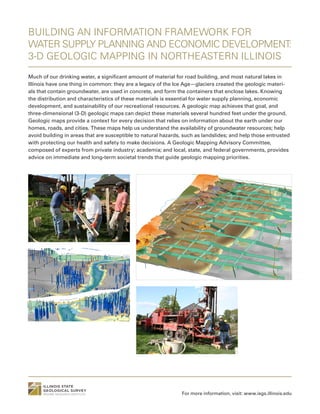
  • 1. BUILDING AN INFORMATION FRAMEWORK FOR WATER SUPPLY PLANNING AND ECONOMIC DEVELOPMENT: 3-D GEOLOGIC MAPPING IN NORTHEASTERN ILLINOIS Much of our drinking water, a significant amount of material for road building, and most natural lakes in Illinois have one thing in common: they are a legacy of the Ice Age—glaciers created the geologic materi- als that contain groundwater, are used in concrete, and form the containers that enclose lakes. Knowing the distribution and characteristics of these materials is essential for water supply planning, economic development, and sustainability of our recreational resources. A geologic map achieves that goal, and three-dimensional (3-D) geologic maps can depict these materials several hundred feet under the ground. Geologic maps provide a context for every decision that relies on information about the earth under our homes, roads, and cities. These maps help us understand the availability of groundwater resources; help avoid building in areas that are susceptible to natural hazards, such as landslides; and help those entrusted with protecting our health and safety to make decisions. A Geologic Mapping Advisory Committee, composed of experts from private industry; academia; and local, state, and federal governments, provides advice on immediate and long-term societal trends that guide geologic mapping priorities. For more information, visit: www.isgs.illinois.edu
  • 2. Create geologic maps for high-priority areas that provide a context for decision making related to the use of earth resources, identification of natural hazards, and creation of economic development opportunities. Objective BUILDING AN INFORMATION FRAMEWORK FOR WATER SUPPLY PLANNING AND ECONOMIC DEVELOPMENT: 3-D GEOLOGIC MAPPING IN NORTHEASTERN ILLINOIS Approach Significant Results and Potential Outcomes Investigators Sponsors Publications STATEMAP and Great Lakes Geologic Mapping Coalition components of the National Cooperative Geologic Mapping Program, administered by the U.S. Geological Survey; county governments. Brown, S. E. 2013. Three-dimensional geologic mapping of Lake County, Illinois: No small task. In Three-Dimensional Geological Mapping Workshop extended abstracts, edited by H. Thorleifson, R. C. Berg, and H. Russell, 23–28. Open-File Report OFR-13-2. St. Paul: Minnesota Geological Survey. Caron, O. 2015. 3-D geologic mapping of Will County, Illinois. Geological Society of America Abstracts with Programs 47 (5): 18. Curry, B. B., and J. F. Thomason. 2012. Surficial geology of the Huntley Quadrangle, Kane and McHenry Counties, Illinois. STATEMAP Huntley-SG 2012, 1:24,000. Champaign: Illinois State Geological Survey. Olivier J. Caron, Steven E. Brown, Richard C. Berg, Brandon B. Curry, Jason F. Thomason, and Andrew J. Stumpf 3-D geologic maps provide critical information for informed decision making related to all of our natural resource needs and for protecting our health and safety from natural and man-made hazards. Digital 3-D geologic map layers can be deployed in a county GIS for effective use with other digital information, such as land parcel, land-use zoning, and park and natural area boundary maps. This information has supported a number of water-sup- ply decisions in Lake County, including planning for additional water withdrawal from Lake Michigan. For planning purposes, dramatic changes in geology over short distances has weak- ened confidence in long-term reliance on groundwater for western Lake County communities. Information gleaned from 3-D geologic mapping explains why some communities have been unable to find suitable aquifer material in areas near existing groundwater production wells. Because each additional allocation of Lake Michigan for some Illinois communities affects the potential future use of that resource for other communities, geologic maps that show aquifers are essential to the long-term sustainability of both our groundwater and surface water. Geologic mapping requires examination and geologic interpretation of historical records and maps containing facts and observations about surface and subsurface geology. Additional information is acquired through a number of exploration methods, including drilling. These data are combined in a geographic information system (GIS) to form a robust 3-D database. State-of-the-art software applications and advanced database management techniques enable 3-D representation and visualization of subsurface information. 3-D visualization provides the capability to create enhanced 3-D geologic map products. Interaction with users of geologic information provides opportunities to customize map products for application-specific needs. 08.15 For more information, visit: www.isgs.illinois.edu
  • 3. HYDROLOGICAL FUNCTIONING AND HISTORY OF NELSON LAKE: PROTECTING THE “JEWEL OF KANE COUNTY” FROM URBAN ENCROACHMENT Nelson Lake, a shallow, spring-fed lake with a wide buffering fen, is home to a nesting group of white peli- cans, as well as rare calciphyllic orchids and other flora. Urban development and its potential impacts on Nelson Lake were investigated through study of the hydrological functioning of the lake: its water residence time, water chemistry, and the long-view history of lake water quality and the surrounding vegetation. Digital modeling of the geological data acquired for the study showed a large teardrop-shaped capture zone, which was immediately purchased or rezoned by the county. The short residence time of Nelson Lake water (less than 3 months) and surrounding geology and topography means that it is constantly being recharged by shal- low groundwater. Today, the capture zone of this shallow aquifer is largely overlain by soccer fields and not strip malls and subdivisions, thereby protecting the unique and fragile aquatic and wetland ecosystems. The long view of the functioning of Nelson Lake warns us that drought leads to landscape instability, the erosion of the surrounding morainal landscape, and rapid infilling of what is already a shallow lake. For more information, visit: www.isgs.illinois.edu 690 730 720 710 700 Figure 17. Ten-year capture zones for Nelson Lake and its fringing marsh (teal). For case 3, the flow lines and contours of the potentiometric surface of the Kaneville aquifer are shown. Case 1 Case 2 Case 3 Case 4 Case 5, low k Case 5, high k Percent 0 1 2 3 4 5 6 7 8 9 10 11 12 13 14 15 16 17 18 Age(calyrBP×1000) 20 40 20 40 60 spruce 20 20 20 20 40 20 40 20 sedge black birch oak hickory grass ragweed elm ash Pollen, relative abundance Analyst: Eric Grimm credit: Kenneth Cole Schneider credit: Bob Andrini
  • 4. To protect the water quality and hydrologic functioning of spring-fed Nelson Lake, an Illinois Natural Area and County Forest Preserve, home to rare and endangered animals and calciphyl- lic plants, and to determine changes in its past moisture balance and watershed vegetation. Objective HYDROLOGICAL FUNCTIONING AND HISTORY OF NELSON LAKE, KANE COUNTY Approach Significant Results and Potential Outcomes Investigators Sponsors Publications Kane County Forest Preserves, Kane County Planning Department Curry, B. B. 2003. Linking ostracodes to climate and landscape. In Bridging the gap: Trends in the ostracode biological and geological sciences, edited by L. E. Park and A. J. Smith, 223–246. The Paleontological Society Papers, vol. 9. Boulder, CO: The Paleontological Society. Curry, B. B., W. S. Dey, E. C. Grimm, S. L. Sargent, and S. A. Kuzin. 2004. Investigation of the geology, hydrology, water balance, paleovegetation, and paleohydrology of Nelson Lake Marsh. Contract Report to the Forest Preserve District of Kane County. Champaign: Illinois State Geological Survey. Dey, W. S., A. M. Davis, B. B. Curry, D. A. Keefer, and C. C. Abert. 2007. Kane County water resources investigations: Final report on geologic investigations. Open File Series 2007-7. Champaign: Illinois State Geological Survey. Nelson, D. M., F. S. Hu, E. C. Grimm, B. B. Curry, and J. E. Slate. 2006. The influence of aridity and fire on Holocene prairie communities in the eastern Prairie Peninsula. Ecology 87: 2523–2536. Brandon Curry, Eric Grimm (Illinois State Museum), William Dey (retired), Steve Sargent, and Edward Mehnert The most profound result of the study was its immediate use by the County Forest Preserves to purchase and rezone property determined to lie within the capture zone delimited by our study. The properties, which were slated for residential and small business use, are now a large sports park maintained by the county. The results of the borings, geophysical logs, electric earth resistivity surveys, and other analyses were used to help construct a three- dimensional model of the glacial sediment used to model groundwater flow in the drift (Dey et al. 2007). The paleoecological studies of the lake sediment core revealed that droughty periods led to rapid infilling of the lake from about 8,200 to 6,700 years ago (Nelson et al. 2003). Instead of being hydrologically open, Nelson Lake during that time was internally drained, and its microflora were sensitive to inputs of limiting nutrients. A holistic investigation of the subsurface geology revealed that Nelson Lake, a glacial kettle, is nestled in thick deposits of sand and gravel that rapidly thin away from the lake. The research included sampling eight sediment cores to bedrock and a continuous sounding of the electrical properties of the sediment immediately surrounding the lake. By mapping the thickness and extent of the sand and gravel, measuring water levels in the sand and gravel aquifer from an array of monitoring wells, and conducting sensitivity analyses of the hydrological and geographical variables in the analysis, we mapped the capture zone of the shallow aquifer. The fossil record of pollen, charcoal, plant macrofossils, and ostracodes (archived in a 50-foot-long sediment core from the center of Nelson Lake) revealed a rich history of biotic response to climate change, including late Pleistocene deglaciation, and climatic conditions over the past 10,000 years, including periods of severe drought. 08.15 For more information, visit: www.isgs.illinois.edu
  • 5. WETLANDS PROGRAM Wetlands provide us with a wide variety of benefits, including wildlife habitat, outdoor recreation, groundwater recharge, floodwater storage, and water-quality improvement. The loss of 90% of Illinois presettlement wetlands with attendant losses of these benefits prompted federal, state, and local laws to protect wetlands and the services they provide. As a result, activities that affect many (but not all) wetlands are subject to regulation, and governmental agencies, industry, and NGOs are routinely faced with wetland-related decisions to meet resource conservation policies, regulatory requirements, or both. These decisions involve issues including protection of sensitive, high-quality wetland habitats, wetland restoration or creation, and construction of artificial wetlands to treat runoff. These groups depend on information based on impartial collection and unbiased interpretation of data that accurately describe the physical, hydrological, and biological characteristics of wetlands. For more information, visit: www.isgs.illinois.edu
  • 6. Collect and interpret hydrogeological, geochemical, and ecological data critical for decision making regarding wetland management. Develop and maintain trust among stakeholders. Objective WETLANDS PROGRAM Approach Significant Results and Potential Outcomes Investigators Sponsors Publications Illinois Department of Transportation, Illinois Tollway, Illinois Nature Preserves Commission/ Department of Natural Resources Miner, J. J., K. W. Carr, and K. E. Bryant. 2014. Performance of bioswales used for improve- ment of roadway runoff from a major interstate in Illinois. Paper presented at that Joint Aquatic Sciences Meeting, Portland, Oregon, May 18–23. Miner, J. J., and M. C. Higley. 2013. Hydrogeologic monitoring in the Illinois-Wisconsin Lake Plain, northern Lake County, Illinois. Champaign: Illinois State Geological Survey, Open-File Series 2013-1, 72 pp. Miner, J. J., and M. V. Miller. 2011. Wetlands geology. In Geology of Illinois, edited by D. R. Kolata and C. K. Nimz, pp. 361–369. Champaign: Illinois State Geological Survey. Plankell, E. T., and J. J. Miner. 2014. Impacts to a forested fen as a result of roadway deicing activi- ties. Paper presented at the Joint Aquatic Sciences Meeting, Portland, Oregon, May 18–23. Pociask, G. E., and J. W. Matthews. 2013. Restoration progress and flood disturbance at IDOT wetland mitigation sites. Rantoul: Illinois Center for Transportation, Research Report FHWA- ICT-13-016, 31 pp. James Miner, Steven Benton, Keith Carr, Geoffrey Pociask, Eric Plankell, Kathleen Bryant, Jessie Ackerman, Jessica Monson, Colleen Long, Katharine Schleich, and Matthew Even In a large, recent project providing assistance to the Illinois Tollway Authority, monitor- ing and analysis of flow volume, water chemistry, and sediment in treatment wetlands (bioswales) constructed to improve the quality of roadway runoff showed that most of the bioswale sites are equally as or more effective than other best management practices, depending on the design parameters and other site characteristics. This information will be used to guide the design and implementation of bioswales in future road construction proj- ects. Other notable results include identification of the geochemical conditions that sustain populations of the federally endangered dragonflies, recommendations for restoration of the large and unique ecosystem at Illinois Beach State Park, assistance to the Illinois Department of Transportation (IDOT) with wetland restoration and creation for its wetland mitigation program, evaluation of the influence of floods on the quality of plant communities at IDOT wetland restoration sites, and delineation of groundwater protection areas for high-quality habitats at Illinois Nature Preserves. Data-driven assessment and characterization of wetland area, quality, and function using traditional hydrogeological and geochemical methods and geographic information systems (GIS); analysis and recommendations to guide the protection, restoration, or creation of natu- ral or artificial wetlands; baseline and postconstruction monitoring of water quality, levels, and flow to provide the basis for wetland management strategies. 08.15 For more information, visit: www.isgs.illinois.edu
  • 7. A NONCONVENTIONAL CO2 -ENHANCED OIL RECOVERY TARGET IN THE ILLINOIS BASIN: OIL RESERVOIRS OF THE THICK CYPRESS SANDSTONE Illinois contains economically significant energy resources in the form of natural gas, oil, and coal. However, extraction of oil from some reservoirs (typically several thousand feet deep) through typical recovery methods is hampered by the geologic complexities of the oil-bearing reservoir and adjacent rocks. The oil in the reservoir rock is often accompanied by the occurrence of extremely salty water (brine). During oil production, brine can enter the well instead of oil. Typically, these nonconventional oil-rich zones are bypassed because of the expense of producing the oil resource and removing the brine, which is an unwanted by-product that creates additional cost. However, innovative oil extraction methods and technologies show great potential for recovering bypassed oil from nonconventional oil rereservoirs and mitigating the impact of human-induced climate change. With the current impetus to reduce greenhouse gas emissions, the carbon dioxide (CO2 ) from anthropogenic or natural sources can be used to enhance oil recovery in these nonconventional reservoirs while storing or sequestering it deep in the ground. This study focuses on developing methods to increase CO2 enhanced oil recovery (EOR) in nonconven- tional oil reservoirs and demonstrating economic incentives for CO2 storage and CO2 use to facilitate oil production in the Cypress Sandstone of Illinois. The findings will be extrapolated to a regional resource assessment and could potentially be used to aid in the development of oil resources that actually result in removing more carbon from the atmospheric part of the carbon cycle than is created by the burning of carbon removed from the ground. For more information, visit: www.isgs.illinois.edu Geocellular porosity model. Roughly 0.5 x 0.5 mi. 50x vertical exaggeration.Graphical log resulting from a detailed core description of the C.T. Montgomery B-34 well (121592606400, Sec 4, T3N, R9E) in Noble Field, Richland County. Locations of logs used in the petrophysical analyses throughout the thick Cypress Sandstone fairway.
  • 8. Identify and quantify the nonconventional carbon dioxide (CO2 ) enhanced oil recovery (EOR) and storage target opportunities within the thick Cypress Sandstone in the Illinois Basin. Objective A NONCONVENTIONAL CO2 -ENHANCED OIL RECOVERY TARGET IN THE ILLINOIS BASIN: OIL RESERVOIRS OF THE THICK CYPRESS SANDSTONE Approach Significant Results and Potential Outcomes Investigators Sponsors U.S. Department of Energy/National Energy Technology Laboratory Nathan Webb, Scott Frailey, Hannes Leetaru, Nathan Grigsby, Peter Berger, Roland Okwen, John Grube, Beverly Seyler, Christopher Korose, and Charles Monson Application of these techniques will provide data that can be used to create guidelines and recommendations for CO2 -EOR development strategies (e.g., well patterns, spacing, and orientations as well as CO2 injection profiles) of the thick Cypress Sandstone (and similar formations) that provide operators an economic incentive to store CO2 . Lessons learned from this research may be extrapolated to other known and as yet undiscovered nonconventional oil reservoirs in similar geologic formations, both within Illinois and at other locations in the United States. Most important, the research could demonstrate that the use of CO2 to enhance oil recovery also could potentially be used to store carbon otherwise released to the atmosphere, thereby creating net carbon-negative oil projects. Reservoir characterization, geologic mapping, three-dimensional modeling, and simula- tion of oil and brine flow in the thick Cypress Sandstone and adjacent rocks will be used to develop methods for improved oil recovery and storage efficiency through CO2 injection. Results from a detailed oil field study will be scaled up and coupled with regional geologic mapping to estimate the size of the potential nonconventional CO2 -EOR and storage resource in the Illinois Basin. Economic evaluations will be completed so that the relatively high storage component anticipated from these formations can be understood in terms of the magnitude of the CO2 -EOR and storage. 08.15 For more information, visit: www.isgs.illinois.edu Publications Webb, N. D., and N. P. Grigsby. 2015 (accepted). Geological characterization and modeling of the Cypress Sandstone at Noble Field, southeastern Illinois. Paper presented at the Eastern Section American Association of Petroleum Geologists Meeting, Indianapolis, Indiana, September 21–22.
  • 9. ILLINOIS BASIN – DECATUR PROJECT Carbon capture and storage (CCS) from ethanol production represents a significant opportunity to miti- gate climate change because of the low cost of capture and purity of the carbon dioxide (CO2 ) produced. The Illinois Basin – Decatur Project (IBDP) is an integrated CCS project being carried out in Decatur, Illinois, by the Illinois State Geological Survey. The IBDP is a full-cycle CCS project—from site characterization to closure—with the goal of injecting one million tonnes of anthropogenic CO2 captured from biofuel produc- tion into a deep saline rock formation, the Mt. Simon Sandstone. The IBDP has successfully completed three years of CO2 injection, with cumulative injection of one million tonnes as of November 2014. The IBDP now moves into a three-year post-injection monitoring period. For more information, visit: www.isgs.illinois.edu
  • 10. The 1-million-tonne Illinois Basin – Decatur Project (IBDP) is verifying the storage capacity, injectivity, and containment of the Mount Simon Sandstone, the largest regional saline reser- voir storage resource in the Illinois Basin region. Objective ILLINOIS BASIN – DECATUR PROJECT Approach Significant Results and Potential Outcomes Investigators Sponsors Publications U.S. Department of Energy/National Energy Technology Laboratory, Illinois Department of Commerce and Economic Opportunity Greenberg, S., ed. 2014. Illinois Basin – Decatur Project. Special Issue, Greenhouse Gases Science and Technology 4 (5): 569–684. Sallie Greenberg (PI), Kathleen Atchley, Robert Bauer, Peter Berger, Richard Berg, Alice Bernard, Curt Blakley, Daniel Byers, Carl Carman, Johnathan Cox, James Damico, Robert Finley, Scott Frailey, Jared Freiburg, Damon Garner, Abbas Iranmanesh, Daniel Klen, Christopher Korose, Ivan Krapac, Timothy Larson, Hannes Leetaru, Randy Locke, Edward Mehnert, Charles Monson, Roland Okwen, Christopher Patterson, LaDonna Pearl, Hongbo Shao, Derek Sompong, Nathan Webb, and Bracken Wimmer • In total, 999,215 tonnes have been stored over three years. • Three years of pre-injection and three years of injection monitoring have been undertaken. • All parameters show full containment of CO2 in the deep subsurface. At the end of the project, we will understand: • carbon storage infrastructure development and implementation. • thresholds for geophysical (3-D vertical seismic profile and 2-D line) plume detection based on rock type, depth, perforated interval, and reservoir properties. • the pressure front distribution and timing of CO2 movement. • the distribution of microseismic events in 3-D space around the injection well and how clusters of events develop. The information gained from this project is being used around the world to mitigate the impact of greenhouse gas emissions on climate change. The IBDP, led by the Illinois State Geological Survey in partnership with Archer Daniels Midland Company (ADM) and Schlumberger Carbon Services, is demonstrating the geological stor- age of 1 million tonnes of CO2 more than 7,000 feet beneath the surface. The project began in 2008 and has created the entire infrastructure needed for carbon storage, including deep injection and monitoring wells, a compression/dehydration facility, a pipeline, and intensive shallow and deep monitoring systems. The IBDP captured CO2 from ethanol production at ADM for a period of three years. A three-year period of post-injection monitoring and research is underway to understand the reservoir response to the cessation of CO2 injection. 08.15 For more information, visit: www.isgs.illinois.edu
  • 11. KARST INVESTIGATIONS IN NORTHWESTERN AND SOUTHWESTERN ILLINOIS About 10 percent of Illinois contains karst terrain. Karst is simply defined as an area underlain by fractured bedrock whose fractures are enlarged by dissolution of the rock. Limestone and dolomite are susceptible to dissolution by rainwater and soil water. The larger the fracture apertures, the more likely that sediment will fall into the fractures or crevices and create sinkholes. The fractures and crevices also provide porosity and permeability of the bedrock. Under certain hydrologic conditions, the fractures and crevices may be filled with water. Provided the water quality is suitable for drinking, the fractured rock becomes an aquifer. However, because the crevices are so large (sometimes cave size), recharge and groundwater movement are rapid and highly susceptible to surface-borne contamination. Consequently, karst terrain is a unique environment that requires special care when building structures and infrastructure so as not to compro- mise the water resources of the karst aquifer. Karst terrain is also susceptible to collapse, creating a safety hazard. In addition, the caves in these areas provide a unique environment that records climate change, changes in land use, and earthquakes. The work we are doing in the karst areas of Illinois focuses on protection of water resources and on taking advantage of the natural records housed within its caves. For more information, visit: www.isgs.illinois.edu
  • 12. Characterize the degree and extent of karst terrain on local and state levels to determine the susceptibility of associated karst aquifers to surface-borne contaminants in northwestern and southwestern Illinois, and identify seismic history associated with the New Madrid and Wabash Valley Seismic Zones in Illinois and adjacent states through the use of speleothems in caves. Objective KARST INVESTIGATIONS IN NORTHWESTERN AND SOUTHWESTERN ILLINOIS Approach Significant Results and Potential Outcomes Investigators Sponsors Publications Illinois State Geological Survey, Jo Daviess County League of Women Voters, U.S. Geological Survey, Prairie Research Institute Panno, S. V., D. E. Luman, and D. R. Kolata. 2015. Characterization of karst terrain using remotely sensed data in Jo Daviess County, Illinois. Circular 587, 29 pp., 1 map, 1:62,500, http://isgs.illinois.edu/publications/58/appendix [digital appendix]. Champaign: Illinois State Geological Survey. Panno, S. V., P. G. Millhouse, R. W. Nyboer, D. Watson, W. R. Kelly, L. Anderson, C. C. Abert, and D. E. Luman. 2014. Guide to the geology, hydrogeology, botany, history, and archaeology of the Driftless Area of northwestern Illinois, Jo Daviess County. Field Trip Guidebook 2014A. Champaign: Illinois State Geological Survey. Tinsley, J. C., J. B. Paces, and S. V. Panno. 2015. Exploring paleoseismic signals from caves in the central and eastern USA. Seismological Research Letters 86 (2B): 597. Samuel Panno, Walton Kelly, Donald Luman, Dennis Kolata, Ya Zhang, Wen-Tso Liu, John Tinsley, Robert Bauer, and Craig Lundstrom A field trip through Jo Daviess County in northwestern Illinois was attended by more than 150 citizens and demonstrated community interest in understanding the ramifications of living in karst terrain. Each was provided a field trip guidebook that included a detailed description of the history, archaeology, biology, geology, and hydrology of the county. The guidebook is now being used throughout the county as a primer on the natural history of northwestern Illinois and the value of citizen participation in implementing groundwater protection strate- gies. In southwestern Illinois, the techniques we developed for identifying seismic events by using speleothems in caves are being applied to fill in gaps in the seismic history of the New Madrid Seismic Zone and the Wabash Valley Seismic Zone. These records demonstrate that ground-shaking (earthquake) activity has recurred during the last 200,000 to 300,000 years. Water quality investigations in karst regions of the state are conducted through mapping of karst features (e.g., sinkholes, large springs, crevices) by using aerial photography, enhanced-resolution digital elevation data, and results of water chemistry. Groundwater samples are obtained from private wells and springs and analyzed for chemical composition, tritium, bacteria, pharmaceuticals, and personal care products to determine baseline condi- tions. Review of land use can lead to likely sources of existing contamination. In addition, the region’s seismic history, or record of ground shaking, has been discovered through examina- tion of stalagmites from caves in southern Illinois and adjacent states. Our close relationship with community leaders helps us identify local and regional issues. Citizen involvement and community-supported outreach create an information network and ready assistance for the protection of local resources. 08.15 For more information, visit: www.isgs.illinois.edu