NDGISUC2017 - Targeting Surface Water Quality with PTMApp
•
0 likes•144 views

Presented at the North Dakota GIS Hub Users Conference, September 19-20, 2017, Bismarck, ND

Recommended
Recommended
More Related Content
What's hot
What's hot (20)
Similar to NDGISUC2017 - Targeting Surface Water Quality with PTMApp
Similar to NDGISUC2017 - Targeting Surface Water Quality with PTMApp (20)
More from North Dakota GIS Hub
More from North Dakota GIS Hub (20)
Recently uploaded
Recently uploaded (20)
NDGISUC2017 - Targeting Surface Water Quality with PTMApp
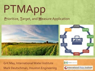
- 1. PTMApp Prioritize, Target, and MeasureApplication Grit May, International Water Institute Mark Deutschman, Houston Engineering
- 2. Evolution of an Idea Red River Basin Mapping Initiative Red River Basin LiDAR Terrain Analysis Watershed Planning Tools Water Quality DSS 2005 LiDAR Hydro- conditioning Smart GIS Products GRID-BASED ANALYSIS Evolution
- 3. PTMApp Goals ▪ Plan and implement prioritized practices ▪ Target projects to improve water quality in specific lakes and rivers ▪ Estimate effectiveness of one or many practices in combination at multiple spatial scales (field, small watershed, large watershed) ▪ Change how decisions can be made about improving water quality – NO MORE RANDOM ACTS OF CONSERVATION! WHAT IS PTMApp?
- 4. James River and ND Red River Basin PTMApp Funding ▪ ND Department of Health ▪ ND NRCS ▪ ND Red River JointWRD ▪ Stutsman County Soil Conservation District ▪ LaMoure County Soil Conservation District ProjectTeam/Production ▪ InternationalWater Institute ▪ Houston Engineering, Inc. Acknowledgements PTMApp Funding
- 5. PTMApp COMPONENTS Create Products Using PTMApp–DESKTOP ▪ Free for download and use ▪ ArcGISToolbar ▪ Creates products ▪ Includes example uses WHAT IS PTMApp? Internet Access of Product Using PTMApp–WEB • Section 319 Implementation Plans • Grant Applications InUseInUse
- 6. PTMApp Inputs WHAT IS PTMApp?
- 7. ▪ Typically, priority resource points reflect some area of interest (e.g. lake inlet/outlet, river reach at risk, gage/monitoring station…) ▪ Locations - in addition to the catchment outlets - within the watershed where sediment, total nitrogen, and total phosphorous are “routed”. ▪ Locations where information about the benefits and costs of conservation/best management practices are generated. Priority Resource Points
- 8. Prioritize,Target, and Measure WHAT IS PTMApp?
- 9. DESCRIBE: Watershed Condition EXAMPLE PRODUCTS AND USES
- 10. PRIORITIZE: Your ResourceConcerns EXAMPLE PRODUCTS AND USES
- 11. COMPLETE:source assessment identifies the magnitude and spatial distribution of potential pollution sources EXAMPLE PRODUCTS AND USES
- 12. EVALUATE: Practice Feasibility EXAMPLE PRODUCTS AND USES • Depends on several factors: ❖ Size of contributing drainage area ❖ Land slope ❖ Flow regime ❖ Land use (e.g. cultivated land) ❖ Societal factors (e.g. landowner willingness) • NRCS design standards used • Six BMP treatment groups BMP Group Storage Filtration Bio-Filtration Infiltration Protection Source Reduction Primary Treatment Process Sedimentation Sedimentation Sedimentation & biological Volume abstraction Physical protectionof landscape Reductionof Mass Potential
- 13. EVALUATE: Practice Feasibility EXAMPLE PRODUCTS AND USES Treatment Group BMP Type MDA BMP Handbook Category Infiltration Alternative Tile Intakes Controlling Filtration Grassed Waterways Controlling Filtration Filter Strip Trapping Protection Grade Stabilization Structure Trapping Source Reduction Nutrient Management Avoiding Storage Water and Sediment Control Basin (WASCOB) Trapping Protection Critical Area Planting Avoiding Storage Pond for Water Use Trapping Protection Streambank and Shoreline Protection Controlling Storage Wetland Restoration Trapping Filtration Conservation Cover Easement Avoiding Bio-Filtration Vegetated Subsurface Drain Outlet (Saturated Buffers) Trapping Storage Drainage Water Management Controlling Bio-Filtration Denitrifying Bioreactor Trapping
- 14. EVALUATE: Practice Feasibility EXAMPLE PRODUCTS AND USES
- 15. ESTIMATE: PracticeWQ Benefits EXAMPLE PRODUCTS AND USES • amount of a pollutant removed • cost to remove one unit of pollutant
- 16. TARGET: Best Practice Locations (WQ , Profitability, Willing Participation) EXAMPLE PRODUCTS AND USES
- 18. MEASURE: Benefits of Targeted Implementation Plan EXAMPLE PRODUCTS AND USES
- 19. Some FinalThoughts No tool is perfect. Define the problem, use the right tool. PTMApp is for Water Quality Planning
- 20. Limitations • PTMApp – Desktop ProcessingTimes • Spatial resolution of Land Use / LandCover Data • Needs more validation forTP/TN loss in range of landscapes • Ignores existing practices unless “entered” • Lacks near channel sediment • No hydrological routing Final Thoughts