
Recommended
More Related Content
Similar to Power Point Group 3 Early childhood.pptx
Similar to Power Point Group 3 Early childhood.pptx (20)
Recently uploaded
Recently uploaded (20)
Power Point Group 3 Early childhood.pptx
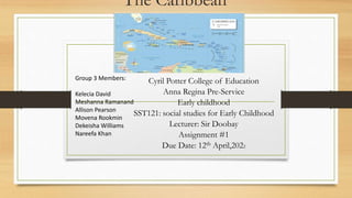
- 1. The Caribbean Cyril Potter College of Education Anna Regina Pre-Service Early childhood SST121: social studies for Early Childhood Lecturer: Sir Doobay Assignment #1 Due Date: 12th April,2022 Group 3 Members: Kelecia David Meshanna Ramanand Allison Pearson Movena Rookmin Dekeisha Williams Nareefa Khan
- 2. CONTENT ●Introduction ●Location of the Caribbean ●Hemispheric/ adjacent land and water bodies/latitude and longitude ●Countries that make up the Caribbean both geographical and cultural ●Conclusion ●References
- 3. The Caribbean is made up of twenty-six (26) countries, thirteen (13) Independent countries, and thirteen (13) Dependent countries. The region is known for its melting pot of different languages, cuisine, music, and customs. Its culture is a beautiful blend of colonial and native elements shaped by each country’s socio-cultural experiences. However, as we proceed in our presentation we will be enlightening you on the location of the Caribbean, the Hemispheric/adjacent land and water bodies/ latitude and longitude, and the countries that make up the Caribbean both geographical and cultural Introduction
- 4. ● The Caribbean island are located in the region of the Caribbean Sea. The Caribbean Sea region is located southeast of the Gulf of the Mexico and the North American mainland, east of Central America, North of South American and West of the Atlantic Ocean. Location of the Caribbean
- 5. Hemispheric/ adjacent land and water bodies/ latitude and longitude The earth divides it into two water equal halves called hemispheres. These are generally considered to be four hemispheres: Northern, Southern, Easter, and Western. The equator, or line of 0 degrees latitude, divide the earth into the Northern and Southern hemispheres. The Earth can also be divided into hemispheres along meridians, or lines of longitude. The prime meridian, or 0 degrees longitude, divide the earth into Eastern and Western hemispheres, Many geographers consider the 20 degrees west line of longitude and the 160 degree east line of longitude as the Eastern and Western hemispheres.
- 6. Hemispheric/adjacent land and water bodies latitude and longitude (Cont`d) The most common way is to identify the location using coordinates such as latitude and longitude. Absolute location can Latitude is used to mark the north-south position of a location on the Earth’s surface and ranges from 0 degrees at the equator to 90 degrees at the North and South Poles. There are 180 degrees of latitude and the distance between each degree of latitude is roughly 69 miles (111 km). Longitude lines run north-south and indicate the location of a point east-west. Latitude is therefore the angular distance east or west of the Prime Meridian. There are 360 degrees of longitude (+180° eastward and −180° westward.).
- 7. Countries that make up the Caribbean both Geographical and Cultural Dependent countries • Anguilla • Aruba • British Virgin Island • Cayman Island • Guadeloupe • Martinique • Montserrat • Neither land Antilles • Puerto Rico • Saint Barthelemy • St. Martin • Turks and Caicos island • • Independent Countries • Antigua and Barbuda • The Bahamas • Barbados • Cuba • Dominica • Dominica Republic • Grenada • Haiti • Jamaica • St. Kitts and Nevis • St. Lucia • St. Vincent and the Grenadines
- 8. Countries that make up the Caribbean both Geographical and Cultural (Cont’d) ● Countries that are 0ften included in the Caribbean Due to their cultural ties with the region are: ● Belize ● Guyana ● Suriname ● French Guiana
- 9. Conclusion In conclusion from our research it was understood that they are 26 countries in the Caribbean Guyana, French Guiana and Suriname because of their cultural and Political believe
- 10. References ● Caribbean. caribbeanislands.com. (2017, May 17). Retrieved April 10, 2022, from https://www.caribbeanislands.com/ ● ● Caitlin. D, January 12, 2021, Geography Basics https://www.geographyrealm.com/absolute-relative-location/ ● ● Curley, R. (2020, April 14). Map of the Caribbean Sea and its Islands. Trip Savvy. Retrieved April 11, 2022, from https://www.tripsavvy.com/maps-of-the-caribbean-sea-and-islands-1487724 ● ● IAC Publishing. (n.d.). How many countries are in the Caribbean? Reference. Retrieved April 10, 2022, from https://www.reference.com/geography/many-countries-caribbean-df0ba050b4457952 ● ● National Geography Society https://www.nationalgeographic.org/encyclopedia/hemisphere/ ●