The Thrust fault architecture in the External Sierras (new)
•Download as PPTX, PDF•
2 likes•1,902 views

The document discusses the geology of the Western External Sierras of the Pyrenees Mountains. It describes the location and types of thrust faults in the region, including duplex, back, and roof thrusts, which formed due to the convergence of the African and Eurasian plates during the Alpine orogeny. It also examines two models of thrust belt development and discusses how different rock layers influenced the fault geometries. Overall, the document provides an overview of the structural geology and tectonic evolution of the Western External Sierras region during the Alpine orogeny.

Recommended
More Related Content
What's hot
What's hot (20)
Viewers also liked
Viewers also liked (20)
Similar to The Thrust fault architecture in the External Sierras (new)
Similar to The Thrust fault architecture in the External Sierras (new) (20)
More from Isaac Kenyon
More from Isaac Kenyon (10)
The Thrust fault architecture in the External Sierras (new)
- 2. Location of the Western External Sierras. Types of thrust faults of the Western External Sierras and how they form i.e. Decollment mechanisms. Geological history of the South Central Pyrenees. Relation of the Western External Sierras and the regional context of the Alpine Orogeny.
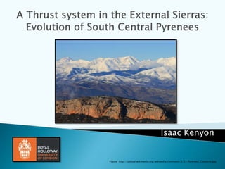
- 3. Figure: http://su- thermochronology.syr.edu/_images/pyreneesmap3.jpg Figure: Minh Nguyen (PANO_20140606_152833 ) photo from the highest peak of my mapping area
- 4. Thrust faults - Are reverse faults but with a low taper angle and have a hanging wall block above a very low angle thrust. Decollment – Is a gliding plane between two rock masses. AKA (basal detachment fault). Back thrusts – A thrust fault which has an opposite vergence to that of the main thrust system or thrust belt.
- 5. Mechanically weak layers slip in strata allowing the development of stepped thrusts. Decollment in the Pyrenees occurs from mechanically weak basements i.e. Shales and evaporites (my area). (Vidal-Royo, Koyi and Muñoz, 2009) Figure: http://upload.wikimedia.org/wikipedia/commons/thumb/ 3/31/Decollement_in_a_compressional_setting.pdf/page1 -1280px-Decollement_in_a_compressional_setting.pdf.jpg It’s a deformational structure associated with compressional settings (fold-and-thrust belts). Triassic Evaporites Figure from mapping: Minh Nguyen photo: IMG_20140604_145331
- 6. Model 1 - (Meigs and Burbank, 1997) Model 2 - (Vidal-Royo, Koyi and Muñoz, 2009) Fold and thrust development Critical- taper wedge model. The thrust belt revolves around the critical taper angle between basal decollment and the surface slope. Model implies that internal deformation is modulated by changes in the surface slope and in material properties within and at the base of the wedge. Model depicts the ductile frictional contrasts of the basal decollment of structures through thin- skinned shortening tectonics (a style of thrusting in which sedimentary cover is entirely removed from underlying basement).
- 7. Model 1 - (Meigs and Burbank, 1997) Model 2 - (Vidal-Royo, Koyi and Muñoz, 2009) Fold and thrust development Critical- taper wedge model. The thrust belt revolves around the critical taper angle between basal decollment and the surface slope. Model implies that internal deformation is modulated by changes in the surface slope and in material properties within and at the base of the wedge. Model depicts the ductile frictional contrasts of the basal decollment of structures through thin- skinned shortening tectonics (a style of thrusting in which sedimentary cover is entirely removed from underlying basement).
- 8. Model 1 - (Meigs and Burbank, 1997) Model 2 - (Vidal-Royo, Koyi and Muñoz, 2009) Issue: not sufficient resolution of data. Limited applicability to fold and thrust belts due to mechanical and deformational incompatibilities between the geological record and the model. Model depends on the mechanical behaviour of evaporites and it’s interaction with the overlying overburden. High frictional domain (dashed lines represent sand) Low frictional domain (black areas shows the ductile layer Source: Meigs and Burbank, 1997)
- 9. Duplex thrusts (Antiformal stack duplex) – Where a series of thrusts connects both with a floor thrust below and a roof thrust above i.e. Back thrust. Form in the hanging walls of the thrust system. Anticlines are related to folding at the tip of basal decollment. It develops as a result of thrusting to accommodate deformation i.e. fault-propagation folds (Vidal-Royo, Koyi and Muñoz, 2009) Source: http://www.diggles.com/pgs/2008/Thrust_Belt_plays.jpg Source: (McClay, 1991) Duplex thrust – my fair copy map
- 10. A thrust fault which has an opposite vergence to that of the main thrust system The back thrusts in my area formed a tectonic wedge (a body of rock that has moved between a pair of oppositely vergent thrusts). The triangle zone in the South of my area is a wedge in which a third, foreland-south vergent thrust completes a triangle in cross section. Figure taken from: http://www.diggles.com/pgs/2008/Thrust_Belt_plays.jpg Figure taken from: (McClay, 1991) Example triangle zone from my fair copy map.
- 11. Roof thrusts – When a back thrust cuts off the top of original thrust vergence. The upper thrust surface bounds a duplex. It can be smooth/folded by movement on underlying thrusts of the duplex. Figure taken from: http://www.diggles.com/pgs/2008/Thrust_Belt_plays.jpg Figure taken from: (McClay, 1991) (McClay, 1991) Example of the Duplex, Back and Roof thrusts in my area – my own cross-section.
- 16. Figure: Shows the change from the rifting of Africa from Eurasia after the break up from Pangaea to compression and the movement of Africa towards Iberia and Eurasia. This is where the thrust faults start to develop early Cretaceous. Image: http://geology.gsapubs.org/content/36/11/839/F4.l arge.jpg
- 17. Bernd Andeweg, 2002 Africa Iberia Eurasia •Not all models correspond to a simple plate tectonic reality. Pyrenean fold belt Figure: http://www.igc.cat/web/en/map ageol_atles_evoluciopaleo.html
- 18. There was a 150km separation between Iberia and Europe during this time (Andeweg, 2002). Most of Iberia was below sea level (subtle eustatic sea level changes caused significant shifts in the position of the coastline. Beach deposits Source: IMG_20140523_121540 Minh Nguyen
- 20. Clockwise rotation of Iberia, with partial subduction under Eurasia (Andeweg, 2002) with large scale deformation. Rapid convergence between Iberia and Africa. Iberia Eurasia Betics Africa Sardinia Bernd Andeweg, 2002
- 21. Southward thrust sheet emplacement from rapid convergence of Africa and Eurasia (Andeweg, 2002). Inversion of previously rifted Mesozoic basins. Introduction of marine foreland deposits. Development of the Ebro basin. Deposits of limestone platforms due to marine transgressions. Figures: mapping Minh Nguyen (A) IMG_20140523_155047 (B) IMG_20140529_123447 (C) Thin section photo supplied by the department B CA Transgression
- 22. Bernd Andeweg, 2002 Africa Iberia Eurasia Figure: http://d1jqu7g1y74ds1.cloudfront.net/wp- content/uploads/2010/11/Geologic-time-scale.jpg
- 23. Pyrenean suture becomes a compressional active plate margin (Andeweg, 2002). Southward thrusting creates the first important relief of the Pyrenees. Ebro foreland basin is deep marine and turbiditic at this point and is widening to the cope with advancing load. The sediments derived are shelf and slope marls and sandstones. Source: IMG_20140528_113104 Minh Nguyen
- 24. Bernd Andeweg, 2002 Africa Iberia Eurasia Ebro Basin Figure: http://d1jqu7g1y74ds1.cloudfront.net/wp- content/uploads/2010/11/Geologic-time-scale.jpg
- 25. Peak collision of the Pyrenees Folding of a syncline separates the Pyrenean foreland basin from marine waters (Andeweg, 2002). Eastern Ebro basin is now closed from the worlds oceans (endoheric). Lacustrine centre and alluvial fan building on the margins of the basin occurs. Basement detachment faults become reactivated. Figure taken from: http://claymin.geoscienceworld.org/content/47/3/303/F2.large.jpg
- 27. Pyrenees is further deformed and uplifted Syn-sedimentary continental deposition and molasse (alluvial) sedimentation Influx of terrestrial sandstone, marine shale and rapid exhumation. (Andeweg, 2002) Figure taken from: http://upload.wikimedia.org/wikipedia/commons/3/37/Uureg_Nuur.jpg
- 29. External Sierras fully develops End of the sedimentation cycle and start of erosion Ebro basin begins to fill with conglomerates, passing into fluvial/lacustrine sediments (siltstones and sandstones). Figure taken from: http://www.reditec.org/en/sortida_geotectonica The External Sierras
- 30. Bernd Andeweg, 2002 Africa Iberia Eurasia Figure: http://d1jqu7g1y74ds1.cloudfront.net/wp- content/uploads/2010/11/Geologic-time-scale.jpg
- 31. Convergence between Eurasia (containing Iberia) and Africa begins to slow down. Sedimentary break in the plate boundary reorganisation. Limited activity along the plate boundary (axial zone). External Sierras stops developing in the west SE verged thrusting terminates (25Ma) A shift to major denudation (erosion) Passive margin (Andeweg, 2002) Figure taken from: http://gent.uab.cat/ateixell/en/content/field-seminar
- 32. Many of the thrust faults in the Pyrenees are roll over thrust anticline faults. Can be ideal for trapping hydrocarbons as the anticlines plunge create a 4-way dip closure effect. (Possibility?) Impermeable evaporites (strong competent, and crystalline) The marine sediments and limestones etc. would act as reservoirs and source rocks for the area. Figure: taken from the Geology of Petroleum module from Moodle Lecture 7 - Pete Burgess Impermeable Source: IMG_20140602_142651 Minh Nguyen
- 34. There is a wealth of geological data in the Western external Sierras to study thrust fault geometry in relation to the Alpine orogeny. The Western External Sierras supports the types of thrusting: duplex, roof and back thrusts. My work reflects on a combination of both models as proof that not all work. Different lithologies (mechanically speaking have variations in tectonic stresses which produce different thrust fault mechanisms). Models are useful in a small context, geology is never small. The thrust fault geometry has a part to play in the depositional environment of the Pyrenees Places similar Future work
- 35. Field photos – Minh Nguyen – Samsung phone RHUL logo – https://www.royalholloway.ac.uk/iQuad/graphics/cER/Primary/RHULMasterlogoCMYK-Cropped-550x275.jpg Wally - http://i.dailymail.co.uk/i/pix/2010/06/01/article-1283070-0622451D0000044D-804_306x598.jpg 4.bp.blogspot.com, (2015). [online] Available at: http://4.bp.blogspot.com/--mh- 6Nft1iE/TlZ240s0MtI/AAAAAAAADE4/GL9HWfkr3n0/s1600/SCHELLART_2002_Pyreenes_profile.jpg [Accessed 20 Feb. 2015]. All-geo.org, (2015). [online] Available at: http://all-geo.org/highlyallochthonous/wp-content/uploads/2010/07/Cretmap.jpg [Accessed 20 Feb. 2015]. Andeweg, B. (2002). Cenozoic tectonic evolution of the Iberian Peninsula. [S.l.: s.n.], pp.83 - 118. Anon, (2015). . Claymin.geoscienceworld.org, (2015). [online] Available at: http://claymin.geoscienceworld.org/content/47/3/303/F2.large.jpg [Accessed 20 Feb. 2015]. Diggles.com, (2015). [online] Available at: http://www.diggles.com/pgs/2008/Thrust_Belt_plays.jpg [Accessed 20 Feb. 2015]. Discoveringfossils.co.uk, (2015). [online] Available at: http://www.discoveringfossils.co.uk/eocenemap.jpg [Accessed 20 Feb. 2015]. Geology.gsapubs.org, (2015). [online] Available at: http://geology.gsapubs.org/content/36/11/839/F4.large.jpg [Accessed 20 Feb. 2015]. Igc.cat, (2015). Paleogeographical evolution. [online] Available at: http://www.igc.cat/web/en/mapageol_atles_evoluciopaleo.html [Accessed 20 Feb. 2015]. McClay, K. (1991). Glossary of thrust tectonic terms. Thrust Tectonics: London, Chapman & Hall, pp.419-433. Meigs, A. and Burbank, D. (1997). Growth of the South Pyrenean orogenic wedge. Tectonics, 16(2), pp.239-258. Reditec.org, (2015). Virtual field trip - Geotectonics | REDITEC. [online] Available at: http://www.reditec.org/en/sortida_geotectonica [Accessed 20 Feb. 2015]. Stampfli, G., Borel, G., Marchant, R. and Mosar, J. (2002). Western Alps geological constraints on western Tethyan reconstructions. Journal of the Virtual Explorer, 08. Su-thermochronology.syr.edu, (2015). [online] Available at: http://su-thermochronology.syr.edu/_images/pyreneesmap3.jpg [Accessed 20 Feb. 2015]. Teixell, A., Arboleya, M., Julivert, M. and Charroud, M. (2003). Tectonic shortening and topography in the central High Atlas (Morocco). Tectonics, 22(5), p.n/a-n/a. Upload.wikimedia.org, (2015). [online] Available at: http://upload.wikimedia.org/wikipedia/commons/thumb/9/92/Tectonic_map_Mediterranean_EN.svg/400px-Tectonic_map_Mediterranean_EN.svg.png [Accessed 20 Feb. 2015]. Upload.wikimedia.org, (2015). [online] Available at: http://upload.wikimedia.org/wikipedia/commons/3/33/Pyrenees_Catalonia.jpg [Accessed 20 Feb. 2015]. Vergés, J., Fernàndez, M. and Martìnez, A. (2002). The Pyrenean orogen: pre-, syn-, and post-collisional evolution. Journal of the Virtual Explorer, 08. Vidal-Royo, O., Koyi, H. and Muñoz, J. (2009). Formation of orogen-perpendicular thrusts due to mechanical contrasts in the basal décollement in the Central External Sierras (Southern Pyrenees, Spain). Journal of Structural Geology, 31(5), pp.523-539.
- 36. Thank you for listening! Feel free to ask any questions Figure: Minh Nguyen (IMG_20140530_120304)
Editor's Notes
- It constitutes for the frontal emerging part of the southernmost Pyrenean thrust sheets (westernmost end of the long Alpine-Himalayan collisional system), consisting of thin-skinned imbricated thrust sheets detached during the late Triassic Facies. It’s located on the hanging wall of the S.Pyrenean thrust and consists of sediments from the Upper Triassic to the Lower Miocene displaced in a southward vergence towards the Ebro foreland basin. It’s intersting because it has a different strucural trend to the Pyrenees. (Vidal-Royo, Koyi and Muñoz, 2009).
- Rocks above the decollment surface are allochtonous and are under brittle deformation. Rocks below the decollment surface are autochthonous and deform in a ductile manner. Material transported further than 2km by thrusting is called a nappe.
- The southern foreland basin is a uniquely high resolution record of deformation and topography contained within sediments deposited during thrusting allowing a structural and topographic development of this orogeny. In the Pyrenees the surface slope and basal decollement varied independantly and caused a continuous taper-angle variation with time.
- The southern foreland basin is a uniquely high resolution record of deformation and topography contained within sediments deposited during thrusting allowing a structural and topographic development of this orogeny. In the Pyrenees the surface slope and basal decollement varied independantly and caused a continuous taper-angle variation with time.
- My area focuses on the closure of the Tephys. Where is Wally is the image that shows my location of my area throughout time. The area was a great place to study and had excellent preservation of the foreland basin deposits, my area (western external sierras) reflects the final stage of orogenic growth. In this image the Iberian Peninsula originated in the Tertiary from the closure of the Tephys ocean during the collision of India, Arabia and Africa against Asia and Europe (Vergés, Fernàndez and Martìnez, 2002).
- I will be taking you through a journey starting briefly with the early Jurassic to the late Miocene. Teaching you about the Alpine orogeny through each stage and it’s affects on the South Central Pyrenean foreland (my mapping area)
- Tephys opened in the early-middle Jurassic following the opening of the Central Atlantic Ocean (Stampfli et al., 2002)
- The flexion of the lithosphere produced by the collision, together with a rise in the sea level, permitted the formation of an Atlantic gulf in the Ebro Basin during the Eocene
- A – thin shelled gastropods B - 3 ridges that represent marine facies (to the left is hard exfoliated marl – associated with deep marine settings (pyrite rusting and fine grained sediment, middle is the Numulitic Limestone ridge associated with forams that represent ocean sediments (reefs) and the far right being micrite lacustrine calcerous sediments) C – Numulitic benthic foraminifera that are associated microfossils of deep ocean.
- Amalgamisation of Iberia into Eurasia along the Pyrenean suture (axial zone).
- The frontal thrust verge southwards contemporaneously making the Jaca basin a piggyback basin
- the Ebro Basin became a closed sea that dried up progressively.
- Basin photo of an endoheric basin showing waterflow input into Üüreg Lake of western Mongolia
- This is the Pyrenean southern front and is known as the exterior ranges, the Ebro Basin and Jaca Basin (piggyback basin both can be clearly seen in this diagram). My mapping area in the red square
- Red star is my mapping area on the cross-section which is what current state of structural geology is now.
- Thrust related hydrocarbons are prolific producers of hydrocarbons