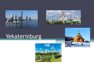
Yekaterinburg
•Download as PPTX, PDF•
1 like•242 views

A presentation about the history of Yekaterinburg (Russian: Екатеринбу́рг), the fourth-largest city in Russia.

Recommended
More Related Content
What's hot
What's hot (20)
Similar to Yekaterinburg
Similar to Yekaterinburg (20)
More from HistoryExpert006
Recently uploaded
Recently uploaded (20)
Yekaterinburg
- 2. Geography • Yekaterinburg (Russian: Екатеринбу́рг; also spelled Ekaterinburg), formerly known as Sverdlovsk (1924–1991) is the fourth-largest city in Russia and the administrative center of Sverdlovsk Oblast (map shown right). • It lies on the Iset River, a tributary of the Tobol River, on the eastern slope of the Ural Mountains, slightly east of the border between Europe and Asia. • It is located 1,036 miles (1,667 km) east of Moscow.
- 3. Current status Administrative status (as of 2011) Municipal status (as of June 2009) • Country: Russia • Federal subject: Sverdlovsk Oblast • Administratively subordinated to: City of Yekaterinburg • Administrative center of: Sverdlovsk Oblast, City of Yekaterinburg • Urban okrug: Yekaterinburg Urban Okrug • Administrative center of: Yekaterinburg Urban Okrug • Head (Mayor): Yevgeny Roizman • Representative body: City Duma
- 4. Current status (cont.) • Statistics ▫ Area: 495 km2 (191 sq mi) ▫ Population (2010 census): 1,349,772 inhabitants (ranked fourth in 2010) ▫ Population (2017 est.): 1,488,791 inhabitants ▫ Density: 2,727/km2 (7,060/sq mi) ▫ Time zone: YEKT (UTC+05:00)
- 5. Symbols Flag Coat of arms
- 6. Yekaterinburg city center and Iset River
- 7. History • Near the village of Shartash, which was founded in 1672 by members of the Russian sect of Old Believers, an ironware was established in 1721, and a castle in 1722. • In 1723, the new community was named Yekaterinburg in honor of Catherine I, the wife of Peter the Great (the ruler of Russia from 1682–1725) and the Empress of Russia from 1725–1727. • The town expanded as the administrative center for all the ironware of the Urals region; its prominence rose after 1783, when the Great Siberian Highway was constructed through it. • It was granted city status in 1796. • After 1878, the Trans-Siberian Railroad connected the city to Siberia. • After the Russian Revolution of 1917 (October), Yekaterinburg gained infamy as the scene of the killing of the last tsar, Nicholas II, and his family in July 1918. • In 1924, the city was renamed Sverdlovsk in honor of the Bolshevik leader Yakov M. Sverdlov. • It changed back to its original name in 1991.
- 10. Modern Yekaterinburg • Modern Yekaterinburg is one of the main manufacturing centers of Russia, particularly for heavy production. • The Uralmash constructs heavy equipment and is the city’s largest production company; it once had about 50,000 workers, but it now has only a small portion of that figure. • Industrial products made in the city include metallurgical and chemical equipment, turbines, diesels, and ball bearings. • During the Soviet era, the city was an important center of biological and chemical warfare research and development. • There is an assortment of light industries, including an old-fashioned one of gem cutting; food managing is also vital. • The city, laid out on a regular grating design, stretches across the valley of the Iset— blocked there to create a sequence of small lakes—and the low adjoining hills.
- 11. Modern Yekaterinburg (cont.) • Yekaterinburg is an important railway interchange, with lines extending from it to all parts of the Urals and the rest of Russia. • The city is the primary cultural center of the Urals and has countless centers of higher education, including the Urals A.M. Gorky State University (founded in 1920; right), a music school, and polytechnic, mining, forestry, agricultural, law, medical, and teacher-training institutes. • The Urals office of the Russian Academy of Sciences and many scientific-research institutions are also situated there. • Boris Yeltsin, the first democratically elected president of Russia and its first post- Soviet leader (1991–1999), was educated in Yekaterinburg and spent much of his political career there.