
Recommended
Recommended
More Related Content
Similar to Secrets of the Wooded Downs Revealed Through Community Archaeology
Similar to Secrets of the Wooded Downs Revealed Through Community Archaeology (20)
Recently uploaded
Recently uploaded (20)
Secrets of the Wooded Downs Revealed Through Community Archaeology
- 2. ‘Secrets of the High Woods’ is a HLF and SDNPA-Funded community archaeology project focused on revealing the hidden history of the Wooded Downs. The project was conceived and developed by Ian McConnell, James Kenny and Anne Bone and received the go-ahead from the HLF and National Park in 2013. About the Project
- 3. The project covers an area of wooded landscape in the centre of the South Downs National Park located between the A3 and the River Arun.
- 4. The landscape comprises a steep chalk scarp to the north with furrowed dry chalk valleys running south. Much of this area is covered with woodland, some of it ancient in origin
- 5. Archaeology of and Within the Woods The historic environment is uniquely preserved in the wooded downs area, as much of the land has never been ploughed but quantifying the resource using traditional methods of archaeological survey is difficult. Forest canopy reduces the visibility of archaeological features from aerial photographs and dense vegetation can also limit access and visibility for field survey.
- 6. Our Aims • Explore the cultural heritage of the wooded downs, using both cutting edge technology and traditional techniques. Doing this will help us to better understand how human interaction with the landscape has changed over time • Engage the public in the heritage of the area through a range of volunteering opportunities and activities such as guided walks. We will also be creating online resources including an e-book and summarising the results of the project in a travelling exhibition. • Train professionals including landowners, foresters and other people working in the woods, alongside local government and commercial archaeologists in the use of lidar data to ensure an increased understanding of and respect for heritage sites. This will lead to enhanced future management and mitigation of the sites.
- 7. The technique is quite simple in principle - a plane fitted with a special sensor scans the ground as it flies across the landscape… Over the last decade archaeologists have increasingly used airborne laser scanning (commonly known as lidar) to map features hidden within woodland. What is Airborne Laser Scanning?
- 8. The laser reflects off both the tree cover and surface of the forest floor. It can penetrate wherever light can, so will pass through all but the densest canopy. Komorebi – a Japanese word for the light that shines between the leaves of the trees
- 9. When it hits an object, the laser bounces back to the sensor which records the time it takes. As the speed of the laser is known it is possible to calculate the distance between the plane and the ground.
- 10. Ground reflection Canopy reflections Each laser reflection is mapped using GPS to creating highly accurate “cloud” of measurement points. Laser reflection points
- 11. In March 2014, the project captured 305km2 (30500 hectares ) of laser scanned data across the survey area at 0.25m resolution.
- 12. The results of the survey can be really dramatic…
- 13. The results of the survey can be really dramatic…
- 14. …but the lidar survey is just the first step!
- 15. In order to really understand what’s going on we need to verify the features seen in the airborne data with field survey. So we don’t mistake this… …for this!
- 16. Then we need to compare the survey results to known archaeological sites and to archive material to deepen our understanding of change in the landscape through time. Known archaeological sites
- 17. The woodlands themselves are a hugely important part of the story – without the protection afforded by this environment there would be far fewer traces of the past. We want to record the stories of those living and working in the woods, to capture the special qualities of this landscape through the eyes of the people who live here.
- 18. Working with the Community Over 100 people have signed up to work with us on the project, undertaking a range of tasks. Our main volunteering roles are in field survey, archival research and oral history collection.
- 19. Wider Engagement We’ll be sending updates through out the project via our newsletter and news pages on the website.
- 20. In late 2016 the results of the project will be shared in a number of ways: Public Events Online We will be commissioning a CGI recreation of the landscape to bring it to life using the results of the lidar survey. We will also be creating a e-book summarising the history of the area Open Days Through 2016 we’ll be hosting a travelling exhibition in a number of locations throughout the project area. There’ll be an open day at each with fun activities for all the family Outdoors Well be creating a new series of guided walks and cycles so that everyone can explore the heritage of this hidden landscape.
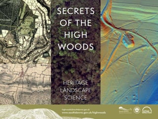
- 21. To find out more, contact the High Woods team highwoods@southdowns.gov.uk 0300 303 1053 www.southdowns.gov.uk/highwoods