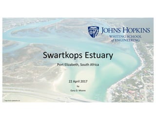
Swartkops Estuary Ecosystem Assessment
•
1 like•458 views

The document provides an outline for a report on the Swartkops Estuary located in Port Elizabeth, South Africa. It includes sections on the physical, chemical, and biological settings of the watershed, airshed, ocean boundary, estuary, and freshwater inputs. In the introduction, it notes that while some studies have been done on parts of the ecosystem, comprehensive integrated information is lacking. It also notes concerns about potential human health risks from contamination in the estuary.

Recommended
Recommended
More Related Content
What's hot
What's hot (19)
Similar to Swartkops Estuary Ecosystem Assessment
Similar to Swartkops Estuary Ecosystem Assessment (20)
Recently uploaded
Recently uploaded (20)
Swartkops Estuary Ecosystem Assessment
- 2. Outline 1. Introduction 2. Physical Setting a. Watershed, Airshed, Ocean Boundary b. Estuary c. Freshwater Inputs 3. Chemical Setting a. Watershed, Airshed, Ocean Boundary b. Estuary c. Freshwater Inputs 4. Biological Setting a. Watershed, Airshed, Ocean Boundary b. Estuary c. Freshwater Inputs 5. Anthropogenic Stresses (such as nutrient, contaminant, habitat modification, harvesting of fish and shell fish, and corresponding health of the estuary) 6. Economic Valuation of Ecosystem Services – Swartkops Estuary 7. Resource Governance – National Legal Framework 8. Sustainable Management Plan Outline a. Programmatic Work Plan (Three Phases) I. Phase I – Baseline Understanding II. Phase II – Protective Regulatory Framework III. Phase III – Monitoring, Reporting, and Monthly Estuary Review 2
- 3. INTRODUCTION • No comprehensive and integrated information exists about the Swartkops Estuary, located on the Indian Ocean along the East Cape coast of South Africa, in the City of Port Elizabeth (300,000 population urban; 1.1 million metropolitan area) (Figures 1-3, next two slides). • Scientific studies completed to date are heavily weighted toward local ecological assessments; only portions of ecosystem’s flora (Hilmer, T., Talbot, M. and Bate, G.C., 1988) and fauna (Beckley, L.E., 1983; Beckley, L.E., 1985; Ellender, B.R., Weyl, O.L. and Swartz, E.R., 2011; Marais, D., 1980; limited trophic relationships (Baird, D. and Ulauowicz, R.E., 1993), broad and general information (Baird, D., Marais, J. and Martin, A.P., 1988) concerning the physical setting of the estuary and its relation to the Indian Ocean. • Regarding anthropogenic impacts, there is recent work on the bioaccumulation of contamination in fish (Nel, L., Strydom, N.A. and Bouwman, H., 2015). • No information on the extent and potential importance of the airshed to estuary nutrient and other pollution types is available, however, regarding the airshed, relevant but fragmented information was discovered and is presented in this report. Anthropogenic impacts to the ecosystem appear to be many (based on published literature, news reports, personal communications); important are concerns of human health risks (including cancer and increased mortalities) from suspected contamination exposures, e.g., recreational use, fish consumption, and so on) originating from industrial and/or improper waste management activities in the watershed. 3
- 4. 4 INTRODUCTION - CONTINUED Swartkops Estuary Source: Google Maps Scale (Approx) 1” = 200 miles Figure 1 Source: Google Maps Scale (Approx) 1” = 4 miles Swartkops Estuary Figure 2
- 5. 5 INTRODUCTION - CONTINUED Source: Google Maps Scale (Approx) 1” = 4000 feet Swartkops Estuary Figure 3
- 6. PHYSICAL SETTING - WATERSHED, AIRSHED, OCEAN BOUNDARY, ESTUARY, FRESHWATER INPUTS 6 Watershed • A watershed for the Swartkops Estuary has not yet been defined, i.e., no published information is available from universities, the Republic of South Africa, or in specialist scientific literature. • Lord, D.A. and Thompson, G.A., (1988) describe the Groot Winterhoek Mountains to the west as the primary watershed (1,342 km^2, approximately) of the Swartkops River. • Further, these researchers state, “…the Swartkops and Eland Rivers are the prime contributors of freshwater to the head of the estuary, with a smaller contribution coming from the Chatty River, directly into the lower reaches of the estuary” ( Figure 4, next slide) (Lord, D.A. and Thompson, G.A., (1988)). The Groendal Dam is operated on the upper Swartkops River but its effect on water and sediment discharge to the estuary is unknown.
- 7. 7 PHYSICAL SETTING - WATERSHED, AIRSHED, OCEAN BOUNDARY, ESTUARY, FRESHWATER INPUTS Figure 4 NOT TO SCALE
- 8. 8 PHYSICAL SETTING - WATERSHED, AIRSHED, OCEAN BOUNDARY, ESTUARY, FRESHWATER INPUTSAirshed • An airshed of the Swartkops Estuary system has not yet been defined, i.e., no published information either from universities or the Republic of South Africa, on the potential of commercial / industrial, residential, automobile exhaust, and other air emission sources and effects on water quality of the estuary. • Available information that may influence an airshed to the estuary system (e.g., climate, local and regional meteorology, regional geomorphology, local and regional land use) is fragmented, some of which is presented below. An airshed determination is appropriate for the Swartkops Estuary; such a determination will be influenced by the regional geomorphology, i.e., Central Plateau, Great Escarpment, proximity to the Atlantic, Southern, and Indian Oceans, and industrial and other air emissions in the region. The airshed would cross international boarders and, as such, would need to be an international transboundary airshed since industrial emission sources exist, for example, from the Zambian Copper Belt (ZCB) located north of the estuary in Zambia (Department of Environmental Affairs, 2012) (Figure 5, next slide). The ZCB is estimated to discharge 2.2-millon tons of sulphur dioxide annually. Information on the full and complete emission profile needs to be investigated to understand the risks to the estuary. • The Republic of South Africa maintains one or more air quality monitoring stations in Port Elizabeth.
- 9. 9 PHYSICAL SETTING - WATERSHED, AIRSHED, OCEAN BOUNDARY, ESTUARY, FRESHWATER INPUTS The complex airshed influencing the estuary system is transboundary, incorporating emissions from neighboring countries to the north. Swartkops Estuary
- 10. 10 PHYSICAL SETTING - WATERSHED, AIRSHED, OCEAN BOUNDARY, ESTUARY, FRESHWATER INPUTS Ocean Boundary The Swartkops Estuary discharges to the Indian Ocean through a constricted inlet (Baird, D. and Ulauowicz, R.E., 1993). Tidal influence is a maximum of 1.6 meters (m) (5.25 feet (ft)), tidal prism is approximately 2.88 x 10^6 m^3, and flushing time is approximately 22 hours in Spring (Baird, D. and Ulauowicz, R.E., 1993).
- 11. 11 Estuary The following is a summary of descriptive information derived from Lord, D.A. and Thompson, G.A., 1988; Reddering, J., and Esterhuysen, K., 1988): • The Estuary is located in a metropolitan center of the City of Port Elizabeth (300,000 population, urban; 1.1 million population metropolitan), with industrial and residential properties location on both the north and south banks of the estuary and Swartkops River. • The Estuary is predominately sandy, with wide intertidal and supratidal flats near the confluence with the Indian Ocean, but becomes muddier with steep banks landward in the upper estuary. • The tidal length is about 16 kilometers from the mouth (i.e., confluence with the Indian Ocean) • Average depth is 3 m (9.8 ft) • Historical reconstruction, based on interpretation of sediment core data, indicates the present-day estuary is significantly smaller; current day depth at mouth ranges from 3 to 4 m; historically the depth was closer to 8 m PHYSICAL SETTING - WATERSHED, AIRSHED, OCEAN BOUNDARY, ESTUARY, FRESHWATER INPUTS
- 12. 12 Freshwater Inputs The primary sources of freshwater to the estuary are the Swartkops and Elands Rivers, with smaller contribution from Chatty River (Lord, D.A. and Thompson, G.A., 1988) PHYSICAL SETTING - WATERSHED, AIRSHED, OCEAN BOUNDARY, ESTUARY, FRESHWATER INPUTS
- 13. CHEMICAL SETTING - WATERSHED, AIRSHED, OCEAN BOUNDARY, ESTUARY, FRESHWATER INPUTS 13 Watershed The information summarized below from Lord, D.A. and Thompson, G.A. (1988) is derived from a paper documenting the pollution status of the Swartkops Estuary. The chemical setting of the watershed can be divided by source category: municipal, industrial, and domestic. • Municipal: sewage discharges (domestic as well as industrial waste water treated) (RELEASES: bacteria, nutruents) • Industrial: wool processing plants, tannery, power generation (RELEASES: thermal, metals (adsorbed to sediments) and aquatic fauna, petroleum hydrocarbons, chlorinated hydrocarbons) • Domestic: runoff from laws, effluent from vehicle washing, broken sewer pipes (RELEASES: fertilizers, lawn treatment chemicals, phosphates, raw sewage)
- 14. CHEMICAL SETTING - WATERSHED, AIRSHED, OCEAN BOUNDARY, ESTUARY, FRESHWATER INPUTS 14 Airshed Ambient air may contain a range of pollutants, originating from local, regional, and international (transboundary) sources, as summarized below (Department of Environmental Affairs, 2012): • Coal combustion from power generation (RELEASES: particulates, sulphur dioxide, nitrogen oxides, mercury) • Vehicle emissions from combustion of gasoline and diesel (RELEASES: carbon monoxide, nitrogen oxides • Industrial emissions from combustion of fossil fuels, especially coal (RELEASES: depends mainly on the combustion of fossil fuels, especially coal, for electricity generation) • Domestic fuel combustion (i.e., coal, paraffin, and wood) (RELEASES: sulphur dioxide, carbon monoxide, volatile organic compounds, particulates) • Biomass combustion, for example, forest fires for agricultural purposes (RELEASES: carbon dioxide, methane, and nitrous oxide, carbon monoxide, volitale organic compounds) • Landfill gas emissions (RELEASES: carbon dioxide, methane, and nitrous oxide, hydrogen sulfide, phenols, chlorobenzene, carcinogens such as benzene and methylene chloride) • Tyre burning emissions (RELEASES: a broad range of combustion and incomplete combustion products, particulate matter) • Commercial aircraft emissions (RELEASES: carbon dioxide, particulates, nitrogen oxide, carbon monoxide, sulfur dioxide, and volatile organic compounds) • Agricultural emissions, e.g., sugar cane industry burns 90% of crop at harvest (RELEASES: carbon monoxide and particulates) • Common air pollutants in South Africa are: Sulphur dioxide, nitrogen dioxide, ozone, carbon monoxide, lead, particulate matter, benzene
- 15. CHEMICAL SETTING - WATERSHED, AIRSHED, OCEAN BOUNDARY, ESTUARY, FRESHWATER INPUTS 15 Ocean Boundary Little is known about the chemical quality of the coastal waters of the Indian Ocean at the mouth of the Swartkops Estuary (locally known as Algoa Bay).
- 16. 16 Estuary The information below is summarized from Lord, D.A. and Thompson, G.A. (1988) from their discussion on pollution occurrence in and near the Swartkops River: • Municipal: sewage discharges (domestic as well as industrial waste water treated) (RELEASES: bacteria, nutrients, toxics) • Industrial: wool processing plants, tannery, power generation (RELEASES: thermal, metals (adsorbed to sediments) and aquatic fauna, petroleum hydrocarbons, chlorinated hydrocarbons) • Domestic: runoff from laws, effluent from vehicle washing, broken sewer pipes (RELEASES: fertilizers, lawn treatment chemicals, phosphates, raw sewage) CHEMICAL SETTING - WATERSHED, AIRSHED, OCEAN BOUNDARY, ESTUARY, FRESHWATER INPUTS
- 17. 17 Freshwater Inputs The information summarized below from Lord, D.A. and Thompson, G.A. (1988) is derived from a paper documenting the pollution status of the Swartkops Estuary. Freshwater flows entering the Swartkops Estuary receive pollution from three primary sources and types: municipal, industrial, and domestic. • Municipal: sewage discharges (domestic as well as industrial waste water treated) (RELEASES: bacteria, nutrients, toxics) • Industrial: wool processing plants, tannery, power generation (RELEASES: thermal, metals (adsorbed to sediments) and aquatic fauna, petroleum hydrocarbons, chlorinated hydrocarbons) • Domestic: runoff from laws, effluent from vehicle washing (RELEASES: fertilizers, lawn treatment chemicals, phosphates) CHEMICAL SETTING - WATERSHED, AIRSHED, OCEAN BOUNDARY, ESTUARY, FRESHWATER INPUTS
- 18. BIOLOGICAL SETTING – WATERSHED, AIRSHED, OCEAN BOUNDARY, ESTUARY, FRESHWATER INPUTS 18 Watershed Because of the estuary’s location (in a developed, urban area) consisting of residential and industrial properties, much of the biodiversity has been removed. However, the headwater of the Swartkops River is located in the Groot Winterhoek Mountains, part of the Cape Floristic Region. The CFR is recognized as one of the most floristically diverse areas on earth (WWF, 2017) containing some 9,000 species. “While vertebrate diversity may not be particularly distinctive”, the area is home to a variety of insects, many of which “may be Gondwanaland relicts” (WWF, 2017).
- 19. 19 Airshed At least 1,000 bird species inhabit southern Africa (Maclean, G.L. and Robert, A.,1985). Source: Penguin Books of South Africa BIOLOGICAL SETTING – WATERSHED, AIRSHED, OCEAN BOUNDARY, ESTUARY, FRESHWATER INPUTS
- 20. 20 Ocean Boundary Algoa Bay’s biodiversity attracts both sightseers and researchers. Below is a summary of marine species and birds to be found in the Bay (Raggy Charters, 2013; Marine Reserves Coalition, ND): Summary of Biodiversity of Algoa Bay, South Africa Southern right whale (Eubalaena austrailis) Humpback whales (Megaptera novaeanglia) Bryde’s whales (Balaenoptera edeni) Bottlenose dolphin (Tursiops aduncus) Common dolphin (Delphinus capensis) African penguins (Spheniscus demersus)(endangered) Cape gannets (Morus capensis) Cape cormorant (Phalacrocorax capensis) White-breasted cormorant (Phalacrocorax lucidus) Africa black oystercatcher (Haematopus moquini) Southern elephant seal (Mirounga leonine) Great white shark (Sphyrna zygaena) Spotted ragged-tooth shark (Carcharius Taurus) Common thresher shark (Alopias vulpinus) Smooth hammerhead shark (Sphyrna zygaena) quini) Kelp gull (Larus dominicanus) Sub-antarctic skua (Stercorarius antarcticus) Swift tern (Thalasseus bergii) Common tern (Sterna hirundo) Roseate tern (Sterna dougallii) Sandwich tern (Thalasseus sandvicensis) Artic tern (Sterna paradisaea) Indian yellow-nosed albatross (Thalassarche carteri) Shy albatross (Thalassarche cauta) White-chinned petrel (Procellaria aequinoctialis) Northern giant petrel (Macronectes halli) Wilson’s storm petrel (Oceanites oceanicus) Cory’s shearwater (Calonectris borealis) Sooty shearwater (Ardenna griseus) Cape fur seal (Arctocephalus pusillus) Sub-antarctic fur seal (Arctocephalus tropicalis) BIOLOGICAL SETTING – WATERSHED, AIRSHED, OCEAN BOUNDARY, ESTUARY, FRESHWATER INPUTS
- 21. 21 Estuary The Swartkops Estuary is habitat for flora and fauna existing in the unique conditions of variable salinity, daily currents and flow exchanges with Algoa Bay. A summary of the organisms that comprise the ecosystem is presented below, based on Gilchrist, J., 1918; Marais, D. and Baird, D, 1980; Baird, D.,1988; Beckley, L.E., 1985; Baird, D. and Ulauowicz, R.E., 1993; Ellender, B.R., Weyl, O.L. and Swartz, E.R., 2011; Hilmer, T., et al.,1988; Pierce, S.M., 1983. This information is best summarized in a table organized generally by type and/or habitat (see Table 1, below). BIOLOGICAL SETTING – WATERSHED, AIRSHED, OCEAN BOUNDARY, ESTUARY, FRESHWATER INPUTS
- 22. 22 Planktonic Ichthyo Plants Microplankton (68-77%, dominant) (circa 1984-1987) Nano and Pico plankton Bacteria Microflagellates microzooplankton Spotted grunter (Pomadasys commersonni) Lithognathus lithognathus Argyrosomus holoepidotus Lichia amia Pomatomus saltatrix Family Gobiidae Round herring (Gilchristella aestuarius) Sea catfish (Tachysurus feliceps) Family Mugilidea Elops machnata Bartail flathead (Platycephalus indicus) Eel grass (Zostera capensis)(extirpated circa 1983?) Rice grass (Spartina maritima) (Dominant on saltmarsh) Spartina trichochia Other Nematodes Macrobenthos Mud prawns (Upogebia Africana) Sand prawn (Callianassa kraussi) Saltmarsh Fauna Crab (Sesarma catenata) Crab (Cleistostoma edwardsii) Mollusc (Assiminea bifasciata) Zooplankton Copepods Mysids Avian (35 species) (top four energy requirements are listed Kelp gull (Larus dominicanus) Grey plover (Pluvialis squatarola) Whimbrel (Numerius phaeopus) Common tern (Sterna hirondo) Estuary Species summary Table 1. BIOLOGICAL SETTING – WATERSHED, AIRSHED, OCEAN BOUNDARY, ESTUARY, FRESHWATER INPUTS
- 23. 23 Freshwater Inputs Little information is available about the ecosystem of the Swartkops River, a primary source of freshwater to the estuary. However, what is know is that the Swartkops receives urban drainage and effluent discharges from a variety of industrial and waste water sources along the river. In addition, flow in the Swartkops is regulated by the Groendal Dam, built circa 1934. The impounded water continues to be the primary source of drinking water to the City of Port Elizabeth. The other main freshwater source – the Elands River, has a confluence with the Swartkops just prior to entering the estuary. Similarly, little is known about the ecology of the Elands River other than the tourist information readily available that describes the headwater area of the river as pristine outdoor/wilderness area with plenty of choice for lodging and recreation activities. BIOLOGICAL SETTING – WATERSHED, AIRSHED, OCEAN BOUNDARY, ESTUARY, FRESHWATER INPUTS
- 24. ANTHROPOGENIC STRESSES 24 Anthropogenic Stresses Not surprisingly contamination of the estuary has received much of the research attention. There is information available in the literature describing myriad anthropogenic stresses on the estuary (Strydom, Nadine, 2014; Emmerson, W.D., 1985; Lord, D.A. and Thompson, G.A.,1988; Nel, L., Strydom, N.A. and Bouwman, H., 2015 – from nutrient pollution to contamination of sediments and fish with metals and other industrial chemicals. This information is best presented in table form (Table 2, see next two slides).Table 2 includes a column of the possible corresponding health impacts for each contaminant type.
- 25. ANTHROPOGENIC STRESSES (CONTINUED) 25 Contamination Type Nutrient Organic, Inorganic, Physio-chemical Effects on Health of Estuary Thermal plume (cause: power plant effluent) Habitat destruction, species extirpation, increased species mortality, species isolation, tropic structure disruption Lower pH; cause: anti-fouling chemicals discharged with power plant effluent Habitat destruction, species extirpation, increased species mortality, species isolation, tropic structure disruption O2 (dissolved); severe depletion; cause: discharge of anti-fouling chemicals from power plant Habitat destruction, species extirpation, increased species mortality, species isolation, tropic structure disruption Phosphate (Aug, Nov, Oct) cause: urban runoff, sewer overflow Severe dissolved oxygen depletion in the head waters; Potential for algal growth cycle creating depleted dissolved oxygen conditions; Habitat destruction, species extirpation, increased species mortality, species isolation, tropic structure disruption Ammonia, nitrate, nitrite (from suspected overflow at Uitenhage sewage treatment plant); cause: runoff, sewer overflows Potential for algal growth cycle creating depleted dissolved oxygen conditions; Habitat destruction, species extirpation, increased species mortality, species isolation, tropic structure disruption Anthropogenic Stresses Summary Table 2.
- 26. ANTHROPOGENIC STRESSES - CONTINUED 26 Phosphorus (deep/bottom water, in Aug and Oct 1981) (in low dissolved O2 conditions; cause: runoff, sewer overflow Potential for algal growth, creating negative feedback loop with depleted dissolved O2 conditions; Habitat destruction, species extirpation, increased species mortality, species isolation, tropic structure disruption Lead, Cadmium, PCBs, Mercury; causes: industrial effluent Present in juvenile fish and bird eggs (PCBs); increase species morbidity and mortality, tropic structure disruption; human exposure risk from ingestion Escherichia coli (bacteria); cause: untreated sewage runoff Unknown on estuary; human risk from ingestion and dermal contact. t-DDT (in fish); cause: industrial runoff, effluent increased species mortality, tropic structure disruption, eventual species extirpation; human risk from ingestion PCBs (in fish); cause: industrial runoff, effluent increased species mortality, tropic structure disruption, eventual species extirpation; human risk from ingestion Contamination Type Nutrient Organic, Inorganic, Physio-chemical Effects on Health of Estuary Anthropogenic Stresses (continued) Summary Table 2.
- 27. ECONOMIC VALUATION OF ECOSYSTEM SERVICES – SWARTKOPS ESTUARY 27 • Historically the Swartkops Estuary has provided valuable natural services to its users and the surrounding communities. • In 2007 an attempt to quantify the value of ecosystem services derived from the Swartkops Estuary was performed by Turpie and Clark (2007). • Turpie and Clark (2007) estimated the Swartkops Estuary provides total ecosystem services valued up to RS$ 150 million per year. • According to the economic analysis by Turpie and Clark (2007), most of the economic value is derived from ecosystem services to the recreation sector (which, according to the definition ‘recreation’ used in the study included the economic value of tourism) • Notably missing from the economic analysis of Turpie and Clark (2007) was added valuation of the benefits received from the use of the estuary for both municipal and industrial waste water treatment and disposal (this omission is, perhaps, a stark indicator of the apparent regional indifference and lack of a complete understanding of estuary function, science, and value).
- 28. RESOURCE GOVERNANCE – NATIONAL LEGAL FRAMEWORK 28 • Recent legislation in the Republic of South Africa, i.e., the Integrated Coastal Management Act (ACT 24, 2008) (ICM), has helped to increase awareness of the importance of estuaries • The ICM required the preparation of estuary management protocols, i.e., an estuary management plan which recognized both the importance and need to sustain a healthy resource, within four years of ICM issuance for every estuary in South Africa. • In spite of this recent advancement, legacy issues of sediment contamination, historical ecosystem disruption, ongoing inappropriate uses of the resource, e.g., effluent discharges, from ‘business as usual’ attitude and practice remain (Personal Communications, 2016/17). • Some analysts point to the extremely complicated multi-tier and vast government bureaucracy combined with weak institutions (i.e., institutions which rely on the party/person in power to guide organizational decisions rather than strong autonomous decision making based on established policy and/procedure, as reasons for the situation.
- 29. 29 RESOURCE GOVERNANCE – NATIONAL LEGAL FRAMEWORK (continued) • In addition, there is an absence of legislation, both national and local, to restore estuaries damaged from historical use. The true reasons for this are not known, however, after extensive review of published information and personal communications with affected persons, the following can be noted: • There is a significant lack of understanding of the fundamental science of estuary systems and function. • The convenient legacy practices of using the estuary and freshwater input streams as effluent treatment and disposal persist.
- 30. 30 RESOURCE GOVERNANCE – SUSTAINABLE MANAGEMENT PLAN OUTLINE The following actions are recommended to sustainability manage the Swartkops Estuary: Programmatic Work Plan (three phases) (Phase I – Baseline Understanding; Phase II – Protective Regulatory Framework; Phase III – Monitoring, Reporting, and Monthly Review) As necessary, a multi-country Swartkops Estuary governing commission shall be formed. The Programmatic Work Plan shall be immediately funded with local and national taxes on ecosystem services used. The Programmatic Work Plan will take legal precedence over all existing law. Phase I – Baseline Understanding Comprehensive scientific investigation of the estuary Tasks -Define history of formation -Define historical to contemporary morphology, hydrology, physics, and chemistry of the estuary and all freshwater and salt water inputs (watershed scale) -including historical and contemporary hydrologic mass balance accounting for all inputs -Define historical to contemporary study of/accounting of all ecosystems, all species -Define historical to contemporary ocean interaction -Define the airshed for the estuary -Define the seasonality of the airshed -Account for the chemistry of the airshed -Account for all anthropogenic impacts to the estuary (comprehensive, at estuary watershed scale) -Including accounting of all sources and loading quantity and chemicals -Ecosystem services economic analysis to assess importance to estuary watershed Based on the results of the Phase I investigation, Phase II will provide estuary-specific, science-based tasks/milestones for estuary restoration and sustainable management.
- 31. 31 RESOURCE GOVERNANCE – SUSTAINABLE MANAGEMENT PLAN OUTLINE (continued) The following actions are recommended to sustainability manage the Swartkops Estuary: Programmatic Work Plan (three phases) (Phase I – Baseline Understanding; Phase II – Protective Regulatory Framework; Phase III – Monitoring, Reporting, and Monthly Estuary Review) Phase II – Protective Regulatory Framework (Goals: restoration and protection of the Swartkops Estuary to ensure continued operation for future generations). Tasks -Establish optimal estuary conditions through permitting, operational modifications, e.g., dam, WWTPs, and broad new enforcement actions, ensuring all hydrologic and sediment inputs to the estuary are seasonally complete and optimal. -Prepare and implement restoration plans. For all areas identified in Phase I as degraded, restoration shall be immediately done. -Establish a comprehensive discharge permit program for all sources of discharge within the estuary’s watershed; only discharge concentrations up to an allowable, estuary-specific and science-based concentration shall be allowed. -Establish a comprehensive air discharge permit program for on all source of air discharge within the estuary’s airshed that may effect the water quality of the estuary; as necessary, international agreements will be implemented. -Public involvement shall be encouraged for all aspects of estuary governance. -Public, industry, and government education of the importance of the estuary will be extensive. -Severe economic and criminal penalties will be enacted for violation of any permit terms. Prosecution in the International Criminal Court will be sought for permit violation outside South Africa.
- 32. 32 RESOURCE GOVERNANCE – SUSTAINABLE MANAGEMENT PLAN OUTLINE (continued) The following actions are recommended to sustainability manage the Swartkops Estuary: Programmatic Work Plan (three phases) (Phase I – Baseline Understanding; Phase II – Protective Regulatory Framework; Phase III – Monitoring, Reporting, and Monthly Estuary Review) Phase III – Monitoring, Reporting, and Monthly Estuary Committee Review -Prepare Sampling and Analysis Plan (SAP); Data collection quality control plan; Data analysis plan -Establish permanent monitoring network -Establish continuous flow gauging stations with telemetry control/reporting, where possible -Collect, analyze, and report samples; prepare monthly reports -Indicator samples of ecosystem health and biological/species health -Water quality, nutrients, salinity (all samples shall be multi-depth, see SAP) -Samples shall characterize the full (for all seasons)estuary hydrologic system, i.e., freshwater inputs, estuary flow, saltwater inputs -Flow within the full estuary hydrologic system (multi-level) shall be monitored (for all seasons) -Air samples shall characterize the daily variation in air quality within the estuary’s airshed -All permitted discharges within the estuary’s watershed shall be monitored, and effluent discharge reports reviewed monthly; percent of actual sites will be audited for compliance monthly. -On a monthly basis, the Committee will review progress made toward restoration, and will implement changes to the Programmatic Work Plan as necessary to ensure the optimal and timely achievement of program goals.
- 33. 33 Bibliography Baird, D., Marais, J. and Martin, A.P. (editors), 1988. Swartkops estuary: Proceedings of a symposium held on 14 and 15 September 1987 at the University of Port Elizabeth. South African National Scientific Programmes Unit, report No. 156. Baird, D., 1988. Synthesis of Ecological Research in the Swartkops Estuary. Port Elizabeth, South Africa. Paper included in the symposium held on 14 and 15 September 1987 at the University of Port Elizabeth. South African National Scientific Programmes Unit, report No. 156. Baird, D. and Ulauowicz, R.E., 1993. Comparative study on the trophic structure, cycling and ecosystem properties of four tidal. Marine Ecology Progress Series, 99, pp.221-237. Beckley, L.E., 1983. The ichthyofauna associated with Zostera capensis Setchell in the Swartkops estuary, South Africa. African Zoology, 18 (1), pp.15-24. Beckley, L.E., 1985. Tidal exchange of ichthyoplankton in the Swartkops estuary mouth, South Africa. South African Journal of Zoology, 20 (1), pp.15-20. Celliers, L., Breetzke, T., Moore, L. and Malan, D., 2009. A user-friendly guide to the integrated coastal management act of South Africa. Department of Environmental Affairs and SSI Engineers & Environmental Consultants, Cape Town. Ellender, B.R., Weyl, O.L. and Swartz, E.R., 2011. Invasion of a headwater stream by non-native fishes in the Swartkops River system, South Africa. African Zoology, 46 (1), pp.39-46. Department of Environmental Affairs, 2012. 2nd South Africa Environment Outlook - a report on the state of the environment. Pretoria, South Africa: Republic of South Africa. Emmerson, W.D., 1985. The nutrient status of the Swartkops River estuary, Eastern Cape. Water S. A., 11 (4), pp.189-198. Gilchrist, J., 1918. Report on nettings in the Zwartkops River. Mar.Bioi.Rep, 4, pp.54-72. Heydorn, A. and Tinley, K.L., 1980. Synopsis of the Cape coast-natural features, dynamics and utilization. Part 1. Estuaries of the Cape Series CSIR Research report. Hilmer, T., Talbot, M. and Bate, G.C., 1988. A synthesis of recent botanical research in the Swartkops estuary. Paper included in the symposium held on 14 and 15 September 1987 at the University of Port Elizabeth. South African National Scientific Programmes Unit, report No. 156. Lloyd, Edwards, 2013. Red Tide in Algoa Bay. [online] Available at: < http://www.raggycharters.co.za/page/red_tide_in_algoa_bay > [Accessed: 11 March 2017]. Lord, D.A. and Thompson, G.A.,1988. The Swartkops: Pollution Status. Paper included in the symposium held on 14 and 15 September 1987 at the University of Port Elizabeth. South African National Scientific Programmes Unit, report No. 156.
- 34. 34 Bibliography (continued) Maclean, G.L. and Robert, A., 1985. Roberts' birds of southern Africa. Trustees of the John Voelcker Bird Book Fund Cape Town. Marais, D., and Baird, D., 1980. Analysis of anglers' catch data from the Swartkops estuary. African Zoology, 15 (2), pp.61-65. Marais, J., 1988. Some factors that influence fish abundance in South African estuaries. South African Journal of Marine Science, 6 (1), pp.67-77. Marine Reserves Coalition, ND. Bird Island Marine Protected Area, South Africa. [online] Available at: < http://www.marinereservescoalition.org/resources/marine-reserves-around-the-world/bird-island-marine-protected-area-south-africa/ >. [Accessed: 12 March 2017]. Nel, L., Strydom, N.A. and Bouwman, H., 2015. Preliminary assessment of contaminants in the sediment and organisms of the Swartkops Estuary, South Africa. Marine pollution bulletin, 101 (2), pp.878-885. Noble, R.G. and Hemens, J., 1978. Inland water ecosystems in South Africa–a review of research needs. National Scientific Programmes Unit: CSIR. Pierce, S.M., 1983. Estimation of the non-seasonal production of Spartina maritima (Curtis) Fernald in a South African estuary. Estuarine, Coastal and Shelf Science, 16 (3), pp.241-254. Raggy Charters – Algoa Bay, Port Elizabeth, 2013. What We See – Marine Species in Port Elizabeth, Algoa Bay. [online] Available at: < http://www.raggycharters.co.za/page/southern_right_whales# >. [Accessed: 12 MARCH 2017]. Reddering, J., and Esterhuysen, K., 1988. The Swartkops estuary: Physical description and history. The Swartkops Estuary, pp.7-15. Strydom, Nadine (Dr.), 2014. New study of fish in Swartkops River – not safe to eat. [online] Available at:< http://www.zwartkopsconservancy.org/new-study-of-fish-in-swartkops-river-not-safe-to-eat/ > [Accessed: 12 March 2017]. Turpie, J. and Clark, B., 2007. Development of a Conservation Plan for Temperate South African Estuaries on the Basis of Biodiversity Importance. Ecosystem Health and Economic Costs and Benefits.Final Report Prepared for CAPE Regional Estuarine Management Programme, CAPE. Van Niekerk, L. and Turpie, J.K., 2012. NATIONAL BIODIVERSITY ASSESSMENT 2011 V. 3: Estuary Component Technical Report. South African national biodiversity assessment 2011: Technical report, Volume 3: Estuary component.
- 35. 35 Bibliography (continued) Whitfield, A.K., 1996. A review of factors influencing fish utilization of South African estuaries. Transactions of the Royal Society of South Africa, 51 (1), pp.115-137. Woithe, S., 20106/2017. Multiple telephone calls and emails regarding anthropogenic impacts, and ongoing effluent discharges to Swartkops Estuary. [personal communications]. World Wildlife Fund, 2017. Mediterranean Forests, Woodlands, and Scrubs: South Africa. [online] Available at: < https://www.worldwildlife.org/ecoregions/at1203 > [Accessed: 11 March 2017].