SlideShare a Scribd company logo
1 of 15
Download to read offline
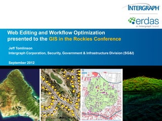
Web Editing and Workflow Optimization
presented to the GIS in the Rockies Conference
Jeff Tomlinson
Intergraph Corporation, Security, Government & Infrastructure Division (SG&I)

September 2012
Problems…and Solutions

   Organizations are not making the most of their very expensive existing
    geodata
     – Solution required: An easy way to roll-out technical apps to large numbers of
       clients.

   GIS means high overhead
     – Solution required: Support high-end geospatial functionality without the cost or
       complexity of desktop GIS.

   Enterprise data management is difficult
     – Solution required: Provide simple data and user management functionality, and
       simple forms and workflow creation.

   You must be a GIS person to do GIS – do you even need to know what ‘GIS’
    is?
     – Solution required: Deliver tools that non-GIS experts can understand and use

   Inaccuracies in field data capture
     – Solution required: Data validation at capture or update.
                                                                                          2
GIS growth SUSPENDED in organizations


 Large potential geo user base
   – Web mapping doesn’t support
     powerful workflows
   – But no experience running
     desktop GIS


 Potential users need:
   – Geo-accelerated business workflows
   – Vertical market-focused workflows


         This requires a new approach!
                                          3
1st Generation: ‘Enterprise GIS’


                               GIS
                              Doers


                            GIS Users


                            GIS Viewers
2012 Vendor Session, Smart Web Editing and Workflow Optimization, Jeff Tomlinson

More Related Content

Similar to 2012 Vendor Session, Smart Web Editing and Workflow Optimization, Jeff Tomlinson

Global Capital Oct08
Global Capital Oct08Global Capital Oct08
Global Capital Oct08Andrew Zolnai
 
GIS KNOWLEDGE SHARING: USING THE WEB FOR OPEN BUSINESS TO PROMOTE REGIONAL GI...
GIS KNOWLEDGE SHARING: USING THE WEB FOR OPEN BUSINESS TO PROMOTE REGIONAL GI...GIS KNOWLEDGE SHARING: USING THE WEB FOR OPEN BUSINESS TO PROMOTE REGIONAL GI...
GIS KNOWLEDGE SHARING: USING THE WEB FOR OPEN BUSINESS TO PROMOTE REGIONAL GI...Greg Babinski
 
The Underutilization of GIS technologies - Q&A with Shane Barrett
The Underutilization of GIS technologies - Q&A with Shane BarrettThe Underutilization of GIS technologies - Q&A with Shane Barrett
The Underutilization of GIS technologies - Q&A with Shane BarrettIQPC Australia
 
Practical GIS workshop programme
Practical GIS workshop programmePractical GIS workshop programme
Practical GIS workshop programmeGIS Global Image
 
Bimodal IT and EDW Modernization
Bimodal IT and EDW ModernizationBimodal IT and EDW Modernization
Bimodal IT and EDW ModernizationRobert Gleave
 
URISA GIS Management Institute® The GIS Capability Maturity Model and the GMI...
URISA GIS Management Institute® The GIS Capability Maturity Model and the GMI...URISA GIS Management Institute® The GIS Capability Maturity Model and the GMI...
URISA GIS Management Institute® The GIS Capability Maturity Model and the GMI...Greg Babinski
 
Big data analytic market opportunity
Big data analytic market opportunityBig data analytic market opportunity
Big data analytic market opportunityStanley Wang
 
iStart - Brave New World: GIS solutions in the cloud
iStart - Brave New World: GIS solutions in the cloudiStart - Brave New World: GIS solutions in the cloud
iStart - Brave New World: GIS solutions in the cloudHayden McCall
 
TechM GIS Utilities
TechM GIS UtilitiesTechM GIS Utilities
TechM GIS UtilitiesTechM-GIS
 
Becoming a data driven organization
Becoming a data driven organization Becoming a data driven organization
Becoming a data driven organization Magnus Backman
 
Geography In Performance Management
Geography In Performance ManagementGeography In Performance Management
Geography In Performance ManagementJohn Maslen
 
Geo-Enabling Retail and Property
Geo-Enabling Retail and PropertyGeo-Enabling Retail and Property
Geo-Enabling Retail and PropertyGeoEnable Limited
 
TOP Business Intelligence Predictions for 2015
TOP Business Intelligence Predictions for 2015TOP Business Intelligence Predictions for 2015
TOP Business Intelligence Predictions for 2015Panorama Software
 
What IT Professionals Should Know About Getting Started With & Supporting GIS
What IT Professionals Should Know About Getting Started With & Supporting GISWhat IT Professionals Should Know About Getting Started With & Supporting GIS
What IT Professionals Should Know About Getting Started With & Supporting GISJim Tochterman
 
BI at your fingertips - views also from Hariram Kalidas (GBM)
BI at your fingertips - views also from Hariram Kalidas (GBM)BI at your fingertips - views also from Hariram Kalidas (GBM)
BI at your fingertips - views also from Hariram Kalidas (GBM)Shwetank Jayaswal
 

Similar to 2012 Vendor Session, Smart Web Editing and Workflow Optimization, Jeff Tomlinson (20)

GRM general presentation
GRM general presentationGRM general presentation
GRM general presentation
 
Global Capital Oct08
Global Capital Oct08Global Capital Oct08
Global Capital Oct08
 
GIS KNOWLEDGE SHARING: USING THE WEB FOR OPEN BUSINESS TO PROMOTE REGIONAL GI...
GIS KNOWLEDGE SHARING: USING THE WEB FOR OPEN BUSINESS TO PROMOTE REGIONAL GI...GIS KNOWLEDGE SHARING: USING THE WEB FOR OPEN BUSINESS TO PROMOTE REGIONAL GI...
GIS KNOWLEDGE SHARING: USING THE WEB FOR OPEN BUSINESS TO PROMOTE REGIONAL GI...
 
The Underutilization of GIS technologies - Q&A with Shane Barrett
The Underutilization of GIS technologies - Q&A with Shane BarrettThe Underutilization of GIS technologies - Q&A with Shane Barrett
The Underutilization of GIS technologies - Q&A with Shane Barrett
 
The Value of Enterprise GIS
The Value of Enterprise GISThe Value of Enterprise GIS
The Value of Enterprise GIS
 
Web Based GIS
Web Based GISWeb Based GIS
Web Based GIS
 
Practical GIS workshop programme
Practical GIS workshop programmePractical GIS workshop programme
Practical GIS workshop programme
 
Geospatial Product Watch 2015
Geospatial Product Watch 2015Geospatial Product Watch 2015
Geospatial Product Watch 2015
 
Bimodal IT and EDW Modernization
Bimodal IT and EDW ModernizationBimodal IT and EDW Modernization
Bimodal IT and EDW Modernization
 
URISA GIS Management Institute® The GIS Capability Maturity Model and the GMI...
URISA GIS Management Institute® The GIS Capability Maturity Model and the GMI...URISA GIS Management Institute® The GIS Capability Maturity Model and the GMI...
URISA GIS Management Institute® The GIS Capability Maturity Model and the GMI...
 
Big data analytic market opportunity
Big data analytic market opportunityBig data analytic market opportunity
Big data analytic market opportunity
 
iStart - Brave New World: GIS solutions in the cloud
iStart - Brave New World: GIS solutions in the cloudiStart - Brave New World: GIS solutions in the cloud
iStart - Brave New World: GIS solutions in the cloud
 
TechM GIS Utilities
TechM GIS UtilitiesTechM GIS Utilities
TechM GIS Utilities
 
Becoming a data driven organization
Becoming a data driven organization Becoming a data driven organization
Becoming a data driven organization
 
Geography In Performance Management
Geography In Performance ManagementGeography In Performance Management
Geography In Performance Management
 
Geo-Enabling Retail and Property
Geo-Enabling Retail and PropertyGeo-Enabling Retail and Property
Geo-Enabling Retail and Property
 
TOP Business Intelligence Predictions for 2015
TOP Business Intelligence Predictions for 2015TOP Business Intelligence Predictions for 2015
TOP Business Intelligence Predictions for 2015
 
What IT Professionals Should Know About Getting Started With & Supporting GIS
What IT Professionals Should Know About Getting Started With & Supporting GISWhat IT Professionals Should Know About Getting Started With & Supporting GIS
What IT Professionals Should Know About Getting Started With & Supporting GIS
 
BI at your fingertips - views also from Hariram Kalidas (GBM)
BI at your fingertips - views also from Hariram Kalidas (GBM)BI at your fingertips - views also from Hariram Kalidas (GBM)
BI at your fingertips - views also from Hariram Kalidas (GBM)
 
Enterprise GIS Planning and Framework
Enterprise GIS Planning and FrameworkEnterprise GIS Planning and Framework
Enterprise GIS Planning and Framework
 

More from GIS in the Rockies

GISCO Fall 2018: Bike Network Equity: A GIS and Qualitative Analysis of Ameri...
GISCO Fall 2018: Bike Network Equity: A GIS and Qualitative Analysis of Ameri...GISCO Fall 2018: Bike Network Equity: A GIS and Qualitative Analysis of Ameri...
GISCO Fall 2018: Bike Network Equity: A GIS and Qualitative Analysis of Ameri...GIS in the Rockies
 
GISCO Fall 2018: Colorado 811: Changes and Challenges – Brian Collison
GISCO Fall 2018: Colorado 811: Changes and Challenges – Brian CollisonGISCO Fall 2018: Colorado 811: Changes and Challenges – Brian Collison
GISCO Fall 2018: Colorado 811: Changes and Challenges – Brian CollisonGIS in the Rockies
 
GISCO Fall 2018: Senate Bill 18-167 and GIS – Dave Murray
GISCO Fall 2018: Senate Bill 18-167 and GIS – Dave MurrayGISCO Fall 2018: Senate Bill 18-167 and GIS – Dave Murray
GISCO Fall 2018: Senate Bill 18-167 and GIS – Dave MurrayGIS in the Rockies
 
2018 GIS in the Rockies Workshop: Coordinate Systems and Projections
2018 GIS in the Rockies Workshop: Coordinate Systems and Projections 2018 GIS in the Rockies Workshop: Coordinate Systems and Projections
2018 GIS in the Rockies Workshop: Coordinate Systems and Projections GIS in the Rockies
 
2018 GIS in Emergency Management: Denver Office of Emergency Management Overview
2018 GIS in Emergency Management: Denver Office of Emergency Management Overview2018 GIS in Emergency Management: Denver Office of Emergency Management Overview
2018 GIS in Emergency Management: Denver Office of Emergency Management OverviewGIS in the Rockies
 
2018 GIS in the Rockies Vendor Showcase (Th): The Data Driven Government
2018 GIS in the Rockies Vendor Showcase (Th): The Data Driven Government2018 GIS in the Rockies Vendor Showcase (Th): The Data Driven Government
2018 GIS in the Rockies Vendor Showcase (Th): The Data Driven GovernmentGIS in the Rockies
 
2018 GIS in the Rockies Vendor Showcase (Th): Solving Real World Issues With ...
2018 GIS in the Rockies Vendor Showcase (Th): Solving Real World Issues With ...2018 GIS in the Rockies Vendor Showcase (Th): Solving Real World Issues With ...
2018 GIS in the Rockies Vendor Showcase (Th): Solving Real World Issues With ...GIS in the Rockies
 
2018 GIS in the Rockies Vendor Showcase (Th): ERDAS Imagine What's New and Ti...
2018 GIS in the Rockies Vendor Showcase (Th): ERDAS Imagine What's New and Ti...2018 GIS in the Rockies Vendor Showcase (Th): ERDAS Imagine What's New and Ti...
2018 GIS in the Rockies Vendor Showcase (Th): ERDAS Imagine What's New and Ti...GIS in the Rockies
 
2018 GIS in the Rockies Vendor Showcase (Th): Building High Performance Gover...
2018 GIS in the Rockies Vendor Showcase (Th): Building High Performance Gover...2018 GIS in the Rockies Vendor Showcase (Th): Building High Performance Gover...
2018 GIS in the Rockies Vendor Showcase (Th): Building High Performance Gover...GIS in the Rockies
 
2018 GIS in Recreation: The Making of a Trail
2018 GIS in Recreation: The Making of a Trail2018 GIS in Recreation: The Making of a Trail
2018 GIS in Recreation: The Making of a TrailGIS in the Rockies
 
2018 GIS in Recreation: The Latest Trail Technology Crowdsourcing Maps and Apps
2018 GIS in Recreation: The Latest Trail Technology Crowdsourcing Maps and Apps2018 GIS in Recreation: The Latest Trail Technology Crowdsourcing Maps and Apps
2018 GIS in Recreation: The Latest Trail Technology Crowdsourcing Maps and AppsGIS in the Rockies
 
2018 GIS in the Rockies: Riparian Shrub Assessment of the Mancos River Canyon...
2018 GIS in the Rockies: Riparian Shrub Assessment of the Mancos River Canyon...2018 GIS in the Rockies: Riparian Shrub Assessment of the Mancos River Canyon...
2018 GIS in the Rockies: Riparian Shrub Assessment of the Mancos River Canyon...GIS in the Rockies
 
2018 GIS in Development: Partnerships Lead to Additional Recreational Content...
2018 GIS in Development: Partnerships Lead to Additional Recreational Content...2018 GIS in Development: Partnerships Lead to Additional Recreational Content...
2018 GIS in Development: Partnerships Lead to Additional Recreational Content...GIS in the Rockies
 
2018 GIS in Recreation: Adding Value to Colorado the Beautiful Initiative carr
2018 GIS in Recreation: Adding Value to Colorado the Beautiful Initiative carr2018 GIS in Recreation: Adding Value to Colorado the Beautiful Initiative carr
2018 GIS in Recreation: Adding Value to Colorado the Beautiful Initiative carrGIS in the Rockies
 
2018 GIS in Recreation: A Creek Runs Through It
2018 GIS in Recreation: A Creek Runs Through It2018 GIS in Recreation: A Creek Runs Through It
2018 GIS in Recreation: A Creek Runs Through ItGIS in the Rockies
 
2018 GIS in Recreation: Virtually Touring the National Trails
2018 GIS in Recreation: Virtually Touring the National Trails2018 GIS in Recreation: Virtually Touring the National Trails
2018 GIS in Recreation: Virtually Touring the National TrailsGIS in the Rockies
 
2018 GIS in the Rockies PLSC Track: Turning Towards the Future
2018 GIS in the Rockies PLSC Track: Turning Towards the Future2018 GIS in the Rockies PLSC Track: Turning Towards the Future
2018 GIS in the Rockies PLSC Track: Turning Towards the FutureGIS in the Rockies
 
2018 GIS in the Rockies PLSC: Intro to PLSS
2018 GIS in the Rockies PLSC: Intro to PLSS2018 GIS in the Rockies PLSC: Intro to PLSS
2018 GIS in the Rockies PLSC: Intro to PLSSGIS in the Rockies
 
2018 GIS in the Rockies PLSC Track: Grid to Ground NATRF2022
2018 GIS in the Rockies PLSC Track: Grid to Ground NATRF20222018 GIS in the Rockies PLSC Track: Grid to Ground NATRF2022
2018 GIS in the Rockies PLSC Track: Grid to Ground NATRF2022GIS in the Rockies
 
2018 GIS in Development: USGS and Citizen Science Success and Enhancements fo...
2018 GIS in Development: USGS and Citizen Science Success and Enhancements fo...2018 GIS in Development: USGS and Citizen Science Success and Enhancements fo...
2018 GIS in Development: USGS and Citizen Science Success and Enhancements fo...GIS in the Rockies
 

More from GIS in the Rockies (20)

GISCO Fall 2018: Bike Network Equity: A GIS and Qualitative Analysis of Ameri...
GISCO Fall 2018: Bike Network Equity: A GIS and Qualitative Analysis of Ameri...GISCO Fall 2018: Bike Network Equity: A GIS and Qualitative Analysis of Ameri...
GISCO Fall 2018: Bike Network Equity: A GIS and Qualitative Analysis of Ameri...
 
GISCO Fall 2018: Colorado 811: Changes and Challenges – Brian Collison
GISCO Fall 2018: Colorado 811: Changes and Challenges – Brian CollisonGISCO Fall 2018: Colorado 811: Changes and Challenges – Brian Collison
GISCO Fall 2018: Colorado 811: Changes and Challenges – Brian Collison
 
GISCO Fall 2018: Senate Bill 18-167 and GIS – Dave Murray
GISCO Fall 2018: Senate Bill 18-167 and GIS – Dave MurrayGISCO Fall 2018: Senate Bill 18-167 and GIS – Dave Murray
GISCO Fall 2018: Senate Bill 18-167 and GIS – Dave Murray
 
2018 GIS in the Rockies Workshop: Coordinate Systems and Projections
2018 GIS in the Rockies Workshop: Coordinate Systems and Projections 2018 GIS in the Rockies Workshop: Coordinate Systems and Projections
2018 GIS in the Rockies Workshop: Coordinate Systems and Projections
 
2018 GIS in Emergency Management: Denver Office of Emergency Management Overview
2018 GIS in Emergency Management: Denver Office of Emergency Management Overview2018 GIS in Emergency Management: Denver Office of Emergency Management Overview
2018 GIS in Emergency Management: Denver Office of Emergency Management Overview
 
2018 GIS in the Rockies Vendor Showcase (Th): The Data Driven Government
2018 GIS in the Rockies Vendor Showcase (Th): The Data Driven Government2018 GIS in the Rockies Vendor Showcase (Th): The Data Driven Government
2018 GIS in the Rockies Vendor Showcase (Th): The Data Driven Government
 
2018 GIS in the Rockies Vendor Showcase (Th): Solving Real World Issues With ...
2018 GIS in the Rockies Vendor Showcase (Th): Solving Real World Issues With ...2018 GIS in the Rockies Vendor Showcase (Th): Solving Real World Issues With ...
2018 GIS in the Rockies Vendor Showcase (Th): Solving Real World Issues With ...
 
2018 GIS in the Rockies Vendor Showcase (Th): ERDAS Imagine What's New and Ti...
2018 GIS in the Rockies Vendor Showcase (Th): ERDAS Imagine What's New and Ti...2018 GIS in the Rockies Vendor Showcase (Th): ERDAS Imagine What's New and Ti...
2018 GIS in the Rockies Vendor Showcase (Th): ERDAS Imagine What's New and Ti...
 
2018 GIS in the Rockies Vendor Showcase (Th): Building High Performance Gover...
2018 GIS in the Rockies Vendor Showcase (Th): Building High Performance Gover...2018 GIS in the Rockies Vendor Showcase (Th): Building High Performance Gover...
2018 GIS in the Rockies Vendor Showcase (Th): Building High Performance Gover...
 
2018 GIS in Recreation: The Making of a Trail
2018 GIS in Recreation: The Making of a Trail2018 GIS in Recreation: The Making of a Trail
2018 GIS in Recreation: The Making of a Trail
 
2018 GIS in Recreation: The Latest Trail Technology Crowdsourcing Maps and Apps
2018 GIS in Recreation: The Latest Trail Technology Crowdsourcing Maps and Apps2018 GIS in Recreation: The Latest Trail Technology Crowdsourcing Maps and Apps
2018 GIS in Recreation: The Latest Trail Technology Crowdsourcing Maps and Apps
 
2018 GIS in the Rockies: Riparian Shrub Assessment of the Mancos River Canyon...
2018 GIS in the Rockies: Riparian Shrub Assessment of the Mancos River Canyon...2018 GIS in the Rockies: Riparian Shrub Assessment of the Mancos River Canyon...
2018 GIS in the Rockies: Riparian Shrub Assessment of the Mancos River Canyon...
 
2018 GIS in Development: Partnerships Lead to Additional Recreational Content...
2018 GIS in Development: Partnerships Lead to Additional Recreational Content...2018 GIS in Development: Partnerships Lead to Additional Recreational Content...
2018 GIS in Development: Partnerships Lead to Additional Recreational Content...
 
2018 GIS in Recreation: Adding Value to Colorado the Beautiful Initiative carr
2018 GIS in Recreation: Adding Value to Colorado the Beautiful Initiative carr2018 GIS in Recreation: Adding Value to Colorado the Beautiful Initiative carr
2018 GIS in Recreation: Adding Value to Colorado the Beautiful Initiative carr
 
2018 GIS in Recreation: A Creek Runs Through It
2018 GIS in Recreation: A Creek Runs Through It2018 GIS in Recreation: A Creek Runs Through It
2018 GIS in Recreation: A Creek Runs Through It
 
2018 GIS in Recreation: Virtually Touring the National Trails
2018 GIS in Recreation: Virtually Touring the National Trails2018 GIS in Recreation: Virtually Touring the National Trails
2018 GIS in Recreation: Virtually Touring the National Trails
 
2018 GIS in the Rockies PLSC Track: Turning Towards the Future
2018 GIS in the Rockies PLSC Track: Turning Towards the Future2018 GIS in the Rockies PLSC Track: Turning Towards the Future
2018 GIS in the Rockies PLSC Track: Turning Towards the Future
 
2018 GIS in the Rockies PLSC: Intro to PLSS
2018 GIS in the Rockies PLSC: Intro to PLSS2018 GIS in the Rockies PLSC: Intro to PLSS
2018 GIS in the Rockies PLSC: Intro to PLSS
 
2018 GIS in the Rockies PLSC Track: Grid to Ground NATRF2022
2018 GIS in the Rockies PLSC Track: Grid to Ground NATRF20222018 GIS in the Rockies PLSC Track: Grid to Ground NATRF2022
2018 GIS in the Rockies PLSC Track: Grid to Ground NATRF2022
 
2018 GIS in Development: USGS and Citizen Science Success and Enhancements fo...
2018 GIS in Development: USGS and Citizen Science Success and Enhancements fo...2018 GIS in Development: USGS and Citizen Science Success and Enhancements fo...
2018 GIS in Development: USGS and Citizen Science Success and Enhancements fo...
 

2012 Vendor Session, Smart Web Editing and Workflow Optimization, Jeff Tomlinson

  • 1. Web Editing and Workflow Optimization presented to the GIS in the Rockies Conference Jeff Tomlinson Intergraph Corporation, Security, Government & Infrastructure Division (SG&I) September 2012
  • 2. Problems…and Solutions  Organizations are not making the most of their very expensive existing geodata – Solution required: An easy way to roll-out technical apps to large numbers of clients.  GIS means high overhead – Solution required: Support high-end geospatial functionality without the cost or complexity of desktop GIS.  Enterprise data management is difficult – Solution required: Provide simple data and user management functionality, and simple forms and workflow creation.  You must be a GIS person to do GIS – do you even need to know what ‘GIS’ is? – Solution required: Deliver tools that non-GIS experts can understand and use  Inaccuracies in field data capture – Solution required: Data validation at capture or update. 2
  • 3. GIS growth SUSPENDED in organizations  Large potential geo user base – Web mapping doesn’t support powerful workflows – But no experience running desktop GIS  Potential users need: – Geo-accelerated business workflows – Vertical market-focused workflows This requires a new approach! 3
  • 4. 1st Generation: ‘Enterprise GIS’ GIS Doers GIS Users GIS Viewers