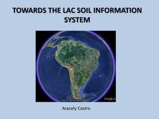
Towards the LAC soil information system - Aracely Castro
•
0 likes•734 views

http://www.fao.org/globalsoilpartnership This presentation was made during the GSP/E-SOTER Global Soil Information workshop that took place at the FAO HQ, Rome , Italy from 20-23 March 2012. This presentation was made on the second day by Aracely Castro, and it presents Towards the LAC Soil Information System. ©FAO: http://www.fao.org

Recommended
Recommended
More Related Content
What's hot
What's hot (20)
Similar to Towards the LAC soil information system - Aracely Castro
Similar to Towards the LAC soil information system - Aracely Castro (20)
More from FAO
More from FAO (20)
Recently uploaded
Recently uploaded (20)
Towards the LAC soil information system - Aracely Castro
- 1. Aracely Castro TOWARDS THE LAC SOIL INFORMATION SYSTEM
- 2. - LAC is a reach territory in terms of their natural resources. High biodiversity and variability of resources makes the region one of the most suitable agricultural land in the world available. - However, soil degradation is a real issue across some landscapes in the region, especially due to unsustainable land management practices. - Natural resources geo-information is quite available at regional and national level, in some cases freely available on internet. - Spatial variability of soils is very high according to the different landscapes. BACKGROUND
- 3. - Only HWSD available (SOTERLAC map). SOIL INFORMATION AT REGIONAL LEVEL
- 4. - Rio workshop in 2010, funded by JRC, EMBRAPA and CIAT. - Very heterogeneous across the region. Countries such as Brazil, Argentina, Chile, Mexico, Panama, Cuba having strong and active national soil institutions. Soil information available at national level and also in scome cases at subnational level. Most of it under GIS platforms. Digital Soil Mapping is also applied, specially at research level. - The situation in other countries is far behind and institutions working on soils are not present or are rather weak. This happens in Honduras, El Salvador, Bolivia and Paraguay. - Private sector in some countries such as Honduras holds a very reach soil database mainly focused at farm level. SOIL INFORMATION AT NATIONAL LEVEL
- 5. SOILS GROUPS IN MEXICO
- 6. SOIL INFORMATION IN CUBA
- 7. SOIL INFORMATION IN PANAMA - Soil information system available including 1767 georeferenced soil profiles.
- 8. SOIL MAPPING IN CHILE
- 9. The map of the soil organic carbon of Rio de Janeiro State (0-10 cm) with environmental features
- 10. SOIL INFORMATION IN BOLIVIA
- 11. - Soil information is still considered useful and most of the countries in the region have gone through soil survey activities for many years. However, in some cases they didn’t know how to use soil data properly. - Few countries count with soil institutions working at national level. - DSM is not widely adopted in the region as some Pedologist refuse to cross the borders from their expertise. - Capacity development of current and future generations of soil mappers was identified as key area to support. - Generate a regional soil information system NEEDS AND PRIORITIES IN THE REGION
- 12. - Short term: FAO through the GSP is funding initial activities in LAC regarding soil legacy data (maps and profile data) systematization and empowering of institutions. This activity is being implemented by CIAT. - Under the same project, EMBRAPA Solos will develop a Digital Soil Mapping toolbox to implement it in a capacity development process. - Twenty countries involved and with a lot expectations, specially regarding training. - Medium and long term: the development of the LACSIS (Latin- American Soil Information System) using DSM approach but with the leadership of the national institutions and local talent. TOWARDS A LAC SOIL INFORMATION SYSTEM
- 13. THANK YOU!