SlideShare a Scribd company logo
1 of 58
Download to read offline
PARTICIPATORY
MONITORING
AND
EVALUATION
Field Experiences
NGO PROGRAMME KTN SERIES 1 NOVEMBER 2005
KARNATAKA-TAMIL NADU
Participatory Monitoring and Evaluation
PARTICIPATORY MONITORING AND EVALUATION:
FIELD EXPERIENCES
NGO PROGRAMME KARNATAKA-TAMIL NADU
SERIES 1 2005
Participatory Monitoring and Evaluation
The use and sharing of information contained in this document is encouraged, with due acknowledgement of
the source.
Contributors
Main text by Ashok Alur and Snehalata Nath, with Prem Kumar. Coordination and editing by Jane Carter.
Design, Layout and Printing
Books for Change (Series cover design concept by Write Arm).
Photos
All photographs by S Jayraj or Jane Carter.
Publisher
Intercooperation; Delegation - India, Hyderabad
Citation
NGO Programme Karnataka-Tamil Nadu (2005) Participatory Monitoring and Evaluation: Field Experiences
NGO Programme Karnataka-Tamil Nadu Series 1 Intercooperation Delegation, Hyderabad, India. 46 pp.
PARTICIPATORY MONITORING AND EVALUATION:
FIELD EXPERIENCES
Copies available from:
SDC-IC NGO Programme Karnataka-Tamil Nadu,
Programme Support and Management Unit,
49, 3rd
Cross, 10th
Main, Indiranagar Stage II,
Bangalore 560 038, India
tel: +91 80 2521 4944
email: icngoktn@blr.vsnl.net.in
Delegation - Intercooperation India,
8-2-351/r/8, Road No. 3, Banjara Hills,
Hyderabad 500 034, India
tel: +91 40 2335 5891
email: info@intercooperation.org.in
Acronyms iv
Foreword v
Acknowledgements vi
Executive summary vii
Background 1
1. Monitoring soil conservation activities 7
1.1. Transect walk: the method
1.2. A transect walk in practice
2. Monitoring and evaluating NRM interventions 12
2.1. Spider web diagram: the method
2.2. Spider web diagrams in practice: monitoring change
3. Evaluating village changes 16
3.1. Participatory resource mapping: the method
3.2. Participatory resource mapping in practice
4. Evaluating NRM interventions 21
4.1. Photographic comparisons: the method
4.2. Photographic comparisons in practice
5. Evaluating skill development training 24
5.1. Matrix ranking: the method
5.2. A matrix ranking in practice
6. Evaluating dietary changes 29
6.1. Time lines: the method
6.2. A simplified time line in practice
7. Evaluating the impact of tank silt application 33
7.1. The H-form: the method
7.2. A modified H-form in practice
8. Evaluating different use of a community pond 39
8.1. Well-being ranking: the method
8.2. A well-being ranking in practice, as part of an evaluation
Conclusions 44
References 46
Content
Participatory Monitoring and Evaluation
Acronyms
GIS Geographical Information System
GPS Global Positioning System
NRM Natural Resource Management
NTFP Non-Timber Forest Products
PME Participatory Monitoring and Evaluation
PRA Participatory Rural Appraisal
RES Rural Education Society
RWT Rural Welfare Trust
SCOPE Social Centre of Peoples’ Education Trust
SHGs Self Help Groups
iv
Foreword
In January 2003, a group of over 20 staff members of the partners of the IC NGO
programme met in the village of Honnashettahalli, Kolar District, Karnataka (hosted by
the NGO partner Grama Vikas) to deepen their understanding on participatory monitoring
and evaluation. We had a three days training programme in which together we explored
the scope of community-centred methods in monitoring and evaluating the development
efforts supported by the NGOs. The training was learner centred, as participation can
only be ‘taught’ by adopting and practicing it.
We spent our time discussing the differences between monitoring and evaluation, on
different types of participation, on the use of PRA tools for impact assessment, etc. All
partners had ample experience with community mobilisation and adopting participatory
methods in implementing the activities supported by the project. Nevertheless the
discussions led us to the basic questions of whose reality counts, whose information need
is met and whose criteria are used. Together we tried to ‘demystify’ the concept by
looking into concrete situations and assessing the possibilities to bring local level
perspectives into the mainstream of M and E. Different participatory methodologies were
considered and their implications were discussed.
Following three days of lively discussions, a number of ideas emerged to translate the
concepts into action. I am happy to note that after the initial workshop, the participants
shared their ideas with their colleagues and the groups at village level and that they
took the step to adopt and adapt PRA methods for monitoring and evaluation. I enjoyed
reading about their experiences with the use of participatory tools to capture changes
and to analyse impacts.
The examples presented in this publication set out a range of methodological challenges
for PME in the context of rural India. They demonstrate the use of visualisation
techniques – diagramming and mapping – for analysis by community members. The
eight cases offer insights in assessments from a gender perspective and provide the
reader with practical tips on the application of participatory appraisal tools that ensure
a meaningful role for all, the community as well as the NGOs. All together they point to
the importance of people centred approaches to learning, analysis and development.
November 2005
Annette Kolff
Head Agriculture Team
Intercooperation Bern
v
Participatory Monitoring and Evaluation
Acknowledgements
Participatory monitoring and evaluation, by its very nature, calls for the involvement of
many people. I would like to thank in particular the many villagers in the project
villages who took part in the exercises described in these pages, and contributed their
views and ideas.
The NGO Programme Karnataka-Tamil Nadu has 12 NGO partners. Whilst seven feature in
the examples outlined, I would like to acknowledge the contribution of all partners to
the development of PME approaches under the Programme. With regard to the examples
described in this document, I would like to acknowledge the particular contribution of
the following persons, whilst recognising that all field staff had a role in the process. At
Grama Vikas, Rao and Pavithra; at Keystone, Snehalata Nath (who also had a greater role
in overall document preparation) and Robert Leo; at Prakruthi, Narayanappa and
Ragvappa; at RES, Mallapur and Jayashree; at RWT, Anand Lobo and RaniKittur; at SCOPE,
Magimaidas and Mary P; and at Vikasana, Varghese, Chandrashekar and Chandrappa.
Annette Kolff played an important role in this document, as she facilitated a Participatory
monitoring and evaluation Workshop organised through the Programme in January
2004, during which the idea of recording and sharing examples of PME under the
Programme first emerged. She kindly provided many suggestions on the final document,
and also wrote the Foreword.
At PSMU, Aparna Chintamani is particularly thanked for her support in bringing many of
the case studies together.
Finally, I thank the main contributors to this document – Ashok Alur, who after nearly
five years of valued work with Intercooperation, is now at ICRISAT; Snehalata Nath at
Keystone; and Jane Carter, Senior Adviser, who brought the document together.
Prem Kumar
Coordinator, NGO Programme Karnataka-Tamil Nadu.
vi
This publication is mainly intended for field practitioners in rural development, particularly
participatory natural resource management. It documents the field experiences of seven
of the partners under the SDC-IC NGO Programme Karnataka-Tamil Nadu in participatory
monitoring and/or evaluation of their activities. After a brief introduction to the concept
of participatory monitoring and evaluation (PME), it sets out a variety of examples,
chosen as ‘real life’ situations that field practitioners are likely to experience. For each
example, a short outline of the PME tool used is given, followed by a description of how
the tool was applied for a particular purpose in the field. A small text box provides an
introduction to the partner concerned. The partners located in Karnataka are Grama
Vikas and Prakruthi in Kolar District, Rural Education Society (RES) and Rural Welfare
Trust (RWT) in Belgaum District, and Vikasana in Chikmagalur District. In Tamil Nadu,
case examples are drawn from Keystone Foundation (Kotagiri District) and Social Centre
of Peoples’ Education (SCOPE) Trust, (Thiruvannamalai District).
All the field situations concern activities that have been supported under the Programme.
Four of the case examples relate to general natural resource management interventions.
Activities mentioned include the construction of check dams, gully plugs, terraces and
farm bunding (for soil conservation and water retention); tree planting (both for soil
retention and for biomass or specific tree products); and farm pond construction (for
local irrigation, water for livestock, and occasionally also fish farming). Specific activities
detailed in the other four case examples are tank silt application for improving soil
fertility, the promotion of traditional food crops, the renovation of a community farm
pond and – somewhat differently, but a common type of activity, a skills training
programme (in this case, training in wool processing for women of a shepherd community).
The Programme has placed emphasis on supporting and empowering marginalised groups
in society, and promoting gender and equity. Thus, the examples document work with
tribal people and other community groups, including women, who have traditionally
been the subject of social discrimination.
The specific PME tools described are those commonly used in participatory appraisal
processes – participatory mapping, transect walks, time lines, photographic comparisons,
matrix ranking and well-being ranking – as well as some perhaps slightly less commonly
used, notably spider web diagrams and the H-form.
Executive
summary
vii
Participatory Monitoring and Evaluation
Background
Why this publication?
This publication arose out of a request from all twelve partners of the SDC-IC NGO Programme
Karnataka-Tamil Nadu (hereafter referred to simply as the Programme). With the support of the
Programme, these partners have implemented a variety of Natural Resource Management (NRM)
activities in selected villages over the past ten to seven years (see box 1). All the partners adopt
participatory approaches to development, based on a well-established rapport with the concerned
village communities. The activities are planned and reviewed through group discussions (facilitated
by the partners), the planning itself often including the use of participatory tools. Until recently,
Box 1: The NGO Programme Karnataka-Tamil Nadu
Supporting sustainable natural resource management with special emphasis on the socially/economically
marginalised (women, dalits, tribal people)
The NGO Programme in these two States began in 1996, partnering with NGOs having a sound
grassroots base in order to promote a technically sound, people-centred approach to natural resource
management (NRM). In its current phase, the Programme is working with 12 NGO partners (6 each in
Karnataka and Tamil Nadu). Key features are:
● supporting a holistic approach to NRM based on activities related to the conservation and
sustainable use of water on rain-fed lands
● strengthening the capacities of the communities and partner NGOs in participatory monitoring
and evaluation, and documenting results and lessons learned
● promoting self-reliance through the enhancement of traditional livelihood systems [such as the
collection and marketing of Non-Timber Forest Products (NTFP) by tribal peoples, sustainable
agricultural practices for food security, etc.]
● strengthening existing people-based institutions, including building capacities in gram panchayats
● promoting linkages with other local level institutions such as financial institutions, farmers’
organisations, and in particular panchayat raj institutions
● supporting gender-balanced, equitable development with an emphasis on working on common
property resources rather than private lands.
The programme is working selectively in the more remote and disadvantaged areas of the two States,
focusing on tribal communities, dalits, and other marginalised groups. Human and institutional
development is a cross-cutting theme in all areas of interventions.
1
Participatory Monitoring and Evaluation
however, there had been little systematic community-based monitoring and evaluation. As part
of the Programme’s consolidation phase, the partners identified this as a matter on which they
would like to work further. Following the outcome from two workshops and considerable field
interactions, this document sets out a variety of examples in participatory monitoring and
evaluation. Different tools are used, but in most the focus is on evaluation rather than monitoring,
given the stage in the programme cycle.
The purpose of this document is to provide development field workers – both staff of the programme
partners and others – with specific examples of participatory monitoring and evaluation, using a
variety of participatory tools. These examples are chosen as those to which field workers can readily
relate. The document is in first instance produced in English, but will also be translated into
Kannada and Tamil, as in many cases it will be more useful in the local language. It is hoped that
the English version will serve particularly for training purposes. Given the depth of experience in
India in participatory appraisal tools, the document does not seek to reproduce the large number of
existing publications (mainly in English) on the subject. Instead, it provides a summary description
of particularly useful tools and refers readers to selected publications for more information.
Following this introductory section, the main part of the document, the second section, describes
tools and examples. For each case study, the tool is first described, followed by the practical field
experience of a partner working in Karnataka or Tamil Nadu. A final short concluding chapter
outlines some of the challenges and lessons for the future.
What is PME?
Changes over time
There are many definitions of participatory monitoring and evaluation, but perhaps the simplest is
keeping track of changes with the community stakeholders. Box 2 – adapted from Estrella et al (2000),
Box 2: Features implied within Participatory Monitoring and Evaluation
Participatory Shared learning
(in this context) Joint decision-making
Co-ownership
Democratic process – involving everyone in the community, not just
the most vocal members
Mutual respect
Empowerment
Enhanced mutual understanding
Monitoring Knowing where we are
Observing, recording change
Regular, timely assessment
Increased, jointly shared accountability
Routine reflection
Feedback
Evaluation Reflection process on what has occurred
Assessment of achievements/impacts over a longer period
Learning from experience
Valuing change
Overall, PME should serve to increase the analytical capacities of community members, and
empower them to question, and become pro-active in development initiatives.
2
and incorporating ideas volunteered by participants at a programme partner workshop in January
2005 – provides some further insight.
From this it may be seen that monitoring is a periodic but regular activity for ‘keeping track’ of
what is happening in any project intervention. In this way, changes over time can be recorded
effectively. Furthermore, any unexpected or new circumstances can be taken into account, and
incorporated in further activities. Evaluation, by contrast, happens normally at the end of a
project – or at a pre-defined point within a long period of project interventions (for example, a mid-
term evaluation) – and entails a reflection and assessment of what has been achieved and learned.
Ideally, the system of monitoring and evaluation should be planned as an integrated part of
project design. It should start before the commencement of project activities, with decisions on
what should be monitored, and eventually evaluated. These criteria are often defined as indicators.
Furthermore, if the system of monitoring and evaluation is to be truly participatory, the indicators
and the means of determining them should be discussed, identified and agreed by the community
stakeholders at the beginning. Indeed, it should then be these same stakeholders who decide
how often progress should be reviewed, who should do it, using what method, etc.
This may be illustrated
by an example. In this
hypothetical case, a donor-
funded project is
supporting the renovation
and management of a
community farm pond over
a five-year project period.
The community members
decide that one indicator
should be the availability
of drinking water for village
livestock all year round
(including throughout the
dry season). They further
decide to monitor water
availability for all village livestock during the critical month of peak water shortage, April, every
year. A small group of villagers representing all community interests (different castes and socio-
economic groups; wealthy and landless, etc) is elected to carry out the monitoring task, with
facilitation (if required) from project staff. To gain full insight, monitoring includes participant
observations on water availability for different types of livestock; and livestock belonging to
different households (near and further away from the pond, and belonging to different communities
in the village). Perhaps they use a matrix ranking for this task, linked to a participatory mapping
exercise conducted at the beginning of the project, which identified the location of all households
and the type of livestock owned by them. A well-being ranking could have recorded further
information about the different households. At the point of monitoring in the second year, it is
realised that water is insufficient, that goats are trampling the pond banks, and that disputes
are arising over pond use. Households far from the pond claim that they are being discriminated,
with those close to the pond using more water. A village meeting is called for, and it is decided
that the channel feeding the pond needs to be modified to maximise the inflow of water, and
Background
Water essential for all
3
Participatory Monitoring and Evaluation
Most of all, PME should be enjoyable
that access to the pond by livestock needs to be improved by making one of the banks more
gently sloping. It is further decided that the livestock of all households should have access to
the pond, and this should be regulated on a fixed time basis to ensure efficient water use. At the
end of five years, the community members evaluate how effective the pond had been in providing
drinking water to the village livestock throughout the period; what lessons were learned in the
monitoring process; and how the pond should continue to be managed in future. They also
identify important factors that should be taken into account when planning and designing farm
ponds in other similar villages. Using the information collected in their monitoring and evaluation
exercises, they are also able to demonstrate to the donor what has happened – and perhaps use
this information to argue for further funding or a different form of intervention. Whilst this
example is highly simplified, it gives an idea of the issues that might arise in a PME process.
In the hypothetical example, PME was integrated into the whole project design. What happens,
however, when a rigorous PME process has not been put in place from the start? The practical
reality is that thinking through a system of monitoring and evaluation is often not given priority
at the beginning of development interventions. However, it is common for a participatory planning
exercise to take place, even if this is not then followed up in a PME process. In such circumstances,
participatory methods can still be used to capture community perceptions of change, even at a
late stage. They can also build on informal systems of monitoring though observations and
community discussions that have taken place. This is not the same as the full PME process, but
it is a step in that direction. Most (although not all) of the examples documented in this manual
are in fact closer to this situation of bringing PME into an existing intervention, rather than
incorporating it from the start.
Who wants to know what has changed?
Although the above discussion makes clear that PME should be based on the ideas and wishes of
the community stakeholders, it is a fact that local people rarely demand information in such a
structured manner. They form their own opinions. It is usually NGO staff, donor agencies or other
interested persons (Government agencies, researchers, journalists) who wish to have changes
captured and, if possible, quantified. Nevertheless, the hypothetical example in the previous
section showed the potential practical value of PME to community members.
Consulting local people
in a monitoring and
evaluation exercise does not
automatically make the
process participatory. If
based on a one-way process
of information collection, it
can be purely extractive.
PME, by contrast, should
entail a two-way exchange
of information. Most of all,
it should be an enjoyable
process in which everyone
feels that they have learned
something.
4
Appropriate tools
Open discussions with the community stakeholders, in which everyone is encouraged to speak
out, are an essential part of PME. However, discussions alone are often insufficient to quantify
change. The use of participatory tools usually cannot give precise figures either (certainly figures
need to be cross-checked with different sources before being quoted as ‘facts’), but it can result
in quantified information that can be used for cross-comparisons (e.g., ‘before’ and ‘after’, etc.).
This adds meaning and value to discussions. For example, a group might say that ’everyone’ in
the village has benefited from a given intervention. However, if asked to analyse through a
matrix what specific benefits have arisen, and then who has enjoyed them, a far more detailed
picture may arise.
Participatory Rural Appraisal (PRA) tools are often only seen as appropriate for gathering information at
the beginning of an intervention, as part of a process of appraisal and planning. Development workers
may talk about having ‘done’ a PRA, sometimes seeing it as just a step towards getting funding. However,
PRA tools have a much wider range of potential uses, and can often be readily adapted and used for
participatory monitoring, and for participatory evaluation.
PME methods and examples
The examples documented in this manual are intended to provoke ideas and demonstrate practical
realities. They are not selected as models to be followed, but as cases of real situations, described
by participants as learning experiences worth sharing. To stimulate further thought, particular
points of note are given in comment boxes. For each case example, a small information box
provides an introduction to the partner concerned, and indicates the communities with whom
they are working. All the partners work to empower those who are disadvantaged in society – be
they tribal communities, dalits or other marginalised groups – and emphasise gender awareness
and promote equity.
The examples described are as follows:
Transect walk: is a means of involving the community in both monitoring and evaluating soil
conservation changes that have taken place over the period of programme intervention. This
method entails direct observation whilst incorporating the views of community members. The
case example comes from the Nilgiri hills of Tamil Nadu, where the partner Keystone is working
with tribal communities.
Spider web diagram: in this case is used as a means for participants to monitor and evaluate key
areas of a programme. The spider web is a simple diagrammatic tool for use in discussions; it does
not entail any direct field observations. The case example comes from the Jawadhu hills of Tamil
Nadu, where the partner SCOPE is working with tribal communities.
Participatory mapping: is perhaps the most easy and popular of participatory tools, used here
to evaluate project interventions. The example is taken from Chikmagalur district, Karnataka,
where the partner Vikasana is working with generally poor and marginalised communities.
Photographic comparisons: is another easy visual tool, here used to stimulate community
discussions in evaluating programme interventions. In this case, the partner RWT is working
with marginalised communities in Belgaum district, Karnataka.
Matrix ranking: in this case used to evaluate the impact of skills training to women belonging
to a shepherd community. The example is taken from Belgaum district, Karnataka, where the
partner RES is working with the Kuruba shepherd community.
Background 5
Participatory Monitoring and Evaluation
Time line: a tool used to elaborate historical change. In this example, only a simple time line is
given, comparing two points in time (usually there would be more). The case is a second one
from the partner Keystone, working in the Nilgiri hills of Tamil Nadu.
H-form: a simple monitoring and evaluation tool, used in this case to evaluate tank silt application
to farm land. The partner, Grama Vikas is working with marginalised farming communities in
Kolar district, Karnataka.
Well-being ranking: is described in the final example, being used to differentiate the benefits
that different community members have gained from the renovation of a community pond. This
example comes from the partner Prakruthi in Kolar district.
6
1.1. Transect walk: the method
Materials needed
For the walk itself:
● notebook and pen
● appropriate clothing and footwear for the
area and time of year
● (maps or aerial photographs if available)
● (compass)
1.
Monitoring
soil
conservation
activities
● (GPS, Global Positioning System, if the details of the transect are to be incorporated into a
GIS, computerised Geographical Information System).
For the subsequent write-up:
● large sheet paper
● coloured pens
● (small coloured cards for marking particular items of interest).
Transect walks are used to gain an understanding of the natural resources of a village, their
diversity and associated problems, and to assess opportunities. Parameters usually covered include
topography, land use and ownership, soil features, vegetation, crops, etc. They are very useful in
planning land development interventions and identifying sub-zones for special consideration. If
conducted at the beginning, middle and end of the project period (during the same season), they
can be used for monitoring and evaluating changes along the particular transect.
Transect walks can be used to compare reactions/discussions of different types of stakeholders,
such as government officials, NGO team members, the local community, etc. They can provide a
good cross-section of information that can be used for specific purposes of verification and appraisal.
A participatory transect walk entails taking a walk along a pre-determined route with a group of
key informants from the local community, and exploring the geography of the area through their
eyes. The walk should take in a cross-section of the area of intervention, covering all the agro-
ecological zones. For example, this might cover from ridge to valley in a watershed, or straight
across a slope if interventions are all roughly at the same elevation.
Steps to conduct a transect walk
1. Identify a group of key informants. Ideally, they should include older and younger people,
women and men, and they should all be willing to walk some distance, and share their observations.
2. Discuss with the group the purpose of the walk, and decide on the path that should be taken
to cover the full geographical variation in the area. The ‘path’ may not be a path at all –
7
Participatory Monitoring and Evaluation
ideally, as a true cross-section, it should be a straight line. However, if the path roughly
corresponds to at least part of the cross-section, it may be easier to use it. Maps or aerial
photographs may be of use, if available, but are certainly not essential. For monitoring and
evaluation purposes, it is important that the line of the transect walk can be readily found
again and again, possibly after substantial periods of time.
3. Decide with the key informants what parameters should be used for recording observations.
Typical ones might include land type, soil type, natural vegetation (perhaps recording certain
key ‘indicator’ species), local fauna, crops, water bodies, and land ownership. Local definitions
of these parameters should be explored – for example, names of land and soil types, or of locally
important plant or animal species. It is best to limit the parameters covered to five or six at
maximum; trying to collect too much information may only result in confusion.
4. In general, the easiest and most stimulating part of transect walks is the walk itself and the
discussions that arise during it, with the local people as experts. Documenting it afterwards
can be more difficult. It helps to clearly decide specific observation points along the transect
walk at which everyone stops to record all parameters.
1.2. A transect walk in practice
Keystone Foundation, Kotagiri, Tamil Nadu
Keystone Foundation works on issues of natural resource management, local governance and enterprise
development with tribal communities in the Nilgiri hills of Tamil Nadu. Keystone has been a partner
of the SDC/IC NGO programme since 2000 – working in a total of 14 tribal villages. Supporting the
tribal communities to develop their lands is a central activity. This is challenging in purely technical
terms, as the land to which the tribal people have traditional claim covers steeply sloping, rain-fed
areas in the rain shadow of the Nilgiris (annual rainfall below 800 mm), which are highly prone to
erosion. To develop their land, the people must clear weeds, construct stone contour bunds and
terraces to control soil erosion, and then gradually establish a mixture of locally adapted species.
These species include Gliricidia sepium, castor, lime, and Nelli (Embilica officinalis), which are planted
to bind the soil with their roots and produce biomass as well as useful end products. At the same
time, millet and other traditional food crops are cultivated; and once shade has been established,
coffee is introduced. Eventually more varied long-term cash crops (e.g., pepper, cloves) are introduced,
although this depends on local conditions, particularly water availability. Some lands are assigned
only for millet and vegetable cultivation. The whole approach emphasises diversity, low input (in
terms of pesticides and fertilisers), and ecological appropriateness.
A transect walk for ‘base line’ information
In 2000, before Keystone began activities in five focal villages, staff undertook a transect walk
with local resource persons across the entire terrain of each village. The transect walk cut through
the terrain from the highest to the lowest elevation, following a local path wherever possible, and
using specific landmarks to enable the same transect to be followed at a future date. The transect
covers grazing land, water sources, land under cultivation, and habitations. Whilst undertaking the
walk, they made notes on the following characteristics at regular 50m intervals:
● land form – nature of slope and other topographical features
● soil – notably the presence of any soil conservation structures
● water – presence of springs or other water bodies; ground water level was measured
● crops – dominant cropping pattern
8
Developing traditional tribal lands on the slopes of the
Nilgiris is a laborious matter
● vegetation – main tree species
(natural and planted); other
prominent woody and non-woody
species
● habitation – type of settlement and
facilities
● other comments by resource
persons – including present and
former land uses other than
agriculture, bird species found
locally, etc.
A repeat transect walk for monitoring
activities
Five years later, the transect walk was conducted again as a participatory monitoring exercise
(Keystone intends to conduct the same exercise at five-yearly intervals). This example documents
the transect walk undertaken in the village of Semmanarai.
Semmanarai is a village of scattered settlements over a terrain covering some 87ha. The total
length of the transect walk was 4,700m, exactly along the route used previously – which partially
used local paths, and otherwise cut across land from one landmark to another. Although traversing
from highest to lowest elevation, the transect covers irregular terrain in-between, including three
natural nalas (small streams) and swamps.
The first transect walk was conducted in June 2000, and ideally the exercise should have been
repeated in the same month. However, for internal reasons the second transect walk was conducted
in January 2005. This means that due allowance had to be made for the seasonal differences. It
should also be noted that the transect walk took place after the first good rainy season in the
project period; prior to 2004, there had been three years of drought.
The intention was that the same persons who had participated in the first transect walk would
conduct it again in 2005. In the end, the team comprised three such persons (two from Keystone,
and one from the community – all male). However, any persons met along the way were asked for
their observations, and in
this way the views of five
(relatively elderly) women
were incorporated.
In all transect walks,
men were more ready
to participate than
women, having more
time available (women
excused themselves
from walking far from
the village, saying
they had other work
to do). When the
Semmanarai transect
walk was conducted in
Monitoring soil conservation activities 9
Participatory Monitoring and Evaluation
2000, seven people participated (three from Keystone, and four community members). At that
time, one incentive to participate was the hope of finding wild bee colonies – two were found and
subsequently hived.
Results
The results were recorded by keystone in a transect chart. A few specific points are as follows.
● The resource persons commented that it is easier to walk along the paths these days; there is
less vegetation surrounding the paths, which eases passage, and they no longer have to keep
an eye out for bears (which used to be a potential danger, hidden in the undergrowth). The
improvement of the paths had not been a direct intervention of Keystone; however, it is an
associated development as through Keystone’s work, the tribal communities have developed
a greater voice in the Gram Panchayat, and have been able to lobby successfully for funds to
renovate the paths.
● There are fewer open springs and small ponds on the upper slopes; water sources are currently
drained through pipes to the inhabited areas down slope. (This is a direct result of programme
interventions).
● Fewer trees are felled at pole stage. This was said to be the result of a government house-
building programme which uses mainly stones and cement, and hence there is a lesser demand
for wooden poles for house building in the area.
● The vegetative cover on the lower slopes is denser, and richer in biodiversity. This is considered
a direct result of Keystone’s interventions to introduce species such as Gliricidia sepium, lime,
etc, and then cash crops such as coffee. In the year 2000, eight species dominated – coffee,
tea, coconut, mango, lime, silk cotton (Ceiba pentandra), silk oak (Grevillea robusta), jack
(Artocarpus spp.) and Erythrina spp. In 2005, the commonly found species had increased to
some 22 (as result of planting). In addition to the eight previously mentioned, these were:
arjuna (Terminalia arjuna), areca nut, bamboo, banana (at least four varieties), Cassia fistula,
Chebula (Terminalia chebula), cinnamon, clove, Dammer (Canarium strictum), gooseberry,
nutmeg, Malabar palm, Pongamia pinnata, and sweet tamarind (Pittoselobium edule).
● The community members also observed that, in their opinion, the soil organic matter has
improved in the fields close to the settlements. This was explained as being the result of
better management and use of cow dung and urine, as promoted by Keystone.
● Around the houses in the settlements, cleanliness and general standards of sanitation have
improved, due to improved water supplies.
● In 2000, no vegetables were cultivated, whereas in 2005 a number of vegetable plots were
observed. These included French beans as a cash crop, as well as brinjal, tomato, onion and
chillies for domestic consumption.
Some of the changes recorded had nothing – or little – to do with programme activities, whilst others
could be seen to be direct ‘cause and effect’. Nevertheless it is important to record all changes, whatever
the reason.
It was realised that the time taken to conduct the transect walk the second time was less. This
may be attributed to a variety of reasons, ranging from the paths being more open and easy to
traverse; the terrain being more familiar; and even some of the participants (members of Keystone
10
staff) being more accustomed to walking than before. However, it is also important not to rush
– to take time to observe changes.
Keystone intends to continue working in all the villages that have been supported through the
Programme. Thus, this transect walk was very much a monitoring, not an evaluation, exercise. The
information recorded in both the first and second transect walks will be kept by Keystone, and used
as reference material to compare against observations made in a third transect walk to be conducted
in another five years time, and possibly a fourth in a further five years. In this way records of
observations by both tribal people and Keystone staff will be built up over an extensive time period
of 15 to 20 or more years, depending on how long it is felt appropriate to continue monitoring.
Suggestions on the method
The main suggestion on the method is to always conduct the transect walk at the same time of
year, to ensure that apparent changes observed cannot merely be attributed to seasonal differences.
It is also helpful if at least some of the people who conducted the earlier one (or ones) also
conduct the repeat walk as this helps to ensure that comparisons are real, rather than based on
differences of individual perceptions. At the same time, including the views of people who were
not present for earlier walks can give fresh insights.
Monitoring soil conservation activities
Separate men and women group discussions
11
Participatory Monitoring and Evaluation
2.
Monitoring
and
evaluating
NRM
interventions
2.1. Spider web diagram:
the method
Materials Needed
● large sheets of paper
● cards and coloured markers
● notebook.
The spider web diagram is also called a cobweb diagram, participation wheel or an evaluation
wheel. It is a highly visual method for analysing the relative importance of, or progress on,
different aspects of an intervention. This exercise can be done to plan projects, but particularly
to monitor and evaluate them. Each aspect is represented by one arm of the frame of the web,
and is graded from 1–10. It is also possible to rank programme/village/group/individual
performance during (monitoring) or at the end (evaluation) of a programme.
Steps in conducting a Spider Web Diagram
1. Discuss the purpose of the exercise with the participants, and reach a common decision on the
aspects to be rated by them, depending on the exercise. These could be the performance of the
project against the original objectives, the various activities of the project, the extent of
developments in different villages, etc.
2. Ask the participants to write these aspects on cards or represent them by drawings. Take a
large paper and arrange the cards radially, away from the centre. Join the centre to the card
with a straight line. (See diagram). This line represents a scale from 1–10.
3. Ask the participants to score each of the aspects based on the performance and ask them to
mark the score on the axes of the circle. This can be done either by asking each individual to
Framework for a spider diagram
12
present her/his ideas and mark the score, and further discuss to reach consensus on a collective
score; or by discussing first and then marking the collective score accordingly.
4. Join the score on each of the axes, with a line as shown in the diagram on page 15.
5. Discuss the scores and the underlying causes/reasons.
6. Document the exercise and take notes of the reasons stated by the participants. These results
can then be used for participatory planning, monitoring and evaluation.
2.2. Spider web diagrams in practice: monitoring change
Social Centre of Peoples Education (SCOPE) Trust, Thiruvannamalai, Tamil Nadu
SCOPE Trust is working in Chengam block of Thiruvannamalai district in Tamil Nadu, with Malayali
tribal people belonging to the Gounder and Kallar communities. Living in scattered settlements in
degraded, often steeply sloping forest areas of the Javadu Hills, these communities were once
hunter-gatherers. They are now settled in villages that have been provided with substantial
infrastructure (such as overhead water tanks, electricity supply, schools, etc.) through various
government schemes (facilitated by SCOPE Trust). Nevertheless, the villages remain quite remote,
with poor vehicular access. SCOPE Trust seeks to promote sustainable natural resource management
with an emphasis on the conservation, utilisation and management of soil and water resources.
Important activities supported under the Programme include bunding in hill tracts, levelling of the
inter-bund area, renovation and conservation of traditional water bodies, etc. Under the Programme,
SCOPE Trust has been working with the tribal communities of three villages since 2001, undertaking
land bunding to conserve and improve the fertility of the soil, water conservation through percolation
ponds and check dams and to reduce soil erosion. The NGO has facilitated the organisation of SHGs
through which support is channelled.
Monitoring changes due to
programme interventions using the
spider web method
SCOPE has been using this method for
nearly three years to measure progress
of the programme activities with the
community participants in the three
villages of Kil Thatyapet, Kil Kollai and
Kotur Kollai. SCOPE staff members first
conducted this exercise in December
2002 to review the progress and
effectiveness of their interventions.
The spider web method was introduced to SCOPE Trust a few years ago by an external facilitator, and
has since become quite widely used, staff being very familiar with it as a tool.
The meeting was held in one of the villages and attended by 16 women and 14 men participants.
Participants listed out the project activities, and then ranked them in order of priority. (These
went beyond the activities done under the SDC-IC programme, because the participants could not
differentiate which activity was funded by which organisation.) A similar exercise was done
again in April 2003. This time the participants listed fewer activities and rated them in order of
priority. This meeting was attended by 33 women, and 10 men from the same project villages.
SCOPE Trust works in scattered settlements
in the Javadu hills
Monitoring and evaluating NRM interventions 13
Participatory Monitoring and Evaluation
It was found that the group rated the activities according to the amount of work done during
that time. From the table we see that PRA maps were done by December 2002 and thereby have
no rank in April 2003. Similarly, other activities like nursery raising, bunding and surface tanks
were started and their activity level was less by April 2003; thus they were ranked lower in
priority. This does not mean that the quality of work was low, but only that the level of activity
dropped.The participants discussed at length how some of the training activities were integrated
into the overall heading of Self Help Groups, why certain activities had not started, or were not
relevant. They also discussed the reasons for giving the scores and how further improvement
could take place. Thus, the spider web analysis provided a good means to stimulate discussion
and define future priorities. As is seen later in the text, by 2005 when the programme was
evaluated, priorities of the people and group had changed and a different set of criteria emerged
for ranking programme activities.
Table showing the results of the two exercises conducted
Project Activities Rating Dec, 2002 Rating April, 2003
PRA mapping exercise 10
Nursery 6 3
Village Committee 5
Veterinary camp and training 6 6
Leaders & Members training to SHGs 7
Income & Expenditure Management training to SHG 0
Bunding 6 3
Surface Tank 7 5
Horticulture 0
Vegetable Cultivation 0 4
Biodiversity & Environment Awareness 5 2
Check dam 7 4
Self Help Groups 8 4
Forest Plants 4
Bio-pesticides and Fertilisers 0
“Bunding construction has increased water retention. Earlier we could not put groundnuts, but now we
can.” Gopal, participating farmer
“The Check Dam was useful for adding 20 acres of land for cultivation. However, to store more water
and stop the force of the water during the monsoons, we should build another check dam upstream.”
Krishnamoorthy (Kil Kollai)
Evaluating changes due to programme interventions using spider web diagrams
In 2005, the organisation conducted an evaluation exercise with participants from the three
programme villages. This exercise was done to identify the kind of indicators/criteria that can be
used to monitor change over the project period. This would present a ‘before’ and ‘after’ project
situation. All the participants actively participated to indicate the impact due to the programme
interventions using a 1–10 scale.
The spider web indicated the impact of the programme in the three villages. The important and
noteworthy change is that all children are going to school. Participants tried to quantify some
14
of the other changes. They estimated that about 50% of the farmers are practicing intercropping
methods. Yield levels have improved from 4 bags to 7 bags per acre. Apart from all this, they
have introduced groundnut for cultivation; this was not grown earlier. Employment generation
on the farm has doubled from an earlier 3 months to the present 6 months. Income level was also
reported to have more than doubled, from the land holdings. Besides, the 100 per cent loan
repayment by the tribal people has resulted in improved linkages with the banks. Bank transactions
have also shown a drastic increase in the last two years.
“Bunding has helped us in reducing soil erosion and bringing land back under regular cultivation.”
– M Kuppu
“We have been able to get more income from land as we are growing more than two crops in a year
after bunding.” – Krishnamurthy and Vellaian
“We are growing many other crops along with Samai (as mixed crop) from last 3 years. We are getting
good income from the mixed crops and vegetables.” – M Saroja
Suggestions on the method
The spider web diagram is a relatively
quick and easy tool for comparative
impact assessment, providing a visual
result to which participants can readily
relate. However, it is not so suitable
for quantitative estimates, which
participants in any case found difficult
to judge.
Spider diagrams showing the criteria identified to depict change by the participants and
their rating
Criteria – Before Criteria – After
Education
1
10
Education
Intercrop
Intercrop
3
5
Yield
Yield
7
4
Employment
Employment
3
6
Bank
Bank
1
8
Income
Income
3
7
Loan Repayment
Loan Repayment
10
3
Paddy Cultivation
Paddy Cultivation
1
3
10
10
10
10
10
10
10
10
10
10
10
10
10
A village scene in the Javadhu hills
Monitoring and evaluating NRM interventions 15
Participatory Monitoring and Evaluation
3.1. Participatory resource
mapping: the method
Materials Needed
● local material (stones, sticks,
leaves, seeds), preferably of
different colours, to depict
different resources
● coloured chalk or powder
3.
Evaluating
village
changes
● large sheets of papers, cards and coloured markers
● notebook.
This method is perhaps the most widely used and popular of PRA tools – particularly for natural
resource management programmes. The idea is that a group of participants draw a map of their
village (or whatever area is decided), depicting important resources and places; how the area is
represented is interesting in itself, as generally aspects of greater importance are portrayed more
prominently. Participatory maps are thus not always drawn to scale, although if participants are
asked to do this (and especially if they are already familiar with maps as a concept), they may
produce maps that are quite accurate in scale. These maps may be used for participatory planning,
monitoring and evaluation purposes, if changes are recorded on it on a regular and participatory
manner. This may be done on the same map, but is usually better done by overlaying an updated
version (tracing paper may be used for this), or simply asking participants to draw new maps at
certain time intervals and comparing the results.
Steps in participatory mapping
1. Organise the group of participants from the village concerned – ideally the group should
comprise both men and women from all age groups.
2. Select a large ground/area for the map to be made. This is usually done using local materials of
sticks, stones, rangoli powder, chalk, seeds, etc. This is better, as it allows for mistakes and
corrections to be made by the participants. If the people are comfortable with writing, it can
also be done on large sheets of paper, using colour markers. If done on the ground, the map has
to be copied on a paper for documentation.
3. Explain to the participants the purpose of map making. Depending on the exact aim, they
may be asked to mark certain features (such as where they take cows for grazing; from where
they bring fuelwood, etc), or they may be asked simply to draw the area in question and mark
on what they consider to be important features.
16
4. Facilitate the participants to ensure that everyone participates, without a few dominating. It
may in fact be necessary to have different groups – split for example on gender lines – to
ensure full participation.
5. Discuss the issues emerging from the map, depending on the project interventions (for example,
which are sloping, degraded lands, which are the areas where water is abundant, etc).
6. Take extensive notes during the discussions, which will be an addendum to the map. If the
map is made on the ground, it will be necessary to copy it on to a large sheet of paper at the
end of the exercise. It may also be captured in photographic form.
3.2. Participatory resource mapping in practice
Vikasana, Tarikere, Karnataka
Vikasana, a non-governmental organisation in Tarikere taluk of Chikmagalur district works with small
and marginal resource poor farmers. Tarikere Taluk lies in a rainfall shadow, with average rainfall
some 400 mm/annum; in the years 2002–2004 it was closer to 200 mm/annum. The NGO focuses its
activities in a total of 115 villages in Tarikere taluk, organised into 6 clusters.
Vikasana has been a partner of the Programme since its inception. Watershed based soil and water
conservation, management and utlisation related interventions have been supported intensively in
three villages, which now serve as examples to others in the area. The area treated covers some 555
acres – both private land as well as common property resources. The representatives who participated
in the PME exercise belong to the project villages of Bhoothanahalli and Arishinighatta. These
farmers have participated in a variety of capacity building events over the period of project
implementation and now have a thorough knowledge of conservation, management and utilisation
of soil and water resources.
Vikasana has used participatory mapping quite widely as a planning tool when beginning
interventions in a village. Thus many villagers are familiar with the method. In this case, it was
decided that rather than refer back to past maps, villagers would draw a map of their village
showing the pre-project situation, and then mark over the current situation. This would be used
to stimulate discussions on overall changes that had taken place.
A group of key informants from two programme-supported villages – persons who have been
present in the village over the time of the interventions – came together. They discussed the
social, economical, education and
environmental situations of the village
before project intervention in
1999 – and in particular issues related
to land, water, vegetation and
community development aspects. To
map the change after the project
period the gathering was divided into
2 groups based on the villages to
which they belong. One group
numbered 21 participants (including
4 NGO staff); the other numbered
13 (again including 4 NGO staff). In
both cases the groups were of mixed Vikasana adopts a watershed approach to soil
and water conservation
Evaluating village changes 17
Participatory Monitoring and Evaluation
Stones, twigs and coloured powders were
used in creating the maps
gender; the relatively large number of
NGO staff was because the exercise
partly served as a ‘refresher’ training;
they acted as observers and facilitators
rather than map drawers.
Participatory mapping of the village
prior to Programme intervention
Participants in the two groups
discussed together, and then began
drawing the map on the ground, using
different colours mixed with sand.
They first mapped boundaries, land
marks, water source of streams, tanks
and bore wells, vegetation, forest and
waste lands. Houses, school, temples and roads were then also marked. Key persons (slightly
older) in the group recalled how life had been before the project period.
Eshwarapp from Arishinaghatta and Rudramma from Boothanhalli explained the situation of their
respective villages. They covered social aspects as well as those related to natural resources using
the map. They also highlighted that there was no community organisation in the village, no
SHGs, no federation and no watershed committee, no community hall. They commented that
child labour and child marriage had been common, and gender discrimination prevailed. No
action had been taken to conserve soil and water, and soil erosion was prevalent; one tank had
completely silted up. Farmers used more chemical fertilisers and had given up the use of organic
manure composting methods. There were a lot of monoculture practices adopted in farming. An
additional comment was that near one particular temple, the Ranganatha temple, there had been
a good forest that had degraded due to it being used for grazing. The people had not thought of
promoting a plantation there.
“[In those days] Women were not involved in any decision-making, and were not going outside the
village.” – Lakshmamma, Arishinaghatta
Participatory mapping of the village after Programme intervention
The next step was to mark the post project changes on the same map. The people marked the
newly made bunds and bund plantings, farm ponds, nala bunds, check dams, gully plugs, vegetative
checks, afforestation at waste lands and degraded forest lands. Promotion of organic manure
units, vermi-composting units and compost units was also marked. Road formation, community
hall construction, community bullock cart and mobilisation of government resources for road and
water supplies, organised community with SHGs, and federations were marked with colour, sticks,
stones, twigs and leaves.
“Now, women and men are participating equally in all family and village development aspects. There
are 18 SHGs and one watershed committee in each of the villages, all of which are actively functioning.”
– Shivamma, Arishnaghatta
Shivamma from Arishnaghatta and Eshwarappa from Boothanahalli described the current social,
economical, environmental and political changed scenario through the maps.
18
– Severe soil erosion on farm lands and
common property
– No trees in the forest area
– No farm ponds on farm land
– No check dams
– Very few horticultural trees
– Very few bore wells
– No initiatives to recharge ground water
– Less/no practice of inter/mixed cropping
– Less livestock population
– More migration
– Lack of people’s organisation at village level
– Increased fertility of lands
– Development of forest in 30 acres area
– 25 farm ponds have been constituted
– 1 check dam is built
– 42 compost units are functioning
– Tremendous increase in fruit crops
– Cross-bred livestock have come to villages;
overall increase in livestock numbers
– SHGs and Watershed Management Committees
are functioning
– Reduced migration
– System of intercropping/mixed cropping has
been re-introduced.
Resources at the beginning
of the project
Resources after the implementation
of the project
Before After
Maps produced in the participatory exercise in Arishinaghatta village
They spoke of how their lands have been completely treated for soil and moisture conservation –
activities including compost pits, silt application, horticulture and tree planting along bunds.
People have become organised in SHGs, and SHG federations and committees. They are now saving
money, and getting loans from SHGs and government schemes. They are using these loans for
agriculture development and income generation activities like sheep and goat rearing, dairy and
poultry. It was also said that more children are going to school, and child labour and child marriage
have ceased.
In the case of village Arishnaghata, a list of specific changes was made, as detailed in the
table below.
The mapping exercise served to heighten awareness amongst the participants on all the changes
that have taken place, summing up these as follows:
● increased organisation within the community
● changed attitudes – greater gender awareness and equality
List of changes in Arishinaghatta village, as identified by participants in the mapping exercise
Evaluating village changes 19
Participatory Monitoring and Evaluation
● well developed savings mentality
in the community
● increased conservation and
protection of soil and water resources
● increased soil fertility and ground
water level
● increased income generating
activities
● increased number of livestock
● more networking and linkages
with government bodies and local
institutions.
Perhaps most importantly, the exercise
served to stimulate thought on how to ensure that all these positive changes continue after
Programme withdrawal. In this, the role of the SHGs and Watershed Committees was recognised
as crucial.
Suggestions on the method
Although a participatory mapping exercise had been conducted in the village when programme
activities had begun, a different group had been involved in doing it. The facilitators therefore
felt it more appropriate to do the exercise by comparing ‘before’ and ‘after’ with the group who
was present. Where possible, the ideal scenario would really be to try to convene the same group
who had participated the first time, and thus compare what they had recorded at the time,
without being influenced by hindsight.
Participatory mapping is an easy, visually interesting and generally enjoyable tool. The risk is
that it becomes simplistic, if not facilitated well. For bringing out a variety of information, it is
best to involve a group of 10 to 15 key informants; a few may take the lead in drawing and
marking, but others should be encouraged to take turns and bring in corrections or other
suggestions. Gender differences in perceptions are quite likely, so this must either be carefully
facilitated in a mixed group – or separate maps drawn by men and women. Similarly, facilitators
should seek to include the different perceptions of people of different castes, class, and ages.
Overall, participatory mapping is a good way to begin – whether planning or monitoring or
evaluating – but for more quantative and qualitative information, it is best combined with
other methods.
Finishing touches are made to the nearly completed map
20
4.1. Photographic comparisons:
the method
Materials Needed
● camera
● enlarged photographs
● marker pens and large sheets of paper
● GPS (optional).
4.
Evaluating
NRM
interventions
Photographic comparison is a simple way to stimulate community discussions on changes in a
particular geographical area over a period of time. Such comparisons can be used to consider
changes in land use, land cover, land form and water bodies. Photographs can be used to track
any major physical changes, but less readily any changes related to people and institutions,
particularly with regard to attitudes and approaches. Fully capturing social change requires
supplementary information collected through other means, such as group discussions.
Steps to conduct photograpghic comparisons:
1. Select various locations for taking the photographs within, or giving a view of, the project
area. The spots need to be fixed locations such as a rock, mountain top, a big tree or any
other location that will not change over the project period. This place can also be marked
with a GPS for its exact location; if many spots are chosen, a system of numbering could
be introduced.
2. The project area has to be photographed before the intervention is made. Different photographs
from different points may be made to capture the entire scene. The photographs should be
clearly named, giving location and date, for future reference.
3. For the purpose of monitoring, the area can be photographed from the same locations at
significant time slots during the project period. Care should be taken that the photos are shot
during the same month/season or preferably the same date in successive years. This will
reduce any seasonal errors.
4. Photographs of the project area from the same points should then be taken at the end of the
project period.
5. The ‘before’ and ‘after’ photographs can then be compared with members of the community,
who can identify the changes. A discussion is thus stimulated, which needs to be recorded
in detail.
21
Participatory Monitoring and Evaluation
4.1. Photographic comparisons in practice
Rural Welfare Trust, Santibastwad, Karnataka
Rural Welfare Trust (RWT), Santibastwad works with small, marginal and resource poor farmers
belonging to backward classes (including nomadic groups such as Gowlis) in Belgaum district of
Karnataka. RWT has been a partner of SDC-IC since 2000. Watershed based natural resource
management with a focus on conservation, utilisation and management of soil and water resources
in rainfed areas have been the important activities of RWT. These interventions have resulted in
improved management of these natural resources and in enhanced productivity from farmlands.
Rural Welfare Trust has been systematic in documenting project activities and changes through
various written and photo documents. At the end of the project, it was possible to make a clear
distinction from the benchmark situation. The community has been using these photo documents
to compare and illustrate the situation before and after the project implementation.
The tool was preliminarily discussed
with the participating team of Rural
Welfare Trust and the members of the
community who participated in the
exercise. The exercise was undertaken
in one of the project villages,
Teerthakunde, with representatives
from other villages also participating.
The facilitator initiated the
discussions on the photographic
documents taken before project
interventions. The groups made close
observations on the photographs,
discussed what they perceived, and then made a list of key features. These features were discussed
in depth; most of them related to the lack of soil and moisture conservation features and lack of
crops and vegetation.
Having done this, the group was presented with photographs taken recently, after the project
intervention. The participants observed and identified the changes that have occurred, and listed
them out. A group discussion on the results was then facilitated.
Results
The main observations made by the community members on the pre-project photographs are
as follows:
● lack of bunding or poor quality traditional bunds on the farm land, occupying a large portion
of the land
● some evidence of soil erosion
● little vegetation on the bunds
● very few perennial trees on the farm, and no trees of commercial value/producing fruit
● little grass on the bunds; participants noted that this was natural grass, not planted
● no farm ponds on the farmland
● no vegetable crops grown.
RWT works with small, marginal and resource poor farmers
(including Gowlis)
22
Turning to the post-project photographs, the community members observed the following:
● farm bunds systematically laid out; narrower, occupying a lesser portion of the farm land
● reduced soil erosion on farm lands, although erosion is still apparent on the nalas (checked
to some extent by planted bamboo and other vegetation)
● much vegetation on the bunds
● many perennial trees of horticultural and commercial value (particularly cashew) planted on
the bunds
● plenty of grass planted on the bunds (which they pointed out gives good fodder to animals)
● farm ponds have changed the outlook of the farms; they added from their own knowledge that
some of the farm ponds have become perennial wells.
● farmers have started different nurseries on the farm land and are also growing vegetables with
the water available; the photographs depicted people working in the nurseries.
“It is easy and simple method to compare the situation before and after implementation.” – Woman
farmer from Teerthakunde
Suggestions on the method
The discussions on the physical changes in the landscape could have been used to stimulate a
more general discussion on the social changes in the village, but this was not done due to time
constraints.
The major limitation with the method was to identify photographs which represent exactly the
same area; this was particularly so, given the changes that have occurred. Although the photographs
had been deliberately taken to document “before” and “after” situations, it was realised that this
requires more systematic planning from the beginning. In addition to photographs being taken
from exactly the same spot at regular intervals, ideally they should be taken
● at exactly the same time of year
● facing exactly the same direction
● at the same time of day.
For this exercise to be successful, it is better to include community members who were present in
the area when the original photos were taken i.e from the start of the project, so that they have a
comparative perspective. Two participants who did not belong to the village, but who joined in the
exercise found it difficult to interpret the earlier photographs as being of the same place!
“Everything is visible in front of our eyes. By seeing this one can make out what has happened.”
– Male farmer from Teerthakunde
In this case, RWT staff members took the photographs that were used in the exercise. An innovative
and somewhat different method of using photographs is to provide a camera to a variety of
community members (preferably young and old, men and women), instruct them in its use if this
is necessary, and ask them to take pictures. This can be repeated at intervals over the period of
an intervention. In this way, photographs can be used to record changes through the eyes of
community members.
Evaluating NRM interventions 23
Participatory Monitoring and Evaluation
5.1. Matrix ranking: the method
Materials Needed
●
●
●
●
● large sheets of paper, notebook and
coloured pens
●
●
●
●
● sticks, stones, leaves, seeds, etc. –
any material readily available locally
that can be used for representation
and/or conducting the ranking.
This method is used to elicit the preferences and opinions of participants with regard to a
particular subject. In this way participants can share their knowledge/opinions on, for example,
different fodder species, crop varieties, credit sources, etc., and develop specific criteria by
which to make comparisons. They may then rank the different species/varieties/credit sources
(whatever is being assessed), on the basis of the criteria they have chosen. While matrix ranking
(first, second, third, etc.) gives an indication of relative preferences, scoring (placing on a scale
of 1–10) introduces a greater element of quantification to the preferences.
Steps in conducting a matrix ranking
1. Organise a meeting at a time when those involved in the issue to be discussed are most readily
available. For women, evening meetings may be more convenient than daytime, for example. It
is assumed that a need for a PME exercise has already been identified and agreed, along with the
issue to be elaborated.
2. Discuss with the participants the attributes of the issue to be ranked. Let us take the example
of fodder species. The different attributes of a fodder species (e.g., giving good milk yields;
giving high butterfat; eaten by cows/buffaloes/goats by preference, etc.) should be determined.
It is easiest if these are positive criteria.
3. Reach agreement on what criteria should be used. Take notes on the reasons for preferences
discussed by the participants.
4. Facilitate a decision on whether to conduct the ranking individually or as a group/small
groups. The participants should be comfortable about participating, and able to discuss the
issues freely and express their opinion.
5. Prepare the matrix on a large paper or drawn with locally available material (a stick/chalk)
on the ground. If the participants are not familiar with the written language, use graphic
representation of the criteria. Ranking/scoring can be done using stones, grains or any
other locally available material. Participants often feel more comfortable if they can change
their minds; from this point of view, using stones or similar material is better than marking
scores with pens.
5.
Evaluating
skill
development
training
24
6. Facilitate the ranking/scoring, ensuring full discussion of the reasons for the different scores.
7. If the exercise is done in different groups, consolidate the ranking/scoring. Analyse and
discuss the findings in the group, with the reasons given for a certain preference.
5.2. A matrix ranking in practice
Rural Education Society, Ghataprabha, Karnataka
Rural Education Society, Ghataprabha works with shepherd communities (Kurubas, a traditionally
nomadic, marginalised community) in Belgaum district of Karnataka. The NGO has been a partner
of the Programme since 2000, working in a total of 5 villages. Soil and water conservation
based land development and shepherds development oriented wool based activities are major
activities of this NGO.
This project has also provided capacity building inputs with special focus on women. The shepherd
families reported that the intervention has brought them closer together, through the intensive
time that they shared together in the training. Traditionally, the shepherd women support the men
in weaving. They use an improved method of spinning the wool, using a pedaled charaka (spinning
wheel), and then the men weave blankets using a traditional loom. The project aimed at enhancing
the knowledge and skills of these women by training them in modern wool processing techniques
over a period of six months. The training was conducted separately in each village, and the timing
was adapted to the request of the families. It entailed several hours every morning, six days a week
(with exceptions for local festivals, etc.).
The village level resource persons employed by the NGO played a key role in planning, conducting
and coordinating the training programme with the help of the resource organisation. Training the
women was a challenging task, most of them lacking confidence at the beginning, and doubting
whether the training would bring them any benefits. After completion of the training, a participatory
impact assessment of the training was done.
Skill development training for
shepherd women
This exercise was organised in
one village, Karoshi, to which
representatives from two other villages
(Yadgud and Bambalwad) were also
invited. The number of participants
from all three villages was seventeen.
The exercise aimed at evaluating the
impact of skill development training
for the shepherd women.
The team of RES first discussed the
tool – how it should be introduced, its applications, steps in using the method, and advantages
and disadvantages.
Ideally, the criteria should be developed at the time of planning an intervention, and then used to
monitor and evaluate what happens. In this case, the fact that the criteria were only developed after the
event means that the depth of trainee participation in the whole evaluation process was somewhat
limited. Nevertheless, it gave them the opportunity to provide a feedback on the training, what they had
learned, and what difficulties they had faced. For example, had the matter of difficulties faced been
addressed at the beginning, some of those very difficulties might have been avoided. For future trainings,
RES staff may incorporate a PME process from the start.
Women work together in preparing wool for spinning
Evaluating skill development training 25
Participatory Monitoring and Evaluation
The participants showed immense interest in the overall preparation of the exercise and gathered
all one material required for the exercise. The facilitators initiated the discussion on the topic
and divided the exercise into four parts:
● major learnings from the training
● period, participation and training methodology adopted in the training
● benefits gained from the training
● difficulties faced during the training.
Following these discussions, the facilitators introduced the idea of criteria for evaluating the
training. Participants listed various criteria; these were further discussed in depth, and a number
of important ones were identified by group consensus. The participants ranked the criteria
and gave a score in the range of 1 (lowest) to 4 (highest) using seeds to give their scores. The
findings were listed for further reflection. Any points that were not clear were then discussed and
clarified with the participants.
In some situations, community members may be most comfortable with ranking, rather than assigning
specific numerical values (scoring). Pair-wise ranking (comparing two attributes and placing one
above another) may be particularly easily understood. However, in other situations – as in this case
– people may be more comfortable with a system of numerical scoring. The important thing is for
the facilitator to ensure that everyone understands and feels at ease with the method used.
The majority of the women rated all the lessons learned with the highest score
(4); relatively few gave lower scores, ranging from 1–3. The main message from the evaluation
was clearly that the majority of the trainees gained good skills in modern spinning, as well as
other skills such as marketing, charaka repair, etc.
Table 1: Criteria and ranking of major skills learned in the training
Score of 0 to 4
Major skills learned
Sl. No. Criteria Total Ranking
Score
1. Complete understanding of charaka and its usage 64 1
2. Enhanced knowledge of modern spinning 56 4
3. Reparing the charaka 53 5
4. Skill of peddling charaka (spinning wheel) 60 3
5. Skill of tightening/loosening the wool thread during spinning 63 2
6. Way for enhancing income 63 2
7. Method for improving quality of the blanket 64 1
8. Way of increasing savings 64 1
9. Way of enhancing organisational power 64 1
10. Marketing skills 63 2
11. Learned how to extend timely assistance for the members 64 1
of the sangha
Results
The results of the exercise are given below:
26
The fact that the women were all very
positive about the training may in part
be a reflection of a wish to appear fully
appreciative at the end of the activity.
Had monitoring and evaluation been
introduced right from the beginning,
with opportunities to change things
during the course of the training, they
might have felt more comfortable in
pointing out any difficulties or
possibilities for improvement.
When asked about the period of the
training, out of seventeen participants,
fifteen participants said that the duration of the training programme was ideal and two felt that
it was too long; none felt that it had been too short.
“We would not have learnt it so well if the training period were less than six months.” – Tayawwa,
Yadgood village
Ten out of seventeen women ranked the participation of the trainers to have been ‘ideal’; the
others felt that their input had been even more than that required. Similar scores were also given
for the training methodology.
As may be seen, the majority of the participants said that they have derived particular benefits
from the training in the form of increased production of wool products, skill development, and
1. Art of using the charaka 60 3
2. Less health hazards 62 2
3. Increased spinning of wool (1/2 to 1 ½ kg) 59 4
4. Increased production of blankets (from 1 per week to 3 per week) 63 1
Table 2: Criteria and scoring to evaluate the benefits of the training
Score of 0 to 4
Benefits gained from the training
Sl. No. Criteria Total Ranking
Score
1. Increased workload (pressure) 51 1
2. Difficulties in time keeping 28 3
3. Cooperation at household 39 2
4. Difficulties in attending agriculture activities 21 4
5. Taking care of children 14 5
Sl. No. Criteria Total Ranking
Score
Table 3: The criteria and score to assess the difficulties faced during the training
Score of 0 to 4
Difficulties faced during the training
Evaluating skill development training 27
Participatory Monitoring and Evaluation
reduced possibilities of health hazards.
The additional income gained from
increased production was clearly
appreciated.
“We are selling at least three
blankets every week; earlier it was
only one. This has resulted in
increased savings and hence I could
buy some gold for myself.” –
Woman participant from
Bambalwad village.
With regard to difficulties faced, it was particularly women from nuclear families (generally fairly
young women, with quite young children and thus no support from daughters or daughters-in-law)
who said that they had experienced an increased workload in trying to balance the demands of
agriculture and child care against participation in the training. By comparison, women from joint
families had experienced fewer problems in making time for the training, due to broader support.
One aspect that was highlighted in discussions was that the training had at first been resisted by some
of the men, who felt that it was of a very long duration and would take too much of the womens’ time.
However, as the training progressed the men saw the advantages and started helping the women in their
domestic activities – in looking after the children, and even helping with preparing meals – so that they
could follow the training.
Suggestions on the method
“Facilitating the women to arrive at their criteria to evaluate the impact was a fascinating and enlightening
experience. Some of the criteria were not even thought of by the trainers. So if the participants do not
have enough time and space to explore and come up with their own criteria, the chances of missing their
realities is very high.” – Ashok Alur, former IC NGO Programme Deputy Coordinator
Some of the criteria identified by the participants were unexpected. For example, the facilitators
had not expected the participants to be so enthusiastic about charaka repair; they had thought
that the women would make use of service providers. Yet, in fact, they were happy to be self-
sufficient in maintenance matters.
While working in a large group, care should be taken that there is no dominance by a few
individuals, which may result in large variation in ranking. If the number of participants is
large, it is better to work in smaller groups (in this case two groups were formed – the facilitators
ensuring that the more vocal participants were spread between the two groups), and arrive at
comparative perspectives.
The scores in matrix method are best given with stones, seeds, pebbles, etc., particularly when
working with participants who are not literate. The main issue here is flexibility. An advantage of
using seeds and stones is that it allows the participants to modify the scores easily, after further
reflection. Scoring in writing tends to be perceived as fixed, once put on paper, even if it is realised
that the rank/score should be modified.
28
6.1. Time lines: the method
Material Needed
● Large sheets of paper and cards, coloured pens,
markers, etc.
● Sticks, stones, leaves, seeds, etc. – any
material readily available locally that can be
used for representation
● Notebook to record notes from the meeting.
A time line helps one understand the history of the village, community or programme. It is used
to trace the chronology of developments, which can be marked by landmark events that many
people remember and know to have taken place at a particular time – e.g., year of major flood,
year of solar eclipse, outbreak of epidemic, etc. With reference to such basic information, other
events can be filled in to give a complete historical analysis.
A time line can be used to gain a historical perspective and to compare changes over a considerable
period of time, with various factors being documented. It can also be used to compare a particular
‘before and after’ situation, as the following case study illustrates. Here, food habits are examined,
with a comparison between only two points in time. This is then a tool for participatory evaluation.
Steps in conducting a time line
1. Call for a village meeting at a suitable time of day and season to assure the participation of
old and young people. As may be expected, older persons tend to recall the past better, while
the younger ones are more accurate with the recent past. Care should also be taken to include
both men and women, as each recall differently – men tend to relate more to outside influences
and women to village/community happenings.
2. Explain the subject of focus to the participants and decide how it will be represented physically
(written words, drawing, etc.).
3. Set the time slots (years, months, weeks) according to the need of the exercise. If the
people do not know the year as per the English calendar, important events can be recorded
according to the local concept of time, which are easy to date later.
4. Facilitate participation from all members and encourage discussion. Ask clarifying questions
and details of events as required. Focus can also be shifted to the topic of particular
interest – in this case, agriculture.
5. Time lines are usually dominated by written or spoken words, with little scope for graphic
representation. However, make sure that the participants are comfortable with the medium
used, and include representation with objects or through the use of drawings, if this is appropriate.
6.
Evaluating
dietary
changes
29
Participatory Monitoring and Evaluation
6. Analyse the results/findings with the members about the related problems and opportunities.
7. Record the data and analyse it for subsequent use for planning, monitoring or evaluation.
Typically, a timeline data is represented in the following way. (Using a hypothetical example of
land use change for adivasi communities in the Nilgiris)
A community seed bank: conserving local food crops is an important
aspect of Keystone’s work
Year/Time Events
When Kamraj was Village was given land as a ‘joint patta’ Every year millet cultivation was
Chief Minister (1965) doneMillet was given to relatives and friends
1970 Elephants raided the village, loss of life and crops
1972–75 Coffee Board promoted plantations in our village
1988–90 3 successive years of drought
1995 Reinitiated millet cultivation as a community activity, Seeds from Palamalai
……this can be continued
6.2. A simplified time line in practice
Keystone Foundation, Kotagiri, Tamil Nadu
As explained in an earlier chapter, Keystone works on issues of natural resource management, local
governance and enterprise development with tribal communities in the Nilgiri hills of Tamil Nadu.
Through claiming and developing their traditional lands, the people have gained a deepened sense
of tribal identity and self-reliance. This is also linked with the cultivation and conservation of local
food crops (millet, pulses and vegetables). Farming their own land has provided an alternative to
daily wage labour, and a potentially more varied and nutritious diet. It has also brought tribal
families together to claim their rights to land, and make group decisions on its management.
Tracking changes in diet –
food diversity
This exercise was conducted in one
village, Samaigudal, to which
representatives from one other nearby
village were also called. All these
people belonged to the Irula
community. The number of villagers
attending the meeting, at 30, was
quite high – however, the majority of
participants were men, with women
numbering only six. (It so happened
that labour opportunities had been
announced that day on the nearby estate – so many women had gone to work). Nevertheless, two
separate groups – one of women and one of men – were formed.
Given their low number, there was a temptation to include the women in one overall group for the
discussions. However, it was decided that their views would probably be lost if this was so. Women
indeed came out with different ideas from men, and although they sometimes volunteered less
information, this could simply have been because they were fewer in number (the men had many
more heads to put together). With regards to food habits, they forcefully expressed that they knew
better, because it was they who did the cooking.
Hypothetical example of key points in a time line
30
1. For example, ragi (finger millet), samai (little millet), tenai (foxtail millet), keerai (amaranthus).
The tool used was an extremely simple
time line – comparing food diversity
before project commencement in 2000
and at the end of 2004. As a first
exercise, this was essentially a
participatory evaluation of how eating
patterns have changed over the
programme period. However, Keystone
intends to continue to gather
information in a similar way over the
years to come; thus the method will
become a monitoring tool (modified
in the light of the first experience).
Participants helped in gathering samples of all the different foodstuffs they use – ranging from
various leafy vegetables (including those gathered wild) to traditional cultivated vegetables,
traditional grains1
, purchased rice and purchased vegetables. The final collection featured 32
different food items. These were lined up on the ground, and a grid drawn around them for
‘before’ (left side) and ‘after’ (right side), as shown in the illustration.
Participants first discussed their eating habits in their two groups. Then one representative of
the men and one of the women marked, using beans (maximum score 5, minimum zero), the
extent to which a particular foodstuff featured (then) and features (now) in their diet.
Results
The results of the exercise were not what Keystone staff expected, as the participants indicated
that overall, the diversity in their diet has decreased, not increased, over the last three years.
Both women and men agreed on this.
The fact that results were not as expected does not mean that the exercise was ‘wrong’. Often more can
be learned from the unexpected, and from considering why certain responses were given.
The results of this exercise stimulated considerable thought and reflection. The following factors
all probably play a part in the apparent decrease in food diversity.
● Despite careful explanations, many participants still tended to take ‘before’ as many years
ago, not just three years back
● This year is the first of good rains during the project period; millet harvests were not so good
in the first two years due to drought. Reintroduction of traditional foods takes time – much
more than three years
● The availability of highly subsidised rice (only Rs3/kg) in the ration shops does indeed
undermine the programme to a certain extent (the market price of millet is some Rs12/kg)
● There could be some hesitance in admitting the eating of traditional grains in a large audience.
Evaluating dietary changes
Simple ‘before’ and ‘after’ time line (the food types are placed
down the centre of the grid)
31
Participatory Monitoring and Evaluation
Two comments recorded at the time are indicative of a misunderstanding of the time period under
consideration.
“In the past we used to pray together, and grow millet together…. Now our community is not so close,
people don’t come together for such things.” – Older man
“We go for wage labour and buy [subsidised] rice at the ration shop… How can we eat a variety of
foods when this is so? We have become used to eating rice, and it is so simple to cook and cheap.” –
Younger man
Suggestions on the method
Probably the main lesson to be learned from the method was that the respondent’s perceptions of
the time periods given appeared different from that of the facilitators. Perhaps this could have
been made clearer by:
● Adding a third time period of long ago, say the early 1990s, to develop a clearer time line
● Defining the points in time using particular events that everyone in the community remembers.
As a method for assessing relatively slow changes such as in natural resource management, time lines
are likely to work best when the periods for consideration are defined into some three to five categories,
using important events remembered by community members that are clearly within living memory.
Comments of Keystone staff were as follows:
“Maybe the question should have been posed in a different way. We know that in all the tribal
settlements they never used to grow millet before 1998 or so, but now millet growing has taken off
everywhere. This rice eating habit is like a status thing. People don’t like to say that they eat millet.
If we talked in a smaller group, maybe the result would be different.” – Robert Leo
“I liked the group discussions. Everyone had a chance to give their views and did – it was a very free
discussion. The finding about food habits was a bit discouraging, that millet consumption has not
increased as we thought. But the reasons – what they are saying – are correct.” – Nagaraj
32
7.1. The H-form: the method
Materials Needed
● large sheet of paper
● coloured pens/markers for each participant
● many cards or ‘post its’ for each participant.
This method is particularly designed for
monitoring and evaluation of programmes.
It was developed in Somalia for assisting local
7.
Evaluating
the
impact
of
tank
silt
application
people to monitor and evaluate local environmental management. The method can be used for
developing indicators, evaluating activities, and to facilitate and record interviews with individuals
or group discussions. As described below, it is used with literate participants, but it is also
possible to use the tool when not everyone is literate (as in the example given later).
Steps in using an H-form
1. Take a large paper and fold it in half length-wise and then fold it in half width-wise, and then
half again width-wise. Unfold the paper and darken the ‘H’ lines with a pen. Exclude the
centre vertical line.
2. Write the question in the top centre of the H-form. This should be simple and lucid. If you have
a complicated issue, break it up into many small questions. On the left of the horizontal line of
‘H’ write 0 representing ‘not well’ and at the right side 10 representing ‘extremely well’.
3. If you are working with a group, ask each individual to place their score along the line
between 0–10. Give them each many cards or ‘post its’ (pieces of paper with a sticky backing)
and ask them to write/draw out as many reasons for their score. Only one reason should be
written on one card.
4. The participants have to write both positive and negative reasons for their score, which are
then collected and pasted on to the respective side, as shown in the figure.
5. The participants are then encouraged to read each other’s comments or each participant is
made to read out the comments they have written. This is a process of sharing and also to
encourage discussion.
6. The next step can be to encourage the group to come out with a consensus group score. Once
this is achieved, the group discussion can focus on ‘steps ahead’, ideas of how to make things
better, etc.
7. The results of the exercise can be recorded and analysed further as a step towards monitoring
and evaluation and documented in a report.
33
Participatory Monitoring and Evaluation
7.2. A modified H-form in practice
Grama Vikas, Kolar District, Karnataka
Grama Vikas has focused its NRM activities supported under the Programme in six villages in Mulbagal
taluk, Kolar district. One aim has been the improvement of soil fertility through vermi-compost production
and the application of tank silt, thus reducing dependence on external sources of manure/fertilisers.
The application of tank silt is widely practised in parts of Karnataka that have been farmed intensively
for many generations. Having the highest number of tanks compared to any other district of the State,
tank silt is widely available in Kolar district. However, in the more marginal farming areas, tank silt
application has not been a regular practice and was viewed as an innovation when suggested to
farmers by Grama Vikas. Support was provided through subsidised transportation of the silt; the
participants did (or paid for) all the manual work themselves. Selected farmers belonging to SHGs from
five out of the six villages covered under the Programme applied varying quantities of silt to their
marginal land (which were sandy in texture, possessing low water holding capacity and low fertility/
productivity) over the course of three years.
This case study documents the
participatory evaluation of the
results of silt application over the
three-year period of Programme
support for this activity. The farmers
first discussed the matter in village-
based groups. Then representatives
were invited for a meeting at one
village, Gandhipura. Reflecting the
relatively good educational
standards in Kolar district, most of
the participants in this exercise were
at least functionally literate. Thus
ranking could be done in writing rather than using signs or pictures.
On the day of the exercise, the method was first discussed amongst Grama Vikas staff – taking
into account the preliminary feedback that they had received from participants. However, on
reaching the field, the method planned had to be modified ‘on the spot’, as many more people
came to the meeting than originally anticipated. There were 73 in total.2
Having to modify plans according to conditions in the field is not unusual – it is important to be flexible.
It is also important for facilitators to try to remain neutral, and not influence the response of participants.
It is difficult to maintain true participation in large groups, and therefore small group discussions
were used as far as possible. This was easily achieved, as the groups formed according to the
village – larger ones then splitting further along gender lines, to ensure that the potentially
different views of men and women were voiced. The result was two men’s groups, two women’s
groups, and three mixed groups.
One aim of Grama Vikas has been the improvement of soil fertility
through vermi-compost production
2. The free lunch provided by Grama Vikas may have been one attraction, but was considered just compensation for a whole day’s
wage labour potentially lost through attending the meeting.
34
As the evaluation criteria had not been identified before the programme commenced, it was inevitable
that their definition was influenced by Programme experience. Villagers could readily define important
criteria by which they thought the application of silt could be evaluated. Although they concentrated
first on positive aspects, when prompted they also suggested negative aspects.
Three stages were adopted in the evaluation procedure:
● identification of positive and negative aspects of tank silt application (small group discussions)
● ranking of key criteria for evaluating the programme (plenary, by vote)
● comparison of field condition prior (2000) and after (2004) silt application, and overall
scoring of the impact of the programme (separate exercise by women and men, undertaken by
village representatives after discussing within their group)
The first two stages are described first, with the results. The next stage and the overall results of
evaluation are described afterwards.
Positive and negative aspects of tank silt application
These discussions lasted for an hour in most of the cases; however, some of the groups were faster.
Each group identified one person with good literacy skills to record the discussions. The points
discussed in each group were read out and reconfirmed by the representative before presentation.
Ranking of criteria
In the plenary, the representative of each group read out their list, and an overall list was thus
compiled. Often different groups had the same or very similar criteria, which could be clubbed –
nevertheless, the result was a long list of 14 varied criteria. Most related to positive changes;
negative aspects of the programme were less readily identified, and amounted to only three.
To reach agreement on the most important criteria in the overall list, a vote was organised by
gender. It was suggested to the participants that they should decide on the five most important
(positive) aspects on which the programme should be evaluated (the negative ones were clear
anyway), and raise their hand when each of these was called out. Two lists with prioritised
criteria, separately for men and women, were thus produced.
One of the men’s groups discusses the criteria for
evaluating silt application
Some people may not have
understood that they only had five
votes; this could have perhaps been
explained more clearly. Furthermore,
some participants followed better
than others (for example, forgetting
to vote when a child was crying and
needed attention). This could have
been watched more carefully, and a
re-count made in case of doubt.
Following this, the lists were compiled
to give one list of the most important
criteria, agreed by women and men. Six
positive criteria stood out as being of
greatest importance to everyone. It had been intended to then incorporate these criteria into the
H-form scoring exercise. However, it was realised that the exercise was becoming too complicated.
Evaluating the impact of tank silt application 35
pme_prog_series1.pdf

More Related Content

Similar to pme_prog_series1.pdf

Ethical Practice Guidelines for Community Radio Stations
Ethical Practice Guidelines for Community Radio StationsEthical Practice Guidelines for Community Radio Stations
Ethical Practice Guidelines for Community Radio StationsCEMCA
 
PARTICIPATORY RURAL APPRAISAL
PARTICIPATORY  RURAL  APPRAISALPARTICIPATORY  RURAL  APPRAISAL
PARTICIPATORY RURAL APPRAISALPrabin Poudel
 
Village Case Study : PRA tools
Village Case Study : PRA tools Village Case Study : PRA tools
Village Case Study : PRA tools rajasekhar527
 
Gender integration in agricultural innovation systems research, CGIAR experie...
Gender integration in agricultural innovation systems research,CGIAR experie...Gender integration in agricultural innovation systems research,CGIAR experie...
Gender integration in agricultural innovation systems research, CGIAR experie...Humidtropics, a CGIAR Research Program
 
Gender and hydropower
Gender and hydropowerGender and hydropower
Gender and hydropowerCPWF Mekong
 
Agriculture Cooperatives’ Contribution to Improvement of Community Life in Pa...
Agriculture Cooperatives’ Contribution to Improvement of Community Life in Pa...Agriculture Cooperatives’ Contribution to Improvement of Community Life in Pa...
Agriculture Cooperatives’ Contribution to Improvement of Community Life in Pa...jo bitonio
 
Socio Economic Contribution of 4-H Club to the Youth of the Western Municipa...
 Socio Economic Contribution of 4-H Club to the Youth of the Western Municipa... Socio Economic Contribution of 4-H Club to the Youth of the Western Municipa...
Socio Economic Contribution of 4-H Club to the Youth of the Western Municipa...PhilEASNet CAR
 
Gender mainstreaming in agricultural research for development: Experiences fr...
Gender mainstreaming in agricultural research for development: Experiences fr...Gender mainstreaming in agricultural research for development: Experiences fr...
Gender mainstreaming in agricultural research for development: Experiences fr...ILRI
 
Construction Management in Developing Countries, Lecture 7
Construction Management in Developing Countries, Lecture 7Construction Management in Developing Countries, Lecture 7
Construction Management in Developing Countries, Lecture 7Hari Krishna Shrestha
 
Presentation on PRA & PLA Process
Presentation on PRA & PLA ProcessPresentation on PRA & PLA Process
Presentation on PRA & PLA ProcessGULZAR HUSSAIN
 
Participatory context and needs analysis in transitional recovery by munas ka...
Participatory context and needs analysis in transitional recovery by munas ka...Participatory context and needs analysis in transitional recovery by munas ka...
Participatory context and needs analysis in transitional recovery by munas ka...Munas Kalden
 
Participative Rural Appraisal,Tools,Techniques Requirements, Scope,Risks, by...
Participative Rural Appraisal,Tools,Techniques  Requirements, Scope,Risks, by...Participative Rural Appraisal,Tools,Techniques  Requirements, Scope,Risks, by...
Participative Rural Appraisal,Tools,Techniques Requirements, Scope,Risks, by...Sarath Thomas
 

Similar to pme_prog_series1.pdf (20)

Participatingingvtprogrammes
ParticipatingingvtprogrammesParticipatingingvtprogrammes
Participatingingvtprogrammes
 
Ethical Practice Guidelines for Community Radio Stations
Ethical Practice Guidelines for Community Radio StationsEthical Practice Guidelines for Community Radio Stations
Ethical Practice Guidelines for Community Radio Stations
 
Srishti kumari cv
Srishti kumari cvSrishti kumari cv
Srishti kumari cv
 
PARTICIPATORY RURAL APPRAISAL
PARTICIPATORY  RURAL  APPRAISALPARTICIPATORY  RURAL  APPRAISAL
PARTICIPATORY RURAL APPRAISAL
 
Village Case Study : PRA tools
Village Case Study : PRA tools Village Case Study : PRA tools
Village Case Study : PRA tools
 
CV-GNP-1
CV-GNP-1CV-GNP-1
CV-GNP-1
 
Buddhi's Profile
Buddhi's ProfileBuddhi's Profile
Buddhi's Profile
 
Slideshow for NGO workshop
Slideshow for NGO workshop Slideshow for NGO workshop
Slideshow for NGO workshop
 
WAT-A-GAME for participatory NRM planning: Fogera case study
WAT-A-GAME for participatory NRM planning: Fogera case studyWAT-A-GAME for participatory NRM planning: Fogera case study
WAT-A-GAME for participatory NRM planning: Fogera case study
 
ACAR-PD_May'2014-July'2015_FINAL
ACAR-PD_May'2014-July'2015_FINALACAR-PD_May'2014-July'2015_FINAL
ACAR-PD_May'2014-July'2015_FINAL
 
Suresh Chandra Khanduri_2
Suresh Chandra Khanduri_2Suresh Chandra Khanduri_2
Suresh Chandra Khanduri_2
 
Gender integration in agricultural innovation systems research, CGIAR experie...
Gender integration in agricultural innovation systems research,CGIAR experie...Gender integration in agricultural innovation systems research,CGIAR experie...
Gender integration in agricultural innovation systems research, CGIAR experie...
 
Gender and hydropower
Gender and hydropowerGender and hydropower
Gender and hydropower
 
Agriculture Cooperatives’ Contribution to Improvement of Community Life in Pa...
Agriculture Cooperatives’ Contribution to Improvement of Community Life in Pa...Agriculture Cooperatives’ Contribution to Improvement of Community Life in Pa...
Agriculture Cooperatives’ Contribution to Improvement of Community Life in Pa...
 
Socio Economic Contribution of 4-H Club to the Youth of the Western Municipa...
 Socio Economic Contribution of 4-H Club to the Youth of the Western Municipa... Socio Economic Contribution of 4-H Club to the Youth of the Western Municipa...
Socio Economic Contribution of 4-H Club to the Youth of the Western Municipa...
 
Gender mainstreaming in agricultural research for development: Experiences fr...
Gender mainstreaming in agricultural research for development: Experiences fr...Gender mainstreaming in agricultural research for development: Experiences fr...
Gender mainstreaming in agricultural research for development: Experiences fr...
 
Construction Management in Developing Countries, Lecture 7
Construction Management in Developing Countries, Lecture 7Construction Management in Developing Countries, Lecture 7
Construction Management in Developing Countries, Lecture 7
 
Presentation on PRA & PLA Process
Presentation on PRA & PLA ProcessPresentation on PRA & PLA Process
Presentation on PRA & PLA Process
 
Participatory context and needs analysis in transitional recovery by munas ka...
Participatory context and needs analysis in transitional recovery by munas ka...Participatory context and needs analysis in transitional recovery by munas ka...
Participatory context and needs analysis in transitional recovery by munas ka...
 
Participative Rural Appraisal,Tools,Techniques Requirements, Scope,Risks, by...
Participative Rural Appraisal,Tools,Techniques  Requirements, Scope,Risks, by...Participative Rural Appraisal,Tools,Techniques  Requirements, Scope,Risks, by...
Participative Rural Appraisal,Tools,Techniques Requirements, Scope,Risks, by...
 

Recently uploaded

High Class Call Girls Noida Sector 39 Aarushi 🔝8264348440🔝 Independent Escort...
High Class Call Girls Noida Sector 39 Aarushi 🔝8264348440🔝 Independent Escort...High Class Call Girls Noida Sector 39 Aarushi 🔝8264348440🔝 Independent Escort...
High Class Call Girls Noida Sector 39 Aarushi 🔝8264348440🔝 Independent Escort...soniya singh
 
VIP Call Girls Service Miyapur Hyderabad Call +91-8250192130
VIP Call Girls Service Miyapur Hyderabad Call +91-8250192130VIP Call Girls Service Miyapur Hyderabad Call +91-8250192130
VIP Call Girls Service Miyapur Hyderabad Call +91-8250192130Suhani Kapoor
 
Call Girls in Defence Colony Delhi 💯Call Us 🔝8264348440🔝
Call Girls in Defence Colony Delhi 💯Call Us 🔝8264348440🔝Call Girls in Defence Colony Delhi 💯Call Us 🔝8264348440🔝
Call Girls in Defence Colony Delhi 💯Call Us 🔝8264348440🔝soniya singh
 
Indian Call Girls in Abu Dhabi O5286O24O8 Call Girls in Abu Dhabi By Independ...
Indian Call Girls in Abu Dhabi O5286O24O8 Call Girls in Abu Dhabi By Independ...Indian Call Girls in Abu Dhabi O5286O24O8 Call Girls in Abu Dhabi By Independ...
Indian Call Girls in Abu Dhabi O5286O24O8 Call Girls in Abu Dhabi By Independ...dajasot375
 
RA-11058_IRR-COMPRESS Do 198 series of 1998
RA-11058_IRR-COMPRESS Do 198 series of 1998RA-11058_IRR-COMPRESS Do 198 series of 1998
RA-11058_IRR-COMPRESS Do 198 series of 1998YohFuh
 
Data Science Jobs and Salaries Analysis.pptx
Data Science Jobs and Salaries Analysis.pptxData Science Jobs and Salaries Analysis.pptx
Data Science Jobs and Salaries Analysis.pptxFurkanTasci3
 
꧁❤ Greater Noida Call Girls Delhi ❤꧂ 9711199171 ☎️ Hard And Sexy Vip Call
꧁❤ Greater Noida Call Girls Delhi ❤꧂ 9711199171 ☎️ Hard And Sexy Vip Call꧁❤ Greater Noida Call Girls Delhi ❤꧂ 9711199171 ☎️ Hard And Sexy Vip Call
꧁❤ Greater Noida Call Girls Delhi ❤꧂ 9711199171 ☎️ Hard And Sexy Vip Callshivangimorya083
 
20240419 - Measurecamp Amsterdam - SAM.pdf
20240419 - Measurecamp Amsterdam - SAM.pdf20240419 - Measurecamp Amsterdam - SAM.pdf
20240419 - Measurecamp Amsterdam - SAM.pdfHuman37
 
RadioAdProWritingCinderellabyButleri.pdf
RadioAdProWritingCinderellabyButleri.pdfRadioAdProWritingCinderellabyButleri.pdf
RadioAdProWritingCinderellabyButleri.pdfgstagge
 
Customer Service Analytics - Make Sense of All Your Data.pptx
Customer Service Analytics - Make Sense of All Your Data.pptxCustomer Service Analytics - Make Sense of All Your Data.pptx
Customer Service Analytics - Make Sense of All Your Data.pptxEmmanuel Dauda
 
VIP High Class Call Girls Jamshedpur Anushka 8250192130 Independent Escort Se...
VIP High Class Call Girls Jamshedpur Anushka 8250192130 Independent Escort Se...VIP High Class Call Girls Jamshedpur Anushka 8250192130 Independent Escort Se...
VIP High Class Call Girls Jamshedpur Anushka 8250192130 Independent Escort Se...Suhani Kapoor
 
{Pooja: 9892124323 } Call Girl in Mumbai | Jas Kaur Rate 4500 Free Hotel Del...
{Pooja:  9892124323 } Call Girl in Mumbai | Jas Kaur Rate 4500 Free Hotel Del...{Pooja:  9892124323 } Call Girl in Mumbai | Jas Kaur Rate 4500 Free Hotel Del...
{Pooja: 9892124323 } Call Girl in Mumbai | Jas Kaur Rate 4500 Free Hotel Del...Pooja Nehwal
 
Consent & Privacy Signals on Google *Pixels* - MeasureCamp Amsterdam 2024
Consent & Privacy Signals on Google *Pixels* - MeasureCamp Amsterdam 2024Consent & Privacy Signals on Google *Pixels* - MeasureCamp Amsterdam 2024
Consent & Privacy Signals on Google *Pixels* - MeasureCamp Amsterdam 2024thyngster
 
Kantar AI Summit- Under Embargo till Wednesday, 24th April 2024, 4 PM, IST.pdf
Kantar AI Summit- Under Embargo till Wednesday, 24th April 2024, 4 PM, IST.pdfKantar AI Summit- Under Embargo till Wednesday, 24th April 2024, 4 PM, IST.pdf
Kantar AI Summit- Under Embargo till Wednesday, 24th April 2024, 4 PM, IST.pdfSocial Samosa
 
Building on a FAIRly Strong Foundation to Connect Academic Research to Transl...
Building on a FAIRly Strong Foundation to Connect Academic Research to Transl...Building on a FAIRly Strong Foundation to Connect Academic Research to Transl...
Building on a FAIRly Strong Foundation to Connect Academic Research to Transl...Jack DiGiovanna
 
9654467111 Call Girls In Munirka Hotel And Home Service
9654467111 Call Girls In Munirka Hotel And Home Service9654467111 Call Girls In Munirka Hotel And Home Service
9654467111 Call Girls In Munirka Hotel And Home ServiceSapana Sha
 
EMERCE - 2024 - AMSTERDAM - CROSS-PLATFORM TRACKING WITH GOOGLE ANALYTICS.pptx
EMERCE - 2024 - AMSTERDAM - CROSS-PLATFORM  TRACKING WITH GOOGLE ANALYTICS.pptxEMERCE - 2024 - AMSTERDAM - CROSS-PLATFORM  TRACKING WITH GOOGLE ANALYTICS.pptx
EMERCE - 2024 - AMSTERDAM - CROSS-PLATFORM TRACKING WITH GOOGLE ANALYTICS.pptxthyngster
 

Recently uploaded (20)

High Class Call Girls Noida Sector 39 Aarushi 🔝8264348440🔝 Independent Escort...
High Class Call Girls Noida Sector 39 Aarushi 🔝8264348440🔝 Independent Escort...High Class Call Girls Noida Sector 39 Aarushi 🔝8264348440🔝 Independent Escort...
High Class Call Girls Noida Sector 39 Aarushi 🔝8264348440🔝 Independent Escort...
 
VIP Call Girls Service Miyapur Hyderabad Call +91-8250192130
VIP Call Girls Service Miyapur Hyderabad Call +91-8250192130VIP Call Girls Service Miyapur Hyderabad Call +91-8250192130
VIP Call Girls Service Miyapur Hyderabad Call +91-8250192130
 
Call Girls in Defence Colony Delhi 💯Call Us 🔝8264348440🔝
Call Girls in Defence Colony Delhi 💯Call Us 🔝8264348440🔝Call Girls in Defence Colony Delhi 💯Call Us 🔝8264348440🔝
Call Girls in Defence Colony Delhi 💯Call Us 🔝8264348440🔝
 
꧁❤ Aerocity Call Girls Service Aerocity Delhi ❤꧂ 9999965857 ☎️ Hard And Sexy ...
꧁❤ Aerocity Call Girls Service Aerocity Delhi ❤꧂ 9999965857 ☎️ Hard And Sexy ...꧁❤ Aerocity Call Girls Service Aerocity Delhi ❤꧂ 9999965857 ☎️ Hard And Sexy ...
꧁❤ Aerocity Call Girls Service Aerocity Delhi ❤꧂ 9999965857 ☎️ Hard And Sexy ...
 
Indian Call Girls in Abu Dhabi O5286O24O8 Call Girls in Abu Dhabi By Independ...
Indian Call Girls in Abu Dhabi O5286O24O8 Call Girls in Abu Dhabi By Independ...Indian Call Girls in Abu Dhabi O5286O24O8 Call Girls in Abu Dhabi By Independ...
Indian Call Girls in Abu Dhabi O5286O24O8 Call Girls in Abu Dhabi By Independ...
 
RA-11058_IRR-COMPRESS Do 198 series of 1998
RA-11058_IRR-COMPRESS Do 198 series of 1998RA-11058_IRR-COMPRESS Do 198 series of 1998
RA-11058_IRR-COMPRESS Do 198 series of 1998
 
Data Science Jobs and Salaries Analysis.pptx
Data Science Jobs and Salaries Analysis.pptxData Science Jobs and Salaries Analysis.pptx
Data Science Jobs and Salaries Analysis.pptx
 
꧁❤ Greater Noida Call Girls Delhi ❤꧂ 9711199171 ☎️ Hard And Sexy Vip Call
꧁❤ Greater Noida Call Girls Delhi ❤꧂ 9711199171 ☎️ Hard And Sexy Vip Call꧁❤ Greater Noida Call Girls Delhi ❤꧂ 9711199171 ☎️ Hard And Sexy Vip Call
꧁❤ Greater Noida Call Girls Delhi ❤꧂ 9711199171 ☎️ Hard And Sexy Vip Call
 
20240419 - Measurecamp Amsterdam - SAM.pdf
20240419 - Measurecamp Amsterdam - SAM.pdf20240419 - Measurecamp Amsterdam - SAM.pdf
20240419 - Measurecamp Amsterdam - SAM.pdf
 
RadioAdProWritingCinderellabyButleri.pdf
RadioAdProWritingCinderellabyButleri.pdfRadioAdProWritingCinderellabyButleri.pdf
RadioAdProWritingCinderellabyButleri.pdf
 
Customer Service Analytics - Make Sense of All Your Data.pptx
Customer Service Analytics - Make Sense of All Your Data.pptxCustomer Service Analytics - Make Sense of All Your Data.pptx
Customer Service Analytics - Make Sense of All Your Data.pptx
 
VIP High Class Call Girls Jamshedpur Anushka 8250192130 Independent Escort Se...
VIP High Class Call Girls Jamshedpur Anushka 8250192130 Independent Escort Se...VIP High Class Call Girls Jamshedpur Anushka 8250192130 Independent Escort Se...
VIP High Class Call Girls Jamshedpur Anushka 8250192130 Independent Escort Se...
 
{Pooja: 9892124323 } Call Girl in Mumbai | Jas Kaur Rate 4500 Free Hotel Del...
{Pooja:  9892124323 } Call Girl in Mumbai | Jas Kaur Rate 4500 Free Hotel Del...{Pooja:  9892124323 } Call Girl in Mumbai | Jas Kaur Rate 4500 Free Hotel Del...
{Pooja: 9892124323 } Call Girl in Mumbai | Jas Kaur Rate 4500 Free Hotel Del...
 
Consent & Privacy Signals on Google *Pixels* - MeasureCamp Amsterdam 2024
Consent & Privacy Signals on Google *Pixels* - MeasureCamp Amsterdam 2024Consent & Privacy Signals on Google *Pixels* - MeasureCamp Amsterdam 2024
Consent & Privacy Signals on Google *Pixels* - MeasureCamp Amsterdam 2024
 
Kantar AI Summit- Under Embargo till Wednesday, 24th April 2024, 4 PM, IST.pdf
Kantar AI Summit- Under Embargo till Wednesday, 24th April 2024, 4 PM, IST.pdfKantar AI Summit- Under Embargo till Wednesday, 24th April 2024, 4 PM, IST.pdf
Kantar AI Summit- Under Embargo till Wednesday, 24th April 2024, 4 PM, IST.pdf
 
Building on a FAIRly Strong Foundation to Connect Academic Research to Transl...
Building on a FAIRly Strong Foundation to Connect Academic Research to Transl...Building on a FAIRly Strong Foundation to Connect Academic Research to Transl...
Building on a FAIRly Strong Foundation to Connect Academic Research to Transl...
 
VIP Call Girls Service Charbagh { Lucknow Call Girls Service 9548273370 } Boo...
VIP Call Girls Service Charbagh { Lucknow Call Girls Service 9548273370 } Boo...VIP Call Girls Service Charbagh { Lucknow Call Girls Service 9548273370 } Boo...
VIP Call Girls Service Charbagh { Lucknow Call Girls Service 9548273370 } Boo...
 
9654467111 Call Girls In Munirka Hotel And Home Service
9654467111 Call Girls In Munirka Hotel And Home Service9654467111 Call Girls In Munirka Hotel And Home Service
9654467111 Call Girls In Munirka Hotel And Home Service
 
Deep Generative Learning for All - The Gen AI Hype (Spring 2024)
Deep Generative Learning for All - The Gen AI Hype (Spring 2024)Deep Generative Learning for All - The Gen AI Hype (Spring 2024)
Deep Generative Learning for All - The Gen AI Hype (Spring 2024)
 
EMERCE - 2024 - AMSTERDAM - CROSS-PLATFORM TRACKING WITH GOOGLE ANALYTICS.pptx
EMERCE - 2024 - AMSTERDAM - CROSS-PLATFORM  TRACKING WITH GOOGLE ANALYTICS.pptxEMERCE - 2024 - AMSTERDAM - CROSS-PLATFORM  TRACKING WITH GOOGLE ANALYTICS.pptx
EMERCE - 2024 - AMSTERDAM - CROSS-PLATFORM TRACKING WITH GOOGLE ANALYTICS.pptx
 

pme_prog_series1.pdf

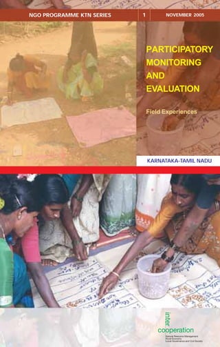
  • 1. PARTICIPATORY MONITORING AND EVALUATION Field Experiences NGO PROGRAMME KTN SERIES 1 NOVEMBER 2005 KARNATAKA-TAMIL NADU
  • 3. PARTICIPATORY MONITORING AND EVALUATION: FIELD EXPERIENCES NGO PROGRAMME KARNATAKA-TAMIL NADU SERIES 1 2005
  • 4. Participatory Monitoring and Evaluation The use and sharing of information contained in this document is encouraged, with due acknowledgement of the source. Contributors Main text by Ashok Alur and Snehalata Nath, with Prem Kumar. Coordination and editing by Jane Carter. Design, Layout and Printing Books for Change (Series cover design concept by Write Arm). Photos All photographs by S Jayraj or Jane Carter. Publisher Intercooperation; Delegation - India, Hyderabad Citation NGO Programme Karnataka-Tamil Nadu (2005) Participatory Monitoring and Evaluation: Field Experiences NGO Programme Karnataka-Tamil Nadu Series 1 Intercooperation Delegation, Hyderabad, India. 46 pp. PARTICIPATORY MONITORING AND EVALUATION: FIELD EXPERIENCES Copies available from: SDC-IC NGO Programme Karnataka-Tamil Nadu, Programme Support and Management Unit, 49, 3rd Cross, 10th Main, Indiranagar Stage II, Bangalore 560 038, India tel: +91 80 2521 4944 email: icngoktn@blr.vsnl.net.in Delegation - Intercooperation India, 8-2-351/r/8, Road No. 3, Banjara Hills, Hyderabad 500 034, India tel: +91 40 2335 5891 email: info@intercooperation.org.in
  • 5. Acronyms iv Foreword v Acknowledgements vi Executive summary vii Background 1 1. Monitoring soil conservation activities 7 1.1. Transect walk: the method 1.2. A transect walk in practice 2. Monitoring and evaluating NRM interventions 12 2.1. Spider web diagram: the method 2.2. Spider web diagrams in practice: monitoring change 3. Evaluating village changes 16 3.1. Participatory resource mapping: the method 3.2. Participatory resource mapping in practice 4. Evaluating NRM interventions 21 4.1. Photographic comparisons: the method 4.2. Photographic comparisons in practice 5. Evaluating skill development training 24 5.1. Matrix ranking: the method 5.2. A matrix ranking in practice 6. Evaluating dietary changes 29 6.1. Time lines: the method 6.2. A simplified time line in practice 7. Evaluating the impact of tank silt application 33 7.1. The H-form: the method 7.2. A modified H-form in practice 8. Evaluating different use of a community pond 39 8.1. Well-being ranking: the method 8.2. A well-being ranking in practice, as part of an evaluation Conclusions 44 References 46 Content
  • 6. Participatory Monitoring and Evaluation Acronyms GIS Geographical Information System GPS Global Positioning System NRM Natural Resource Management NTFP Non-Timber Forest Products PME Participatory Monitoring and Evaluation PRA Participatory Rural Appraisal RES Rural Education Society RWT Rural Welfare Trust SCOPE Social Centre of Peoples’ Education Trust SHGs Self Help Groups iv
  • 7. Foreword In January 2003, a group of over 20 staff members of the partners of the IC NGO programme met in the village of Honnashettahalli, Kolar District, Karnataka (hosted by the NGO partner Grama Vikas) to deepen their understanding on participatory monitoring and evaluation. We had a three days training programme in which together we explored the scope of community-centred methods in monitoring and evaluating the development efforts supported by the NGOs. The training was learner centred, as participation can only be ‘taught’ by adopting and practicing it. We spent our time discussing the differences between monitoring and evaluation, on different types of participation, on the use of PRA tools for impact assessment, etc. All partners had ample experience with community mobilisation and adopting participatory methods in implementing the activities supported by the project. Nevertheless the discussions led us to the basic questions of whose reality counts, whose information need is met and whose criteria are used. Together we tried to ‘demystify’ the concept by looking into concrete situations and assessing the possibilities to bring local level perspectives into the mainstream of M and E. Different participatory methodologies were considered and their implications were discussed. Following three days of lively discussions, a number of ideas emerged to translate the concepts into action. I am happy to note that after the initial workshop, the participants shared their ideas with their colleagues and the groups at village level and that they took the step to adopt and adapt PRA methods for monitoring and evaluation. I enjoyed reading about their experiences with the use of participatory tools to capture changes and to analyse impacts. The examples presented in this publication set out a range of methodological challenges for PME in the context of rural India. They demonstrate the use of visualisation techniques – diagramming and mapping – for analysis by community members. The eight cases offer insights in assessments from a gender perspective and provide the reader with practical tips on the application of participatory appraisal tools that ensure a meaningful role for all, the community as well as the NGOs. All together they point to the importance of people centred approaches to learning, analysis and development. November 2005 Annette Kolff Head Agriculture Team Intercooperation Bern v
  • 8. Participatory Monitoring and Evaluation Acknowledgements Participatory monitoring and evaluation, by its very nature, calls for the involvement of many people. I would like to thank in particular the many villagers in the project villages who took part in the exercises described in these pages, and contributed their views and ideas. The NGO Programme Karnataka-Tamil Nadu has 12 NGO partners. Whilst seven feature in the examples outlined, I would like to acknowledge the contribution of all partners to the development of PME approaches under the Programme. With regard to the examples described in this document, I would like to acknowledge the particular contribution of the following persons, whilst recognising that all field staff had a role in the process. At Grama Vikas, Rao and Pavithra; at Keystone, Snehalata Nath (who also had a greater role in overall document preparation) and Robert Leo; at Prakruthi, Narayanappa and Ragvappa; at RES, Mallapur and Jayashree; at RWT, Anand Lobo and RaniKittur; at SCOPE, Magimaidas and Mary P; and at Vikasana, Varghese, Chandrashekar and Chandrappa. Annette Kolff played an important role in this document, as she facilitated a Participatory monitoring and evaluation Workshop organised through the Programme in January 2004, during which the idea of recording and sharing examples of PME under the Programme first emerged. She kindly provided many suggestions on the final document, and also wrote the Foreword. At PSMU, Aparna Chintamani is particularly thanked for her support in bringing many of the case studies together. Finally, I thank the main contributors to this document – Ashok Alur, who after nearly five years of valued work with Intercooperation, is now at ICRISAT; Snehalata Nath at Keystone; and Jane Carter, Senior Adviser, who brought the document together. Prem Kumar Coordinator, NGO Programme Karnataka-Tamil Nadu. vi
  • 9. This publication is mainly intended for field practitioners in rural development, particularly participatory natural resource management. It documents the field experiences of seven of the partners under the SDC-IC NGO Programme Karnataka-Tamil Nadu in participatory monitoring and/or evaluation of their activities. After a brief introduction to the concept of participatory monitoring and evaluation (PME), it sets out a variety of examples, chosen as ‘real life’ situations that field practitioners are likely to experience. For each example, a short outline of the PME tool used is given, followed by a description of how the tool was applied for a particular purpose in the field. A small text box provides an introduction to the partner concerned. The partners located in Karnataka are Grama Vikas and Prakruthi in Kolar District, Rural Education Society (RES) and Rural Welfare Trust (RWT) in Belgaum District, and Vikasana in Chikmagalur District. In Tamil Nadu, case examples are drawn from Keystone Foundation (Kotagiri District) and Social Centre of Peoples’ Education (SCOPE) Trust, (Thiruvannamalai District). All the field situations concern activities that have been supported under the Programme. Four of the case examples relate to general natural resource management interventions. Activities mentioned include the construction of check dams, gully plugs, terraces and farm bunding (for soil conservation and water retention); tree planting (both for soil retention and for biomass or specific tree products); and farm pond construction (for local irrigation, water for livestock, and occasionally also fish farming). Specific activities detailed in the other four case examples are tank silt application for improving soil fertility, the promotion of traditional food crops, the renovation of a community farm pond and – somewhat differently, but a common type of activity, a skills training programme (in this case, training in wool processing for women of a shepherd community). The Programme has placed emphasis on supporting and empowering marginalised groups in society, and promoting gender and equity. Thus, the examples document work with tribal people and other community groups, including women, who have traditionally been the subject of social discrimination. The specific PME tools described are those commonly used in participatory appraisal processes – participatory mapping, transect walks, time lines, photographic comparisons, matrix ranking and well-being ranking – as well as some perhaps slightly less commonly used, notably spider web diagrams and the H-form. Executive summary vii
  • 11. Background Why this publication? This publication arose out of a request from all twelve partners of the SDC-IC NGO Programme Karnataka-Tamil Nadu (hereafter referred to simply as the Programme). With the support of the Programme, these partners have implemented a variety of Natural Resource Management (NRM) activities in selected villages over the past ten to seven years (see box 1). All the partners adopt participatory approaches to development, based on a well-established rapport with the concerned village communities. The activities are planned and reviewed through group discussions (facilitated by the partners), the planning itself often including the use of participatory tools. Until recently, Box 1: The NGO Programme Karnataka-Tamil Nadu Supporting sustainable natural resource management with special emphasis on the socially/economically marginalised (women, dalits, tribal people) The NGO Programme in these two States began in 1996, partnering with NGOs having a sound grassroots base in order to promote a technically sound, people-centred approach to natural resource management (NRM). In its current phase, the Programme is working with 12 NGO partners (6 each in Karnataka and Tamil Nadu). Key features are: ● supporting a holistic approach to NRM based on activities related to the conservation and sustainable use of water on rain-fed lands ● strengthening the capacities of the communities and partner NGOs in participatory monitoring and evaluation, and documenting results and lessons learned ● promoting self-reliance through the enhancement of traditional livelihood systems [such as the collection and marketing of Non-Timber Forest Products (NTFP) by tribal peoples, sustainable agricultural practices for food security, etc.] ● strengthening existing people-based institutions, including building capacities in gram panchayats ● promoting linkages with other local level institutions such as financial institutions, farmers’ organisations, and in particular panchayat raj institutions ● supporting gender-balanced, equitable development with an emphasis on working on common property resources rather than private lands. The programme is working selectively in the more remote and disadvantaged areas of the two States, focusing on tribal communities, dalits, and other marginalised groups. Human and institutional development is a cross-cutting theme in all areas of interventions. 1
  • 12. Participatory Monitoring and Evaluation however, there had been little systematic community-based monitoring and evaluation. As part of the Programme’s consolidation phase, the partners identified this as a matter on which they would like to work further. Following the outcome from two workshops and considerable field interactions, this document sets out a variety of examples in participatory monitoring and evaluation. Different tools are used, but in most the focus is on evaluation rather than monitoring, given the stage in the programme cycle. The purpose of this document is to provide development field workers – both staff of the programme partners and others – with specific examples of participatory monitoring and evaluation, using a variety of participatory tools. These examples are chosen as those to which field workers can readily relate. The document is in first instance produced in English, but will also be translated into Kannada and Tamil, as in many cases it will be more useful in the local language. It is hoped that the English version will serve particularly for training purposes. Given the depth of experience in India in participatory appraisal tools, the document does not seek to reproduce the large number of existing publications (mainly in English) on the subject. Instead, it provides a summary description of particularly useful tools and refers readers to selected publications for more information. Following this introductory section, the main part of the document, the second section, describes tools and examples. For each case study, the tool is first described, followed by the practical field experience of a partner working in Karnataka or Tamil Nadu. A final short concluding chapter outlines some of the challenges and lessons for the future. What is PME? Changes over time There are many definitions of participatory monitoring and evaluation, but perhaps the simplest is keeping track of changes with the community stakeholders. Box 2 – adapted from Estrella et al (2000), Box 2: Features implied within Participatory Monitoring and Evaluation Participatory Shared learning (in this context) Joint decision-making Co-ownership Democratic process – involving everyone in the community, not just the most vocal members Mutual respect Empowerment Enhanced mutual understanding Monitoring Knowing where we are Observing, recording change Regular, timely assessment Increased, jointly shared accountability Routine reflection Feedback Evaluation Reflection process on what has occurred Assessment of achievements/impacts over a longer period Learning from experience Valuing change Overall, PME should serve to increase the analytical capacities of community members, and empower them to question, and become pro-active in development initiatives. 2
  • 13. and incorporating ideas volunteered by participants at a programme partner workshop in January 2005 – provides some further insight. From this it may be seen that monitoring is a periodic but regular activity for ‘keeping track’ of what is happening in any project intervention. In this way, changes over time can be recorded effectively. Furthermore, any unexpected or new circumstances can be taken into account, and incorporated in further activities. Evaluation, by contrast, happens normally at the end of a project – or at a pre-defined point within a long period of project interventions (for example, a mid- term evaluation) – and entails a reflection and assessment of what has been achieved and learned. Ideally, the system of monitoring and evaluation should be planned as an integrated part of project design. It should start before the commencement of project activities, with decisions on what should be monitored, and eventually evaluated. These criteria are often defined as indicators. Furthermore, if the system of monitoring and evaluation is to be truly participatory, the indicators and the means of determining them should be discussed, identified and agreed by the community stakeholders at the beginning. Indeed, it should then be these same stakeholders who decide how often progress should be reviewed, who should do it, using what method, etc. This may be illustrated by an example. In this hypothetical case, a donor- funded project is supporting the renovation and management of a community farm pond over a five-year project period. The community members decide that one indicator should be the availability of drinking water for village livestock all year round (including throughout the dry season). They further decide to monitor water availability for all village livestock during the critical month of peak water shortage, April, every year. A small group of villagers representing all community interests (different castes and socio- economic groups; wealthy and landless, etc) is elected to carry out the monitoring task, with facilitation (if required) from project staff. To gain full insight, monitoring includes participant observations on water availability for different types of livestock; and livestock belonging to different households (near and further away from the pond, and belonging to different communities in the village). Perhaps they use a matrix ranking for this task, linked to a participatory mapping exercise conducted at the beginning of the project, which identified the location of all households and the type of livestock owned by them. A well-being ranking could have recorded further information about the different households. At the point of monitoring in the second year, it is realised that water is insufficient, that goats are trampling the pond banks, and that disputes are arising over pond use. Households far from the pond claim that they are being discriminated, with those close to the pond using more water. A village meeting is called for, and it is decided that the channel feeding the pond needs to be modified to maximise the inflow of water, and Background Water essential for all 3
  • 14. Participatory Monitoring and Evaluation Most of all, PME should be enjoyable that access to the pond by livestock needs to be improved by making one of the banks more gently sloping. It is further decided that the livestock of all households should have access to the pond, and this should be regulated on a fixed time basis to ensure efficient water use. At the end of five years, the community members evaluate how effective the pond had been in providing drinking water to the village livestock throughout the period; what lessons were learned in the monitoring process; and how the pond should continue to be managed in future. They also identify important factors that should be taken into account when planning and designing farm ponds in other similar villages. Using the information collected in their monitoring and evaluation exercises, they are also able to demonstrate to the donor what has happened – and perhaps use this information to argue for further funding or a different form of intervention. Whilst this example is highly simplified, it gives an idea of the issues that might arise in a PME process. In the hypothetical example, PME was integrated into the whole project design. What happens, however, when a rigorous PME process has not been put in place from the start? The practical reality is that thinking through a system of monitoring and evaluation is often not given priority at the beginning of development interventions. However, it is common for a participatory planning exercise to take place, even if this is not then followed up in a PME process. In such circumstances, participatory methods can still be used to capture community perceptions of change, even at a late stage. They can also build on informal systems of monitoring though observations and community discussions that have taken place. This is not the same as the full PME process, but it is a step in that direction. Most (although not all) of the examples documented in this manual are in fact closer to this situation of bringing PME into an existing intervention, rather than incorporating it from the start. Who wants to know what has changed? Although the above discussion makes clear that PME should be based on the ideas and wishes of the community stakeholders, it is a fact that local people rarely demand information in such a structured manner. They form their own opinions. It is usually NGO staff, donor agencies or other interested persons (Government agencies, researchers, journalists) who wish to have changes captured and, if possible, quantified. Nevertheless, the hypothetical example in the previous section showed the potential practical value of PME to community members. Consulting local people in a monitoring and evaluation exercise does not automatically make the process participatory. If based on a one-way process of information collection, it can be purely extractive. PME, by contrast, should entail a two-way exchange of information. Most of all, it should be an enjoyable process in which everyone feels that they have learned something. 4
  • 15. Appropriate tools Open discussions with the community stakeholders, in which everyone is encouraged to speak out, are an essential part of PME. However, discussions alone are often insufficient to quantify change. The use of participatory tools usually cannot give precise figures either (certainly figures need to be cross-checked with different sources before being quoted as ‘facts’), but it can result in quantified information that can be used for cross-comparisons (e.g., ‘before’ and ‘after’, etc.). This adds meaning and value to discussions. For example, a group might say that ’everyone’ in the village has benefited from a given intervention. However, if asked to analyse through a matrix what specific benefits have arisen, and then who has enjoyed them, a far more detailed picture may arise. Participatory Rural Appraisal (PRA) tools are often only seen as appropriate for gathering information at the beginning of an intervention, as part of a process of appraisal and planning. Development workers may talk about having ‘done’ a PRA, sometimes seeing it as just a step towards getting funding. However, PRA tools have a much wider range of potential uses, and can often be readily adapted and used for participatory monitoring, and for participatory evaluation. PME methods and examples The examples documented in this manual are intended to provoke ideas and demonstrate practical realities. They are not selected as models to be followed, but as cases of real situations, described by participants as learning experiences worth sharing. To stimulate further thought, particular points of note are given in comment boxes. For each case example, a small information box provides an introduction to the partner concerned, and indicates the communities with whom they are working. All the partners work to empower those who are disadvantaged in society – be they tribal communities, dalits or other marginalised groups – and emphasise gender awareness and promote equity. The examples described are as follows: Transect walk: is a means of involving the community in both monitoring and evaluating soil conservation changes that have taken place over the period of programme intervention. This method entails direct observation whilst incorporating the views of community members. The case example comes from the Nilgiri hills of Tamil Nadu, where the partner Keystone is working with tribal communities. Spider web diagram: in this case is used as a means for participants to monitor and evaluate key areas of a programme. The spider web is a simple diagrammatic tool for use in discussions; it does not entail any direct field observations. The case example comes from the Jawadhu hills of Tamil Nadu, where the partner SCOPE is working with tribal communities. Participatory mapping: is perhaps the most easy and popular of participatory tools, used here to evaluate project interventions. The example is taken from Chikmagalur district, Karnataka, where the partner Vikasana is working with generally poor and marginalised communities. Photographic comparisons: is another easy visual tool, here used to stimulate community discussions in evaluating programme interventions. In this case, the partner RWT is working with marginalised communities in Belgaum district, Karnataka. Matrix ranking: in this case used to evaluate the impact of skills training to women belonging to a shepherd community. The example is taken from Belgaum district, Karnataka, where the partner RES is working with the Kuruba shepherd community. Background 5
  • 16. Participatory Monitoring and Evaluation Time line: a tool used to elaborate historical change. In this example, only a simple time line is given, comparing two points in time (usually there would be more). The case is a second one from the partner Keystone, working in the Nilgiri hills of Tamil Nadu. H-form: a simple monitoring and evaluation tool, used in this case to evaluate tank silt application to farm land. The partner, Grama Vikas is working with marginalised farming communities in Kolar district, Karnataka. Well-being ranking: is described in the final example, being used to differentiate the benefits that different community members have gained from the renovation of a community pond. This example comes from the partner Prakruthi in Kolar district. 6
  • 17. 1.1. Transect walk: the method Materials needed For the walk itself: ● notebook and pen ● appropriate clothing and footwear for the area and time of year ● (maps or aerial photographs if available) ● (compass) 1. Monitoring soil conservation activities ● (GPS, Global Positioning System, if the details of the transect are to be incorporated into a GIS, computerised Geographical Information System). For the subsequent write-up: ● large sheet paper ● coloured pens ● (small coloured cards for marking particular items of interest). Transect walks are used to gain an understanding of the natural resources of a village, their diversity and associated problems, and to assess opportunities. Parameters usually covered include topography, land use and ownership, soil features, vegetation, crops, etc. They are very useful in planning land development interventions and identifying sub-zones for special consideration. If conducted at the beginning, middle and end of the project period (during the same season), they can be used for monitoring and evaluating changes along the particular transect. Transect walks can be used to compare reactions/discussions of different types of stakeholders, such as government officials, NGO team members, the local community, etc. They can provide a good cross-section of information that can be used for specific purposes of verification and appraisal. A participatory transect walk entails taking a walk along a pre-determined route with a group of key informants from the local community, and exploring the geography of the area through their eyes. The walk should take in a cross-section of the area of intervention, covering all the agro- ecological zones. For example, this might cover from ridge to valley in a watershed, or straight across a slope if interventions are all roughly at the same elevation. Steps to conduct a transect walk 1. Identify a group of key informants. Ideally, they should include older and younger people, women and men, and they should all be willing to walk some distance, and share their observations. 2. Discuss with the group the purpose of the walk, and decide on the path that should be taken to cover the full geographical variation in the area. The ‘path’ may not be a path at all – 7
  • 18. Participatory Monitoring and Evaluation ideally, as a true cross-section, it should be a straight line. However, if the path roughly corresponds to at least part of the cross-section, it may be easier to use it. Maps or aerial photographs may be of use, if available, but are certainly not essential. For monitoring and evaluation purposes, it is important that the line of the transect walk can be readily found again and again, possibly after substantial periods of time. 3. Decide with the key informants what parameters should be used for recording observations. Typical ones might include land type, soil type, natural vegetation (perhaps recording certain key ‘indicator’ species), local fauna, crops, water bodies, and land ownership. Local definitions of these parameters should be explored – for example, names of land and soil types, or of locally important plant or animal species. It is best to limit the parameters covered to five or six at maximum; trying to collect too much information may only result in confusion. 4. In general, the easiest and most stimulating part of transect walks is the walk itself and the discussions that arise during it, with the local people as experts. Documenting it afterwards can be more difficult. It helps to clearly decide specific observation points along the transect walk at which everyone stops to record all parameters. 1.2. A transect walk in practice Keystone Foundation, Kotagiri, Tamil Nadu Keystone Foundation works on issues of natural resource management, local governance and enterprise development with tribal communities in the Nilgiri hills of Tamil Nadu. Keystone has been a partner of the SDC/IC NGO programme since 2000 – working in a total of 14 tribal villages. Supporting the tribal communities to develop their lands is a central activity. This is challenging in purely technical terms, as the land to which the tribal people have traditional claim covers steeply sloping, rain-fed areas in the rain shadow of the Nilgiris (annual rainfall below 800 mm), which are highly prone to erosion. To develop their land, the people must clear weeds, construct stone contour bunds and terraces to control soil erosion, and then gradually establish a mixture of locally adapted species. These species include Gliricidia sepium, castor, lime, and Nelli (Embilica officinalis), which are planted to bind the soil with their roots and produce biomass as well as useful end products. At the same time, millet and other traditional food crops are cultivated; and once shade has been established, coffee is introduced. Eventually more varied long-term cash crops (e.g., pepper, cloves) are introduced, although this depends on local conditions, particularly water availability. Some lands are assigned only for millet and vegetable cultivation. The whole approach emphasises diversity, low input (in terms of pesticides and fertilisers), and ecological appropriateness. A transect walk for ‘base line’ information In 2000, before Keystone began activities in five focal villages, staff undertook a transect walk with local resource persons across the entire terrain of each village. The transect walk cut through the terrain from the highest to the lowest elevation, following a local path wherever possible, and using specific landmarks to enable the same transect to be followed at a future date. The transect covers grazing land, water sources, land under cultivation, and habitations. Whilst undertaking the walk, they made notes on the following characteristics at regular 50m intervals: ● land form – nature of slope and other topographical features ● soil – notably the presence of any soil conservation structures ● water – presence of springs or other water bodies; ground water level was measured ● crops – dominant cropping pattern 8
  • 19. Developing traditional tribal lands on the slopes of the Nilgiris is a laborious matter ● vegetation – main tree species (natural and planted); other prominent woody and non-woody species ● habitation – type of settlement and facilities ● other comments by resource persons – including present and former land uses other than agriculture, bird species found locally, etc. A repeat transect walk for monitoring activities Five years later, the transect walk was conducted again as a participatory monitoring exercise (Keystone intends to conduct the same exercise at five-yearly intervals). This example documents the transect walk undertaken in the village of Semmanarai. Semmanarai is a village of scattered settlements over a terrain covering some 87ha. The total length of the transect walk was 4,700m, exactly along the route used previously – which partially used local paths, and otherwise cut across land from one landmark to another. Although traversing from highest to lowest elevation, the transect covers irregular terrain in-between, including three natural nalas (small streams) and swamps. The first transect walk was conducted in June 2000, and ideally the exercise should have been repeated in the same month. However, for internal reasons the second transect walk was conducted in January 2005. This means that due allowance had to be made for the seasonal differences. It should also be noted that the transect walk took place after the first good rainy season in the project period; prior to 2004, there had been three years of drought. The intention was that the same persons who had participated in the first transect walk would conduct it again in 2005. In the end, the team comprised three such persons (two from Keystone, and one from the community – all male). However, any persons met along the way were asked for their observations, and in this way the views of five (relatively elderly) women were incorporated. In all transect walks, men were more ready to participate than women, having more time available (women excused themselves from walking far from the village, saying they had other work to do). When the Semmanarai transect walk was conducted in Monitoring soil conservation activities 9
  • 20. Participatory Monitoring and Evaluation 2000, seven people participated (three from Keystone, and four community members). At that time, one incentive to participate was the hope of finding wild bee colonies – two were found and subsequently hived. Results The results were recorded by keystone in a transect chart. A few specific points are as follows. ● The resource persons commented that it is easier to walk along the paths these days; there is less vegetation surrounding the paths, which eases passage, and they no longer have to keep an eye out for bears (which used to be a potential danger, hidden in the undergrowth). The improvement of the paths had not been a direct intervention of Keystone; however, it is an associated development as through Keystone’s work, the tribal communities have developed a greater voice in the Gram Panchayat, and have been able to lobby successfully for funds to renovate the paths. ● There are fewer open springs and small ponds on the upper slopes; water sources are currently drained through pipes to the inhabited areas down slope. (This is a direct result of programme interventions). ● Fewer trees are felled at pole stage. This was said to be the result of a government house- building programme which uses mainly stones and cement, and hence there is a lesser demand for wooden poles for house building in the area. ● The vegetative cover on the lower slopes is denser, and richer in biodiversity. This is considered a direct result of Keystone’s interventions to introduce species such as Gliricidia sepium, lime, etc, and then cash crops such as coffee. In the year 2000, eight species dominated – coffee, tea, coconut, mango, lime, silk cotton (Ceiba pentandra), silk oak (Grevillea robusta), jack (Artocarpus spp.) and Erythrina spp. In 2005, the commonly found species had increased to some 22 (as result of planting). In addition to the eight previously mentioned, these were: arjuna (Terminalia arjuna), areca nut, bamboo, banana (at least four varieties), Cassia fistula, Chebula (Terminalia chebula), cinnamon, clove, Dammer (Canarium strictum), gooseberry, nutmeg, Malabar palm, Pongamia pinnata, and sweet tamarind (Pittoselobium edule). ● The community members also observed that, in their opinion, the soil organic matter has improved in the fields close to the settlements. This was explained as being the result of better management and use of cow dung and urine, as promoted by Keystone. ● Around the houses in the settlements, cleanliness and general standards of sanitation have improved, due to improved water supplies. ● In 2000, no vegetables were cultivated, whereas in 2005 a number of vegetable plots were observed. These included French beans as a cash crop, as well as brinjal, tomato, onion and chillies for domestic consumption. Some of the changes recorded had nothing – or little – to do with programme activities, whilst others could be seen to be direct ‘cause and effect’. Nevertheless it is important to record all changes, whatever the reason. It was realised that the time taken to conduct the transect walk the second time was less. This may be attributed to a variety of reasons, ranging from the paths being more open and easy to traverse; the terrain being more familiar; and even some of the participants (members of Keystone 10
  • 21. staff) being more accustomed to walking than before. However, it is also important not to rush – to take time to observe changes. Keystone intends to continue working in all the villages that have been supported through the Programme. Thus, this transect walk was very much a monitoring, not an evaluation, exercise. The information recorded in both the first and second transect walks will be kept by Keystone, and used as reference material to compare against observations made in a third transect walk to be conducted in another five years time, and possibly a fourth in a further five years. In this way records of observations by both tribal people and Keystone staff will be built up over an extensive time period of 15 to 20 or more years, depending on how long it is felt appropriate to continue monitoring. Suggestions on the method The main suggestion on the method is to always conduct the transect walk at the same time of year, to ensure that apparent changes observed cannot merely be attributed to seasonal differences. It is also helpful if at least some of the people who conducted the earlier one (or ones) also conduct the repeat walk as this helps to ensure that comparisons are real, rather than based on differences of individual perceptions. At the same time, including the views of people who were not present for earlier walks can give fresh insights. Monitoring soil conservation activities Separate men and women group discussions 11
  • 22. Participatory Monitoring and Evaluation 2. Monitoring and evaluating NRM interventions 2.1. Spider web diagram: the method Materials Needed ● large sheets of paper ● cards and coloured markers ● notebook. The spider web diagram is also called a cobweb diagram, participation wheel or an evaluation wheel. It is a highly visual method for analysing the relative importance of, or progress on, different aspects of an intervention. This exercise can be done to plan projects, but particularly to monitor and evaluate them. Each aspect is represented by one arm of the frame of the web, and is graded from 1–10. It is also possible to rank programme/village/group/individual performance during (monitoring) or at the end (evaluation) of a programme. Steps in conducting a Spider Web Diagram 1. Discuss the purpose of the exercise with the participants, and reach a common decision on the aspects to be rated by them, depending on the exercise. These could be the performance of the project against the original objectives, the various activities of the project, the extent of developments in different villages, etc. 2. Ask the participants to write these aspects on cards or represent them by drawings. Take a large paper and arrange the cards radially, away from the centre. Join the centre to the card with a straight line. (See diagram). This line represents a scale from 1–10. 3. Ask the participants to score each of the aspects based on the performance and ask them to mark the score on the axes of the circle. This can be done either by asking each individual to Framework for a spider diagram 12
  • 23. present her/his ideas and mark the score, and further discuss to reach consensus on a collective score; or by discussing first and then marking the collective score accordingly. 4. Join the score on each of the axes, with a line as shown in the diagram on page 15. 5. Discuss the scores and the underlying causes/reasons. 6. Document the exercise and take notes of the reasons stated by the participants. These results can then be used for participatory planning, monitoring and evaluation. 2.2. Spider web diagrams in practice: monitoring change Social Centre of Peoples Education (SCOPE) Trust, Thiruvannamalai, Tamil Nadu SCOPE Trust is working in Chengam block of Thiruvannamalai district in Tamil Nadu, with Malayali tribal people belonging to the Gounder and Kallar communities. Living in scattered settlements in degraded, often steeply sloping forest areas of the Javadu Hills, these communities were once hunter-gatherers. They are now settled in villages that have been provided with substantial infrastructure (such as overhead water tanks, electricity supply, schools, etc.) through various government schemes (facilitated by SCOPE Trust). Nevertheless, the villages remain quite remote, with poor vehicular access. SCOPE Trust seeks to promote sustainable natural resource management with an emphasis on the conservation, utilisation and management of soil and water resources. Important activities supported under the Programme include bunding in hill tracts, levelling of the inter-bund area, renovation and conservation of traditional water bodies, etc. Under the Programme, SCOPE Trust has been working with the tribal communities of three villages since 2001, undertaking land bunding to conserve and improve the fertility of the soil, water conservation through percolation ponds and check dams and to reduce soil erosion. The NGO has facilitated the organisation of SHGs through which support is channelled. Monitoring changes due to programme interventions using the spider web method SCOPE has been using this method for nearly three years to measure progress of the programme activities with the community participants in the three villages of Kil Thatyapet, Kil Kollai and Kotur Kollai. SCOPE staff members first conducted this exercise in December 2002 to review the progress and effectiveness of their interventions. The spider web method was introduced to SCOPE Trust a few years ago by an external facilitator, and has since become quite widely used, staff being very familiar with it as a tool. The meeting was held in one of the villages and attended by 16 women and 14 men participants. Participants listed out the project activities, and then ranked them in order of priority. (These went beyond the activities done under the SDC-IC programme, because the participants could not differentiate which activity was funded by which organisation.) A similar exercise was done again in April 2003. This time the participants listed fewer activities and rated them in order of priority. This meeting was attended by 33 women, and 10 men from the same project villages. SCOPE Trust works in scattered settlements in the Javadu hills Monitoring and evaluating NRM interventions 13
  • 24. Participatory Monitoring and Evaluation It was found that the group rated the activities according to the amount of work done during that time. From the table we see that PRA maps were done by December 2002 and thereby have no rank in April 2003. Similarly, other activities like nursery raising, bunding and surface tanks were started and their activity level was less by April 2003; thus they were ranked lower in priority. This does not mean that the quality of work was low, but only that the level of activity dropped.The participants discussed at length how some of the training activities were integrated into the overall heading of Self Help Groups, why certain activities had not started, or were not relevant. They also discussed the reasons for giving the scores and how further improvement could take place. Thus, the spider web analysis provided a good means to stimulate discussion and define future priorities. As is seen later in the text, by 2005 when the programme was evaluated, priorities of the people and group had changed and a different set of criteria emerged for ranking programme activities. Table showing the results of the two exercises conducted Project Activities Rating Dec, 2002 Rating April, 2003 PRA mapping exercise 10 Nursery 6 3 Village Committee 5 Veterinary camp and training 6 6 Leaders & Members training to SHGs 7 Income & Expenditure Management training to SHG 0 Bunding 6 3 Surface Tank 7 5 Horticulture 0 Vegetable Cultivation 0 4 Biodiversity & Environment Awareness 5 2 Check dam 7 4 Self Help Groups 8 4 Forest Plants 4 Bio-pesticides and Fertilisers 0 “Bunding construction has increased water retention. Earlier we could not put groundnuts, but now we can.” Gopal, participating farmer “The Check Dam was useful for adding 20 acres of land for cultivation. However, to store more water and stop the force of the water during the monsoons, we should build another check dam upstream.” Krishnamoorthy (Kil Kollai) Evaluating changes due to programme interventions using spider web diagrams In 2005, the organisation conducted an evaluation exercise with participants from the three programme villages. This exercise was done to identify the kind of indicators/criteria that can be used to monitor change over the project period. This would present a ‘before’ and ‘after’ project situation. All the participants actively participated to indicate the impact due to the programme interventions using a 1–10 scale. The spider web indicated the impact of the programme in the three villages. The important and noteworthy change is that all children are going to school. Participants tried to quantify some 14
  • 25. of the other changes. They estimated that about 50% of the farmers are practicing intercropping methods. Yield levels have improved from 4 bags to 7 bags per acre. Apart from all this, they have introduced groundnut for cultivation; this was not grown earlier. Employment generation on the farm has doubled from an earlier 3 months to the present 6 months. Income level was also reported to have more than doubled, from the land holdings. Besides, the 100 per cent loan repayment by the tribal people has resulted in improved linkages with the banks. Bank transactions have also shown a drastic increase in the last two years. “Bunding has helped us in reducing soil erosion and bringing land back under regular cultivation.” – M Kuppu “We have been able to get more income from land as we are growing more than two crops in a year after bunding.” – Krishnamurthy and Vellaian “We are growing many other crops along with Samai (as mixed crop) from last 3 years. We are getting good income from the mixed crops and vegetables.” – M Saroja Suggestions on the method The spider web diagram is a relatively quick and easy tool for comparative impact assessment, providing a visual result to which participants can readily relate. However, it is not so suitable for quantitative estimates, which participants in any case found difficult to judge. Spider diagrams showing the criteria identified to depict change by the participants and their rating Criteria – Before Criteria – After Education 1 10 Education Intercrop Intercrop 3 5 Yield Yield 7 4 Employment Employment 3 6 Bank Bank 1 8 Income Income 3 7 Loan Repayment Loan Repayment 10 3 Paddy Cultivation Paddy Cultivation 1 3 10 10 10 10 10 10 10 10 10 10 10 10 10 A village scene in the Javadhu hills Monitoring and evaluating NRM interventions 15
  • 26. Participatory Monitoring and Evaluation 3.1. Participatory resource mapping: the method Materials Needed ● local material (stones, sticks, leaves, seeds), preferably of different colours, to depict different resources ● coloured chalk or powder 3. Evaluating village changes ● large sheets of papers, cards and coloured markers ● notebook. This method is perhaps the most widely used and popular of PRA tools – particularly for natural resource management programmes. The idea is that a group of participants draw a map of their village (or whatever area is decided), depicting important resources and places; how the area is represented is interesting in itself, as generally aspects of greater importance are portrayed more prominently. Participatory maps are thus not always drawn to scale, although if participants are asked to do this (and especially if they are already familiar with maps as a concept), they may produce maps that are quite accurate in scale. These maps may be used for participatory planning, monitoring and evaluation purposes, if changes are recorded on it on a regular and participatory manner. This may be done on the same map, but is usually better done by overlaying an updated version (tracing paper may be used for this), or simply asking participants to draw new maps at certain time intervals and comparing the results. Steps in participatory mapping 1. Organise the group of participants from the village concerned – ideally the group should comprise both men and women from all age groups. 2. Select a large ground/area for the map to be made. This is usually done using local materials of sticks, stones, rangoli powder, chalk, seeds, etc. This is better, as it allows for mistakes and corrections to be made by the participants. If the people are comfortable with writing, it can also be done on large sheets of paper, using colour markers. If done on the ground, the map has to be copied on a paper for documentation. 3. Explain to the participants the purpose of map making. Depending on the exact aim, they may be asked to mark certain features (such as where they take cows for grazing; from where they bring fuelwood, etc), or they may be asked simply to draw the area in question and mark on what they consider to be important features. 16
  • 27. 4. Facilitate the participants to ensure that everyone participates, without a few dominating. It may in fact be necessary to have different groups – split for example on gender lines – to ensure full participation. 5. Discuss the issues emerging from the map, depending on the project interventions (for example, which are sloping, degraded lands, which are the areas where water is abundant, etc). 6. Take extensive notes during the discussions, which will be an addendum to the map. If the map is made on the ground, it will be necessary to copy it on to a large sheet of paper at the end of the exercise. It may also be captured in photographic form. 3.2. Participatory resource mapping in practice Vikasana, Tarikere, Karnataka Vikasana, a non-governmental organisation in Tarikere taluk of Chikmagalur district works with small and marginal resource poor farmers. Tarikere Taluk lies in a rainfall shadow, with average rainfall some 400 mm/annum; in the years 2002–2004 it was closer to 200 mm/annum. The NGO focuses its activities in a total of 115 villages in Tarikere taluk, organised into 6 clusters. Vikasana has been a partner of the Programme since its inception. Watershed based soil and water conservation, management and utlisation related interventions have been supported intensively in three villages, which now serve as examples to others in the area. The area treated covers some 555 acres – both private land as well as common property resources. The representatives who participated in the PME exercise belong to the project villages of Bhoothanahalli and Arishinighatta. These farmers have participated in a variety of capacity building events over the period of project implementation and now have a thorough knowledge of conservation, management and utilisation of soil and water resources. Vikasana has used participatory mapping quite widely as a planning tool when beginning interventions in a village. Thus many villagers are familiar with the method. In this case, it was decided that rather than refer back to past maps, villagers would draw a map of their village showing the pre-project situation, and then mark over the current situation. This would be used to stimulate discussions on overall changes that had taken place. A group of key informants from two programme-supported villages – persons who have been present in the village over the time of the interventions – came together. They discussed the social, economical, education and environmental situations of the village before project intervention in 1999 – and in particular issues related to land, water, vegetation and community development aspects. To map the change after the project period the gathering was divided into 2 groups based on the villages to which they belong. One group numbered 21 participants (including 4 NGO staff); the other numbered 13 (again including 4 NGO staff). In both cases the groups were of mixed Vikasana adopts a watershed approach to soil and water conservation Evaluating village changes 17
  • 28. Participatory Monitoring and Evaluation Stones, twigs and coloured powders were used in creating the maps gender; the relatively large number of NGO staff was because the exercise partly served as a ‘refresher’ training; they acted as observers and facilitators rather than map drawers. Participatory mapping of the village prior to Programme intervention Participants in the two groups discussed together, and then began drawing the map on the ground, using different colours mixed with sand. They first mapped boundaries, land marks, water source of streams, tanks and bore wells, vegetation, forest and waste lands. Houses, school, temples and roads were then also marked. Key persons (slightly older) in the group recalled how life had been before the project period. Eshwarapp from Arishinaghatta and Rudramma from Boothanhalli explained the situation of their respective villages. They covered social aspects as well as those related to natural resources using the map. They also highlighted that there was no community organisation in the village, no SHGs, no federation and no watershed committee, no community hall. They commented that child labour and child marriage had been common, and gender discrimination prevailed. No action had been taken to conserve soil and water, and soil erosion was prevalent; one tank had completely silted up. Farmers used more chemical fertilisers and had given up the use of organic manure composting methods. There were a lot of monoculture practices adopted in farming. An additional comment was that near one particular temple, the Ranganatha temple, there had been a good forest that had degraded due to it being used for grazing. The people had not thought of promoting a plantation there. “[In those days] Women were not involved in any decision-making, and were not going outside the village.” – Lakshmamma, Arishinaghatta Participatory mapping of the village after Programme intervention The next step was to mark the post project changes on the same map. The people marked the newly made bunds and bund plantings, farm ponds, nala bunds, check dams, gully plugs, vegetative checks, afforestation at waste lands and degraded forest lands. Promotion of organic manure units, vermi-composting units and compost units was also marked. Road formation, community hall construction, community bullock cart and mobilisation of government resources for road and water supplies, organised community with SHGs, and federations were marked with colour, sticks, stones, twigs and leaves. “Now, women and men are participating equally in all family and village development aspects. There are 18 SHGs and one watershed committee in each of the villages, all of which are actively functioning.” – Shivamma, Arishnaghatta Shivamma from Arishnaghatta and Eshwarappa from Boothanahalli described the current social, economical, environmental and political changed scenario through the maps. 18
  • 29. – Severe soil erosion on farm lands and common property – No trees in the forest area – No farm ponds on farm land – No check dams – Very few horticultural trees – Very few bore wells – No initiatives to recharge ground water – Less/no practice of inter/mixed cropping – Less livestock population – More migration – Lack of people’s organisation at village level – Increased fertility of lands – Development of forest in 30 acres area – 25 farm ponds have been constituted – 1 check dam is built – 42 compost units are functioning – Tremendous increase in fruit crops – Cross-bred livestock have come to villages; overall increase in livestock numbers – SHGs and Watershed Management Committees are functioning – Reduced migration – System of intercropping/mixed cropping has been re-introduced. Resources at the beginning of the project Resources after the implementation of the project Before After Maps produced in the participatory exercise in Arishinaghatta village They spoke of how their lands have been completely treated for soil and moisture conservation – activities including compost pits, silt application, horticulture and tree planting along bunds. People have become organised in SHGs, and SHG federations and committees. They are now saving money, and getting loans from SHGs and government schemes. They are using these loans for agriculture development and income generation activities like sheep and goat rearing, dairy and poultry. It was also said that more children are going to school, and child labour and child marriage have ceased. In the case of village Arishnaghata, a list of specific changes was made, as detailed in the table below. The mapping exercise served to heighten awareness amongst the participants on all the changes that have taken place, summing up these as follows: ● increased organisation within the community ● changed attitudes – greater gender awareness and equality List of changes in Arishinaghatta village, as identified by participants in the mapping exercise Evaluating village changes 19
  • 30. Participatory Monitoring and Evaluation ● well developed savings mentality in the community ● increased conservation and protection of soil and water resources ● increased soil fertility and ground water level ● increased income generating activities ● increased number of livestock ● more networking and linkages with government bodies and local institutions. Perhaps most importantly, the exercise served to stimulate thought on how to ensure that all these positive changes continue after Programme withdrawal. In this, the role of the SHGs and Watershed Committees was recognised as crucial. Suggestions on the method Although a participatory mapping exercise had been conducted in the village when programme activities had begun, a different group had been involved in doing it. The facilitators therefore felt it more appropriate to do the exercise by comparing ‘before’ and ‘after’ with the group who was present. Where possible, the ideal scenario would really be to try to convene the same group who had participated the first time, and thus compare what they had recorded at the time, without being influenced by hindsight. Participatory mapping is an easy, visually interesting and generally enjoyable tool. The risk is that it becomes simplistic, if not facilitated well. For bringing out a variety of information, it is best to involve a group of 10 to 15 key informants; a few may take the lead in drawing and marking, but others should be encouraged to take turns and bring in corrections or other suggestions. Gender differences in perceptions are quite likely, so this must either be carefully facilitated in a mixed group – or separate maps drawn by men and women. Similarly, facilitators should seek to include the different perceptions of people of different castes, class, and ages. Overall, participatory mapping is a good way to begin – whether planning or monitoring or evaluating – but for more quantative and qualitative information, it is best combined with other methods. Finishing touches are made to the nearly completed map 20
  • 31. 4.1. Photographic comparisons: the method Materials Needed ● camera ● enlarged photographs ● marker pens and large sheets of paper ● GPS (optional). 4. Evaluating NRM interventions Photographic comparison is a simple way to stimulate community discussions on changes in a particular geographical area over a period of time. Such comparisons can be used to consider changes in land use, land cover, land form and water bodies. Photographs can be used to track any major physical changes, but less readily any changes related to people and institutions, particularly with regard to attitudes and approaches. Fully capturing social change requires supplementary information collected through other means, such as group discussions. Steps to conduct photograpghic comparisons: 1. Select various locations for taking the photographs within, or giving a view of, the project area. The spots need to be fixed locations such as a rock, mountain top, a big tree or any other location that will not change over the project period. This place can also be marked with a GPS for its exact location; if many spots are chosen, a system of numbering could be introduced. 2. The project area has to be photographed before the intervention is made. Different photographs from different points may be made to capture the entire scene. The photographs should be clearly named, giving location and date, for future reference. 3. For the purpose of monitoring, the area can be photographed from the same locations at significant time slots during the project period. Care should be taken that the photos are shot during the same month/season or preferably the same date in successive years. This will reduce any seasonal errors. 4. Photographs of the project area from the same points should then be taken at the end of the project period. 5. The ‘before’ and ‘after’ photographs can then be compared with members of the community, who can identify the changes. A discussion is thus stimulated, which needs to be recorded in detail. 21
  • 32. Participatory Monitoring and Evaluation 4.1. Photographic comparisons in practice Rural Welfare Trust, Santibastwad, Karnataka Rural Welfare Trust (RWT), Santibastwad works with small, marginal and resource poor farmers belonging to backward classes (including nomadic groups such as Gowlis) in Belgaum district of Karnataka. RWT has been a partner of SDC-IC since 2000. Watershed based natural resource management with a focus on conservation, utilisation and management of soil and water resources in rainfed areas have been the important activities of RWT. These interventions have resulted in improved management of these natural resources and in enhanced productivity from farmlands. Rural Welfare Trust has been systematic in documenting project activities and changes through various written and photo documents. At the end of the project, it was possible to make a clear distinction from the benchmark situation. The community has been using these photo documents to compare and illustrate the situation before and after the project implementation. The tool was preliminarily discussed with the participating team of Rural Welfare Trust and the members of the community who participated in the exercise. The exercise was undertaken in one of the project villages, Teerthakunde, with representatives from other villages also participating. The facilitator initiated the discussions on the photographic documents taken before project interventions. The groups made close observations on the photographs, discussed what they perceived, and then made a list of key features. These features were discussed in depth; most of them related to the lack of soil and moisture conservation features and lack of crops and vegetation. Having done this, the group was presented with photographs taken recently, after the project intervention. The participants observed and identified the changes that have occurred, and listed them out. A group discussion on the results was then facilitated. Results The main observations made by the community members on the pre-project photographs are as follows: ● lack of bunding or poor quality traditional bunds on the farm land, occupying a large portion of the land ● some evidence of soil erosion ● little vegetation on the bunds ● very few perennial trees on the farm, and no trees of commercial value/producing fruit ● little grass on the bunds; participants noted that this was natural grass, not planted ● no farm ponds on the farmland ● no vegetable crops grown. RWT works with small, marginal and resource poor farmers (including Gowlis) 22
  • 33. Turning to the post-project photographs, the community members observed the following: ● farm bunds systematically laid out; narrower, occupying a lesser portion of the farm land ● reduced soil erosion on farm lands, although erosion is still apparent on the nalas (checked to some extent by planted bamboo and other vegetation) ● much vegetation on the bunds ● many perennial trees of horticultural and commercial value (particularly cashew) planted on the bunds ● plenty of grass planted on the bunds (which they pointed out gives good fodder to animals) ● farm ponds have changed the outlook of the farms; they added from their own knowledge that some of the farm ponds have become perennial wells. ● farmers have started different nurseries on the farm land and are also growing vegetables with the water available; the photographs depicted people working in the nurseries. “It is easy and simple method to compare the situation before and after implementation.” – Woman farmer from Teerthakunde Suggestions on the method The discussions on the physical changes in the landscape could have been used to stimulate a more general discussion on the social changes in the village, but this was not done due to time constraints. The major limitation with the method was to identify photographs which represent exactly the same area; this was particularly so, given the changes that have occurred. Although the photographs had been deliberately taken to document “before” and “after” situations, it was realised that this requires more systematic planning from the beginning. In addition to photographs being taken from exactly the same spot at regular intervals, ideally they should be taken ● at exactly the same time of year ● facing exactly the same direction ● at the same time of day. For this exercise to be successful, it is better to include community members who were present in the area when the original photos were taken i.e from the start of the project, so that they have a comparative perspective. Two participants who did not belong to the village, but who joined in the exercise found it difficult to interpret the earlier photographs as being of the same place! “Everything is visible in front of our eyes. By seeing this one can make out what has happened.” – Male farmer from Teerthakunde In this case, RWT staff members took the photographs that were used in the exercise. An innovative and somewhat different method of using photographs is to provide a camera to a variety of community members (preferably young and old, men and women), instruct them in its use if this is necessary, and ask them to take pictures. This can be repeated at intervals over the period of an intervention. In this way, photographs can be used to record changes through the eyes of community members. Evaluating NRM interventions 23
  • 34. Participatory Monitoring and Evaluation 5.1. Matrix ranking: the method Materials Needed ● ● ● ● ● large sheets of paper, notebook and coloured pens ● ● ● ● ● sticks, stones, leaves, seeds, etc. – any material readily available locally that can be used for representation and/or conducting the ranking. This method is used to elicit the preferences and opinions of participants with regard to a particular subject. In this way participants can share their knowledge/opinions on, for example, different fodder species, crop varieties, credit sources, etc., and develop specific criteria by which to make comparisons. They may then rank the different species/varieties/credit sources (whatever is being assessed), on the basis of the criteria they have chosen. While matrix ranking (first, second, third, etc.) gives an indication of relative preferences, scoring (placing on a scale of 1–10) introduces a greater element of quantification to the preferences. Steps in conducting a matrix ranking 1. Organise a meeting at a time when those involved in the issue to be discussed are most readily available. For women, evening meetings may be more convenient than daytime, for example. It is assumed that a need for a PME exercise has already been identified and agreed, along with the issue to be elaborated. 2. Discuss with the participants the attributes of the issue to be ranked. Let us take the example of fodder species. The different attributes of a fodder species (e.g., giving good milk yields; giving high butterfat; eaten by cows/buffaloes/goats by preference, etc.) should be determined. It is easiest if these are positive criteria. 3. Reach agreement on what criteria should be used. Take notes on the reasons for preferences discussed by the participants. 4. Facilitate a decision on whether to conduct the ranking individually or as a group/small groups. The participants should be comfortable about participating, and able to discuss the issues freely and express their opinion. 5. Prepare the matrix on a large paper or drawn with locally available material (a stick/chalk) on the ground. If the participants are not familiar with the written language, use graphic representation of the criteria. Ranking/scoring can be done using stones, grains or any other locally available material. Participants often feel more comfortable if they can change their minds; from this point of view, using stones or similar material is better than marking scores with pens. 5. Evaluating skill development training 24
  • 35. 6. Facilitate the ranking/scoring, ensuring full discussion of the reasons for the different scores. 7. If the exercise is done in different groups, consolidate the ranking/scoring. Analyse and discuss the findings in the group, with the reasons given for a certain preference. 5.2. A matrix ranking in practice Rural Education Society, Ghataprabha, Karnataka Rural Education Society, Ghataprabha works with shepherd communities (Kurubas, a traditionally nomadic, marginalised community) in Belgaum district of Karnataka. The NGO has been a partner of the Programme since 2000, working in a total of 5 villages. Soil and water conservation based land development and shepherds development oriented wool based activities are major activities of this NGO. This project has also provided capacity building inputs with special focus on women. The shepherd families reported that the intervention has brought them closer together, through the intensive time that they shared together in the training. Traditionally, the shepherd women support the men in weaving. They use an improved method of spinning the wool, using a pedaled charaka (spinning wheel), and then the men weave blankets using a traditional loom. The project aimed at enhancing the knowledge and skills of these women by training them in modern wool processing techniques over a period of six months. The training was conducted separately in each village, and the timing was adapted to the request of the families. It entailed several hours every morning, six days a week (with exceptions for local festivals, etc.). The village level resource persons employed by the NGO played a key role in planning, conducting and coordinating the training programme with the help of the resource organisation. Training the women was a challenging task, most of them lacking confidence at the beginning, and doubting whether the training would bring them any benefits. After completion of the training, a participatory impact assessment of the training was done. Skill development training for shepherd women This exercise was organised in one village, Karoshi, to which representatives from two other villages (Yadgud and Bambalwad) were also invited. The number of participants from all three villages was seventeen. The exercise aimed at evaluating the impact of skill development training for the shepherd women. The team of RES first discussed the tool – how it should be introduced, its applications, steps in using the method, and advantages and disadvantages. Ideally, the criteria should be developed at the time of planning an intervention, and then used to monitor and evaluate what happens. In this case, the fact that the criteria were only developed after the event means that the depth of trainee participation in the whole evaluation process was somewhat limited. Nevertheless, it gave them the opportunity to provide a feedback on the training, what they had learned, and what difficulties they had faced. For example, had the matter of difficulties faced been addressed at the beginning, some of those very difficulties might have been avoided. For future trainings, RES staff may incorporate a PME process from the start. Women work together in preparing wool for spinning Evaluating skill development training 25
  • 36. Participatory Monitoring and Evaluation The participants showed immense interest in the overall preparation of the exercise and gathered all one material required for the exercise. The facilitators initiated the discussion on the topic and divided the exercise into four parts: ● major learnings from the training ● period, participation and training methodology adopted in the training ● benefits gained from the training ● difficulties faced during the training. Following these discussions, the facilitators introduced the idea of criteria for evaluating the training. Participants listed various criteria; these were further discussed in depth, and a number of important ones were identified by group consensus. The participants ranked the criteria and gave a score in the range of 1 (lowest) to 4 (highest) using seeds to give their scores. The findings were listed for further reflection. Any points that were not clear were then discussed and clarified with the participants. In some situations, community members may be most comfortable with ranking, rather than assigning specific numerical values (scoring). Pair-wise ranking (comparing two attributes and placing one above another) may be particularly easily understood. However, in other situations – as in this case – people may be more comfortable with a system of numerical scoring. The important thing is for the facilitator to ensure that everyone understands and feels at ease with the method used. The majority of the women rated all the lessons learned with the highest score (4); relatively few gave lower scores, ranging from 1–3. The main message from the evaluation was clearly that the majority of the trainees gained good skills in modern spinning, as well as other skills such as marketing, charaka repair, etc. Table 1: Criteria and ranking of major skills learned in the training Score of 0 to 4 Major skills learned Sl. No. Criteria Total Ranking Score 1. Complete understanding of charaka and its usage 64 1 2. Enhanced knowledge of modern spinning 56 4 3. Reparing the charaka 53 5 4. Skill of peddling charaka (spinning wheel) 60 3 5. Skill of tightening/loosening the wool thread during spinning 63 2 6. Way for enhancing income 63 2 7. Method for improving quality of the blanket 64 1 8. Way of increasing savings 64 1 9. Way of enhancing organisational power 64 1 10. Marketing skills 63 2 11. Learned how to extend timely assistance for the members 64 1 of the sangha Results The results of the exercise are given below: 26
  • 37. The fact that the women were all very positive about the training may in part be a reflection of a wish to appear fully appreciative at the end of the activity. Had monitoring and evaluation been introduced right from the beginning, with opportunities to change things during the course of the training, they might have felt more comfortable in pointing out any difficulties or possibilities for improvement. When asked about the period of the training, out of seventeen participants, fifteen participants said that the duration of the training programme was ideal and two felt that it was too long; none felt that it had been too short. “We would not have learnt it so well if the training period were less than six months.” – Tayawwa, Yadgood village Ten out of seventeen women ranked the participation of the trainers to have been ‘ideal’; the others felt that their input had been even more than that required. Similar scores were also given for the training methodology. As may be seen, the majority of the participants said that they have derived particular benefits from the training in the form of increased production of wool products, skill development, and 1. Art of using the charaka 60 3 2. Less health hazards 62 2 3. Increased spinning of wool (1/2 to 1 ½ kg) 59 4 4. Increased production of blankets (from 1 per week to 3 per week) 63 1 Table 2: Criteria and scoring to evaluate the benefits of the training Score of 0 to 4 Benefits gained from the training Sl. No. Criteria Total Ranking Score 1. Increased workload (pressure) 51 1 2. Difficulties in time keeping 28 3 3. Cooperation at household 39 2 4. Difficulties in attending agriculture activities 21 4 5. Taking care of children 14 5 Sl. No. Criteria Total Ranking Score Table 3: The criteria and score to assess the difficulties faced during the training Score of 0 to 4 Difficulties faced during the training Evaluating skill development training 27
  • 38. Participatory Monitoring and Evaluation reduced possibilities of health hazards. The additional income gained from increased production was clearly appreciated. “We are selling at least three blankets every week; earlier it was only one. This has resulted in increased savings and hence I could buy some gold for myself.” – Woman participant from Bambalwad village. With regard to difficulties faced, it was particularly women from nuclear families (generally fairly young women, with quite young children and thus no support from daughters or daughters-in-law) who said that they had experienced an increased workload in trying to balance the demands of agriculture and child care against participation in the training. By comparison, women from joint families had experienced fewer problems in making time for the training, due to broader support. One aspect that was highlighted in discussions was that the training had at first been resisted by some of the men, who felt that it was of a very long duration and would take too much of the womens’ time. However, as the training progressed the men saw the advantages and started helping the women in their domestic activities – in looking after the children, and even helping with preparing meals – so that they could follow the training. Suggestions on the method “Facilitating the women to arrive at their criteria to evaluate the impact was a fascinating and enlightening experience. Some of the criteria were not even thought of by the trainers. So if the participants do not have enough time and space to explore and come up with their own criteria, the chances of missing their realities is very high.” – Ashok Alur, former IC NGO Programme Deputy Coordinator Some of the criteria identified by the participants were unexpected. For example, the facilitators had not expected the participants to be so enthusiastic about charaka repair; they had thought that the women would make use of service providers. Yet, in fact, they were happy to be self- sufficient in maintenance matters. While working in a large group, care should be taken that there is no dominance by a few individuals, which may result in large variation in ranking. If the number of participants is large, it is better to work in smaller groups (in this case two groups were formed – the facilitators ensuring that the more vocal participants were spread between the two groups), and arrive at comparative perspectives. The scores in matrix method are best given with stones, seeds, pebbles, etc., particularly when working with participants who are not literate. The main issue here is flexibility. An advantage of using seeds and stones is that it allows the participants to modify the scores easily, after further reflection. Scoring in writing tends to be perceived as fixed, once put on paper, even if it is realised that the rank/score should be modified. 28
  • 39. 6.1. Time lines: the method Material Needed ● Large sheets of paper and cards, coloured pens, markers, etc. ● Sticks, stones, leaves, seeds, etc. – any material readily available locally that can be used for representation ● Notebook to record notes from the meeting. A time line helps one understand the history of the village, community or programme. It is used to trace the chronology of developments, which can be marked by landmark events that many people remember and know to have taken place at a particular time – e.g., year of major flood, year of solar eclipse, outbreak of epidemic, etc. With reference to such basic information, other events can be filled in to give a complete historical analysis. A time line can be used to gain a historical perspective and to compare changes over a considerable period of time, with various factors being documented. It can also be used to compare a particular ‘before and after’ situation, as the following case study illustrates. Here, food habits are examined, with a comparison between only two points in time. This is then a tool for participatory evaluation. Steps in conducting a time line 1. Call for a village meeting at a suitable time of day and season to assure the participation of old and young people. As may be expected, older persons tend to recall the past better, while the younger ones are more accurate with the recent past. Care should also be taken to include both men and women, as each recall differently – men tend to relate more to outside influences and women to village/community happenings. 2. Explain the subject of focus to the participants and decide how it will be represented physically (written words, drawing, etc.). 3. Set the time slots (years, months, weeks) according to the need of the exercise. If the people do not know the year as per the English calendar, important events can be recorded according to the local concept of time, which are easy to date later. 4. Facilitate participation from all members and encourage discussion. Ask clarifying questions and details of events as required. Focus can also be shifted to the topic of particular interest – in this case, agriculture. 5. Time lines are usually dominated by written or spoken words, with little scope for graphic representation. However, make sure that the participants are comfortable with the medium used, and include representation with objects or through the use of drawings, if this is appropriate. 6. Evaluating dietary changes 29
  • 40. Participatory Monitoring and Evaluation 6. Analyse the results/findings with the members about the related problems and opportunities. 7. Record the data and analyse it for subsequent use for planning, monitoring or evaluation. Typically, a timeline data is represented in the following way. (Using a hypothetical example of land use change for adivasi communities in the Nilgiris) A community seed bank: conserving local food crops is an important aspect of Keystone’s work Year/Time Events When Kamraj was Village was given land as a ‘joint patta’ Every year millet cultivation was Chief Minister (1965) doneMillet was given to relatives and friends 1970 Elephants raided the village, loss of life and crops 1972–75 Coffee Board promoted plantations in our village 1988–90 3 successive years of drought 1995 Reinitiated millet cultivation as a community activity, Seeds from Palamalai ……this can be continued 6.2. A simplified time line in practice Keystone Foundation, Kotagiri, Tamil Nadu As explained in an earlier chapter, Keystone works on issues of natural resource management, local governance and enterprise development with tribal communities in the Nilgiri hills of Tamil Nadu. Through claiming and developing their traditional lands, the people have gained a deepened sense of tribal identity and self-reliance. This is also linked with the cultivation and conservation of local food crops (millet, pulses and vegetables). Farming their own land has provided an alternative to daily wage labour, and a potentially more varied and nutritious diet. It has also brought tribal families together to claim their rights to land, and make group decisions on its management. Tracking changes in diet – food diversity This exercise was conducted in one village, Samaigudal, to which representatives from one other nearby village were also called. All these people belonged to the Irula community. The number of villagers attending the meeting, at 30, was quite high – however, the majority of participants were men, with women numbering only six. (It so happened that labour opportunities had been announced that day on the nearby estate – so many women had gone to work). Nevertheless, two separate groups – one of women and one of men – were formed. Given their low number, there was a temptation to include the women in one overall group for the discussions. However, it was decided that their views would probably be lost if this was so. Women indeed came out with different ideas from men, and although they sometimes volunteered less information, this could simply have been because they were fewer in number (the men had many more heads to put together). With regards to food habits, they forcefully expressed that they knew better, because it was they who did the cooking. Hypothetical example of key points in a time line 30
  • 41. 1. For example, ragi (finger millet), samai (little millet), tenai (foxtail millet), keerai (amaranthus). The tool used was an extremely simple time line – comparing food diversity before project commencement in 2000 and at the end of 2004. As a first exercise, this was essentially a participatory evaluation of how eating patterns have changed over the programme period. However, Keystone intends to continue to gather information in a similar way over the years to come; thus the method will become a monitoring tool (modified in the light of the first experience). Participants helped in gathering samples of all the different foodstuffs they use – ranging from various leafy vegetables (including those gathered wild) to traditional cultivated vegetables, traditional grains1 , purchased rice and purchased vegetables. The final collection featured 32 different food items. These were lined up on the ground, and a grid drawn around them for ‘before’ (left side) and ‘after’ (right side), as shown in the illustration. Participants first discussed their eating habits in their two groups. Then one representative of the men and one of the women marked, using beans (maximum score 5, minimum zero), the extent to which a particular foodstuff featured (then) and features (now) in their diet. Results The results of the exercise were not what Keystone staff expected, as the participants indicated that overall, the diversity in their diet has decreased, not increased, over the last three years. Both women and men agreed on this. The fact that results were not as expected does not mean that the exercise was ‘wrong’. Often more can be learned from the unexpected, and from considering why certain responses were given. The results of this exercise stimulated considerable thought and reflection. The following factors all probably play a part in the apparent decrease in food diversity. ● Despite careful explanations, many participants still tended to take ‘before’ as many years ago, not just three years back ● This year is the first of good rains during the project period; millet harvests were not so good in the first two years due to drought. Reintroduction of traditional foods takes time – much more than three years ● The availability of highly subsidised rice (only Rs3/kg) in the ration shops does indeed undermine the programme to a certain extent (the market price of millet is some Rs12/kg) ● There could be some hesitance in admitting the eating of traditional grains in a large audience. Evaluating dietary changes Simple ‘before’ and ‘after’ time line (the food types are placed down the centre of the grid) 31
  • 42. Participatory Monitoring and Evaluation Two comments recorded at the time are indicative of a misunderstanding of the time period under consideration. “In the past we used to pray together, and grow millet together…. Now our community is not so close, people don’t come together for such things.” – Older man “We go for wage labour and buy [subsidised] rice at the ration shop… How can we eat a variety of foods when this is so? We have become used to eating rice, and it is so simple to cook and cheap.” – Younger man Suggestions on the method Probably the main lesson to be learned from the method was that the respondent’s perceptions of the time periods given appeared different from that of the facilitators. Perhaps this could have been made clearer by: ● Adding a third time period of long ago, say the early 1990s, to develop a clearer time line ● Defining the points in time using particular events that everyone in the community remembers. As a method for assessing relatively slow changes such as in natural resource management, time lines are likely to work best when the periods for consideration are defined into some three to five categories, using important events remembered by community members that are clearly within living memory. Comments of Keystone staff were as follows: “Maybe the question should have been posed in a different way. We know that in all the tribal settlements they never used to grow millet before 1998 or so, but now millet growing has taken off everywhere. This rice eating habit is like a status thing. People don’t like to say that they eat millet. If we talked in a smaller group, maybe the result would be different.” – Robert Leo “I liked the group discussions. Everyone had a chance to give their views and did – it was a very free discussion. The finding about food habits was a bit discouraging, that millet consumption has not increased as we thought. But the reasons – what they are saying – are correct.” – Nagaraj 32
  • 43. 7.1. The H-form: the method Materials Needed ● large sheet of paper ● coloured pens/markers for each participant ● many cards or ‘post its’ for each participant. This method is particularly designed for monitoring and evaluation of programmes. It was developed in Somalia for assisting local 7. Evaluating the impact of tank silt application people to monitor and evaluate local environmental management. The method can be used for developing indicators, evaluating activities, and to facilitate and record interviews with individuals or group discussions. As described below, it is used with literate participants, but it is also possible to use the tool when not everyone is literate (as in the example given later). Steps in using an H-form 1. Take a large paper and fold it in half length-wise and then fold it in half width-wise, and then half again width-wise. Unfold the paper and darken the ‘H’ lines with a pen. Exclude the centre vertical line. 2. Write the question in the top centre of the H-form. This should be simple and lucid. If you have a complicated issue, break it up into many small questions. On the left of the horizontal line of ‘H’ write 0 representing ‘not well’ and at the right side 10 representing ‘extremely well’. 3. If you are working with a group, ask each individual to place their score along the line between 0–10. Give them each many cards or ‘post its’ (pieces of paper with a sticky backing) and ask them to write/draw out as many reasons for their score. Only one reason should be written on one card. 4. The participants have to write both positive and negative reasons for their score, which are then collected and pasted on to the respective side, as shown in the figure. 5. The participants are then encouraged to read each other’s comments or each participant is made to read out the comments they have written. This is a process of sharing and also to encourage discussion. 6. The next step can be to encourage the group to come out with a consensus group score. Once this is achieved, the group discussion can focus on ‘steps ahead’, ideas of how to make things better, etc. 7. The results of the exercise can be recorded and analysed further as a step towards monitoring and evaluation and documented in a report. 33
  • 44. Participatory Monitoring and Evaluation 7.2. A modified H-form in practice Grama Vikas, Kolar District, Karnataka Grama Vikas has focused its NRM activities supported under the Programme in six villages in Mulbagal taluk, Kolar district. One aim has been the improvement of soil fertility through vermi-compost production and the application of tank silt, thus reducing dependence on external sources of manure/fertilisers. The application of tank silt is widely practised in parts of Karnataka that have been farmed intensively for many generations. Having the highest number of tanks compared to any other district of the State, tank silt is widely available in Kolar district. However, in the more marginal farming areas, tank silt application has not been a regular practice and was viewed as an innovation when suggested to farmers by Grama Vikas. Support was provided through subsidised transportation of the silt; the participants did (or paid for) all the manual work themselves. Selected farmers belonging to SHGs from five out of the six villages covered under the Programme applied varying quantities of silt to their marginal land (which were sandy in texture, possessing low water holding capacity and low fertility/ productivity) over the course of three years. This case study documents the participatory evaluation of the results of silt application over the three-year period of Programme support for this activity. The farmers first discussed the matter in village- based groups. Then representatives were invited for a meeting at one village, Gandhipura. Reflecting the relatively good educational standards in Kolar district, most of the participants in this exercise were at least functionally literate. Thus ranking could be done in writing rather than using signs or pictures. On the day of the exercise, the method was first discussed amongst Grama Vikas staff – taking into account the preliminary feedback that they had received from participants. However, on reaching the field, the method planned had to be modified ‘on the spot’, as many more people came to the meeting than originally anticipated. There were 73 in total.2 Having to modify plans according to conditions in the field is not unusual – it is important to be flexible. It is also important for facilitators to try to remain neutral, and not influence the response of participants. It is difficult to maintain true participation in large groups, and therefore small group discussions were used as far as possible. This was easily achieved, as the groups formed according to the village – larger ones then splitting further along gender lines, to ensure that the potentially different views of men and women were voiced. The result was two men’s groups, two women’s groups, and three mixed groups. One aim of Grama Vikas has been the improvement of soil fertility through vermi-compost production 2. The free lunch provided by Grama Vikas may have been one attraction, but was considered just compensation for a whole day’s wage labour potentially lost through attending the meeting. 34
  • 45. As the evaluation criteria had not been identified before the programme commenced, it was inevitable that their definition was influenced by Programme experience. Villagers could readily define important criteria by which they thought the application of silt could be evaluated. Although they concentrated first on positive aspects, when prompted they also suggested negative aspects. Three stages were adopted in the evaluation procedure: ● identification of positive and negative aspects of tank silt application (small group discussions) ● ranking of key criteria for evaluating the programme (plenary, by vote) ● comparison of field condition prior (2000) and after (2004) silt application, and overall scoring of the impact of the programme (separate exercise by women and men, undertaken by village representatives after discussing within their group) The first two stages are described first, with the results. The next stage and the overall results of evaluation are described afterwards. Positive and negative aspects of tank silt application These discussions lasted for an hour in most of the cases; however, some of the groups were faster. Each group identified one person with good literacy skills to record the discussions. The points discussed in each group were read out and reconfirmed by the representative before presentation. Ranking of criteria In the plenary, the representative of each group read out their list, and an overall list was thus compiled. Often different groups had the same or very similar criteria, which could be clubbed – nevertheless, the result was a long list of 14 varied criteria. Most related to positive changes; negative aspects of the programme were less readily identified, and amounted to only three. To reach agreement on the most important criteria in the overall list, a vote was organised by gender. It was suggested to the participants that they should decide on the five most important (positive) aspects on which the programme should be evaluated (the negative ones were clear anyway), and raise their hand when each of these was called out. Two lists with prioritised criteria, separately for men and women, were thus produced. One of the men’s groups discusses the criteria for evaluating silt application Some people may not have understood that they only had five votes; this could have perhaps been explained more clearly. Furthermore, some participants followed better than others (for example, forgetting to vote when a child was crying and needed attention). This could have been watched more carefully, and a re-count made in case of doubt. Following this, the lists were compiled to give one list of the most important criteria, agreed by women and men. Six positive criteria stood out as being of greatest importance to everyone. It had been intended to then incorporate these criteria into the H-form scoring exercise. However, it was realised that the exercise was becoming too complicated. Evaluating the impact of tank silt application 35