Parque nacional de manu
•Download as DOC, PDF•
0 likes•209 views

Un trabajo hecho en base a Inglès

Recommended
More Related Content
What's hot
Viewers also liked
Viewers also liked (20)
Similar to Parque nacional de manu
Similar to Parque nacional de manu (20)
Recently uploaded
Recently uploaded (20)
Parque nacional de manu
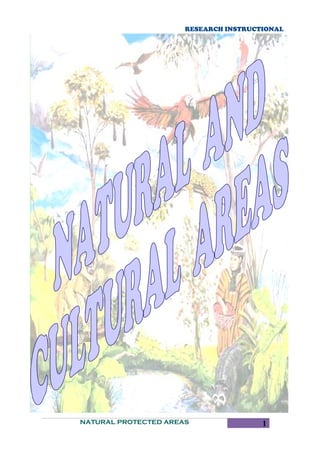
- 1. RESEARCH INSTRUCTIONAL NATURAL PROTECTED AREAS 1
- 2. RESEARCH INSTRUCTIONAL Manu National Park is a protected area located in southeastern Peru, located partly in the departments of Madre de Dios and Cusco, in the provinces of Manu and Paucartambo. With an area of 1.9098 million (hectares or square hectometer) is divided into three zones: the National Park, with 1,532,806; Reserved Zone, with 257 000, and the Transition or Cultural Zone, with 120 000 ha. It also has the documentation as a Biosphere Reserve. NATURAL PROTECTED AREAS 2
- 3. RESEARCH INSTRUCTIONAL It extends from 300 meters above sea level at the confluence of the Manu River with the Madre de Dios River, to the 3800 meters at the summit of the mountain Apu Kañajhuay. Some researchers believe in the virgin areas of this reserve is Païtiti or the lost city of the Incas. HISTORY Inca – colonial: In the Manu Biosphere Reserve there is evidence of ancient culture s such as the Pyramids of Paratoari ( in the headwaters of the manu Paratoar ) near the Pongo de NATURAL PROTECTED AREAS 3
- 4. RESEARCH INSTRUCTIONAL Mekanto , Pusharo Petroglyphs , a set of engravings of which has not yet been explain its origin and meaning , which were first reported by Father Vincent de Cenitagoya in 1921 and are located on the right bank Shinkibenia river , a tributary of the river Palotoa , others petroglyphs found in the river Q'eros , on the great rock " Xinkiori " , legendary for Huachipaeris . Similarly, it is aware of an archaeological site Mameria area , located in the headwaters of Piñi Piñi and High Tone. The Manu area has a history marked by the arrival of outsiders , since the time of the Inca Empire in the Inca Pachacutec Inca Tupac Yupanqui and annexed this area to their empire , until the arrival of the Spanish that shortly after Cuzco invasion Paucartambo founded , where established farms and parcels and where in addition to King Charles III of Spain ordered the construction of a bridge to facilitate trade in the products of the area, was well as the valley began to supply product Cuzco as coke, sugar, cotton, pepper , wood and others. In March 1567, the Spanish Juan Alvarez Maldonado by Mojos Province undertook a journey of 37 days to the first expedition from Paucartambo to the current town of Pillcopata . In May of the same year , Manuel de Escobar mounted a second expedition followed the river Madre de Dios River to Manu . Republican: In 1861, the Colonel Faustino Maldonado launched a new expedition from Paucartambo to the Madre de Dios River. It was after him that 30 years later the rubber baron Carlos Fitzcarrald baptizes Tambopata River mouth as Puerto Maldonado, the capital of the department of Madre de Dios. In the lowlands , indigenous people were affected by mining activities in the late nineteenth century , the exploitation of rubber marked the beginning of intrepid Fitzcarrald companies as one of the most famous tappers his time. However, Manu area was partially exploited. Rubber activities ceased in the 20s when the resource, unable to bounce back from intensive exploitation and competition from less expensive prosperous crops in Asia, began to decline. Between 50 and 60, the construction of the final section of the road (which is now known as Via Interoceanica South) began logging of cedar and mahogany, the work of extracting properties and subsequently their fur (jaguar, tiger and otters). More recent are the oil NATURAL PROTECTED AREAS 4
- 5. RESEARCH INSTRUCTIONAL exploration activities. Meanwhile, in the Andean region, agricultural activities were affected by the agrarian reform initiated in 1969. From the twentieth century, the religious presence became more significant. In 1902 the Dominicans founded their first mission in Asuncion. In 1908 they installed the second mission , San Luis del Manu , the Manu River mouth , then leaving it in the mission were established Palotoa River (in the area of Pantiacolla ) , which after being destroyed by a flood Shintuya definitely started in 1958. Creation: In 1967, on the initiative of Celestino Kalinowski , son of a famous Polish naturalist who came to Peru in 1887, and the report of the British adviser Ian Grimwood , the Peruvian state recommended the creation of a National Park in Manu . In 1968 was declared National Forest and later, Manu National Park was established on May 29, 1973, by Supreme Decree 0644-73 -AG , in order to preserve its natural and cultural heritage for the benefit of present and future same purpose determined for recognition by Unesco Biosphere Reserve Manu now covers an area of 1,881,200 ha ( 18,812 km ²) in the provinces of Paucartambo in Cuzco and Manu in Madre de Dios . Its boundaries were drawn using the principle of natural boundaries and domain sockets. However, the Park boundary in the same river Manu had to stop at the confluence with the river because there was Panagua oil exploration. DISTRIBUTION • CORE AREA OR MANU NATIONAL PARK: It is intended to protect and only allowed activities and biological anthropological research, limited to the observation of life and ecological processes in their natural form, in the park is Cocha Biological Station Cashu, one of the most important centers of tropical forest research. The place to visit is intangible and must have a special permit. In this same area there Amazonian native human populations belonging to different ethnic groups that inhabit from time immemorial, whose number is estimated at about 1000 indigenous, but there is also a Quechua population of about 200 people in the Callanga. NATURAL PROTECTED AREAS 5
- 6. RESEARCH INSTRUCTIONAL • BUFFER ZONE MANU OR RESTRICTED AREA: It is located in the lower part of the Manu River in this area are permitted tourist activities (organized by authorized agencies) and research with minimal handling. It is possible to observe a rich natural landscape and the large number of wildlife visible from the rivers and the lakes (meandering river that close and are isolated from the mainstream, forming lakes that hold a wealth of fauna). The visits are controlled. It extends from the valley of the river Panagua, to Boca Manu. • TRANSITION ZONE AND CULTURAL: It is formed by the banks of the Madre de Dios River and the Andean territories bordering the southern part of the reserve, between the National Park boundary and the river Mapacho. The area is dominated by settler populations who develop agricultural, livestock and forestry and who have basic health services, education and development, albeit incipient. Around the Manu Biosphere Reserve there are other areas such as the Territorial Reserve for State Ethnic Groups Kugapakori and Nahua, Sanctuary and Reserve Megantoni Amarakaeri; these areas and river basin Mapacho, plus the expansion of the existing cultural area (later called Multiple Use Zone Andean and Amazon) are considered within studies and proposals for integration into the Manu Biosphere Reserve. GEOGRAPHY In its vast territory , from the high plateaus to 3500 m , co vered with grass , where the dry air and temperatures vary depending on whether the sun or under the shade, and depending on the months reaching -9 ° C to 22 ° C steptiembre between the months of April and the rainy snow or hail from October to April were down a long stretch of transition called " scrub forest " that down to about 2600 meters from where the vegetation forming a forest , area in NATURAL PROTECTED AREAS 6
- 7. RESEARCH INSTRUCTIONAL which to date have identified about 450 species of plants and fat where rainfall can reach between 500 and 1000 mm . Forests " Montano low" take place between 2200 and 1650 m; being found trees up to 25 m . families covered high orchids and ferns grow on the walls of deep precipices . Among them can be found Araceae broad leaves and ferns that characterize the place , in these mist covered forests , there is a cold climate and a landscape darkened shadows and constantly damp and wet rain The forest " Montano Rain " also known as " cloud forest " , between 600 m and 1650 m . in the fog is constant cover splendid scenery full of greenery, here there are trees up to 30 m in height that are overgrown looking for orchids , ferns and averages , forming a dense forest broken only by small streams and waterfalls that are born and lost in the vegetation . Currently it is estimated that this area contains no less than 200 different species of trees with a density that can exceed 700 per hectare. Here the temperature varies between 20 ° and 25 ° C at night can drop to 16 or 18 ° C. In " tropical rainforest " also called " lowland " is spread over the vast Amazonian plain from 300 to 600 m . This is undoubtedly the most representative and comprehensive landscape of the reserve. Here in the area of winding river Manu , the trees have a gigantic height , on the high tops of these, some species of trees may emerge as the shihuahuaco ( Dipteryx micrantha ) and kapok (Ceiba pentandra ) . climate The rainy season or low season from January to March but throu ghout the year may have unexpected rainfall, the temperatures in the lowlands range from 35 ° C during the day and 20 ° C overnight. NATURAL PROTECTED AREAS 7
- 8. RESEARCH INSTRUCTIONAL FLORA AND FAUNA It is one of the most biodiverse regions of the world.1 In Manu you can find the full range of ecological zones that exist in the Amazon and this makes it one of the most prized protected areas. In a single hectare have come to find up to 250 species of trees. [Citation needed] In the Biosphere Reserve of Manu there have been 222 species of mammals and 1005 birds. NATURAL PROTECTED AREAS 8
- 9. RESEARCH INSTRUCTIONAL It is located in one of the most NATURAL PROTECTED AREAS 9
- 10. RESEARCH INSTRUCTIONAL desert of the Peruvian coast, in the department of Ica, and has an area of 335,000 Ha-some 200,000 in the Pacific Ocean. Paracas Peninsula is located in an exceptionally rich marine area, where outcrops of extremely cold waters produce an abundance of plankton that feeds on fish, crustaceans and molluscs. ENVIRONMENT Part of the area of the reserve, specifically 217 594 hectares, cons ists of aquatic environments (for many the world's richest sea). Due to its importance as a resting and feeding place for migratory species in 1991 was elevated to the category of Regional Reserve Hemispheric Shorebird Network (currently "Wetlands for the Americas"). Also in April 1992, he was recognized as one of the sites specifically for the Convention on Wetlands of International Importance (Ramsar Convention), especially as habitat for aquatic species such as fur seals, Humboldt penguins (which are in danger of extinction), sea birds such as boobies, guanay, pelicans and other important species. CLIMATE The climate is typical of subtropical wilderness training, me aning that there is approximately a difference of 6-8 ° C in the average temperature of the hottest month and the coldest. In February and August, respectively, it is 22 ° C and 15.5 ° C, with an annual average 18.7 ° C. Precipitation is very poor, with an average annual total of 1.83 mm., The relative humidity is around 82%, with 83% in winter. The prevailing winds are south and southwest, reaching an average speed of 14.9 km / h, but can reach up to 32 km / h, being the strongest of the coast, known by the name of "Paracas". With a mild climate and an average of 22 degrees and sunny almost constantly, with low humidity, the room is nice. NATURAL PROTECTED AREAS 10
- 11. RESEARCH INSTRUCTIONAL PLANKTON Plankton is favored by water microcurrent, which attract large numbers of fish, other species in the area and the farmers. In general the outcrop of Paracas is one of 9 in the world, this upwelling brings nutrients to the seabed, fertilize surface waters, this leads to an overproduction of phytoplankton, which biologists called high primary productivity. THE RESERV The reserve on the coast enabling environments for the preservation and reproduction of numerous peaceful species of resident and migratory . Among the most commonly found are the pelicans , gray gull ( Larus modestus ) , tendril ( Larosterna Inca ) , scorer ( Rynchops nigra ) , Arctic plover ( P luvialis squatarola ) chuita ( Phalacrocorax gaimardi ) guanay ( Phalacrocorax bougainvilli ), the condor, the Humboldt penguin ( endangered ) and flamingoes ( Phoenicopterus chilensis ) , among other species. The fish found in this sea area are the sole ( Etropus extenes ), the white toyo ( Mustelus whitneyi ) , bonito (Sarda chilensis ), the tramboyo , skate, cheetah, sardine, anchovy Engraulis ringens , butterfish , grouper, croaker , lorna and many other species . The mammals in this book are represented mainly by sea lions of a hair or comical ( byronia Sealion ), the fur seal or fur ( Arctocephalus australis ), the dolphin ( Delphinus Delphinius ) and sea cat ( Lontra felina) , this , in danger of extinction. Also the book is filled with green and leatherback turtles , reptiles like lizards ( Microlophus spp . ) And geckos ( Phyllodactylus spp . ) , Octopus , squid ( Loligo gahi ) , clams and crustaceans as the road ( Ocypode gaudichaudii ) , crab violet ( Platyxantus orbigny ) and muimuy ( Emerita analog ) . FLORA NATURAL PROTECTED AREAS 11
- 12. RESEARCH INSTRUCTIONAL This part of the Pacific Ocean is rich in phytoplankton and algae. According to research conducted in situ, have been able to record more than 250 species of algae, such as weeds (Gigartina chamissoi and Grapeloupia doryphora), sea lettuce (Ulva fasciata form costata), and aracanto (Macrocystis integrifolia) . The terrestrial flora has few species, due to the extreme aridity of the desert. However, there are areas in the desert, called hillocks, which receive a constant supply of coastal fog, which are developed in small communities of lichens, Tillandsias, and some herbs (among the most common are species of Solanum and Oxalis). The northern part of the Reserve includes large areas covered by Distichlis spicata and a small forest of sofaique (Geoffroea decorticans) meylin key and wan. THE CHANDELIER The Chandelier, located northwest of the Paracas Bay, is a petroglyph (channels or lines engraved in rock) that has an extension of 120 meters, which is also called Tres Cruces or Trident. The candle is engraved cream-colored rock, but mostly covered with sand. The sand is never completely clear chandelier because the winds are always removing excess sand from the channels. It is believed that the Paracas chandelier relates to the lines and geoglyphs of Nasca and Pampas de Jumana. The best way to appreciate this petroglyph is from the sea and the Ballestas Islands tours always stop and spend a few minutes so that tourists can take their photos. THE CATHEDRAL The Cathedral was an imposing rock formation caused by se a erosion and wind over the centuries. Its concave shape was reminiscent of the domes of the cathedrals, and some cats living inside marine or chingungos and seabirds. A World Heritage Site, was one of the natural images of Peru's most photographed and disseminated. Its structure collapsed during the violent earthquake of 8 degrees on the Richter scale of August 15, 2007 which had its epicenter in the town of Pisco. The remains of this figure are among Yumaque and Supay beaches. NATURAL PROTECTED AREAS 12
- 13. RESEARCH INSTRUCTIONAL NATURAL PROTECTED AREAS 13
- 14. RESEARCH INSTRUCTIONAL The Machu Picchu Historic Sanctuary is a protected area of Peru of more than 35 000 hectares comprising the natural environment of the archaeological site of Machu Picchu, nestled in the steep of the Yungas cloud forest on the eastern slope of the Peruvian Andes and both sides Urubamba river, which runs in this section to the northwest. This allows this unique protected area cover what could be considered one of the most extraordinary altitudinal transects Peru, and protect, with only about twenty kilometers linear ecosystems varying the eternal snow, to more than 4,000 m, and the steamy jungles tropical, just over 1,700 meters. NATURAL PROTECTED AREAS 14
- 15. RESEARCH INSTRUCTIONAL BASIC INFORMATION • Category: Historical Sanctuary. • Date added: January 8, 1981. • Law added: Supreme Decree No. 001-81-AG. • Area: 32,592 hectares. • Location: District of Machu Picchu, province of Urubamba, Cusco region • Ecoregion: Peruvian Yungas. CONSERVATION OBJECTIVES Protect the Inca citadel of Machu Picchu, a set of archeological groups linked to the Capac Yum and other archeological findings and Andean culture. Keep the spectacular landscape environment, natural habitat of important species of flora and fauna that are vulnerable or endangered. PROTECTED SPECIES Among them: the Andean bear uku mari ¨ vicuña and alpaca (Spectacled Bear) declared symbol Sanctuary, the quetzal high (Pharomachrus auriceps) and t he cock of the rock (rupicola peruviana) in wildlife and wacanki (Masdevallia veitchiana) and wiñay wayna (Epidendrum secundum) Quechua word meaning "cry" and "forever young", respectively. GEOGRAPHY Seen from the air, the territory of the temple was shown as a large open book in half, with the mighty Urubamba River in the central part and tw o great mountain chains that precipitate to either side of a deep valley covered by tropical vegetation. On each side of the river, the limits of this natural area comprehensively protect entire sections of two of the most important sub-region: in its northern Cordillera Urubamba and in the south of Vilcabamba. And with them, two of the most important summits: the Nevado Veronica (5,682 m) and the majestic Salkantay (6,271 m), considered the Apu or tutelary deity of the region. Rounding out the boundaries of the Sanctuary Cusichaca valleys and Acobamba, east and west, respectively. NATURAL PROTECTED AREAS 15
- 16. RESEARCH INSTRUCTIONAL CLIMATE By its geographical and topographical National Sanctuary of Machu Picchu presents climatic varieties reason that there are peaks reaching up to 6,270 meters, where the temperature is extremely cold and the lower parts with approximately 2,000 m with warmer temperatures. Temperatures in the Machu Picchu area differ when assessed in the highlands or on the bottom of the canyons, though generally, the climate of this area is kind, that is, with typical subtropical characteristics: warm and humid, with sensation of heat during the day and cool at night. By being in a subtropical zone has a temperature ranging between 8 ° and 22 ° C. Minimum temperatures are from 8 ° to 11.2 ° C, while the maximum is the order of 20 - 22.20 ° C. ECOSYSTEM Scientists have recorded up to ten inside living areas and two distinct ecoregions , the most important from the ecological point of view the high Andean grasslands , elfin forests high and high or Yungas jungle , represented by the cloud forests and the mountain brow . This huge variety of ecological or habitat can , in turn , the existence of an amazing variety of flora and fauna, perfectly adapted to the specific conditions of their environment. The natural world of Machu Picchu begins , then, above 4,000 m , where the wind constantly sweeps bunch grass plains and where the rocks are filled with lichen and moss. In the territory of the Andean condor and taruka , the largest and most elusive of deer of the Andes, from the playful vizcachas ( typical rodent Heights ) and puma or mountain lion . A land where the temperature variations are so intense that some creatures survive only : intense sun during the day and freezing at night unforgiving . High Andean scenery on the route the Inca Trail to Machu Picchu , which spans much of the Sanctuary Descending , we arrive at an area where the cold winds from the snowy mountains join the warm currents of the forest amounting to form a strange world in miniature. They dwarf forests , trees twisted scenario where the dimensions appear to be disrupted by freak of nature : here the trees are small and mosses , giants deer measured a few inches and the NATURAL PROTECTED AREAS 16
- 17. RESEARCH INSTRUCTIONAL hummingbirds the size of a pigeon . It is the land of bromeliads and the rarest flowers , the home of the Andean bear and the toucan ucumari high. Further down , where moisture reigns throughout the year and the rains are more frequent than anywhere else in the country , the cloud forests are shown to visitors from time to time , just when the mysterious veil of mist that cover is opened to make way for a magical and wonderful , this is one of the most prolific and unfamiliar environments of nature , a realm of waterfalls and mysterious beings where trees grow almost hanging from the cliffs , taking advantage of the low fertile soil they produce and subject to large granite rocks that outcrop in the mountains. This is the home of colorful cock of the rock , Peru's national bird , flocks of colorful tanagers , toucans and quetzals emerald tall, of ocelots and coatis , the kingdom of giant ferns , bromeliads and orchids , whose group here reaches up to 200 species , including the spectacular highlighting wakanki and wiñay wayna , whose flowers have been used to name some of the most spectacular archaeological sites Qhapac Nan ( Inca Trail ) . Finally , at the bottom of the valleys and on the thermal effect of the waterways that run through the forests of the mountain brow provide the ideal conditions for a wide variety of crops : coca achiote , corn , cacao , coffee and fruit . this was the pantry of the Incas, who resorted to it in pursuit of its most precious , and continues to be for the people settled in their domains . A bamboo forest land that bloom after decades to die en masse, as following a mandate mysterious and strange territory where the valleys widen and rivers appease his anger to make way for transparent channels licking slime mountain rich in nutrients. This is the prelude to the great Amazon forest . CONSERVATION AND THREATS From the environmental point of view , the main value of t he Sanctuary lies in the role played by the dense forests of the mountains to the maintenance of fluid balance in the region, capturing rainwater and leading without causing erosion to the course Urubamba . If these forests disappear, be lost with them numerous species of flora and fauna unique and almost unknown to science , but especially in the area would begin an irreversible process of environmental deterioration that would bring devastating consequences for man and the destruction of communication channels , the disappearance of growing areas , floods and landslides. Hikers on Inca trail in a cloud forest . At present , the main threat to the Sanctuary , and disproportionate growth of tourism , are forest fires . Started by farmers living in the highlands bordering the protected area , seasonal fires , aimed at renewing natural pastures become uncontrollable and enter , aided by the wind and the fragility of vegetation , slope down towards the middle of the woods haze . Often , the fire destroys everything in its path , destroying vast tracts of virgin forest, until the effect of rainfall appeased the fury of the flames. In recent years, the magnitude of these NATURAL PROTECTED AREAS 17
- 18. RESEARCH INSTRUCTIONAL fires has been such that its devastating effect even managed to transpose the limits of the Inca citadel of Machu Picchu. Fortunately , the administration of the Sanctuary , in coordination with the different sectors involved in conservation , and with the support of international cooperation , has been working on developing a plan Purpose of resources, training farmers about the dangers of annual burning of pastures and offering non-destructive alternative uses of resources to area residents who depend on it. The Historic Sanctuary of Machu Picchu was recognized internationally by UNESCO in 1983 , granting the category of Cultural and Natural Heritage of Humanity . Only two areas in the Americas hold this distinction (the other is Tikal in Guatemala ) . NATURAL PROTECTED AREAS 18