3. 1
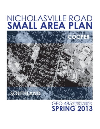
NICHOLASVILLE ROAD SMALL AREA PLAN
GEO485G has been a semester long
exploration of the theories and processes
involvedinurbanplanningandsustainability.
corridor of Nicholasville Road (from Cooper
has grown beyond it’s current infrastructure
and desperately needs renovation.
PREFACE
4. 2
NICHOLASVILLE ROAD SMALL AREA PLAN
As the Nicholasville Road corridor impacts
has come from the 2012 Comprehensive
ACKNOWLEDGE OF 2012 COMPREHENSIVE PLAN
5. 3
NICHOLASVILLE ROAD SMALL AREA PLAN
VISION STATEMENT
corridor while ensuring quality of life,
of the surrounding communities while
maintaining
along this corridor of Nicholasville
Road. This can be accomplished while
protecting the
commuters that travel daily to Lexington.
9. 7
NICHOLASVILLE ROAD SMALL AREA PLAN
46,000
TRAFFIC & ROAD CONDITIONS
side streets such as Southland or Alumni and traveling that stretch of Nicholasville Road
in order to get to another side street such as Rosemont Gardens. This would happen
OVERVIEW OF EXISTING STATE
11. 9
NICHOLASVILLE ROAD SMALL AREA PLAN
#1: The Elizabeth Street Neighborhood
#2:
#3:
#4: The Suburban Court Neighborhood
#5:
#6:
#7: The Southern Heights Neighborhood
NEIGHBORHOODS
OVERVIEW OF EXISTING STATE
#1
#2
#3
#4
#5
#6
#7
13. 11
NICHOLASVILLE ROAD SMALL AREA PLAN
south side of Waller Ave. from the railroad. This is the area that is generally regarded
near Suburban Court and are four parcels in total. One of them is a multistory apartment
OVERVIEW OF EXISTING STATE
14. 12
NICHOLASVILLE ROAD SMALL AREA PLAN
that is trust company and the other is currently under construction. The other two
at least the end of the building so that the entire building is within that zoning. The part
advise that the zoning of that parcel be reevaluated once the parcel is subdivided.
areas. The way this area is currently zoned there are four parcels that are zoned
OVERVIEW OF EXISTING STATE
16. 14
NICHOLASVILLE ROAD SMALL AREA PLAN
The last zoning issue in the area deals with the parcel at 205 Southland Drive. This
OVERVIEW OF EXISTING STATE
17. 15
NICHOLASVILLE ROAD SMALL AREA PLAN
PARKING
the student housing area) are the streets that are directly connected to Nicholasville
no way that two cars going in opposite directions can safely pass each other
moment while the other car could pass safely pass. While this observation was only
Due to this reason and the fact that the vast majority of these homes and parcels
group of students who have move into these areas instead of living in the student
OVERVIEW OF EXISTING STATE
18. 16
NICHOLASVILLE ROAD SMALL AREA PLAN
lots with permeable pavement/surfaces. This type of pavement/surface will reduce
runoff and in some cases will reduce the pollutants that are in the runoff as well based
on evidence found in several studies done around the world on this type of surface.
should be something that people of this area get on board with. Also with the amount
OVERVIEW OF EXISTING STATE
20. 18
NICHOLASVILLE ROAD SMALL AREA PLAN
UTILITIES
The majority of the utilities in this area are above ground. While it is hard to
determine the exact size of the utility easements in every part of the area but the
wooden electric poles. The condition of some of the poles in the area are not good
on visual inspection of them. Some of them could easily come down in a severe wind
storm in the future. As well the closeness of some trees and the lines could cause
lines or poles due to weather or other issues which companies currently deal with now.
OVERVIEW OF EXISTING STATE
21. 19
NICHOLASVILLE ROAD SMALL AREA PLAN
ENVIRONMENTAL GRAPHICS
This area of Lexington does not much in the way of environmental graphics
that line Nicholasville Road. There are no oblivious violations of the sign regulations
and conforms to the area and does not cause an eyesore for the community.
OVERVIEW OF EXISTING STATE
23. 21
NICHOLASVILLE ROAD SMALL AREA PLAN
designated local historic districts of Lexington. Design guidelines help property owners
by the National Park Service’s Secretary of Interior’s Standards for Rehabilitation.
OVERVIEW OF EXISTING STATE
24. 22
NICHOLASVILLE ROAD SMALL AREA PLAN
SEVEN PARKS HISTORIC DISTRICT
small section of the district is located east of Nicholasville Road and includes houses on
OVERVIEW OF EXISTING STATE
25. 23
NICHOLASVILLE ROAD SMALL AREA PLAN
ARCHITECTURE
OVERVIEW OF EXISTING STATE
appears around the turn of the century
Bungalow/Craftsman:
These architectural styles appear throughout the neighborhoods within
26. 24
NICHOLASVILLE ROAD SMALL AREA PLAN
OVERVIEW OF EXISTING STATE
White Persons:
Other Persons:
DEMOGRAPHICS OF LEXINGTON
27. 25
NICHOLASVILLE ROAD SMALL AREA PLAN
White Persons:
Asian Persons:
Other Persons:
Male:
Female:
Age 18-24:
Age 25-34:
Age 35-49:
Age 50-64:
DEMOGRAPHICS WITHIN THE SAP
OVERVIEW OF EXISTING STATE
28. 26
NICHOLASVILLE ROAD SMALL AREA PLAN
DEMOGRAPHICS & HOUSING WITHIN THE SAP
of occupied homes that owner occupied and renter occupied is fairly close. Of the
the homes for both owner and renter occupied are around 2.24 persons per home.
COLLEGE AGE
PERSONS
23.1%.
THERE ARE 2,066 HOMES WITHIN THE
48.5%
WHILE 51.5%
OVERVIEW OF EXISTING STATE
32. 30
NICHOLASVILLE ROAD SMALL AREA PLAN
HISTORY
1775:
Lexington established by hunting group from Virginia
1779:
1780’s:
1782:
Incorporated as a town by the Virginia legislature
1783:
Street width resolution
1792:
1831:
1900’s:
1931:
HISTORY OF LEXINGTON
34. 32
NICHOLASVILLE ROAD SMALL AREA PLAN
HISTORY OF NICHOLASVILLE ROAD
SOURCE: Comprehensive Plan of Lexington, Kentucky & Environs, 1931
maximum sunlight into the buildings and culminating into a happy accident for the city.
HISTORY
35. 33
NICHOLASVILLE ROAD SMALL AREA PLAN
unrivalled as the agricultural and commercial center of the
region… It is the consensus of opinion that it was [only] due to
HISTORY
36. 34
NICHOLASVILLE ROAD SMALL AREA PLAN
river transportation that Lexington had to yield its leadership
to these river cities. With undaunted enterprise its citizens
subscribed generously to the building of a railroad to Louisville
entered the Civil War where progress essentially was halted. The city of Lexington
was never able to become the powerhouse it had been in its’ earliest days. During
HISTORY
37. 35
NICHOLASVILLE ROAD SMALL AREA PLAN
HISTORY
TRANSPORTATION HISTORY
SOURCE: Comprehensive Plan of Lexington, Kentucky & Environs, 1931
transportation but serve instead as transportation for freight or other industrial means.
38. 36
NICHOLASVILLE ROAD SMALL AREA PLAN
HIGHWAY HISTORY
SOURCE: Comprehensive Plan of Lexington, Kentucky & Environs, 1931
which later became Nicholasville Road) that connected the heart of the city
HOUSING HISTORY
SOURCE: Comprehensive Plan of Lexington, Kentucky & Environs, 1931
HISTORY
46. 44
NICHOLASVILLE ROAD SMALL AREA PLAN
STUDENT HOUSING
A large number of owner occupied single family houses within the Elizabeth St.
conversions are fundamentally changing the character of the neighborhood while at
residents. It stands to reason that the number of conversions in the area will continue
HOUSING & NEIGHBORHOODS
47. 45
NICHOLASVILLE ROAD SMALL AREA PLAN
HOUSING & NEIGHBORHOODS
Long term residents of the area consistently have to deal with noise issues
together in higher densities than other residents within housing units in an attempt to
a student can invite anyone they choose into their residence at whatever hour they
housing especially when a student lives in an inordinately high density dwelling.
48. 46
NICHOLASVILLE ROAD SMALL AREA PLAN
and prevent further student encroachment into other surrounding neighborhoods.
and usage of neighborhood zoning overlays for the neighborhoods surrounding
between existing student housing dwellings and any new construction student
dwellings. This minimum number of lots should be arrived at by the planning
department and should be determined only with input gathered from the public
number permissible to live in a distinct housing unit is 6 unrelated individuals. We
recommend that the number be reduced to 4 unrelated individuals for any new
HOUSING & NEIGHBORHOODS
49. 47
NICHOLASVILLE ROAD SMALL AREA PLAN
Another recommendation for alleviating the problems faced by the Elizabeth
system. This recommendation is aimed at reducing students’ desires to relocate
alleviate the number of students residing in the surrounding neighborhoods.
HOUSING & NEIGHBORHOODS
IMAGES OF CURRENT ISSUES
BACKYARD PARKING LOTS
50. 48
NICHOLASVILLE ROAD SMALL AREA PLAN
CONVERTED SINGLE-FAMILY HOMES
HIGH DENSITY CONVERSIONS AND NEW COSTRUCTION
QUESTIONABLE AND UPKEEP
HOUSING & NEIGHBORHOODS
52. 50
NICHOLASVILLE ROAD SMALL AREA PLAN
TRANSPORTATION & MOBILITY
LEXTRAN
during rush hour in the morning and afternoon due to extremely high automobile
count between Cooper and Southland (see Image 1). The urban character is
The three major goals are to:
corridor
53. 51
NICHOLASVILLE ROAD SMALL AREA PLAN
Encourage use of public transportation through improvements in existing
services and by creating user incentives
Lextran currently offers two routes along the Nicholasville corridor. Route
number 5 is the standard Nicholasville Road route with 41 stops including points of
(see Image 2).
Route number 23 is the Nicholasville Road express route with 8 stops including points
TRANSPORTATION & MOBILITY
55. 53
NICHOLASVILLE ROAD SMALL AREA PLAN
these commuters being low income. Even though ridership is considered low
Increasing use of existing routes through improvements
Creating incentives to increase overall ridership and diversity of riders
Considering that road expansion and rail are impractical options due to
improve what currently exists. Ridership and lateness can be improved by adding
busses to existing routes. A way to get more commuters on board is to provide
incentivizing promotions for commuters traveling to the largest hubs such as Central
offers discount passes for students. If these same discounts were made available
the diversity of ridership. The more people that choose to use Lextran for their
TRANSPORTATION & MOBILITY
56. 54
NICHOLASVILLE ROAD SMALL AREA PLAN
system (see Image 4)
fast. It can exceed rail systems for a fraction of the cost at $5 million to $15 million
a mile versus $25 to $50 million a mile for streetcar rail and $12.5 million to $20 million
options such as allowing car poolers to also use the bus lanes. This option has a lot
of potential to improve public transportation along the Nicholasville Road corridor.
TRANSPORTATION & MOBILITY
57. 55
NICHOLASVILLE ROAD SMALL AREA PLAN
BIKEABILITY
cycling community has largely forgone travel along Nicholasville Rd. because of safety
TRANSPORTATION & MOBILITY
58. 56
NICHOLASVILLE ROAD SMALL AREA PLAN
Implementing a new bicycling plan for this area would accomplish multiple
Decrease congestion and open up capacity along Nicholasville Road
Decrease the number of turning cars between Waller/Cooper and
Decrease the emissions produced in Lexington and improve the overall
health of those cycling and the communities along the potential route
Increase the economic vitality of Rosemont Garden and Southland Dr.
citizens
even more congestion problems. The carriageway has also been expanded
TRANSPORTATION & MOBILITY
60. 58
NICHOLASVILLE ROAD SMALL AREA PLAN
The no build option would be to not improve cycling along this route. The
or increase bicycle commuting from these areas to downtown and other areas.
Expanding Nicholasville would involve expanding and redesigning the road
down lane size and perhaps even eliminating a lane along Nicholasville Rd. A sharrow
above cutting down or changing lane size would cause more congestion problems.
TRANSPORTATION & MOBILITY
61. 59
NICHOLASVILLE ROAD SMALL AREA PLAN
Creating cycling routes through the neighborhoods on either side of
Nicholasville Road would utilize already existing streets to create a route connecting
East side and Elizabeth on the west would be utilized as the routes. On the east
common cause for speeding cars along this route). The larger obstacle would be
TRANSPORTATION & MOBILITY
62. 60
NICHOLASVILLE ROAD SMALL AREA PLAN
We recommend the third option for implementation. While creating a connected
already in motion as the route along the east side of Nicholasville Rd. has already
been planned. This route also opens up the possibility of more cycling routes through
recreation and limiting the encroachment of high density housing in these areas.
TRANSPORTATION & MOBILITY
64. 62
NICHOLASVILLE ROAD SMALL AREA PLAN
SIGNIFICANT AREAS TO CONSIDER
BAPTIST HEALTH
the small collector streets within the Southern Heights neighborhood. Service vehicles
65. 63
NICHOLASVILLE ROAD SMALL AREA PLAN
the Southern Heights neighborhood and surrounding areas with increased noise
SIGNIFICANT AREAS TO CONSIDER
66. 64
NICHOLASVILLE ROAD SMALL AREA PLAN
The Southern Heights neighborhood offers a desirable and safe environment for
this area threatens these charming characteristics and the safety of the roadways.
BAPTIST HEALTH & ITS IMPACT: SOUTHERN HEIGHTS NEIGHBORHOOD
SIGNIFICANT AREAS TO CONSIDER
67. 65
NICHOLASVILLE ROAD SMALL AREA PLAN
to avoidance of the Nicholasville Road corridor as motor vehicles use the Southern
SIGNIFICANT AREAS TO CONSIDER
69. 67
NICHOLASVILLE ROAD SMALL AREA PLAN
Currently road conditions are unsafe for pedestrians and cyclists as
there is little to no signage to caution drivers. Additional signage will help
when moving at a steady pace also emits fewer fumes. Community streets
interaction amongst neighbors. Southern Heights is very interconnected and
maintaining the integrity of this community is the neighborhood’s top priority.
SIGNIFICANT AREAS TO CONSIDER
70. 68
NICHOLASVILLE ROAD SMALL AREA PLAN
Alumni Drive is a minor arterial road that connects Nicholasville Road
number demonstrates a relatively high use of these roadways. Current conditions
SIGNIFICANT AREAS TO CONSIDER
71. 69
NICHOLASVILLE ROAD SMALL AREA PLAN
would be a safe and effective way to limit speeding and reduce the number of
when compared to two way or four way stops.
roadside curb conditions are poor.
/ Commonwealth Stadium.
UNIVERSITYDRIVEUNIVERSITYCOURT
ALUMNI DRIVEALUMNI DRIVE
PED XING
PED XING
PEDXING
PEDXING
SIGNIFICANT AREAS TO CONSIDER
72. 70
NICHOLASVILLE ROAD SMALL AREA PLAN
traverses through the Southern Heights neighborhood en route to the hospital.
collects stormwater runoff and provides a natural drainage system. We
recommend that a permeable material be used to prevent standing water
SIGNIFICANT AREAS TO CONSIDER
74. 72
NICHOLASVILLE ROAD SMALL AREA PLAN
ENVIRONMENTAL ANALYSIS
TREE COVERAGE, SOIL QUALITY & SURFACE CONDITIONS
To analyze the current environmental conditions of the South Nicholasville
elements it becomes apparent that creating and maintaining a sustainable
cities which are managed to provide the inhabitants with a continuing level of
tree cover and impermeable surface within the small area plan. This analysis
75. 73
NICHOLASVILLE ROAD SMALL AREA PLAN
to plant more trees without soil remediation. An optimal soil organic matter content
ENVIRONMENTAL ANALYSIS
76. 74
NICHOLASVILLE ROAD SMALL AREA PLAN
the increase in impermeable surface coverage in the student housing area due
housing and the increase of impermeable surface coverage could exacerbate
of the Southland Drive Shopping Center could have very similar negative results
ENVIRONMENTAL ANALYSIS
77. 75
NICHOLASVILLE ROAD SMALL AREA PLAN
TREE COVERAGE & SURFACE CONDITIONS RESULTS
TREE COVERAGE
PERVIOUS SURFACESIMPERVIOUS SURFACES
ALL RESULTS
ENVIRONMENTAL ANALYSIS
78. 76
NICHOLASVILLE ROAD SMALL AREA PLAN
STORMWATER MITIGATION
ENVIRONMENTAL ANALYSIS
Involves using cisterns over large areas and
several homes to harvest rain water.
Goals:
Determine the impact of large scale
rain harvesting to reduce the amount of
stormwater annually.
Reduce the total stormwater to affect
To potentially provide costs savings for both
residents and local municipality.
80. 78
NICHOLASVILLE ROAD SMALL AREA PLAN
ENVIRONMENTAL ANALYSIS
STORMWATER MITIGATION: METHODOLOGY
Take the square footage of each home Ex. 33’ x 43’ = 1419 square feet
Include the pitch of the roof Ex. 6rise 12Run = Average Pitch* (6-9 in)
Square each and add the two together Ex. 180
Take square root and divide by 12 Ex. 13.417/2 = 1.118 **
Use multiplier to determine roof square footage from home square footage
Ex. 1.18 x 1419 = 1586 square feet
Convert to cubic feet Ex. 1586 x .0833 = 132.11
Convert cubic feet to gallons Ex. 132.11 = 988.25 gallons
Multiply gallons by historical rainfall data Ex. 988.25 x 45.2 inches = 44,668 gallons
Averages create some error (average pitch and rainfall)
81. 79
NICHOLASVILLE ROAD SMALL AREA PLAN
SECTIONENVIRONMENTAL ANALYSIS
STORMWATER MITIGATION: RESULTS
Lackawanna
Road
Elizabeth
Street
Cherokee
Park
Totals
Total Homes 49 37 34 120
Average Home
Age
1943 1942 1938
Average Home
Value
152489 160783 405800
Average Home
square footage
1485 1650 2716
Average Roof
square footage
1660 1844 3036
Average Cubic
feet
137.24 152.73 250.45
Sum of Gallons
Yielded
2,273,480 1,961620 2,963,626 7,198,726
83. 81
NICHOLASVILLE ROAD SMALL AREA PLAN
HISTORIC PRESERVATION & WORKING WITHIN HISTORIC CONTEXT
context and the historic resources that represent it be carefully considered throughout
the planning process. The 2010-2014 Kentucky State Historic Preservation Plan is an
2010-2014KentuckyStateHistoricPreservation
Plan
2010-2014 Kentucky State Historic Preservation Plan declares that historic preservation
planning is most effective when (1) public comments and recommendations are
historic preservation projects and help community leaders understand issues within a
broader context are closely examined (3) the nature and condition of our cultural and
Top four goals of the 2010-2014 Kentucky State Historic Preservation Plan
provide historic preservation educational opportunities. Integrating historic and cultural
communities to fund the maintenance of existing infrastructure rather than construct
OTHER CONSIDERATIONS
84. 82
NICHOLASVILLE ROAD SMALL AREA PLAN
preservation
planning provides for conservative use of historic properties, permitting drastic
(2) and (3) preservation
planning includes public participation. The danger of historic preservation planning
is that it can become separated from the overall community planning process.
preservation laws are typically adopted as a part of zoning ordinance and can
help establish guidelines for new development on or around historic properties. The
OTHER CONSIDERATIONS
85. 83
NICHOLASVILLE ROAD SMALL AREA PLAN
Development Districts (ADD) are possible resources for community development efforts.
Historic context is a narrative that includes information based on a cultural
describes and/or illustrates broad patterns of community development by identifying
objects or districts. Historic context can provide direction for evaluating and protecting
context distributed throughout the six neighborhoods. While only a small portion of
on the city of Lexington. The automobile allowed for suburban developments on
the edge of downtown to thrive as the Lexington population continued to grow.
There are aspects of the 2010-2014 Kentucky State Historic Preservation Plan that
plan is to integrate preservation planning into community planning efforts across the
preservation plan encourages the integration of historic places into comprehensive
OTHER CONSIDERATIONS
86. 84
NICHOLASVILLE ROAD SMALL AREA PLAN
planning efforts because it can enable communities to fund the maintenance of
existing infrastructure rather than construct new infrastructure and even preserve open
trends were all included on the list as major factors affecting historic preservation
2010-2014 Kentucky State Historic Preservation
Plan
preservation plan also mentions that the incorporation of preservation planning into
OTHER CONSIDERATIONS
87. 85
NICHOLASVILLE ROAD SMALL AREA PLAN
OTHER CONSIDERATIONS
New construction of primary residential
or commercial buildings should
in harmony with location and surroundings
of neighboring buildings
use of the same or similar materials to the
original or existing materials
property’s and/or surrounding property’s
form or style
Scale:
proportional elements that demonstrate
consistent distances of the buildings from
the street and adjacent buildings
Orientation to the Street:
all buildings should have a primary
entrance on the front of building
FORM BASED CODES
89. 87
NICHOLASVILLE ROAD SMALL AREA PLAN
CONCLUSIONS & RECOMMENDATIONS
INCREASE OVERALL TREE COVERAGE
CONCLUSIONS: MAIN ISSUES OBSERVED
90. 88
NICHOLASVILLE ROAD SMALL AREA PLAN
CONCLUSIONS & RECOMMENDATIONS
TO AID IN HEAVY TRAFFIC SURROUNDING
BAPTIST HEALTH:
6 months to 1 year
91. 89
NICHOLASVILLE ROAD SMALL AREA PLAN
CONCLUSIONS & RECOMMENDATIONS
TO PREVENT ENCROACHMENT OF
STUDENT HOUSING:
92. 90
NICHOLASVILLE ROAD SMALL AREA PLAN
CONCLUSIONS & RECOMMENDATIONS
TO INCREASE OVERALL TREE COVERAGE
AND RESIDENT KNOWLEDGE:
street trees
Identify areas where more street trees
could be planted
93. 91
NICHOLASVILLE ROAD SMALL AREA PLAN
CONCLUSIONS & RECOMMENDATIONS
TO INCREASE PERMEABLE SURFACES:
commission to approve additions of
permeable surfaces to list of approved
permeable surfaces
94. 92
NICHOLASVILLE ROAD SMALL AREA PLAN
CONCLUSIONS & RECOMMENDATIONS
TO INCREASE USABILITY OF ALTERNATE
TRANSPORTATION:
3 years