SlideShare a Scribd company logo
1 of 2
Download to read offline
Esri Data
                 ®


    Inaccurate data impacts health care.


Three things every health care provider
should know about demographic data:

1.	Your decisions are only as good as your data.
This is true whether we’re talking about your patient data, financials,
insurance, or demographic data. Projections of demographic shifts drive
your critical decisions about where to locate, expand, or reduce services,
impacting your bottom line.

Demographic data is the bedrock for many projections and analyses,
including those that integrate your proprietary data. But is your
demographic data reliable?


2.	It’s a myth that all demographic data is the same.
The census occurs only every 10 years and is the primary source for          Data accuracy affects
demographic data, which data vendors incorporate into their releases.        costs and care provided.
Therefore, demographic data provided after a census year will all be about   Consider the risk and costs of
the same, regardless of vendor.                                              using inaccurate data for planning
                                                                             distribution of flu vaccines. In Miami-
What about demographic data for years that don’t end in 0?
                                                                             Dade County, Florida, for example,
For the intervening years, data vendors generate projections based           there are an estimated 502,000
on proprietary methodologies developed by their demographers and             people in the target at-risk populace
analysts. Accuracy depends on how projections are calculated.                of young children and the elderly.

                                                                             If demographic projections are too
                                                                             low by 10 percent, vaccine would
3.	Demographic data is just the beginning.
                                                                             be unavailable to over 50,000 people.
Demographic data is a powerful first cut at key information about the        If the population is overestimated by
communities you serve. Used alone, it falls short of generating true         10 percent, over $1.4 million in vaccine
understanding and insight. When combined with data about population          inventory could be wasted.
behaviors, attitudes, and critical health factors such as diabetes and       Risks
obesity, it’s a powerful tool for determining your future direction.
                                                                             Vaccine unavailable to 50,200 people
Data providers, whether they source health and lifestyle data, generate      $1.4 million loss
it themselves, or a bit of both, overlay this data on their demographic
projections. If their demographic projections are inaccurate, other data
they provide to you will be less accurate as well.


                                                                                                 Continued on back
Be smart about sourcing demographic data.                                                                                                                   Study confirms
                                                                                                                                                            Esri data accuracy.
You’ll have more confidence in your decisions if you’re using the most accurate
data available. Your 5- and 10-year forecasts of need for specific services, for                                                                              Esri
instance, are based heavily on demographic projections generated by your data
vendor. In essence, the accuracy of your critical business decisions depends on
their expertise.

Ask your data vendor these questions:

•	 What methodology do you use for generating projections?

•	 How do you assess and test your methodology?

•	 Who generates the projections, and what are the experience and
   credentials of this team?

•	 Can you prove the accuracy of your projections?
                                                                                                                                                              Vendor 3
Proof that Esri® demographic data is the most accurate
A blind study conducted by independent, credentialed demographers of the top
five data vendors showed that Esri demographic projections were by far the most
accurate.

Demographers benchmarked each vendor’s 2010 projections against data
released by the US Census Bureau following the 2010 Census. The study revealed
how accurately each vendor projected key demographics 10 years out from the
last census, in this case 10-year projections based on Census 2000 data.


                                                                 Esri Ranked First
 Geography                                Vendor 1                           Esri                    Vendor 3                     Vendor 4       Vendor 5

  Total US                                     315.9                       247.7                         276.7                           295.7    304.7

  State                                         21.4                         12.6                         17.9                           19.3      29.7

  County                                        49.2                         39.8                         52.1                           46.5      55.7
                                                                                                                                                            Accuracy of household data projections
  Census Tract                                 106.6                         89.5                         93.3                           106       99.6     between Esri and vendor 3 varies greatly
                                                                                                                                                            for the state of Michigan. Using data from
  Block Group                                  138.7                       105.8                         113.4                           123.9    119.7     vendor 3 would introduce measurable
                                                                                                                                                            inaccuracies into market analyses. The
The lowest score indicates the highest accuracy. Accuracy was assessed for population and                                                                   margin of error inherent in projections and
households. Go to esri.com/accuracy to see the report.                                                                                                      models would be reduced by using the
                                                                                                                                                            more accurate Esri data.
                                                                                                                                                            Using vendor 3 data to locate specific
                                                                                                                                                            health services in Wisconsin’s north
                                                                                                                                                            counties, where the data had a greater
                                                                                                                                                            than 15 percent error rate, could be risky.
                                                                                                                                                            Potentially, you could underserve the
                                                                                                                                                            population or overbuild, resulting in
                                                                                                                                                            serious financial consequences.


                                                                                                                                                            See the report at
                                                                                                                                                            esri.com/accuracy.


Copyright © 2012 Esri. All rights reserved. Esri, the Esri globe logo, and esri.com are trademarks, service marks, or registered marks
of Esri in the United States, the European Community, or certain other jurisdictions. Other companies and products or services
mentioned herein may be trademarks, service marks, or registered marks of their respective mark owners.

130212 ESRI1M5/12ed

More Related Content

Similar to Esri Data for Health

IssaPopulation and SamplingThe constructs of population and sa.docx
IssaPopulation and SamplingThe constructs of population and sa.docxIssaPopulation and SamplingThe constructs of population and sa.docx
IssaPopulation and SamplingThe constructs of population and sa.docx
vrickens
 
SAC360 Chapter 8 role of data in public health
SAC360 Chapter 8 role of data in public healthSAC360 Chapter 8 role of data in public health
SAC360 Chapter 8 role of data in public health
BealCollegeOnline
 
WithinReachFinalReport
WithinReachFinalReportWithinReachFinalReport
WithinReachFinalReport
Jinyang Luo
 
Comparative Analytical Review of Cancer DeathsObjective.docx
Comparative Analytical Review of Cancer DeathsObjective.docxComparative Analytical Review of Cancer DeathsObjective.docx
Comparative Analytical Review of Cancer DeathsObjective.docx
pickersgillkayne
 
A Two-sample Approach for State Estimates of a Chronic Condition Outcome
A Two-sample Approach for State Estimates of a Chronic Condition OutcomeA Two-sample Approach for State Estimates of a Chronic Condition Outcome
A Two-sample Approach for State Estimates of a Chronic Condition Outcome
soder145
 

Similar to Esri Data for Health (20)

How a Revamped Data Analytics Approach Can Mitigate Healthcare Disparities.pdf
How a Revamped Data Analytics Approach Can Mitigate Healthcare Disparities.pdfHow a Revamped Data Analytics Approach Can Mitigate Healthcare Disparities.pdf
How a Revamped Data Analytics Approach Can Mitigate Healthcare Disparities.pdf
 
Privacy Preserving for Mobile Health Data
Privacy Preserving for Mobile Health DataPrivacy Preserving for Mobile Health Data
Privacy Preserving for Mobile Health Data
 
Using Linked Survey and Administrative Records Studies to Partially Correct S...
Using Linked Survey and Administrative Records Studies to Partially Correct S...Using Linked Survey and Administrative Records Studies to Partially Correct S...
Using Linked Survey and Administrative Records Studies to Partially Correct S...
 
Centralized BI in Healthcare
Centralized BI in HealthcareCentralized BI in Healthcare
Centralized BI in Healthcare
 
Data Con LA 2019 - Applied Privacy Engineering Study on SEER database by Ken ...
Data Con LA 2019 - Applied Privacy Engineering Study on SEER database by Ken ...Data Con LA 2019 - Applied Privacy Engineering Study on SEER database by Ken ...
Data Con LA 2019 - Applied Privacy Engineering Study on SEER database by Ken ...
 
Trust & Predictive Technologies 2016
Trust & Predictive Technologies 2016Trust & Predictive Technologies 2016
Trust & Predictive Technologies 2016
 
Preserving Privacy and Utility in Text Data Analysis
Preserving Privacy and Utility in Text Data AnalysisPreserving Privacy and Utility in Text Data Analysis
Preserving Privacy and Utility in Text Data Analysis
 
IssaPopulation and SamplingThe constructs of population and sa.docx
IssaPopulation and SamplingThe constructs of population and sa.docxIssaPopulation and SamplingThe constructs of population and sa.docx
IssaPopulation and SamplingThe constructs of population and sa.docx
 
Capabilities Technical Briefing - Healthcare
Capabilities Technical Briefing - HealthcareCapabilities Technical Briefing - Healthcare
Capabilities Technical Briefing - Healthcare
 
SAC360 Chapter 8 role of data in public health
SAC360 Chapter 8 role of data in public healthSAC360 Chapter 8 role of data in public health
SAC360 Chapter 8 role of data in public health
 
New IBM IBV Study - Cognitive in Pharmacovigilence
New IBM IBV Study - Cognitive in PharmacovigilenceNew IBM IBV Study - Cognitive in Pharmacovigilence
New IBM IBV Study - Cognitive in Pharmacovigilence
 
Tim Kieschnick - Data Are People Too
Tim Kieschnick - Data Are People TooTim Kieschnick - Data Are People Too
Tim Kieschnick - Data Are People Too
 
Big Data Issues Today
Big Data Issues TodayBig Data Issues Today
Big Data Issues Today
 
LIS 60030 Final Project
LIS 60030 Final ProjectLIS 60030 Final Project
LIS 60030 Final Project
 
Wireless Substitution: State-level Estimates From the National Health Intervi...
Wireless Substitution: State-level Estimates From the National Health Intervi...Wireless Substitution: State-level Estimates From the National Health Intervi...
Wireless Substitution: State-level Estimates From the National Health Intervi...
 
WithinReachFinalReport
WithinReachFinalReportWithinReachFinalReport
WithinReachFinalReport
 
Comparative Analytical Review of Cancer DeathsObjective.docx
Comparative Analytical Review of Cancer DeathsObjective.docxComparative Analytical Review of Cancer DeathsObjective.docx
Comparative Analytical Review of Cancer DeathsObjective.docx
 
Using Linked Survey and Administrative Records Studies to Partially Correct S...
Using Linked Survey and Administrative Records Studies to Partially Correct S...Using Linked Survey and Administrative Records Studies to Partially Correct S...
Using Linked Survey and Administrative Records Studies to Partially Correct S...
 
High Speed Internet Take Rate Brief
High Speed Internet Take Rate BriefHigh Speed Internet Take Rate Brief
High Speed Internet Take Rate Brief
 
A Two-sample Approach for State Estimates of a Chronic Condition Outcome
A Two-sample Approach for State Estimates of a Chronic Condition OutcomeA Two-sample Approach for State Estimates of a Chronic Condition Outcome
A Two-sample Approach for State Estimates of a Chronic Condition Outcome
 

More from Esri

Aena Aeropuerto Adolfo Suárez-Barajas crea potentes aplicaciones para sus cli...
Aena Aeropuerto Adolfo Suárez-Barajas crea potentes aplicaciones para sus cli...Aena Aeropuerto Adolfo Suárez-Barajas crea potentes aplicaciones para sus cli...
Aena Aeropuerto Adolfo Suárez-Barajas crea potentes aplicaciones para sus cli...
Esri
 

More from Esri (20)

INIA- CISA: Análisis de las amenazas en la fauna silvestre
INIA- CISA: Análisis de las amenazas en la fauna silvestreINIA- CISA: Análisis de las amenazas en la fauna silvestre
INIA- CISA: Análisis de las amenazas en la fauna silvestre
 
Aena Aeropuerto Adolfo Suárez-Barajas crea potentes aplicaciones para sus cli...
Aena Aeropuerto Adolfo Suárez-Barajas crea potentes aplicaciones para sus cli...Aena Aeropuerto Adolfo Suárez-Barajas crea potentes aplicaciones para sus cli...
Aena Aeropuerto Adolfo Suárez-Barajas crea potentes aplicaciones para sus cli...
 
Plataforma Smart City de Móstoles
Plataforma Smart City de MóstolesPlataforma Smart City de Móstoles
Plataforma Smart City de Móstoles
 
ArcGIS Online para Organizaciones
ArcGIS Online para OrganizacionesArcGIS Online para Organizaciones
ArcGIS Online para Organizaciones
 
Molina de Segura se convierte en una smart city
Molina de Segura se convierte en una smart cityMolina de Segura se convierte en una smart city
Molina de Segura se convierte en una smart city
 
Portal for ArcGIS
Portal for ArcGISPortal for ArcGIS
Portal for ArcGIS
 
GIS-Based Web Services Provide Rapid Analysis and Dissemination of Maritime Data
GIS-Based Web Services Provide Rapid Analysis and Dissemination of Maritime DataGIS-Based Web Services Provide Rapid Analysis and Dissemination of Maritime Data
GIS-Based Web Services Provide Rapid Analysis and Dissemination of Maritime Data
 
An Effective Tool for Drinking Water Protection
An Effective Tool for Drinking Water ProtectionAn Effective Tool for Drinking Water Protection
An Effective Tool for Drinking Water Protection
 
GeoCollector for ArcPad
GeoCollector for ArcPadGeoCollector for ArcPad
GeoCollector for ArcPad
 
GeoCollector for ArcGIS for Windows Mobile
GeoCollector for ArcGIS for Windows MobileGeoCollector for ArcGIS for Windows Mobile
GeoCollector for ArcGIS for Windows Mobile
 
Data Appliance for ArcGIS
Data Appliance for ArcGISData Appliance for ArcGIS
Data Appliance for ArcGIS
 
Esri and BlackBridge
Esri and BlackBridgeEsri and BlackBridge
Esri and BlackBridge
 
GeoPlanner for ArcGIS
GeoPlanner for ArcGISGeoPlanner for ArcGIS
GeoPlanner for ArcGIS
 
Esri and AccuWeather
Esri and AccuWeatherEsri and AccuWeather
Esri and AccuWeather
 
Esri and Airbus Defense & Space
Esri and Airbus Defense & SpaceEsri and Airbus Defense & Space
Esri and Airbus Defense & Space
 
Esri US Data Fact Sheet
Esri US Data Fact SheetEsri US Data Fact Sheet
Esri US Data Fact Sheet
 
ArcGIS for Server on Microsoft Azure Jumpstart
ArcGIS for Server on Microsoft Azure JumpstartArcGIS for Server on Microsoft Azure Jumpstart
ArcGIS for Server on Microsoft Azure Jumpstart
 
ArcGIS for the Military--Maritime Operations
ArcGIS for the Military--Maritime OperationsArcGIS for the Military--Maritime Operations
ArcGIS for the Military--Maritime Operations
 
Esri Geoportal Server
Esri Geoportal ServerEsri Geoportal Server
Esri Geoportal Server
 
ArcGIS GeoEvent Extension for Server
ArcGIS GeoEvent Extension for ServerArcGIS GeoEvent Extension for Server
ArcGIS GeoEvent Extension for Server
 

Recently uploaded

Why Teams call analytics are critical to your entire business
Why Teams call analytics are critical to your entire businessWhy Teams call analytics are critical to your entire business
Why Teams call analytics are critical to your entire business
panagenda
 
Cloud Frontiers: A Deep Dive into Serverless Spatial Data and FME
Cloud Frontiers:  A Deep Dive into Serverless Spatial Data and FMECloud Frontiers:  A Deep Dive into Serverless Spatial Data and FME
Cloud Frontiers: A Deep Dive into Serverless Spatial Data and FME
Safe Software
 
Architecting Cloud Native Applications
Architecting Cloud Native ApplicationsArchitecting Cloud Native Applications
Architecting Cloud Native Applications
WSO2
 

Recently uploaded (20)

GenAI Risks & Security Meetup 01052024.pdf
GenAI Risks & Security Meetup 01052024.pdfGenAI Risks & Security Meetup 01052024.pdf
GenAI Risks & Security Meetup 01052024.pdf
 
Why Teams call analytics are critical to your entire business
Why Teams call analytics are critical to your entire businessWhy Teams call analytics are critical to your entire business
Why Teams call analytics are critical to your entire business
 
MS Copilot expands with MS Graph connectors
MS Copilot expands with MS Graph connectorsMS Copilot expands with MS Graph connectors
MS Copilot expands with MS Graph connectors
 
AXA XL - Insurer Innovation Award Americas 2024
AXA XL - Insurer Innovation Award Americas 2024AXA XL - Insurer Innovation Award Americas 2024
AXA XL - Insurer Innovation Award Americas 2024
 
Axa Assurance Maroc - Insurer Innovation Award 2024
Axa Assurance Maroc - Insurer Innovation Award 2024Axa Assurance Maroc - Insurer Innovation Award 2024
Axa Assurance Maroc - Insurer Innovation Award 2024
 
Strategize a Smooth Tenant-to-tenant Migration and Copilot Takeoff
Strategize a Smooth Tenant-to-tenant Migration and Copilot TakeoffStrategize a Smooth Tenant-to-tenant Migration and Copilot Takeoff
Strategize a Smooth Tenant-to-tenant Migration and Copilot Takeoff
 
Artificial Intelligence Chap.5 : Uncertainty
Artificial Intelligence Chap.5 : UncertaintyArtificial Intelligence Chap.5 : Uncertainty
Artificial Intelligence Chap.5 : Uncertainty
 
Emergent Methods: Multi-lingual narrative tracking in the news - real-time ex...
Emergent Methods: Multi-lingual narrative tracking in the news - real-time ex...Emergent Methods: Multi-lingual narrative tracking in the news - real-time ex...
Emergent Methods: Multi-lingual narrative tracking in the news - real-time ex...
 
Cloud Frontiers: A Deep Dive into Serverless Spatial Data and FME
Cloud Frontiers:  A Deep Dive into Serverless Spatial Data and FMECloud Frontiers:  A Deep Dive into Serverless Spatial Data and FME
Cloud Frontiers: A Deep Dive into Serverless Spatial Data and FME
 
Polkadot JAM Slides - Token2049 - By Dr. Gavin Wood
Polkadot JAM Slides - Token2049 - By Dr. Gavin WoodPolkadot JAM Slides - Token2049 - By Dr. Gavin Wood
Polkadot JAM Slides - Token2049 - By Dr. Gavin Wood
 
A Beginners Guide to Building a RAG App Using Open Source Milvus
A Beginners Guide to Building a RAG App Using Open Source MilvusA Beginners Guide to Building a RAG App Using Open Source Milvus
A Beginners Guide to Building a RAG App Using Open Source Milvus
 
Strategies for Unlocking Knowledge Management in Microsoft 365 in the Copilot...
Strategies for Unlocking Knowledge Management in Microsoft 365 in the Copilot...Strategies for Unlocking Knowledge Management in Microsoft 365 in the Copilot...
Strategies for Unlocking Knowledge Management in Microsoft 365 in the Copilot...
 
Apidays New York 2024 - Accelerating FinTech Innovation by Vasa Krishnan, Fin...
Apidays New York 2024 - Accelerating FinTech Innovation by Vasa Krishnan, Fin...Apidays New York 2024 - Accelerating FinTech Innovation by Vasa Krishnan, Fin...
Apidays New York 2024 - Accelerating FinTech Innovation by Vasa Krishnan, Fin...
 
How to Troubleshoot Apps for the Modern Connected Worker
How to Troubleshoot Apps for the Modern Connected WorkerHow to Troubleshoot Apps for the Modern Connected Worker
How to Troubleshoot Apps for the Modern Connected Worker
 
Architecting Cloud Native Applications
Architecting Cloud Native ApplicationsArchitecting Cloud Native Applications
Architecting Cloud Native Applications
 
Powerful Google developer tools for immediate impact! (2023-24 C)
Powerful Google developer tools for immediate impact! (2023-24 C)Powerful Google developer tools for immediate impact! (2023-24 C)
Powerful Google developer tools for immediate impact! (2023-24 C)
 
FWD Group - Insurer Innovation Award 2024
FWD Group - Insurer Innovation Award 2024FWD Group - Insurer Innovation Award 2024
FWD Group - Insurer Innovation Award 2024
 
Exploring the Future Potential of AI-Enabled Smartphone Processors
Exploring the Future Potential of AI-Enabled Smartphone ProcessorsExploring the Future Potential of AI-Enabled Smartphone Processors
Exploring the Future Potential of AI-Enabled Smartphone Processors
 
ProductAnonymous-April2024-WinProductDiscovery-MelissaKlemke
ProductAnonymous-April2024-WinProductDiscovery-MelissaKlemkeProductAnonymous-April2024-WinProductDiscovery-MelissaKlemke
ProductAnonymous-April2024-WinProductDiscovery-MelissaKlemke
 
Apidays Singapore 2024 - Building Digital Trust in a Digital Economy by Veron...
Apidays Singapore 2024 - Building Digital Trust in a Digital Economy by Veron...Apidays Singapore 2024 - Building Digital Trust in a Digital Economy by Veron...
Apidays Singapore 2024 - Building Digital Trust in a Digital Economy by Veron...
 

Esri Data for Health

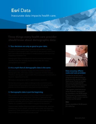
  • 1. Esri Data ® Inaccurate data impacts health care. Three things every health care provider should know about demographic data: 1. Your decisions are only as good as your data. This is true whether we’re talking about your patient data, financials, insurance, or demographic data. Projections of demographic shifts drive your critical decisions about where to locate, expand, or reduce services, impacting your bottom line. Demographic data is the bedrock for many projections and analyses, including those that integrate your proprietary data. But is your demographic data reliable? 2. It’s a myth that all demographic data is the same. The census occurs only every 10 years and is the primary source for Data accuracy affects demographic data, which data vendors incorporate into their releases. costs and care provided. Therefore, demographic data provided after a census year will all be about Consider the risk and costs of the same, regardless of vendor. using inaccurate data for planning distribution of flu vaccines. In Miami- What about demographic data for years that don’t end in 0? Dade County, Florida, for example, For the intervening years, data vendors generate projections based there are an estimated 502,000 on proprietary methodologies developed by their demographers and people in the target at-risk populace analysts. Accuracy depends on how projections are calculated. of young children and the elderly. If demographic projections are too low by 10 percent, vaccine would 3. Demographic data is just the beginning. be unavailable to over 50,000 people. Demographic data is a powerful first cut at key information about the If the population is overestimated by communities you serve. Used alone, it falls short of generating true 10 percent, over $1.4 million in vaccine understanding and insight. When combined with data about population inventory could be wasted. behaviors, attitudes, and critical health factors such as diabetes and Risks obesity, it’s a powerful tool for determining your future direction. Vaccine unavailable to 50,200 people Data providers, whether they source health and lifestyle data, generate $1.4 million loss it themselves, or a bit of both, overlay this data on their demographic projections. If their demographic projections are inaccurate, other data they provide to you will be less accurate as well. Continued on back
  • 2. Be smart about sourcing demographic data. Study confirms Esri data accuracy. You’ll have more confidence in your decisions if you’re using the most accurate data available. Your 5- and 10-year forecasts of need for specific services, for Esri instance, are based heavily on demographic projections generated by your data vendor. In essence, the accuracy of your critical business decisions depends on their expertise. Ask your data vendor these questions: • What methodology do you use for generating projections? • How do you assess and test your methodology? • Who generates the projections, and what are the experience and credentials of this team? • Can you prove the accuracy of your projections? Vendor 3 Proof that Esri® demographic data is the most accurate A blind study conducted by independent, credentialed demographers of the top five data vendors showed that Esri demographic projections were by far the most accurate. Demographers benchmarked each vendor’s 2010 projections against data released by the US Census Bureau following the 2010 Census. The study revealed how accurately each vendor projected key demographics 10 years out from the last census, in this case 10-year projections based on Census 2000 data. Esri Ranked First Geography Vendor 1 Esri Vendor 3 Vendor 4 Vendor 5 Total US 315.9 247.7 276.7 295.7 304.7 State 21.4 12.6 17.9 19.3 29.7 County 49.2 39.8 52.1 46.5 55.7 Accuracy of household data projections Census Tract 106.6 89.5 93.3 106 99.6 between Esri and vendor 3 varies greatly for the state of Michigan. Using data from Block Group 138.7 105.8 113.4 123.9 119.7 vendor 3 would introduce measurable inaccuracies into market analyses. The The lowest score indicates the highest accuracy. Accuracy was assessed for population and margin of error inherent in projections and households. Go to esri.com/accuracy to see the report. models would be reduced by using the more accurate Esri data. Using vendor 3 data to locate specific health services in Wisconsin’s north counties, where the data had a greater than 15 percent error rate, could be risky. Potentially, you could underserve the population or overbuild, resulting in serious financial consequences. See the report at esri.com/accuracy. Copyright © 2012 Esri. All rights reserved. Esri, the Esri globe logo, and esri.com are trademarks, service marks, or registered marks of Esri in the United States, the European Community, or certain other jurisdictions. Other companies and products or services mentioned herein may be trademarks, service marks, or registered marks of their respective mark owners. 130212 ESRI1M5/12ed