The document provides an overview of Big Bend National Park in Texas, describing key landforms and geological features along a proposed virtual field trip route. It begins with background on the park's tectonic history and formation. Stops covered include the Panther Junction Visitor Center, Cattail Falls, The Window, Blue Creek Canyon, Burro Mesa Pour-off, Santa Elena Canyon, and Boquillas Canyon. For each stop, it highlights prominent geological features and processes like waterfalls, faults, river terraces, and cave formation through limestone dissolution. Diagrams and photos illustrate concepts like hydraulic jumps, exfoliation, and fluvial landforms like meanders and point bars shaped by the Rio Grande
2. Table of Content/Featured Landforms
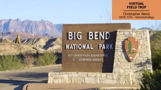
Big Bend National Park Teaser [3]
Big Bend National Park Introduction [4]
Park Texas Location Map [5]
Tectonic History & Geologic Map [6]
Field Trip Route Overview [7]
Formation of The Big Bend [8]
Panther Junction Visitor Center [9]
Cattail Falls [10-15]
The Window [16-20]
Blue Creek Canyon [21-24]
Burro Mesa Pour-Off [25-29]
Santa Elena Canyon [30-37]
Boquillas Canyon [38-44]
References [45]
3. Splendid Isolation, the Big Bend
“A place in Far West Texas where night skies are dark as coal and rivers carve
temple-like canyons in ancient limestone.” – nps.gov
(c) 2018 C. Alexis
4. BIG BEND NATIONAL PARK
INTRODUCTION
The Big Bend National Park is an American national park located in
southwest Texas, bordering Mexico. The park has national significance
as the largest protected area of Chihuahuan Desert topography and
ecology in the United States.[4]
Geological features in the park include sea fossils and dinosaur bones,
as well as volcanic dikes. The area has a rich cultural history,
from archeological sites dating back nearly 10,000 years to more
recent pioneers, ranchers, and miners.[4]
5. LOCATION
Big Bend National Park is an
American national
park located in southern
West Texas, bordering
Mexico.
Photo from NPS
6. TECTONIC HISTORY
The oldest recorded tectonic activity in the
park is related to the Paleozoic
Marathon orogeny. [4]
Between the Triassic and the Cretaceous,
the South American Plate rifted from the
North American Plate, resulting in the
deposition of the major formations at the
park such as the Glen Rose Limestone,
Santa Elena Limestone
and Boquillas formations.[4]
Following the ending of rifting in the Late
Cretaceous to the early Cenozoic, the Big
Bend area was subjected to the Laramide
orogeny. [4]
The most recent tectonic activity in the
park is basin and range faulting from
the Neogene to Quaternary. [4] Map from USGS
7. Route Overview
This Virtual Field Trip of Big Bend
National Park begins at the
Panther Junction Visitor Center
and visits the popular landforms
within the Chisos Mountains
along the Ross Maxwell Scenic
Drive. Then follow the Rio
Grande through the Santa Elena
and the Boquillas Canyons.
Photo from NPS
8. Formation of The Big
Bend
Mountain building by
compression, volcanism, and
tension formed the framework
for Big Bend National Park. [5]
Erosion also formed the Rio
Grande, making it the youngest
major river system in the United
States. [5]
Erosion in Big Bend is best
defined by rapid runoff and
flash-flooding.[5]
[12]
9. Panther Junction Visitor Center is
the best place to begin Big Bend
National Park visit.
It is located at park headquarters,
and they provide interactive
exhibits to provide an overview of
geology and natural and cultural
histories of the park.[3]
The visitor center also has a
theater, with a park orientation
movie shown.[3]
Panther Junction Visitor Center
Photo from NPS
10. CATTAIL FALLS
Cattail Falls is a beautiful,
hidden waterfall above an
enchanting series of pools,
in a wooded canyon on the
west side of the Chisos
Mountains.[13]
Google Earth, 2019
11. Cattail Falls
The Cattail Falls are the last
drop for water flowing down
Cattail Canyon. The cliffs
consist of the intrusive
igneous rocks of Ward
Mountain on the west side of
the Basin.[9]
[9]
12. Cascades at Cattail
Falls
The base of Cattail Falls features
plants such as ferns and a rare
orchid named yellow
columbine.[9]
Shown is the picture to the right
is a fern lined cascade at the
bottom of Cattail Falls.
A cascade is a small waterfall,
typically one of several that fall in
stages down a steep rocky
slope.[5]Cascade
[9]
13. Hydraulic Jump at
Cattail Falls
Another fluvial process featured
in the picture is a phenomenon
known as hydraulic jump.
Hydraulic jump is the jump or
standing wave formed when the
depth of flow of water changes
from supercritical to subcritical
state.[6]
Hydraulic Jump
[9]
14. Cattail Falls Creek
Cattail Falls Creek features
smooth, polished rocks formed
through the movement of
water with sediment such as
sand and silt constantly
rubbing against the rocks.[9]
[10]
15. Cattail Falls
The process of weathering
loosen rocks on the cliffs
above the base of Cattail
Falls, which they end up as
rock-fall blocks.[9]
The block in the picture has
served to preserve the
material upon which it fell,
the older landslide,
alluvial, colluvial deposits of
Quaternary age that
generally have been eroded
away at the base of the
falls.[9]
[10]
16. THE WINDOW
Near Cattail Falls within the
Oak Creek Canyon features
the Window pour-off which
frames panoramic desert
vistas.[13]
Google Earth, 2019
17. The Window Trail
The trail to The Window
through Oak Creek Canyon
is the most popular in the
Chisos Mountains and
possibly in the whole of Big
Bend National Park. [13]
(c) 2018 C. Alexis
18. The Window Trail
The Window trail features a
fluvial process called “base
flow” where groundwater
percolates out of the ground
and into the stream.[9]
This occurs where the
local water table is higher
than the stream bed.[9]
[10]
19. The Window
The Window is a narrow
passage which you can look
out over the Chihuahua desert
to the northwest from an
elevation of over 3000 feet
above the desert floor.[9]
It features the escape of
surface water out of the Basin.
(c) 2018 C. Alexis
20. The Window Bottom
Oak Creek erode materials
along its path and goes through
cycles of erosion and deposition
as the flow changes velocity and
direction over time.[9]
The picture shows what is most
likely colluvium due to evidence
of the lack of obvious bedding
planes and the mixture of many
sizes of clasts in the outcrop.[9]
[10]
21. BLUE CREEK CANYON
Blue Creek Canyon is on the
southwest side of the high
Chisos Mountains, accessed
from Homer Wilson ranch
just off Ross Maxwell Scenic
Drive.[13]
Google Earth, 2019
22. Blue Creek Canyon
Blue Creek forms one of the
larger drainages of the Chisos
Mountains in the center of Big
Bend National Park.[9]
[9]
23. Blue Creek Canyon
The image shows a weathering
process called exfoliation of a
massive tuff bed.
These are volcanic rocks were
deposited at or near the
surface of the Earth.[9]
Chemical changes have caused
the minerals at the surface of
the rock to swell, creating
stress that leads to the
exfoliation observed.[9]
[9]
24. Blue Creek Canyon
The picture shows evidence of a
major recent flooding event
where increasing evidences is
shown further up the canyon.
Flash floods through Blue Creek
had eroded steep sides into
the alluvium of the creek bed.[9]
This is an example of evidence
of erosional processes that
continue to reshape the Big
Bend region, where rare but
large events can have a
substantial impact.[9]
[9]
25. BURRO MESA POUR-
OFF
The Burro Mesa Pour-of is
halfway along the Ross
Maxwell Scenic Drive, the
access road is to the
southwest section of Big
Bend National Park.[3]
Google Earth, 2019
26. Burro Mesa Pour-off
The trail to the Burro Mesa Pour-
off is a short, easy hike to an
unusual canyon feature, in desert
terrain.[13]
It is well marked over sandy
ground and along a dry wash to
the base of an unclimbable dry
fall at the edge of sheer volcanic
cliffs.[13]
Photo from NPS
27. Burro Mesa Pour-off
Big Bend National Park is full of pour-
offs of various sizes.
They are intermittent waterfalls,
usually dry, and the higher ones can
be show-stoppers for hikers trailing up
a stream bed.[9]
The Burro Mesa Pour-off forms a box
canyon that stops you in your tracks
unlike others that require more
hiking.[9]
Photo from NPS
28. Burro Mesa Pour-off
The picture shows a cavity
below the Burro Mesa
Rhyolite, which as been
smooth and polished by
sediment carried over the
pour-off during the occasional
desert rainstorm.[9]
The cavity may have been
formed when the ground level
was at the base of the
rhyolite.[9]
Burro Mesa Rhyolite
(c) 2018 C. Alexis
29. Burro Mesa Pour-off
A plunge pool forms at the base of a waterfall
through the swirling of the water containing
sediment. This wears away the rock at the
base through a process called abrasion.[9]
Abrasion is the process of friction caused by
scuffing, scratching, wearing down, marring,
and rubbing away of materials. The intensity
of abrasion depends on
the hardness, concentration, velocity and ma
ss of the moving particles.[5]
This causes waterfalls to retreat upstream.
Photo from NPS
31. Santa Elena Canyon
The Santa Elena Canyon is visible
for over 10 miles away, as the Rio
Grande changes direction
abruptly after following beneath
the straight Sierra Ponce cliffs for
several miles and heads due
west, cutting through the
mountains via a deep, narrow
gorge. In places, the canyon walls
tower 1,500 ft (457 m) above the
river.[13](c) 2018 C. Alexis
32. Formation of The
Santa Elena Canyon
Between 60 and 130 million
years ago, sediments that
accumulated in a shallow
inland sea were laid down in
the area that now makes
up Big Bend.[1]
These sediments eventually
hardened into massive
limestone layers that over
millions of years were carved
by the Rio Grande, forming
Santa Elena Canyon.[1]
Photo from NPS
33. Fluvial Processes at
Santa Elena Canyon
The mouth of the canyon features
fluvial landforms formed by erosion
and deposition of the Rio Grande.
The bars labeled in the picture are
elevated regions sand and alluvium
that has been deposited by the Rio
Grande. The vegetated bar is a
much older and stable landform
than sand bar due its vegetation.
Bars reflect sediment supply
conditions and can show where
sediment supply rate is greater than
the transport capacity.(c) 2018 C. Alexis
Sand Bar
Vegetated Bar
Floodplain
34. Hydraulic Roughness
at Santa Elena Canyon
The picture also show elements of
hydraulic roughness.
Hydraulic roughness is the measure
of the amount of frictional
resistance water experiences when
passing over land
and channel features.[2]
Factors such as suspended load,
sediment grain size, presence
of bedrock or boulders in the
stream channel, and
overall sinuosity of the stream
channel can all affected flow
velocity.[2]
(c) 2018 C. Alexis
Vegetated Bar
Bank Vegetation
Irregularities in wetted
perimeter
Bend/Meander
35. River Terraces in Santa
Elena Area
Long-lived fluvial systems can
produce a series of terrace surfaces
over the course of their geologic
lifetime. Terraces can be formed in
many ways and in several geologic
and environmental settings.[13]
When rivers flood, sediment
deposits in sheets across
the floodplain and build up over
time.
(c) 2018 C. Alexis
Rio Grande Terraces
(c) 2018 C. Alexis
36. River Terraces in Santa
Elena Area
The labeled terraces, T1-T3, are
numbered based age of the river
deposits comprising the terraces:
youngest, older, and oldest,
respectively. T4 can be considered
the most recent floodplain.
The deposits consist largely of
gravel, sand, and silt, well-rounded
by the action of water. The tops of
these terraces correspond to
former flood plains of the river.[10]
(c) 2018 C. Alexis
T3
T2
T1
(c) 2018 C. Alexis
37. Fluvial Deposits
Oldest intermediate axial
river deposits of the Rio
Grande preserved in isolated
terrace 37 m above the Rio
Grande floodplain.[3]
Margaret E. Berry
38. Boquillas Canyon
Boquillas Canyon is the
easternmost of the 3 main
narrows sections along the
Rio Grande within Big Bend
National Park; it is about 20
miles long, starting just east
of Rio Grande Village.[3]
Google Earth, 2019
39. Boquillas Canyon
The mouth of Boquillas Canyon
passes through an overgrown
riparian area and ends at a
heavily pebbled beach beside
the Rio Grande.
Riparian zones are the areas
bordering rivers and other
bodies of surface water. They
include the floodplain as well
as the riparian buffers adjacent
to the floodplain.[9]
David Kosareff
40. Boquillas Canyon
The mouth of the canyon
features an obvious fault. The
fault shown in the picture is a
normal fault in which the
hanging wall moves down
relative to the foot wall.
There is several hundred feet
of displacement. The canyon
walls are approximately 1200
feet.[3]
(c) 2018 C. Alexis
Foot Wall
Hanging Wall
41. Boquillas Canyon
The Boquillas Canyon features
many fluvial geomorphology
through fluvial processes by the
Rio Grande.
The picture shows a meander in
the Rio Grande with a point
bar on left side and a cut bank
on the right side.
(c) 2018 C. Alexis
42. Boquillas Canyon
The meander produced by the
Rio Grande as it erodes the
sediments comprising an outer,
concave bank (cut bank) and
deposits this and other sediment
downstream on an inner, convex
bank which is known as a point
bar.[9]
MeanderPoint Bar
Cut Bank
(c) 2018 C. Alexis
43. Dissolution Features
The picture shows caves and other
dissolution features forming in the
Del Carmen Limestone, Boquillas
Canyon area.
Caves are formed by the dissolution
of limestone. Rainwater picks up
carbon dioxide from the air and as it
percolates through the soil, which
turns into a weak acid. This slowly
dissolves out the limestone along the
joints, bedding planes and fractures,
some of which become enlarged
enough to form caves.[8]
Kenzie J. Turner
44. Sand Dune at Boquillas
Canyon
The Boquillas Canyon also feature a
sand dune.
A dune is a mound of sand formed by
the wind, usually along the beach or
in a desert.[5]
This dune formed when wind blows
sand into the sheltered area in front
of the canyon wall. The dune is
approximately 300 feet tall.[12]
Sand Dune
People for scale(c) 2018 C. Alexis
45. References
1. A service of USRA. (n.d.). Retrieved from https://epod.usra.edu/blog/2014/09/santa-elena-canyon.html.
2. Fard, R., Heidarnejad, M., & Zohrabi, N. (2013). Study Factors Influencing the Hydraulic Roughness Coefficient of the
Karun River (Iran). International Journal of Farming and Allied Sciences.
3. National Park Service. (n.d.). Retrieved from https://www.nps.gov/rigr/planyourvisit/boq_cyn.htm.
4. Gray, J.E.; Page, W.R., eds. (October 2008). Geological, geochemical, and geophysical studies by the U.S. Geological Survey
in Big Bend National Park, Texas. Circular 1327. U.S. Geological Survey
5. Geology and Landforms. (n.d.). Retrieved from https://texasbigbend.weebly.com/geology-and-landforms.html.
6. Hydraulic Jump -Types and Characteristics of Hydraulic Jump. (2017, September 11). Retrieved from
https://theconstructor.org/water-resources/hydraulic-jump-types-characteristics/12091/.
7. How caves form. (n.d.). Retrieved from https://www.bgs.ac.uk/mendips/caveskarst/caveform.htm.
8. Riparian Zone. (n.d.). Retrieved from https://allaboutwatersheds.org/library/kyw-poster-files-and-links/riparian-zone.
9. Redfern, F. (n.d.). Retrieved from https://prism-redfern.org/bbvirtualtrip/cattail/cattail.html.
10. Neuendorf, K.K.E., J.P. Mehl, Jr., and J.A. Jackson, J.A., eds. (2005) Glossary of Geology (5th ed.). Alexandria, Virginia,
American Geological Institute. 779 pp
11. Running in Big Bend National Park. Best routes and places to run in Big Bend National Park. (2017, May 18). Retrieved
from https://greatruns.com/big-bend-national-park/.
12. Texas Park & Wildlife (n.d.). Big Bend Ranch State Park.
13. The American Southwest (n.d.). Big Bend Ranch State Park.
![Table of Content/Featured Landforms
Big Bend National Park Teaser [3]
Big Bend National Park Introduction [4]
Park Texas Location Map [5]
Tectonic History & Geologic Map [6]
Field Trip Route Overview [7]
Formation of The Big Bend [8]
Panther Junction Visitor Center [9]
Cattail Falls [10-15]
The Window [16-20]
Blue Creek Canyon [21-24]
Burro Mesa Pour-Off [25-29]
Santa Elena Canyon [30-37]
Boquillas Canyon [38-44]
References [45]](data:image/gif;base64,R0lGODlhAQABAIAAAAAAAP///yH5BAEAAAAALAAAAAABAAEAAAIBRAA7)