SlideShare a Scribd company logo
1 of 55
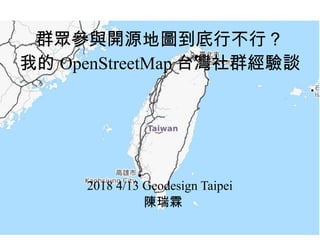
群眾參與開源地圖到底行不行?
我的 OpenStreetMap 台灣社群經驗談
2018 4/13 Geodesign Taipei
陳瑞霖
● OSM ID: Supaplex
●
日常工作:科技新報
●
維基人,台灣維基協會監事
●
台灣開放街圖社群組織理事 ( 冷凍中 )
●
臺北聚會主持人,翻譯計畫譯者
Dennis 陳瑞霖
排名第三
http://osm.kcwu.csie.org/stats/
公園大量增加
https://blog.openstreetmap.org/2018/04/01/niantic-openstreetmap-collaboration/
什麼是 OpenStreetMap
● OSM, osm.org
●
開放街圖
●
2004 成立
●
社群共編的網路地圖
●
維基百科版本的地圖
●
使用 OSM 的網站: Foursquare 、 Apple
Photo 、 Facebook 、實價登錄網站、台北市土壤潛勢地圖
OpenStreetMap 創辦人
●
英國人 Steve Coast
●
GIS 領域學生
●
當年 OS Geodata 太貴了
●
受到維基百科影響,決
定創辦類似的地圖計
畫,讓所有人都能貢獻
資料格式
●
Node :實際帶有經緯度資訊的部分
●
Way :可能是線段或構成封閉區域
●
Relation :多個線段或點的集合,可構成
公車路線、行政邊界
資料格式 -XML
一份資料,可以多種地圖樣式呈現
交通運輸
3D 建築
高壓電線與電塔
今古地圖對照 - 倫敦霍亂爆發
Snow 霍亂點子圖 Vs WikiminiAtalas (OSM-based map)
第三方使用
第三方使用
第三方使用
編輯畫面、背景影像
https://www.openstreetmap.org/#map=18/25.03966/121.53962
GPS 軌跡
編輯歷史記錄
錯誤偵測工具 -OSMInspector
https://tools.geofabrik.de/osmi/
錯誤偵測工具 -Osmose
http://osmose.openstreetmap.fr/en/map/
救災大顯身手
2012 - 海地地震繪圖行動
https://twitter.com/billgates/status/595461719897538561
在臺灣防災資源多,就不大有
OpenStreetMap 發揮的地方
在 GIS 軟體處理
資料授權
●
與維基百科類似
●
地圖資料授權: ODBL 開放資料庫授權
●
OSM-carto 圖磚授權: CC-BY-SA 3.0
臺灣狀況
●
好幾種資料評估標準
●
基本道路網
●
水系
●
公共設施:鐵路、捷運
●
行政單位
●
POI :商家
●
導航
有些商圈店家標了不少
有些地方只有基本的道路網
鐵路和捷運路網
登山圖資 - 魯地圖
https://www.facebook.com/photo.php?fbid=10154544537337138&set=gm.676811479141135&type=3&theat
http://sea.tokyo.idv.tw/?p=3004
●
OpenStreetMap+ 內
政部 DEM 資料
●
活躍的登山社群編
輯登山步道
最近煩惱的事情
●
Pokemon Go 玩家
● Facebook
OpenStreetMap 與 Pokemon Go
在植物園打不到超夢的玩家
Facebook!
2015 年臉書開始用 OSM
臉書來的回報 ( 抱怨 )
https://www.flickr.com/photos/dongpo/19138103974
https://twitter.com/mappingmashups/status/756996185437511681
Credit: Facebook
臉書之亂
●
抱怨店家沒標示
●
附近巷弄不齊
●
不知道臉書改用
OpenStreetMap
●
這例子從 2015 年講
到現在
https://twitter.com/mappingmashups/status/756996185437511681
Credit: Facebook
Mark Zuckerburg - AI 畫地圖影片
https://www.facebook.com/zuck/posts/10102695816334251
App
臉書社團 - OpenStreetMap 台灣
https://www.facebook.com/groups/Ope
nStreetMap.TW/
https://www.facebook.com/photo.php?
fbid=10154622972912915&set=g.468945293170945&type=1&theater
臺北月聚
@ 摩茲工寮 , 5/7 19:30
COSCUP 徵稿宣傳、工作人員招募
COSCUP Open Geo
● OpenStreetMap
● GIS
●
資料視覺化
●
型式可以是演講或是工作坊
●
OSGeo Live USB 解決操作演示環境
OSGeo Live
OSGeo Live 的開源地
理軟體
https://live.osgeo.org/en/overview/overview.html
謝謝指教
● b92612009@gmail.com
●
Facebook: 陳瑞霖
● Twitter: dennisc140

More Related Content

What's hot

AtCoder Regular Contest 030 解説
AtCoder Regular Contest 030 解説AtCoder Regular Contest 030 解説
AtCoder Regular Contest 030 解説AtCoder Inc.
 
Lecture_16_Self-supervised_Learning.pptx
Lecture_16_Self-supervised_Learning.pptxLecture_16_Self-supervised_Learning.pptx
Lecture_16_Self-supervised_Learning.pptxKarimdabbabi
 
密碼學漏洞與他們的產地 Crypto fail and where to find them
密碼學漏洞與他們的產地   Crypto fail and where to find them密碼學漏洞與他們的產地   Crypto fail and where to find them
密碼學漏洞與他們的產地 Crypto fail and where to find themJohn L Chen
 
Control your service resources with systemd
 Control your service resources with systemd  Control your service resources with systemd
Control your service resources with systemd Marian Marinov
 
平面グラフと交通ネットワークのアルゴリズム
平面グラフと交通ネットワークのアルゴリズム平面グラフと交通ネットワークのアルゴリズム
平面グラフと交通ネットワークのアルゴリズムTakuya Akiba
 
RedisConf17 - Geofencing using Redis Geospatial Queries
RedisConf17 - Geofencing using Redis Geospatial QueriesRedisConf17 - Geofencing using Redis Geospatial Queries
RedisConf17 - Geofencing using Redis Geospatial QueriesRedis Labs
 

What's hot (8)

AtCoder Regular Contest 030 解説
AtCoder Regular Contest 030 解説AtCoder Regular Contest 030 解説
AtCoder Regular Contest 030 解説
 
Lecture_16_Self-supervised_Learning.pptx
Lecture_16_Self-supervised_Learning.pptxLecture_16_Self-supervised_Learning.pptx
Lecture_16_Self-supervised_Learning.pptx
 
Convex Hull Trick
Convex Hull TrickConvex Hull Trick
Convex Hull Trick
 
密碼學漏洞與他們的產地 Crypto fail and where to find them
密碼學漏洞與他們的產地   Crypto fail and where to find them密碼學漏洞與他們的產地   Crypto fail and where to find them
密碼學漏洞與他們的產地 Crypto fail and where to find them
 
Control your service resources with systemd
 Control your service resources with systemd  Control your service resources with systemd
Control your service resources with systemd
 
AlphaGo and AlphaGo Zero
AlphaGo and AlphaGo ZeroAlphaGo and AlphaGo Zero
AlphaGo and AlphaGo Zero
 
平面グラフと交通ネットワークのアルゴリズム
平面グラフと交通ネットワークのアルゴリズム平面グラフと交通ネットワークのアルゴリズム
平面グラフと交通ネットワークのアルゴリズム
 
RedisConf17 - Geofencing using Redis Geospatial Queries
RedisConf17 - Geofencing using Redis Geospatial QueriesRedisConf17 - Geofencing using Redis Geospatial Queries
RedisConf17 - Geofencing using Redis Geospatial Queries
 

Similar to 群眾參與開源地圖到底行不行?我的OSM台灣社群經驗談

飲水松-開放街圖簡介 drinking water map and openstreetmap
飲水松-開放街圖簡介 drinking water map and openstreetmap飲水松-開放街圖簡介 drinking water map and openstreetmap
飲水松-開放街圖簡介 drinking water map and openstreetmapDennis Raylin Chen
 
OpenStreetMap Introduce / 介紹
OpenStreetMap Introduce / 介紹OpenStreetMap Introduce / 介紹
OpenStreetMap Introduce / 介紹Shi-Xun Hong
 
2016 公訓演講開放街圖-開放街圖與災害應用
2016 公訓演講開放街圖-開放街圖與災害應用2016 公訓演講開放街圖-開放街圖與災害應用
2016 公訓演講開放街圖-開放街圖與災害應用Dennis Raylin Chen
 
Open streetmap open data day 2020
Open streetmap open data day 2020Open streetmap open data day 2020
Open streetmap open data day 2020Dennis Raylin Chen
 
守護宜蘭工作坊Osm簡介
守護宜蘭工作坊Osm簡介守護宜蘭工作坊Osm簡介
守護宜蘭工作坊Osm簡介Dennis Raylin Chen
 
OpenStreetMap 簡介
OpenStreetMap 簡介OpenStreetMap 簡介
OpenStreetMap 簡介Jeff Huang
 
Openstreetmap Introduce
Openstreetmap IntroduceOpenstreetmap Introduce
Openstreetmap IntroduceShi-Xun Hong
 
Open data day 2013 Taipei - OpenStreetMap工作坊
Open data day 2013 Taipei - OpenStreetMap工作坊Open data day 2013 Taipei - OpenStreetMap工作坊
Open data day 2013 Taipei - OpenStreetMap工作坊Dennis Raylin Chen
 
OpensStreetMap Workshop
OpensStreetMap WorkshopOpensStreetMap Workshop
OpensStreetMap WorkshopShi-Xun Hong
 
想要怎麼用就怎麼用Openstreetmaps開放街圖
想要怎麼用就怎麼用Openstreetmaps開放街圖想要怎麼用就怎麼用Openstreetmaps開放街圖
想要怎麼用就怎麼用Openstreetmaps開放街圖VintageJhan
 
研考會20131007 開放內容與開放資料
研考會20131007 開放內容與開放資料研考會20131007 開放內容與開放資料
研考會20131007 開放內容與開放資料Dennis Raylin Chen
 
loadingthon 陳瑞霖 〈開放街圖的實踐〉
loadingthon 陳瑞霖 〈開放街圖的實踐〉loadingthon 陳瑞霖 〈開放街圖的實踐〉
loadingthon 陳瑞霖 〈開放街圖的實踐〉Sun Quan Huang
 
開放街圖的實踐
開放街圖的實踐開放街圖的實踐
開放街圖的實踐瑞霖 陳
 
奇岩Osm 探查方法和注意事項
奇岩Osm 探查方法和注意事項奇岩Osm 探查方法和注意事項
奇岩Osm 探查方法和注意事項Dennis Raylin Chen
 
Openstreetmap 介紹
Openstreetmap 介紹Openstreetmap 介紹
Openstreetmap 介紹Shi-Xun Hong
 
想要怎麼用就怎麼用Openstreetmaps
想要怎麼用就怎麼用Openstreetmaps想要怎麼用就怎麼用Openstreetmaps
想要怎麼用就怎麼用OpenstreetmapsDennis Raylin Chen
 
開放街圖社群經營的不等式
開放街圖社群經營的不等式開放街圖社群經營的不等式
開放街圖社群經營的不等式Dongpo Deng
 
OpenStreetMap簡介與GIS應用
OpenStreetMap簡介與GIS應用OpenStreetMap簡介與GIS應用
OpenStreetMap簡介與GIS應用Dennis Raylin Chen
 

Similar to 群眾參與開源地圖到底行不行?我的OSM台灣社群經驗談 (20)

飲水松-開放街圖簡介 drinking water map and openstreetmap
飲水松-開放街圖簡介 drinking water map and openstreetmap飲水松-開放街圖簡介 drinking water map and openstreetmap
飲水松-開放街圖簡介 drinking water map and openstreetmap
 
OpenStreetMap Introduce / 介紹
OpenStreetMap Introduce / 介紹OpenStreetMap Introduce / 介紹
OpenStreetMap Introduce / 介紹
 
2016 公訓演講開放街圖-開放街圖與災害應用
2016 公訓演講開放街圖-開放街圖與災害應用2016 公訓演講開放街圖-開放街圖與災害應用
2016 公訓演講開放街圖-開放街圖與災害應用
 
Open streetmap open data day 2020
Open streetmap open data day 2020Open streetmap open data day 2020
Open streetmap open data day 2020
 
守護宜蘭工作坊Osm簡介
守護宜蘭工作坊Osm簡介守護宜蘭工作坊Osm簡介
守護宜蘭工作坊Osm簡介
 
災難繪圖與OpenStreetMap
災難繪圖與OpenStreetMap災難繪圖與OpenStreetMap
災難繪圖與OpenStreetMap
 
開放街圖與災害應用
開放街圖與災害應用開放街圖與災害應用
開放街圖與災害應用
 
OpenStreetMap 簡介
OpenStreetMap 簡介OpenStreetMap 簡介
OpenStreetMap 簡介
 
Openstreetmap Introduce
Openstreetmap IntroduceOpenstreetmap Introduce
Openstreetmap Introduce
 
Open data day 2013 Taipei - OpenStreetMap工作坊
Open data day 2013 Taipei - OpenStreetMap工作坊Open data day 2013 Taipei - OpenStreetMap工作坊
Open data day 2013 Taipei - OpenStreetMap工作坊
 
OpensStreetMap Workshop
OpensStreetMap WorkshopOpensStreetMap Workshop
OpensStreetMap Workshop
 
想要怎麼用就怎麼用Openstreetmaps開放街圖
想要怎麼用就怎麼用Openstreetmaps開放街圖想要怎麼用就怎麼用Openstreetmaps開放街圖
想要怎麼用就怎麼用Openstreetmaps開放街圖
 
研考會20131007 開放內容與開放資料
研考會20131007 開放內容與開放資料研考會20131007 開放內容與開放資料
研考會20131007 開放內容與開放資料
 
loadingthon 陳瑞霖 〈開放街圖的實踐〉
loadingthon 陳瑞霖 〈開放街圖的實踐〉loadingthon 陳瑞霖 〈開放街圖的實踐〉
loadingthon 陳瑞霖 〈開放街圖的實踐〉
 
開放街圖的實踐
開放街圖的實踐開放街圖的實踐
開放街圖的實踐
 
奇岩Osm 探查方法和注意事項
奇岩Osm 探查方法和注意事項奇岩Osm 探查方法和注意事項
奇岩Osm 探查方法和注意事項
 
Openstreetmap 介紹
Openstreetmap 介紹Openstreetmap 介紹
Openstreetmap 介紹
 
想要怎麼用就怎麼用Openstreetmaps
想要怎麼用就怎麼用Openstreetmaps想要怎麼用就怎麼用Openstreetmaps
想要怎麼用就怎麼用Openstreetmaps
 
開放街圖社群經營的不等式
開放街圖社群經營的不等式開放街圖社群經營的不等式
開放街圖社群經營的不等式
 
OpenStreetMap簡介與GIS應用
OpenStreetMap簡介與GIS應用OpenStreetMap簡介與GIS應用
OpenStreetMap簡介與GIS應用
 

More from Dennis Raylin Chen

Wikidata introduction-20201205 Final
Wikidata introduction-20201205 FinalWikidata introduction-20201205 Final
Wikidata introduction-20201205 FinalDennis Raylin Chen
 
Wikidata introduction on g0v Summit 2020 V2
Wikidata introduction on g0v Summit 2020 V2Wikidata introduction on g0v Summit 2020 V2
Wikidata introduction on g0v Summit 2020 V2Dennis Raylin Chen
 
Wikidata introduction on g0v Summit 2020
Wikidata introduction on g0v Summit 2020Wikidata introduction on g0v Summit 2020
Wikidata introduction on g0v Summit 2020Dennis Raylin Chen
 
Taigu coscup-open streetmap-multilanguage
Taigu coscup-open streetmap-multilanguageTaigu coscup-open streetmap-multilanguage
Taigu coscup-open streetmap-multilanguageDennis Raylin Chen
 
Wikidata、 Wiki Commons的藝術人文應用簡介
Wikidata、 Wiki Commons的藝術人文應用簡介Wikidata、 Wiki Commons的藝術人文應用簡介
Wikidata、 Wiki Commons的藝術人文應用簡介Dennis Raylin Chen
 
Pokemon go use of open streetmap state of the map asia 2018
Pokemon go use of open streetmap state of the map asia 2018Pokemon go use of open streetmap state of the map asia 2018
Pokemon go use of open streetmap state of the map asia 2018Dennis Raylin Chen
 
The progress and challenge of OpenStreetMap in East Asia
The progress and challenge of OpenStreetMap in East AsiaThe progress and challenge of OpenStreetMap in East Asia
The progress and challenge of OpenStreetMap in East AsiaDennis Raylin Chen
 
My Experience of OpenStreetMap Taiwan
My Experience of OpenStreetMap TaiwanMy Experience of OpenStreetMap Taiwan
My Experience of OpenStreetMap TaiwanDennis Raylin Chen
 
Osm繪圖技巧與圖資整合應用
Osm繪圖技巧與圖資整合應用Osm繪圖技巧與圖資整合應用
Osm繪圖技巧與圖資整合應用Dennis Raylin Chen
 
知了新聞 GIS X OpenStreetMap
知了新聞 GIS X OpenStreetMap知了新聞 GIS X OpenStreetMap
知了新聞 GIS X OpenStreetMapDennis Raylin Chen
 
Progress and Challenges of OpenStreetMap Taiwan
Progress and Challenges of OpenStreetMap TaiwanProgress and Challenges of OpenStreetMap Taiwan
Progress and Challenges of OpenStreetMap TaiwanDennis Raylin Chen
 
如何確保圖資即時且正確
如何確保圖資即時且正確如何確保圖資即時且正確
如何確保圖資即時且正確Dennis Raylin Chen
 
G0v summit-open-content-and-open-government
G0v summit-open-content-and-open-governmentG0v summit-open-content-and-open-government
G0v summit-open-content-and-open-governmentDennis Raylin Chen
 
如何貢獻維基百科 台北大學
如何貢獻維基百科 台北大學如何貢獻維基百科 台北大學
如何貢獻維基百科 台北大學Dennis Raylin Chen
 
均優2014 校園推廣課程-台大校園文化資產詮釋
均優2014 校園推廣課程-台大校園文化資產詮釋均優2014 校園推廣課程-台大校園文化資產詮釋
均優2014 校園推廣課程-台大校園文化資產詮釋Dennis Raylin Chen
 

More from Dennis Raylin Chen (20)

Wikidata introduction-20201205 Final
Wikidata introduction-20201205 FinalWikidata introduction-20201205 Final
Wikidata introduction-20201205 Final
 
Wikidata introduction on g0v Summit 2020 V2
Wikidata introduction on g0v Summit 2020 V2Wikidata introduction on g0v Summit 2020 V2
Wikidata introduction on g0v Summit 2020 V2
 
Wikidata introduction on g0v Summit 2020
Wikidata introduction on g0v Summit 2020Wikidata introduction on g0v Summit 2020
Wikidata introduction on g0v Summit 2020
 
Pydata taipei-20200921
Pydata taipei-20200921Pydata taipei-20200921
Pydata taipei-20200921
 
Taigu coscup-open streetmap-multilanguage
Taigu coscup-open streetmap-multilanguageTaigu coscup-open streetmap-multilanguage
Taigu coscup-open streetmap-multilanguage
 
Wikidata、 Wiki Commons的藝術人文應用簡介
Wikidata、 Wiki Commons的藝術人文應用簡介Wikidata、 Wiki Commons的藝術人文應用簡介
Wikidata、 Wiki Commons的藝術人文應用簡介
 
Pokemon go use of open streetmap state of the map asia 2018
Pokemon go use of open streetmap state of the map asia 2018Pokemon go use of open streetmap state of the map asia 2018
Pokemon go use of open streetmap state of the map asia 2018
 
Wikidata query
Wikidata queryWikidata query
Wikidata query
 
The progress and challenge of OpenStreetMap in East Asia
The progress and challenge of OpenStreetMap in East AsiaThe progress and challenge of OpenStreetMap in East Asia
The progress and challenge of OpenStreetMap in East Asia
 
My Experience of OpenStreetMap Taiwan
My Experience of OpenStreetMap TaiwanMy Experience of OpenStreetMap Taiwan
My Experience of OpenStreetMap Taiwan
 
Osm繪圖技巧與圖資整合應用
Osm繪圖技巧與圖資整合應用Osm繪圖技巧與圖資整合應用
Osm繪圖技巧與圖資整合應用
 
知了新聞 GIS X OpenStreetMap
知了新聞 GIS X OpenStreetMap知了新聞 GIS X OpenStreetMap
知了新聞 GIS X OpenStreetMap
 
Progress and Challenges of OpenStreetMap Taiwan
Progress and Challenges of OpenStreetMap TaiwanProgress and Challenges of OpenStreetMap Taiwan
Progress and Challenges of OpenStreetMap Taiwan
 
如何確保圖資即時且正確
如何確保圖資即時且正確如何確保圖資即時且正確
如何確保圖資即時且正確
 
G0v summit-open-content-and-open-government
G0v summit-open-content-and-open-governmentG0v summit-open-content-and-open-government
G0v summit-open-content-and-open-government
 
如何貢獻維基百科 台北大學
如何貢獻維基百科 台北大學如何貢獻維基百科 台北大學
如何貢獻維基百科 台北大學
 
均優2014 校園推廣課程-台大校園文化資產詮釋
均優2014 校園推廣課程-台大校園文化資產詮釋均優2014 校園推廣課程-台大校園文化資產詮釋
均優2014 校園推廣課程-台大校園文化資產詮釋
 
如何貢獻維基百科
如何貢獻維基百科如何貢獻維基百科
如何貢獻維基百科
 
災害地圖操作指引
災害地圖操作指引災害地圖操作指引
災害地圖操作指引
 
Wiki語法教學
Wiki語法教學Wiki語法教學
Wiki語法教學
 

群眾參與開源地圖到底行不行?我的OSM台灣社群經驗談

Editor's Notes

  1. Let's watch a video of crisis mapping. An area that OpenStreetMap has huge advantage. The video shows after the Haiti Earthquake, mappers around the world using satellite image to trace roads and building in Haiti capital.
  2. A recent example is Nepal Earthquake action, even Bill Gates praise citizen around the world for mapping the effected area.