Progress and Challenges of OpenStreetMap Taiwan
•Download as ODP, PDF•
1 like•448 views

In this slide I'll talk about how things going on Taiwan. What progress and big news is coming, and the difficulties that the community in Taiwan has to face and solve. OpenStreetMap is already used heavily in the bus and rail community. Now the hiking community in Taiwan is not only using the map for offline navigation when there's no network available, they also even add the trail missing.

Recommended
More Related Content
More from Dennis Raylin Chen
More from Dennis Raylin Chen (20)
Recently uploaded
Recently uploaded (20)
Progress and Challenges of OpenStreetMap Taiwan
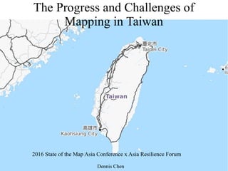
- 1. The Progress and Challenges of Mapping in Taiwan 2016 State of the Map Asia Conference x Asia Resilience Forum Dennis Chen
- 2. ● OSM ID: Supaplex ● Work in Tech media in Taiwan ● Wikipedian, Supervisor of Wikimedia ● Board member of OpenStreetMap Taiwan Organization ● Taipei Meetup host, translator of OSM related project Dennis
- 4. Advantage Power Tower useasreferecewhen hiking • Power line in Northern Taiwan Openstreetmap Taiwan Supaplex 7
- 5. Hiking Map data ● Already using OpenStreetMap ● Some hikers also adding trail to OpenStreetmap ● Combining the DTM data from the government, the map rending is more useful for climbing mountain
- 6. Activities in Taiwan ● Taipei Meetup ● Kaohsiung Wikimedia X OpenStreetMap ● State of the Map Taiwan
- 7. 社群活動
- 8. Facebook use of OpenStreetMap Credit: Facebook, OpenStreetMap
- 10. Facebook test of OSM ● The Facebook people mention they use OSM map data for Checkin in Japan and South Korea ● Actually the also tested in Taiwan, China and North Vietnam ● A disaster for OSM Taiwan Community
- 12. They pointed the complain directly by the note, so the language is not very polite (maybe not aware it is public)
- 13. Challenges of Localization ● Different Chinese character (Traditonal/Simplified Chinese) ● How to tag temple in Taiwan: there's many deities outside the Christian World
- 14. Different Chinese Characters ● 正體 / 简体 ● Traditonal Chinese / Simplified Chinese ● China and Taiwan use different set of Chinese characters ● Some terms (place name) are totally different ● Name:zh is not enough
- 16. Name tag use in Taiwan (proposed) https://docs.google.com/spreadsheets/d/1d0ahZTEuu9B8Ud7CJOFYi5fBSoI_s1iOo8QZoKkrA5E/edit#gid= 0
- 17. Name tag use in Taiwan (proposed)
- 18. Taiwan folklore religion ● There are some deities from Taoism and Buddhism ● But these temple are neither Taoism or Buddhism ● And there are more than one deities By Suzuki1314 at Chinese Wikipedia (Own work) [Public domain], via Wikimedia Commons
- 19. ●Polytheism and apotheosis of historical figures
- 20. The way to tag deities and religious (proposed) Tsihua Temple Queen Mother of the West Tiandiism
- 21. Work with Mapbox
- 23. Situation in Taiwan ● Increase aware of OpenStreetmap ● More use cases, mostly in hiking community ● Some government use case, sometimes aware of the military landuse on OSM
- 24. Thank You
Editor's Notes
- Hi everyone. I'm Dennis from Taiwan. Today I'm talking about the challenges and progress the OpenStreetMap Taiwan community is facing.
- Here is my profile. I'm also a Wikipedian. Host of Taipei meetup, and sometimes translating OpenStreetMap material or software.
- I think public transport data is most complicated data to map. So here is the route network of Taipe, to give you the idea of how the mapping in Taiwan is done. All the subway line is mapped and some route are added.
- Another example from hiking usage. The power line and tower is well mapped in Taiwan. The hiker use power tower and line to recognize where is he. Compare to another commercial maps have few data, OSM is very usefull.
- The hiking community engage more deepl yin OpenStreetMap project. Not only render hiking map, but also add missing trail.
- There are more community activities in Taiwan. Not only the big State of the Map Taiwan, but for the meetup in Two cities every month. Kaohsiung meetup is co hosed with Wikimedia community
- Here's the photo of the community activities. The Taipei Meetup, and this is the meetup during the Taiwan largest open source conference COSCUP, and the booth on COSCUP.
- Someone already knows Facebook use OpenStreetMap.
- The Facebook guys report how they use AI to recognize road feature on satellite image during the State uf the Map US. It's quite impress to see the progress.
- However, Facebook use OSM on checkin page, note only in Japan and South Korea, they test on Taiwan, China, and North Vietnam. For the community in Taiwan, Facebook act is a disaster
- Screensho I took last year when Facebook is testing on checkin page.
- The OpenStreetMap road network is not totally complete in Taiwan. Someone complain but doesn't not the complain send to OSM note. Not aware of what OSM is, the language is not polite and probability not aware it is public.
- For the community in Taiwan,the challenges of localization is the word and religion: different Chinese character use in different place, and totally different religious system in Taiwan
- First talk about the characters. Theres are twoo different type of characters: Traditional and Simplified Chinese, one is use in Taiwan, the other use in China. And make things worst is some terms (place name) is different. The name zh tag is not enough to distinguish.
- Here is an example. Despite Taiwan, Hong Kong and Macao use Traditional Chinese, and China use Simplified Chinese
- Despite the different character set, some terms are different. There are different names for Mt. Elveres, the one use in Taiwan, the another use in China.t
- So we have a proposed to solve the problem, distinguishing the difference between Traditional Chinese and Simplified Chinese.
- We also include the Formosa Austronesian language use in Taiwan.
- The temple in Taiwan is hard to define it below to Taoism or Buddhism. We could easy find one taoism deity in a Buddhism temple, and one Buddhism deity in Taoism temple . We usually find one more deities in a temple.
- There are many Historical figures is apotheosis and has its own temple, like the famous “行天宮”in Taipei.
- We have another propose to define the complex and totally different religion in Taiwan.
- There is a big news for OSM Tawain Community .A task led by mapbox to aligning road network according to Mapbox new Satellite image and Strava GPS trace. It is going on for awhiel . I hope it will finish soon.