COMIT Dec 2016 - Automated Drone Reality Project
•
1 like•284 views

Presentation on the Automated Drone Reality Project by Stuart Young & Futureaerial at the Winter Community Day, 1st December 2016. Held at High Wycombe & hosted by IFS.

Recommended
Recommended
More Related Content
What's hot
What's hot (20)
Similar to COMIT Dec 2016 - Automated Drone Reality Project
Similar to COMIT Dec 2016 - Automated Drone Reality Project (20)
More from Comit Projects Ltd
More from Comit Projects Ltd (20)
Recently uploaded
Recently uploaded (20)
COMIT Dec 2016 - Automated Drone Reality Project
- 1. Automated Drone Reality project
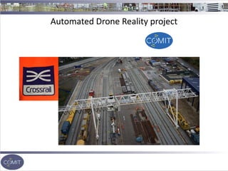
- 2. Automated Drone Reality project Project overview Proof of concept for the first phase of the Automated Drone Reality project to ensure that all the different parts of the solution would work Where Plumstead Crossrail site SE London Who Future Aerial, Costain, Bentley ,Crossrail
- 3. Automated Drone Reality project System wide Induction - Confirmation of CSCS cards - Crossrail induction, best practice for railway operations - D&A Testing by Occupational Health Nurse - Track Safety Awareness Course - Security pass issuing
- 4. The UK UAS regulation is governed by the CAA and navigating the regulations and safety planning makes up a large part of any UAS project. RAMS (Risk Assessment and Method Statements) Airspace management Working with local Authorities Use of the latest industrial grade equipment Automated Drone Reality project
- 5. As you can see, the site is bounded by the railway to the south, HMP Belmarsh to the north and is within 1km of the flight path for London City Airport. FAI cleared our flights with London city ATC and kept mobile phone communication with them throughout the day. Automated Drone Reality project
- 6. Automated Drone Reality project
- 7. Automated Drone Reality project - Ascending Technologies Falcon 8 Trinity - Industrial grade UAV - Triple redundant flight controller - 8 x rotors - Dual receiver/transiever “The Plumstead site was a difficult environment to work. Surrounded by potential hazards, flying needed to be controlled and planned. The site is not only in Central London, but is surrounded by busy infrastructure, including A roads, railway line and London City Airport. All had to be factored into the flight plan and Risk Assessments. The site itself was a live construction site and the upmost care is taken during flights to ensure no one’s safety is compromised, or indeed flying too close to machinery.”
- 8. Automated Drone Reality project Using a predefined flight path with image overlap of 60% lateral and 70% longitudinal. The UAV follows a path using GPS and each image is Geo-tagged at the trigger points.
- 9. Automated Drone Reality project
- 11. Automated Drone Reality project Drone in a box - What are the problems that the construction industry faces, where is there a lack of data - What data do they need? - What’s going to be the best sensor/aircraft combination to collect the data? - How will the data be processed? - Will that tool or process be able to be integrated into things like record keeping, maintenance, reporting requirements and staff training? - What are the health safety issues on site?
- 12. Automated Drone Reality project Possible payloads for UAV platforms - Imaging - NIR Near infra-red - Multispectral - Thermal - Lidar - 360 degree video - VR/AR - Air quality monitoring
- 13. Automated Drone Reality project Breakout workshop Risk and hazards management /health safety Using a map and 3D image, how can this data be used Give a few examples Data Analytics What are the potential uses of the data? How much they use it? Snagging? Tracking items Counting Bollards How often is data needed? Environmental Compliance Oil spill or something- drone comes and maps it etc. How often is data needed? Security What issues do site currently face? Is there a theft of materials issue? How often is data needed? Logistics and planning Planning of people of site and materials on site How often is data needed? (Please refer to print out)