2. 00 Table of Contents
2
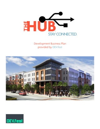
01 EXECUTIVE SUMMARY
What is “the hub?”
Why create the hub?
Wanna invest?
Site Plan
02 PROPERTY DESCRIPTION
Location
Project Objectives
Project Amenities
Urban Lifestyle
Proposed Uses
Current Zoning
03 DEAL ECONOMICS
Construction Budget
Combined 10-Year Cash Flow
Multi-Family Economics
04 FEASIBILITY STUDY
Population Growth Estimates in Davis County
The Greater Wasatch Vision for 2040
Professional Perspectives
Financing
Parking Philosophy
Davis County Economic Outlook
Multi-Family Feasibility
Retail Feasibility
Office Feasibility
05 EXHIBITS
3
5
8
10
14
3. 01 Executive Summary
WHAT IS “THE HUB?”
“The HUB,” a mixed-use transit-oriented development, is the community of choice
connecting you to your network. It is located adjacent to Layton City’s new transportation hub
- where I-15, Layton Parkway, and Frontrunner converge (a.k.a. the center of the universe). The
HUB’s proximity to Layton’s historic downtown and the future IHC community hospital, along
with its quick access to the Wasatch Front, makes The HUB a very attractive development. These
connections create the opportunity of a walkable master planned mixed-use development. The
HUB creates an urban center for residents and neighbors through open space, recreation, and a
vibrant mix of retail and commercial services.
WHY CREATE THE HUB?
Atrifectaofshadowanchorsexistsaroundoursitewhichhascreatedaprimedevelopment
opportunity.
WANNA INVEST?
The Hub is a rewarding development whose location will dictate high quality tenants and
healthy profits for years to come. Dev.Fest is excited to deliver an exciting mixed-use, transit-
oriented development. Stay connected.
• Unlevered IRR of 7.67%
• Levered IRR of 15.02%
• 10% Equity Partner needed for $3.16M
• 83% Debt Financing
• Stabilized NOI of $2.16M
3
• Community Hospital
• Destination location
• Activity generator
• Mutual development
benefit
• Already Zoned MU-TOD
• Fulfills Layton City’s TOD
vision
• Efficient tax base created by
greater density
• Need land for FrontRunner
patron parking
• MU-TOD creates higher
ridership
• Increases traffic counts to
TOD
THE
HUBSTAYCONNECTED
TM
R
5. 02 Property Description
LOCATION
The HUB is a 20-acre mixed-use,
transit-oriented development in Layton,
Utah. The site is located within Layton
City’s Downtown Plan and is described
as the “West Field Area.” The site is west
of the Layton FrontRunner station, south
of Kay’s Creek, and bordered on the west
by an existing neighborhood. The current
owner is IHC Health Services Inc. c/o
James F. Wood. Our development plan is
focused on this MU-TOD 20 acre parcel.
PROJECT OBJECTIVES
1. Create a sense of community
2. Provide convenient access to transportation
3. Improve quality of life with health services and active lifestyle amenities
4. Provide a return to our investors
PROJECT AMENITIES
• Live/work/shop amenities
• Open space
• Utopia Fiber Optic Internet Connection
• Community Hospital
• Close proximity to transportation
corridors
• Kay’s Creek Trail and regional trail system
• Close proximity to the freeway
• FrontRunner access and parking
• Close to Layton’s up and coming
downtown
The project has a healthy mix of
residential, retail, office, and recreational uses.
In addition to the internal project amenities,
there are several neighborhood parks, local
and regional trails, and public transit that add
value to the development. Layton City plans
to add a trail along Kay’s Creek and construct
5
1/4 MILE RADIUS
5-MINUTE WALK
1/2 MILE RADIUS
10-MINUTE WALK
FUTURE
GROCERY
STORE
ELEMENTARY
SCHOOL
FUTURE
COMMUNITY
HOSPITAL
DEVELOPMENT SITE:
ZONED: MU-TOD
FRONTRUNNER
STATION
!H
!H
!H
!H
!H
!H
!H
!H
S a l t L a k e C i t yS a l t L a k e C i t y
H o o p e rH o o p e r
O g d e nO g d e n
L a y t o nL a y t o n
R o yR o y
B o u n t i f u lB o u n t i f u l
K a y s v i l l eK a y s v i l l e
P l a i n C i t yP l a i n C i t y
C l i n t o nC l i n t o n
W e s t P o i n tW e s t P o i n t
S y r a c u s eS y r a c u s e
F a r m i n g t o nF a r m i n g t o n
W e s t H a v e nW e s t H a v e n
C l e a r f i e l dC l e a r f i e l d
F a r r W e s tF a r r W e s t
N o r t h O g d e nN o r t h O g d e n
N o r t h S a l t L a k eN o r t h S a l t L a k e
C e n t e r v i l l eC e n t e r v i l l e
R i v e r d a l eR i v e r d a l e
M o r g a nM o r g a n
P l e a s a n t V i e wP l e a s a n t V i e w
S o u t h W e b e rS o u t h W e b e r
M a r r i o t t - S l a t e r v i l l eM a r r i o t t - S l a t e r v i l l e
W o o d s C r o s sW o o d s C r o s s
S o u t h O g d e nS o u t h O g d e n
H a r r i s v i l l eH a r r i s v i l l e
S u n s e tS u n s e t
W e s t B o u n t i f u lW e s t B o u n t i f u l
F r u i t H e i g h t sF r u i t H e i g h t s
U i n t a hU i n t a h
W a s h i n g t o n Te r r a c eW a s h i n g t o n Te r r a c e
H u n t s v i l l eH u n t s v i l l e
FrontRunner North0 5 102.5
Miles
Existing LRT
Pleasant View
Woods Cross
Salt Lake Central
Ogden
Roy
Clearfield
Layton
Farmington
Weber County
Davis County
Davis
County
Salt Lake County
Morgan County
H A F BH A F B
FrontRunner South
(under construction)
Airport LRT
(under construction)
6. a tunnel under the existing rail line linking the trail system and neighborhood to the UTA
FrontRunner station. On the south side of Layton Parkway, IHC is planning to build a community
hospital that will provide medical services to the surrounding community. Not only does The
HUB have great access to the transportation network of the Wasatch Front, but it will also deliver
its residents and businesses access to the world via a fiber optic network. Layton City is one of
13 cities in Utah to provide its citizens with internet access to Utopia’s Fiber Optic Network. The
HUB is where people stay connected to life both virtually and physically.
Given its numerous and varied amenities, The HUB provides its residents with a greater
quality of life. Picture waking up and walking to the local fitness center or taking a peaceful walk
along Kay’s Creek trail to several nearby parks. Not your cup of tea? Walk over to the local café
for your favorite brew and surf the web via Utopia’s fiber optic network. Found out you need to
go into work? No problem. Jump on the nearby commuter rail and arrive downtown in no time.
Long day at work? Take your family over to the local restaurant and enjoy dessert in the park.
Need to get your kids out of the house? Take them on a bike ride along Kay’s creek trail to the
nearby library or over to the community club house. The HUB keeps your life running smoothly.
6
UTA PARKING
MEDICAL OFFICE
BUILDINGS
HUB 1
HUB 2
HUB 3
HOTEL PAD
CLUB
HOUSE
PARK
RESTAURANT
PAD
RETAIL
PAD
IHC ADMINISTRATION
BUILDINGS
7. 7
URBAN LIFESTYLE
The HUB will provide its residents with an urban lifestyle. The project contributes to
Layton’s overall downtown plan of creating a “District,” which is a place of distinguishing character.
The development will attract more intense use by connecting walkable community places, open
spaces, and providing aesthetically pleasing architecture.
The “American Dream” is shifting. Arthur C. Nelson, PH.D, FAICP, University of Utah, called
it “A Decade of Changing Housing Demand.” The 40-year career, house in the suburbs, cheap gas,
and all homes appreciate attitude has evolved. What is the “New American Dream?” Connections.
Connections from home to friends, nature, recreation and technology. “Baby Boomers and Echo
Boomers are looking for urban amenities.” The Ivory Institute, 2011. Convenience, connectivity,
walk-ability, and efficiency are now associated with current housing demands.
PROPOSED USES
The proposed use is congruent
with the current zoning. Our site plan
will consist of mixed-use, transit-oriented
development with residential, office, and
retail. Layton City and UTA have proposed
either a tunnel or sky bridge that will allow
easy access to the FrontRunner station.
CURRENT ZONING
Mixed-Use, Transit-Oriented Development (MU-TOD). The land is currently zoned in
accordance with our proposed use; therefore, no zoning changes will be required. “The purpose
of the Transit-Oriented Development (TOD) Zone is to provide locations for developments near
transit centers that allow for concentrations
of commercial, retail, and multiple-family
residential uses that can take advantage of
public transportation facilities. This zone
also uses the demand for higher density
development generated by mixed-use
design to help accomplish Layton’s land
preservation goals through the voluntary
use of transfer of development rights.”
Layton City Municipal Code 19.26 Mixed-
Use/Transit Oriented Development (TOD)
Zone, 19.26.010-Purpose and intent (July
8,2009).AA
R -SR -S
R -1 -6R -1 -6
R- 1 - 6R- 1 - 6
C -T HC -T H
B- R PB- R P
MU - TO DMU - TO D
:1 inch = 300 feet
R-1-8R-1-8
R-1-8R-1-8
8. 8
03 Deal Economics
The HUB will be a community success and a financial one as well. Based upon the realistic
assumptions given in the pro forma, the leveraged IRR for the project is 15% and unleveraged
is 7.6%. Because of these attractive returns Dev.fest’s excitement for The HUB isn’t limited to
the fee we will earn managing the project. We also want to participate in the cash flows of this
project and will thus contribute our development fee as deferred equity. However this leaves
another $3.1M that is required in additional equity. According to Stan Castleton, CEO, DDRM
Development, it is easier to raise 100 million than 100 thousand dollars. Projects like The HUB
illustrate this principle. An economist from AEW has shown that with today’s capital markets,
institutional money can be crucial for large scale projects. Additionally, institutional money
managers demand class A investments. We are confident that the appealing returns will attract
the necessary joint venture partner(s).
CONSTRUCTION BUDGET
COMBINED 10-YEAR CASH FLOW
2013 2014 2015 2016 2017 2018 2019 2020 2021 2022 2023
POTENTIAL GROSS REVENUE
Gross Income - - 2,057,344 4,239,998 4,412,743 4,592,525 4,779,631 4,974,361 5,177,024 5,387,944 5,607,457
Vacancy - - (2,070,570) (3,184,585) (1,709,042) (386,435) (355,758) (385,336) (417,375) (452,076) (489,663)
EFFECTIVE GROSS REVENUE - - (13,226) 1,055,414 2,703,701 4,206,089 4,423,873 4,589,024 4,759,649 4,935,867 5,117,794
TOTAL OPERATING EXPENSES - - (735,872) (1,516,566) (1,578,353) (1,642,657) (1,709,582) (1,779,233) (1,851,722) (1,927,164) (2,005,679)
NET OPERATING INCOME - - (749,099) (461,152) 1,125,348 2,563,432 2,714,291 2,809,791 2,907,928 3,008,704 3,112,114
OPERATING CASH FLOW - - (749,099) (461,152) 1,125,348 2,563,432 2,714,291 2,809,791 2,907,928 3,008,704 3,112,114
ACQUISITION AND RESIDUAL SALE
Land Acquisition Cost (6,241,277) - - - - - - - - - -
Construction Cost - (19,498,807) (10,045,315) - - - - - - - -
Land Sale for UTA Parking Lot 1,289,351
Land Sale for Hotel 593,180
Land Sale for Office Building 1,128,889
Land Sale for Restaraunts 1,086,709
Land Sale for Retail 251,216
Sales Price 4,349,344 - - - - - - - - 43,832,597 -
Selling Costs (2% + Commissions) (330,550) - - - - - - - - (3,331,277) -
Unlevered IRR
CASH FLOW BEFORE DEBT (2,222,483) (19,498,807) (10,794,414) (461,152) 1,125,348 2,563,432 2,714,291 2,809,791 2,907,928 43,510,023 7.67%
FINANCING
Loan Funding 16,362,628 9,800,251
Debt Serv. Payments/Payoffs - - (588,093) (1,411,423) (1,411,423) (1,411,423) (1,411,423) (1,411,423) (1,411,423) (24,516,786) -
Levered IRR
CASH FLOW AFTER DEBT (2,222,483) (3,136,179) (1,582,256) (1,872,575) (286,075) 1,152,009 1,302,868 1,398,368 1,496,505 18,993,238 15.02%
Cash on Cash Return -141.1% -71.2% -84.3% -12.9% 51.8% 58.6% 62.9% 67.3% 854.6%
Acres Feet Price/SF Total Price
Land Purchase from IHC 15.92 693,475 9.00 6,241,277
Land Sale to UTA 2.52 109,732 11.75 1,289,351
Land Sale to Hotel Developer 1.07 46,524 12.75 593,180
Land to Office Building Developer 2.07 90,311 12.50 1,128,889
Land to Restaurants 1.35 58,741 18.50 1,086,709
Land to Retail Developer 0.36 15,701 16.00 251,216
Remaining Land for Dev.fest 8.91 1,891,933
LAND ALLOCATION AND PRICING
Total Costs Land Value Dev Fee Addit Equity
Multi-Family 31,521,541 3,929,811 2,200,000 3,158,662
31,521,541 3,929,811 2,200,000 3,158,662
CONSTRUCTION BUDGET
USES OF FUNDS Acres Size (SF) PSF Project Costs Loan Equity
Land Cost Minus Proceeds from Sales 8.9 388,167 n/a 1,891,933
Land Improvements 8.9 388,167 5 2,037,878
Multi-Family 340,600 71 25,391,730 26,162,879
Developer Fee 7.0% 2,200,000 2,200,000
Building Costs 27,591,730
Building Costs Incl. Land 31,521,541
Initial Equity 2,200,000
Additional Equity Needed 3,158,662
Uses of Funds 31,521,541 26,162,879 5,358,662
SOURCES OF FUNDS
Total
Bank Funding
Maximum Loan Amount 26,162,879 83.0%
JV Partner
Additional Cash Equity 3,158,662 10.0%
DevFest Funding
Deferred Equity 2,200,000 7.0%
Total Sources 31,521,541 100%
9. 9
MULTI-FAMILY ECONOMICS
Units Leasable SF Total SF Lease Rate Inc/Unit/Mo Stabilized
Studios 10% 40 350 14,000 1.27 442.75 212,520
1 Bed - 1 Bath 20% 80 600 48,000 1.11 666.60 639,936
2 Bed - 1 Bath 25% 100 860 86,000 0.87 747.34 896,808
2 Bed - 2 Bath 30% 120 1,020 122,400 0.87 886.38 1,276,387
3 Bed - 2 Bath 15% 60 1,170 70,200 0.79 926.64 667,181
400 340,600 3,692,832
Gross income 3,692,832
Less: MF Vacancy & Turnover5.8% ($212,338)
Effective Gross Income 3,480,494
Operating Expenses: Cost Per Year
Administrative 146 Per Unit 58,320
Management 3% 261 Per Unit 104,415
Advertising 211 Per Unit 84,240
Turnover Cost 156 Per Unit 62,280
Repairs and Maintenance 338 Per Unit 135,000
Payroll 935 Per Unit 374,040
Utilities 593 Per Unit 237,240
Taxes 529 Per Unit 211,680
Insurance 134 Per Unit 53,640
Total Operating Expenses 3,302 Per Unit (1,320,855)
NET OPERATING INCOME 2,159,639
MULTI-FAMILY PROJECT ECONOMICS
Total NOI 2,159,639
Cap Rate Value
Multi-Family 6.35% 34,010,068
Total Value 34,010,068
INCOME APPROACH TO VALUE
10. 10
04 Feasibility Study
The Park Lane Village in Farmington is a reasonable comparable based upon the type of
programing and proposed uses. The HUB’s rents are in line with other similar products in the
surrounding area. Construction costs are based upon current industry standards for the type of
construction.
POPULATION GROWTH ESTIMATES IN DAVIS COUNTY
GREATER WASATCH VISION FOR 2040
Wasatch Front Regional Council and
Mountainland Association of Governments:
• Average household transit use in 2040 45%
higher than today.
• Walkable community: new homes are
twice as likely as today’s homes to have
convenient access to places to work, shop,
play and learn.
• More vertical development, less sprawl:
by 2040 there will be 40% more vertical
development.
Vision 2040
• Utah is among the fastest growing states in
the nation.
• More than 900,000 growth-related
residential units will be constructed by
2040.
• Nearly 1.9 billion square feet of new and rebuilt space will be needed to accommodate the
projected 2.9 million jobs we’ll have by 2040.
• The Wasatch Front has limited land available for development, and building roads to serve
widely dispersed populations will become increasingly impractical and expensive.
11. 11
PROFESSIONAL PERSPECTIVES
“IHC hospitals tend to generate lots of activity and become a destination.”
Tom Uriona, IHC, Corporate Real Estate Director, CRE, MAI, CCIM
We do lease property, out of necessity, at the Layton Station for overflow parking. This
will be going away in the next few months as development starts where we currently have the
temp lot. The preference would be to capitalize the land and improvement costs once and not
being subject to a lease that could expire, increase or terminate.
Ryan McFarland, Manager, UTA, Transit Economic Development
Trails along Kay’s Creek would provide additional means of pedestrian circulation
connecting to a future trail system across the city. These new circulation routes will open this
area to greater development opportunities. Kay’s Creek would be developed as a pedestrian-
friendly zone fronted by urban amenities such as nearby mixed-use buildings.
Wasatch Front TOD Study: Layton Downtown- Proposed Commuter Rail Station
FINANCING
We plan to use the
HUD-221-D4 Construction/
Perm loan program to
finance our multi-family
project. Loan structure:
42 Year loan with 2 years
Interest only that transitions
into a 40 Term. This is a 100%
Non-recourse loan with a
fixed interest rate of 4.25%.
The loan amount is based
off the lesser of LTC/LTV at
83% + 7% Development fee +
3% Contractor fee. This type
of financing is typical for
multi-family financing right
now.
“Approximately 80 percent of all units proposed to be built are planning on obtaining
HUD financing.”
2012 Commercial Real Estate Symposium, by Kevin M. Hart, Vice President ARA, West Region
DEBT UNDERWRITING
Test #1 Multi-Family
Maximum Loan to Value 83%
Maximum Loan based on LTV 28,228,357
Test #2
Minimum Debt Service Coverage Ratio 1.17
Annual Debt Payment Supported by NOI 1,845,846
Monthly Debt Payment Supported by NOI 153,820
Debt Variables:
Term / Amortization (years): !" 40
Rate: 4.25%
Maximum Loan Based on Debt Service PV 35,473,547
Test #3
Maximum Loan to Cost 83%
Maximum Loan Based on on LTC 26,162,879
Maximum Loan Amount 26,162,879
12. 12
PARKING PHILOSOPHY
Redevelopment Agency of Salt Lake, CitiVenture Associates LLC.
DAVIS COUNTY ECONOMIC OUTLOOK
The economic outlook for Davis County shows signs of growth. Davis County posted a 4.5
percent increase in jobs over the last 12 months. The Standard Examiner reports that the county
had a net gain of about 4,600 jobs from November 2010 to November 2011.
Source: 2012 Commercial Real Estate Symposium, pg. 75
MULTI-FAMILY FEASIBILITY
Potential Home Buyers Are Becoming Renters: Many would-be first-time home buyers
are staying in the rental market. In many cases they cannot qualify for a home loan, and/or they
simply don’t want a mortgage.
Source: 2012 Commercial Real Estate Symposium, Kevin Hart, Vice President, ARA, West Region, pg. 54
The number of households is expected to continue to expand, which in turn will add even
more demand to the rental market.
2012 Commercial Real Estate Symposium, Source: Apartment Realty Advisors
Transit Oriented Developments typically command 10% higher rents than comparable
properties.
Bruce Jones, Chief Legal Counsel of UTA, presentation to NAIOP chapter meeting
2010’s will be a decade of increased rental demand.
Arthur C. Nelson, PH.D., FAICP, Metropolitan Research Center
Multi-‐Family Vacancy Absorption Lease Rates Cap Rate
Avg. Class A 5.75%-‐6.25% 1% per year $927 8.28%
Source: ARA January 2012
13. 13
RETAIL FEASIBILITY
Retail was a strong performer for 2011. Vacancy rates are slightly higher than last year
at this time but are down from six months ago. Larger anchored centers enjoy higher levels of
occupancy with an average vacancy rate at 9.32 percent.
Source: 2012 Commercial Real Estate Symposium: Davis County-Robert Lindsey, Cushman & Wakefield, Commerce, pg. 75
OFFICE FEASIBILITY
Office Vacancy Absorption Lease Rates Cap Rate
Class A 14.35% 175,000 sqft $14.56 8.72%
Source: NAI West 2012. Office, Davis and Weber Counties Market Overview
Retail Vacancy Absorption Lease Rates Cap Rate
9.08% -‐25000 $15.43 6.35%
Source: NAI West 2012. Retail, Davis and Weber Counties Market Overview
Davis County Units Under Construction
Ridgeview Ph II 50 North Salt Lake
Eaglegate Apatments 220 North Salt Lake
Parklane Village Ph I 325 Farmington
Total Units Under Cons: 595
Davis County Proposed 2011/2012 Construction
Legacy Crossing 160 Centerville
Tuscany Villas 40 Layton
Kays Crossing 156 Layton
Renaissance 110 Woods Cross
Eastgate at Greyhawk 110 Layton
Eaglegate Lofts 215 North Salt Lake
To Be Determined 160 Layton
Total Proposed Units: 951
14. 14
05 Exhibits
Introduction
Layton City, in collaboration with the area merchants, stakeholders, residents, the Utah Department of
Transportation and an Advisory Committee, has moved forward to create a plan focused on the Old Downtown and
Fort Lane areas. This document is based on a foundation of ideas and the vision that many people have given to
the project over the years. For the purposes of this plan document, downtown Layton refers to the 280-acre study
area described on the map below. This Plan document was generated from planning committee meetings, advisory
committee meetings, text from the Downtown Revitalization Study (2001), Envision Utah’s TOD Guidelines (2002, the
Layton City RDA Plan (2004) and various other studies affecting the downtown area.
The key organizing compass that has emerged to guide the development and redevelopment of downtown Layton is
the vision of a “district”. While urban development issues are by nature rather complex, this complexity does not
have to confuse participants, especially when there is a very clear goal: a district. A district is an area or place with
a “distinguishing character”. In order to be successful, this Plan will rely on the leadership and skills of all those
who have interests in the area and a desire to implement the strategies outlined in this Plan.
LAYTON DOWNTOWN PLAN
1
Map 1: Downtown Study Area, 280 Acres
15. 15
Building
The Future We Want
The GreaterWasatchVision for 2040
The GreaterWasatch is one region, stretching fromWeber County south to Utah County and fromTooele County east
to theWasatch Back. We compete economically with other regions, comprise one job and housing market, and share
the same air and water. Where and how we shape tomorrow’s neighborhoods, communities, and economic centers
within our region will dramatically affect the quality of our lives, including how much time and money we spend getting
around, the quality of the air we breath, and the choices we have available to live, work, shop, and play.
General Land Use Legend
Residential
Industrial
Special Use District
Commercial
Green Space
N
Wasatch
CHOICE for 2040
NOTE: TheWasatch Choice for 2040 (May 2010) is a vision illustrating how growth
could unfold.The map’s purpose is to guide the development of our regional
transportation plan.The vision map reflects the Regional Growth Principles
adopted by the Wasatch Front Regional Council (WFRC) and the Mountainland
Association of Governments (MAG).The map is not a general plan and has no
regulatory authority.WFRC/MAG encourages cities and counties to consider the
growth principles and the vision map as local plans are updated in order to keep
people and goods moving, our communities livable, and cities prosperous for
generations to come.
Challenge and Opportunity
Utah is among the fastest growing states in the nation. Growth brings both benefits
and challenges:
• Two-thirds of the buildings that will exist in 2040 have not yet been built.
• Total investment in new development will approach $700 billion.
• More than 900,000 growth-related residential units will be constructed by 2040.
About 180,000 existing dwellings will be replaced, rebuilt or renovated.
• Nearly 1.9 billion square feet of new and rebuilt space will be needed to
accommodate the projected 2.9 million jobs we’ll have by 2040.
• If we continue current patterns of development, municipalities will soon find
that growth-related expenses exceed expected revenues.
• The Wasatch Front has limited land available for development, and building
roads to serve widely dispersed populations will become increasingly
impractical and expensive.
Source:Arthur C. Nelson, Presidential Professor of City and Metropolitan Planning, University of Utah (2009)
Envision Utah’s 3% Strategy
What if we respond to market demand and allow one-third of our future homes,
jobs, and stores in walkable town centers and villages…and link them with a world-
class transportation system?
This approach, which would accommodate one-third of projected growth on just
3% of our region’s developable land, encourages targeted investment to create
exceptional places, maximize efficiency, keep the cost of living in check, and reduce
growth pressure on critical lands. Market analysts suggest that one-third of Utahns
will want to live in walkable neighborhoods, close to school, church, the grocery
store, and other services (Sources: RCLCO,Wasatch Front Development Trends,
Nov. 2007; Nelson, 2009). Declining household size, increasing housing and energy
costs, and a growing desire to trade commute time for family, service, work, and
recreation time will drive this demand for walkable living. Currently, the supply of
these neighborhoods lags behind demand, increasing their cost and reducing choice.
The 3% Strategy responds to this consumer demand, while preserving traditional
single-family neighborhoods for the majority who prefer suburban living.
How?
• Focus growth in economic centers and along major transportation corridors.
• Create mixed-use centers throughout the region.
• Target growth around transit stations.
• Encourage infill and redevelopment to revitalize declining parts of town.
• Preserve working farms, recreational areas and critical lands.
Growth Principles for a Bright Future
When we plan together—understanding the local and regional impacts of our land
use and transportation decisions—we create thriving urban environments, friendly
neighborhoods, and a prosperous region. Our nine regional growth principles,
developed through extensive public input and adopted by elected officials, provide a
common framework and regional benefits:
1. Efficient Infrastructure
Maximizing existing infrastructure and building more compactly
and contiguously conserves green space, saves taxpayer dollars, and
makes high-quality, lower-cost services available to us all.
2. Regional Mobility (Transportation Choice)
With a balanced muti-modal transportation system, more
transportation options, and jobs and services closer to home, we
reduce the growth in per capita vehicles miles traveled, we spend
less time in traffic and have more time for friends, family, and doing
what we enjoy.
3. Coordinated Planning
Local land use planning and regional transportation investments
impact one another. Coordination makes our communities healthy
and connected and our region vibrant.
4. Housing Choice
Encouraging a variety of housing options, especially near transit
and job centers, addresses market demand and makes living more
affordable for people in all life stages and incomes.
5. Health and Safety
When our streets are walkable, interconnected, and safe, we lead
healthier lives by walking and biking more and driving less. These
streets also provide efficient access for emergency services. Trails
and access to nature provide healthy recreational opportunities.
6. Regional Economy
Strategic transportation investments and land use decisions can
encourage business investment and help secure jobs closer to home,
so we can provide for our families and keep our dollars in our
region.
7. Regional Collaboration
Broad involvement, information sharing, and mutual decision making
preserve common values and encourage progress toward shared
goals.
8. Sense of Community
Land use and transportation decisions that preserve our local
heritage while valuing diversity enrich our community life, keeping
our towns and cities beautiful and neighborly.
9. Environment
Protecting and enhancing air and water quality as well as critical
and working lands also protects our health, safety, and quality of life
for our kids and grand kids. Conserving water, energy, open space,
and other resources is good for the environment and our economy.
Coordinated trail systems will enhance access to areas of natural
beauty and recreation.
Growth Principles Come to Life
We protect local
food production.
We live close to
where we work.
We enjoy
access to
recreation
and nature.
We enjoy walkable,
bikeable streets. Transit connects
communities to
job centers.
We save billions on
infrastructure costs.
We cultivate vibrant
urban centers for
living, work and play.
We provide more
housing options and
preserve existing
neighborhoods.
Vision Highlights
Corridors
TheWasatch Choice for 2040 is our renewed vision, and it
informs our transportation investments.This “Choice” points
the way forward, focusing growth in a variety of activity
centers across the region, many of which are coordinated
with our existing and near-term transportation system:
freeways, rail lines, rapid busways and key boulevards.While
these centers are coordinated with today’s transportation
system, tomorrow’s transportation investments will enhance
service to these centers, including our region’s special
districts – like the Salt Lake International Airport, the
University of Utah, and BrighamYoung University.
Commuter Rail / TRAX Freeways
Realizing TheWasatch Choice for 2040
Why WFRC and MAG Developed aVision
Our cities and counties do a terrific job planning for their individual futures, but
there are no groups better able to facilitate discussion about the collective future
of our metro area than the Wasatch Front Regional Council (WFRC) and the
Mountainland Association of Governments (MAG)—groups led by mayors and
county commissioners. WFRC and MAG have developed the long-range regional
transportation plans for our metro area for decades. With a visioning process called
Wasatch Choices 2040 (facilitated by Envision Utah), which began with a huge citizen
involvement effort, and its renewal, TheWasatch Choice for 2040,WFRC and MAG
are also thinking about how growth patterns can help us maintain our quality of life
for the coming decades.
Cities Should Explore What’s on the Map
WFRC and MAG encourage cities to explore a mix of activities and walkable
development to reduce the need for long drives and provide residents with what
they want out of life: more time for what matters most, affordability, family, improved
health, and the pride of living in a world-class region.
Regional Role Convergence Local RoleImplementation
Cap
acity
Comprehensiv
e
Planning
Public
Input
Forecasts/
M
odeling Coordination
Centers
Centers are historical and emerging regional destinations
of economic activity.The vision suggests that these centers
should expand to provide ever-broadening choices for
residents to live, work, shop and play; a mix of all of these
activities is welcome. Centers should work with the long-
term market, helping provide opportunities to residents who want to live close
to work, walk or bike to shop, and have both great transit and road access –
desperately needed as our population ages, gas prices and congestion increase, and
housing prices inch upward.
Downtown Salt Lake
City is the metropolitan
center, serving as the hub
of business and cultural
activity in the region. It
has the most intensive
form of development
for both employment and housing, with high-rise development common in the central
business district. It will continue to serve as the finance, commerce, government, retail,
tourism, arts, and entertainment center for the region.The metropolitan center benefits
from pedestrian friendly streetscapes and an urban style grid network. Downtown Salt
Lake is the central hub for public transportation in the region. Auto access is prevalent
with access to several major highways and thoroughfares.
Metropolitan Center Floor Area Ratio 1 to 10
20 to 200 Housing units per acre
Urban Centers are the focus of
commerce and local government
services benefiting a market area of a
few hundred thousand people. Urban
Centers will be served by high-capacity transit and
major streets.They are characterized by two- to
four-story employment and housing options.
Urban Center Floor Area Ratio 0.75 to 4
20 to 100 Housing units per acre
Town centers provide localized services
to tens of thousands of people within a
two to three mile radius. One- to three-
story buildings for employment and housing are
characteristic.Town centers have a strong sense of
community identity and are well served by transit
and streets.
Town Center Floor Area Ratio 0.5 to 1.5
10 to 50 Housing units per acre
Station Communities are geographically
small, high-intensity centers surrounding
high capacity transit stations. Each helps
pedestrians and bicyclists access transit without
a car. Station Communities vary in their land use:
some feature employment, others focus on housing,
and many will include a variety of shops and
services.
Station Community Floor Area Ratio 0.5 to 2.5
20 to 100 Housing units per acre
Main Streets are a linear town
center. Each has a traditional commercial identity
but are on a community scale with a strong sense
of the immediate neighborhood. Main streets
prioritize pedestrian-friendly features, but also
benefit from good auto access and often transit.
Main Street Community Floor Area Ratio 0.5 to 1.5
10 to 50 Housing units per acre
A Boulevard Community is a
linear center coupled with a transit route. Unlike
a Main Street, a Boulevard Community may not
necessarily have a commercial identity, but may
vary between housing, employment, and retail along
any given stretch. Boulevard Communities create a
positive sense of place for adjacent neighborhoods
by ensuring that walking and bicycling are safe and
comfortable even as traffic flow is maintained.
Boulevard Community Floor Area Ratio 0.35 to 1.0
0 to 50 Housing units per acre
Greenspace
Greenspace rings our valleys, connects our cities, and
provides space for civic and social functions in our towns
and neighborhoods. TheWasatch Choice for 2040 affirms that
our natural resources and working lands provide immense
benefits.We should safeguard them to preserve our regional
food system, protect our water quality, and maintain our recreational opportunities.
These lands also provide needed wildlife habitat, help to clean our air, and provide
relief from our urban environment. Even closer to home, our parklands and
greenways provide critical gathering spaces, recreational amenities, and connection
to the natural world.
Regional Greenways
The Bonneville ShorelineTrail, the
Jordan River Parkway, and the Provo
River Parkway
Regional Connections
Links between greenways and major
population centers
Green Context
TheWasatch Mountains, the
Oquirrh Mountains, the Great
Salt Lake, and Utah Lake.
Vision Benefits:
TheWasatch Choice for 2040 is a vision for how growth should unfold in our region.
When compared with a baseline (a projection of current trends in the future),
TheWasatch Choice for 2040 exhibits distinct benefits:
• Walkable communities: new homes are about twice as likely as today’s homes to
have convenient access to places to work, shop, play and learn.
• More growing up, less growing out: 40% more of our growth – compared to
recent trends -- fills-in existing communities and revitalizes business districts.
This enables more biking, shorter commutes, better air quality, and makes the
most of existing infrastructure.
• Real options for commuters:Average household transit use in 2040 could
be 45% higher than today, making commuting more affordable and providing
residents with more ways to get around.
• More open land stays open: Over the next 30 years, 24 fewer square miles
convert to buildings and streets enabling us to have more green infrastructure
and open land, with benefits ranging from more places for families to play, more
local farmer’s market food, better water quality, and more wildlife habitat.
Choice for 2040
HEBER
VALLEY
MIDWAY
CHARLESTON DANIEL
HEBER
SNYDERVILLE
BASIN
NEW PARK
SNYDERVILLE
PARK CITY
MORGAN
VALLEY
MOUNTAIN
GREEN
ENTERPRISE
MORGAN
BOX
ELDER
BRIGHAM CITY
PERRY
MANTUA
Brigham City
Airport
OGDEN
VALLEY
EDEN
LIBERTY
HUNTSVILLE
PINEVIEW
RESERVOIR
STANSBURY
PARK
GRANTSVILLE
Tooele Army
Depot
TOOELE
TOOELE
VALLEY
I-84
I-15
I-80
I-80
UINTA NATIONAL
FOREST
WEST
MOUNTAIN
LAKE
MOUNTAINS
MOUNT TIMPANOGOS
WILDERNESS AREA
LONE PEAK
WILDERNESS AREA
OQUIRRH
MOUNTAINS
TWIN PEAKS
WILDERNESS AREA
WASATCH-CACHE
NATIONAL FOREST
WASATCH-CACHE
NATIONAL FOREST
WASATCH-CACHE
NATIONAL FOREST
FARMINGTON BAY
WATER FOWL
MANAGEMENT AREA
ANTELOPE
ISLAND
UINTA NATIONAL
FOREST
PINEVIEW
RESERVOIR
PLEASANT VIEW
NORTH
OGDEN
FARR
WEST
PLAIN
CITY
OGDEN
WEST
HAVEN
MARRIOTT-
SLATERVILLE
ROY
SUNSET
WEST
POINT
CLEARFIELD
LAYTON
SOUTH
WEBER
UINTAH
KAYSVILLE
FRUIT
HEIGHTS
CENTERVILLE
WEST
BOUNTIFUL
WOODS
CROSS
NORTH
SALT LAKE
MURRAY
MIDVALE
COTTONWOOD
HEIGHTS
HOLLADAY
SANDY
DRAPER
BLUFFDALE
RIVERTON
HERRIMAN
SOUTH JORDAN
WEST JORDAN
Salt Lake
County
Davis
County
Weber
County
HOOPER RIVERDALE
WEST VALLEY
CLINTON
SALT LAKE
CITY
Hill Air Force Base
Weber State
University
University of
Utah
Salt Lake
International Airport
Municipal
Airport
Corrections
Facility
SYRACUSE
CEDAR
HILLS
ALPINE
HIGHLAND
AMERICAN
FORK
PLEASANT
GROVE
SARATOGA
SPRINGS
OREM
LINDON
SPRINGVILLE
MAPELTON
SPANISH
FORK
SALEM
PAYSON
GENOLA
GOSHEN
FARMINGTON
BOUNTIFUL
EAGLE
MOUNTAIN
PROVO
VINEYARD
Utah
County
SLCC
Main Campus
SOUTH
SALT LAKE
TAYLORSVILLE
HARRISVILLE
SOUTH
OGDEN
WASHINGTON
TERRACE
McKay-Dee
Hospital
IMC
Hospital
ALTA
Camp
Williams
Utah Valley
University
Brigham Young
University
Provo Municipal
Airport
Ogden
Airport
GREAT SALT LAKE
UTAH LAKE
SANTAQUIN
215
80
15
15
15
15
84
84
215
80
80
15
15
16. 16
§¨¦15
MM
aaiinnSStt
GGeennttiillee SStt
FFoorrttLLnn
MMaaiinnSStt
FFoorrttLLaannee
GGeennttiillee SStt
FFoorrttLLaannee
LLaayyttoonn PPrrkkwwyy
MMaaiinnSStt
222255EE
SSppuurrlloocckkSStt
RRoosseewwooooddLLnn
117755EE
770000 SS
2255EE
GGeennttiillee SStt
442255 SS
222255WW
EEllmm SStt
112255EE
440055 SS
885500SS
997755 SS
110000WW
228800WW
LLiibbeerrttyyAAvvee
GGrreeeenn
DDrr
777755SS
993355
SS
335500 SS
22
0000EE
DDaawwssoonn SStt
557755 SS
AAssppeenn SStt
DDaaww
ssoonnSStt
LLaarrssoonn LLnn
992255SS
225500EE
WWiilllloowwSStt
117755WW
WWeeaavveerrLLnn
MMoorrggaannSStt
330000EE
MMeellooddyySStt112255WW
PPaarrkk AAvvee
LLaarrssoonn LLnn
EElllliissoonnSStt
880000 SS
KKnnoowwllttoonn
HHaawwtthhoorrnnee DDrr
OO
ww
eennssSStt
CCrroossssSStt
WWaassaattcchh DDrr
FFlliinnttSStt
CChhuurrcchhSStt
990000SS
990000 SS
CChhuurrcchhSStt
FortLane
Antelope Dr
Interchange
Main Street Area²
500 0 500250
Feet
SILL, JOHN S
Medical Campus
Layton City
Mixed Use/
Transit-Oriented Development
FrontRunnerStation
Medical
Office
Pedestrian Tunnel
Layton Parkway
I-15
Downtown Housing
Mixed Use/ Office
19. 19
13
afford a parking structure, either the quality of the building must be reduced, the rents must go
up, outside funds must be received, or the project just won’t go forward. To the extent that
market conditions cap rents, too often the building quality suffers. Increasingly communities
are realizing that the initial burden of structured parking is a major deterrent to quality infill
development, and are assisting with that expense.
The parking challenge is somewhat alleviated by proximity to transit, especially transit that
serves many destinations, including jobs. Extensive research in many markets, and recently
validated by the new parking standards from the ITE (Institute of Transportation Engineers,
widely acknowledged as the industry experts and the organization that sets transportation and
parking standards used by most municipalities) shows much lower driving and parking usage
than in non-‐transit settings. Evidence shows that when transit is located in mixed-‐use districts,
parking requirements drop from 20-‐50% or more, depending on the site. This is due to normal
turnover in the course of a day, the mix of building uses, and the phenomenon that people self-‐
select to live and work in jobs where they have an opportunity to use transit.
Accordingly, TOD parking ratios can be much lower than conventional suburban standards. If
the Hub District is to become a national model for this type of high-‐quality development, an
aggressive TOD parking strategy is recommended.
Parking Spaces / 1,000 SF of Building Development
Typical TOD Hub District
Residential 2 ½-‐1 Self-‐parks ion site
Retail 3-‐15 1 ½-‐3 1 ½-‐
Office/Institutional 5-‐6 1 ½-‐3 1 ½-‐
The lower ratios work well but will require careful parking structure management, a strategic
mix of uses to create the right day and night balance, and metered on-‐street parking with
enforcement.
7. Parking Structure Cost:
Parking structures cost anywhere between $14,000-‐$20,000/space for above-‐grade structures
depending on whether they are at least 50% open air, simple concrete construction, or enclosed
and “wrapped” with first floor retail, or upper floor development as well. (Below grade
20. 20
Zone Regulation Chart
Table 5-2
LOT SIZE:
Minimum Lot Area (Sq ft)
Setbacks: Lots
PRINCIPAL USES:
Minimum Front Yard
Minimum Side Yard (Int)
Minimum Side Yard (Street)
Minimum Rear Yard
Distance between structures on
same lot
, " , ..'" i"" '0 '
ACCESSORY l.JSES:
Minimum Front Yard
Minimum Side Yard (Int)
Minimum Side Yard (Street)
IRear Yard
ADJACENT TO
RESIDENTIAL ZONES
Reart
SideS
HEIGHT
Principal Uses (Max)
Accessory Uses (Max)
Minimum Allowable
, '.
LOT COVERAGE
Maximum for all BuildinlZ,s
Minimum Landscaping
B-RP
20,000
20'
10'
20'
10'
o
, .'
SO'
10'
l'
10'
20+
20+
100'
20'
10'
40%
2S%
P-B
10,000
2S'
I'
0'
0'
o,
30'
1'
0'
l'
20'+
3S'
3S'
10'
50%
10%
CP-I
20,000
20'
0'
20'
0'
o
"
25'
1'
0'
1'
20'+
40'
40'
10'
40%
10%
CP-2
20,000
20'
0'
20'
0'
o
25'
1'
0'
l'
20'+
40'
40'
10'
50%
10%
CP-3
20,000
0'
0'
0'
0'
o
2S'
l'
0'
l'
20'+
60'
40'
10'
60%
10%
C-H
20,000
0'
0'
0'
0'
o
2S'
l'
0'
1'
3S''-
20'+
60'
40'
10'
60%
10%
M-I
o
0'
20'
0'
o
25'
l'
0'
l'
3S'+
20'+
60'
60'
10'
60%
M-2
o
30'
0'
30'
0'
25'
l'
0'
l'
35'+
20'+
100'
100'
10'
60%
MU
o
0'
0'
0'
0'
0'
• 0'
100%
MU- '*TOD
o
0'
0'
0'
0'
0'
100%
VThose numbets whICh include a plus (+J sIgn after tlieihltiOicate. that fOYevery fo'Otof1'1eight above 35' on principal' uso'
~ructutes;;and lI!jove 2'0' on accessory structure~ an atfditionar one foot (l'!j' of sef15ackWltlbe required?
fComrnercial uses adjaeertrto muIdI5te familyresidetiHal devetoI5rnents'oftwo (2)'$.tories onfiote may reduce the rear yard~
setbaCk to a miniftiUlfl{jrzO'7 '
3 Each lot or parcel in the M-I zone shall have a front yard of not less than IS', In addition, any building having a height greater
than twenty feet (20') shall have an additional foot offront yard for every foot of height above twenty feet (20').
25. 25
1 5 ARA • Multi-family Brokerage & Counseling Services • 801-531-1221 • www.ARAusa.comJanuary 2012
J a n u a r y 2 0 1 2
0
200
400
600
800
1000
1200
Studio 1 Bed
1 Bath
2 Bed
1 Bath
2 Bed
2 Bath
3 Bed
2 Bath
OVERALL
$1.15(sq.ft.)
$1.25
$1.26
$1.29
$1.01(sq.ft.)
$1.02
$0.82
$1.05
$0.79(sq.ft.)
$0.85
$0.72
$0.88
$0.86(sq.ft.)
$0.85
$0.73
$0.91
$0.72(sq.ft.)
$0.81
$0.71
$0.88
$0.84(sq.ft.)
$0.88
$0.75
$0.94
$395
$581
$474
$515
$597
$654
$579
$685
$678
$678
$654
$758
$879
$829
$756
$910
$841
$903
$807
$1,059
$701
$753
$655
$791
Utah repeats this year
as Forbes Best State for
Business and Careers in
their sixth annual look at
the business climates of
the 50 states. No state
can match the consistent
performance of Utah. It is
the only state that ranks
among the top 15 states in
each of the six main cat-
egories rated. Utah high-
lights include energy costs
31% below the national avg.
and employment growth that
has averaged 0.6% the past
five years. Compare that to
the U.S. as a whole where
job growth has averaged
negative 0.6% since 2005.
Businesses are getting the
message on Utah. Proctor
& Gamble, ITT, Home Depot
and Boeing all announced
expansions in Utah this year.
The Goldman Sachs office in
Salt Lake City is its second
biggest in the Americas with
more than 1,000 employees
and significant expansion
expected over the next four
years.
Technology companies par-
ticularly have had Utah on
their radar as an affordable
alternative to California with
overall business costs in
Utah 10% below the national
average. Adobe Systems,
eBay, Electronic Arts and
Oracle have all expanded in
Utah in recent years.
Companies are also at-
tracted by Utah’s population
growth which is one of the
fastest in the country and
provides a burgeoning work-
force. “Utah has a young,
dynamic economy with a vi-
brant high-tech sector,” says
Mark Zandi, chief economist
of Moody’s Analytics.
Source: Forbes, Nov. 22, 2011
Wasatch Front
Rents By Unit Type and Property Class
Wasatch Front
Rents/Vacancies By County
Wasatch Front
Rents by Unit Type
Davis County
Utah County
Weber County
Salt Lake County
County
Salt Lake
Davis
Utah
Weber
OVERALL
Year-end
2009
Year-end
2010
Avg Dollar/ Vac
Rent Sq.Ft. Rate
$739 88¢ 8.6%
$701 81¢ 8.0%
$701 83¢ 7.0%
$639 73¢ 9.0%
$724 86¢ 8.5%
Avg Dollar/ Vac
Rent Sq.Ft. Rate
$755 89¢ 6.2%
$711 84¢ 5.1%
$716 84¢ 5.5%
$640 73¢ 6.8%
$738 87¢ 6.1%
Year-end
2011
Avg Dollar/ Vac
Rent Sq.Ft. Rate
$791 94¢ 5.2%
$701 84¢ 5.8%
$753 88¢ 5.0%
$655 75¢ 6.5%
$769 91¢ 5.4%
Category Rent $/Ft Vac Rent $/Ft Vac Rent $/Ft Vac Rent $/Ft Vac
Studio N/A N/A N/A $482 $1.32 5.6% $435 $1.10 7.5% $481 $1.26 6.2%
1 Bed 1 Bath $815 $1.11 5.9% $646 $1.02 4.5% $553 $0.95 4.5% $672 $1.04 4.8%
2 Bed 1 Bath $831 $0.88 7.4% $747 $0.86 5.8% $633 $0.77 4.9% $720 $0.84 5.7%
2 Bed 2 Bath $1,019 $0.97 5.7% $842 $0.86 5.0% $708 $0.66 6.4% $893 $0.89 5.2%
3 Bed 2 Bath $1,178 $0.92 5.7% $935 $0.81 5.8% $764 $0.59 5.5% $973 $0.83 5.8%
OVERALL $927 $0.99 6.3% $753 $0.89 5.1% $615 $0.80 5.0% $769 $0.91 5.4%
CLASS A CLASS B CLASS C OVERALL
Note: All data is for traditional rental housing. Numbers do not include seasonally adjusted student housing
properties.
The Best
States For
Business
26. 26
1 7 ARA • Multi-family Brokerage & Counseling Services • 801-531-1221 • www.ARAusa.comJanuary 2012
J a n u a r y 2 0 1 2
After a low number of
sales transactions during
2010 and the first half
of 2011 for 100+ unit
communities, the sales
volume during the fourth
quarter of 2011 showed
strong improvement.
1,800 units traded during
the fourth quarter of 2011
for a total transaction
volume of more than
$185 Million. Notable
transactions were Royal
Farms (366 units), Royal
Ridge (328 units), Irving
Schoolhouse (232 units)
and Alpine meadows
(222 units).
Fannie Mae and Freddie
Mac continue to be the
main source of apartment
lending. All of the fourth
quarter transactions
were financed with new
agency debt. The low
interest rates and inter-
est- only options make
Fannie Mae and Freddie
Mac the preferred lending
option.
Cap rates have com-
pressed over the last 12
months. The following
is a basic outline of cap
rates for the different as-
set classes.
Class A -- 5.75% - 6.25%
Class B -- 6.0% - 6.5%
Class C -- 6.5% - 7.0%
LARGER PROPERTY REPORT
Sales of 100+ Unit Properties
SALT LAKE COUNTY
Average Cap Rate Average Price per Property/Sq FT
Average Property Age Average Price per Unit/Units Sold
Total Sales Volume/Number of Sales Salt Lake County Sales Summary
0
50
100
150
200
111009111009111009111009
Overall Class A Class B Class C
$13,650,000
$192,882,758
$134,150,000
$94,532,000
$69,125,000
$87,782,758
$30,700,000
$105,100,000
(2sales)
(7sales)
(5sales)
(2sales)
(4sales)
(1sale)
$80,882,000(3sales)
Million
N/A
$34,325,000(2sales)
N/A
(5sales)
(3sales)
0
50
100
150
200
111009111009111009111009
OVERALL Class A Class B Class C
$192,882,758
$134,150,000
$94,532,000
N/A
$69,125,000
$13,650,000
$87,782,754
$30,700,000
$105,100,000
$34,325,000
1,928units(6.2%cap)
1,556units(7.2%cap)
1,140units(6.7%cap)
760units(7.5%cap)
232units(7.8%cap)
1,026units(6.4%cap)
276units(6.2%cap)
902units(6.0%cap)
520units(7.5%cap)
$80,882,000908units(6.6%cap)
Million
N/A
Sales of
100+ Unit
Properties
0
10
20
30
40
50
111009111009111009111009
OVERALL Class A Class B Class C
19
17
14
23
22
14
N/A
50
9
26
33
N/A
0
20
40
60
80
100
120
111009111009111009111009
OVERALL Class A Class B Class C
$82,923
$100,042
$86,215
$90,954
$89,077
$85,558
$111,232
$
(1,140units)
(1,928units)
(1,556units)
(760units)
(908units)
(1,026units)
(276units)
$58,836(232units)
$116,518
$66,010(520units)
Thousand
N/A
N/A
(902units)
0
1
2
3
4
5
6
7
8
111009111009111009111009
OVERALL Class A Class B Class C
6.7%
6.2%
7.2%
6.0%
7.8%
6.4%
6.2%
N/A
6.6%
7.5%
7.5%
N/A
0
5
10
15
20
25
30
35
40
111009111009111009111009
OVERALL Class A Class B Class C
$18,906,400
$27,554,679
$26,830,000
$34,562,500
$26,960,667
$21,945,689
$30,700,000
$
$6,825,000
$87.64(persf)
$118.35(persf)
$102.03(persf)
$95.38(persf)
$89.07(persf)
$103.17(persf)
$125.29(persf)
$80.04(persf)
N/A
$17,162,500$99.48(persf)
Million
N/A
$134.93(persf)$35,033,333
28. 28
1 9 ARA • Multi-family Brokerage & Counseling Services • 801-531-1221 • www.ARAusa.comJanuary 2012
J a n u a r y 2 0 1 2
LARGER PROPERTY REPORT
Operating Expenses (50+ Units)
Operating Expense
Comparison by Age of Construction
Operating Expense
Comparison by Property Class
% of Total Per Sq.Ft. Per Unit Variance
Expense
1999
& Older
Payroll Costs 29.9% 29.0% $1.22 $1.09 $1,039 $996 -$43
Utilities 15.5% 16.3% $0.63 $0.61 $537 $560 $23
Property Taxes 13.8% 13.6% $0.56 $0.51 $478 $467 -$11
Repairs & Maintenance 12.0% 8.7% $0.49 $0.33 $417 $298 -$119
Management Fee 10.1% 10.9% $0.41 $0.41 $350 $374 $24
Turnover Costs 5.5% 4.0% $0.22 $0.15 $190 $136 -$54
Advertising 4.9% 4.7% $0.20 $0.18 $170 $162 -$8
Administrative Costs 4.1% 9.0% $0.17 $0.34 $143 $309 $166
Property Insurance 4.3% 3.9% $0.18 $0.15 $149 $136 -$13
OVERALL 100% 100% $4.08 $3.77 $3,473 $3,438 -$35
Reserves $378 $262 -$116
TOTAL EXPENSES $3,851 $3,700 -$151
2000
& Newer
1999
& Older
2000
& Newer
1999
& Older
2000
& Newer
% of Total Per Sq.Ft. Per Unit
Expense
Class
A
Payroll Costs 26.9% 30.6% 28.9% $1.14 $1.23 $1.10 $1,039 $1,037 $934
Utilities 17.1% 14.9% 19.3% $0.72 $0.60 $0.73 $659 $505 $622
Property Taxes 15.3% 13.4% 13.6% $0.65 $0.54 $0.52 $588 $455 $437
Repairs & Maintenance 13.4% 11.0% 12.3% $0.57 $0.44 $0.47 $517 $371 $397
Management Fee 8.7% 10.6% 8.6% $0.37 $0.43 $0.33 $336 $360 $278
Turnover Costs 4.5% 5.4% 4.6% $0.19 $0.22 $0.18 $173 $184 $149
Advertising 6.1% 4.8% 3.8% $0.26 $0.19 $0.14 $234 $162 $121
Administrative Costs 4.2% 4.8% 4.6% $0.18 $0.19 $0.17 $162 $163 $147
Property Insurance 3.9% 4.4% 4.3% $0.16 $0.18 $0.16 $149 $148 $140
OVERALL 100% 100% 100% $4.24 $4.02 $3.80 $3,857 $3,385 $3,225
Reserves $293 $375 $318
TOTAL EXPENSES $4,150 $3,760 $3,543
Class
B
Class
C
Class
A
Class
B
Class
C
Class
A
Class
B
Class
C
Prime Source Wholesale
Distributors, a local whole-
sale distributor of parts for
recreational vehicles, is
in the process of expand-
ing from 5,000 to 20,000
sf. Selling to dealers and
retailers, the new space will
allow more room to stock
product and accommodate
increased business.
Woodbury Corporation in
Salt Lake City has plans to
break ground this spring for
a 60,000 square foot office
and laboratory building in
Research Park, Salt Lake
City. Construction should
take eight to 12 months.
Fifty percent of the struc-
ture has been pre-leased
to Blackrock Microsystems
which draws on high-tech
innovation that began with
Bionic Technologies, a
spin-off from the University
of Utah in 1997. Blackrock
provides enabling tools for
the neuroscience, neural
engineering and neuropros-
thetics research and clinical
community worldwide.
Ereplacementparts.com,
an online retailer of parts
for items such as power
tools and appliances, is
slated to make a significant
expansion move. The
Sandy-based firm is moving
its warehouse from approxi-
mately 10,000 sf to 115,200
sf in Midvale where 60
people will be immediately
employed once the move is
complete. Plans are to em-
ploy more than 100 people
at the Midvale warehouse
within the next couple of
years, and as many as 300
workers by the end of the
firm’s seven-year lease.
Source: The Enterprise, Dec. 19-25,,
2012; Jan. 2-8, 2012
Expansion in
the Market