
Recommended
More Related Content
Similar to Lassen County
Similar to Lassen County (20)
Recently uploaded
Recently uploaded (20)
Lassen County
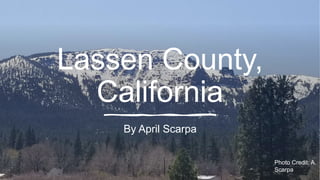
- 1. Lassen County, California By April Scarpa Photo Credit: A. Scarpa
- 2. In the north east corner of California is the county of Lassen. Lassen county consists of part of the Sierra Nevada mountains, and the high desert terrain, like that of Nevada on the east. Lassen county is at the northeastern most part of the Sierra Nevada mountains and at the most southern end of the Cascades that take in much of Oregon and Washington State. Lassen county is the home of Mt. Lassen and has experienced much volcanic activity. Photo Credit: A.Scarpa
- 3. Photo Credit: A. Scarpa Thompson Peak Overlooking the Honey Lake Valley of Lassen, is Thompson Peak. Thompson Peak is part of the Diamond Mountains, which is a subrange of the Sierra Nevada Mountains. The Diamond Mountains are the Northeastern end of the Sierra’s. “The Sierra’s Susanville terminus is a mass of Sierran granodiorite, cut or capped in various places by a gamut of volcanic rocks and conglomerates, towering more than 3000 feet above Susanville on the valley floor, with a high point at Diamond Mountain summit (7738 feet)”. (U.S. Forest Service, n.d., p2) South of Susanville, Thompson Peak towers over the small town of Janesville, CA., at it’s base. The peak is composed of a blend of Tertiary volcanic rock, on the upper portion of the mountain, while the bottom portion and surrounding areas is mezoic granitics.
- 4. As I was researching Thompson Peak, I noticed that the soil on the lower portion of the peak consisted of mostly decomposed granite. The top photo is an outcropping of granite on the east side of the peak. It sits about one-third of the way up the peak. As you can see in the middle photo, the decomposed granite, excluding the large piece, is coarse and rough, with pieces of granite as large as 10 millimeters. However, in the bottom picture, which is in my backyard, at the base of Thompson Peak, the decomposed granite is fine and sand like. It is easily moved by water. You can also see where the current rain has removed the sand and deposited a flow of black iron oxides. As the decomposed granite has eroded and moved down the mountain, the pieces have become smaller and less coarse.
- 5. Photo Credit: A.Scarpa Granite This piece of granite was found on the western side of Thompson Peak, near Antelope Lake. It is a flat piece of granite measuring only about a half an inch thick on one end and about an inch and a half on the other. The granite has a very rough surface. It is white, with specks of gray crystals and black which suggests that it has feldspar, biotite, and quartz in it. (Monroe & Wicander, 2012, p 75) The crystal in the granite tells me that this is a metamorphic rock that has been formed by either heat, pressure, or both.
- 6. Vesicular basalt Vesicular basalt is an igneous rock commonly known as lava flow. Basalt is a dark-colored, fine-grained, igneous rock composed mainly of plagioclase and pyroxene minerals. (Basalt, n.d., p 1) It has holes in it from bubbles of gas trapped within it as the fluid lava cooled. Basalt is usually dark grey or black and has small mineral crystals that are not visible to the naked eye. This piece of basalt was found in the high desert area of Lassen County just northeast of Susanville. The area is called Rice Canyon and has numerous amounts of basalt rock, which suggest that this was an area where the lava was surfacing through cracks or crevices in the ground. Photo Credits: A.Scarpa
- 8. Mt Lassen is near the Northern edge of the Sierra-Nevada mountains and sits in the southern most part of the Cascades. Mt Lassen is a volcano. Lassen last erupted in 1917. There were more than 400 eruptions between the years of 1914-1917. The most significant and greatest was on May 22, 1915. This event altered the appearance of Mt. Lassen. Mt. Lassen, at 10,457 feet elevation, is the largest volcanic dome in the world. The primary rock is dacite, although flows of basalt and andesite have added to the complex rock mosaic. (Webmaster, 2015, p5) About 5 million years ago, as new volcanic activity was increasing, Mt. Lassen began to emerge. It emerged from the base of Mt Tehama, a large composite volcano that began erupting around 600,000 years ago, just south of where Mt Lassen sits today... Photo Credit: USGS
- 9. This picture of the May 1915 eruption gives us a glimpse of what Mount Lassen looked like prior to the eruption. Will it erupt again? Photo Credit: USGS
- 10. “In May 1915, Lassen Peak, California, the southernmost active volcano in the Cascade Range, erupted explosively. Avalanches, mudflows, and flows of hot ash and gas devastated nearby areas, and volcanic ash fell as far away as 200 miles to the east. The Lassen area remains volcanically active, and the volcano hazards demonstrated in 1915 still can threaten not only nearby areas but also more distant communities.” (Volcano Hazards of the Lassen Volcanic National Park Area, California: USGS Volcano Hazards Fact Sheet, n.d., p1) This map, from the USGS, shows what is likely to happen if, and when, an eruption occurs within the Lassen Volcanic Center.
- 11. Lassen County is home to a wide variety of wildlife, from the majestic bald eagle, the white-tailed deer, and antelope, to the bobcat, mountain lion and grey fox, to name just a few. Of all the animals that live in the area, the Black Bear stands out as the most problematic. Photo Credit: gohunt n.d.). photograph. Retrieved from https://gohunt- assets.s3.amazonaws.com/medi a/Large-black-bear-OG.jpg
- 12. California Black Bear Scientific Classification Kingdom: Animalia Phylum: Chordata Class: Mammalia Order: Carnivora Family: Ursidae Genus: Ursus Species: U. americanus Subspecies: U. americanus californiensis (American black bear, 2020, p1) Photo Credit: (n.d.). photograph. Retrieved from https://bear.org/wp- content/uploads/2018/02/Faith-4-8-11-768x768.jpg
- 13. Modern bears appeared in Eurasia around 5 million years ago during the late Miocene Epoch. These bears were relatively small animals, but some types eventually grew quite large. They diversified and spread through Europe, Asia, and North America, eventually reaching South America. Fossils indicate that bears once lived in Africa, with one large primitive species found as far south as present-day South Africa. (Bear Evolution, 2019, p2) Photo Credit: (n.d.). photograph. Retrieved from https://bear.org/wp- content/uploads/2008/10/bear_ready_to_climb_tree-768x543.jpg
- 14. Not only has the black bears been a problem for Lassen County, but have become a nuisance throughout most of the California mountains and foothills. “California's black bear population has increased over the past 25 years. In 1982, the statewide bear population was estimated to be between 10,000 and 15,000. Presently, the statewide black bear population is conservatively estimated to be between 30,000 and 40,000.” (Black Bear Population Information, n. d., p1) There are two subspecies of black bear recognized in California, the California black bear (Ursus americana californiensis) and the northwestern black bear (Ursus americana altifrontalis). The California black bear is what populates the area of Lassen in which I reside. It is differentiated regionally, into the Sierra subpopulation. Credit: Black Bear Population Information. (n.d.). Retrieved from https://wildlife.ca.gov/Conservation/Mammals/Black- Bear/Population
- 15. Black bears of California have become more of a problem for people in recent years. As humans have moved further into their natural habitat, the bears have become more adaptive to the accessibility of food from human garbage. They have learned that it is much easier to forage through trash or raid homeowners of their livestock feed. In my case, our chickens, as seen by the damage done in this picture. Photo Credit: A. Scarpa
- 16. Columnar Basalt Formations Along the Bizz Johnson Trail in Lassen County are these towering walls of rock. These are columnar basalt rock formations. The basalt rock is an example of lava flow and is a direct result of volcanic activity. The orange color also suggests that the rocks contain iron. Along the Bizz Johnson Trail there are two examples of lava flow, Pleistocene lava, which is approximately 1 million years old and Tertiary lava that is approximately 10- 11 million years old. In the photo’s, the Susan River flowed between me and the rock walls of the canyon. The erosional force of the river has cut through these lava flows, exposing the basalt and andesite formations. (Mincher, n.d., p4) Photo Credit: A. Scarpa
- 17. Disconformity and Horizontality Although they are not in Lassen County, this picture is an example of disconformity. While visiting the Petrified Forest National Park, I took this photo of the “Tepees”. “As part of the Blue Mesa Member in the Chinle Formation, they consist of thick deposits of grey, blue, purple, and green mudstones and white minor sandstone beds, and are colored by iron, manganese, and other minerals”. (BournDesigner, 2018, p4) The Chinle Formation was formed from deposits during the Triassic Period over 200 million years ago. This photo is also an example of Steno’s law principle of horizontality. (Monroe & Wicander, 2012, p418) Because this area was covered in water, and with the help of gravity, sediment settled in horizontal layers, as depicted in the photo.
- 18. References: • (n.d.). photograph. Retrieved from https://gohunt-assets.s3.amazonaws.com/media/Large-black-bear-OG.jpg • (n.d.). photograph. Retrieved from https://wildlife.ca.gov/portals/0/Images/Game/BlackBear/BearPopulationEstimates1992_2012_thumb.gif • (n.d.). photograph. Retrieved from https://bear.org/wp-content/uploads/2008/10/bear_ready_to_climb_tree-768x543.jpg • (n.d.). photograph. Retrieved from https://bear.org/wp-content/uploads/2018/02/Faith-4-8-11-768x768.jpg • American black bear. (2020, May 18). Retrieved from https://en.wikipedia.org/wiki/American_black_bear#Taxonomy_and_evolution • Basalt. (n.d.). Retrieved May 18, 2020, from https://geology.com/rocks/basalt.shtml • Bear Evolution. (2019, March 28). Retrieved from https://bear.org/bear-evolution/ • Black Bear Population Information. (n.d.). Retrieved from https://wildlife.ca.gov/Conservation/Mammals/Black-Bear/Population • BournDesigner, J. (2018, July 21). The Tepees At Petrified Forest National Park. Retrieved from https://inspiredimperfection.com/adventures/tepees-petrified-forest/ • Mincher, E. (n.d.). Welcome to Rocky Star Geology. Retrieved from http://www.rockystar.com/home/geology/bizzgeol/bizzgeol.html • Monroe, J. S., & Wicander, R. (2012). The changing earth: exploring geology and evolution. Pacific Grove, CA: Brooks/Cole Cengage Learning. • U.S. Forest Service. (n.d.). Retrieved from https://www.fs.fed.us/wildflowers/regions/Pacific_Southwest/DiamondMountains/index.shtml • Thompson Peak (Diamond Mountains). (n.d.). Retrieved from https://www.summitpost.org/thompson-peak-diamond-mountains/794813 • Volcano Hazards of the Lassen Volcanic National Park Area, California: USGS Volcano Hazards Fact Sheet. (n.d.). Retrieved from https://pubs.usgs.gov/fs/2000/fs022-00/ • Webmaster. (2015, March 2). Mt. Lassen – a Geological Must-See. Retrieved from https://www.gsoc.org/news/2015/3/2/mt-lassen-a-geological-must-see