Weastflows Project Freight Transport Analysis
•
1 like•442 views

The document summarizes a workshop on maritime networks in North-West Europe held in Paris from June 16-18, 2014. It discusses the Weastflows project, which created a GIS database of over 250,000 freight infrastructure objects in North-West Europe. It then describes the methodology for a spatial analysis of freight interactions between 76 zones within and outside the region using distance, tonnage and ton-kilometers transported by road, rail, inland waterways and sea. The analysis identified the major interaction routes and maritime flows within North-West Europe.

Recommended
Recommended
More Related Content
Similar to Weastflows Project Freight Transport Analysis
Similar to Weastflows Project Freight Transport Analysis (20)
More from AURH - Agence d'urbanisme Le Havre - Estuaire de la Seine
More from AURH - Agence d'urbanisme Le Havre - Estuaire de la Seine (20)
Recently uploaded
Recently uploaded (20)
Weastflows Project Freight Transport Analysis
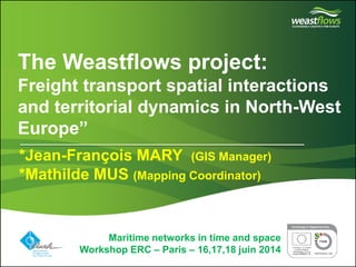
- 1. Partner logo(s) go here Delete this box and place partner logo(s) here on the master page The Weastflows project: Freight transport spatial interactions and territorial dynamics in North-West Europe” Maritime networks in time and space Workshop ERC – Paris – 16,17,18 juin 2014 *Jean-François MARY (GIS Manager) *Mathilde MUS (Mapping Coordinator)
- 2. Partner logo(s) go here Delete this box and place partner logo(s) here on the master page Maritime networks in time and space Workshop ERC – Paris – 16,17,18 juin 2014 OVERVIEW 1 - AURH presentation 2 - The Weastflows project 3 - Spatial analysis of freight interactions
- 3. Partner logo(s) go here Delete this box and place partner logo(s) here on the master page Maritime networks in time and space Workshop ERC – Paris – 16,17,18 juin 2014 OVERVIEW 1 - AURH presentation 2 - The Weastflows project 3 - Spatial analysis of freight interactions
- 4. Who we are?
- 5. Partner logo(s) go here Delete this box and place partner logo(s) here on the master page Our missions Town planning and Geography Observing (the economy, real estate, population, housing market...) Territorial projects, planning, local town planning, masterplan… Specific thematic studies (urban policy, housing, commerce, urban transport...) Prospective studies: Seine Axis, European project..
- 6. Partner logo(s) go here Delete this box and place partner logo(s) here on the master page Different scales of analysis
- 7. Partner logo(s) go here Delete this box and place partner logo(s) here on the master page Maritime networks in time and space Workshop ERC – Paris – 16,17,18 juin 2014 OVERVIEW 1 - AURH presentation 2 - The Weastflows project 3 - Spatial analysis of freight interactions
- 8. Partner logo(s) go here Delete this box and place partner logo(s) here on the master page The Weastflows project •An Interreg IVB North West Europe (NWE) project (2011-2014) •Strategic initiative •Aims: improve and enhance freight logistics toward sustainability in NWE •Budget: 9 million € •12 actions split in 5 WorkPackages •22 partners and more than 30 observers The Weastflows project is managed by CRITT TL (France) and IFS (London).
- 10. Weastflows Challenge for North-West Europe
- 11. Weastflows Challenge for Seine Gateway® in Europe
- 12. Partner logo(s) go here Delete this box and place partner logo(s) here on the master page More than 250 000 geographical objects: -Ports -Airports -Railway stations -Waterways -Railways -Roads -Ferries -Etc. GIS database (Data repository on freight infrastructures in NWE) A GIS database : a starting point •A web-mapping platform http://geo.weastflows.eu •Deliverable 01 of AURH •Mapping of major North- West European freight infrastructures •Deliverable 02 of AURH •Quantitative and qualitative analysis of freight infrastructures •Analysis of the interactions between regions of North West Europe
- 13. Partner logo(s) go here Delete this box and place partner logo(s) here on the master page Maritime networks in time and space Workshop ERC – Paris – 16,17,18 juin 2014 OVERVIEW 1 - AURH presentation 2 - The Weastflows project 3 - Spatial analysis of freight interactions
- 14. Partner logo(s) go here Delete this box and place partner logo(s) here on the master page Objectives of the spatial analysis of freight interactions •To identify the main area in North-West Europe which are transmitter / receiver of goods •To show the interactions between the different region of North-West Europe •To be able to qualify the main interactions by type of transport used (railway, maritime, waterways, roads…) and to be able to quantify the interactions
- 15. Partner logo(s) go here Delete this box and place partner logo(s) here on the master page Methodology : the matrix All goods interactions with North- West Europe are considered 76 x 76 zones
- 16. Partner logo(s) go here Delete this box and place partner logo(s) here on the master page Methodology : the matrix All goods interactions with North- West Europe are considered 76 x 76 zones > For the NWE each country has its own geo zone •France : NUTS2 •Irland is the most detailed •Germany the less detailed > Outside NWE •Rest of Europe is splitted into group of countries •Outside, it is only « continent »
- 17. Partner logo(s) go here Delete this box and place partner logo(s) here on the master page Methodology : the matrix 3 Units : •Distance matrix km •‘000s Tons •Million T-km All goods interactions with North- West Europe are considered 4 modes: •Roads (2011) •Rail (2010) •Inland waterways (2012) •Maritime (2011) 76 x 76 zones
- 18. Partner logo(s) go here Delete this box and place partner logo(s) here on the master page Methodology : two scales of analysis Total of interactions:5 776 3 spatial Tables: 2 extends : •Inside North-West Europe (61 zones) •Outside North-West Europe (15 zones) All goods interactions with North- West Europe are considered NWE : 7, 7 million kT •5,8 millions kT inside •1,9 millions kT outside
- 19. Total of Interactions by GeoZone Results:
- 20. Localisation of interactions Results:
- 21. Distribution of Interactions by mode Results:
- 22. Major interactions inside NWE Results:
- 23. Major maritime interactions inside NWE Results:
- 24. Major maritime interactions inside NWE Results: Major maritime interaction intra NWE (mode maritime) 41 flows > 1 million Tons (2011)
- 25. Major maritime interactions inside NWE Results:
- 26. Major maritime interactions inside NWE Results:
- 27. Partner logo(s) go here Delete this box and place partner logo(s) here on the master page Conclusion •First work / First Exploration •Tons-kilometers to be used •Re-use these data as freight demande to identify major freight routes •Maritime routes : can you help us? •To go further for Seine Gateway (NUTS 3 or better, good types)
- 28. Partner logo(s) go here Delete this box and place partner logo(s) here on the master page The AURH team: Juliette Duszynski, j.duszynski@aurh.fr Lucile Audièvre, l.audievre@aurh.fr Mathilde Mus, m.mus@aurh.fr Jean-François Mary, jf.mary@aurh.fr Think to visit and to subscribe our blog to be inform about AURH activities in Weastflows: http://www.aurhinweastflows.com/ Geoweastflows: http://geoweastflows.eu Maritime networks in time and space Workshop ERC – Paris – 16,17,18 juin 2014 THANK YOU FOR YOUR ATTENTION