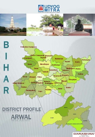
Arwal District Profile
•Download as PPTX, PDF•
2 likes•1,437 views

The document provides information about Arwal district in Bihar, India. It discusses that Arwal district was formed in 2001 and is known for papermaking. It has a population of over 699,000 people and agriculture is the main economic activity. The district lacks major industries but has potential for food processing given its agricultural production. It describes the district's administrative structure, demographics, infrastructure, and the steps needed to set up small and medium enterprises.

Recommended
Recommended
More Related Content
What's hot
What's hot (20)
Similar to Arwal District Profile
Similar to Arwal District Profile (20)
Recently uploaded
Recently uploaded (20)
Arwal District Profile
- 2. Arwal district is one of the thirty-eight districts of Bihar state Arwal town is situated on the right side bank of the river Son, which is a tributary to the river Ganges. INTRODUCTION Arwal district is a part of Magadh division. It came into existence in August 2001 and was earlier part of Jehanabad district. Famous Sanskrit poet Baan Bhatt and the writer of the biography of king Harshvardhan, the book named “Harsh Charit” was born in village Banshi Suryapur of Arwal district Bihar had two major papermaking centers in medieval times. One of them was Arwal town and second was Bihar Sharif HISTORICAL BACKGROUND ADMINISTRATIVE Arwal Town is the district headquarters. Arwal district comprise of 01 sub-divisions has been divided into 05 Blocks: o Arwal o Kaler o Karpi o Kurtha o Suryapur Vanshi Total Number of Panchayats in Arwal district 65. Arwal district has 335 number of villages.
- 3. Arwal district is a predominantly agricultural district. Arwal district does not have presence of any industry. Paddy, wheat, maize and pulse are the main crops. Cane is also grown in some parts of the district. ECONOMIC PROFILE 0 2000 4000 6000 8000 10000 12000 14000 2006-07 2007-08 2008-09 2009-10 2010-11 6366 6621 6981 7290 8148 9832 10237 11311 11815 13404 Per Capita Gross State and District Domestic Product Per Capita Gross District Domestic Product Per Capita Gross State Domestic Product GEOGRAPHIC Coordinates Latitude: 25º to 25.15 Longitude: 84.7º to 85.15 Temperature 42° C (Max.) 14° C (Min.) Average rainfall 817 Mm Area 637 Sq. km. Altitude 67.9 meters Source: Directorate of Economics and Statistics, Govt. of Bihar Source: MSME – DI Muzaffarpur, official website of district
- 4. DEMOGRAPHIC Population 6,99,563 Population Density 1098 per sq km Population Growth 19% Sex ratio 927 per 1000 male Literacy rate 69% Language spoken Magahi and Hindi INDUSTRIAL Registered Industrial Unit 169 Registered medium & large unit Nil Total Industrial Unit 430 No. of Industrial Areas Nil Type of industries Agro based, Wood/ wooden based furniture, Metal based, Repairing & servicing Source: MSME – DI Muzaffarpur, official website of district
- 5. There is no industrial area developed yet in Arwal district. There is potential to develop food processing industry as the district’s primary activity is agriculture. INVESTMENT INDUSTRIAL PROFILE There is no major industry in Arwal District Potential for agro based industries in the district. Beside this substantial number of Wood and wooden based unit district should come up altogether with agro based industries for the development. Due to awareness in general masses, the growth of consumable items (food, chemical, cosmetic, & electronics) are increasing but at slow pace. 0 50 100 150 200 250 Investment (Rs. Lakh) Source: MSME – DI Muzaffarpur
- 6. INDUSTRIES AT A GLANCE Registered industrial unit 169 Total industrial unit 430 Registered medium & large unit - Estimated avg. No. Of daily worker employed in small scale industries 900 Employment in large and medium industries NA No. Of industrial area Nil EXISTING MICRO & SMALL ENTERPRISES AND ARTISAN UNITS Type of industry No. of Units Investment (Rs. Lakh) Agro based 31 222 Ready-made garments & embroidery 15 58 Wood/wooden based furniture 68 232 Paper & Paper products 4 18 Chemical/Chemical based 2 8 Metal based (Steel Fab.) 18 32 Repairing & servicing 17 60 Others 14 60 Total 169 690 Source: MSME – DI Muzaffarpur
- 7. MAJOR INDUSTRIAL AREA No major industrial area exist in Arwal district INFRASTRUCTURE Total No. of hospitals and health centers are 100 There are total 37 commercial banks and financial products Educational institutes No. of Primary school – 333 No. of Middle school – 193 No. of secondary and senior secondary school – 39 No. of colleges – 05
- 8. AGRICULTURE AND FOOD PROCESSING INDUSTRY Arwal district is a predominantly agricultural district. The soil is highly fertile. This district is densely populated. Paddy, wheat, maize and pulses are the main agricultural crops raised by farmers in the district. Cane is also grown in some parts of the district. There is potential of growth in food processing sector in the district
- 9. LARGE SCALE INDUSTRY/ PUBLIC SECTOR UNDERTAKING Micro & Small Enterprise •Agro based -Rice Milling, Atta Chakki, • Demand Based products – Bakery & Namkeen unit Major Existing Clusters • No major cluster Potential Service Enterprises •Mobile repairing •Computer application & hardware •Beauty parlours • Ready made garments • Small Dhaba / restaurant STEPS TO SETUP MSMEs S. No. Type of assistance Name and address of agencies 1. Provisional Registration Certificate ( EM-1) & Permanent Registration Certificate ( EM-II) General Manager, District Industries Centre, Arwal 2. Identification of Project Profiles, techno-economic and managerial consultancy services, market survey and economic survey reports. 1. Director, MSME-DI, Patliputra Industrial Area, Patna-800013. 2. DIC, Arwal 3. KVIB, Jahanabad, Patna 3. Land and Industrial shed BIADA, Patna 4. Financial Assistance Banks, KVIC/ KVIB, DIC, NSIC 5. For raw materials under Govt. Supply National Small Industries Corporation, Patna 6. Plant and machinery under hire/ purchase basis. National Small Industries Corporation, Patna 7. Power/ Electricity SDO, BRVB, Arwal 8. Technical Know–how. MSME Development Institute, Patna DIC, Arwal, KVIC/ KVIB, Patna 9. Quality & Standard Bureau of Indian Standard, Patna 10. Marketing /Export Assistance MSME Development Institute, Patna DIC, Arwal, KVIC/ KVIB, Patna 11. Other Promotional Agencies Punjab National Bank, Arwal has set up one training Centre at Arwal for skill development programme. Source: MSME – DI Muzaffarpur
- 10. TRANSPORT INFRASTRUCTURE Railway •Nearest Railway Station is Jahanabad Road • Connected with NH 98, NH 110 • Efficiently linked with Jehanabad, Patna and Bhojpur Airport • The nearest airport is at Patna from where regular flights are available to all important towns and cities across the country EDUCATION Arwal has schools and colleges to meet the requirement of basic education Educational institutes Gyan Ganga Public School, Oxford Public School, Jawahar Navodaya Vidyalaya, Assembly of God School of Learning, Cambridge Coaching Center
- 11. HERITAGE & TOURISM There are few places of attraction in Arwal district Bodh Mandir Madhusurva Temple Makhdum Shah Ka Mazaar Surya Mandir Bhim Rao Ambedkar Smarak
- 12. Udyog Mitra, Dept. of Industries Govt. of Bihar Ground Floor, Indira Bhawan, RCS Path, Patna, Bihar 800 001. Tel : +91 612 2532695 Fax : +91 612 2532695 Email: info@udyogmitrabihar.com Industries Department 2nd Floor, Vikas Bhawan, Bailey Road, Patna, Bihar 800 015 www.udyogmitrabihar.com