
Recommended
Recommended
More Related Content
What's hot
What's hot (20)
Viewers also liked
Similar to Herp Meeting 2010 Tn
Similar to Herp Meeting 2010 Tn (20)
Herp Meeting 2010 Tn
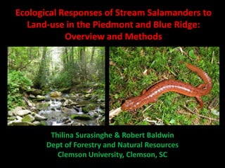
- 1. Ecological Responses of Stream Salamanders to Land-use in the Piedmont and Blue Ridge: Overview and Methods Thilina Surasinghe & Robert Baldwin Dept of Forestry and Natural Resources Clemson University, Clemson, SC
- 2. Global Biodiversity Loss Causes : habitat loss, overexploitation, pollution, invasions, pathogens, climate change. Anthropogenic drivers: land transformation Agricultural expansion, urbanization, infrastructure development, river impoundments, international trade, increasing demand for natural products Ecological cascades and keystone functions
- 3. Species Distribution • Landform diversity • Habitat heterogeneity • Physiography • Hydrology • Microhabitat features • Resource availability • Disturbance regimes!!!!! • Land-use !!!!!! • Habitat modification!!!!! • Community interactions!!!!
- 4. Stream salamanders as focal species • Environmental sentinels • Disturbance intolerance??? • Plethodontids & the Wilder –Dunn Hypothesis • Major form of biomass in headwater streams • Role in nutrient cycles and transportation • Role played in trophic cacades • Dependency on stream- riparian/watershed interactions
- 5. Threats and conservation of amphibians • Massive population declines – 32% Redlisted globally • Impacts of land development & anthropocentric land-use practices – Altered stream morphology & hydrology – Disturbances in the watershed and riparian areas – Degradation in water quality – Biotic homogenization
- 6. Study Area – Upstate South Carolina • Southern Appalachian Mountains and Southern United States • Rich in biodiversity & endemism Kevin Kubach
- 7. Study Area – Upstate South Carolina • Level III EPA ecoregion: Blue Ridge & Piedmont • Four major river basins: Savannah, Saluda, Catawba, Broad
- 8. Study Area – Upstate South Carolina • High rate of land development, urbanization, population growth • Intensive land use history • Pressure on native biodiversity!!!
- 9. Project Objectives • How different land-use activities in the riparian zone and the watershed affect the habitat association of stream-dwelling salamanders? • Does historical alterations in the natural habitats affect the current distribution and habitat occupancy of stream salamanders? • Does anthropogenic land-use practices alter community interactions (competition) among stream salamanders?
- 10. Methods & Materials • Randomized block design – Blocked across level IV ecoregions & river basins – 40 sampling locations – land-use types: forested areas, agricultural lands, residential areas, & urban areas • Field transect survey – Stream transects in the wetted channel (100 m) – Riparian belt transects (100 m x 5 m) – Visual observation & active searching – Random sampling : sequence/time among different sites
- 11. Active Searching • Stream transects – Diurnally searching all stream channel habitats with rectangle-framed kick nets, D-framed nets and dip nets • Belt transects – Nocturnally searching all riparian microhabitats • Date, starting /ending time, weather & the crew size are recorded • Will be surveyed for two consecutive years (April – July) • Identification and specimen preservation
- 12. Methodology: Determining Habitat Association • Nested analysis to determine the effects of – Different land-use activities in the riparian areas – Different habitats variables in the sampling location on species composition of stream salamanders – Metrics: Relative nestedness and discrepancy measure • Categorization of species assemblages reflecting species response to land-use gradient – Disturbance exploiters, disturbance adapters, disturbance avoiders – Ordination (NMDS)
- 13. Methodology: Determining Habitat Association • 12 habitat variables will be recorded along transects – To indicate land development, disturbance, & ecological conditions of the sampling locations – A correlation test to determine correlation between habitat variables and species occurrence
- 14. Methodology: Effects of Historical Land-use 1944 2010 • Comparison of historical aerial photos (1920-60) with LULC 2001 • Spatial scale: 200 m, 500 m, 1000 m–radius from sampling points • Calculate proportional coverage for the four land-use types • Use historical land-use cover as a variable for the correlation
- 15. Methodology: Community Interactions Vs • Four riparian land-use types simulated in artificial streams • Experimental species: Urban adapter Vs Urban avoider • Coexistence and isolation • Observations/measurements: body weight, snout-vent length, spatial occupancy, # individuals alive • Assess: (i) percentage survival; (ii) percentage body weight change; (iii) percent change in body length; (iv) growth rate; (v) daily movement range
- 16. Acknowledgement: Dr Mark Scott & Stream Bioassessment team, SC DNR Dr John Hains, Dr Hap Wheeler, Dept of Biological Sciences Dr Bryan Brown, Dept of Forestry & Natural Resources Highlands Biological Station, NC