How to get open geo data on the road
•Download as PPTX, PDF•
2 likes•520 views

The document discusses how to obtain open geographic data and contribute to open data projects. It mentions starting with community involvement, experimenting to create a complete ecosystem, and contributing data while developing supportive policy. The overall message is one of collaborative development of open geographic data to enable new forms of spatial thinking.

Recommended
More Related Content
More from Jan Willem van Eck
More from Jan Willem van Eck (20)
Recently uploaded
Recently uploaded (20)
How to get open geo data on the road
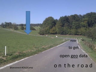
- 1. How to get open geo data @jwvaneck #OGDCamp on the road
- 5. Where this road got s t a r t ed
- 8. Saxton’s map of Derbyshire, 1579 Rivers, bridges, no roads.
- 9. How to get on the open road
- 10. Get community
- 11. + a complete ecosystem
- 12. Experiment
- 13. W e, the map Contribute
- 15. Develop policy as you go
- 16. Go easy on the arguments Thank you Latina_x
- 18. Government has no monopoly over open data Hack the government!
- 19. Great times for spatial thinking: We cannot even imagine a world where things do not have a place
- 20. How to get open geo data on the road @jwvaneck http://ogdcamp.org/ Warsaw, October 19th, 2011
Editor's Notes
- How to get open geo data on the road Where did we come from and where are we going with open geo data.
- A lightning map of Holland
- A jetstream map of Holland
- http://www.newscientist.com/article/dn19200-twitter-mood-maps-reveal-emotional-states-of-america.htmlA happy map
- Actually in a veryclosed domain, sobearwithus.
- Mappingfortradepurposes, alsoverymuchsecrative
- DERBYS: GENERAL MAP:Saxton/Hole.V.Decorative.c16x13.NC.(Universi.)Includesparts of Lancashire.Chestershire.Staffordshire.Nottinghamshire and Leicestershire.http://www.antiquemapsandprints.com/scans/SCANS18.htmFrom “Earlychart succes” http://www.amazon.co.uk/Exploring-History-Around-Derbyshire-Richard/dp/1859837050
- Understand what is takes to support a community of people.
- Meaning here: data, technology, knowledge, experience, etc.
- Resulted in manyappcontests (which are reallygreat)
- Contribute to openstreetmap. With data, supportingtheirevent, integrate tools, service the maps, etc.
- Understandwhatmakesgeographicinformation different: visualisationrules, data quality, quantity of data (and much more…)
- Don’tmake up all the rules in the beginning, go slow
- And choose ‘it’sjust practical’ approach
- Ifyou want to getanideawhat to strivefor….
- Citizens and firmsneed to contribute as well