SlideShare a Scribd company logo
1 of 17
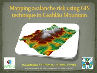
Mapping avalanche risk using GIS technique in Ceahl ă u Mountain A. Cov ăsnianu , I.R. Grigoraş, L.E. State, S. Hogaş
[object Object],[object Object],[object Object],[object Object],[object Object],[object Object],[object Object],[object Object],Mapping avalanche risk using GIS technique in Ceahl ă u Mountain
[object Object],[object Object],Mapping avalanche risk using GIS technique in Ceahl ă u Mountain Concept ,[object Object],[object Object],[object Object],[object Object],Past background  in Romania ,[object Object],[object Object],[object Object],[object Object]
 
[object Object],[object Object],[object Object],[object Object],Mapping avalanche risk using GIS technique in Ceahl ă u Mountain
[object Object],[object Object],[object Object],[object Object],Mapping avalanche risk using GIS technique in Ceahl ă u Mountain
[object Object],[object Object],[object Object],[object Object],[object Object],[object Object],[object Object],[object Object],[object Object],Mapping avalanche risk using GIS technique in Ceahl ă u Mountain
Mapping avalanche risk using GIS technique in Ceahl ă u Mountain ,[object Object],[object Object],[object Object]
Mapping avalanche risk using GIS technique in Ceahl ă u Mountain Aspect map The South, South-West and South-East versants are the most representative  due to the fact that the avalanche risk is higher in those areas.
Mapping avalanche risk using GIS technique in Ceahl ă u Mountain Landforms map  describes the concavit y/convexity of the terrain.  The landform is very useful for snow avalanche risk because it determines the probable snow accumulation  areas  or the possible areas of propagation . The concave  areas  are mostly represented by the bed’s rivers.  The convex  one’s ,  in general ,  are represented by the highest slope values.
[object Object],[object Object],[object Object],[object Object],[object Object],Mapping avalanche risk using GIS technique in Ceahl ă u Mountain
Mapping avalanche risk using GIS technique in Ceahl ă u Mountain The higher probability of producing a snow avalanche is near Toaca Peak and close to Dochia chalet.  Avalanche risk classes: 0-5 = low risk  (tourism activity not forbidden in winter season) 5-10 = moderate risk  (tourism activity permitted only for experienced users) 10-15 = considerable risk  (tourism activity admitted under certain conditions) 15-20 = high risk  (restricted under certain conditions).
Mapping avalanche risk using GIS technique in Ceahl ă u Mountain - The tourist tracks were obtained by GPS technique - Any of  those three tourist tracks passes through areas with avalanche risk
Mapping avalanche risk using GIS technique in Ceahl ă u Mountain
[object Object],[object Object],[object Object],[object Object],Mapping avalanche risk using GIS technique in Ceahl ă u Mountain
[object Object],[object Object],Problems occurred : Future abordation : ,[object Object],[object Object],[object Object],Mapping avalanche risk using GIS technique in Ceahl ă u Mountain

More Related Content

What's hot

Geographic Information Systems in the Oil & Gas Industry
Geographic Information Systems in the Oil & Gas IndustryGeographic Information Systems in the Oil & Gas Industry
Geographic Information Systems in the Oil & Gas Industry
Francois Viljoen
 
WHAT'S THERE IN GEOMATICS ENGINEERING???
WHAT'S THERE IN GEOMATICS ENGINEERING???WHAT'S THERE IN GEOMATICS ENGINEERING???
WHAT'S THERE IN GEOMATICS ENGINEERING???
Nepal Flying Labs
 
Introduction To and Arcaeological Apps of GIS
Introduction To and Arcaeological Apps of GIS Introduction To and Arcaeological Apps of GIS
Introduction To and Arcaeological Apps of GIS
Jo Dyson
 

What's hot (19)

GIS LANDSLIDES ANALYSIS ii
GIS LANDSLIDES ANALYSIS iiGIS LANDSLIDES ANALYSIS ii
GIS LANDSLIDES ANALYSIS ii
 
Spatial Technology Resources for Teachers
Spatial Technology Resources for TeachersSpatial Technology Resources for Teachers
Spatial Technology Resources for Teachers
 
Geomatics
Geomatics Geomatics
Geomatics
 
INFRARISK. Novel Indicators for identifying critical INFRAstructure at RISK f...
INFRARISK. Novel Indicators for identifying critical INFRAstructure at RISK f...INFRARISK. Novel Indicators for identifying critical INFRAstructure at RISK f...
INFRARISK. Novel Indicators for identifying critical INFRAstructure at RISK f...
 
Google map
Google mapGoogle map
Google map
 
Introduction to geomatics
Introduction to geomaticsIntroduction to geomatics
Introduction to geomatics
 
application of gis
application of gisapplication of gis
application of gis
 
GeoAvalanche Avalanche danger index processing
GeoAvalanche Avalanche danger index processingGeoAvalanche Avalanche danger index processing
GeoAvalanche Avalanche danger index processing
 
Using Spatial Technologies in the Geography Classroom
Using Spatial Technologies in the Geography ClassroomUsing Spatial Technologies in the Geography Classroom
Using Spatial Technologies in the Geography Classroom
 
civil engineer
civil engineercivil engineer
civil engineer
 
Geography school talk on GIS, mapping, spatial analytics, industry applicatio...
Geography school talk on GIS, mapping, spatial analytics, industry applicatio...Geography school talk on GIS, mapping, spatial analytics, industry applicatio...
Geography school talk on GIS, mapping, spatial analytics, industry applicatio...
 
Application of GIS
Application of GISApplication of GIS
Application of GIS
 
Urban planing & gis
Urban planing & gisUrban planing & gis
Urban planing & gis
 
Geographic Information Systems in the Oil & Gas Industry
Geographic Information Systems in the Oil & Gas IndustryGeographic Information Systems in the Oil & Gas Industry
Geographic Information Systems in the Oil & Gas Industry
 
WHAT'S THERE IN GEOMATICS ENGINEERING???
WHAT'S THERE IN GEOMATICS ENGINEERING???WHAT'S THERE IN GEOMATICS ENGINEERING???
WHAT'S THERE IN GEOMATICS ENGINEERING???
 
Urbanization of mancherial town
Urbanization of mancherial town Urbanization of mancherial town
Urbanization of mancherial town
 
Geospatial Applications in Civil Engineering
Geospatial Applications in Civil EngineeringGeospatial Applications in Civil Engineering
Geospatial Applications in Civil Engineering
 
Application of gis and gps in civil engineering
Application of gis and gps in civil engineeringApplication of gis and gps in civil engineering
Application of gis and gps in civil engineering
 
Introduction To and Arcaeological Apps of GIS
Introduction To and Arcaeological Apps of GIS Introduction To and Arcaeological Apps of GIS
Introduction To and Arcaeological Apps of GIS
 

Similar to Mapping Avalanche Risk Using Gis Technique In Ceahlau

Analysis of snow-drifting_vulnerability._application_to_botosani_county
Analysis of snow-drifting_vulnerability._application_to_botosani_countyAnalysis of snow-drifting_vulnerability._application_to_botosani_county
Analysis of snow-drifting_vulnerability._application_to_botosani_county
Bărcăcianu Florentina
 
Abstract Shuvra
Abstract ShuvraAbstract Shuvra
Abstract Shuvra
065msw418
 
Gis Applications Presentation
Gis Applications PresentationGis Applications Presentation
Gis Applications Presentation
Idua Olunwa
 
Investigation of the Lake Victoria Region (Africa: Tanzania, Kenya and Uganda)
Investigation of the Lake Victoria Region (Africa: Tanzania, Kenya and Uganda)Investigation of the Lake Victoria Region (Africa: Tanzania, Kenya and Uganda)
Investigation of the Lake Victoria Region (Africa: Tanzania, Kenya and Uganda)
Universität Salzburg
 
Combined ariborne and ground geophysics Flåm Norway
Combined ariborne and ground geophysics Flåm NorwayCombined ariborne and ground geophysics Flåm Norway
Combined ariborne and ground geophysics Flåm Norway
Bjorn Sture Rosenvold
 

Similar to Mapping Avalanche Risk Using Gis Technique In Ceahlau (20)

Assessment of landslide susceptibility using geospatial analysis and interfer...
Assessment of landslide susceptibility using geospatial analysis and interfer...Assessment of landslide susceptibility using geospatial analysis and interfer...
Assessment of landslide susceptibility using geospatial analysis and interfer...
 
Gis avalanche hazard report daniel
Gis avalanche hazard report danielGis avalanche hazard report daniel
Gis avalanche hazard report daniel
 
11__Saurav Poudel__Landslide Hazard mapping.pptx
11__Saurav Poudel__Landslide Hazard mapping.pptx11__Saurav Poudel__Landslide Hazard mapping.pptx
11__Saurav Poudel__Landslide Hazard mapping.pptx
 
gis in natural disaster management geo hazards
gis in natural disaster management  geo hazardsgis in natural disaster management  geo hazards
gis in natural disaster management geo hazards
 
Analysis of snow-drifting_vulnerability._application_to_botosani_county
Analysis of snow-drifting_vulnerability._application_to_botosani_countyAnalysis of snow-drifting_vulnerability._application_to_botosani_county
Analysis of snow-drifting_vulnerability._application_to_botosani_county
 
Risks reading1
Risks reading1Risks reading1
Risks reading1
 
Risks reading1
Risks reading1Risks reading1
Risks reading1
 
Abstract Shuvra
Abstract ShuvraAbstract Shuvra
Abstract Shuvra
 
IRJET- Landslide Susceptibility Mapping using Weights of Evidence Method ...
IRJET-  	  Landslide Susceptibility Mapping using Weights of Evidence Method ...IRJET-  	  Landslide Susceptibility Mapping using Weights of Evidence Method ...
IRJET- Landslide Susceptibility Mapping using Weights of Evidence Method ...
 
LANDSLIDE HAZARD ZONATION MAPPING USING RS AND GIS
LANDSLIDE HAZARD ZONATION MAPPING USING RS AND GISLANDSLIDE HAZARD ZONATION MAPPING USING RS AND GIS
LANDSLIDE HAZARD ZONATION MAPPING USING RS AND GIS
 
Role of Geologists in Natural Hazard Mapping and Application_Dr Kyi Khin_MGSS...
Role of Geologists in Natural Hazard Mapping and Application_Dr Kyi Khin_MGSS...Role of Geologists in Natural Hazard Mapping and Application_Dr Kyi Khin_MGSS...
Role of Geologists in Natural Hazard Mapping and Application_Dr Kyi Khin_MGSS...
 
Refinement of regionally modeled coastal zone population data enabling more a...
Refinement of regionally modeled coastal zone population data enabling more a...Refinement of regionally modeled coastal zone population data enabling more a...
Refinement of regionally modeled coastal zone population data enabling more a...
 
LANDSLIDE SUSCEPTIBILITY MAPPING OF THE AITOLOAKARNANIA AND EVRYTANIA REGIONA...
LANDSLIDE SUSCEPTIBILITY MAPPING OF THE AITOLOAKARNANIA AND EVRYTANIA REGIONA...LANDSLIDE SUSCEPTIBILITY MAPPING OF THE AITOLOAKARNANIA AND EVRYTANIA REGIONA...
LANDSLIDE SUSCEPTIBILITY MAPPING OF THE AITOLOAKARNANIA AND EVRYTANIA REGIONA...
 
Gis Applications Presentation
Gis Applications PresentationGis Applications Presentation
Gis Applications Presentation
 
Landslide Susceptibility Map using Remote Sensing and GIS
Landslide Susceptibility Map using Remote Sensing and GISLandslide Susceptibility Map using Remote Sensing and GIS
Landslide Susceptibility Map using Remote Sensing and GIS
 
Investigation of the Lake Victoria Region (Africa: Tanzania, Kenya and Uganda)
Investigation of the Lake Victoria Region (Africa: Tanzania, Kenya and Uganda)Investigation of the Lake Victoria Region (Africa: Tanzania, Kenya and Uganda)
Investigation of the Lake Victoria Region (Africa: Tanzania, Kenya and Uganda)
 
Combined ariborne and ground geophysics Flåm Norway
Combined ariborne and ground geophysics Flåm NorwayCombined ariborne and ground geophysics Flåm Norway
Combined ariborne and ground geophysics Flåm Norway
 
Development of avalanche hazard maps by ArcGIS for Trentino (Alpine Italy)
Development of avalanche hazard maps by ArcGIS for Trentino (Alpine Italy)Development of avalanche hazard maps by ArcGIS for Trentino (Alpine Italy)
Development of avalanche hazard maps by ArcGIS for Trentino (Alpine Italy)
 
Development of avalanche hazard maps by ArcGIS for Alpine Italy
Development of avalanche hazard maps by ArcGIS for Alpine ItalyDevelopment of avalanche hazard maps by ArcGIS for Alpine Italy
Development of avalanche hazard maps by ArcGIS for Alpine Italy
 
Cat hazard maps
Cat hazard mapsCat hazard maps
Cat hazard maps
 

Recently uploaded

Recently uploaded (20)

Workshop - Best of Both Worlds_ Combine KG and Vector search for enhanced R...
Workshop - Best of Both Worlds_ Combine  KG and Vector search for  enhanced R...Workshop - Best of Both Worlds_ Combine  KG and Vector search for  enhanced R...
Workshop - Best of Both Worlds_ Combine KG and Vector search for enhanced R...
 
A Domino Admins Adventures (Engage 2024)
A Domino Admins Adventures (Engage 2024)A Domino Admins Adventures (Engage 2024)
A Domino Admins Adventures (Engage 2024)
 
Finology Group – Insurtech Innovation Award 2024
Finology Group – Insurtech Innovation Award 2024Finology Group – Insurtech Innovation Award 2024
Finology Group – Insurtech Innovation Award 2024
 
From Event to Action: Accelerate Your Decision Making with Real-Time Automation
From Event to Action: Accelerate Your Decision Making with Real-Time AutomationFrom Event to Action: Accelerate Your Decision Making with Real-Time Automation
From Event to Action: Accelerate Your Decision Making with Real-Time Automation
 
Developing An App To Navigate The Roads of Brazil
Developing An App To Navigate The Roads of BrazilDeveloping An App To Navigate The Roads of Brazil
Developing An App To Navigate The Roads of Brazil
 
Boost Fertility New Invention Ups Success Rates.pdf
Boost Fertility New Invention Ups Success Rates.pdfBoost Fertility New Invention Ups Success Rates.pdf
Boost Fertility New Invention Ups Success Rates.pdf
 
How to Troubleshoot Apps for the Modern Connected Worker
How to Troubleshoot Apps for the Modern Connected WorkerHow to Troubleshoot Apps for the Modern Connected Worker
How to Troubleshoot Apps for the Modern Connected Worker
 
AWS Community Day CPH - Three problems of Terraform
AWS Community Day CPH - Three problems of TerraformAWS Community Day CPH - Three problems of Terraform
AWS Community Day CPH - Three problems of Terraform
 
ProductAnonymous-April2024-WinProductDiscovery-MelissaKlemke
ProductAnonymous-April2024-WinProductDiscovery-MelissaKlemkeProductAnonymous-April2024-WinProductDiscovery-MelissaKlemke
ProductAnonymous-April2024-WinProductDiscovery-MelissaKlemke
 
Bajaj Allianz Life Insurance Company - Insurer Innovation Award 2024
Bajaj Allianz Life Insurance Company - Insurer Innovation Award 2024Bajaj Allianz Life Insurance Company - Insurer Innovation Award 2024
Bajaj Allianz Life Insurance Company - Insurer Innovation Award 2024
 
Partners Life - Insurer Innovation Award 2024
Partners Life - Insurer Innovation Award 2024Partners Life - Insurer Innovation Award 2024
Partners Life - Insurer Innovation Award 2024
 
What Are The Drone Anti-jamming Systems Technology?
What Are The Drone Anti-jamming Systems Technology?What Are The Drone Anti-jamming Systems Technology?
What Are The Drone Anti-jamming Systems Technology?
 
Real Time Object Detection Using Open CV
Real Time Object Detection Using Open CVReal Time Object Detection Using Open CV
Real Time Object Detection Using Open CV
 
How to Troubleshoot Apps for the Modern Connected Worker
How to Troubleshoot Apps for the Modern Connected WorkerHow to Troubleshoot Apps for the Modern Connected Worker
How to Troubleshoot Apps for the Modern Connected Worker
 
Scaling API-first – The story of a global engineering organization
Scaling API-first – The story of a global engineering organizationScaling API-first – The story of a global engineering organization
Scaling API-first – The story of a global engineering organization
 
Boost PC performance: How more available memory can improve productivity
Boost PC performance: How more available memory can improve productivityBoost PC performance: How more available memory can improve productivity
Boost PC performance: How more available memory can improve productivity
 
Advantages of Hiring UIUX Design Service Providers for Your Business
Advantages of Hiring UIUX Design Service Providers for Your BusinessAdvantages of Hiring UIUX Design Service Providers for Your Business
Advantages of Hiring UIUX Design Service Providers for Your Business
 
Apidays New York 2024 - The value of a flexible API Management solution for O...
Apidays New York 2024 - The value of a flexible API Management solution for O...Apidays New York 2024 - The value of a flexible API Management solution for O...
Apidays New York 2024 - The value of a flexible API Management solution for O...
 
Axa Assurance Maroc - Insurer Innovation Award 2024
Axa Assurance Maroc - Insurer Innovation Award 2024Axa Assurance Maroc - Insurer Innovation Award 2024
Axa Assurance Maroc - Insurer Innovation Award 2024
 
Apidays Singapore 2024 - Building Digital Trust in a Digital Economy by Veron...
Apidays Singapore 2024 - Building Digital Trust in a Digital Economy by Veron...Apidays Singapore 2024 - Building Digital Trust in a Digital Economy by Veron...
Apidays Singapore 2024 - Building Digital Trust in a Digital Economy by Veron...
 

Mapping Avalanche Risk Using Gis Technique In Ceahlau

  • 1. Mapping avalanche risk using GIS technique in Ceahl ă u Mountain A. Cov ăsnianu , I.R. Grigoraş, L.E. State, S. Hogaş
  • 2.
  • 3.
  • 4.  
  • 5.
  • 6.
  • 7.
  • 8.
  • 9.
  • 10. Mapping avalanche risk using GIS technique in Ceahl ă u Mountain Aspect map The South, South-West and South-East versants are the most representative due to the fact that the avalanche risk is higher in those areas.
  • 11. Mapping avalanche risk using GIS technique in Ceahl ă u Mountain Landforms map describes the concavit y/convexity of the terrain. The landform is very useful for snow avalanche risk because it determines the probable snow accumulation areas or the possible areas of propagation . The concave areas are mostly represented by the bed’s rivers. The convex one’s , in general , are represented by the highest slope values.
  • 12.
  • 13. Mapping avalanche risk using GIS technique in Ceahl ă u Mountain The higher probability of producing a snow avalanche is near Toaca Peak and close to Dochia chalet. Avalanche risk classes: 0-5 = low risk (tourism activity not forbidden in winter season) 5-10 = moderate risk (tourism activity permitted only for experienced users) 10-15 = considerable risk (tourism activity admitted under certain conditions) 15-20 = high risk (restricted under certain conditions).
  • 14. Mapping avalanche risk using GIS technique in Ceahl ă u Mountain - The tourist tracks were obtained by GPS technique - Any of those three tourist tracks passes through areas with avalanche risk
  • 15. Mapping avalanche risk using GIS technique in Ceahl ă u Mountain
  • 16.
  • 17.