SlideShare a Scribd company logo
1 of 10
Download to read offline
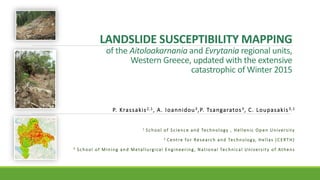
LANDSLIDE SUSCEPTIBILITY MAPPING
of the Aitoloakarnania and Evrytania regional units,
Western Greece, updated with the extensive
catastrophic of Winter 2015
P. Krassakis2,1, A. Ioannidou3,P. Tsangaratos3, C. Loupasakis3,1
1 School of Science and Technology , Hellenic Open University
2 Centre for Research and Technology, Hellas (CERTH)
3 School of Mining and Metallurgical Engineering, National Technical University of Athens
General Information
- Area of Research: Aitoloakarnania and Evrytania Regionals Units of Western Greece
- A great number of landslides reports
- Between January and February 2015
- Serious damages were caused to villages’ infrastructure
- Main cause: prolonged precipitations events
Scope
1. Identification and analysis of landslide phenomena during an engineering geological survey
2. Production of landslide susceptibility maps for a particular high interest region
3. Validation and comparison between two expert-based geospatial techniques applied for the
development of landslide susceptibility maps.
Susceptibility AHP RES
Very Low 16.09% 15.09%
Low 26.37% 26.10%
Medium 27.30% 27.72%
High/ Very High 30.25% 31.09%
Figure 1. Flow work of the present work
Methodology
Four phase procedure:
a) Production of the landslide inventory map and selecting the landslide related variables
b) Classification of each variable
c) Application of Analytical Hierarchy Process (AHP) and Rock Engineering System (RES) in GIS
d) Validation and comparison of the two models
Inventory –
Geological Survey
− Winter 2015, after the manifestation of the
landslide events
− 92 failures were recorded and imported in the
created geodatabase.
− The majority of those events were classified as
rotational slides, transitional, flows or complex.
Figure 2. Route of engineering geological survey for the identification
of landslide occurrences.
Inventory –
Geological Survey
Perista village (Naupaktia Municipality)
Pindos flysh and its weathering mantle
• First landslide event (PE1) occurred inside the
village. This phenomenon is the reactivation of a
former rotational landslide of the weathering
mantle. A house and its frontal road suffered
serious damages. Ruptures were also recorded at
two houses which were located at the toe slope of
the road (Fig. 3b)
• Second landslide event (PE2) is located in the cliff
above the village (Fig. 3c)
Figure 3. General aspect of the Perista village and the identified
landslides
Inventory – Geological
Survey
Ampliani settlement (Karpenision Municipality)
Excessive mud flows were depicted at the hill above the
village. The landslide deposits moved approximately 150m
causing serious damages at the Ampliani village. The
investigated landslide (Fig. 4) is classified as complex, as the
rotational slide which occurred at the crown of the slope
progressed to earth flow. Creep markings were identified at
the parameter of the landslide’s borders.
Figure 4. Perspective views of the a) mud flow that caused extensive
damages to b) Ampliani’s village buildings.
a)
b)
Results
• More than 30% of the total extent within the common region
(black polygon) is categorized as High and Very High landslide
susceptibility zone, visualized with orange and red colours.
• The vast majority of landslide events occurred in cherts and
flysch formations.
• Lithology and slope inclination, were calculated as the
dominant factors in landslide manifestation for both
techniques
Susceptibility AHP RES
Very Low 16.09% 15.09%
Low 26.37% 26.10%
Medium 27.30% 27.72%
High/ Very High 30.25% 31.09%
Conclusion
1. Regarding the infield findings, the most important landslide causal factors were the ground settings such
as mechanical properties, discontinuities and slope’s orientation.
2. According to the final map, lithology and slope inclination, were the dominant factors in landslide
manifestation.
3. The validation results showed that RES methodology is better and more adaptive in prediction than
AHP with 51.98% and 44.89% respectively in the highest-class zone of landslide susceptibility.
4. This work also aims to create a useful and sustainable geospatial application, in order to reduce the
impact of landslide occurrences on humans and manmade environment in the future
Thank you for your attention!

More Related Content

What's hot

IRJET-Investigation of Landslides and its Effects on Kothagiri
IRJET-Investigation of Landslides and its Effects on KothagiriIRJET-Investigation of Landslides and its Effects on Kothagiri
IRJET-Investigation of Landslides and its Effects on KothagiriIRJET Journal
 
A Survey on Landslide Susceptibility Mapping Using Soft Computing Techniques
A Survey on Landslide Susceptibility Mapping Using Soft Computing TechniquesA Survey on Landslide Susceptibility Mapping Using Soft Computing Techniques
A Survey on Landslide Susceptibility Mapping Using Soft Computing Techniquesiosrjce
 
landslide hazard mapping in Ethiopia
landslide hazard mapping in Ethiopialandslide hazard mapping in Ethiopia
landslide hazard mapping in EthiopiaUniversity of Gondar
 
Mulla - Precision Conservation
Mulla - Precision ConservationMulla - Precision Conservation
Mulla - Precision ConservationJose A. Hernandez
 
Uganda investment forum_-_natural_resources_-_keith_winning_-_cbi
Uganda investment forum_-_natural_resources_-_keith_winning_-_cbiUganda investment forum_-_natural_resources_-_keith_winning_-_cbi
Uganda investment forum_-_natural_resources_-_keith_winning_-_cbiWilly Mutenza
 
Assessment of Ground Water Potential Zones by GIS – Perundurai Taluk
Assessment of Ground Water  Potential Zones  by GIS – Perundurai TalukAssessment of Ground Water  Potential Zones  by GIS – Perundurai Taluk
Assessment of Ground Water Potential Zones by GIS – Perundurai TalukIRJET Journal
 
Photogrammetry & Remote Sensing applications in Engineering
Photogrammetry & Remote Sensing applications in EngineeringPhotogrammetry & Remote Sensing applications in Engineering
Photogrammetry & Remote Sensing applications in EngineeringAmira Abdallah
 
Assessing the effectiveness of Sustainable Land Management for large-scale cl...
Assessing the effectiveness of Sustainable Land Management for large-scale cl...Assessing the effectiveness of Sustainable Land Management for large-scale cl...
Assessing the effectiveness of Sustainable Land Management for large-scale cl...ExternalEvents
 
Short Version of Wet Area Mapping CANNOR
Short Version of Wet Area Mapping CANNORShort Version of Wet Area Mapping CANNOR
Short Version of Wet Area Mapping CANNORGustavo Moran
 
Role of Geologists in Natural Hazard Mapping and Application_Dr Kyi Khin_MGSS...
Role of Geologists in Natural Hazard Mapping and Application_Dr Kyi Khin_MGSS...Role of Geologists in Natural Hazard Mapping and Application_Dr Kyi Khin_MGSS...
Role of Geologists in Natural Hazard Mapping and Application_Dr Kyi Khin_MGSS...KYI KHIN
 
Flood modelling and prediction 1
Flood modelling and prediction 1Flood modelling and prediction 1
Flood modelling and prediction 1tp jayamohan
 
GIS application in Natural Resource Management
GIS application in Natural Resource ManagementGIS application in Natural Resource Management
GIS application in Natural Resource ManagementAchal Gupta
 
Remote Sensing Method for Flood Management System
 Remote Sensing Method for Flood Management System Remote Sensing Method for Flood Management System
Remote Sensing Method for Flood Management SystemIJMREMJournal
 
Soil Erosion for Vishwamitri River watershed using RS and GIS
Soil Erosion for Vishwamitri River watershed using RS and GISSoil Erosion for Vishwamitri River watershed using RS and GIS
Soil Erosion for Vishwamitri River watershed using RS and GISvishvam Pancholi
 
IDENTIFICATION OF GROUNDWATER POTENTIAL ZONES USING REMOTE SENSING AND GEOGRA...
IDENTIFICATION OF GROUNDWATER POTENTIAL ZONES USING REMOTE SENSING AND GEOGRA...IDENTIFICATION OF GROUNDWATER POTENTIAL ZONES USING REMOTE SENSING AND GEOGRA...
IDENTIFICATION OF GROUNDWATER POTENTIAL ZONES USING REMOTE SENSING AND GEOGRA...IAEME Publication
 
south west transport corridor project-a case study of geotechnical instrument...
south west transport corridor project-a case study of geotechnical instrument...south west transport corridor project-a case study of geotechnical instrument...
south west transport corridor project-a case study of geotechnical instrument...tp jayamohan
 
Course ENG4903 Professional Practice 2
Course ENG4903 Professional Practice 2Course ENG4903 Professional Practice 2
Course ENG4903 Professional Practice 2John Worrall
 
Determining Paleoflow of Glacial Fluvial Systems in Crawford County (2)
Determining Paleoflow of Glacial Fluvial Systems in Crawford County (2)Determining Paleoflow of Glacial Fluvial Systems in Crawford County (2)
Determining Paleoflow of Glacial Fluvial Systems in Crawford County (2)Thomas Hunter
 

What's hot (20)

IRJET-Investigation of Landslides and its Effects on Kothagiri
IRJET-Investigation of Landslides and its Effects on KothagiriIRJET-Investigation of Landslides and its Effects on Kothagiri
IRJET-Investigation of Landslides and its Effects on Kothagiri
 
A Survey on Landslide Susceptibility Mapping Using Soft Computing Techniques
A Survey on Landslide Susceptibility Mapping Using Soft Computing TechniquesA Survey on Landslide Susceptibility Mapping Using Soft Computing Techniques
A Survey on Landslide Susceptibility Mapping Using Soft Computing Techniques
 
landslide hazard mapping in Ethiopia
landslide hazard mapping in Ethiopialandslide hazard mapping in Ethiopia
landslide hazard mapping in Ethiopia
 
Mulla - Precision Conservation
Mulla - Precision ConservationMulla - Precision Conservation
Mulla - Precision Conservation
 
Uganda investment forum_-_natural_resources_-_keith_winning_-_cbi
Uganda investment forum_-_natural_resources_-_keith_winning_-_cbiUganda investment forum_-_natural_resources_-_keith_winning_-_cbi
Uganda investment forum_-_natural_resources_-_keith_winning_-_cbi
 
Assessment of Ground Water Potential Zones by GIS – Perundurai Taluk
Assessment of Ground Water  Potential Zones  by GIS – Perundurai TalukAssessment of Ground Water  Potential Zones  by GIS – Perundurai Taluk
Assessment of Ground Water Potential Zones by GIS – Perundurai Taluk
 
Photogrammetry & Remote Sensing applications in Engineering
Photogrammetry & Remote Sensing applications in EngineeringPhotogrammetry & Remote Sensing applications in Engineering
Photogrammetry & Remote Sensing applications in Engineering
 
Assessing the effectiveness of Sustainable Land Management for large-scale cl...
Assessing the effectiveness of Sustainable Land Management for large-scale cl...Assessing the effectiveness of Sustainable Land Management for large-scale cl...
Assessing the effectiveness of Sustainable Land Management for large-scale cl...
 
Short Version of Wet Area Mapping CANNOR
Short Version of Wet Area Mapping CANNORShort Version of Wet Area Mapping CANNOR
Short Version of Wet Area Mapping CANNOR
 
Role of Geologists in Natural Hazard Mapping and Application_Dr Kyi Khin_MGSS...
Role of Geologists in Natural Hazard Mapping and Application_Dr Kyi Khin_MGSS...Role of Geologists in Natural Hazard Mapping and Application_Dr Kyi Khin_MGSS...
Role of Geologists in Natural Hazard Mapping and Application_Dr Kyi Khin_MGSS...
 
Flood modelling and prediction 1
Flood modelling and prediction 1Flood modelling and prediction 1
Flood modelling and prediction 1
 
GIS application in Natural Resource Management
GIS application in Natural Resource ManagementGIS application in Natural Resource Management
GIS application in Natural Resource Management
 
Remote Sensing Method for Flood Management System
 Remote Sensing Method for Flood Management System Remote Sensing Method for Flood Management System
Remote Sensing Method for Flood Management System
 
Soil Erosion for Vishwamitri River watershed using RS and GIS
Soil Erosion for Vishwamitri River watershed using RS and GISSoil Erosion for Vishwamitri River watershed using RS and GIS
Soil Erosion for Vishwamitri River watershed using RS and GIS
 
Applications of remote sensing and modelling in flood risk analysis and irrig...
Applications of remote sensing and modelling in flood risk analysis and irrig...Applications of remote sensing and modelling in flood risk analysis and irrig...
Applications of remote sensing and modelling in flood risk analysis and irrig...
 
IDENTIFICATION OF GROUNDWATER POTENTIAL ZONES USING REMOTE SENSING AND GEOGRA...
IDENTIFICATION OF GROUNDWATER POTENTIAL ZONES USING REMOTE SENSING AND GEOGRA...IDENTIFICATION OF GROUNDWATER POTENTIAL ZONES USING REMOTE SENSING AND GEOGRA...
IDENTIFICATION OF GROUNDWATER POTENTIAL ZONES USING REMOTE SENSING AND GEOGRA...
 
south west transport corridor project-a case study of geotechnical instrument...
south west transport corridor project-a case study of geotechnical instrument...south west transport corridor project-a case study of geotechnical instrument...
south west transport corridor project-a case study of geotechnical instrument...
 
Course ENG4903 Professional Practice 2
Course ENG4903 Professional Practice 2Course ENG4903 Professional Practice 2
Course ENG4903 Professional Practice 2
 
Determining Paleoflow of Glacial Fluvial Systems in Crawford County (2)
Determining Paleoflow of Glacial Fluvial Systems in Crawford County (2)Determining Paleoflow of Glacial Fluvial Systems in Crawford County (2)
Determining Paleoflow of Glacial Fluvial Systems in Crawford County (2)
 
GIS IN DISASTER MANAGEMENT
GIS IN DISASTER MANAGEMENTGIS IN DISASTER MANAGEMENT
GIS IN DISASTER MANAGEMENT
 

Similar to LANDSLIDE SUSCEPTIBILITY MAPPING OF THE AITOLOAKARNANIA AND EVRYTANIA REGIONAL UNITS, WESTERN GREECE, UPDATED WITH THE EXTENSIVE CATASTROPHIC OF WINTER 2015

Assessment of landslide susceptibility using geospatial analysis and interfer...
Assessment of landslide susceptibility using geospatial analysis and interfer...Assessment of landslide susceptibility using geospatial analysis and interfer...
Assessment of landslide susceptibility using geospatial analysis and interfer...Pavlos Krassakis
 
Integrated hydro-geological risk for Mallero (Alpine Italy) – part 1: geology
Integrated hydro-geological risk for Mallero (Alpine Italy) – part 1: geologyIntegrated hydro-geological risk for Mallero (Alpine Italy) – part 1: geology
Integrated hydro-geological risk for Mallero (Alpine Italy) – part 1: geologyMaryam Izadifar
 
Integrated hydro-geological risk for Mallero basin (Alpine Italy) – part 1: g...
Integrated hydro-geological risk for Mallero basin (Alpine Italy) – part 1: g...Integrated hydro-geological risk for Mallero basin (Alpine Italy) – part 1: g...
Integrated hydro-geological risk for Mallero basin (Alpine Italy) – part 1: g...Alireza Babaee
 
IRJET- Landslide Susceptibility Mapping using Weights of Evidence Method ...
IRJET-  	  Landslide Susceptibility Mapping using Weights of Evidence Method ...IRJET-  	  Landslide Susceptibility Mapping using Weights of Evidence Method ...
IRJET- Landslide Susceptibility Mapping using Weights of Evidence Method ...IRJET Journal
 
IGARSS11_Stramondo.ppt
IGARSS11_Stramondo.pptIGARSS11_Stramondo.ppt
IGARSS11_Stramondo.pptgrssieee
 
IGARSS11_Stramondo.ppt
IGARSS11_Stramondo.pptIGARSS11_Stramondo.ppt
IGARSS11_Stramondo.pptgrssieee
 
The integration of space born and ground remotely sensed data
The integration of space born and ground remotely sensed dataThe integration of space born and ground remotely sensed data
The integration of space born and ground remotely sensed dataoilandgas24
 
The International Journal of Engineering and Science (The IJES)
The International Journal of Engineering and Science (The IJES)The International Journal of Engineering and Science (The IJES)
The International Journal of Engineering and Science (The IJES)theijes
 
IRJET- Flood Susceptibility Assessment through GIS-Based Multi-Criteria Appro...
IRJET- Flood Susceptibility Assessment through GIS-Based Multi-Criteria Appro...IRJET- Flood Susceptibility Assessment through GIS-Based Multi-Criteria Appro...
IRJET- Flood Susceptibility Assessment through GIS-Based Multi-Criteria Appro...IRJET Journal
 
Water erosion and the ENSO phenomenon over Penisetum chilense steppe of Puna ...
Water erosion and the ENSO phenomenon over Penisetum chilense steppe of Puna ...Water erosion and the ENSO phenomenon over Penisetum chilense steppe of Puna ...
Water erosion and the ENSO phenomenon over Penisetum chilense steppe of Puna ...ExternalEvents
 
Gi4DM2010 GIS and geomatics for disaster relief
Gi4DM2010 GIS and geomatics for disaster reliefGi4DM2010 GIS and geomatics for disaster relief
Gi4DM2010 GIS and geomatics for disaster reliefMassimo Lanfranco
 
Site effects in the city: Seismic Risk Evaluation
Site effects in the city: Seismic Risk EvaluationSite effects in the city: Seismic Risk Evaluation
Site effects in the city: Seismic Risk EvaluationAli Osman Öncel
 
Egu talk on EcoHydrology by Brenner et al.
Egu talk on EcoHydrology by Brenner et al.Egu talk on EcoHydrology by Brenner et al.
Egu talk on EcoHydrology by Brenner et al.Riccardo Rigon
 
Landslide Susceptibility Assessment Using Modified Frequency Ratio Model in K...
Landslide Susceptibility Assessment Using Modified Frequency Ratio Model in K...Landslide Susceptibility Assessment Using Modified Frequency Ratio Model in K...
Landslide Susceptibility Assessment Using Modified Frequency Ratio Model in K...Dr. Amarjeet Singh
 
Geohydrological study of weathered basement aquifers in Oban Massif and envir...
Geohydrological study of weathered basement aquifers in Oban Massif and envir...Geohydrological study of weathered basement aquifers in Oban Massif and envir...
Geohydrological study of weathered basement aquifers in Oban Massif and envir...iosrjce
 
A contribution to the analysis of urban erosion (Democratic Republic of Congo)
A contribution to the analysis of urban erosion (Democratic Republic of Congo) A contribution to the analysis of urban erosion (Democratic Republic of Congo)
A contribution to the analysis of urban erosion (Democratic Republic of Congo) ExternalEvents
 
gis in natural disaster management geo hazards
gis in natural disaster management  geo hazardsgis in natural disaster management  geo hazards
gis in natural disaster management geo hazardsSoumik Chakraborty
 

Similar to LANDSLIDE SUSCEPTIBILITY MAPPING OF THE AITOLOAKARNANIA AND EVRYTANIA REGIONAL UNITS, WESTERN GREECE, UPDATED WITH THE EXTENSIVE CATASTROPHIC OF WINTER 2015 (20)

Assessment of landslide susceptibility using geospatial analysis and interfer...
Assessment of landslide susceptibility using geospatial analysis and interfer...Assessment of landslide susceptibility using geospatial analysis and interfer...
Assessment of landslide susceptibility using geospatial analysis and interfer...
 
Integrated hydro-geological risk for Mallero (Alpine Italy) – part 1: geology
Integrated hydro-geological risk for Mallero (Alpine Italy) – part 1: geologyIntegrated hydro-geological risk for Mallero (Alpine Italy) – part 1: geology
Integrated hydro-geological risk for Mallero (Alpine Italy) – part 1: geology
 
Integrated hydro-geological risk for Mallero basin (Alpine Italy) – part 1: g...
Integrated hydro-geological risk for Mallero basin (Alpine Italy) – part 1: g...Integrated hydro-geological risk for Mallero basin (Alpine Italy) – part 1: g...
Integrated hydro-geological risk for Mallero basin (Alpine Italy) – part 1: g...
 
IRJET- Landslide Susceptibility Mapping using Weights of Evidence Method ...
IRJET-  	  Landslide Susceptibility Mapping using Weights of Evidence Method ...IRJET-  	  Landslide Susceptibility Mapping using Weights of Evidence Method ...
IRJET- Landslide Susceptibility Mapping using Weights of Evidence Method ...
 
IGARSS11_Stramondo.ppt
IGARSS11_Stramondo.pptIGARSS11_Stramondo.ppt
IGARSS11_Stramondo.ppt
 
IGARSS11_Stramondo.ppt
IGARSS11_Stramondo.pptIGARSS11_Stramondo.ppt
IGARSS11_Stramondo.ppt
 
The integration of space born and ground remotely sensed data
The integration of space born and ground remotely sensed dataThe integration of space born and ground remotely sensed data
The integration of space born and ground remotely sensed data
 
Final.Project.Geophysics
Final.Project.GeophysicsFinal.Project.Geophysics
Final.Project.Geophysics
 
The International Journal of Engineering and Science (The IJES)
The International Journal of Engineering and Science (The IJES)The International Journal of Engineering and Science (The IJES)
The International Journal of Engineering and Science (The IJES)
 
IRJET- Flood Susceptibility Assessment through GIS-Based Multi-Criteria Appro...
IRJET- Flood Susceptibility Assessment through GIS-Based Multi-Criteria Appro...IRJET- Flood Susceptibility Assessment through GIS-Based Multi-Criteria Appro...
IRJET- Flood Susceptibility Assessment through GIS-Based Multi-Criteria Appro...
 
Water erosion and the ENSO phenomenon over Penisetum chilense steppe of Puna ...
Water erosion and the ENSO phenomenon over Penisetum chilense steppe of Puna ...Water erosion and the ENSO phenomenon over Penisetum chilense steppe of Puna ...
Water erosion and the ENSO phenomenon over Penisetum chilense steppe of Puna ...
 
Gi4DM2010 GIS and geomatics for disaster relief
Gi4DM2010 GIS and geomatics for disaster reliefGi4DM2010 GIS and geomatics for disaster relief
Gi4DM2010 GIS and geomatics for disaster relief
 
Site effects in the city: Seismic Risk Evaluation
Site effects in the city: Seismic Risk EvaluationSite effects in the city: Seismic Risk Evaluation
Site effects in the city: Seismic Risk Evaluation
 
Egu talk on EcoHydrology by Brenner et al.
Egu talk on EcoHydrology by Brenner et al.Egu talk on EcoHydrology by Brenner et al.
Egu talk on EcoHydrology by Brenner et al.
 
proposal dadu.pptx
proposal dadu.pptxproposal dadu.pptx
proposal dadu.pptx
 
Landslide Susceptibility Assessment Using Modified Frequency Ratio Model in K...
Landslide Susceptibility Assessment Using Modified Frequency Ratio Model in K...Landslide Susceptibility Assessment Using Modified Frequency Ratio Model in K...
Landslide Susceptibility Assessment Using Modified Frequency Ratio Model in K...
 
Geohydrological study of weathered basement aquifers in Oban Massif and envir...
Geohydrological study of weathered basement aquifers in Oban Massif and envir...Geohydrological study of weathered basement aquifers in Oban Massif and envir...
Geohydrological study of weathered basement aquifers in Oban Massif and envir...
 
Anna Stork (University of Bristol) - Microseismic Monitoring at the Aquistore...
Anna Stork (University of Bristol) - Microseismic Monitoring at the Aquistore...Anna Stork (University of Bristol) - Microseismic Monitoring at the Aquistore...
Anna Stork (University of Bristol) - Microseismic Monitoring at the Aquistore...
 
A contribution to the analysis of urban erosion (Democratic Republic of Congo)
A contribution to the analysis of urban erosion (Democratic Republic of Congo) A contribution to the analysis of urban erosion (Democratic Republic of Congo)
A contribution to the analysis of urban erosion (Democratic Republic of Congo)
 
gis in natural disaster management geo hazards
gis in natural disaster management  geo hazardsgis in natural disaster management  geo hazards
gis in natural disaster management geo hazards
 

Recently uploaded

Low Rate Call Girls Bikaner Anika 8250192130 Independent Escort Service Bikaner
Low Rate Call Girls Bikaner Anika 8250192130 Independent Escort Service BikanerLow Rate Call Girls Bikaner Anika 8250192130 Independent Escort Service Bikaner
Low Rate Call Girls Bikaner Anika 8250192130 Independent Escort Service BikanerSuhani Kapoor
 
(AISHA) Wagholi Call Girls Just Call 7001035870 [ Cash on Delivery ] Pune Esc...
(AISHA) Wagholi Call Girls Just Call 7001035870 [ Cash on Delivery ] Pune Esc...(AISHA) Wagholi Call Girls Just Call 7001035870 [ Cash on Delivery ] Pune Esc...
(AISHA) Wagholi Call Girls Just Call 7001035870 [ Cash on Delivery ] Pune Esc...ranjana rawat
 
Mumbai Call Girls, 💞 Prity 9892124323, Navi Mumbai Call girls
Mumbai Call Girls, 💞  Prity 9892124323, Navi Mumbai Call girlsMumbai Call Girls, 💞  Prity 9892124323, Navi Mumbai Call girls
Mumbai Call Girls, 💞 Prity 9892124323, Navi Mumbai Call girlsPooja Nehwal
 
VIP Call Girls Moti Ganpur ( Hyderabad ) Phone 8250192130 | ₹5k To 25k With R...
VIP Call Girls Moti Ganpur ( Hyderabad ) Phone 8250192130 | ₹5k To 25k With R...VIP Call Girls Moti Ganpur ( Hyderabad ) Phone 8250192130 | ₹5k To 25k With R...
VIP Call Girls Moti Ganpur ( Hyderabad ) Phone 8250192130 | ₹5k To 25k With R...Suhani Kapoor
 
The Most Attractive Pune Call Girls Shirwal 8250192130 Will You Miss This Cha...
The Most Attractive Pune Call Girls Shirwal 8250192130 Will You Miss This Cha...The Most Attractive Pune Call Girls Shirwal 8250192130 Will You Miss This Cha...
The Most Attractive Pune Call Girls Shirwal 8250192130 Will You Miss This Cha...ranjana rawat
 
VIP Call Girl Gorakhpur Aashi 8250192130 Independent Escort Service Gorakhpur
VIP Call Girl Gorakhpur Aashi 8250192130 Independent Escort Service GorakhpurVIP Call Girl Gorakhpur Aashi 8250192130 Independent Escort Service Gorakhpur
VIP Call Girl Gorakhpur Aashi 8250192130 Independent Escort Service GorakhpurSuhani Kapoor
 
Freegle User Survey as visual display - BH
Freegle User Survey as visual display - BHFreegle User Survey as visual display - BH
Freegle User Survey as visual display - BHbill846304
 
CSR_Module5_Green Earth Initiative, Tree Planting Day
CSR_Module5_Green Earth Initiative, Tree Planting DayCSR_Module5_Green Earth Initiative, Tree Planting Day
CSR_Module5_Green Earth Initiative, Tree Planting DayGeorgeDiamandis11
 
DENR EPR Law Compliance Updates April 2024
DENR EPR Law Compliance Updates April 2024DENR EPR Law Compliance Updates April 2024
DENR EPR Law Compliance Updates April 2024itadmin50
 
(ANAYA) Call Girls Hadapsar ( 7001035870 ) HI-Fi Pune Escorts Service
(ANAYA) Call Girls Hadapsar ( 7001035870 ) HI-Fi Pune Escorts Service(ANAYA) Call Girls Hadapsar ( 7001035870 ) HI-Fi Pune Escorts Service
(ANAYA) Call Girls Hadapsar ( 7001035870 ) HI-Fi Pune Escorts Serviceranjana rawat
 
webinaire-green-mirror-episode-2-Smart contracts and virtual purchase agreeme...
webinaire-green-mirror-episode-2-Smart contracts and virtual purchase agreeme...webinaire-green-mirror-episode-2-Smart contracts and virtual purchase agreeme...
webinaire-green-mirror-episode-2-Smart contracts and virtual purchase agreeme...Cluster TWEED
 
VVIP Pune Call Girls Koregaon Park (7001035870) Pune Escorts Nearby with Comp...
VVIP Pune Call Girls Koregaon Park (7001035870) Pune Escorts Nearby with Comp...VVIP Pune Call Girls Koregaon Park (7001035870) Pune Escorts Nearby with Comp...
VVIP Pune Call Girls Koregaon Park (7001035870) Pune Escorts Nearby with Comp...Call Girls in Nagpur High Profile
 
Call Girls In Okhla DELHI ~9654467111~ Short 1500 Night 6000
Call Girls In Okhla DELHI ~9654467111~ Short 1500 Night 6000Call Girls In Okhla DELHI ~9654467111~ Short 1500 Night 6000
Call Girls In Okhla DELHI ~9654467111~ Short 1500 Night 6000Sapana Sha
 
BOOK Call Girls in (Dwarka) CALL | 8377087607 Delhi Escorts Services
BOOK Call Girls in (Dwarka) CALL | 8377087607 Delhi Escorts ServicesBOOK Call Girls in (Dwarka) CALL | 8377087607 Delhi Escorts Services
BOOK Call Girls in (Dwarka) CALL | 8377087607 Delhi Escorts Servicesdollysharma2066
 
VIP Call Girls Service Chaitanyapuri Hyderabad Call +91-8250192130
VIP Call Girls Service Chaitanyapuri Hyderabad Call +91-8250192130VIP Call Girls Service Chaitanyapuri Hyderabad Call +91-8250192130
VIP Call Girls Service Chaitanyapuri Hyderabad Call +91-8250192130Suhani Kapoor
 
VIP Kolkata Call Girl Kalighat 👉 8250192130 Available With Room
VIP Kolkata Call Girl Kalighat 👉 8250192130  Available With RoomVIP Kolkata Call Girl Kalighat 👉 8250192130  Available With Room
VIP Kolkata Call Girl Kalighat 👉 8250192130 Available With Roomdivyansh0kumar0
 
Contact Number Call Girls Service In Goa 9316020077 Goa Call Girls Service
Contact Number Call Girls Service In Goa  9316020077 Goa  Call Girls ServiceContact Number Call Girls Service In Goa  9316020077 Goa  Call Girls Service
Contact Number Call Girls Service In Goa 9316020077 Goa Call Girls Servicesexy call girls service in goa
 

Recently uploaded (20)

Low Rate Call Girls Bikaner Anika 8250192130 Independent Escort Service Bikaner
Low Rate Call Girls Bikaner Anika 8250192130 Independent Escort Service BikanerLow Rate Call Girls Bikaner Anika 8250192130 Independent Escort Service Bikaner
Low Rate Call Girls Bikaner Anika 8250192130 Independent Escort Service Bikaner
 
(AISHA) Wagholi Call Girls Just Call 7001035870 [ Cash on Delivery ] Pune Esc...
(AISHA) Wagholi Call Girls Just Call 7001035870 [ Cash on Delivery ] Pune Esc...(AISHA) Wagholi Call Girls Just Call 7001035870 [ Cash on Delivery ] Pune Esc...
(AISHA) Wagholi Call Girls Just Call 7001035870 [ Cash on Delivery ] Pune Esc...
 
Green Marketing
Green MarketingGreen Marketing
Green Marketing
 
young Whatsapp Call Girls in Delhi Cantt🔝 9953056974 🔝 escort service
young Whatsapp Call Girls in Delhi Cantt🔝 9953056974 🔝 escort serviceyoung Whatsapp Call Girls in Delhi Cantt🔝 9953056974 🔝 escort service
young Whatsapp Call Girls in Delhi Cantt🔝 9953056974 🔝 escort service
 
Mumbai Call Girls, 💞 Prity 9892124323, Navi Mumbai Call girls
Mumbai Call Girls, 💞  Prity 9892124323, Navi Mumbai Call girlsMumbai Call Girls, 💞  Prity 9892124323, Navi Mumbai Call girls
Mumbai Call Girls, 💞 Prity 9892124323, Navi Mumbai Call girls
 
Call Girls In Dhaula Kuan꧁❤ 🔝 9953056974🔝❤꧂ Escort ServiCe
Call Girls In Dhaula Kuan꧁❤ 🔝 9953056974🔝❤꧂ Escort ServiCeCall Girls In Dhaula Kuan꧁❤ 🔝 9953056974🔝❤꧂ Escort ServiCe
Call Girls In Dhaula Kuan꧁❤ 🔝 9953056974🔝❤꧂ Escort ServiCe
 
VIP Call Girls Moti Ganpur ( Hyderabad ) Phone 8250192130 | ₹5k To 25k With R...
VIP Call Girls Moti Ganpur ( Hyderabad ) Phone 8250192130 | ₹5k To 25k With R...VIP Call Girls Moti Ganpur ( Hyderabad ) Phone 8250192130 | ₹5k To 25k With R...
VIP Call Girls Moti Ganpur ( Hyderabad ) Phone 8250192130 | ₹5k To 25k With R...
 
The Most Attractive Pune Call Girls Shirwal 8250192130 Will You Miss This Cha...
The Most Attractive Pune Call Girls Shirwal 8250192130 Will You Miss This Cha...The Most Attractive Pune Call Girls Shirwal 8250192130 Will You Miss This Cha...
The Most Attractive Pune Call Girls Shirwal 8250192130 Will You Miss This Cha...
 
VIP Call Girl Gorakhpur Aashi 8250192130 Independent Escort Service Gorakhpur
VIP Call Girl Gorakhpur Aashi 8250192130 Independent Escort Service GorakhpurVIP Call Girl Gorakhpur Aashi 8250192130 Independent Escort Service Gorakhpur
VIP Call Girl Gorakhpur Aashi 8250192130 Independent Escort Service Gorakhpur
 
Freegle User Survey as visual display - BH
Freegle User Survey as visual display - BHFreegle User Survey as visual display - BH
Freegle User Survey as visual display - BH
 
CSR_Module5_Green Earth Initiative, Tree Planting Day
CSR_Module5_Green Earth Initiative, Tree Planting DayCSR_Module5_Green Earth Initiative, Tree Planting Day
CSR_Module5_Green Earth Initiative, Tree Planting Day
 
DENR EPR Law Compliance Updates April 2024
DENR EPR Law Compliance Updates April 2024DENR EPR Law Compliance Updates April 2024
DENR EPR Law Compliance Updates April 2024
 
(ANAYA) Call Girls Hadapsar ( 7001035870 ) HI-Fi Pune Escorts Service
(ANAYA) Call Girls Hadapsar ( 7001035870 ) HI-Fi Pune Escorts Service(ANAYA) Call Girls Hadapsar ( 7001035870 ) HI-Fi Pune Escorts Service
(ANAYA) Call Girls Hadapsar ( 7001035870 ) HI-Fi Pune Escorts Service
 
webinaire-green-mirror-episode-2-Smart contracts and virtual purchase agreeme...
webinaire-green-mirror-episode-2-Smart contracts and virtual purchase agreeme...webinaire-green-mirror-episode-2-Smart contracts and virtual purchase agreeme...
webinaire-green-mirror-episode-2-Smart contracts and virtual purchase agreeme...
 
VVIP Pune Call Girls Koregaon Park (7001035870) Pune Escorts Nearby with Comp...
VVIP Pune Call Girls Koregaon Park (7001035870) Pune Escorts Nearby with Comp...VVIP Pune Call Girls Koregaon Park (7001035870) Pune Escorts Nearby with Comp...
VVIP Pune Call Girls Koregaon Park (7001035870) Pune Escorts Nearby with Comp...
 
Call Girls In Okhla DELHI ~9654467111~ Short 1500 Night 6000
Call Girls In Okhla DELHI ~9654467111~ Short 1500 Night 6000Call Girls In Okhla DELHI ~9654467111~ Short 1500 Night 6000
Call Girls In Okhla DELHI ~9654467111~ Short 1500 Night 6000
 
BOOK Call Girls in (Dwarka) CALL | 8377087607 Delhi Escorts Services
BOOK Call Girls in (Dwarka) CALL | 8377087607 Delhi Escorts ServicesBOOK Call Girls in (Dwarka) CALL | 8377087607 Delhi Escorts Services
BOOK Call Girls in (Dwarka) CALL | 8377087607 Delhi Escorts Services
 
VIP Call Girls Service Chaitanyapuri Hyderabad Call +91-8250192130
VIP Call Girls Service Chaitanyapuri Hyderabad Call +91-8250192130VIP Call Girls Service Chaitanyapuri Hyderabad Call +91-8250192130
VIP Call Girls Service Chaitanyapuri Hyderabad Call +91-8250192130
 
VIP Kolkata Call Girl Kalighat 👉 8250192130 Available With Room
VIP Kolkata Call Girl Kalighat 👉 8250192130  Available With RoomVIP Kolkata Call Girl Kalighat 👉 8250192130  Available With Room
VIP Kolkata Call Girl Kalighat 👉 8250192130 Available With Room
 
Contact Number Call Girls Service In Goa 9316020077 Goa Call Girls Service
Contact Number Call Girls Service In Goa  9316020077 Goa  Call Girls ServiceContact Number Call Girls Service In Goa  9316020077 Goa  Call Girls Service
Contact Number Call Girls Service In Goa 9316020077 Goa Call Girls Service
 

LANDSLIDE SUSCEPTIBILITY MAPPING OF THE AITOLOAKARNANIA AND EVRYTANIA REGIONAL UNITS, WESTERN GREECE, UPDATED WITH THE EXTENSIVE CATASTROPHIC OF WINTER 2015

  • 1. LANDSLIDE SUSCEPTIBILITY MAPPING of the Aitoloakarnania and Evrytania regional units, Western Greece, updated with the extensive catastrophic of Winter 2015 P. Krassakis2,1, A. Ioannidou3,P. Tsangaratos3, C. Loupasakis3,1 1 School of Science and Technology , Hellenic Open University 2 Centre for Research and Technology, Hellas (CERTH) 3 School of Mining and Metallurgical Engineering, National Technical University of Athens
  • 2. General Information - Area of Research: Aitoloakarnania and Evrytania Regionals Units of Western Greece - A great number of landslides reports - Between January and February 2015 - Serious damages were caused to villages’ infrastructure - Main cause: prolonged precipitations events
  • 3. Scope 1. Identification and analysis of landslide phenomena during an engineering geological survey 2. Production of landslide susceptibility maps for a particular high interest region 3. Validation and comparison between two expert-based geospatial techniques applied for the development of landslide susceptibility maps. Susceptibility AHP RES Very Low 16.09% 15.09% Low 26.37% 26.10% Medium 27.30% 27.72% High/ Very High 30.25% 31.09% Figure 1. Flow work of the present work
  • 4. Methodology Four phase procedure: a) Production of the landslide inventory map and selecting the landslide related variables b) Classification of each variable c) Application of Analytical Hierarchy Process (AHP) and Rock Engineering System (RES) in GIS d) Validation and comparison of the two models
  • 5. Inventory – Geological Survey − Winter 2015, after the manifestation of the landslide events − 92 failures were recorded and imported in the created geodatabase. − The majority of those events were classified as rotational slides, transitional, flows or complex. Figure 2. Route of engineering geological survey for the identification of landslide occurrences.
  • 6. Inventory – Geological Survey Perista village (Naupaktia Municipality) Pindos flysh and its weathering mantle • First landslide event (PE1) occurred inside the village. This phenomenon is the reactivation of a former rotational landslide of the weathering mantle. A house and its frontal road suffered serious damages. Ruptures were also recorded at two houses which were located at the toe slope of the road (Fig. 3b) • Second landslide event (PE2) is located in the cliff above the village (Fig. 3c) Figure 3. General aspect of the Perista village and the identified landslides
  • 7. Inventory – Geological Survey Ampliani settlement (Karpenision Municipality) Excessive mud flows were depicted at the hill above the village. The landslide deposits moved approximately 150m causing serious damages at the Ampliani village. The investigated landslide (Fig. 4) is classified as complex, as the rotational slide which occurred at the crown of the slope progressed to earth flow. Creep markings were identified at the parameter of the landslide’s borders. Figure 4. Perspective views of the a) mud flow that caused extensive damages to b) Ampliani’s village buildings. a) b)
  • 8. Results • More than 30% of the total extent within the common region (black polygon) is categorized as High and Very High landslide susceptibility zone, visualized with orange and red colours. • The vast majority of landslide events occurred in cherts and flysch formations. • Lithology and slope inclination, were calculated as the dominant factors in landslide manifestation for both techniques Susceptibility AHP RES Very Low 16.09% 15.09% Low 26.37% 26.10% Medium 27.30% 27.72% High/ Very High 30.25% 31.09%
  • 9. Conclusion 1. Regarding the infield findings, the most important landslide causal factors were the ground settings such as mechanical properties, discontinuities and slope’s orientation. 2. According to the final map, lithology and slope inclination, were the dominant factors in landslide manifestation. 3. The validation results showed that RES methodology is better and more adaptive in prediction than AHP with 51.98% and 44.89% respectively in the highest-class zone of landslide susceptibility. 4. This work also aims to create a useful and sustainable geospatial application, in order to reduce the impact of landslide occurrences on humans and manmade environment in the future
  • 10. Thank you for your attention!